Middle Down Plantation

Wood, Forest in Devon Mid Devon

England

Middle Down Plantation

Lane to Vellake A no through road for most vehicles, but continuing as a green lane to Splitwell Cross.
Lane to Vellake Credit: Derek Harper

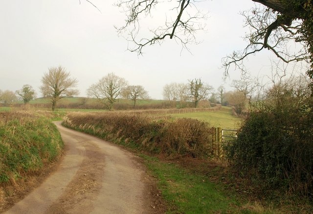
Middle Down Plantation is a picturesque woodland located in the county of Devon, England. Situated in the heart of the Devonshire countryside, this plantation spans over a vast area, providing a haven of natural beauty and tranquility.

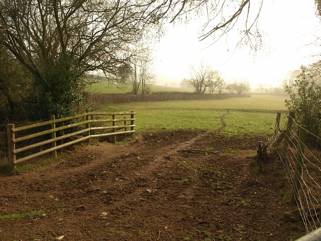
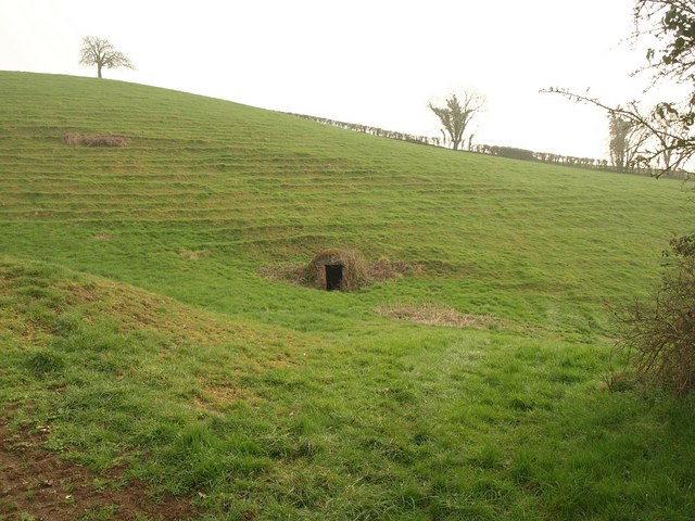
The plantation is primarily composed of a dense forest, characterized by its towering trees and lush undergrowth. The area is home to a diverse range of tree species, including oak, beech, and birch, which create a varied and captivating landscape throughout the seasons. The forest floor is rich in vegetation, adorned with an array of wildflowers, ferns, and mosses, further enhancing its visual appeal.

Middle Down Plantation not only boasts stunning flora, but it is also a haven for wildlife. The forest provides a habitat for numerous species, such as deer, squirrels, and a variety of bird species, making it a popular spot for nature enthusiasts and birdwatchers.

Visitors to the plantation can enjoy a range of activities, from leisurely walks along the well-maintained trails to more adventurous pursuits, such as cycling and horseback riding. The peaceful atmosphere and idyllic surroundings make it an ideal destination for those seeking solace and a connection with nature.

The plantation is open to the public throughout the year, with designated parking areas and picnic spots available for visitors. It is advisable to bring suitable footwear and clothing, as the terrain can be uneven and muddy in certain areas.

Middle Down Plantation is a hidden gem in the Devon countryside, offering a captivating blend of natural beauty and wildlife. Its serene atmosphere and stunning scenery make it a must-visit destination for nature lovers and those seeking a peaceful retreat.

If you have any feedback on the listing, please let us know in the comments section below.

Middle Down Plantation Images

Images are sourced within 2km of 50.849496/-3.665445 or Grid Reference SS8206. Thanks to Geograph Open Source API. All images are credited.

Lane to Vellake A no through road for most vehicles, but continuing as a green lane to Splitwell Cross.
Lane to Vellake
A no through road for most vehicles, but continuing as a green lane to Splitwell Cross.
Field beside Heathfield Copse Taken from the same spot as <a href="https://www.geograph.org.uk/photo/2316949">SS8305 : Lane to Vellake</a>, looking to the right; the copse is out of shot to the right.
Field beside Heathfield Copse
Taken from the same spot as SS8305 : Lane to Vellake, looking to the right; the copse is out of shot to the right.
Gatehouse, Dowrich Originally C16, the gatehouse <span class="nowrap"><a title="http://www.britishlistedbuildings.co.uk/en-445509-gatehouse-approximately-30-metres-south-" rel="nofollow ugc noopener" href="http://www.britishlistedbuildings.co.uk/en-445509-gatehouse-approximately-30-metres-south-">Link</a><img style="margin-left:2px;" alt="External link" title="External link - shift click to open in new window" src="https://s1.geograph.org.uk/img/external.png" width="10" height="10"/></span> with its square castellated turrets stands in front of Dowrich House.
Gatehouse, Dowrich
Originally C16, the gatehouse LinkExternal link with its square castellated turrets stands in front of Dowrich House.
Well, Dowrich A wellhead in a steep field near Dowrich House, with terracettes above.
Well, Dowrich
A wellhead in a steep field near Dowrich House, with terracettes above.
Lane to Stockleigh English Curving across a slight dip, the head of a side valley of Holly Water. There is a more direct route to Stockleigh English for walkers, using Sandford Footpath 41 across the fields to the right.
Lane to Stockleigh English
Curving across a slight dip, the head of a side valley of Holly Water. There is a more direct route to Stockleigh English for walkers, using Sandford Footpath 41 across the fields to the right.
Road to Kennerleigh The road, running along the valley of the Binneford Water, approaches a bridge across one of its larger tributaries.
Road to Kennerleigh
The road, running along the valley of the Binneford Water, approaches a bridge across one of its larger tributaries.
Manor Farm, Kennerleigh A view from Kennerleigh Footpath 3. Most of the sheep prefer the view to the east.
Manor Farm, Kennerleigh
A view from Kennerleigh Footpath 3. Most of the sheep prefer the view to the east.
Cottage, Kennerleigh The C18 cob and thatch Leigh Cottage <span class="nowrap"><a title="http://www.britishlistedbuildings.co.uk/en-96505-leigh-cottage-including-adjoining-cob-wal" rel="nofollow ugc noopener" href="http://www.britishlistedbuildings.co.uk/en-96505-leigh-cottage-including-adjoining-cob-wal">Link</a><img style="margin-left:2px;" alt="External link" title="External link - shift click to open in new window" src="https://s1.geograph.org.uk/img/external.png" width="10" height="10"/></span> is positioned so that it casues a slight kink in the village street.
Cottage, Kennerleigh
The C18 cob and thatch Leigh Cottage LinkExternal link is positioned so that it casues a slight kink in the village street.
Village stores, Kennerleigh Unable to resist submitting another picture of <a href="https://www.geograph.org.uk/photo/218778">SS8107 : Kennerleigh: Post Office and Stores</a>, which, on a sunny day, looks like the archtypal village shop.
Village stores, Kennerleigh
Unable to resist submitting another picture of SS8107 : Kennerleigh: Post Office and Stores, which, on a sunny day, looks like the archtypal village shop.
Church, Kennerleigh A similar view to <a href="https://www.geograph.org.uk/photo/218777">SS8107 : Kennerleigh: St John the Baptist church</a> at an earlier season of the year. The tower and chancel are C14 <span class="nowrap"><a title="http://www.britishlistedbuildings.co.uk/en-96501-church-of-st-john-the-baptist-kennerleigh" rel="nofollow ugc noopener" href="http://www.britishlistedbuildings.co.uk/en-96501-church-of-st-john-the-baptist-kennerleigh">Link</a><img style="margin-left:2px;" alt="External link" title="External link - shift click to open in new window" src="https://s1.geograph.org.uk/img/external.png" width="10" height="10"/></span> .
Church, Kennerleigh
A similar view to SS8107 : Kennerleigh: St John the Baptist church at an earlier season of the year. The tower and chancel are C14 LinkExternal link .
Meadow by Binneford Water With the road to Kennerleigh in shadow on the left. The stream follows the line of trees and blackthorn on the right and centre (looking upstream).
Meadow by Binneford Water
With the road to Kennerleigh in shadow on the left. The stream follows the line of trees and blackthorn on the right and centre (looking upstream).
Road to Kennerleigh A view of the bend shown in <a href="https://www.geograph.org.uk/photo/218776">SS8206 : Kennerleigh: road in Kennerleigh Wood</a> from the other side of it. The bend takes the road away from the Binneford Water, which is some 20 metres off into the wood to the right of the camera.
Road to Kennerleigh
A view of the bend shown in SS8206 : Kennerleigh: road in Kennerleigh Wood from the other side of it. The bend takes the road away from the Binneford Water, which is some 20 metres off into the wood to the right of the camera.
Woodland by Binneford Water The stream is meandering somewhere through this woodland, part of Kennerleigh Wood. Seen from the same spot as <a href="https://www.geograph.org.uk/photo/2367151">SS8206 : Road to Kennerleigh</a>.
Woodland by Binneford Water
The stream is meandering somewhere through this woodland, part of Kennerleigh Wood. Seen from the same spot as SS8206 : Road to Kennerleigh.
Entrance to Higher Woodbeer Seen leaving the road through Kennerleigh, this farm road is followed by Kennerleigh Footpath 10.
Entrance to Higher Woodbeer
Seen leaving the road through Kennerleigh, this farm road is followed by Kennerleigh Footpath 10.
Lower Woodbeer Another view of <a href="https://www.geograph.org.uk/photo/218779">SS8107 : Kennerleigh: Lower Woodbeer</a>, which Kennerleigh Footpath 10 runs past. The former farmhouse, originally C16 <span class="nowrap"><a title="http://www.britishlistedbuildings.co.uk/en-96500-lower-woodbeer-kennerleigh" rel="nofollow ugc noopener" href="http://www.britishlistedbuildings.co.uk/en-96500-lower-woodbeer-kennerleigh">Link</a><img style="margin-left:2px;" alt="External link" title="External link - shift click to open in new window" src="https://s1.geograph.org.uk/img/external.png" width="10" height="10"/></span> , straddles an easting gridline, so the barn is in <a href="https://www.geograph.org.uk/gridref/SS8207">SS8207</a>.
Lower Woodbeer
Another view of SS8107 : Kennerleigh: Lower Woodbeer, which Kennerleigh Footpath 10 runs past. The former farmhouse, originally C16 LinkExternal link , straddles an easting gridline, so the barn is in SS8207.
Start of footpath, Kennerleigh Showing the point at which the drive to Higher Woodbeer, carrying Kennerleigh Footpath 10 and shown in <a href="https://www.geograph.org.uk/photo/2367168">SS8107 : Entrance to Higher Woodbeer</a>, leaves the road through Kennerleigh.
Start of footpath, Kennerleigh
Showing the point at which the drive to Higher Woodbeer, carrying Kennerleigh Footpath 10 and shown in SS8107 : Entrance to Higher Woodbeer, leaves the road through Kennerleigh.
Field at Kennerleigh Crossed by Kennerleigh Footpath 3. The trees on the right obscure a pond.
Field at Kennerleigh
Crossed by Kennerleigh Footpath 3. The trees on the right obscure a pond.
Kennerleigh: houses on the east side Taken from the same point as <a href="https://www.geograph.org.uk/photo/2367204">SS8207 : Field at Kennerleigh</a>. On the right is <a href="https://www.geograph.org.uk/photo/2366292">SS8207 : Manor Farm, Kennerleigh</a>. Towards the left is a thatched former farmhouse, now two cottages <span class="nowrap"><a title="http://www.britishlistedbuildings.co.uk/en-96504-sarum-kennerleigh" rel="nofollow ugc noopener" href="http://www.britishlistedbuildings.co.uk/en-96504-sarum-kennerleigh">Link</a><img style="margin-left:2px;" alt="External link" title="External link - shift click to open in new window" src="https://s1.geograph.org.uk/img/external.png" width="10" height="10"/></span> .
Kennerleigh: houses on the east side
Taken from the same point as SS8207 : Field at Kennerleigh. On the right is SS8207 : Manor Farm, Kennerleigh. Towards the left is a thatched former farmhouse, now two cottages LinkExternal link .
Show me another place!

Middle Down Plantation is located at Grid Ref: SS8206 (Lat: 50.849496, Lng: -3.665445)

Administrative County: Devon

District: Mid Devon

Police Authority: Devon and Cornwall

What 3 Words

///proposals.easy.shopper. Near Morchard Bishop, Devon

Related Wikis

Kennerleigh

Kennerleigh is a village and civil parish in Devon, England.The church is dedicated to St John the Baptist, which underwent significant restoration around...

Fordy Wood Copse

Fordy Wood Copse is a woodland in Devon, England, near Sandford. It covers a total area of 0.64 hectares (1.58 acres) and overlooks the River Creedy. It...

Woolfardisworthy, Mid Devon

Woolfardisworthy (pronounced "Woolsery") is a village and civil parish in Mid Devon. It is situated about 5 miles (9 km) north of Crediton. According to...

Stockleigh English

Stockleigh English is a village and civil parish in Devon, England. It has a 15th-century church, Saint Mary the Virgin, which was restored 1878–83.Stockleigh...

Nearby Amenities

Located within 500m of 50.849496,-3.665445
74. haffocumb 2nd?
Lat/Long: 50.8482634/-3.6699551
The data included in this document is from www.openstreetmap.org. The data is made available under ODbL.

Have you been to Middle Down Plantation?

Leave your review of Middle Down Plantation below (or comments, questions and feedback).