Askridge Coppice

Wood, Forest in Devon Mid Devon

England

Askridge Coppice

Towards Windmill Hill A view from Coppice Lane past a manure heap. Hidden on this side of the Windmill Hill is the Binneford Water valley.
Towards Windmill Hill Credit: Derek Harper

Askridge Coppice is a small woodland located in Devon, England. It covers an area of approximately 20 acres and is situated near the village of Askridge. The coppice is known for its diverse range of tree species and abundant wildlife.

The woodland is primarily composed of native broadleaf trees such as oak, beech, and ash. These trees create a dense canopy, providing shade and shelter for the smaller plants and animals that inhabit the area. The understory is rich with native flora, including bluebells, wood anemones, and wild garlic, which create a vibrant display during the spring and summer months.

Askridge Coppice is also home to a variety of wildlife. Birdwatchers can spot a range of species, including woodpeckers, nuthatches, and tawny owls. Mammals such as foxes, badgers, and deer can be occasionally seen roaming the woodland. The coppice also provides an important habitat for insects, including butterflies and beetles.

The woodland is a popular destination for nature enthusiasts and walkers. It offers several well-maintained trails that wind through the trees, allowing visitors to explore the diverse ecosystem at their own pace. The peaceful atmosphere and natural beauty of Askridge Coppice make it an ideal location for those seeking tranquility and a connection with nature.

In conclusion, Askridge Coppice is a charming woodland in Devon, England, offering a diverse range of tree species, abundant wildlife, and well-maintained trails for visitors to enjoy. It is a haven for nature enthusiasts and a place of natural beauty.

If you have any feedback on the listing, please let us know in the comments section below.

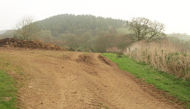
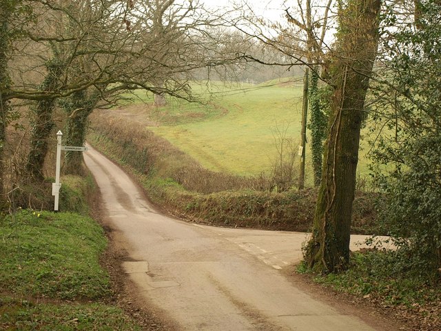
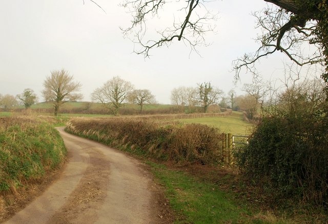
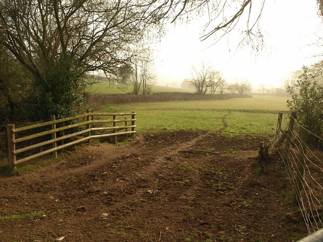
Askridge Coppice Images

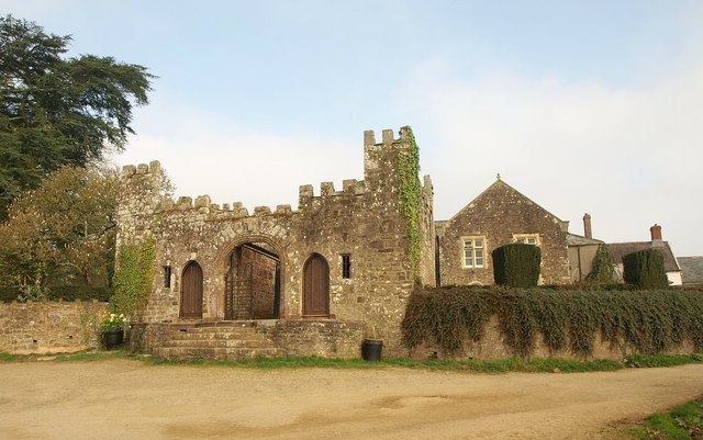
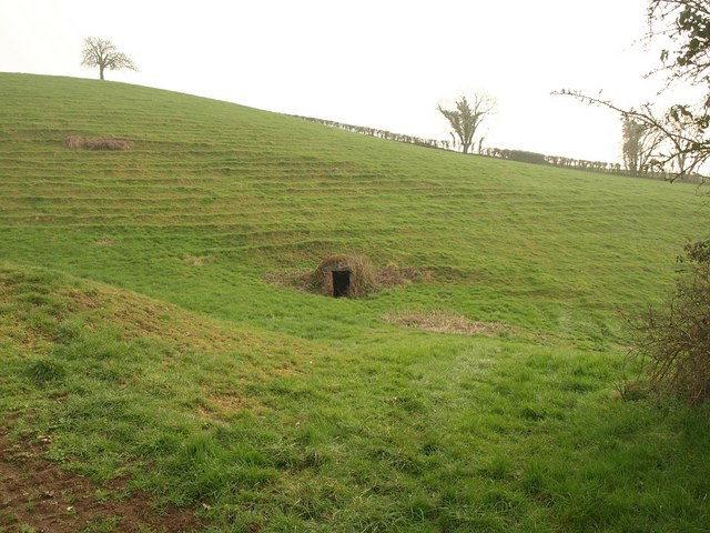
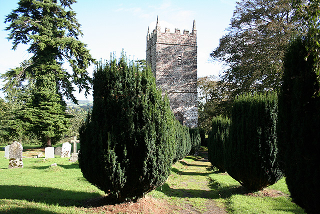
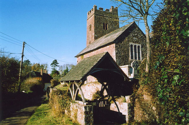
Images are sourced within 2km of 50.846366/-3.6667114 or Grid Reference SS8206. Thanks to Geograph Open Source API. All images are credited.

Towards Windmill Hill A view from Coppice Lane past a manure heap. Hidden on this side of the Windmill Hill is the Binneford Water valley.
Towards Windmill Hill
A view from Coppice Lane past a manure heap. Hidden on this side of the Windmill Hill is the Binneford Water valley.
Junction near Dowrich Bridge Taken from Dowrich Bridge across Binneford Water. The right turn leads through Aller Down; straight ahead is for Sandford.
Junction near Dowrich Bridge
Taken from Dowrich Bridge across Binneford Water. The right turn leads through Aller Down; straight ahead is for Sandford.
Binneford Water The stream seen looking upstream from Dowrich Bridge, with daffodils on the banks.
Binneford Water
The stream seen looking upstream from Dowrich Bridge, with daffodils on the banks.
Lane to Vellake A no through road for most vehicles, but continuing as a green lane to Splitwell Cross.
Lane to Vellake
A no through road for most vehicles, but continuing as a green lane to Splitwell Cross.
Field beside Heathfield Copse Taken from the same spot as <a href="https://www.geograph.org.uk/photo/2316949">SS8305 : Lane to Vellake</a>, looking to the right; the copse is out of shot to the right.
Field beside Heathfield Copse
Taken from the same spot as SS8305 : Lane to Vellake, looking to the right; the copse is out of shot to the right.
Gatehouse, Dowrich Originally C16, the gatehouse <span class="nowrap"><a title="http://www.britishlistedbuildings.co.uk/en-445509-gatehouse-approximately-30-metres-south-" rel="nofollow ugc noopener" href="http://www.britishlistedbuildings.co.uk/en-445509-gatehouse-approximately-30-metres-south-">Link</a><img style="margin-left:2px;" alt="External link" title="External link - shift click to open in new window" src="https://s1.geograph.org.uk/img/external.png" width="10" height="10"/></span> with its square castellated turrets stands in front of Dowrich House.
Gatehouse, Dowrich
Originally C16, the gatehouse LinkExternal link with its square castellated turrets stands in front of Dowrich House.
Well, Dowrich A wellhead in a steep field near Dowrich House, with terracettes above.
Well, Dowrich
A wellhead in a steep field near Dowrich House, with terracettes above.
Sheep and tractor near The Forge Breakfast for a flock given access to some tasty-looking mangold leaves. From the lane shown in <a href="https://www.geograph.org.uk/photo/2317052">SS8405 : The Forge</a>.
Sheep and tractor near The Forge
Breakfast for a flock given access to some tasty-looking mangold leaves. From the lane shown in SS8405 : The Forge.
Lane to Stockleigh English Curving across a slight dip, the head of a side valley of Holly Water. There is a more direct route to Stockleigh English for walkers, using Sandford Footpath 41 across the fields to the right.
Lane to Stockleigh English
Curving across a slight dip, the head of a side valley of Holly Water. There is a more direct route to Stockleigh English for walkers, using Sandford Footpath 41 across the fields to the right.
Breakfast concluding near The Forge An hour and a quarter since <a href="https://www.geograph.org.uk/photo/2317069">SS8405 : Sheep and tractor near The Forge</a> was taken and the sheep have made a substantial impact.
Breakfast concluding near The Forge
An hour and a quarter since SS8405 : Sheep and tractor near The Forge was taken and the sheep have made a substantial impact.
Swannaton Lane The green lane (Sandford Restricted Byway 45) descends to the farm at Swannaton, where it becomes a public road and drops further.
Swannaton Lane
The green lane (Sandford Restricted Byway 45) descends to the farm at Swannaton, where it becomes a public road and drops further.
Swannaton Lane A reverse view of <a href="https://www.geograph.org.uk/photo/2364971">SS8005 : Swannaton Lane</a>, looking up Sandford Restricted Byway 45 from just above the farm.
Swannaton Lane
A reverse view of SS8005 : Swannaton Lane, looking up Sandford Restricted Byway 45 from just above the farm.
Field, Swannaton A field grazed by sheep that lies on the right of the stretch of lane shown in <a href="https://www.geograph.org.uk/photo/2364992">SS8105 : Swannaton Lane</a>. Swannaton is at top left.
Field, Swannaton
A field grazed by sheep that lies on the right of the stretch of lane shown in SS8105 : Swannaton Lane. Swannaton is at top left.
Road to Kennerleigh The road, running along the valley of the Binneford Water, approaches a bridge across one of its larger tributaries.
Road to Kennerleigh
The road, running along the valley of the Binneford Water, approaches a bridge across one of its larger tributaries.
Manor Farm, Kennerleigh A view from Kennerleigh Footpath 3. Most of the sheep prefer the view to the east.
Manor Farm, Kennerleigh
A view from Kennerleigh Footpath 3. Most of the sheep prefer the view to the east.
Cottage, Kennerleigh The C18 cob and thatch Leigh Cottage <span class="nowrap"><a title="http://www.britishlistedbuildings.co.uk/en-96505-leigh-cottage-including-adjoining-cob-wal" rel="nofollow ugc noopener" href="http://www.britishlistedbuildings.co.uk/en-96505-leigh-cottage-including-adjoining-cob-wal">Link</a><img style="margin-left:2px;" alt="External link" title="External link - shift click to open in new window" src="https://s1.geograph.org.uk/img/external.png" width="10" height="10"/></span> is positioned so that it casues a slight kink in the village street.
Cottage, Kennerleigh
The C18 cob and thatch Leigh Cottage LinkExternal link is positioned so that it casues a slight kink in the village street.
Village stores, Kennerleigh Unable to resist submitting another picture of <a href="https://www.geograph.org.uk/photo/218778">SS8107 : Kennerleigh: Post Office and Stores</a>, which, on a sunny day, looks like the archtypal village shop.
Village stores, Kennerleigh
Unable to resist submitting another picture of SS8107 : Kennerleigh: Post Office and Stores, which, on a sunny day, looks like the archtypal village shop.
Church, Kennerleigh A similar view to <a href="https://www.geograph.org.uk/photo/218777">SS8107 : Kennerleigh: St John the Baptist church</a> at an earlier season of the year. The tower and chancel are C14 <span class="nowrap"><a title="http://www.britishlistedbuildings.co.uk/en-96501-church-of-st-john-the-baptist-kennerleigh" rel="nofollow ugc noopener" href="http://www.britishlistedbuildings.co.uk/en-96501-church-of-st-john-the-baptist-kennerleigh">Link</a><img style="margin-left:2px;" alt="External link" title="External link - shift click to open in new window" src="https://s1.geograph.org.uk/img/external.png" width="10" height="10"/></span> .
Church, Kennerleigh
A similar view to SS8107 : Kennerleigh: St John the Baptist church at an earlier season of the year. The tower and chancel are C14 LinkExternal link .
Show me another place!

Askridge Coppice is located at Grid Ref: SS8206 (Lat: 50.846366, Lng: -3.6667114)

Administrative County: Devon

District: Mid Devon

Police Authority: Devon and Cornwall

What 3 Words

///scores.deodorant.correct. Near Morchard Bishop, Devon

Related Wikis

Fordy Wood Copse

Fordy Wood Copse is a woodland in Devon, England, near Sandford. It covers a total area of 0.64 hectares (1.58 acres) and overlooks the River Creedy. It...

Kennerleigh

Kennerleigh is a village and civil parish in Devon, England.The church is dedicated to St John the Baptist, which underwent significant restoration around...

Woolfardisworthy, Mid Devon

Woolfardisworthy (pronounced "Woolsery") is a village and civil parish in Mid Devon. It is situated about 5 miles (9 km) north of Crediton. According to...

Stockleigh English

Stockleigh English is a village and civil parish in Devon, England. It has a 15th-century church, Saint Mary the Virgin, which was restored 1878–83.Stockleigh...

Poughill, Devon

Poughill (pronounced "po-il") is a village and civil parish in Devon, England. It lies 5 miles (8 km) north of Crediton. In 2011, the parish had a population...

Upton Hellions

Upton Hellions is a village in Devon, England, located north of Long Barn and south of East Village, and near to Crediton. == External links == Media...

Berry Castle, Black Dog

Berry Castle is an earthwork probably dating to the Iron Age close to Black Dog in Devon north of Crediton and west of Tiverton. It does not fit the traditional...

Black Dog, Devon

Black Dog is a village in Mid Devon, ten miles west of Tiverton and six miles north of Crediton. The village is on one of the highest ridges of land between...

Nearby Amenities

Located within 500m of 50.846366,-3.6667114
Ashridge Farm
Addr City: Crediton
Addr Housename: Ashridge Farm
Addr Postcode: EX17 4EN
Addr Suburb: Sandford
Tourism: guest_house
Lat/Long: 50.8436325/-3.6706656
74. haffocumb 2nd?
Lat/Long: 50.8482634/-3.6699551
The data included in this document is from www.openstreetmap.org. The data is made available under ODbL.

Have you been to Askridge Coppice?

Leave your review of Askridge Coppice below (or comments, questions and feedback).