Angerton

Settlement in Cumberland Allerdale

England

Angerton

River Wampool
River Wampool Credit: Clive Nicholson

Angerton is a small village located in the historic county of Cumberland, England. Situated in the picturesque countryside, it lies approximately 5 miles southeast of the town of Brampton and 12 miles northeast of the city of Carlisle. The village is nestled within the district of Allerdale, which is known for its rural charm and stunning landscapes.

Angerton is characterized by its tranquil atmosphere and close-knit community. The village is primarily residential, with a small number of houses and farms scattered across the area. The architecture of the village reflects its long history, with many buildings dating back several centuries.

Surrounded by rolling hills and verdant fields, Angerton offers its residents and visitors ample opportunities for outdoor activities. The nearby countryside provides an idyllic setting for hiking, cycling, and horse riding. Moreover, the charming River Irthing flows close to the village, allowing for fishing and leisurely walks along its banks.

Despite its small size, Angerton benefits from a strong sense of community. The village has a community center that serves as a hub for various social activities and events. Additionally, there is a local church that plays an important role in the spiritual life of the residents.

While Angerton is a peaceful and serene village, its proximity to larger towns and cities ensures that essential amenities and services are easily accessible. The village is well-connected by road, making commuting to neighboring areas convenient.

In summary, Angerton is a quaint village in Cumberland that offers a tranquil lifestyle amidst beautiful natural surroundings. Its close-knit community, historic architecture, and proximity to amenities make it an attractive place to live or visit.

If you have any feedback on the listing, please let us know in the comments section below.

Angerton Images

Images are sourced within 2km of 54.902215/-3.204682 or Grid Reference NY2257. Thanks to Geograph Open Source API. All images are credited.

River Wampool
River Wampool
Whitrigg Bridge Across the River Wampool
Whitrigg Bridge
Across the River Wampool
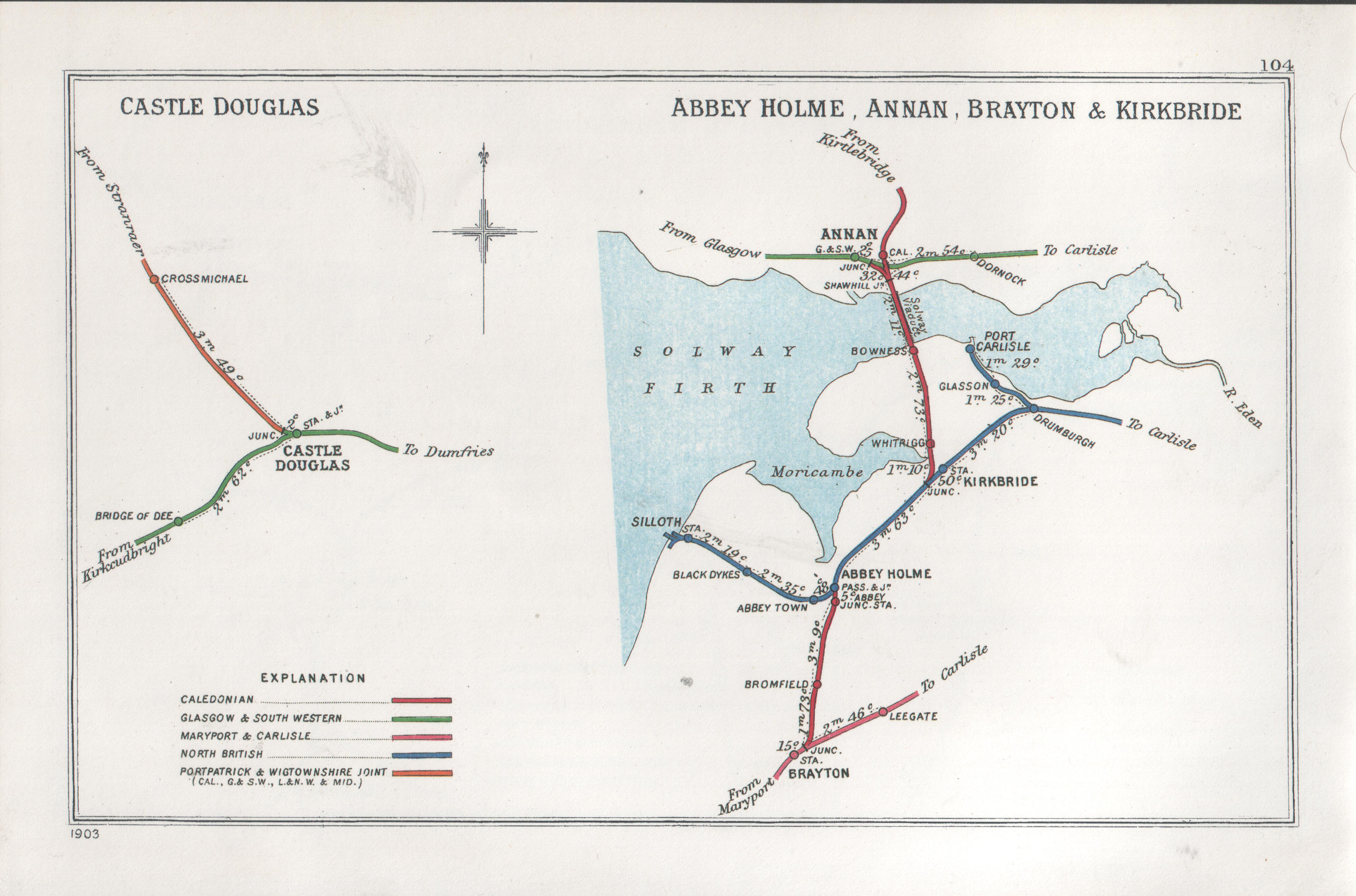
Whitrigg Station House The station was on the direct railway route across the Solway on a viaduct. Some distance beyond the house are the masts for Anthorn Radio Transmitting Station.
Whitrigg Station House
The station was on the direct railway route across the Solway on a viaduct. Some distance beyond the house are the masts for Anthorn Radio Transmitting Station.
Direction Sign – Signpost at Whitrigg Located on the northwest side of the T junction at Whitrigg in Bowness parish. 3 arms and annulus finial. The destination covered by the blanking plate reads NO THROUGH ROAD which is shown on the reverse of the arm. In 1943 a Royal Naval Air Station was built between Anthorn and Cardurnock, cutting off the road. The airfield shut in 1958 and is now a radio transmission site and at some date the road was relaid around the perimeter of the airfield. See also <a title="https://www.geograph.org.uk/photo/5791161" href="https://www.geograph.org.uk/photo/5791161">Link</a> , <a title="https://www.geograph.org.uk/photo/2020379" href="https://www.geograph.org.uk/photo/2020379">Link</a> and <span class="nowrap"><a title="http://www.geog.port.ac.uk/webmap/thelakes/photos/byw68.jpg" rel="nofollow ugc noopener" href="http://www.geog.port.ac.uk/webmap/thelakes/photos/byw68.jpg">Link</a><img style="margin-left:2px;" alt="External link" title="External link - shift click to open in new window" src="https://s1.geograph.org.uk/img/external.png" width="10" height="10"/></span>.

Milestone Society National ID: CU_NY2257
Direction Sign – Signpost at Whitrigg
Located on the northwest side of the T junction at Whitrigg in Bowness parish. 3 arms and annulus finial. The destination covered by the blanking plate reads NO THROUGH ROAD which is shown on the reverse of the arm. In 1943 a Royal Naval Air Station was built between Anthorn and Cardurnock, cutting off the road. The airfield shut in 1958 and is now a radio transmission site and at some date the road was relaid around the perimeter of the airfield. See also Link , Link and LinkExternal link. Milestone Society National ID: CU_NY2257
Direction Sign – Signpost near Whitrigg House Located on the north side of the road junction southeast of Whitrigg House. Bowness parish. 3 arms and missing annulus finial.

Milestone Society National ID: CU_NY2358
Direction Sign – Signpost near Whitrigg House
Located on the north side of the road junction southeast of Whitrigg House. Bowness parish. 3 arms and missing annulus finial. Milestone Society National ID: CU_NY2358
Direction Sign – Signpost on the B5307 in Angerton Located in Angerton on the northwest side of the junction of the B5307 and a minor road to Whitrigg. Kirkbride parish. 4 arms and pawn finial. See also <span class="nowrap"><a title="http://www.geog.port.ac.uk/webmap/thelakes/photos/byw67.jpg" rel="nofollow ugc noopener" href="http://www.geog.port.ac.uk/webmap/thelakes/photos/byw67.jpg">Link</a><img style="margin-left:2px;" alt="External link" title="External link - shift click to open in new window" src="https://s1.geograph.org.uk/img/external.png" width="10" height="10"/></span>.

Milestone Society National ID: CU_NY2257A
Direction Sign – Signpost on the B5307 in Angerton
Located in Angerton on the northwest side of the junction of the B5307 and a minor road to Whitrigg. Kirkbride parish. 4 arms and pawn finial. See also LinkExternal link. Milestone Society National ID: CU_NY2257A
Direction Sign – Signpost at Whitrigglees in Aikton parish Located on the northeast side of the crossroads at Whitrigglees in Aikton parish. 4 arms and annulus finial. See also <a title="https://www.geograph.org.uk/photo/4976034" href="https://www.geograph.org.uk/photo/4976034">Link</a>.

Milestone Society National ID: CU_NY2457
Direction Sign – Signpost at Whitrigglees in Aikton parish
Located on the northeast side of the crossroads at Whitrigglees in Aikton parish. 4 arms and annulus finial. See also Link. Milestone Society National ID: CU_NY2457
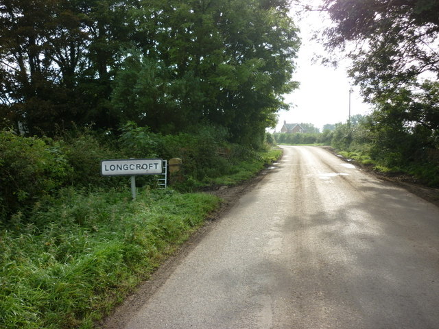
Entering Longcroft
Entering Longcroft
A house in Longcroft
Swallows Return, Longcroft
A road leading to Rogersceugh
Beckbrow Cottage
Beckbrow Cottage
Houses near West Whitrigg Farm
The River Wampool from Whitrigg Bridge
The village of Angerton
The B5307 towards Newton Arlosh
Arlosh House Farm
Arlosh House Farm
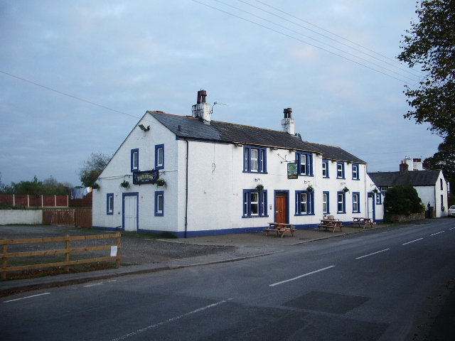
The Bush Inn, Kirkbride
Show me another place!

Angerton is located at Grid Ref: NY2257 (Lat: 54.902215, Lng: -3.204682)

Administrative County: Cumbria

District: Allerdale

Police Authority: Cumbria

What 3 Words

///flooding.agency.slice. Near Wigton, Cumbria

Related Wikis

Nearby Amenities

Located within 500m of 54.902215,-3.204682
Kirkbride
Disused Railway: station
Railway: site
Source: npe
Wikidata: Q6415574
Lat/Long: 54.8992604/-3.203626
Angerton Crossroads
Local Ref: AT
Naptan AtcoCode: 090002391366
Naptan Bearing: E
Naptan BusStopType: CUS
Naptan CommonName: Angerton Crossroads
Naptan Indicator: at
Naptan Landmark: junction with Birch Hill Lane
Naptan NaptanCode: cumagata
Naptan Street: B5307
Naptan Verified: no
Source: naptan_import
Lat/Long: 54.9020846/-3.2037858
Bus Stop
Grove Cottages
Local Ref: AT
Naptan AtcoCode: 090002391693
Naptan Bearing: S
Naptan CommonName: Grove Cottages
Naptan Indicator: at
Naptan Landmark: Grove Cottages
Naptan NaptanCode: cumagatg
Naptan Street: No name
Naptan Verified: no
Source: naptan_import
Lat/Long: 54.8985565/-3.2024798
Crossroads
Local Ref: AT
Naptan AtcoCode: 090002393270
Naptan Bearing: N
Naptan BusStopType: CUS
Naptan CommonName: Crossroads
Naptan Indicator: at
Naptan Landmark: junction with Birch Hill Lane
Naptan NaptanCode: cumagatm
Naptan Street: B5307
Naptan Verified: no
Source: naptan_import
Lat/Long: 54.902064/-3.2040504
Post Box
Ref: CA7 431
Source: survey
Lat/Long: 54.9009565/-3.2032363
Noexit: yes
Lat/Long: 54.899505/-3.2029831
Angerton
Place: hamlet
Wikidata: Q4763145
Lat/Long: 54.9039376/-3.2052152
Generator Method: photovoltaic
Generator Output Electricity: yes
Generator Source: solar
Generator Type: solar_photovoltaic_panel
Location: roof
Power: generator
Lat/Long: 54.9001718/-3.2001664
Generator Method: photovoltaic
Generator Output Electricity: yes
Generator Source: solar
Generator Type: solar_photovoltaic_panel
Location: roof
Power: generator
Lat/Long: 54.9020595/-3.2046497
Generator Method: photovoltaic
Generator Output Electricity: yes
Generator Source: solar
Generator Type: solar_photovoltaic_panel
Location: roof
Power: generator
Lat/Long: 54.9021845/-3.2019407
Generator Method: photovoltaic
Generator Output Electricity: yes
Generator Source: solar
Generator Type: solar_photovoltaic_panel
Location: roof
Power: generator
Lat/Long: 54.9017696/-3.1974748
Generator Method: photovoltaic
Generator Output Electricity: yes
Generator Source: solar
Generator Type: solar_photovoltaic_panel
Location: roof
Power: generator
Lat/Long: 54.901529/-3.1975016
Generator Method: photovoltaic
Generator Output Electricity: yes
Generator Source: solar
Generator Type: solar_photovoltaic_panel
Location: roof
Power: generator
Lat/Long: 54.9015229/-3.1975606
Generator Method: photovoltaic
Generator Output Electricity: yes
Generator Source: solar
Generator Type: solar_photovoltaic_panel
Location: ground
Power: generator
Lat/Long: 54.899248/-3.2011762
Generator Method: photovoltaic
Generator Output Electricity: yes
Generator Source: solar
Generator Type: solar_photovoltaic_panel
Location: roof
Power: generator
Lat/Long: 54.8995225/-3.201482
Generator Method: photovoltaic
Generator Output Electricity: yes
Generator Source: solar
Generator Type: solar_photovoltaic_panel
Location: roof
Power: generator
Lat/Long: 54.8984337/-3.2028258
Generator Method: photovoltaic
Generator Output Electricity: yes
Generator Source: solar
Generator Type: solar_photovoltaic_panel
Location: roof
Power: generator
Lat/Long: 54.8984367/-3.2028848
Generator Method: photovoltaic
Generator Output Electricity: yes
Generator Source: solar
Generator Type: solar_photovoltaic_panel
Location: roof
Power: generator
Lat/Long: 54.8978769/-3.202638
The data included in this document is from www.openstreetmap.org. The data is made available under ODbL.

Have you been to Angerton?

Leave your review of Angerton below (or comments, questions and feedback).