Angle
Settlement in Pembrokeshire
Wales
Angle

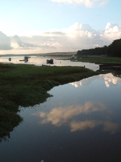
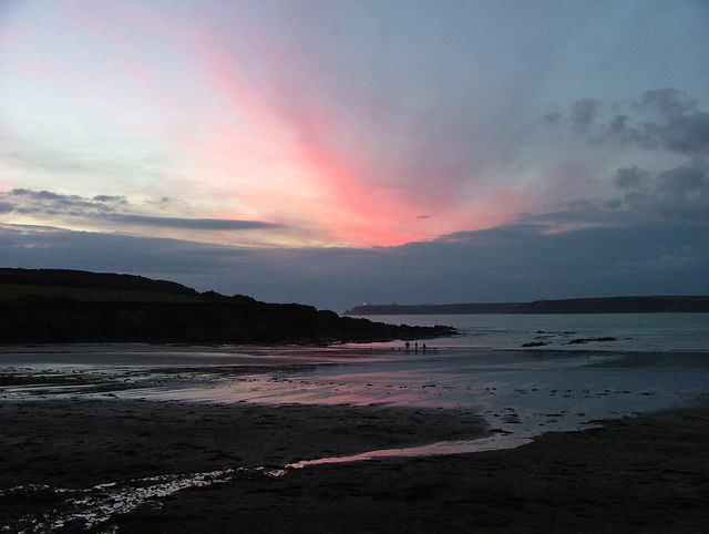
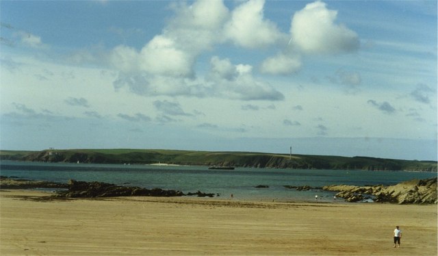
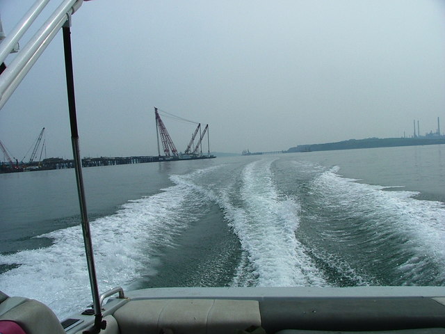
Angle is a picturesque village located on the southwestern tip of Wales, in the county of Pembrokeshire. Situated on the Angle Peninsula, the village is surrounded by beautiful coastal scenery and offers stunning views of the Milford Haven Waterway.
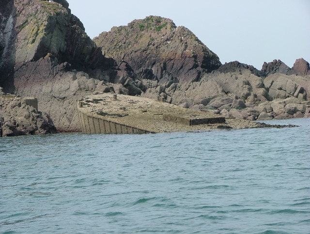
The village of Angle is rich in history, dating back to prehistoric times. It is believed to have been a significant point of trade during the Roman and Viking eras due to its strategic location. Today, remnants of its past can be seen in the form of ancient burial chambers and Iron Age forts.
The village itself is small but charming, with traditional Welsh cottages lining its narrow streets. The local community is close-knit and welcoming, making it a popular destination for tourists seeking a peaceful getaway. The village boasts a handful of amenities, including a local pub, a village hall, and a small convenience store.
Nature enthusiasts will be delighted by the natural beauty that surrounds Angle. The area is home to a variety of wildlife, including seals and dolphins, which can often be spotted in the water. The nearby coastline offers sandy beaches and rugged cliffs, perfect for coastal walks and exploring rock pools.
For history buffs, the surrounding area offers several historical sites to explore. Just a short distance away is Pembroke Castle, a medieval fortress that played a significant role in Welsh history. Visitors can also visit nearby St. Govan's Chapel, a 6th-century hermit's cell built into the cliffs.
Overall, Angle, Pembrokeshire, is a tranquil and picturesque village that offers a perfect blend of history, natural beauty, and Welsh charm.
If you have any feedback on the listing, please let us know in the comments section below.
Angle Images
Images are sourced within 2km of 51.684798/-5.091766 or Grid Reference SM8602. Thanks to Geograph Open Source API. All images are credited.


Angle is located at Grid Ref: SM8602 (Lat: 51.684798, Lng: -5.091766)
Unitary Authority: Pembrokeshire
Police Authority: Dyfed Powys
What 3 Words
///knees.gains.activism. Near Herbrandston, Pembrokeshire
Nearby Locations
Related Wikis

Angle, Pembrokeshire
Angle (Welsh: Angl) is a village, parish and community on the southern side of the entrance to the Milford Haven Waterway in Pembrokeshire, Wales. The...
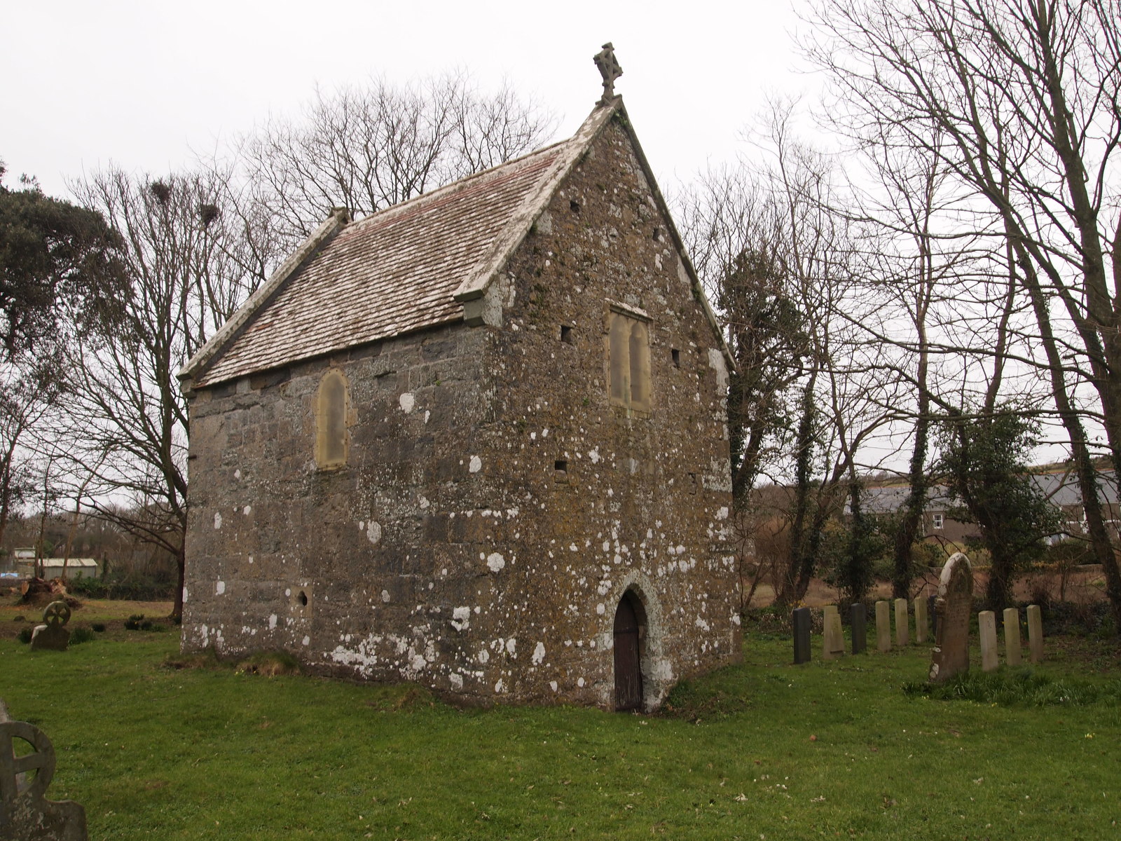
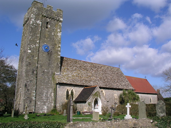
Sailors' Chapel, Angle
Sailors' Chapel, Seamen's Chapel or Fishermen's Chapel is a Grade I listed building in Angle, Pembrokeshire, Wales. The chapel, which is dedicated to St...

Angle Peninsula Coast
The Angle Peninsula Coast on the southern side of the entrance to the Milford Haven Waterway in Pembrokeshire, Wales, is a Site of Special Scientific Interest...

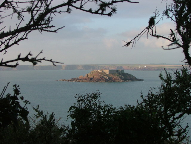
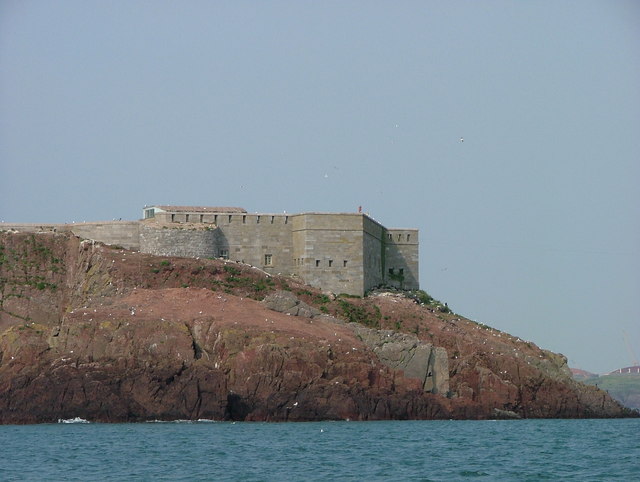
Chapel Bay Fort
Chapel Bay Fort is located on the southern shore of the Milford Haven Waterway, Pembrokeshire, Wales. The fort is approximately 1 mile (1.6 km) from the...

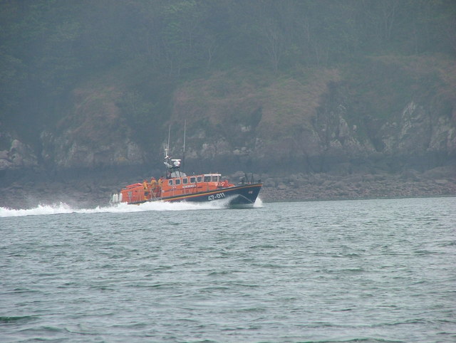
Angle Lifeboat Station
Angle Lifeboat Station, Angle, Pembrokeshire, Wales, first opened in 1868 after a request from the local Coastguard for a lifeboat station to be opened...

RAF Angle
Royal Air Force Angle or more commonly RAF Angle, is a former Royal Air Force station located on the Angle Peninsula Coast, 8 miles (13 km) west of Pembroke...

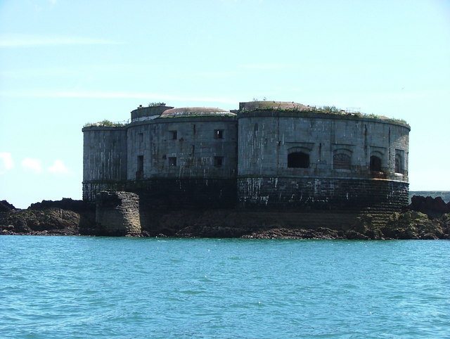
Stack Rock Fort
Stack Rock Fort is a fort built on a small island in the Milford Haven Waterway, Pembrokeshire, Wales. A 3-gun fort was built between 1850 and 1852, and...

Thorne Island
Thorne Island is a rocky islet and part of the community of Angle, Pembrokeshire, Wales, with an area of 2 acres (8,100 m2), dominated by a coastal artillery...
Nearby Amenities
Located within 500m of 51.684798,-5.091766Have you been to Angle?
Leave your review of Angle below (or comments, questions and feedback).