Morell Plantation

Wood, Forest in Devon Mid Devon

England

Morell Plantation

Flooded path at Rolstone Barton
Flooded path at Rolstone Barton Credit: Roger Cornfoot

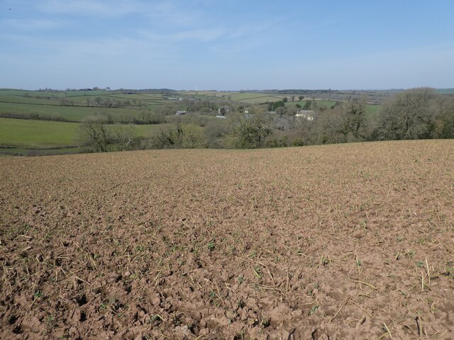
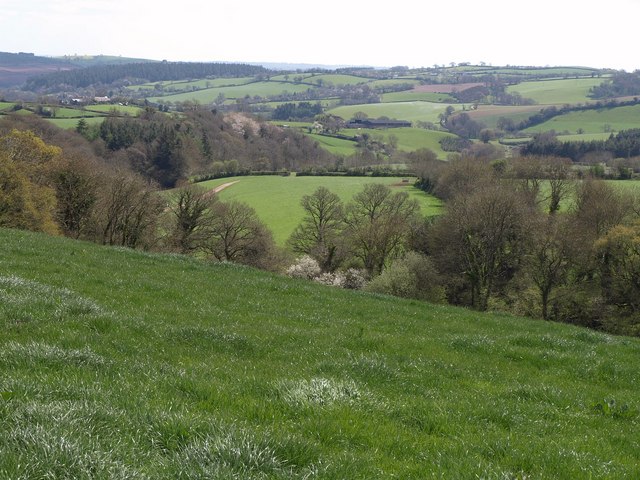
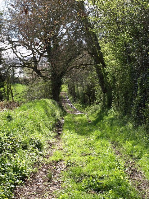
Morell Plantation is a picturesque woodland located in Devon, England. Covering an area of approximately 200 acres, it is a popular destination for nature lovers and outdoor enthusiasts. The plantation is situated near the village of Morell and is surrounded by rolling hills and stunning countryside.

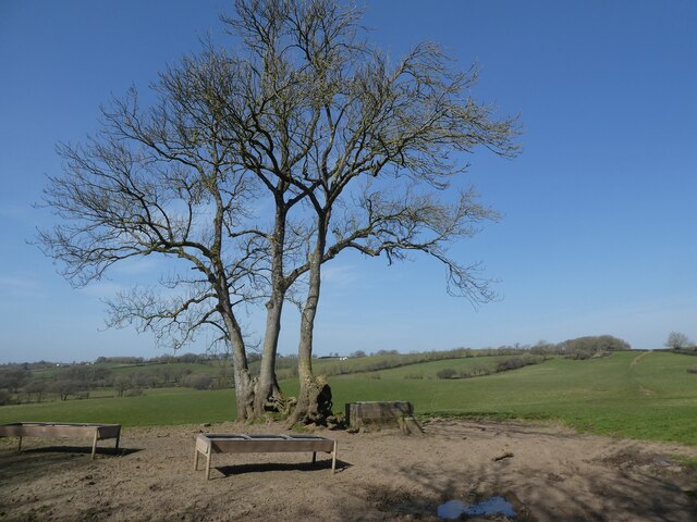
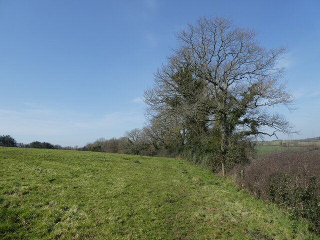
The woodland is primarily composed of a variety of native tree species, including oak, beech, and birch, which create a diverse and vibrant ecosystem. The dense canopy provides shelter to numerous bird species, making it a paradise for birdwatchers. Visitors can often spot woodpeckers, nightingales, and various species of owls.

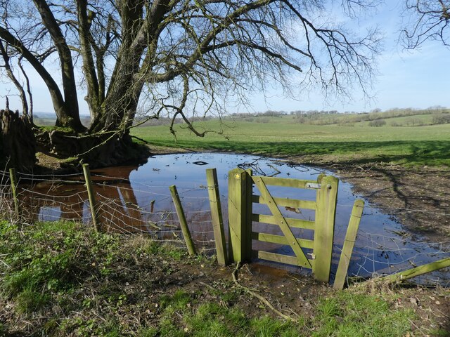
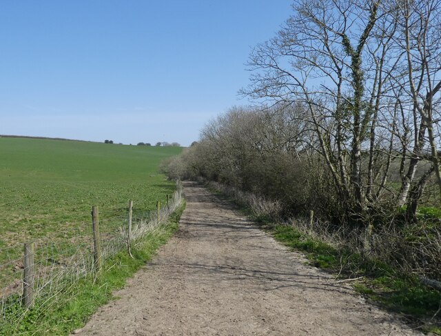
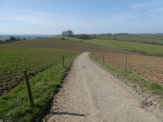
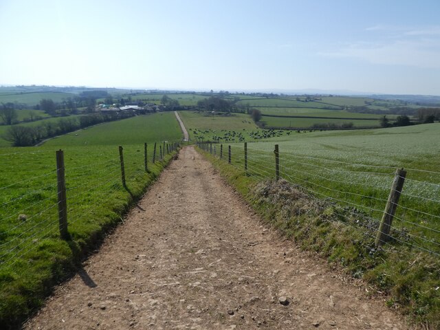
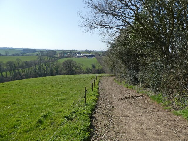
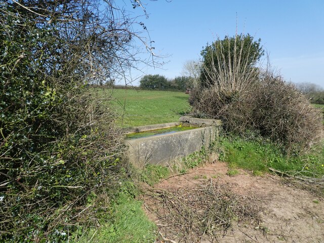
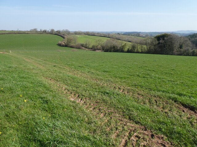
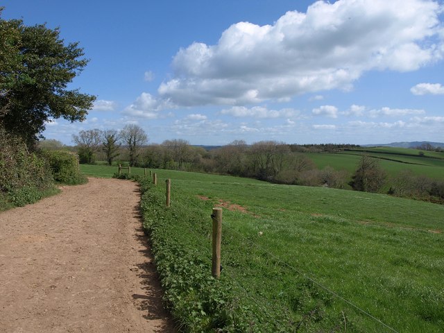
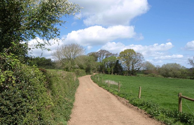
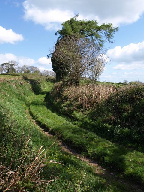
Several well-maintained walking trails traverse the plantation, allowing visitors to explore the beauty of the woodland at their own pace. These trails offer breathtaking views of the surrounding countryside and provide an opportunity to observe the diverse flora and fauna up close. Additionally, a small lake within the plantation attracts a variety of waterfowl and adds to the tranquility of the surroundings.

Morell Plantation is managed by the local forestry commission, which ensures the preservation of the woodland's natural beauty while also providing recreational opportunities. The commission periodically organizes educational events and guided tours for visitors, allowing them to learn about the local wildlife and the importance of sustainable forest management.

Overall, Morell Plantation is a haven of natural beauty, offering a peaceful retreat for those seeking solace in the great outdoors. Its diverse ecosystem and well-maintained trails make it an ideal destination for nature enthusiasts and families alike.

If you have any feedback on the listing, please let us know in the comments section below.

Morell Plantation Images

Images are sourced within 2km of 50.855087/-3.7036785 or Grid Reference SS8007. Thanks to Geograph Open Source API. All images are credited.

Flooded path at Rolstone Barton
Looking west, from Rolstone Barton
Track to 'Scotland' Well, I suppose, that if you keep walking in this direction.....
Track to 'Scotland'
Well, I suppose, that if you keep walking in this direction.....
Track to Moor Farm
Track to Moor Farm
Moor Farm
Moor Farm
Track to Rolstone Barton
Dairy herd at Rolstone Barton
Track to Rolstone Barton
Cattle trough, above Rolstone Barton
Path down to Swannaton Lane
North Brake Plantation
Barn at South Emlett
Fields, Swannaton A view from Morchard Bishop Footpath 38 as it briefly crosses the northwest corner of the square, looking down the Pidsley valley.
Fields, Swannaton
A view from Morchard Bishop Footpath 38 as it briefly crosses the northwest corner of the square, looking down the Pidsley valley.
Track to Harestreet Followed by Morchard Bishop Footpath 38, which branches off it in a while to meet Scotland/Swannaton Lane.
Track to Harestreet
Followed by Morchard Bishop Footpath 38, which branches off it in a while to meet Scotland/Swannaton Lane.
Track to Harestreet Taken from the bend shown in <a href="https://www.geograph.org.uk/photo/2364200">SS8006 : Track to Harestreet</a>, carrying Morchard Bishop Footpath 38. A tiny stream emerges in the trees ahead, a headwater of the Pidsley valley stream.
Track to Harestreet
Taken from the bend shown in SS8006 : Track to Harestreet, carrying Morchard Bishop Footpath 38. A tiny stream emerges in the trees ahead, a headwater of the Pidsley valley stream.
Swannaton Lane Although in 2004 it was recommended <span class="nowrap"><a title="http://www.devon.gov.uk/loadtrimdocument?url=&filename=ED/04/118/HQ.CMR&rn=10/WD218&dg=Public" rel="nofollow ugc noopener" href="http://www.devon.gov.uk/loadtrimdocument?url=&filename=ED/04/118/HQ.CMR&rn=10/WD218&dg=Public">Link</a><img style="margin-left:2px;" alt="External link" title="External link - shift click to open in new window" src="https://s1.geograph.org.uk/img/external.png" width="10" height="10"/></span> that this green lane be classified as a bridleway, and it now appears on the Devon rights of way map as Sandford Restricted Byway 45, the 1:25000 map still doesn't show it as a right of way. It is seen here at the junction with Morchard Bishop Footpath 38.
Swannaton Lane
Although in 2004 it was recommended LinkExternal link that this green lane be classified as a bridleway, and it now appears on the Devon rights of way map as Sandford Restricted Byway 45, the 1:25000 map still doesn't show it as a right of way. It is seen here at the junction with Morchard Bishop Footpath 38.
Swannaton Lane Sandford Restricted Byway 45 follows this green lane around the head of the valley containing Swannaton Wood.
Swannaton Lane
Sandford Restricted Byway 45 follows this green lane around the head of the valley containing Swannaton Wood.
Swannaton Lane A reverse view of the stretch of Sandford Restricted Byway 45 shown in <a href="https://www.geograph.org.uk/photo/2364295">SS8006 : Swannaton Lane</a>, with an oak coming into leaf in the adjoining field.
Swannaton Lane
A reverse view of the stretch of Sandford Restricted Byway 45 shown in SS8006 : Swannaton Lane, with an oak coming into leaf in the adjoining field.
Show me another place!

Morell Plantation is located at Grid Ref: SS8007 (Lat: 50.855087, Lng: -3.7036785)

Administrative County: Devon

District: Mid Devon

Police Authority: Devon and Cornwall

What 3 Words

///presumes.bank.bogus. Near Morchard Bishop, Devon

Related Wikis

Berry Castle, Black Dog

Berry Castle is an earthwork probably dating to the Iron Age close to Black Dog in Devon north of Crediton and west of Tiverton. It does not fit the traditional...

Kennerleigh

Kennerleigh is a village and civil parish in Devon, England.The church is dedicated to St John the Baptist, which underwent significant restoration around...

Black Dog, Devon

Black Dog is a village in Mid Devon, ten miles west of Tiverton and six miles north of Crediton. The village is on one of the highest ridges of land between...

Fordy Wood Copse

Fordy Wood Copse is a woodland in Devon, England, near Sandford. It covers a total area of 0.64 hectares (1.58 acres) and overlooks the River Creedy. It...

Nearby Amenities

Located within 500m of 50.855087,-3.7036785
Power: pole
Lat/Long: 50.8580631/-3.7025911
Power: pole
Lat/Long: 50.8569236/-3.7035754
Power: pole
Lat/Long: 50.8560567/-3.706381
Power: pole
Lat/Long: 50.8555335/-3.7080735
Power: pole
Lat/Long: 50.8550729/-3.7095273
Power: pole
Lat/Long: 50.8540214/-3.7105948
Generator Method: photovoltaic
Generator Output Electricity: yes
Generator Source: solar
Generator Type: solar_photovoltaic_panel
Location: roof
Power: generator
Lat/Long: 50.8577939/-3.6992477
The data included in this document is from www.openstreetmap.org. The data is made available under ODbL.

Have you been to Morell Plantation?

Leave your review of Morell Plantation below (or comments, questions and feedback).