Angell Town

Settlement in Surrey

England

Angell Town

Old Milestone, A204, Effra Road, Windrush Square The milestone is located just before the junction with Brixton Hill on the East side of the road in the paved area of Windrush Square. Parish of Brixton (Lambeth District). Carved stone post, Surrey limestone pillar design, erected by the Surrey & Sussex turnpike trust in the 19th century.

Inscription reads:-  WHITEHALL 3½ / (MI)LES  ::  ROYAL / EXCHANGE / 4 / MILES  ::  ROYAL / EXCHANGE / 4 / MILES

Milestone Society National ID: SY_LBT03a
Old Milestone, A204, Effra Road, Windrush Square Credit: Colin Woodward

Angell Town is a residential area located in Brixton, London, England. It is part of the borough of Lambeth and falls within the postal code SW9. The locality is situated in the southern part of the city and is known for its diverse cultural atmosphere and vibrant community.

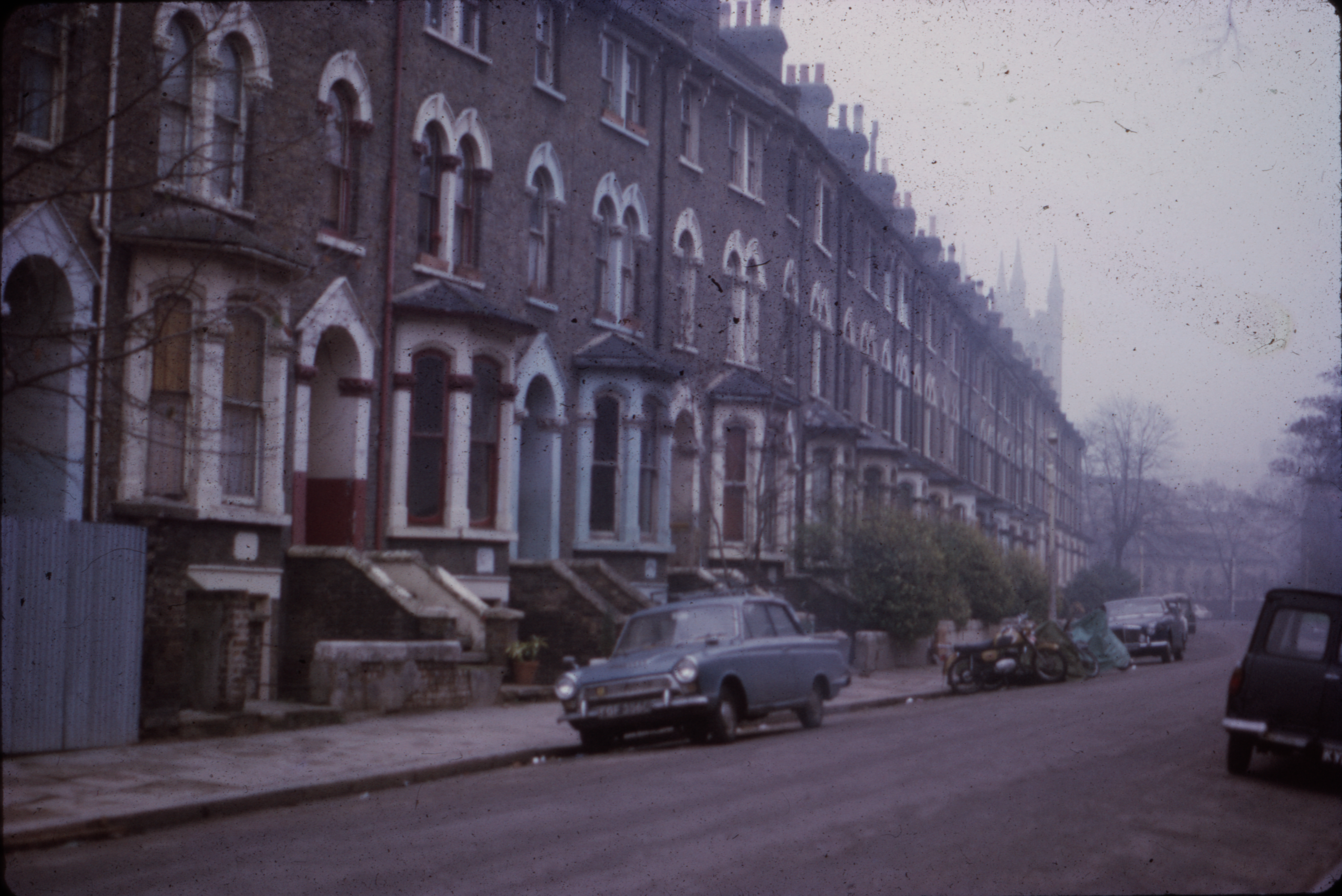
Angell Town is a predominantly residential neighborhood, characterized by rows of terraced houses and low-rise apartment buildings. The area is home to a mix of social housing and private residences, providing accommodation for a range of income levels. The community is ethnically diverse, with residents from various backgrounds contributing to the multicultural fabric of the area.

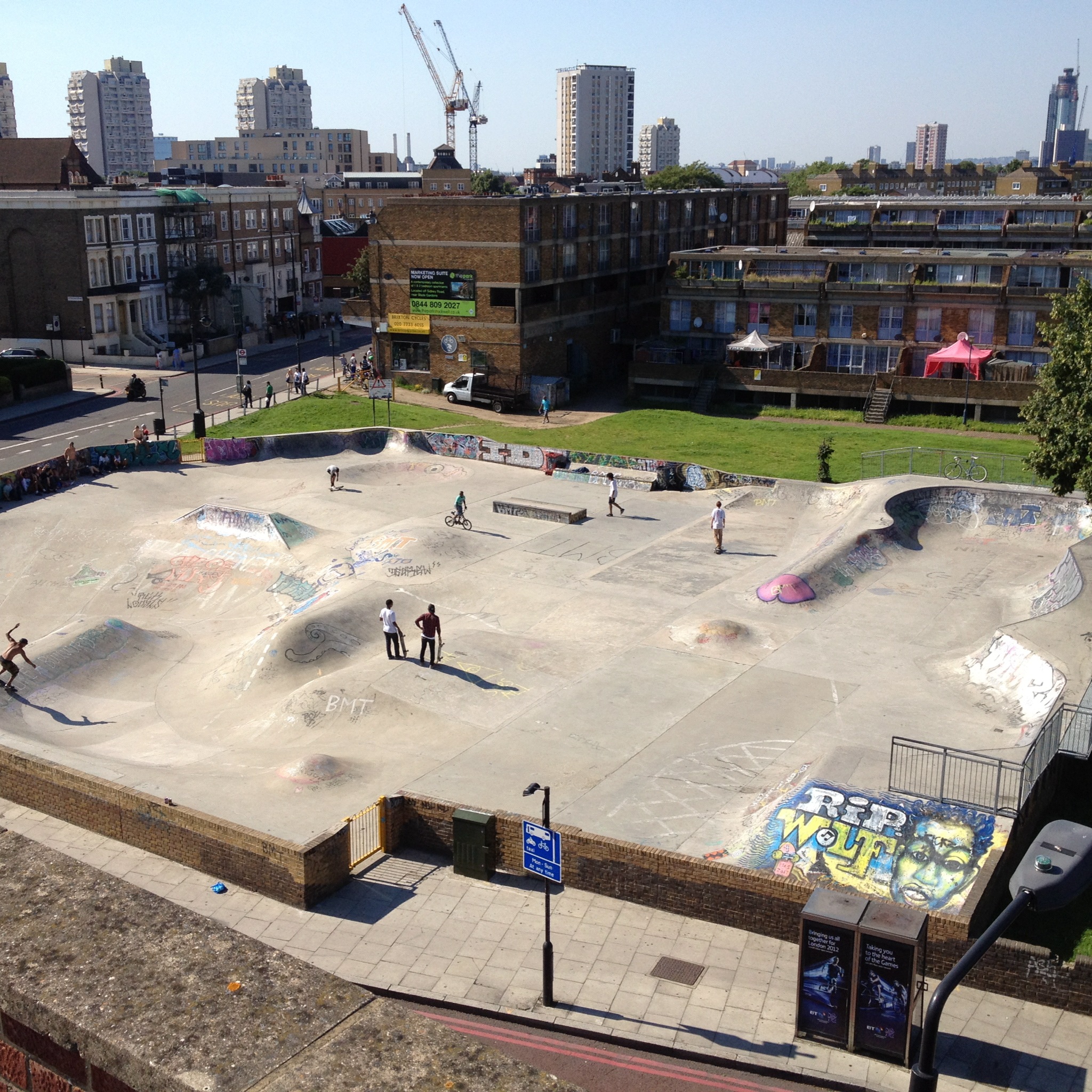
Despite facing socioeconomic challenges in the past, Angell Town has seen significant regeneration efforts in recent years. The area has undergone improvements in housing infrastructure, public spaces, and community services. These initiatives aim to enhance the quality of life for residents and promote a sense of pride and belonging within the neighborhood.

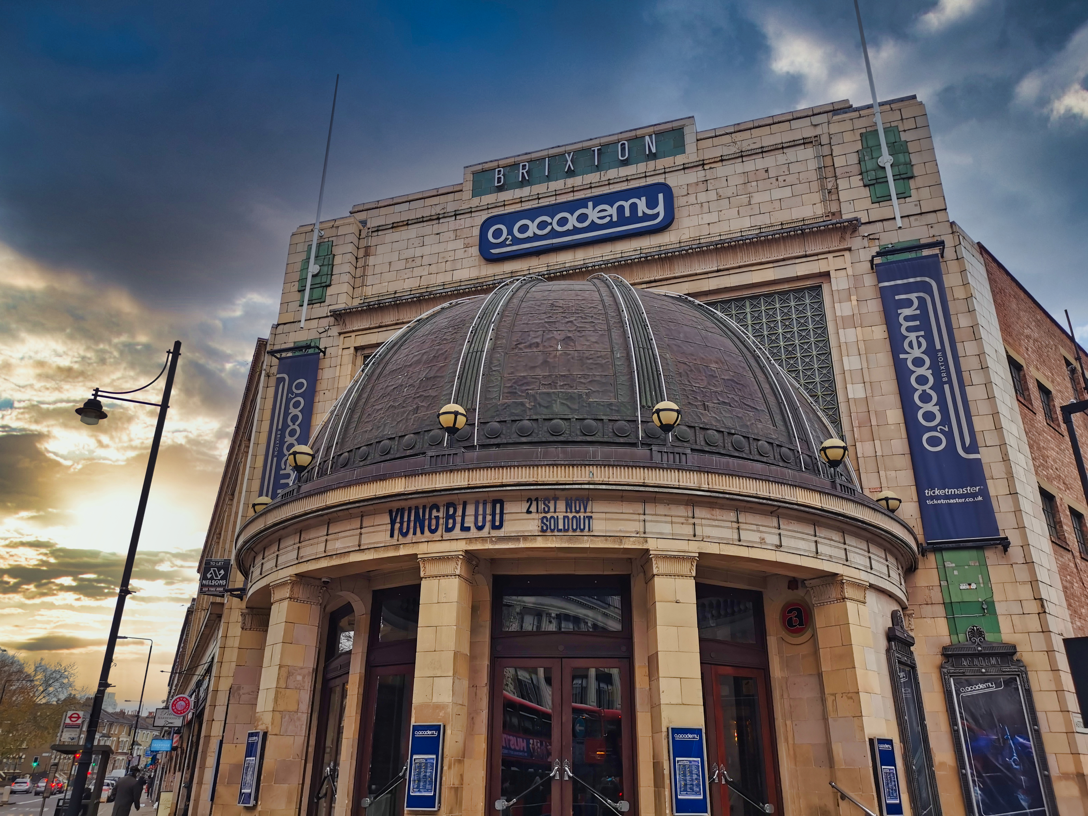
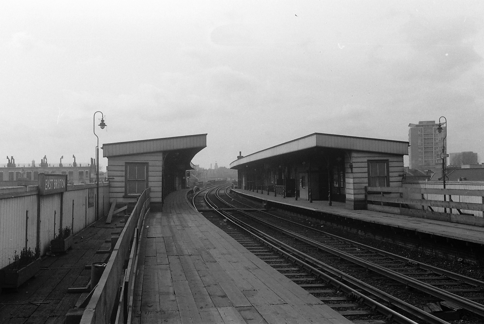
Angell Town benefits from its proximity to central London, with excellent transport links allowing for easy access to the city's amenities and employment opportunities. The area is also well-served by local amenities, including shops, schools, and recreational facilities.

Overall, Angell Town is a dynamic and evolving neighborhood that showcases the diversity and resilience of its community. Its ongoing regeneration projects have contributed to the improvement of the area, making it an attractive place to live for individuals and families seeking a vibrant and well-connected urban environment.

If you have any feedback on the listing, please let us know in the comments section below.
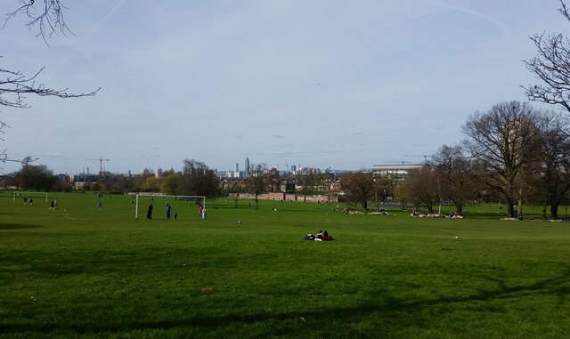
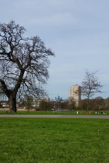
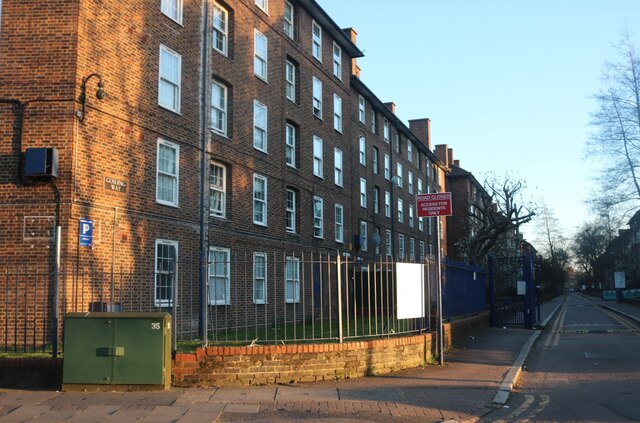
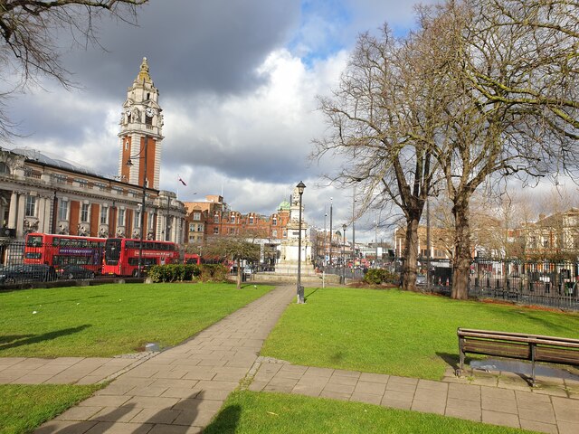
Angell Town Images

Images are sourced within 2km of 51.466791/-0.111138 or Grid Reference TQ3175. Thanks to Geograph Open Source API. All images are credited.

Old Milestone, A204, Effra Road, Windrush Square The milestone is located just before the junction with Brixton Hill on the East side of the road in the paved area of Windrush Square. Parish of Brixton (Lambeth District). Carved stone post, Surrey limestone pillar design, erected by the Surrey & Sussex turnpike trust in the 19th century.

Inscription reads:-  WHITEHALL 3½ / (MI)LES  ::  ROYAL / EXCHANGE / 4 / MILES  ::  ROYAL / EXCHANGE / 4 / MILES

Milestone Society National ID: SY_LBT03a
Old Milestone, A204, Effra Road, Windrush Square
The milestone is located just before the junction with Brixton Hill on the East side of the road in the paved area of Windrush Square. Parish of Brixton (Lambeth District). Carved stone post, Surrey limestone pillar design, erected by the Surrey & Sussex turnpike trust in the 19th century. Inscription reads:- WHITEHALL 3½ / (MI)LES :: ROYAL / EXCHANGE / 4 / MILES :: ROYAL / EXCHANGE / 4 / MILES Milestone Society National ID: SY_LBT03a
The Oval
The Oval
England play India at the Oval On this sunny September afternoon England had just begun a futile chase in their second innings against India.  They duly lost the following day: <span class="nowrap"><a title="https://www.espncricinfo.com/series/india-tour-of-england-2021-1239527/england-vs-india-4th-test-1239546/full-scorecard" rel="nofollow ugc noopener" href="https://www.espncricinfo.com/series/india-tour-of-england-2021-1239527/england-vs-india-4th-test-1239546/full-scorecard">Link</a><img style="margin-left:2px;" alt="External link" title="External link - shift click to open in new window" src="https://s1.geograph.org.uk/img/external.png" width="10" height="10"/></span> . Archbishop Tenison's School <span class="nowrap"><a title="https://www.tenisons.com/" rel="nofollow ugc noopener" href="https://www.tenisons.com/">Link</a><img style="margin-left:2px;" alt="External link" title="External link - shift click to open in new window" src="https://s1.geograph.org.uk/img/external.png" width="10" height="10"/></span> is visible to the right of the lights.
England play India at the Oval
On this sunny September afternoon England had just begun a futile chase in their second innings against India. They duly lost the following day: LinkExternal link . Archbishop Tenison's School LinkExternal link is visible to the right of the lights.
Nine Elms Station, Wandsworth Road On its first day of operation. It is one of two stations on a new Northern Line extension from Kennington, the terminus being Battersea Power Station.
They will serve an area being filled with hideous towers, examples of which can be seen behind, as well as the revamped power station, US Embassy etc.
Nine Elms Station, Wandsworth Road
On its first day of operation. It is one of two stations on a new Northern Line extension from Kennington, the terminus being Battersea Power Station. They will serve an area being filled with hideous towers, examples of which can be seen behind, as well as the revamped power station, US Embassy etc.
Interior detail of Nine Elms Station, Wandsworth Road The platforms on the station's first day of operation.
Exterior view: <a href="https://www.geograph.org.uk/photo/6968699">TQ3077 : Nine Elms Station, Wandsworth Road</a>.
Interior detail of Nine Elms Station, Wandsworth Road
The platforms on the station's first day of operation. Exterior view: TQ3077 : Nine Elms Station, Wandsworth Road.
Denmark Place Baptist Church
The derelict Cricketers pub The Cricketers pub next to Kennington Oval has been closed and derelict since 2002. In March 2019, planning permission was granted for demolition and construction of a new residential development with a replacement ground floor public house. Behind are the famous Grade II gasholders, familiar from test matches at the Oval. The shape of the Oval Cricket Ground was determined by the pre-existing street pattern – not the other way around.
The derelict Cricketers pub
The Cricketers pub next to Kennington Oval has been closed and derelict since 2002. In March 2019, planning permission was granted for demolition and construction of a new residential development with a replacement ground floor public house. Behind are the famous Grade II gasholders, familiar from test matches at the Oval. The shape of the Oval Cricket Ground was determined by the pre-existing street pattern – not the other way around.
David Bowie mural
David Bowie mural
Brockwell Park Brockwell Park is a 50 hectare park located between Brixton, Herne Hill and Tulse Hill, bordered by Brixton Water Lane, Norwood Road, Tulse Hill (Road), and Dulwich Road in South London.
The park commands views of the skyline of the city and Central London, and hosts almost 4 million annual visits. At the top of the hill within the park stands Brockwell Hall.
Brockwell Park is a Site of Importance for Nature Conservation (SINC) of Borough Importance, with mature trees including ancient oaks, substantial lawn areas set to meadow, and a series of lakes. As well as adding to the landscape value, these support a variety of birds, and bats.
The Park is listed for its heritage value on The National Heritage List for England, Parks & Gardens, Grade II. Noted for its nineteenth century layout as a gracious public park, the clocktower, water garden, JJ Sexby designed walled garden and other monuments, the park provides a pleasant exploration with links to its eighteenth century agricultural past in the hedge lines, and mature oak trees. 
The Brockwell Lido, a Grade II listed art deco building near the top of the park, is an open-air swimming pool popular with swimmers and bathers. Its attached café/restaurant is also popular. Other amenities in Brockwell Park include tennis courts, a bowling green, a BMX track and a miniature railway.
Brockwell Park
Brockwell Park is a 50 hectare park located between Brixton, Herne Hill and Tulse Hill, bordered by Brixton Water Lane, Norwood Road, Tulse Hill (Road), and Dulwich Road in South London. The park commands views of the skyline of the city and Central London, and hosts almost 4 million annual visits. At the top of the hill within the park stands Brockwell Hall. Brockwell Park is a Site of Importance for Nature Conservation (SINC) of Borough Importance, with mature trees including ancient oaks, substantial lawn areas set to meadow, and a series of lakes. As well as adding to the landscape value, these support a variety of birds, and bats. The Park is listed for its heritage value on The National Heritage List for England, Parks & Gardens, Grade II. Noted for its nineteenth century layout as a gracious public park, the clocktower, water garden, JJ Sexby designed walled garden and other monuments, the park provides a pleasant exploration with links to its eighteenth century agricultural past in the hedge lines, and mature oak trees. The Brockwell Lido, a Grade II listed art deco building near the top of the park, is an open-air swimming pool popular with swimmers and bathers. Its attached café/restaurant is also popular. Other amenities in Brockwell Park include tennis courts, a bowling green, a BMX track and a miniature railway.
Brixton Road Youth Centre
Gosling Way, Stockwell
Cowley Road, Stockwell At the junction of Vassall Road
Cowley Road, Stockwell
At the junction of Vassall Road
Georgian house on Vassall Road, Stockwell
Church of St John the Divine, Kennington
Brixton - St Matthews Garden and Town Hall Brixton in London, with St Matthews Garden in the foreground and the Town Hall to the left, with the tower.
Brixton - St Matthews Garden and Town Hall
Brixton in London, with St Matthews Garden in the foreground and the Town Hall to the left, with the tower.
Show me another place!

Angell Town is located at Grid Ref: TQ3175 (Lat: 51.466791, Lng: -0.111138)

Unitary Authority: Lambeth

Police Authority: Metropolitan

What 3 Words

///wash.feel.thing. Near Brixton, London

Nearby Locations

Angell Town Brixton

Related Wikis

Nearby Amenities

Located within 500m of 51.466791,-0.111138
Traffic Signals
Traffic Signals Direction: backward
Lat/Long: 51.4679431/-0.1126214
Railway: switch
Lat/Long: 51.4633696/-0.1146802
Public Transport: stop_position
Railway: stop
Train: yes
Lat/Long: 51.462883/-0.1133593
Crossing
Lat/Long: 51.4634776/-0.114613
Traffic Calming: cushion
Lat/Long: 51.4664125/-0.1040939
Railway: switch
Lat/Long: 51.4633557/-0.1100523
Mini Roundabout
Direction: clockwise
Lat/Long: 51.4663859/-0.110502
Ref GB Tflcid: RWG106292
Traffic Calming: hump
Lat/Long: 51.46798/-0.1100889
Ref GB Tflcid: RWG119353
Traffic Calming: table
Lat/Long: 51.4673154/-0.1149228
Traffic Signals
Traffic Signals Direction: backward
Lat/Long: 51.4638482/-0.1147147
Crossing
Crossing: uncontrolled
Crossing Island: no
Crossing Ref: zebra
Tactile Paving: yes
Lat/Long: 51.4626529/-0.1131181
Crossing
Button Operated: yes
Crossing: traffic_signals
Crossing Island: no
Crossing Ref: pelican
Tactile Paving: yes
Lat/Long: 51.4632574/-0.114706
Ref GB Tflcid: RWG106234
Traffic Calming: table
Lat/Long: 51.4625734/-0.1129365
Surface: paving_stones
Traffic Calming: table
Lat/Long: 51.4705544/-0.1145827
Ref GB Tflcid: RWG106054
Traffic Calming: hump
Lat/Long: 51.4683661/-0.1083562
Ref GB Tflcid: RWG106250
Traffic Calming: hump
Lat/Long: 51.4700131/-0.1082911
Traffic Signals
Traffic Signals Direction: backward
Lat/Long: 51.4706578/-0.1075049
Ref GB Tflcid: RWG119348
Traffic Calming: hump
Lat/Long: 51.4691995/-0.1166768
Ref GB Tflcid: RWG119347
Traffic Calming: hump
Lat/Long: 51.4692445/-0.1169847
Ref GB Tflcid: RWG119356
Traffic Calming: table
Lat/Long: 51.4674767/-0.1140275
Ref GB Tflcid: RWG119294
Traffic Calming: table
Lat/Long: 51.4671709/-0.1158563
Barrier: bollard
Lat/Long: 51.4685504/-0.1173768
Traffic Calming: cushion
Lat/Long: 51.4639895/-0.1094794
Ref GB Tflcid: RWG105768
Traffic Calming: hump
Lat/Long: 51.4642612/-0.1113997
Ref GB Tflcid: RWG105939
Traffic Calming: yes
Lat/Long: 51.4645499/-0.113597
Traffic Calming: cushion
Lat/Long: 51.4650637/-0.1125971
Surface: paving_stones
Traffic Calming: table
Lat/Long: 51.4632207/-0.1125842
Atm
Fee: £1.5
Lat/Long: 51.4709819/-0.1127226
Car Sharing
Capacity: 1
Operator: Streetcar
Operator Wikidata: Q7623070
Source: WebSite
Lat/Long: 51.4645689/-0.1076531
Post Box
Brand: Royal Mail
Brand Wikidata: Q638098
Brand Wikipedia: en:Royal Mail
Operator: Royal Mail
Operator Wikidata: Q638098
Ref: SW9 15
Lat/Long: 51.4668163/-0.1101209
Bicycle Parking
Bicycle Parking: stands
Capacity: 6
Covered: no
Source: survey ch
Lat/Long: 51.4647113/-0.1137068
Bicycle Parking
Bicycle Parking: stands
Capacity: 8
Covered: no
Source: survey ch
Lat/Long: 51.4648115/-0.1136657
Fire Station
L.C.C. Fire Brigade Station Brixton
Check Date: 2023-12-20
Lat/Long: 51.463738/-0.1094055
Telephone
Booth: KX100
Covered: booth
Lat/Long: 51.4650897/-0.1088841
Post Box
Brand: Royal Mail
Brand Wikidata: Q638098
Brand Wikipedia: en:Royal Mail
Operator: Royal Mail
Operator Wikidata: Q638098
Lat/Long: 51.4662975/-0.1056797
Telephone
Booth: KX100
Covered: booth
Lat/Long: 51.4666622/-0.1074508
Bicycle Parking
Capacity: 12
Lat/Long: 51.4674875/-0.1061449
Ref GB Tflcid: RWG106346
Traffic Calming: hump
Lat/Long: 51.4702299/-0.1107158
Crossing
Button Operated: yes
Crossing: traffic_signals
Crossing Island: no
Tactile Paving: yes
Lat/Long: 51.4632012/-0.1148544
Pub
SW9 BAR
Addr City: London
Addr Housenumber: 11
Addr Postcode: SW9 8EG
Addr Street: Dorrell Place
Fhrs Authority: Lambeth
Fhrs Id: 484077
Fhrs Inspectiondate: 2013-01-17
Fhrs Rating: 3
Lat/Long: 51.4633202/-0.1157269
Post Office
Brixton Post Office
Addr City: London
Addr Postcode: SW9 8FR
Addr Street: Ferndale Road
Brand: Post Office
Brand Wikidata: Q1783168
Operator: Post Office
Operator Wikidata: Q1783168
Ref Pol Id: 135672
Lat/Long: 51.4641172/-0.116046
Telephone
Booth: KX100
Covered: booth
Lat/Long: 51.4640605/-0.1159202
Telephone
Booth: InLink
Lat/Long: 51.4642309/-0.1144836
Bicycle Parking
Bicycle Parking: stands
Capacity: 12
Covered: no
Source: survey ch
Lat/Long: 51.4643088/-0.1144491
Fuel
Esso
Addr Housenumber: 330
Addr Street: Brixton Road
Brand: Esso
Brand Wikidata: Q867662
Brand Wikipedia: en:Esso
Contact Website: https://www.esso.co.uk/en-gb/find-station/esso-stockwell-essotescostockwellexpress-100311928
Fuel Diesel: yes
Fuel Octane 95: yes
Fuel Octane 99: yes
Postal Code: SW9 7AA
Lat/Long: 51.4685651/-0.1129054
Pub
Jamm
Addr City: London
Addr Housenumber: 261
Addr Postcode: SW9 6LH
Addr Street: Brixton Road
Alt Name: Brixton Jamm
Source: website
Website: https://brixtonjamm.org/
Lat/Long: 51.4706805/-0.112081
Recycling
Lat/Long: 51.4679248/-0.1049238
Bus Stop
Brixton Station
Bus: yes
Local Ref: L
Naptan AtcoCode: 490000031E
Naptan Bearing: S
Naptan CommonName: Brixton
Naptan Indicator: Stop L
Naptan Street: ATLANTIC ROAD
Naptan Verified: no
Public Transport: platform
Ref: 50089
Lat/Long: 51.4629377/-0.1136269
Bus Stop
Brixton Station
Bus: yes
Local Ref: LA
Naptan AtcoCode: 490000031W
Naptan Bearing: NW
Naptan CommonName: Brixton
Naptan Indicator: Stop LA
Naptan Verified: no
Public Transport: platform
Ref: 71551
Lat/Long: 51.4630998/-0.1144089
Bus Stop
Gresham Road / Brixton Police Station
Bench: yes
Bus: yes
Local Ref: H
Naptan AtcoCode: 490004361H
Naptan Bearing: N
Naptan CommonName: Gresham Rd Brixton Police Stn
Naptan Indicator: H
Naptan Street: GRESHAM ROAD
Naptan Verified: no
Public Transport: platform
Shelter: yes
Lat/Long: 51.4650614/-0.1131557
Bus Stop
Gresham Road / Brixton Police Station
Bus: yes
Local Ref: K
Naptan AtcoCode: 490004361K
Naptan Bearing: N
Naptan CommonName: Gresham Rd Brixton Police Stn
Naptan Indicator: K
Naptan Street: GRESHAM ROAD
Naptan Verified: no
Public Transport: platform
Shelter: yes
Lat/Long: 51.4649003/-0.1134611
Bus Stop
Brixton Academy
Bench: yes
Bus: yes
Lit: yes
Local Ref: B
Naptan AtcoCode: 490007523B
Naptan Bearing: SE
Naptan CommonName: Brixton Police Station
Naptan Indicator: Stop B
Naptan Street: STOCKWELL ROAD
Naptan Verified: no
Public Transport: platform
Ref: 73696
Shelter: yes
Lat/Long: 51.465208/-0.115225
Bus Stop
Brixton Academy
Bench: yes
Bin: yes
Bus: yes
Lit: yes
Local Ref: C
Naptan AtcoCode: 490007523C
Naptan Bearing: N
Naptan CommonName: Brixton Police Station
Naptan Indicator: C
Naptan Street: STOCKWELL ROAD
Naptan Verified: no
Public Transport: platform
Ref: 48876
Shelter: yes
Tactile Paving: no
Lat/Long: 51.4649669/-0.1150367
Bus Stop
Brixton Road / Brixton Police Station
Local Ref: D
Naptan AtcoCode: 490007523D
Naptan Bearing: N
Naptan CommonName: Brixton Police Station
Naptan Indicator: D
Naptan Street: BRIXTON ROAD
Public Transport: platform
Ref: 49468
Lat/Long: 51.4656652/-0.1138902
Bus Stop
Brixton Road / Brixton Police Station
Bus: yes
Local Ref: E
Naptan AtcoCode: 490007523E
Naptan Bearing: N
Naptan CommonName: Brixton Police Station
Naptan Indicator: E
Naptan Street: BRIXTON ROAD
Public Transport: platform
Ref: 51628
Lat/Long: 51.4653844/-0.1140095
Bus Stop
Stockwell Park Walk
Bus: yes
Naptan AtcoCode: 490007523EB
Naptan Bearing: E
Naptan CommonName: Brixton Police Station
Naptan Indicator: Stop
Naptan Street: STOCKWELL PARK WALK
Naptan Verified: no
Note: Bus stand
Public Transport: platform
Lat/Long: 51.466059/-0.1146153
Bus Stop
Brixton Road / Brixton Police Station
Bench: yes
Bin: no
Bus: yes
Lit: yes
Local Ref: F
Naptan AtcoCode: 490007523F
Naptan Bearing: N
Naptan CommonName: Brixton Police Station
Naptan Indicator: F
Public Transport: platform
Ref: 72181
Shelter: yes
Tactile Paving: no
Lat/Long: 51.4655067/-0.1136412
Bus Stop
Brixton Road / Brixton Police Station
Bench: yes
Bin: yes
Bus: yes
Lit: yes
Local Ref: G
Naptan AtcoCode: 490007523G
Naptan Bearing: N
Naptan CommonName: Brixton Police Station
Naptan Indicator: Stop G
Naptan Street: BRIXTON ROAD
Public Transport: platform
Ref: 52704
Shelter: yes
Tactile Paving: no
Lat/Long: 51.46536/-0.1137201
Bus Stop
Loughborough Road / Hopton House
Bus: yes
Naptan AtcoCode: 490008345N
Naptan Bearing: N
Naptan CommonName: Loughborough Rd Hopton House
Naptan Street: LOUGHBOROUGH ROAD
Naptan Verified: no
Public Transport: platform
Ref: 51577
Source Ref: naptan
Lat/Long: 51.4681044/-0.1056662
Bus Stop
Loughborough Road / Hopton House
Bus: yes
Naptan AtcoCode: 490008345S
Naptan Bearing: N
Naptan CommonName: Loughborough Rd Hopton House
Naptan Street: LOUGHBOROUGH ROAD
Naptan Verified: no
Public Transport: platform
Ref: 56747
Source Ref: naptan
Lat/Long: 51.467709/-0.1052503
Bus Stop
Loughborough Road
Bus: yes
Local Ref: RB
Naptan AtcoCode: 490009373N1
Naptan Bearing: N
Naptan CommonName: Loughborough Rd Brixton Road
Naptan Indicator: Stop RB
Naptan Street: BRIXTON ROAD
Naptan Verified: no
Public Transport: platform
Ref: 72478
Shelter: yes
Lat/Long: 51.4695851/-0.11259
Bus Stop
Loughborough Road
Bus: yes
Local Ref: RK
Naptan AtcoCode: 490009373S1
Naptan Bearing: S
Naptan CommonName: Loughborough Rd Brixton Road
Naptan Indicator: Stop RK
Naptan Street: BRIXTON ROAD
Naptan Verified: no
Public Transport: platform
Ref: 76061
Shelter: yes
Lat/Long: 51.4698165/-0.1124022
Bus Stop
Lilford Road
Bench: yes
Bus: yes
Naptan AtcoCode: 490009154N
Naptan Bearing: N
Naptan CommonName: Lilford Road Loughborough Rd
Naptan Street: LOUGHBOROUGH ROAD
Naptan Verified: no
Public Transport: platform
Shelter: yes
Lat/Long: 51.4700711/-0.106879
Bus Stop
Lilford Road
Naptan AtcoCode: 490009154S
Naptan Bearing: N
Naptan CommonName: Lilford Road Loughborough Rd
Naptan Street: LOUGHBOROUGH ROAD
Naptan Verified: no
Public Transport: platform
Lat/Long: 51.4697326/-0.1064267
Bus Stop
Stansfield Road
Bus: yes
Naptan AtcoCode: 490012578B
Naptan Bearing: E
Naptan CommonName: Stansfield Road
Naptan Street: STOCKWELL ROAD
Naptan Verified: no
Public Transport: platform
Ref: 53827
Lat/Long: 51.4663363/-0.1167851
Bus Stop
Stansfield Road
Bus: yes
Naptan AtcoCode: 490012578N
Naptan Bearing: N
Naptan CommonName: Stansfield Road
Naptan Street: STOCKWELL ROAD
Naptan Verified: no
Public Transport: platform
Ref: 59344
Lat/Long: 51.4665276/-0.1171706
Bus Stop
Villa Road
Bus: yes
Local Ref: RA
Naptan AtcoCode: 490014085N
Naptan Bearing: N
Naptan CommonName: Villa Road
Naptan Indicator: Stop RA
Naptan Street: BRIXTON ROAD
Naptan Verified: no
Public Transport: platform
Ref: 52215
Lat/Long: 51.4674627/-0.1128724
Bus Stop
Villa Road
Bus: yes
Local Ref: RL
Naptan AtcoCode: 490014085S
Naptan Bearing: S
Naptan CommonName: Villa Road
Naptan Indicator: Stop RL
Naptan Street: BRIXTON ROAD
Naptan Verified: no
Public Transport: platform
Ref: 47190
Lat/Long: 51.4676074/-0.1126444
Bus Stop
Brixton Station Road
Bench: yes
Bin: yes
Bus: yes
Lit: yes
Local Ref: R
Naptan AtcoCode: 490014794W
Naptan Bearing: W
Naptan CommonName: Brixton Station Road
Naptan Indicator: Stop R
Naptan Street: GRESHAM ROAD
Naptan Verified: no
Public Transport: platform
Ref: 53809
Shelter: yes
Source Ref: naptan
Tactile Paving: no
Lat/Long: 51.4642098/-0.1098907
Bus Stop
Brixton Station Road
Bench: yes
Bus: yes
Local Ref: T
Naptan AtcoCode: 490015389E
Naptan Bearing: E
Naptan CommonName: Brixton Station RdMoorland Rd
Naptan Indicator: Stop T
Naptan Verified: no
Public Transport: platform
Ref: 72137
Shelter: yes
Source Ref: naptan
Lat/Long: 51.4633955/-0.1082581
Bus Stop
Moorland Road
Bench: no
Bin: no
Bus: yes
Lit: yes
Local Ref: N
Naptan AtcoCode: 490015389W
Naptan Bearing: W
Naptan CommonName: Brixton Station RdMoorland Rd
Naptan Indicator: Stop N
Naptan Verified: no
Public Transport: platform
Ref: 71225
Shelter: no
Source Ref: naptan
Tactile Paving: no
Lat/Long: 51.4632986/-0.1066702
Bus Stop
Western Road
Bench: no
Bin: no
Bus: yes
Lit: yes
Local Ref: S
Naptan AtcoCode: 490014447E
Naptan Bearing: E
Naptan CommonName: Western Road Gresham Road
Naptan Indicator: Stop S
Naptan Verified: no
Public Transport: platform
Shelter: no
Tactile Paving: no
Lat/Long: 51.4649067/-0.1105135
Post Box
Brand: Royal Mail
Brand Wikidata: Q638098
Brand Wikipedia: en:Royal Mail
Operator: Royal Mail
Operator Wikidata: Q638098
Ref: SW9 12
Lat/Long: 51.4658669/-0.1065021
Barrier: bollard
Lat/Long: 51.4678026/-0.1094475
Barrier: bollard
Foot: yes
Lat/Long: 51.467906/-0.1123413
Barrier: bollard
Foot: yes
Lat/Long: 51.4678676/-0.111918
Toilets
Pope's Road Toilets
Fee: no
Source: survey
Lat/Long: 51.4629238/-0.1127436
Telephone
Source: BrixtonVillageMap
Lat/Long: 51.4628116/-0.1130109
Cafe
San Marino
Addr City: London
Addr Housenumber: 413
Addr Postcode: SW9 7DG
Addr Street: Brixton Road
Check Date: 2024-04-12
Cuisine: italian
Fhrs Authority: Lambeth
Fhrs Id: 483505
Fhrs Inspectiondate: 2013-02-06
Fhrs Rating: 5
Lat/Long: 51.4635424/-0.1144562
Crossing
Crossing: traffic_signals
Crossing Island: yes
Crossing Ref: pelican
Tactile Paving: yes
Lat/Long: 51.4671882/-0.104996
Ref GB Tflcid: RWG106282
Traffic Calming: hump
Lat/Long: 51.4683791/-0.109335
Post Box
Brand: Royal Mail
Brand Wikidata: Q638098
Brand Wikipedia: en:Royal Mail
Operator: Royal Mail
Operator Wikidata: Q638098
Ref: SW9 34
Lat/Long: 51.4672083/-0.1053099
Post Box
Brand: Royal Mail
Brand Wikidata: Q638098
Operator: Royal Mail
Operator Wikidata: Q638098
Ref: SW9 5
Lat/Long: 51.4696199/-0.1066034
Post Box
Operator: Royal Mail
Operator Wikidata: Q638098
Ref: SW9 124
Lat/Long: 51.4640588/-0.115404
Post Box
Brand: Royal Mail
Brand Wikidata: Q638098
Brand Wikipedia: en:Royal Mail
Operator: Royal Mail
Operator Wikidata: Q638098
Ref: SW9 29
Lat/Long: 51.4650513/-0.110631
Post Box
Brand: Royal Mail
Brand Wikidata: Q638098
Operator: Royal Mail
Operator Wikidata: Q638098
Ref: SW9 10
Lat/Long: 51.4628793/-0.1083755
Ref GB Tflcid: RWG105727
Traffic Calming: cushion
Lat/Long: 51.4657734/-0.106847
Ref GB Tflcid: RWG106045
Traffic Calming: hump
Lat/Long: 51.4677267/-0.1079112
Surface: paving_stones
Traffic Calming: table
Lat/Long: 51.4704824/-0.1150839
Ref GB Tflcid: RWG106313
Traffic Calming: hump
Lat/Long: 51.4687143/-0.1108415
Ref GB Tflcid: RWG106334
Traffic Calming: hump
Lat/Long: 51.4696085/-0.1113533
Public Transport: stop_position
Railway: stop
Train: yes
Lat/Long: 51.4629077/-0.1133353
Railway: railway_crossing
Lat/Long: 51.4632929/-0.1143426
Railway: switch
Lat/Long: 51.4633249/-0.110045
Railway: switch
Lat/Long: 51.4633928/-0.1146472
Railway: railway_crossing
Lat/Long: 51.4634233/-0.1095539
Crossing
Crossing: traffic_signals
Crossing Island: separate
Crossing Markings: dots
Crossing Signals: yes
Lat/Long: 51.4647211/-0.1143894
Traffic Calming: cushion
Lat/Long: 51.4654471/-0.1095067
Crossing
Crossing: traffic_signals
Crossing Island: no
Crossing Markings: dots
Crossing Signals: yes
Crossing Ref: pelican
Tactile Paving: yes
Lat/Long: 51.4660253/-0.1138076
Ref GB Tflcid: RWG105955
Traffic Calming: hump
Lat/Long: 51.466126/-0.1126335
Ref GB Tflcid: RWG106300
Traffic Calming: hump
Lat/Long: 51.4682644/-0.1113909
Ref GB Tflcid: RWG106319
Traffic Calming: hump
Lat/Long: 51.4684552/-0.1113336
Entrance: yes
Lat/Long: 51.4624081/-0.1124316
Bicycle Parking
Bicycle Parking: stands
Capacity: 4
Covered: no
Source: survey ch
Lat/Long: 51.4646583/-0.1143342
Bicycle Parking
Bicycle Parking: stands
Capacity: 6
Covered: no
Source: survey ch
Lat/Long: 51.4647411/-0.115472
Bicycle Parking
Bicycle Parking: stands
Capacity: 4
Check Date: 2023-09-04
Covered: no
Source: survey ch
Lat/Long: 51.4650069/-0.1151097
Crossing
Crossing: unmarked
Lat/Long: 51.4629143/-0.1138441
Fitness First
Brand: Fitness First
Brand Wikidata: Q127120
Brand Wikipedia: en:Fitness First
Check Date: 2024-04-27
Leisure: fitness_centre
Lat/Long: 51.4644175/-0.1153397
Atm
Lat/Long: 51.464135/-0.114259
Bicycle Parking
Bicycle Parking: stands
Capacity: 4
Covered: no
Source: survey ch
Lat/Long: 51.4626947/-0.1092128
Bicycle Parking
Bicycle Parking: stands
Capacity: 12
Source: survey ch
Lat/Long: 51.4632763/-0.1127587
Bicycle Parking
Bicycle Parking: stands
Capacity: 4
Covered: no
Source: survey ch
Lat/Long: 51.4628384/-0.1134759
Bicycle Parking
Bicycle Parking: stands
Capacity: 4
Covered: no
Source: survey ch
Lat/Long: 51.463127/-0.1141896
Bicycle Parking
Bicycle Parking: stands
Capacity: 16
Covered: no
Source: survey ch
Lat/Long: 51.4639108/-0.1146259
Bicycle Parking
Bicycle Parking: stands
Capacity: 6
Covered: no
Source: survey ch
Lat/Long: 51.4646465/-0.1103877
Bicycle Parking
Bicycle Parking: stands
Capacity: 4
Covered: no
Source: survey ch
Lat/Long: 51.4659082/-0.1137442
Bicycle Parking
Bicycle Parking: stands
Capacity: 4
Covered: no
Source: survey ch
Lat/Long: 51.4651222/-0.1141231
Bicycle Parking
Bicycle Parking: stands
Capacity: 4
Covered: no
Source: survey ch
Lat/Long: 51.4648203/-0.1142286
Bicycle Parking
Bicycle Parking: stands
Capacity: 10
Source: survey ch
Lat/Long: 51.4669292/-0.1102696
Bicycle Parking
Bicycle Parking: stands
Capacity: 2
Covered: no
Source: survey ch
Lat/Long: 51.4708222/-0.1126783
Bicycle Parking
Capacity: 5
Lat/Long: 51.4639473/-0.1151913
Bicycle Parking
Access: yes
Bicycle Parking: stands
Capacity: 28
Covered: no
Fee: no
Lat/Long: 51.4632619/-0.1152587
Bicycle Parking
Bicycle Parking: Plantlocker
Capacity: 3
Covered: no
Source: survey ch
Lat/Long: 51.4663589/-0.1168022
Bicycle Parking
Bicycle Parking: stands
Capacity: 2
Covered: no
Source: survey ch
Lat/Long: 51.4668579/-0.1171755
Bicycle Parking
Bicycle Parking: stands
Capacity: 4
Covered: no
Source: survey ch
Lat/Long: 51.4664041/-0.1168397
Bicycle Parking
Bicycle Parking: stands
Capacity: 4
Covered: no
Source: survey ch
Lat/Long: 51.4657684/-0.1160383
Bicycle Parking
Bicycle Parking: post_hoop
Capacity: 2
Covered: no
Source: survey ch
Lat/Long: 51.4661922/-0.1172449
Bicycle Parking
Bicycle Parking: stands
Capacity: 2
Covered: no
Source: survey ch
Lat/Long: 51.465583/-0.1163278
Bicycle Parking
Bicycle Parking: stands
Capacity: 6
Covered: no
Source: survey ch
Lat/Long: 51.46675/-0.1047295
Bicycle Parking
Bicycle Parking: stands
Capacity: 8
Covered: no
Source: survey ch
Lat/Long: 51.4667032/-0.1050943
Bicycle Parking
Bicycle Parking: stands
Capacity: 2
Check Date: 2023-09-04
Covered: no
Source: survey ch
Lat/Long: 51.465079/-0.115233
Crossing
Crossing: unmarked
Lat/Long: 51.466168/-0.1130038
Traffic Signals
Traffic Signals Direction: forward
Lat/Long: 51.4660924/-0.1134413
Traffic Signals
Traffic Signals Direction: backward
Lat/Long: 51.46581/-0.1136458
Traffic Signals
Lat/Long: 51.4660114/-0.113912
Crossing
Crossing: traffic_signals
Crossing Island: separate
Crossing Markings: dots
Crossing Signals: yes
Crossing Ref: pelican
Tactile Paving: yes
Lat/Long: 51.4649522/-0.1138363
Give Way
Direction: forward
Lat/Long: 51.4658715/-0.1161585
Bicycle Parking
Bicycle Parking: stands
Capacity: 50
Covered: no
Lat/Long: 51.4630193/-0.1148395
Rajan News
Addr Housenumber: 193
Addr Street: Ferndale Road
Shop: newsagent
Lat/Long: 51.4639435/-0.116145
Bicycle Parking
Access: yes
Bicycle Parking: stands
Capacity: 8
Covered: no
Fee: no
Lat/Long: 51.4638901/-0.1152322
Restaurant
Nando's
Addr City: London
Addr Postcode: SW9 9SP
Addr Street: Stockwell Road
Brand: Nando's
Brand Wikidata: Q3472954
Brand Wikipedia: en:Nando's
Check Date: 2023-12-20
Cuisine: chicken;portuguese
Fhrs Authority: Lambeth
Fhrs Id: 484483
Fhrs Inspectiondate: 2011-11-21
Fhrs Rating: 5
Website: https://www.nandos.co.uk/restaurants/brixton
Lat/Long: 51.4648591/-0.1150117
Crossing
Crossing: unmarked
Crossing Island: no
Traffic Calming: table
Lat/Long: 51.4656828/-0.1164406
Fast Food
Morley's
Addr City: London
Addr Housenumber: 398
Addr Postcode: SW9 7AW
Addr Street: Brixton Road
Brand: Morley's
Brand Wikidata: Q21008528
Brand Wikipedia: en:Morley's
Cuisine: chicken
Fhrs Authority: Lambeth
Fhrs Id: 483261
Fhrs Inspectiondate: 2014-07-09
Fhrs Rating: 5
Takeaway: yes
Lat/Long: 51.4652654/-0.1142356
Bernados
Addr City: London
Addr Housenumber: 414
Addr Postcode: SW9 7AY
Addr Street: Brixton Road
Check Date: 2023-12-20
Opening Hours: Mo-Sa 09:30-17:30; Su 10:00-16:00
Phone: +44 20 7274 4165
Shop: charity
Website: https://www.barnardos.org.uk/shops/our-shops/brixton
Lat/Long: 51.4646055/-0.1145138
Shop: houseware
Lat/Long: 51.4625878/-0.1124578
Shop: houseware
Lat/Long: 51.4626195/-0.113292
SW Food Store
Addr City: London
Addr Housenumber: 34-36
Addr Postcode: SW9 8JR
Addr Street: Electric Avenue
Fhrs Authority: Lambeth
Fhrs Id: 484083
Fhrs Inspectiondate: 2007-09-04
Fhrs Rating: 4
Shop: grocery
Lat/Long: 51.4624922/-0.1132221
Shop: bakery
Lat/Long: 51.4626433/-0.1125579
Entrance: yes
Lat/Long: 51.462782/-0.1133233
Brixton
Fare Zone: 2
Name Ru: Брикстон
Naptan AtcoCode: 9100BRIXTON
Network: National Rail
Network Website: https://www.nationalrail.co.uk/stations/brx/
Network Wikidata: Q26334
Opening Hours: Mo-Fr 06:30-20:30; Sa 08:00-15:00
Operator: Southeastern
Operator Website: https://www.southeasternrailway.co.uk/travel-information/more-travel-help/station-information/stations/brixton
Operator Wikidata: Q108888230
Public Transport: station
Railway: station
Ref Crs: BRX
Ref Stanox: 87248
Ref Tiploc: BRIXTON
Source Network: Sign
Source Ref: http://en.wikipedia.org/wiki/List_of_London_railway_stations
Train: yes
Wheelchair: no
Wikidata: Q2212863
Wikipedia: en:Brixton railway station
Lat/Long: 51.4628953/-0.1133473
Ref GB Tflcid: RWG078577
Traffic Calming: hump
Lat/Long: 51.4710223/-0.1100404
Ref GB Tflcid: RWG078579
Traffic Calming: hump
Lat/Long: 51.4711081/-0.1101486
Ref GB Tflcid: RWG106057
Traffic Calming: hump
Lat/Long: 51.4699076/-0.1083049
Ref GB Tflcid: RWG106254
Traffic Calming: hump
Lat/Long: 51.4700889/-0.1090508
Crossing
Crossing: unmarked
Lat/Long: 51.464572/-0.1081078
Crackerjack Food And Wine
Addr City: London
Addr Housenumber: 394
Addr Postcode: SW9 7AW
Addr Street: Brixton Road
Fhrs Authority: Lambeth
Fhrs Id: 623101
Fhrs Inspectiondate: 2013-11-27
Fhrs Rating: 4
Shop: convenience
Lat/Long: 51.4654123/-0.1141672
Ice Cream
Creams
Addr City: London
Addr Housenumber: 392-394
Addr Postcode: SW9 7AW
Addr Street: Brixton Road
Brand: Creams
Brand Wikidata: Q111811895
Contact Email: brixton@creamscafe.com
Contact Phone: 0207 738 4002
Contact Website: https://www.creamscafe.com/our-stores/london-brixton/
Cuisine: ice_cream
Fhrs Authority: Lambeth
Fhrs Id: 623105
Shop: ice_cream
Lat/Long: 51.4654859/-0.1141301
J F Grocer
Addr City: London
Addr Housenumber: 406-408
Addr Postcode: SW9 7AW
Addr Street: Brixton Road
Fhrs Authority: Lambeth
Fhrs Id: 483263
Fhrs Inspectiondate: 2012-03-01
Fhrs Rating: 1
Shop: convenience
Lat/Long: 51.4651107/-0.1143104
Restaurant
Dahlak
Addr City: London
Addr Housenumber: 256-258
Addr Postcode: SW9 6AQ
Addr Street: Brixton Road
Cuisine: eritrean
Fhrs Authority: Lambeth
Fhrs Id: 483253
Fhrs Inspectiondate: 2013-03-22
Fhrs Rating: 1
Lat/Long: 51.4711009/-0.1128227
Crossing
Crossing: traffic_signals
Crossing Ref: pelican
Lat/Long: 51.4679886/-0.1126046
Fast Food
Panda Oriental
Addr City: London
Addr Floor: Ground Floor
Addr Housenumber: 284
Addr Postcode: SW9 6AG
Addr Street: Brixton Road
Cuisine: chinese
Fhrs Id: 981463
Fhrs Local Authority Id: 17/00113/COMM
Old Fhrs Id: 483388
Old Name: Chicken and Kebab Junction
Source: FHRS Open Data
Takeaway: yes
Lat/Long: 51.4704518/-0.1127271
Low Cost Food & Wine
Addr City: London
Addr Housenumber: 274-280
Addr Postcode: SW9 6AG
Addr Street: Brixton Road
Fhrs Id: 483256
Fhrs Local Authority Id: 05650/0274/3/001
Shop: convenience
Lat/Long: 51.4705502/-0.1127356
Fast Food
Fez & Bar-B-Q
Addr City: London
Addr Housenumber: 292
Addr Postcode: SW9 6AG
Addr Street: Brixton Road
Cuisine: kebab
Fhrs Id: 747533
Fhrs Local Authority Id: 15/00012/COMM
Old Fhrs Id: 483257
Old Name: Planet Kebab
Source: FHRS Open Data
Takeaway: yes
Lat/Long: 51.4703186/-0.1127183
Tesco Express
Addr City: London
Addr Country: GB
Addr Housenumber: 330
Addr Postcode: SW9 7AA
Addr Street: Brixton Road
Brand: Tesco Express
Brand Wikidata: Q98456772
Brand Wikipedia: en:Tesco
Contact Website: https://www.tesco.com/store-locator/london/330-brixton-rd
Fhrs Authority: Lambeth
Fhrs Id: 483259
Fhrs Inspectiondate: 2007-02-22
Fhrs Rating: 4
Name Fa: تسکو اکسپرس
Shop: convenience
Lat/Long: 51.468558/-0.1132469
Haynuf
Addr City: London
Addr Housenumber: 288
Addr Postcode: SW9 6AG
Addr Street: Brixton Road
Fhrs Id: 517218
Fhrs Local Authority Id: 13/00099/COMM
Shop: convenience
Lat/Long: 51.4703684/-0.1127199
Fast Food
Grab & Go
Addr City: London
Addr Housenumber: 6
Addr Postcode: SW9 8HY
Addr Street: Atlantic Road
Cuisine: sandwich
Fhrs Authority: Lambeth
Fhrs Id: 617081
Fhrs Inspectiondate: 2013-10-03
Fhrs Rating: 3
Lat/Long: 51.4630627/-0.1143238
Cafe
Station Cafe
Addr City: London
Addr Housenumber: 32
Addr Postcode: SW9 8PE
Addr Street: Brixton Station Road
Fhrs Authority: Lambeth
Fhrs Id: 483118
Fhrs Inspectiondate: 2014-02-14
Fhrs Rating: 4
Lat/Long: 51.463183/-0.1129038
A & N Fresh Fruit & Veg
Addr Housenumber: 17
Shop: greengrocer
Lat/Long: 51.46245/-0.1122582
Brixton Party Shop
Shop: party
Lat/Long: 51.4623848/-0.1121098
Kapoor Corner
Level: 0
Service: watch_repair;phone_unlocking
Shop: mobile_phone
Lat/Long: 51.4624325/-0.1124288
Shop: art
Lat/Long: 51.4624179/-0.1120406
Khan Mobile
Service: phone_unlocking
Shop: mobile_phone
Lat/Long: 51.4625522/-0.1131567
P & Juliet Exclusive Hair Flair
Shop: hairdresser
Website: http://www.julietflair.com
Lat/Long: 51.4631609/-0.1133583
Last Minute Boutique
Shop: clothes
Lat/Long: 51.4631574/-0.1133058
Entrance: yes
Lat/Long: 51.4625116/-0.1131367
Fast Food
Addr City: London
Addr Housenumber: 36
Addr Postcode: SW9 8QQ
Addr Street: Brixton Station Road
Lat/Long: 51.4631521/-0.1129844
Fast Food
Bushmans Kitchen
Addr City: London
Addr Housenumber: 36
Addr Postcode: SW9 8QQ
Addr Street: Brixton Station Road
Fhrs Authority: Lambeth
Fhrs Id: 483432
Fhrs Inspectiondate: 2013-02-22
Fhrs Rating: 3
Lat/Long: 51.4632708/-0.1133045
Shop: laundry
Lat/Long: 51.4676723/-0.1048831
Camera Mount: pole
Man Made: surveillance
Surveillance: public
Surveillance Type: camera
Lat/Long: 51.4647507/-0.114291
Crossing
Button Operated: yes
Crossing: traffic_signals
Crossing Signals: yes
Crossing Ref: pelican
Tactile Paving: yes
Lat/Long: 51.4648142/-0.113899
Crossing
Crossing: traffic_signals
Crossing Island: yes
Crossing Markings: dots
Crossing Signals: yes
Crossing Ref: pelican
Lat/Long: 51.4649302/-0.1140793
Telephone
Atm: yes
Booth: KXPlus
Check Date: 2024-05-16
Operator: BT
Lat/Long: 51.4629885/-0.1148571
Recycling
Lat/Long: 51.4671437/-0.1130476
Atm
Fee: no
Lat/Long: 51.470396/-0.1127284
Brixton DIY Centre
Shop: doityourself
Lat/Long: 51.4631161/-0.1122864
Grit Bin
Lat/Long: 51.4631589/-0.1125014
Mini Cab One World International Shipping Services
Office: taxi
Lat/Long: 51.463152/-0.1133256
Entrance: yes
Lat/Long: 51.462655/-0.1125117
Ref GB Tflcid: RWG106027
Traffic Calming: cushion
Lat/Long: 51.4664488/-0.1081332
Crossing
Crossing: unmarked
Crossing Island: no
Crossing Markings: no
Surface: paving_stones
Tactile Paving: yes
Traffic Calming: table
Lat/Long: 51.4669274/-0.1173142
Crossing
Crossing: traffic_signals
Crossing Ref: pelican
Lat/Long: 51.4670137/-0.1175262
Post Box
Operator: Royal Mail
Operator Wikidata: Q638098
Post Box Type: pillar
Source: survey
Lat/Long: 51.470968/-0.1126612
Post Office
Brand: Post Office
Lat/Long: 51.4690352/-0.1137921
Restaurant
Mama dough
Addr City: London
Addr Housenumber: 354
Addr Postcode: SW9 8QH
Addr Street: Coldharbour Lane
Cuisine: pizza
Fhrs Id: 810897
Source Addr: FHRS Open Data
Website: https://www.mammadough.co.uk/
Lat/Long: 51.4627716/-0.1092199
Traffic Calming: table
Lat/Long: 51.4705545/-0.1145452
Brixton Cycles
Addr City: London
Addr Housenumber: 296-298
Addr Postcode: SW9 6AG
Addr Street: Brixton Road
Currency XLT: BXTP
Payment Cash XLT-BXTP: yes
Payment Text XLT-BXTP: yes
Phone: +44 20 7733 6055
Shop: bicycle
Website: https://brixtoncycles.co.uk/
Lat/Long: 51.4701563/-0.112708
Cafe
Look Mum No Hands
Opening Hours: closed
Theme: bicycle
Website: https://www.lookmumnohands.com
Lat/Long: 51.4702132/-0.1127107
The Chocolate Museum
Addr City: London
Addr Housenumber: 187
Addr Postcode: SW9 8BA
Addr Street: Ferndale Road
Opening Hours: We-Fr 14:00-19:00; Sa 11:00-18:00
Phone: +44 7723434235
Tourism: museum
Website: https://www.thechocolatemuseum.co.uk/
Lat/Long: 51.4639484/-0.1163525
Conference Centre
we are 336
Addr City: London
Addr Housenumber: 336
Addr Postcode: SW9 7AA
Addr Street: Brixton Road
Old Name: Lambeth ACCORD
Website: https://www.weare336.org.uk/
Lat/Long: 51.4681469/-0.1129366
Give Way
Direction: forward
Lat/Long: 51.4664069/-0.1106028
Stansfield Road
Bus: yes
Public Transport: stop_position
Lat/Long: 51.4665577/-0.11709
Stansfield Road
Bus: yes
Public Transport: stop_position
Lat/Long: 51.4663058/-0.1168841
Brixton Academy
Bus: yes
Local Ref: B
Public Transport: stop_position
Lat/Long: 51.4651658/-0.1152818
Brixton Academy
Bus: yes
Local Ref: C
Public Transport: stop_position
Lat/Long: 51.4650058/-0.1149747
Brixton Station
Bus: yes
Local Ref: LA
Public Transport: stop_position
Lat/Long: 51.4631449/-0.1143603
Brixton Station
Bus: yes
Local Ref: L
Public Transport: stop_position
Lat/Long: 51.4628904/-0.1136721
Merkato
Alt Name: Merkato Spices, Frankincense & Myrrh
Shop: deli
Lat/Long: 51.463919/-0.1165703
Mabrouka
Alt Name: Mabrouka Sugaring, Waxing
Shop: beauty
Lat/Long: 51.4639317/-0.1164851
Power: substation
Lat/Long: 51.4641059/-0.1164377
Shop: hairdresser
Lat/Long: 51.4639371/-0.1164201
Restaurant
500 Degrees
Addr City: London
Addr Housenumber: 191
Addr Postcode: SW9 8BA
Addr Street: Ferndale Road
Cuisine: pizza
Website: https://500degrees.co/brixton/
Lat/Long: 51.4639407/-0.1162105
Restaurant
Sushi Revolution
Addr City: London
Addr Housenumber: 240
Addr Postcode: SW9 8FR
Addr Street: Ferndale Road
Cuisine: sushi
Email: hello@sushirevolution.co.uk
Phone: +44 20 4537 4331
Website: https://www.sushirevolution.co.uk
Lat/Long: 51.4641118/-0.1162292
Cafe
Zula
Addr Housenumber: 189
Addr Street: Ferndale Road
Lat/Long: 51.4639463/-0.1162814
Restaurant
Cativo
Cuisine: brazilian
Outdoor Seating: no
Lat/Long: 51.4638954/-0.115717
Bicycle Parking
Bicycle Parking: stands
Capacity: 4
Lat/Long: 51.4640174/-0.1158639
Grit Bin
Lat/Long: 51.4639963/-0.1160131
Grit Bin
Lat/Long: 51.46402/-0.1158281
Restaurant
DF Tacos
Cuisine: mexican
Lat/Long: 51.4628243/-0.1137458
Brixton Road / Brixton Police Station
Bus: yes
Local Ref: D
Public Transport: stop_position
Lat/Long: 51.4656353/-0.1137304
Brixton Road / Brixton Police Station
Bus: yes
Local Ref: F
Public Transport: stop_position
Lat/Long: 51.4655221/-0.1137842
Brixton Road / Brixton Police Station
Bus: yes
Local Ref: E
Public Transport: stop_position
Lat/Long: 51.4653306/-0.1138789
Brixton Road / Brixton Police Station
Bus: yes
Local Ref: G
Public Transport: stop_position
Lat/Long: 51.4653852/-0.1138527
Villa Road
Bus: yes
Local Ref: RA
Public Transport: stop_position
Lat/Long: 51.4674498/-0.1127857
Villa Road
Bus: yes
Local Ref: RL
Public Transport: stop_position
Lat/Long: 51.4676152/-0.1127298
Loughborough Road
Bus: yes
Local Ref: RK
Public Transport: stop_position
Lat/Long: 51.4698229/-0.1124926
Loughborough Road
Bus: yes
Local Ref: RB
Public Transport: stop_position
Lat/Long: 51.4695338/-0.1124839
Car Wash
Lat/Long: 51.4635203/-0.1083764
Fast Food
Morley's
Addr City: London
Addr Country: GB
Addr Housenumber: 332
Addr Postcode: SW9 8QH
Addr Street: Coldharbour Lane
Brand: Morley's
Brand Wikidata: Q21008528
Brand Wikipedia: en:Morley's
Cuisine: chicken
Fhrs Id: 722861
Takeaway: yes
Lat/Long: 51.4629575/-0.1083824
Payless Food & Wine
Addr City: London
Addr Country: GB
Addr Housenumber: 324
Addr Postcode: SW9 8QH
Addr Street: Coldharbour Lane
Check Date: 2024-04-03
Fhrs Id: 508083
Shop: convenience
Lat/Long: 51.463036/-0.1080759
Diako & Rahe Barber Shop
Addr City: London
Addr Country: GB
Addr Housenumber: 322
Addr Postcode: SW9 8QH
Addr Street: Coldharbour Lane
Check Date: 2024-04-03
Fhrs Id: 483827
Shop: hairdresser
Lat/Long: 51.4630418/-0.107986
Addr Housenumber: 8
Addr Street: Nursery Road
Lat/Long: 51.4634965/-0.1159963
Grit Bin
Lat/Long: 51.4635178/-0.1157965
Bar
BRIXTON ROOFTOP BEACHE
Addr Street: Pope's Rd, Brixton, London, SW9 8JH, UK
Phone: +44 20 7733 3709
Website: http://www.brixtonrooftop.co.uk
Lat/Long: 51.4628902/-0.1127555
Green Workshop
Contact Phone: +44 20 7274 2264
Currency XLT: BXTP
Fixme: place not accurate
Payment Cash XLT-BXTP: yes
Payment Text XLT-BXTP: yes
Shop: florist
Lat/Long: 51.4625181/-0.1115806
Nightclub
Phonox
Addr City: London
Addr Housenumber: 418
Addr Postcode: SW9 7AY
Addr Street: Brixton Road
Fhrs Id: 1059465
Source Addr: FHRS Open Data
Lat/Long: 51.4644457/-0.1145037
Dentist
Dentistry For You
Check Date: 2023-12-20
Healthcare: dentist
Phone: 02072747484
Lat/Long: 51.4648201/-0.1102071
Ladbrokes
Brand: Ladbrokes
Brand Wikidata: Q1799875
Brand Wikipedia: en:Ladbrokes Coral
Shop: bookmaker
Lat/Long: 51.4651865/-0.1142754
Bureau De Change
DT&T Money Transfer
Lat/Long: 51.465218/-0.1142594
Mothercare
Brand: Mothercare
Brand Wikidata: Q136738
Brand Wikipedia: en:Mothercare
Shop: baby_goods
Lat/Long: 51.4645232/-0.1145361
Cafe
T4 - Tea 4 U
Addr Housenumber: 410a
Addr Street: Brixton Road
Check Date: 2024-04-03
Cuisine: bubble_tea
Opening Hours: 12:00-20:00
Website: http://t4.co.uk/
Lat/Long: 51.4650533/-0.1143413
Fast Food
Brixton Road Restaurant & Grill
Cuisine: burger;chicken;kebab
Takeaway: yes
Lat/Long: 51.4643872/-0.1145862
Bar
Turtle Bay
Addr City: London
Addr Housenumber: 382 - 384
Addr Postcode: SW9 7AW
Addr Street: Brixton Road
Fhrs Id: 830143
Source Addr: FHRS Open Data
Lat/Long: 51.4656796/-0.114034
Fast Food
Brixton Pizza Box
Addr City: London
Addr Housenumber: 406 - 408
Addr Postcode: SW9 7AW
Addr Street: Brixton Road
Cuisine: burger;chicken;pizza
Fhrs Id: 1054373
Source Addr: FHRS Open Data
Takeaway: yes
Lat/Long: 51.4650781/-0.1143254
Grit Bin
Lat/Long: 51.4637344/-0.1089392
Bar
The Juice Unit
Addr City: London
Addr Housename: BRIXTON MALL
Addr Housenumber: 422
Addr Postcode: SW9 7AE
Addr Street: Brixton Road
Addr Unit: 1
Fhrs Id: 1288199
Opening Hours: Mo-Sa 09:00-18:00
Source Addr: FHRS Open Data
Lat/Long: 51.4641767/-0.1146637
CeX
Brand: CeX
Brand Wikidata: Q5055676
Shop: electronics
Lat/Long: 51.4641185/-0.1147131
Bureau De Change
Victoria Mutual
Lat/Long: 51.465759/-0.1139946
Shop: optician
Lat/Long: 51.4653347/-0.1142033
Linda's
Shop: beauty
Lat/Long: 51.4698749/-0.1126947
Bureau De Change
Ria Money Transfer
Lat/Long: 51.4698294/-0.1126925
Cafe
Quality Cafe
Lat/Long: 51.4654763/-0.1155946
Restaurant
Afandina
Addr City: London
Addr Housenumber: 133
Addr Postcode: SW9 9TN
Addr Street: Stockwell Road
Cuisine: lebanese
Fhrs Id: 1023194
Source Addr: FHRS Open Data
Lat/Long: 51.4672251/-0.1175273
Muna Topp's
Shop: dry_cleaning
Lat/Long: 51.4656053/-0.1158484
Christian Books Plus
Alt Name: UKCG HelpCentre
Office: religion
Religion: christian
Lat/Long: 51.4655899/-0.1140785
The Professional
Shop: beauty
Lat/Long: 51.4699074/-0.1126962
Live True
Shop: hairdresser
Lat/Long: 51.4658366/-0.1139561
One Stop Express
Brand: One Stop
Brand Wikidata: Q65954217
Shop: convenience
Lat/Long: 51.4655267/-0.1156934
Peter's Barbers
Check Date: 2023-12-20
Male: yes
Shop: hairdresser
Lat/Long: 51.465318/-0.1152628
Armour Lock & Safe Co.
Check Date: 2024-04-03
Craft: locksmith
Shop: locksmith
Lat/Long: 51.4652402/-0.1150999
Edmund & Sons
Shop: funeral_directors
Lat/Long: 51.4656935/-0.1160344
Sackville Travel
Check Date: 2023-12-20
Shop: travel_agency
Lat/Long: 51.4653544/-0.1153415
Providence Ventures
Check Date: 2023-12-20
Shop: hairdresser
Lat/Long: 51.4652832/-0.115195
Virgo Consultancy
Office: lawyer
Lat/Long: 51.4654352/-0.1155072
Dentist
Blue Dental Care
Healthcare: dentist
Lat/Long: 51.4650644/-0.1153377
Gedd's Hair & Beauty Salon
Shop: beauty
Lat/Long: 51.4655619/-0.1157641
Bureau De Change
Lat/Long: 51.4656701/-0.1159801
ICAL Fire Safety Ltd.
Shop: hardware
Lat/Long: 51.4656367/-0.1159197
Addr Housenumber: 180
Addr Street: Stockwell Road
Lat/Long: 51.4661688/-0.1170825
Addr Housenumber: 178
Addr Street: Stockwell Road
Lat/Long: 51.466355/-0.1171931
Container records
Addr Housenumber: 49
Addr Street: Brixton Station Road
Shop: gift
Lat/Long: 51.4633602/-0.1127115
Traffic Signals
Traffic Signals Direction: backward
Lat/Long: 51.4631623/-0.1072144
Traffic Signals
Traffic Signals Direction: forward
Lat/Long: 51.4629342/-0.1079341
Traffic Signals
Lat/Long: 51.4631588/-0.1074538
Traffic Signals
Traffic Signals Direction: forward
Lat/Long: 51.4630906/-0.1078385
Bureau De Change
JN Money
Check Date: 2024-05-02
Lat/Long: 51.4641734/-0.1141962
Atm
Brand: Sainsbury's
Lat/Long: 51.4630198/-0.114199
Atm
Fee: £0.50
Lat/Long: 51.4651588/-0.114114
Crossing
Bicycle: yes
Crossing: marked
Crossing Markings: yes
Segregated: no
Lat/Long: 51.4657805/-0.1164421
Give Way
Direction: forward
Lat/Long: 51.4646339/-0.1158102
Crossing
Button Operated: yes
Crossing: traffic_signals
Crossing Signals: yes
Crossing Ref: pelican
Tactile Paving: yes
Lat/Long: 51.4648669/-0.1139314
Traffic Signals
Traffic Signals Direction: forward
Lat/Long: 51.4657712/-0.1164272
Crossing
Crossing: traffic_signals
Crossing Island: separate
Crossing Markings: dots
Crossing Signals: yes
Lat/Long: 51.4647852/-0.1143647
KATABA Japanese Knife Shop, The Knife Shed
Addr City: London
Addr Housenumber: 49
Addr Postcode: SW9 8PQ
Addr Street: Brixton Station Road
Phone: +44 7380 609900
Shop: hardware
Website: http://theknifeshed.com
Lat/Long: 51.4636625/-0.1124629
Give Way
Direction: backward
Lat/Long: 51.4664573/-0.1104331
Give Way
Direction: forward
Lat/Long: 51.4663244/-0.1105365
Traffic Calming: cushion
Lat/Long: 51.465859/-0.1108282
Crossing
Crossing: unmarked
Crossing Island: yes
Lat/Long: 51.4668398/-0.1102049
Crossing
Crossing: unmarked
Crossing Island: yes
Lat/Long: 51.4670043/-0.110035
Surface: paving_stones
Traffic Calming: table
Lat/Long: 51.4674039/-0.1082572
Traffic Calming: bump
Lat/Long: 51.4668328/-0.1061629
Crossing
Crossing: unmarked
Lat/Long: 51.4658032/-0.1165985
Crossing
Crossing: traffic_signals
Crossing Island: no
Crossing Markings: dots
Crossing Ref: pelican
Tactile Paving: yes
Lat/Long: 51.4629491/-0.1078759
Crossing
Button Operated: yes
Crossing: traffic_signals
Crossing Island: yes
Crossing Markings: dots
Crossing Ref: pelican
Tactile Paving: yes
Traffic Signals Sound: no
Lat/Long: 51.4630566/-0.107794
Entrance: yes
Lat/Long: 51.463292/-0.1124503
Crossing
Crossing: unmarked
Crossing Island: no
Lat/Long: 51.4705163/-0.1073796
Restaurant
Habesha Village
Addr City: London
Addr Housename: Granville Arcade
Addr Postcode: SW9 8PS
Addr Street: Coldharbour Lane
Addr Unit: 55
Cuisine: ethiopian
Fhrs Id: 1107549
Source Addr: FHRS Open Data
Lat/Long: 51.4625475/-0.1120547
Cafe
Annapurna
Addr City: London
Addr Housenumber: 39A
Addr Postcode: SW9 7TB
Addr Street: Loughborough Road
Cuisine: coffee_shop;tea;cafe
Fhrs Id: 1154137
Opening Hours: We-Fr 08:00-16:00; Sa-Su 09:00-17:00; Mo-Tu off
Lat/Long: 51.4709014/-0.1085878
Traffic Signals
Traffic Signals Direction: backward
Lat/Long: 51.4630929/-0.1149062
Traffic Signals
Traffic Signals Direction: forward
Lat/Long: 51.4632404/-0.1146488
Traffic Signals
Traffic Signals Direction: forward
Lat/Long: 51.4634308/-0.1147496
Toilets
Fee: no
Unisex: yes
Lat/Long: 51.4627125/-0.1117103
Atm
Lat/Long: 51.462679/-0.1117357
Bicycle Parking
Capacity: 1
Lat/Long: 51.4628845/-0.1138009
Bicycle Parking
Capacity: 16
Lat/Long: 51.4633119/-0.1134228
Bicycle Parking
Capacity: 2
Lat/Long: 51.4632831/-0.1129781
Toilets
Check Date: 2022-06-07
Female: no
Lat/Long: 51.4636211/-0.1122145
Bicycle Parking
Bicycle Parking: stands
Capacity: 12
Covered: no
Lat/Long: 51.4635231/-0.1148151
Bicycle Parking
Bicycle Parking: stands
Capacity: 2
Covered: no
Lat/Long: 51.4640564/-0.1159703
Atm
Lat/Long: 51.4640981/-0.1159681
Bicycle Parking
Capacity: 2
Lat/Long: 51.4639827/-0.1161423
Restaurant
Canova Hall
Addr City: London
Addr Housenumber: 250
Addr Postcode: SW9 8BQ
Addr Street: Ferndale Road
Addr Suburb: Brixton
Bar: yes
Check Date: 2024-04-27
Cocktails: yes
Craft: distillery
Cuisine: pizza
Diet Vegan: yes
Diet Vegetarian: yes
Level: 0;-1
Opening Hours: Mo-Th 08:00-00:00; Fr-Sa 08:00-01:00; Su 09:00-22:30
Outdoor Seating: yes
Toilets: yes
Toilets Access: customers
Website: https://www.canovahall.com/
Lat/Long: 51.4639838/-0.1150886
Traffic Signals
Bicycle: yes
Traffic Signals: signal
Traffic Signals Direction: forward
Lat/Long: 51.4638762/-0.114709
Barrier: bollard
Lat/Long: 51.4641822/-0.1151581
Crossing
Crossing: unmarked
Crossing Island: no
Traffic Calming: table
Lat/Long: 51.4638448/-0.1146918
Bicycle Rental
Ferndale Road
Bicycle Rental: docking_station
Brand: Santander Cycles
Brand Wikidata: Q807961
Check Date: 2024-04-27
Local: Brixton
Network: tfl_cycle_hire
Official Name: Ferndale Road, Brixton
Official Ref: 832
Operator: Serco
Lat/Long: 51.4640101/-0.1157636
Bicycle Rental
Wynne Road
Bicycle Rental: docking_station
Brand: Santander Cycles
Brand Wikidata: Q807961
Local: Stockwell
Network: tfl_cycle_hire
Official Name: Wynne Road, Stockwell
Official Ref: 829
Operator: Serco
Operator Wikidata: Q499104
Lat/Long: 51.4692138/-0.1128022
Bicycle Rental
St. John's Crescent
Bicycle Rental: docking_station
Brand: Santander Cycles
Brand Wikidata: Q807961
Local: Brixton
Network: tfl_cycle_hire
Official Name: St. John's Crescent, Brixton
Official Ref: 831
Operator: Serco
Lat/Long: 51.4662207/-0.1131309
Traffic Signals
Traffic Signals Direction: backward
Lat/Long: 51.4657987/-0.1164743
Traffic Signals
Traffic Signals Direction: forward
Lat/Long: 51.4660688/-0.1139939
Crossing
Crossing: traffic_signals
Crossing Island: separate
Crossing Markings: dots
Crossing Signals: yes
Crossing Ref: pelican
Tactile Paving: yes
Lat/Long: 51.4661128/-0.113563
Cycleway: asl
Direction: forward
Lat/Long: 51.4660694/-0.1139235
Cycleway: asl
Direction: backward
Traffic Calming: island
Lat/Long: 51.4658476/-0.1136292
Barrier: kerb
Kerb: lowered
Lat/Long: 51.4661048/-0.1139849
Tactile Paving: yes
Lat/Long: 51.466077/-0.1137863
Crossing
Crossing: traffic_signals
Crossing Island: separate
Crossing Markings: dots
Crossing Signals: yes
Crossing Ref: pelican
Tactile Paving: yes
Lat/Long: 51.4660286/-0.1134857
Cycleway: asl
Direction: forward
Lat/Long: 51.4660525/-0.1134655
Traffic Signals
Traffic Signals Direction: forward
Lat/Long: 51.4680259/-0.1125918
Traffic Signals
Traffic Signals Direction: forward
Lat/Long: 51.4670514/-0.1175714
Traffic Signals
Traffic Signals Direction: backward
Lat/Long: 51.4669771/-0.1174876
Charging Station
Lat/Long: 51.4640374/-0.1167941
Restaurant
O Cantinho de Portugal
Addr City: London
Addr Housenumber: 135-137
Addr Postcode: SW9 9TN
Addr Street: Stockwell Road
Check Date: 2024-05-05
Cuisine: portuguese
Fhrs Id: 484477
Source Addr: FHRS Open Data
Lat/Long: 51.4671547/-0.1174639
Cafe
Funchal Bakery
Addr City: London
Addr Housenumber: 141 - 143
Addr Postcode: SW9 9TN
Addr Street: Stockwell Road
Check Date: 2024-05-05
Cuisine: portuguese
Fhrs Id: 484478
Source Addr: FHRS Open Data
Lat/Long: 51.4670406/-0.117347
Canterbury Road Junction
Railway: junction
Lat/Long: 51.4633583/-0.109995
Brixton Junction
Railway: junction
Lat/Long: 51.4633808/-0.1146607
Give Way
Direction: forward
Lat/Long: 51.4652064/-0.1162936
Crossing
Fixme: The pedestrian crossing of the side road here may be either via a speed table (traffic_calming=table) or a "Copenhagen Crossing" (crossing:continuous=yes) #tflcid #surveyme
Ref GB Tflcid: RWG101951
Lat/Long: 51.4658595/-0.1161723
Crossing
Fixme: The pedestrian crossing of the side road here may be either via a speed table (traffic_calming=table) or a "Copenhagen Crossing" (crossing:continuous=yes) #tflcid #surveyme
Ref GB Tflcid: RWG119245
Lat/Long: 51.4701047/-0.1125814
Access Conditional: yes
Barrier: bollard
Bicycle: yes
Bollard: removable
Foot: yes
Tfl Id: RWG107285
Lat/Long: 51.4634163/-0.1138751
Fast Food
Halo Burger
Check Date: 2022-06-07
Cuisine: burger
Diet Vegan: yes
Fhrs Id: 1092078
Lat/Long: 51.4635594/-0.1123774
Bicycle Parking
Access: private
Bicycle Parking: shed
Capacity: 6
On Carriageway: yes
Operator: cyclehoop
Ref: Bikehangar 521
Lat/Long: 51.4655736/-0.1172472
Bicycle Parking
Access: private
Bicycle Parking: shed
Capacity: 6
On Carriageway: yes
Operator: cyclehoop
Ref: Bikehangar 142
Lat/Long: 51.4648574/-0.1174647
Bicycle Parking
Bicycle Parking: stands
Capacity: 6
Lat/Long: 51.4654731/-0.1139494
Bicycle Parking
Access: private
Bicycle Parking: shed
Capacity: 6
On Carriageway: yes
Operator: cyclehoop
Ref: Bikehangar 141
Lat/Long: 51.4649848/-0.1170429
Bicycle Parking
Bicycle Parking: stands
Capacity: 6
Lat/Long: 51.4643428/-0.1153173
Bicycle Parking
Bicycle Parking: hoop
Capacity: 2
Lat/Long: 51.4643401/-0.1165501
Bicycle Parking
Bicycle Parking: stands
Capacity: 8
Lat/Long: 51.4699817/-0.1126219
Bicycle Parking
Access: private
Bicycle Parking: shed
Capacity: 6
On Carriageway: yes
Operator: cyclehoop
Ref: Bikehangar 150
Lat/Long: 51.4662183/-0.1174085
Bicycle Parking
Bicycle Parking: stands
Capacity: 8
Covered: no
Lat/Long: 51.4658184/-0.1135313
Bicycle Parking
Bicycle Parking: stands
Capacity: 8
Covered: no
Lat/Long: 51.4658284/-0.113529
Bicycle Parking
Bicycle Parking: stands
Capacity: 6
Lat/Long: 51.4646125/-0.1138049
Bicycle Parking
Bicycle Parking: hoop
Capacity: 2
Lat/Long: 51.4639545/-0.1151025
Bicycle Parking
Bicycle Parking: stands
Capacity: 4
Covered: no
Lat/Long: 51.4648386/-0.1144343
Bicycle Parking
Bicycle Parking: stands
Capacity: 16
Lat/Long: 51.4633138/-0.1154405
Noexit: yes
Lat/Long: 51.4635246/-0.1099231
Traffic Calming: cushion
Lat/Long: 51.4643255/-0.1168218
Traffic Calming: cushion
Lat/Long: 51.4706859/-0.1135066
Traffic Calming: cushion
Lat/Long: 51.4706212/-0.1140236
Give Way
Direction: backward
Lat/Long: 51.4675576/-0.118072
Give Way
Direction: backward
Lat/Long: 51.466916/-0.1173417
Crossing
Crossing: marked
Crossing Markings: yes
Lat/Long: 51.4657971/-0.1162293
Tactile Paving: yes
Lat/Long: 51.4649294/-0.1138694
Traffic Signals
Traffic Signals: signal
Traffic Signals Direction: backward
Lat/Long: 51.4637278/-0.1146218
Give Way
Direction: forward
Lat/Long: 51.4639771/-0.1158492
Cycleway: asl
Direction: backward
Lat/Long: 51.4702781/-0.1125087
Traffic Signals
Traffic Signals: signal
Traffic Signals Direction: backward
Lat/Long: 51.4702317/-0.1125049
Cycleway: asl
Direction: forward
Lat/Long: 51.4705741/-0.1125149
Traffic Signals
Traffic Signals: signal
Traffic Signals Direction: forward
Lat/Long: 51.4706174/-0.1125174
Traffic Signals
Traffic Signals: signal
Traffic Signals Direction: forward
Lat/Long: 51.4704407/-0.1123072
Crossing
Crossing: marked
Lat/Long: 51.4705432/-0.1125135
Crossing
Crossing: marked
Lat/Long: 51.4703077/-0.1125107
Crossing
Crossing: marked
Lat/Long: 51.4704362/-0.1123459
Cycleway: asl
Direction: forward
Lat/Long: 51.464963/-0.1140612
Traffic Signals
Crossing: no
Traffic Signals: traffic_lights
Traffic Signals Direction: forward
Lat/Long: 51.4650053/-0.1140392
Traffic Signals
Traffic Signals: signal
Traffic Signals Direction: forward
Lat/Long: 51.4650497/-0.11391
Cycleway: asl
Direction: forward
Lat/Long: 51.4649941/-0.1139037
Give Way
Direction: forward
Lat/Long: 51.4649302/-0.1137726
Traffic Signals
Crossing: no
Traffic Signals: traffic_lights
Traffic Signals Direction: backward
Lat/Long: 51.4648074/-0.1144712
Cycleway: asl
Direction: backward
Lat/Long: 51.4647914/-0.114403
Cycleway: asl
Direction: backward
Lat/Long: 51.4645432/-0.1142537
Traffic Signals
Crossing: no
Traffic Signals: traffic_lights
Traffic Signals Direction: backward
Lat/Long: 51.4645041/-0.1142693
Cycleway: asl
Direction: forward
Lat/Long: 51.4648317/-0.1138383
Traffic Signals
Crossing: no
Traffic Signals: traffic_lights
Traffic Signals Direction: forward
Lat/Long: 51.4648451/-0.1137822
Cycleway: asl
Direction: backward
Lat/Long: 51.4631288/-0.1148879
Crossing
Crossing: unmarked
Lat/Long: 51.4667415/-0.1044933
Give Way
Direction: forward
Lat/Long: 51.4674156/-0.1050956
Crossing
Crossing: uncontrolled
Crossing Island: no
Crossing Ref: zebra
Tactile Paving: yes
Lat/Long: 51.4687209/-0.1059272
Cycleway: asl
Direction: backward
Lat/Long: 51.4706456/-0.1074472
Was Cycleway: asl
Lat/Long: 51.4703585/-0.1069405
Henry Havelock Ellis
Historic: memorial
Inscription: Henry Havelock Ellis (1859-1939) Pioneer in the scientific study of sex lived here
Memorial: blue_plaque
Openplaques Id: 441
Subject Wikidata: Q552983
Lat/Long: 51.46437/-0.1134355
Crossing
Lat/Long: 51.4670984/-0.1056708
Crossing
Crossing: traffic_signals
Crossing Island: no
Crossing Ref: pelican
Lat/Long: 51.4703967/-0.1069706
Addr City: London
Barrier: height_restrictor
Maxheight: 12'9"
Note: This node represents the entrance to the arch used as a vehicular path to the other side inline with neighbouring arches.
Lat/Long: 51.4626293/-0.112872
Barrier: bollard
Lat/Long: 51.4631743/-0.1126472
Crossing
Crossing: unmarked
Crossing Island: yes
Lat/Long: 51.4669969/-0.1097972
Traffic Signals
Traffic Signals Direction: backward
Lat/Long: 51.4672314/-0.1050417
Telephone
Booth: KX100
Covered: booth
Lat/Long: 51.4640571/-0.1159061
Post Box
Post Box Type: pillar
Royal Cypher: EIIR
Royal Cypher Wikidata: Q33102113
Lat/Long: 51.4640939/-0.1160335
Turning Loop
Lat/Long: 51.4626805/-0.1107002
Entrance: yes
Lat/Long: 51.4627479/-0.1132673
Traffic Calming: cushion
Lat/Long: 51.4671571/-0.1091976
Crossing
Lat/Long: 51.4674461/-0.1083683
Crossing
Lat/Long: 51.4674034/-0.1097418
Crossing
Crossing: unmarked
Crossing Markings: no
Lat/Long: 51.4674921/-0.1182057
Crossing
Lat/Long: 51.466894/-0.11751
Traffic Signals
Traffic Signals Direction: forward
Lat/Long: 51.4671522/-0.1049613
Restaurant
Other Side Fried
Addr City: London
Addr Country: GB
Addr Housenumber: 3
Addr Postcode: SW9 8HX
Addr Street: Atlantic Road
Addr Unit: 14
Fhrs Id: 1223860
Lat/Long: 51.4632758/-0.1144661
Fast Food
Forno Brixton
Check Date: 2024-04-27
Contact Instagram: fornobrixton
Cuisine: pizza
Diet Vegetarian: yes
Outdoor Seating: yes
Survey Date: 2021-09-11
Lat/Long: 51.4641564/-0.1150394
Crossing
Lat/Long: 51.4627782/-0.1083924
Crossing
Lat/Long: 51.4627091/-0.1087236
Car Wash
Automated: no
Check Date: 2024-04-03
Self Service: no
Lat/Long: 51.4625791/-0.1085966
Bench
Lat/Long: 51.4625018/-0.1095007
Give Way
Direction: forward
Lat/Long: 51.4626686/-0.1093057
Crossing
Crossing: marked
Crossing Island: no
Tactile Paving: yes
Lat/Long: 51.4630173/-0.1072923
Cycleway: asl
Direction: forward
Lat/Long: 51.4630695/-0.1078103
Barrier: kerb
Kerb: lowered
Lat/Long: 51.465135/-0.107563
Crossing
Crossing: unmarked
Lat/Long: 51.4651715/-0.1075231
Crossing
Crossing: unmarked
Lat/Long: 51.4648053/-0.1079863
Give Way
Direction: backward
Lat/Long: 51.4647412/-0.1081138
Give Way
Direction: forward
Lat/Long: 51.4647038/-0.1079534
Crossing
Crossing: unmarked
Lat/Long: 51.4646987/-0.1079191
Crossing
Lat/Long: 51.4646982/-0.1075386
Barrier: bollard
Lat/Long: 51.464806/-0.1058574
Barrier: bollard
Lat/Long: 51.4648366/-0.1048491
Barrier: kerb
Kerb: flush
Lat/Long: 51.466781/-0.1047156
Crossing
Lat/Long: 51.4662239/-0.1039857
Barrier: kerb
Kerb: flush
Lat/Long: 51.4668529/-0.1048132
Crossing
Crossing: unmarked
Lat/Long: 51.466818/-0.1047659
Give Way
Direction: forward
Lat/Long: 51.4705388/-0.1113659
Crossing
Crossing: unmarked
Traffic Calming: table
Lat/Long: 51.4706274/-0.1132777
Crossing
Crossing: unmarked
Traffic Calming: table
Lat/Long: 51.4707552/-0.1126644
Give Way
Direction: backward
Lat/Long: 51.4711992/-0.1124961
Give Way
Direction: forward
Lat/Long: 51.4707564/-0.112636
Crossing
Crossing: unmarked
Crossing Markings: no
Lat/Long: 51.4658734/-0.1160143
Noexit: yes
Lat/Long: 51.4657181/-0.1160993
Give Way
Direction: backward
Lat/Long: 51.4658888/-0.1160164
Barrier: kerb
Kerb: lowered
Lat/Long: 51.4658407/-0.1164514
Crossing
Crossing: unmarked
Lat/Long: 51.4704601/-0.1152771
Crossing
Crossing: unmarked
Lat/Long: 51.4705385/-0.1146968
Crossing
Crossing: unmarked
Lat/Long: 51.4705876/-0.1145945
Tactile Paving: yes
Lat/Long: 51.4705164/-0.1144999
Tactile Paving: yes
Lat/Long: 51.4705095/-0.114562
Crossing
Crossing: unmarked
Crossing Island: no
Lat/Long: 51.4705126/-0.1145341
Bicycle: yes
Colour Arrow: white
Colour Back: blue
Colour Text: white
Cycle Network: GB:London Cycle Network
Description: London Cycle Network Route sign indicating a left turn (into Ferndale Road) for Stockwell tube station (½ mile), Vauxhall (1 mile) and Victoria (2 miles)
Destination: Stockwell Underground station;Vauxhall;Victoria
Direction: 190
Guide Type: destination
Information: guidepost
Operator: TfL
Tourism: information
Lat/Long: 51.4637353/-0.1147106
Embedism
Addr City: London
Addr Housename: Arch 533 Orphans Yard
Addr Postcode: SW9 8QB
Addr Street: Brixton Station Road
Operator: Embedism LTD
Shop: electronics
Website: https://embedism.com
Lat/Long: 51.4639942/-0.1069354
Rich London
Addr City: London
Addr Housename: Arch 538 Orphans Yard
Addr Postcode: SW9 8QB
Addr Street: Brixton Station Road
Office: advertising_agency
Website: https://rich.london
Lat/Long: 51.4638895/-0.1074446
Traffic Signals
Traffic Signals: signal
Traffic Signals Direction: forward
Lat/Long: 51.4639589/-0.1145188
Tactile Paving: yes
Lat/Long: 51.4638822/-0.1146758
Barrier: kerb
Kerb: flush
Tactile Paving: yes
Lat/Long: 51.4635135/-0.1145997
Barrier: kerb
Kerb: flush
Tactile Paving: yes
Lat/Long: 51.4634524/-0.1146225
Traffic Calming: hump
Lat/Long: 51.4635781/-0.1158671
Bicycle: yes
Colour Arrow: white
Colour Back: blue
Colour Text: white
Cycle Network: GB:London Cycle Network
Description: London Cycle Network Route sign indicating a right turn (into Brixton Road) for Brixton tube & rail stations (¼ mile), Norwood (3 miles) and Streatham (3 miles)
Destination: Brixton Underground station;Brixton rail station;Norwood;Streatham
Destination Symbol: subway;train_station;;
Direction: 280
Distance: 0.25 mi;0.25 mi;3 mi;3 mi
Guide Type: destination
Information: guidepost
Operator: TfL
Tourism: information
Lat/Long: 51.4638888/-0.1146913
Give Way
Direction: forward
Lat/Long: 51.4708289/-0.1087947
Give Way
Direction: backward
Lat/Long: 51.465126/-0.1112967
Give Way
Direction: forward
Lat/Long: 51.4650384/-0.1113729
Give Way
Direction: forward
Lat/Long: 51.4707855/-0.1092438
Crossing
Crossing: unmarked
Lat/Long: 51.4645658/-0.115872
Bicycle: yes
Colour Arrow: white
Colour Back: blue
Colour Text: white
Cycle Network: GB:London Cycleways
Direction: forward
Information: guidepost
Operator: Lambeth Council
Ref Colour: #93d50a
Tourism: information
Lat/Long: 51.4640677/-0.1159494
Bicycle: yes
Colour Back: blue
Colour Text: white
Description: Route recommended for pedal cycles on the main carriageway of a road.
Direction: 70
Operator: Lambeth Council
Traffic Sign: GB:967
Lat/Long: 51.4644369/-0.1161483
Bicycle: yes
Colour Back: blue
Colour Text: white
Description: Route recommended for pedal cycles on the main carriageway of a road.
Direction: 70
Operator: Lambeth Council
Traffic Sign: GB:967
Lat/Long: 51.4642694/-0.1168301
Traffic Calming: cushion
Lat/Long: 51.4644782/-0.1161995
Bicycle: yes
Colour Text: white
Operator: Lambeth Council
Traffic Sign: GB:1057
Traffic Sign Direction: forward
Lat/Long: 51.4644019/-0.1165107
Bicycle: yes
Colour Text: white
Operator: Lambeth Council
Traffic Sign: GB:1057
Traffic Sign Direction: forward
Lat/Long: 51.4645146/-0.116051
Crossing
Crossing: traffic_signals
Crossing Island: yes
Crossing Signals: yes
Lat/Long: 51.4645814/-0.1142375
Crossing
Crossing: marked
Crossing Markings: yes
Lat/Long: 51.4650872/-0.1116669
Traffic Calming: hump
Lat/Long: 51.4648981/-0.1114521
Colour Text: white
Direction: forward
Operator: Lambeth Council
Traffic Sign: GB:1057
Lat/Long: 51.4650753/-0.1111665
Traffic Calming: cushion
Lat/Long: 51.4654459/-0.1110901
Give Way
Direction: backward
Lat/Long: 51.46506/-0.1108031
Give Way
Direction: forward
Lat/Long: 51.4636193/-0.1089928
Give Way
Direction: backward
Lat/Long: 51.4636505/-0.1088255
Traffic Calming: hump
Lat/Long: 51.4637277/-0.1083901
Direction: forward
Traffic Calming: cushion
Lat/Long: 51.4645415/-0.1081218
Direction: backward
Traffic Calming: cushion
Lat/Long: 51.4646036/-0.1080948
Traffic Calming: cushion
Lat/Long: 51.4652056/-0.110009
Give Way
Direction: backward
Lat/Long: 51.463323/-0.1104622
Give Way
Direction: forward
Lat/Long: 51.4633093/-0.1118566
Crossing
Lat/Long: 51.4632541/-0.111856
Crossing
Crossing: unmarked
Crossing Markings: no
Lat/Long: 51.4651382/-0.1112888
Crossing
Crossing: unmarked
Lat/Long: 51.4662966/-0.1105466
Crossing
Crossing: unmarked
Lat/Long: 51.4664111/-0.110651
Crossing
Crossing: unmarked
Lat/Long: 51.4664824/-0.1104175
Give Way
Direction: backward
Lat/Long: 51.4660785/-0.1094829
Traffic Calming: cushion
Lat/Long: 51.4661171/-0.1093181
Give Way
Lat/Long: 51.4652937/-0.1094712
Crossing
Lat/Long: 51.4642092/-0.1096336
Traffic Calming: cushion
Lat/Long: 51.4649/-0.108659
Give Way
Direction: forward
Lat/Long: 51.4669042/-0.1099506
Give Way
Direction: forward
Lat/Long: 51.4673585/-0.1099428
Traffic Calming: hump
Lat/Long: 51.4672753/-0.1122816
Tactile Paving: yes
Lat/Long: 51.4672579/-0.1127491
Tactile Paving: yes
Lat/Long: 51.4673415/-0.1127159
Crossing
Crossing: unmarked
Tactile Paving: yes
Lat/Long: 51.4673011/-0.1127319
Give Way
Direction: backward
Lat/Long: 51.4673031/-0.1127628
Give Way
Direction: forward
Lat/Long: 51.4701034/-0.1126069
Crossing
Crossing: unmarked
Lat/Long: 51.4701028/-0.1126278
Give Way
Direction: forward
Lat/Long: 51.4691858/-0.1125665
Traffic Calming: choker
Lat/Long: 51.4691829/-0.1126375
Crossing
Crossing: unmarked
Lat/Long: 51.4691834/-0.1126015
Crossing
Crossing: unmarked
Lat/Long: 51.4688295/-0.1125796
Crossing
Crossing: unmarked
Lat/Long: 51.4686396/-0.1125777
Crossing
Crossing: unmarked
Crossing Markings: no
Lat/Long: 51.4685028/-0.1125884
Crossing
Crossing: unmarked
Lat/Long: 51.4684347/-0.1126013
Crossing
Crossing: unmarked
Lat/Long: 51.4682604/-0.1126358
Crossing
Crossing: unmarked
Lat/Long: 51.4681879/-0.1126514
Crossing
Crossing: unmarked
Lat/Long: 51.4680869/-0.11268
Crossing
Lat/Long: 51.4697924/-0.1126133
Crossing
Lat/Long: 51.4669143/-0.1138773
Barrier: bollard
Lat/Long: 51.4669044/-0.1138271
Barrier: bollard
Lat/Long: 51.4667754/-0.1132948
Give Way
Direction: backward
Lat/Long: 51.4662099/-0.113326
Barrier: kerb
Kerb: lowered
Lat/Long: 51.4661513/-0.1135833
Tactile Paving: yes
Lat/Long: 51.4662476/-0.1132713
Tactile Paving: yes
Lat/Long: 51.4661669/-0.1133064
Crossing
Crossing: unmarked
Crossing Island: no
Tactile Paving: yes
Lat/Long: 51.4662052/-0.1132898
Barrier: kerb
Kerb: flush
Tactile Paving: yes
Lat/Long: 51.4658484/-0.113496
Crossing
Crossing: unmarked
Crossing Island: no
Tactile Paving: yes
Lat/Long: 51.4658831/-0.1134785
Crossing
Crossing: unmarked
Tactile Paving: yes
Lat/Long: 51.465266/-0.1137387
Barrier: kerb
Kerb: flush
Tactile Paving: yes
Lat/Long: 51.4659112/-0.1134644
Give Way
Direction: forward
Lat/Long: 51.4675053/-0.118181
Barrier: kerb
Kerb: lowered
Lat/Long: 51.4656443/-0.1164639
Bicycle: yes
Colour Text: white
Direction: forward
Operator: Lambeth Council
Traffic Sign: GB:1057
Lat/Long: 51.4655424/-0.1163953
Bicycle: yes
Colour Text: white
Direction: forward
Operator: Lambeth Council
Traffic Sign: GB:1057
Lat/Long: 51.4653143/-0.1162848
Bicycle: yes
Colour Text: white
Direction: forward
Operator: Lambeth Council
Traffic Sign: GB:1057
Lat/Long: 51.4647244/-0.115901
Bicycle: yes
Colour Text: white
Direction: forward
Operator: Lambeth Council
Traffic Sign: GB:1057
Lat/Long: 51.4650609/-0.116163
Bicycle: yes
Colour Text: white
Direction: backward
Operator: Lambeth Council
Traffic Sign: GB:1057
Lat/Long: 51.4655712/-0.1164093
Bicycle: yes
Colour Text: white
Direction: backward
Operator: Lambeth Council
Traffic Sign: GB:1057
Lat/Long: 51.4654275/-0.1163396
Bicycle: yes
Colour Text: white
Direction: backward
Operator: Lambeth Council
Traffic Sign: GB:1057
Lat/Long: 51.4652341/-0.1162423
Bicycle: yes
Colour Text: white
Direction: backward
Operator: Lambeth Council
Traffic Sign: GB:1057
Lat/Long: 51.4648212/-0.1160175
Bicycle: yes
Colour Text: white
Direction: backward
Operator: Lambeth Council
Traffic Sign: GB:1057
Lat/Long: 51.4646455/-0.1158208
Crossing
Crossing: unmarked
Crossing Markings: no
Lat/Long: 51.4662997/-0.1170165
Crossing
Crossing: marked
Crossing Markings: yes
Lat/Long: 51.4658876/-0.116356
Give Way
Direction: forward
Lat/Long: 51.4650108/-0.1148169
Give Way
Direction: forward
Lat/Long: 51.4650645/-0.1151686
Barrier: kerb
Kerb: flush
Tactile Paving: yes
Lat/Long: 51.4668998/-0.1172815
Barrier: kerb
Kerb: flush
Tactile Paving: yes
Lat/Long: 51.4669597/-0.1173529
Crossing
Crossing: unmarked
Crossing Markings: no
Lat/Long: 51.4675633/-0.1180554
Crossing
Lat/Long: 51.4701251/-0.1068974
Crossing
Crossing: unmarked
Lat/Long: 51.4672584/-0.1051899
Crossing
Crossing: unmarked
Crossing Markings: no
Lat/Long: 51.4670419/-0.1049944
Give Way
Direction: forward
Lat/Long: 51.4668436/-0.1047115
Barrier: bollard
Lat/Long: 51.4669231/-0.1048106
Barrier: bollard
Lat/Long: 51.4669925/-0.1048972
Barrier: bollard
Lat/Long: 51.4666944/-0.1045255
Barrier: bollard
Lat/Long: 51.4667816/-0.1044657
Barrier: bollard
Lat/Long: 51.4667439/-0.1044141
Traffic Calming: cushion
Lat/Long: 51.4665899/-0.1052418
Crossing
Lat/Long: 51.4666236/-0.1044845
Traffic Calming: choker
Lat/Long: 51.4664477/-0.1041363
Barrier: bollard
Lat/Long: 51.4664672/-0.1040621
Barrier: bollard
Lat/Long: 51.4664814/-0.1040849
Barrier: bollard
Lat/Long: 51.4664298/-0.1041969
Barrier: bollard
Lat/Long: 51.4664116/-0.1041771
Crossing
Lat/Long: 51.4697107/-0.1066477
Barrier: bollard
Lat/Long: 51.4696276/-0.1065519
Barrier: bollard
Lat/Long: 51.4695912/-0.1065327
Barrier: bollard
Lat/Long: 51.4695398/-0.1065086
Crossing
Crossing: unmarked
Crossing Island: yes
Lat/Long: 51.4694837/-0.106395
Direction: backward
Traffic Calming: cushion
Lat/Long: 51.4695128/-0.1064097
Direction: forward
Traffic Calming: cushion
Lat/Long: 51.4694488/-0.106378
Barrier: bollard
Lat/Long: 51.4692829/-0.1063494
Barrier: bollard
Lat/Long: 51.4686705/-0.1060014
Barrier: bollard
Lat/Long: 51.4686034/-0.1059578
Barrier: bollard
Lat/Long: 51.4685738/-0.1059405
Barrier: bollard
Lat/Long: 51.4681259/-0.1056854
Barrier: bollard
Lat/Long: 51.4679546/-0.1055785
Traffic Calming: cushion
Lat/Long: 51.4680383/-0.1055577
Traffic Calming: cushion
Lat/Long: 51.4675548/-0.1052671
Crossing
Lat/Long: 51.4679111/-0.1055858
Barrier: bollard
Lat/Long: 51.4678678/-0.1055244
Barrier: bollard
Lat/Long: 51.467886/-0.1055372
Barrier: bollard
Lat/Long: 51.4673682/-0.1052298
Barrier: bollard
Lat/Long: 51.4673373/-0.105212
Barrier: bollard
Lat/Long: 51.4673151/-0.1052069
Access: no
Barrier: bollard
Bollard: fixed
Foot: yes
Lat/Long: 51.4665774/-0.1040784
Access: no
Barrier: bollard
Foot: yes
Lat/Long: 51.4668198/-0.1043817
Crossing
Crossing: unmarked
Lat/Long: 51.4674238/-0.1050641
Barrier: bollard
Lat/Long: 51.4688761/-0.1059654
Crossing
Crossing: unmarked
Crossing Island: no
Lat/Long: 51.4696811/-0.1064063
Crossing
Crossing: unmarked
Crossing Island: no
Lat/Long: 51.4700312/-0.1066105
Crossing
Crossing: unmarked
Lat/Long: 51.4637821/-0.1080663
Give Way
Direction: forward
Lat/Long: 51.4637859/-0.1080434
Crossing
Crossing: unmarked
Lat/Long: 51.4638669/-0.1080003
Crossing
Crossing: unmarked
Crossing Markings: no
Lat/Long: 51.4638208/-0.1078706
Traffic Calming: hump
Lat/Long: 51.4633794/-0.1076508
Traffic Signals
Traffic Signals: signal
Traffic Signals Direction: backward
Lat/Long: 51.4631937/-0.1074779
Colour Text: white
Direction: backward
Operator: Lambeth Council
Traffic Sign: GB:1057
Lat/Long: 51.4635018/-0.1077531
Colour Text: white
Direction: backward
Operator: Lambeth Council
Traffic Sign: GB:1057
Lat/Long: 51.4636228/-0.1078457
Traffic Calming: choker
Lat/Long: 51.4650847/-0.1107352
Crossing
Crossing: unmarked
Lat/Long: 51.4636095/-0.1090362
Crossing
Lat/Long: 51.4632519/-0.1082043
Crossing
Lat/Long: 51.4633531/-0.1084426
Colour Text: white
Direction: forward
Operator: Lambeth Council
Traffic Sign: GB:1057
Lat/Long: 51.4647475/-0.1103897
Colour Text: white
Direction: backward
Operator: Lambeth Council
Traffic Sign: GB:1057
Lat/Long: 51.4649909/-0.1107608
Colour Text: white
Direction: forward
Operator: Lambeth Council
Traffic Sign: GB:1057
Lat/Long: 51.4650806/-0.1123216
Crossing
Crossing: unmarked
Lat/Long: 51.4637022/-0.1090502
Crossing
Crossing: unmarked
Crossing Markings: no
Lat/Long: 51.4650739/-0.1107692
Crossing
Crossing: unmarked
Lat/Long: 51.4640303/-0.109655
Crossing
Crossing: unmarked
Crossing Markings: no
Lat/Long: 51.4650719/-0.1111368
Barrier: cycle_barrier
Lat/Long: 51.4651763/-0.111705
Barrier: swing_gate
Lat/Long: 51.4651072/-0.1129374
Colour Text: white
Direction: forward
Operator: Lambeth Council
Traffic Sign: GB:1057
Lat/Long: 51.4632163/-0.1080158
Colour Text: white
Direction: backward
Operator: Lambeth Council
Traffic Sign: GB:1057
Lat/Long: 51.463309/-0.1081972
Colour Text: white
Direction: forward
Operator: Lambeth Council
Traffic Sign: GB:1057
Lat/Long: 51.4635687/-0.1087844
Colour Text: white
Direction: backward
Operator: Lambeth Council
Traffic Sign: GB:1057
Lat/Long: 51.4638056/-0.1092221
Colour Text: white
Direction: forward
Operator: Lambeth Council
Traffic Sign: GB:1057
Lat/Long: 51.4641102/-0.109625
Colour Text: white
Direction: backward
Operator: Lambeth Council
Traffic Sign: GB:1057
Lat/Long: 51.464445/-0.1100125
Traffic Calming: hump
Lat/Long: 51.4677538/-0.104167
Give Way
Direction: forward
Lat/Long: 51.4704936/-0.1145281
Traffic Calming: hump
Lat/Long: 51.4684914/-0.1051218
Crossing
Lat/Long: 51.4635773/-0.1094745
Give Way
Direction: forward
Lat/Long: 51.463271/-0.1113898
Give Way
Direction: backward
Lat/Long: 51.4633052/-0.111397
Bicycle: yes
Colour Text: white
Operator: Lambeth Council
Traffic Sign: GB:1057
Traffic Sign Direction: both
Lat/Long: 51.4631986/-0.1119202
Bicycle: yes
Colour Text: white
Operator: Lambeth Council
Traffic Sign: GB:1057
Traffic Sign Direction: both
Lat/Long: 51.4631893/-0.1124073
Bicycle: yes
Colour Text: white
Operator: Lambeth Council
Traffic Sign: GB:1057
Traffic Sign Direction: both
Lat/Long: 51.463207/-0.1117327
Give Way
Direction: backward
Lat/Long: 51.463245/-0.1118553
Bicycle: yes
Colour Text: white
Operator: Lambeth Council
Traffic Sign: GB:1057
Traffic Sign Direction: both
Lat/Long: 51.4632292/-0.1113707
Bicycle: yes
Colour Text: white
Operator: Lambeth Council
Traffic Sign: GB:1057
Traffic Sign Direction: both
Lat/Long: 51.4633313/-0.1105631
Traffic Calming: bump
Lat/Long: 51.4627684/-0.1094006
Traffic Calming: bump
Lat/Long: 51.4630318/-0.1097289
Bicycle: yes
Colour Text: white
Operator: Lambeth Council
Traffic Sign: GB:1057
Traffic Sign Direction: both
Lat/Long: 51.4633645/-0.110372
Bicycle: yes
Colour Text: white
Operator: Lambeth Council
Traffic Sign: GB:1057
Traffic Sign Direction: backward
Lat/Long: 51.4633478/-0.1104645
Bicycle: yes
Colour Text: white
Operator: Lambeth Council
Traffic Sign: GB:1057
Traffic Sign Direction: both
Lat/Long: 51.4635225/-0.1094945
Bicycle: yes
Colour Text: white
Operator: Lambeth Council
Traffic Sign: GB:1057
Traffic Sign Direction: backward
Lat/Long: 51.46357/-0.109225
Give Way
Direction: forward
Lat/Long: 51.4633954/-0.1118219
Fast Food
Kamome Japanese Kitchen
Check Date: 2022-06-07
Cuisine: japanese
Fhrs Id: 1416133
Indoor Seating: no
Outdoor Seating: no
Takeaway: only
Lat/Long: 51.4635234/-0.1122944
Traffic Calming: table
Lat/Long: 51.4703622/-0.1103414
Restaurant
Okan
Addr Housenumber: 338
Addr Street: Coldharbour Lane
Branch: Brixton East
Check Date: 2022-06-28
Cuisine: japanese
Diet Vegan: yes
Diet Vegetarian: yes
Fhrs Id: 950571
Indoor Seating: yes
Opening Hours: Mo-Sa 12:00-22:00; Su 12:00-21:00
Outdoor Seating: no
Payment Cash: no
Payment Credit Cards: yes
Payment Debit Cards: yes
Phone: +44 20 3441 1084
Reservation: yes
Website: https://www.okanlondon.com/
Lat/Long: 51.462914/-0.1085447
Pub
Brixton Brewery Tap Room
Addr City: London
Addr Housename: Arch 548
Addr Postcode: SW9 8PF
Addr Street: Brixton Station Road
Brewery: brixton_brewery
Smoking: no
Website: https://brixtonbrewery.com/pages/taproom
Lat/Long: 51.4634912/-0.1094156
Give Way
Direction: forward
Lat/Long: 51.4661524/-0.1135697
Crossing
Crossing: unmarked
Lat/Long: 51.4712036/-0.1124499
Bicycle: yes
Colour Arrow: white
Colour Back: blue
Colour Text: white
Cycle Network: GB:London Cycleways
Destination: Clapham Old Town
Direction: backward
Guide Type: destination
Information: guidepost
Operator: Lambeth Council
Ref Colour: #93d50a
Time: 00:05
Tourism: information
Lat/Long: 51.4640643/-0.1167584
Cycleway: asl
Direction: forward
Lat/Long: 51.4633812/-0.1147736
Tactile Paving: yes
Lat/Long: 51.4632184/-0.114941
Tactile Paving: yes
Lat/Long: 51.4631804/-0.1147768
Cycleway: asl
Direction: backward
Lat/Long: 51.4637627/-0.1146061
Cycleway: asl
Direction: forward
Lat/Long: 51.4639205/-0.1145339
Ref GB Tflcid: RWG106042
Traffic Calming: cushion
Lat/Long: 51.4670782/-0.1068718
Ref GB Tflcid: RWG106183
Traffic Calming: hump
Lat/Long: 51.4684459/-0.1068406
Ref GB Tflcid: RWG106030
Traffic Calming: cushion
Lat/Long: 51.4666826/-0.1070661
Ref GB Tflcid: RWG106191
Traffic Calming: hump
Lat/Long: 51.4691567/-0.1069417
Ref GB Tflcid: RWG106271
Traffic Calming: hump
Lat/Long: 51.4696178/-0.11029
Ref GB Tflcid: RWG106025
Traffic Calming: hump
Lat/Long: 51.4673355/-0.110365
Ref GB Tflcid: RWG106056
Traffic Calming: hump
Lat/Long: 51.4695011/-0.108319
Ref GB Tflcid: RWG106187
Traffic Calming: hump
Lat/Long: 51.4688038/-0.1067339
Ref GB Tflcid: RWG106379
Traffic Calming: hump
Lat/Long: 51.4676808/-0.1047217
Ref GB Tflcid: RWG105730
Traffic Calming: cushion
Lat/Long: 51.4661542/-0.1061281
Ref GB Tflcid: RWG105770
Traffic Calming: hump
Lat/Long: 51.4640331/-0.1105385
Bicycle Parking
Bicycle Parking: stands
Capacity: 2
Ref GB Tflcid: RWG102734
Lat/Long: 51.4646688/-0.1079263
Bicycle Parking
Bicycle Parking: stands
Capacity: 12
Ref GB Tflcid: RWG102849
Lat/Long: 51.4670641/-0.1057015
Bicycle Parking
Bicycle Parking: post_hoop
Capacity: 2
Ref GB Tflcid: RWG102744
Lat/Long: 51.4642347/-0.1119575
Bicycle Parking
Bicycle Lock: bring_own
Bicycle Parking: lockers
Capacity: 7
Ref GB Tflcid: RWG102742
Lat/Long: 51.4641517/-0.1113725
Bicycle Parking
Bicycle Lock: bring_own
Bicycle Parking: lockers
Capacity: 7
Ref GB Tflcid: RWG102743
Lat/Long: 51.464124/-0.1115817
Bicycle Parking
Bicycle Parking: stands
Capacity: 2
Ref GB Tflcid: RWG102835
Lat/Long: 51.4637456/-0.1089833
Bicycle Parking
Bicycle Parking: stands
Capacity: 4
Ref GB Tflcid: RWG102947
Lat/Long: 51.4627004/-0.1131228
Bicycle Parking
Bicycle Parking: post_hoop
Capacity: 2
Ref GB Tflcid: RWG080465
Lat/Long: 51.4709345/-0.108833
Bicycle Parking
Bicycle Parking: stands
Capacity: 6
Ref GB Tflcid: RWG102962
Lat/Long: 51.4687826/-0.1114114
Bicycle Parking
Bicycle Parking: post_hoop
Capacity: 2
Ref GB Tflcid: RWG102745
Lat/Long: 51.4641542/-0.1127439
Bicycle Parking
Bicycle Parking: post_hoop
Capacity: 2
Ref GB Tflcid: RWG103225
Lat/Long: 51.4638158/-0.1125508
Bicycle Parking
Bicycle Parking: stands
Capacity: 6
Ref GB Tflcid: RWG102961
Lat/Long: 51.4687629/-0.1114125
Bicycle Parking
Bicycle Parking: post_hoop
Capacity: 2
Ref GB Tflcid: RWG102746
Lat/Long: 51.464153/-0.1126583
Bicycle Parking
Bicycle Parking: stands
Capacity: 8
Ref GB Tflcid: RWG102928
Lat/Long: 51.468761/-0.1066213
Ref GB Tflcid: RWG119354
Traffic Calming: hump
Lat/Long: 51.4673742/-0.1145775
Ref GB Tflcid: RWG119357
Traffic Calming: hump
Lat/Long: 51.4676967/-0.1140789
Ref GB Tflcid: RWG106023
Traffic Calming: hump
Lat/Long: 51.4672723/-0.1112899
Ref GB Tflcid: RWG119360
Traffic Calming: hump
Lat/Long: 51.4689723/-0.1146524
Ref GB Tflcid: RWG119350
Traffic Calming: hump
Lat/Long: 51.4683894/-0.1163469
Ref GB Tflcid: RWG119351
Traffic Calming: hump
Lat/Long: 51.4680026/-0.1161895
Ref GB Tflcid: RWG119359
Traffic Calming: hump
Lat/Long: 51.4686245/-0.1145027
Ref GB Tflcid: RWG119355
Traffic Calming: hump
Lat/Long: 51.4674131/-0.1143523
Ref GB Tflcid: RWG105772
Traffic Calming: hump
Lat/Long: 51.4642413/-0.1125178
Ref GB Tflcid: RWG119343
Traffic Calming: hump
Lat/Long: 51.4694442/-0.1155369
Ref GB Tflcid: RWG119361
Traffic Calming: hump
Lat/Long: 51.4693094/-0.1147849
Ref GB Tflcid: RWG119345
Traffic Calming: hump
Lat/Long: 51.4693502/-0.1160972
Ref GB Tflcid: RWG119358
Traffic Calming: hump
Lat/Long: 51.4681785/-0.114299
Ref GB Tflcid: RWG105957
Traffic Calming: hump
Lat/Long: 51.4662061/-0.1115777
Ref GB Tflcid: RWG106323
Traffic Calming: hump
Lat/Long: 51.468907/-0.1113613
Traffic Signals
Bicycle: yes
Traffic Signals Direction: forward
Lat/Long: 51.4703532/-0.1069981
Tactile Paving: yes
Lat/Long: 51.4694958/-0.1063387
Tactile Paving: yes
Lat/Long: 51.4694688/-0.1064651
Tactile Paving: yes
Lat/Long: 51.4687162/-0.1059478
Tactile Paving: yes
Lat/Long: 51.468728/-0.1058953
Tactile Paving: yes
Lat/Long: 51.4671643/-0.10506
Tactile Paving: yes
Lat/Long: 51.4672119/-0.1049327
Barrier: bollard
Lat/Long: 51.4703006/-0.1067139
Kerb: lowered
Lat/Long: 51.4638696/-0.1147676
Tactile Paving: yes
Lat/Long: 51.4638264/-0.1147005
Tactile Paving: yes
Lat/Long: 51.4658584/-0.1163484
Tactile Paving: yes
Lat/Long: 51.4659231/-0.1163651
Tactile Paving: yes
Lat/Long: 51.4656307/-0.1163532
Tactile Paving: yes
Lat/Long: 51.465705/-0.1164779
Ice Cream
Jefferson's
Addr Street: Brixton Station Road
Check Date: 2023-05-21
Delivery: yes
Drive Through: no
Outdoor Seating: yes
Payment American Express: yes
Payment Mastercard: yes
Payment Visa: yes
Payment Visa Debit: yes
Takeaway: yes
Lat/Long: 51.4635416/-0.1091325
Brixton Best Shop
Addr Street: Brixton Station Road
Check Date: 2023-05-21
Shop: greengrocer
Lat/Long: 51.4632645/-0.1107348
Budget Appliances
Addr Street: Brixton Station Road
Check Date: 2023-05-21
Shop: appliance
Lat/Long: 51.4631647/-0.1116508
Entrance: yes
Lat/Long: 51.4675284/-0.1134245
Entrance: yes
Lat/Long: 51.4675586/-0.1135824
Entrance: yes
Lat/Long: 51.4675887/-0.1137401
Shimirose
Addr City: London
Addr Postcode: SW9 8PS
Addr Street: Brixton Villiage
Opening Hours: Mo-Fr 10:00-18:00; Sa 09:00-19:00; Su 12:00-17:00
Shop: beauty
Vegan: yes
Website: https://shimirose.com
Lat/Long: 51.4626413/-0.1120011
Weight and Pay
Addr City: London
Addr Housename: Unit 33
Addr Postcode: SW9 8PS
Addr Street: Brixton Village
Opening Hours: Mo off; Tu off; We-Sa 12:00-18:00; Su 23:00-17:00
Shop: zero_waste
Website: https://www.weighandpay.uk
Lat/Long: 51.4626557/-0.1119316
Traffic Signals
Traffic Signals Direction: forward
Lat/Long: 51.4703186/-0.1069154
Atm
Cash In: no
Lat/Long: 51.4624849/-0.1118748
Addr Housenumber: 2
Addr Street: Robsart Street
Lat/Long: 51.4708187/-0.113093
Addr Housenumber: 2a
Addr Street: Robsart Street
Lat/Long: 51.470809/-0.1131737
Addr Housenumber: 4
Addr Street: Robsart Street
Lat/Long: 51.470809/-0.1133025
Addr Housenumber: 6
Addr Street: Robsart Street
Lat/Long: 51.4708041/-0.1133479
Addr Housenumber: 8
Addr Street: Robsart Street
Lat/Long: 51.4708004/-0.1133858
Addr Housenumber: 308,310,312
Addr Street: Brixton Road
Lat/Long: 51.4697203/-0.1127551
Addr Housenumber: 374
Addr Street: Brixton Road
Lat/Long: 51.465938/-0.1139058
Cafe
Station 26
Cuisine: brunch
Lat/Long: 51.4625813/-0.1122457
Fitness First
Check Date: 2023-12-20
Leisure: sports_hall
Lat/Long: 51.4648268/-0.1148749
Bank
JN Bank
Check Date: 2024-04-03
Website: https://jnbank.co.uk/
Lat/Long: 51.4649059/-0.1143772
Tactile Paving: yes
Lat/Long: 51.4659906/-0.113822
Tactile Paving: yes
Lat/Long: 51.4661187/-0.1136001
Tactile Paving: yes
Lat/Long: 51.4661061/-0.1135205
Tactile Paving: yes
Lat/Long: 51.4649779/-0.1138035
Bar
Lost In Brixton
Addr City: London
Addr Postcode: SW9 8PS
Addr Street: Coldharbour Ln
Lat/Long: 51.4626887/-0.1117963
Addr City: London
Addr Housename: Arch 511
Addr Postcode: SW9 7EX
Addr Street: Ridgway Road
Addr Unit: 511
Lat/Long: 51.4648664/-0.1046232
Addr City: London
Addr Housename: Arch 512
Addr Postcode: SW9 7EX
Addr Street: Ridgway Road
Addr Unit: 512
Lat/Long: 51.4648144/-0.1047158
Addr City: London
Addr Housename: Arch 513
Addr Postcode: SW9 7EX
Addr Street: Ridgway Road
Addr Unit: 513
Lat/Long: 51.4647654/-0.1048081
Addr City: London
Addr Housename: Arch 515
Addr Postcode: SW9 7EX
Addr Street: Ridgway Road
Addr Unit: 515
Lat/Long: 51.4646672/-0.1050059
Addr City: London
Addr Housename: Arch 516
Addr Postcode: SW9 7EX
Addr Street: Ridgway Road
Addr Unit: 516
Lat/Long: 51.4646237/-0.1050989
Addr City: London
Addr Housename: Arch 514
Addr Postcode: SW9 7EX
Addr Street: Ridgway Road
Addr Unit: 514
Lat/Long: 51.4647159/-0.1049064
Addr City: London
Addr Housename: Arch 516
Addr Unit: 516
Lat/Long: 51.4645144/-0.1051314
Addr City: London
Addr Housename: Arch 516
Addr Unit: 516
Lat/Long: 51.4644658/-0.1052405
Addr City: London
Addr Housename: Arch 516
Addr Unit: 516
Lat/Long: 51.4644286/-0.105334
Addr City: London
Addr Housename: Arch 516
Addr Unit: 516
Lat/Long: 51.4643869/-0.1054435
Addr City: London
Addr Housename: Arch 516
Addr Unit: 516
Lat/Long: 51.4643399/-0.1055492
MC Scaffolding Supplies Ltd.
Addr City: London
Addr Housename: Arch 286
Addr Postcode: SW9 7DT
Addr Street: Belinda Road
Addr Unit: 286
Craft: scaffolder
Website: https://www.mcscaffoldingsupplies.co.uk/
Lat/Long: 51.4642593/-0.1055117
WG Studios Ltd.
Addr City: London
Addr Housename: Arch 285
Addr Postcode: SW9 7DT
Addr Street: Belinda Road
Addr Unit: 285
Craft: carpenter
Lat/Long: 51.4642979/-0.1054011
Perficio Trading Ltd.
Addr City: London
Addr Housename: Arch 284
Addr Postcode: SW9 7DT
Addr Street: Belinda Road
Addr Unit: 284
Shop: yes
Lat/Long: 51.464333/-0.1052957
London Beer Lab
Addr City: London
Addr Housename: Arch 283
Addr Postcode: SW9 7DT
Addr Street: Belinda Road
Addr Unit: 283
Craft: brewery
Lat/Long: 51.464374/-0.1051895
Dwaynamics Boxing Gym
Addr City: London
Addr Housename: Arch 282
Addr Postcode: SW9 7DT
Addr Street: Belinda Road
Addr Unit: 282
Leisure: sports_hall
Lat/Long: 51.4644143/-0.1050818
Julian Carter Design Ltd.
Addr City: London
Addr Housename: Arch 281
Addr Postcode: SW9 7DT
Addr Street: Belinda Road
Addr Unit: 281
Craft: metal_construction
Lat/Long: 51.4644539/-0.1049801
Addr City: London
Addr Housename: Arch 289
Addr Postcode: SW9 7DT
Addr Street: Coldharbour Lane
Addr Unit: 289
Lat/Long: 51.4640098/-0.1057033
Addr City: London
Addr Housename: Arch 288
Addr Postcode: SW9 7DT
Addr Street: Coldharbour Lane
Addr Unit: 288
Lat/Long: 51.4640433/-0.1055974
Addr City: London
Lat/Long: 51.4639899/-0.1070623
Addr City: London
Lat/Long: 51.46401/-0.1069451
Addr City: London
Lat/Long: 51.4640694/-0.1067172
Addr City: London
Lat/Long: 51.4640351/-0.1068287
Addr City: London
Lat/Long: 51.4639702/-0.1071759
Addr City: London
Lat/Long: 51.4639294/-0.1074074
Addr City: London
Lat/Long: 51.4639498/-0.1072916
Addr City: London
Lat/Long: 51.4639095/-0.1075225
Addr City: London
Lat/Long: 51.463889/-0.1076382
Addr City: London
Lat/Long: 51.4642235/-0.1061454
Addr City: London
Lat/Long: 51.4642551/-0.1060411
Addr City: London
Lat/Long: 51.4641915/-0.1062637
Addr City: London
Lat/Long: 51.4641266/-0.1064863
Addr City: London
Lat/Long: 51.464098/-0.1066018
Addr City: London
Lat/Long: 51.4641579/-0.1063726
MC Scaffolding Supplies Ltd.
Addr City: London
Addr Housename: Arch 287
Addr Postcode: SW9 7DT
Addr Street: Belinda Road
Addr Unit: 287
Craft: scaffolder
Website: https://www.mcscaffoldingsupplies.co.uk/
Lat/Long: 51.4642208/-0.1056225
Addr City: London
Addr Housename: Arch 301
Addr Housenumber: 320A
Addr Postcode: SW9 8SE
Addr Street: Coldharbour Lane
Addr Unit: 301
Lat/Long: 51.4636259/-0.1070684
Addr City: London
Addr Housename: Arch 300
Addr Housenumber: 320A
Addr Postcode: SW9 8SE
Addr Street: Coldharbour Lane
Addr Unit: 300
Lat/Long: 51.4636521/-0.1069477
Addr City: London
Addr Housename: Arch 309
Addr Unit: 309
Lat/Long: 51.4637093/-0.1067209
Addr City: London
Addr Housename: Arch 310
Addr Unit: 310
Lat/Long: 51.4637385/-0.1066037
Addr City: London
Addr Housename: Arch
Lat/Long: 51.4637685/-0.1064902
Addr City: London
Addr Housename: Arch
Lat/Long: 51.4637973/-0.1063753
Addr City: London
Addr Housename: Arch
Lat/Long: 51.463832/-0.1062588
Addr City: London
Addr Housename: Arch
Lat/Long: 51.4638654/-0.1061504
Addr City: London
Addr Housename: Arch
Lat/Long: 51.4639365/-0.1059297
Addr City: London
Addr Housename: Arch 290
Addr Unit: 290
Lat/Long: 51.4639682/-0.1058196
Addr City: London
Addr Housename: Arch
Lat/Long: 51.4639009/-0.1060401
Addr City: London
Addr Housename: Arch 308
Addr Housenumber: 320A
Addr Postcode: SW9 8SE
Addr Street: Coldharbour Lane
Addr Unit: 308
Lat/Long: 51.4636807/-0.1068343
Addr City: London
Addr Housename: Arch 304
Addr Unit: 304
Lat/Long: 51.4635542/-0.107423
Addr City: London
Addr Housename: Arch 302
Addr Unit: 302
Lat/Long: 51.4636005/-0.1071863
Addr City: London
Addr Housename: Arch 303
Addr Unit: 303
Lat/Long: 51.4635774/-0.1073046
Addr City: London
Addr Housename: Arch 305
Addr Unit: 305
Lat/Long: 51.4635321/-0.1075532
Addr City: London
Addr Housename: Arch 322
Addr Unit: 322
Lat/Long: 51.4636651/-0.1075465
Addr City: London
Addr Housename: Arch 323
Addr Unit: 323
Lat/Long: 51.4636872/-0.1074163
Childcare
Little Angels Brixton
Addr Housenumber: 50
Addr Street: Gresham Road
Check Date: 2024-04-03
Email: info@littleangelsbrixton.co.uk
Phone: 02072748333
Website: https://www.littleangelsbrixton.co.uk/
Lat/Long: 51.4647758/-0.1107064
Addr City: London
Lat/Long: 51.4632057/-0.1133241
Beautiful Books
Addr City: London
Addr Housenumber: 24
Addr Postcode: SW9 8PD
Addr Street: Brixton Station Road
Shop: books
Lat/Long: 51.4632168/-0.113447
Addr City: London
Lat/Long: 51.4632327/-0.1135666
Addr City: London
Addr Street: Brixton Station Road
Lat/Long: 51.4632443/-0.1136885
Addr City: London
Addr Street: Brixton Station Road
Lat/Long: 51.463277/-0.1139351
H&T Pawnbrokers
Addr City: London
Brand: H&T Pawnbrokers
Brand Wikidata: Q105672451
Shop: pawnbroker
Lat/Long: 51.4633009/-0.1140482
Cafe
Sendero Specialty Coffee
Addr City: London
Cuisine: coffee_shop
Lat/Long: 51.4633881/-0.1145213
Restaurant
Other Side Fried
Addr City: London
Addr Country: GB
Fhrs Id: 1223860
Lat/Long: 51.4633629/-0.1144046
Fishbowl
Addr City: London
Shop: seafood
Lat/Long: 51.4633385/-0.1142877
Restaurant
Koi Ramen Bar
Addr City: London
Addr Housenumber: 8
Addr Postcode: SW9 8PD
Addr Street: Brixton Station Road
Cuisine: ramen
Lat/Long: 51.4633215/-0.1141659
Cafe
Max Snack Bar
Addr City: London
Addr Housenumber: 18
Addr Postcode: SW9 8PD
Addr Street: Brixton Station Road
Lat/Long: 51.4632597/-0.1138118
Cafe
Sendero Specialty Coffee
Addr City: London
Addr Housenumber: 1
Addr Postcode: SW9 8HX
Addr Street: Atlantic Road
Cuisine: coffee_shop
Lat/Long: 51.4633098/-0.1145756
Fishbowl
Addr City: London
Addr Housenumber: 5
Addr Postcode: SW9 8HX
Addr Street: Atlantic Road
Shop: seafood
Lat/Long: 51.4632407/-0.1143577
Stella Exclusive Hair & Beauty Salon
Addr City: London
Addr Housenumber: 7
Addr Postcode: SW9 8HX
Addr Street: Atlantic Road
Shop: beauty
Lat/Long: 51.4632055/-0.1142446
Beauty Choice Cosmetics & Hair
Addr City: London
Addr Housenumber: 31
Addr Postcode: SW9 8JL
Addr Street: Atlantic Road
Shop: beauty
Lat/Long: 51.462558/-0.1127339
Top Gift Fabric Ltd.
Addr City: London
Addr Housenumber: 33
Addr Postcode: SW9 8JL
Addr Street: Atlantic Road
Shop: fabric
Lat/Long: 51.4625053/-0.1126412
Top Gift Fabric Ltd.
Addr City: London
Addr Housenumber: 35
Addr Postcode: SW9 8JL
Addr Street: Atlantic Road
Shop: fabric
Lat/Long: 51.462458/-0.1125456
Addr City: London
Addr Housenumber: 37
Addr Postcode: SW9 8JL
Addr Street: Atlantic Road
Note: This arch is used as a pedestrian access route to Brixton Village comprised of many other shops.
Lat/Long: 51.462398/-0.1124522
H&T Pawnbrokers
Addr City: London
Addr Housenumber: 9
Addr Postcode: SW9 8HX
Addr Street: Atlantic Road
Brand: H&T Pawnbrokers
Brand Wikidata: Q105672451
Shop: pawnbroker
Lat/Long: 51.4631683/-0.1141364
Addr City: London
Addr Housenumber: 11
Addr Postcode: SW9 8HX
Addr Street: Atlantic Road
Check Date: 2024-03
Note: Vacant arches.
Lat/Long: 51.4631312/-0.1140296
The Liquor Club
Addr City: London
Addr Housenumber: 13
Addr Postcode: SW9 8HX
Addr Street: Atlantic Road
Shop: beverages
Lat/Long: 51.4630923/-0.1139223
Addr City: London
Addr Housenumber: 15
Addr Postcode: SW9 8HX
Addr Street: Atlantic Road
Check Date: 2024-03
Note: Vacant arches.
Lat/Long: 51.4630521/-0.1138189
Addr City: London
Addr Housenumber: 17
Addr Postcode: SW9 8HX
Addr Street: Atlantic Road
Check Date: 2024-03
Note: Vacant arches.
Lat/Long: 51.4630105/-0.1137176
Addr City: London
Addr Housenumber: 19
Addr Postcode: SW9 8HX
Addr Street: Atlantic Road
Note: Vacant arches.
Lat/Long: 51.4629699/-0.1136127
Addr City: London
Addr Housenumber: 21
Addr Postcode: SW9 8HX
Addr Street: Atlantic Road
Note: Vacant arches.
Lat/Long: 51.4629254/-0.1135112
Catwalk Beauty Ltd.
Addr City: London
Addr Housenumber: 29
Addr Postcode: SW9 8JJ
Addr Street: Atlantic Road
Note: This business (27-29 Atlantic Road) seems to be the only address using this postcode. No other address here shares this postcode.
Shop: cosmetics
Lat/Long: 51.4626992/-0.1130167
Catwalk Beauty Ltd.
Addr City: London
Addr Housenumber: 27
Addr Postcode: SW9 8JJ
Addr Street: Atlantic Road
Note: This business (27-29 Atlantic Road) seems to be the only address using this postcode. No other address here shares this postcode.
Shop: cosmetics
Lat/Long: 51.4627466/-0.1131142
Note: This node represents the entrance to the arch used as a pedestrian path to the other side inline with neighbouring arches..
Lat/Long: 51.4627901/-0.1132155
S & S Textiles
Addr City: London
Addr Housenumber: 25
Addr Postcode: SW9 8HX
Addr Street: Atlantic Road
Shop: fabric
Lat/Long: 51.4628347/-0.1133134
Addr City: London
Addr Housenumber: 23
Addr Postcode: SW9 8HX
Addr Street: Atlantic Road
Note: Vacant arches.
Lat/Long: 51.4628807/-0.1134166
Telephone
Booth: KX100
Covered: booth
Operator: BT
Operator Wikidata: Q593786
Lat/Long: 51.4627509/-0.1131904
Building: service
Operator: UK Power Networks
Operator Wikidata: Q7864927
Power: substation
Substation: minor_distribution
Lat/Long: 51.4640719/-0.1136502
Entrance: yes
Lat/Long: 51.4636091/-0.1093866
Fast Food
Migue's
Check Date: 2024-04-27
Lat/Long: 51.4639249/-0.1147724
AK Mobile
Check Date: 2024-04-27
Shop: mobile_phone
Lat/Long: 51.4639176/-0.114696
Cafe
Maison du Sandwich
Check Date: 2024-04-27
Lat/Long: 51.4639642/-0.1148383
Allure - Nails & Beauty
Beauty: nails
Check Date: 2024-04-27
Opening Hours: Mo-Sa 10:00-19:00; Su 11:00-17:00
Shop: beauty
Lat/Long: 51.466148/-0.1138974
The data included in this document is from www.openstreetmap.org. The data is made available under ODbL.

Have you been to Angell Town?

Leave your review of Angell Town below (or comments, questions and feedback).