Abraham's Wood

Wood, Forest in Devon South Hams

England

Abraham's Wood

Old Boundary Marker on Staverton Bridge Parish Boundary Marker carved into the coping stones at the apex of the second pedestrian refuge from the southwest end of Staverton Bridge, River Dart. Inscribed D for Dartington parish and S for Staverton parish.

Milestone Society National ID: DV_RTSV03pb
Old Boundary Marker on Staverton Bridge Credit: T Jenkinson

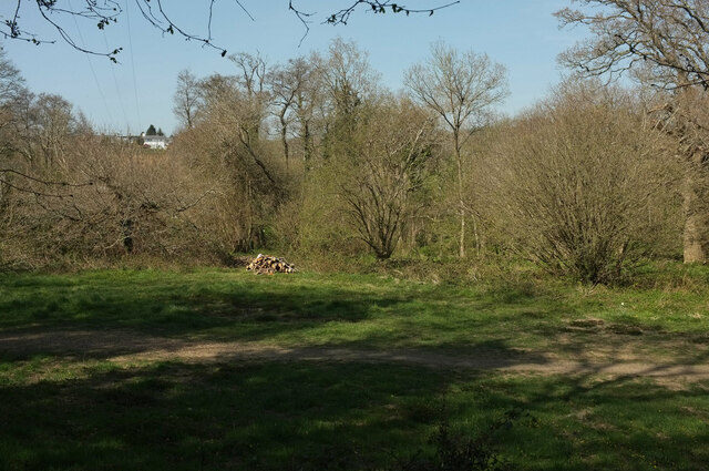
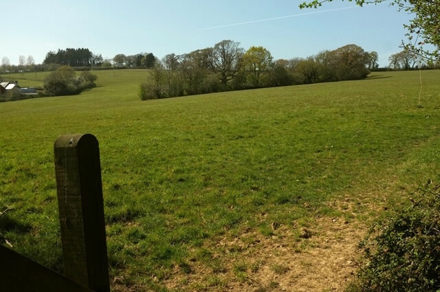
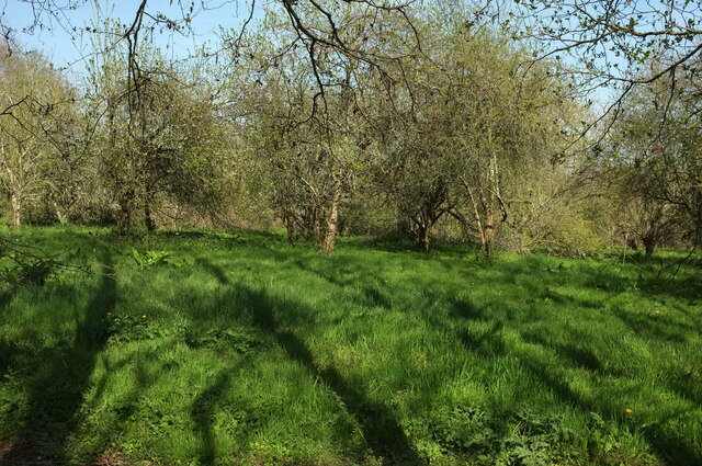
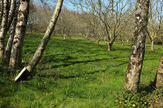
Abraham's Wood is a captivating forest located in the county of Devon, England. Nestled in the heart of the countryside, this woodland area covers an expanse of approximately 100 acres, offering visitors a serene and tranquil environment to explore.

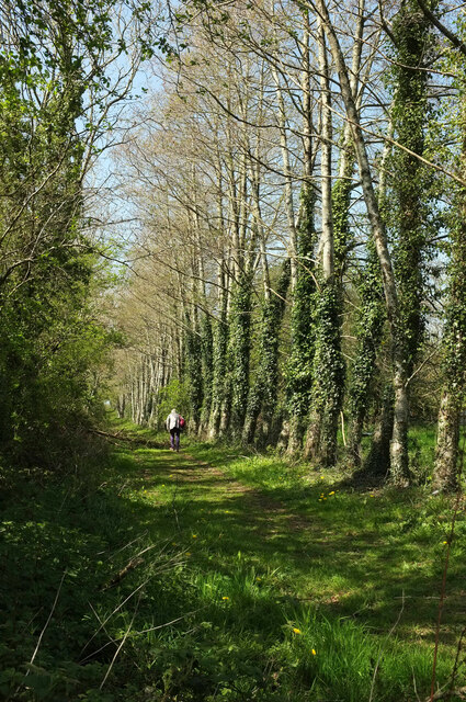
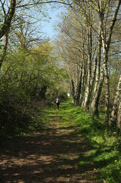
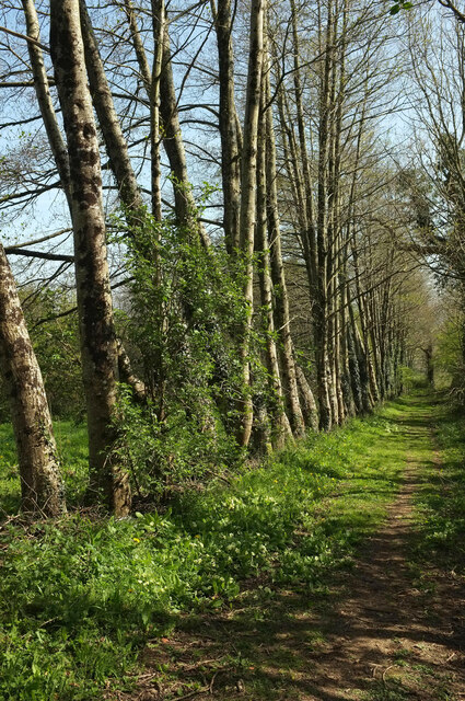
The wood is named after Abraham, a local landowner who once owned the land on which the forest now stands. It boasts a diverse range of tree species, including oak, beech, birch, and ash, which create a rich tapestry of colors throughout the seasons. The forest floor is carpeted with an array of wildflowers, adding to its natural beauty.

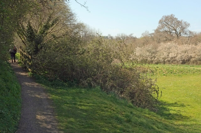
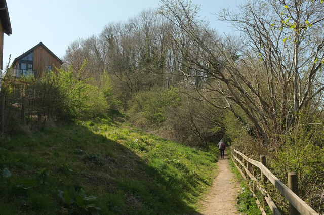
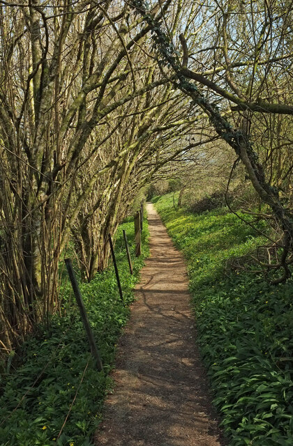
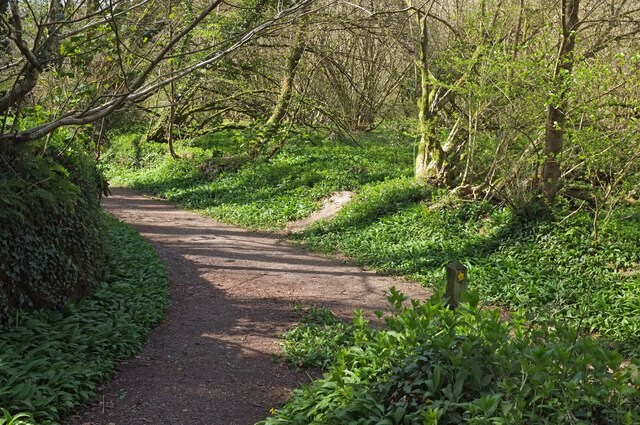
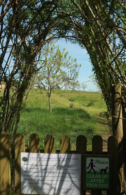
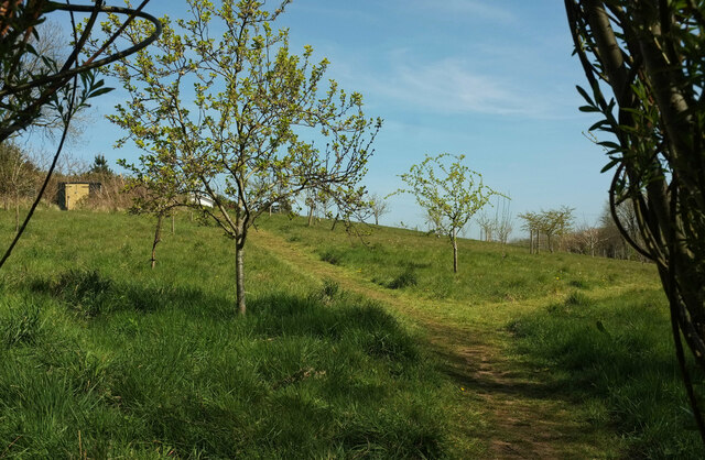
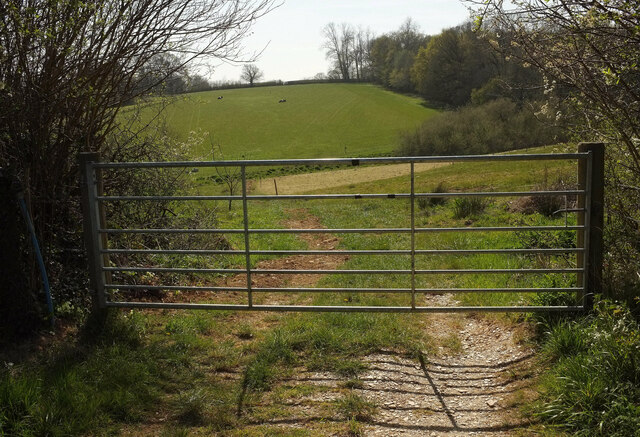
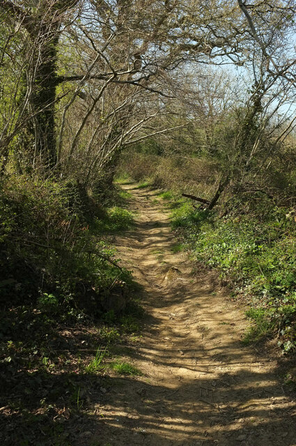
One of the striking features of Abraham's Wood is its well-maintained network of walking trails that wind through the forest. These paths provide visitors with the opportunity to immerse themselves in the peaceful surroundings while taking in the sights and sounds of nature. The evergreen foliage provides shade in the summer months, making it an ideal spot for a leisurely stroll or a picnic.

Abraham's Wood is also home to a diverse array of wildlife. Birdwatchers can spot various species, including woodpeckers, owls, and songbirds. Small mammals such as squirrels, rabbits, and even the occasional deer can be glimpsed among the trees.

The wood is a popular destination for nature enthusiasts, hikers, and families alike, offering a peaceful retreat from the hustle and bustle of everyday life. With its picturesque landscapes, abundant wildlife, and extensive walking trails, Abraham's Wood is a true gem of Devon's countryside.

If you have any feedback on the listing, please let us know in the comments section below.

Abraham's Wood Images

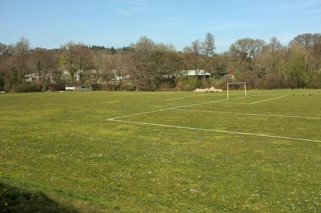
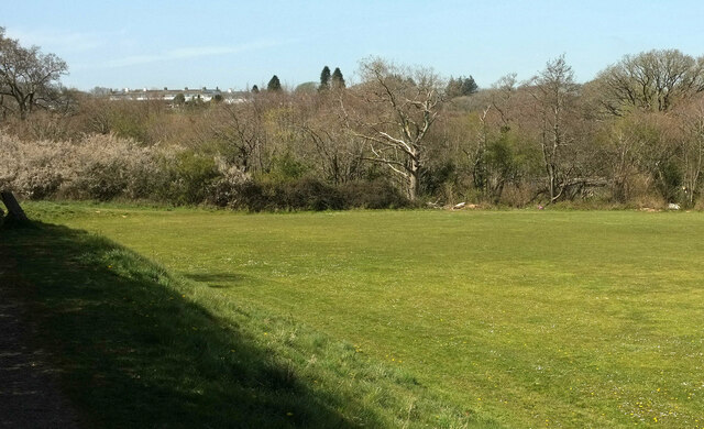
Images are sourced within 2km of 50.461404/-3.7286157 or Grid Reference SX7763. Thanks to Geograph Open Source API. All images are credited.

Old Boundary Marker on Staverton Bridge Parish Boundary Marker carved into the coping stones at the apex of the second pedestrian refuge from the southwest end of Staverton Bridge, River Dart. Inscribed D for Dartington parish and S for Staverton parish.

Milestone Society National ID: DV_RTSV03pb
Old Boundary Marker on Staverton Bridge
Parish Boundary Marker carved into the coping stones at the apex of the second pedestrian refuge from the southwest end of Staverton Bridge, River Dart. Inscribed D for Dartington parish and S for Staverton parish. Milestone Society National ID: DV_RTSV03pb
Playing field, Dartington Looking left from close to <a href="https://www.geograph.org.uk/photo/6983144">SX7862 : Dog-related notices, Dartington</a>. Behind the trees is Bidwell Brook School.
Playing field, Dartington
Looking left from close to SX7862 : Dog-related notices, Dartington. Behind the trees is Bidwell Brook School.
Playing field, Dartington The northwest corner of the playing field also shown in <a href="https://www.geograph.org.uk/photo/6983178">SX7862 : Playing field, Dartington</a>, <a href="https://www.geograph.org.uk/photo/6983012">SX7862 : Dorothy Elmhirst Playing Fields</a> and <a href="https://www.geograph.org.uk/photo/6982903">SX7862 : Playing field, Dartington</a>. The Bidwell Brook runs along the edge of the woodland.
Playing field, Dartington
The northwest corner of the playing field also shown in SX7862 : Playing field, Dartington, SX7862 : Dorothy Elmhirst Playing Fields and SX7862 : Playing field, Dartington. The Bidwell Brook runs along the edge of the woodland.
Path to Week Dartington Footpath 13 seen looking left from <a href="https://www.geograph.org.uk/photo/6983381">SX7862 : Playing field, Dartington</a>.
Path to Week
Dartington Footpath 13 seen looking left from SX7862 : Playing field, Dartington.
Path to Week A little further along Dartington Footpath 13 from <a href="https://www.geograph.org.uk/photo/6983777">SX7862 : Path to Week</a>. The houses on the left are on Longstem Drive and Limberland Avenue.
Path to Week
A little further along Dartington Footpath 13 from SX7862 : Path to Week. The houses on the left are on Longstem Drive and Limberland Avenue.
Towards the Bidwell Brook Looking right from the stretch of path shown in <a href="https://www.geograph.org.uk/photo/6983794">SX7862 : Path to Week</a>. The distant houses on the left are on Broom Park.
Towards the Bidwell Brook
Looking right from the stretch of path shown in SX7862 : Path to Week. The distant houses on the left are on Broom Park.
Path to Dartington Looking right from <a href="https://www.geograph.org.uk/photo/6983938">SX7862 : Towards the Bidwell Brook</a>, and the other way along Dartington Footpath 13, the path shown in <a href="https://www.geograph.org.uk/photo/6983794">SX7862 : Path to Week</a>.
Path to Dartington
Looking right from SX7862 : Towards the Bidwell Brook, and the other way along Dartington Footpath 13, the path shown in SX7862 : Path to Week.
Path junction near Lownard A path (seen in <a href="https://www.geograph.org.uk/photo/6983938">SX7862 : Towards the Bidwell Brook</a>) comes in from the right to join Dartington Footpath 13.
Path junction near Lownard
A path (seen in SX7862 : Towards the Bidwell Brook) comes in from the right to join Dartington Footpath 13.
Community Orchard Week The entrance through a bamboo arch to the hamlet's orchard.
Community Orchard Week
The entrance through a bamboo arch to the hamlet's orchard.
Community Orchard Week The view through the entrance arch shown in <a href="https://www.geograph.org.uk/photo/6984259">SX7762 : Community Orchard Week</a>.
Community Orchard Week
The view through the entrance arch shown in SX7762 : Community Orchard Week.
Farmland, Week With a gate beside a footpath junction. See also <a href="https://www.geograph.org.uk/photo/6991869">SX7762 : Farmland, Week</a>, taken from the gate.
Farmland, Week
With a gate beside a footpath junction. See also SX7762 : Farmland, Week, taken from the gate.
Footpath from Week Dartington Footpath 11 curves temptingly uphill on a lovely spring day.
Footpath from Week
Dartington Footpath 11 curves temptingly uphill on a lovely spring day.
Field near Billany Farm Dartington Footpath 11 runs up the right-hand edge of this field. In contrast to <a href="https://www.geograph.org.uk/photo/6984393">SX7762 : Footpath from Week</a>, this route is rendered very untempting as it is occupied by cattle and 50% of the party refuses to go that way. Billany Farm is on the left.
Field near Billany Farm
Dartington Footpath 11 runs up the right-hand edge of this field. In contrast to SX7762 : Footpath from Week, this route is rendered very untempting as it is occupied by cattle and 50% of the party refuses to go that way. Billany Farm is on the left.
Near Billany Farm A bovine-free route.
Near Billany Farm
A bovine-free route.
Near Billany Farm A steady climb to the lane between Willing Cross and Huxham's Cross.
Near Billany Farm
A steady climb to the lane between Willing Cross and Huxham's Cross.
Trees near Billany Farm Looking the other way from <a href="https://www.geograph.org.uk/photo/6984438">SX7762 : Near Billany Farm</a>.
Trees near Billany Farm
Looking the other way from SX7762 : Near Billany Farm.
Orchard near Huxhams Cross Farm Looking right from <a href="https://www.geograph.org.uk/photo/6984438">SX7762 : Near Billany Farm</a>.
Orchard near Huxhams Cross Farm
Looking right from SX7762 : Near Billany Farm.
Orchard near Huxhams Cross Farm A little north of <a href="https://www.geograph.org.uk/photo/6984498">SX7762 : Orchard near Huxhams Cross Farm</a>.
Orchard near Huxhams Cross Farm
Show me another place!

Abraham's Wood is located at Grid Ref: SX7763 (Lat: 50.461404, Lng: -3.7286157)

Administrative County: Devon

District: South Hams

Police Authority: Devon and Cornwall

What 3 Words

///digests.widen.magic. Near Buckfastleigh, Devon

Nearby Locations

Hood Island Abraham's Wood

Related Wikis

Nearby Amenities

Located within 500m of 50.461404,-3.7286157
Traffic Signals
Lat/Long: 50.4610315/-3.7316189
Traffic Signals
Lat/Long: 50.4601057/-3.7321955
Power: tower
Lat/Long: 50.4649758/-3.7307835
Power: tower
Lat/Long: 50.4634762/-3.7332672
Post Box
Brand: Royal Mail
Brand Wikidata: Q638098
Brand Wikipedia: en:Royal Mail
Collection Times: Mo-Fr 16:15; Sa 07:15; Su off
Operator: Royal Mail
Operator Wikidata: Q638098
Post Box Design: 2010_pattern
Post Box Mounting: pier
Post Box Type: lamp
Ref: TQ9 52
Royal Cypher: EIIR
Royal Cypher Wikidata: Q33102113
Source: survey;streetlevel imagery;aerial imagery
Lat/Long: 50.4579505/-3.7303349
Riverford Farm UWC
Railway: level_crossing
Lat/Long: 50.4603468/-3.7299028
4 1/4 Milepost
Railway: milestone
Lat/Long: 50.4622246/-3.7348707
4 Milepost
Railway: milestone
Lat/Long: 50.460349/-3.7296722
3 3/4 Milepost
Railway: milestone
Lat/Long: 50.4602802/-3.7236848
Charlies Cross
Place: locality
Lat/Long: 50.4629421/-3.7349384
Parking
Lat/Long: 50.4619346/-3.7333307
Generator Method: photovoltaic
Generator Output Electricity: yes
Generator Source: solar
Generator Type: solar_photovoltaic_panel
Location: roof
Power: generator
Lat/Long: 50.4573879/-3.7307355
The data included in this document is from www.openstreetmap.org. The data is made available under ODbL.

Have you been to Abraham's Wood?

Leave your review of Abraham's Wood below (or comments, questions and feedback).