Ashcombe Plantation

Wood, Forest in Somerset Somerset West and Taunton

England

Ashcombe Plantation

Gate and winter trees at Clovenrocks Bridge
Gate and winter trees at Clovenrocks Bridge Credit: David Smith

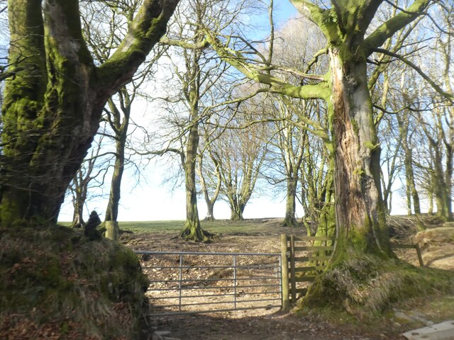
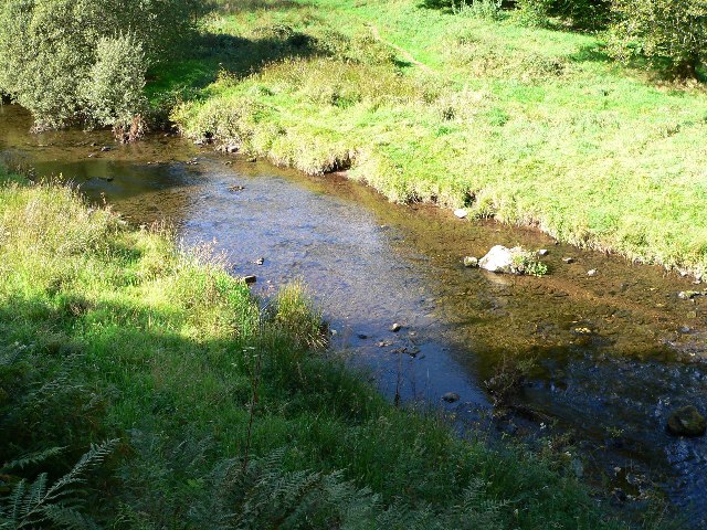
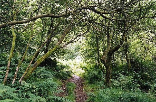
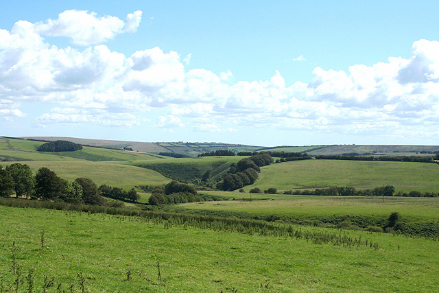
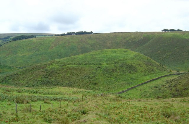
Ashcombe Plantation is a picturesque woodland area located in Somerset, England. Situated within the scenic surroundings of the Mendip Hills, this enchanting forest covers an expansive area of approximately 500 acres. Ashcombe Plantation is renowned for its rich biodiversity and is home to a diverse range of plant and animal species.

The woodland is predominantly composed of native deciduous trees such as oak, beech, and ash, creating a dense canopy that provides a haven for wildlife. The forest floor is adorned with a plethora of wildflowers, including bluebells, primroses, and wood anemones, which add a burst of color to the landscape during the spring season.

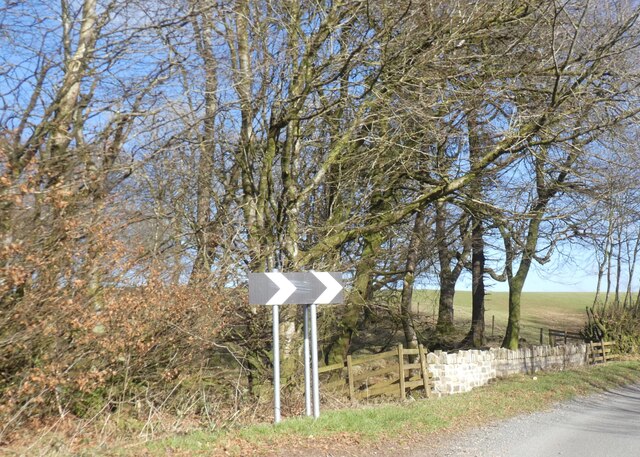
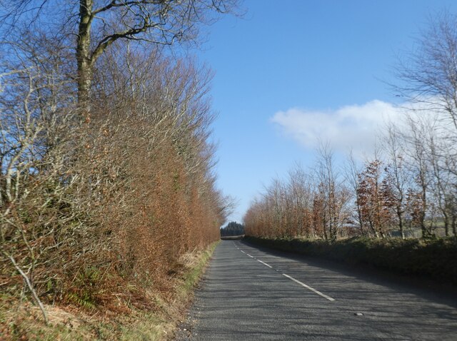
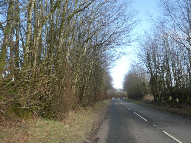
Visitors to Ashcombe Plantation can enjoy a variety of recreational activities, including walking, birdwatching, and photography. The forest is crisscrossed with a network of well-maintained trails, offering opportunities to explore the natural beauty of the area. The plantation is also a popular spot for picnics and family outings, with designated areas equipped with benches and picnic tables.

The forest is teeming with wildlife, with sightings of deer, foxes, rabbits, and a variety of bird species being common. Nature enthusiasts can also spot smaller creatures such as squirrels, badgers, and hedgehogs, adding to the charm of the plantation.

Ashcombe Plantation is a cherished natural gem in Somerset, offering visitors a tranquil escape from the hustle and bustle of daily life. Its stunning scenery, diverse ecosystem, and numerous recreational activities make it a must-visit destination for nature lovers and outdoor enthusiasts alike.

If you have any feedback on the listing, please let us know in the comments section below.

Ashcombe Plantation Images

Images are sourced within 2km of 51.14266/-3.7546189 or Grid Reference SS7739. Thanks to Geograph Open Source API. All images are credited.

Gate and winter trees at Clovenrocks Bridge
Clovenrocks Bridge
Clovenrocks Bridge
Winter hedge east of Clovenrocks Bridge
High hedges west of Honeymead Farm
River Barle entering Simonsbath Just to west of village and south of junction of B3358 with B3223.
River Barle entering Simonsbath
Just to west of village and south of junction of B3358 with B3223.
Exmoor: Ashcombe Plantation, Simonsbath Public footpath through the woods above Ashcombe Bottom
Exmoor: Ashcombe Plantation, Simonsbath
Public footpath through the woods above Ashcombe Bottom
River Barle Looking downstream. November snow, not often seen on Exmoor nowadays.
River Barle
Looking downstream. November snow, not often seen on Exmoor nowadays.
Fish pass Recently restored weir and fish pass or salmon ladder on River Barle
Fish pass
Recently restored weir and fish pass or salmon ladder on River Barle
Exmoor: the Barle valley at Simonsbath A public footpath runs at the foot of the wood and along the left bank of the river to the site of Wheal Eliza, a 19th century mine, and on past Cow Castle to link with the Two Moors Way
Exmoor: the Barle valley at Simonsbath
A public footpath runs at the foot of the wood and along the left bank of the river to the site of Wheal Eliza, a 19th century mine, and on past Cow Castle to link with the Two Moors Way
River Barle Above Simonsbath, looking downstream.
River Barle
Above Simonsbath, looking downstream.
Exmoor: near Cloven Rocks Looking south-south-east towards Winstitchen
Exmoor: near Cloven Rocks
Looking south-south-east towards Winstitchen
Exmoor: Bale Water By the bridge over the river on the B3358 Simonsbath-Challacombe road. A small tributary stream runs in from the right. The Bale is a tributary of the Barle. Looking south east
Exmoor: Bale Water
By the bridge over the river on the B3358 Simonsbath-Challacombe road. A small tributary stream runs in from the right. The Bale is a tributary of the Barle. Looking south east
Exmoor: lane to kennels Looking north near Cornham Bungalow. The buildings beyond the trees are indicated on the Ordnance Survey map as the home of the Exmoor Foxhounds
Exmoor: lane to kennels
Looking north near Cornham Bungalow. The buildings beyond the trees are indicated on the Ordnance Survey map as the home of the Exmoor Foxhounds
Exmoor: river Barle Looking west above Cornham Brake. Seen from the South Molton road near Simonsbath
Exmoor: river Barle
Looking west above Cornham Brake. Seen from the South Molton road near Simonsbath
Wheal Eliza Ruin of C19th iron mine.  see <span class="nowrap"><a title="http://webapp1.somerset.gov.uk/her/details.asp?prn=33007" rel="nofollow ugc noopener" href="http://webapp1.somerset.gov.uk/her/details.asp?prn=33007">Link</a><img style="margin-left:2px;" alt="External link" title="External link - shift click to open in new window" src="https://s1.geograph.org.uk/img/external.png" width="10" height="10"/></span>
Wheal Eliza
Ruin of C19th iron mine. see LinkExternal link
River Barle at Simonsbath View east - downstream
River Barle at Simonsbath
View east - downstream
The upper River Barle Viewed from the Kinsford road, west of Simonsbath.
The upper River Barle
Viewed from the Kinsford road, west of Simonsbath.
Exmoor Forest Inn, Simonsbath What a wet and miserable day!
Exmoor Forest Inn, Simonsbath
What a wet and miserable day!
Show me another place!

Ashcombe Plantation is located at Grid Ref: SS7739 (Lat: 51.14266, Lng: -3.7546189)

Administrative County: Somerset

District: Somerset West and Taunton

Police Authority: Avon and Somerset

What 3 Words

///trickled.ever.connector. Near Lynton, Devon

Related Wikis

Simonsbath

Simonsbath () is a small village high on Exmoor in the English county of Somerset. It is the principal settlement in the Exmoor civil parish, which is...

St Luke's Church, Simonsbath

St Luke's Church is a Church of England church in Simonsbath, Exmoor, Somerset, England. The church, which was designed by Henry Clutton and built in 1855...

Simonsbath House

Simonsbath House is a historic house in Simonsbath on Exmoor in Somerset, England. The Grade II listed building is now the Simonsbath House Hotel, and...

Wheal Eliza Mine

Wheal Eliza Mine was an unsuccessful copper and iron mine on the River Barle near Simonsbath on Exmoor in the English county of Somerset. The first mining...

Cow Castle

Cow Castle is an Iron Age hillfort 5.75 kilometres (4 mi) West South West of Exford, Somerset, England within the Exmoor National Park. It is a Scheduled...

Lanacombe

Lanacombe is an area of Exmoor in Somerset, South West England. It is the site of several standing stones and cairns which have been scheduled as ancient...

Chains (geological site)

The Chains is the name given to the north-west plateau of Exmoor, Somerset, England. This plateau lies above the 1,500 feet (457 m) contour line, and includes...

North Exmoor SSSI

North Exmoor (grid reference SS800430) is a 12,005.3-hectare (29,666-acre) biological Site of Special Scientific Interest (SSSI) in Devon and Somerset...

Nearby Amenities

Located within 500m of 51.14266,-3.7546189
Simonsbath
Is In: Somerset, England, UK
Place: village
Wikidata: Q2414371
Lat/Long: 51.1389297/-3.7558302
Toilets
Lat/Long: 51.1408123/-3.7540901
Barrier: swing_gate
Lat/Long: 51.1385761/-3.7549504
Give Way
Lat/Long: 51.1386599/-3.7564731
Historic: yes
Operator: Somerset County Council
Traffic Sign: destination_sign
Lat/Long: 51.1386166/-3.7566168
The data included in this document is from www.openstreetmap.org. The data is made available under ODbL.

Have you been to Ashcombe Plantation?

Leave your review of Ashcombe Plantation below (or comments, questions and feedback).