Church End

Settlement in Bedfordshire

England

Church End

Beer barrels outside the Engineers Arms, Henlow
Beer barrels outside the Engineers Arms, Henlow Credit: David Martin

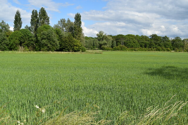
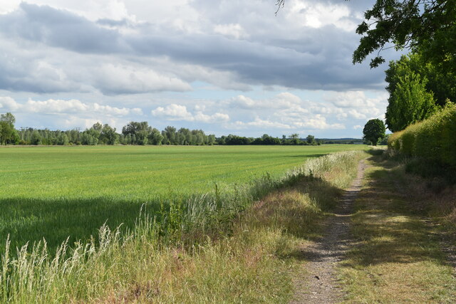
Church End is a small village located in Bedfordshire, England. Situated in the Northill civil parish, it lies approximately 5 miles south of the town of Biggleswade. The village is surrounded by picturesque countryside, offering residents and visitors a peaceful and idyllic setting.

The focal point of Church End is the charming St. Mary's Church, a Grade II listed building with a rich history dating back to the 12th century. The church's architecture is predominantly Norman, featuring a distinctive tower and beautiful stained glass windows. It serves as both a religious and community hub, hosting regular services as well as various events and gatherings throughout the year.

Despite its small size, Church End has a strong sense of community. The village is home to a close-knit population, with residents taking an active role in maintaining the village's character and heritage. The local village hall serves as a venue for social activities and meetings, fostering a sense of togetherness among the villagers.

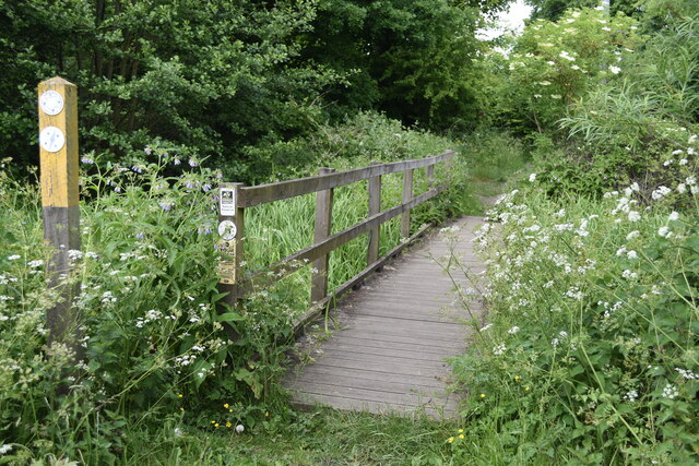
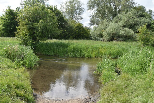
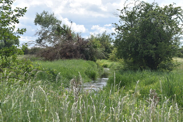
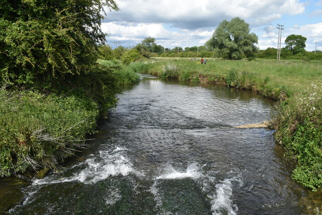
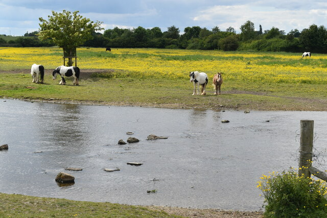
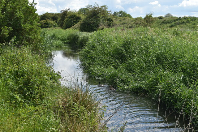
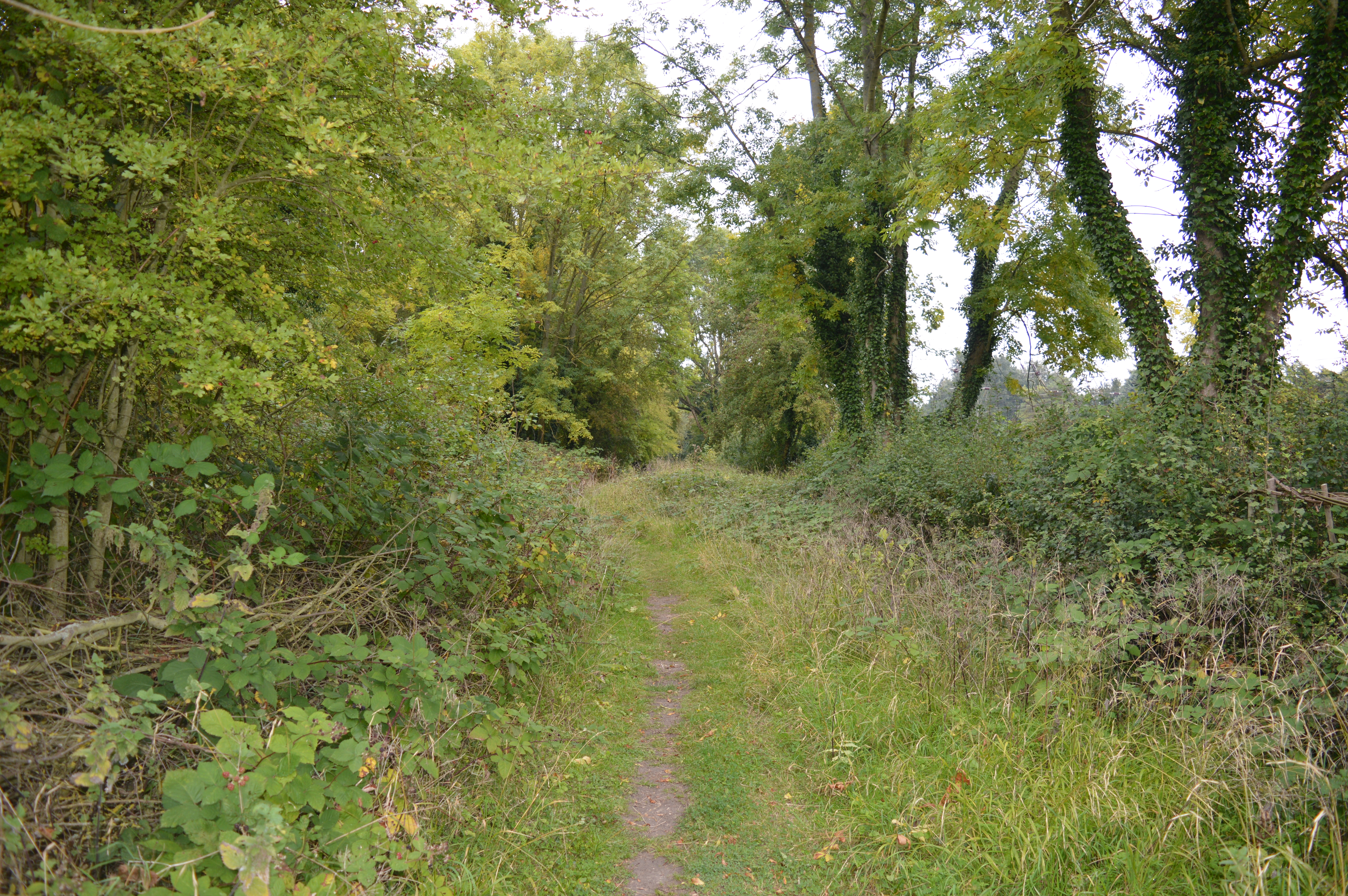
Nature enthusiasts will find Church End a delightful place to explore, thanks to its proximity to the beautiful Bedfordshire countryside. The village is surrounded by rolling hills, scenic walking trails, and picturesque landscapes that offer breathtaking views. Additionally, the nearby River Ivel provides opportunities for fishing and boating.

Church End offers a tranquil and close community, making it an attractive place to live or visit for those seeking a peaceful rural setting in Bedfordshire.

If you have any feedback on the listing, please let us know in the comments section below.

Church End Images

Images are sourced within 2km of 52.022864/-0.264278 or Grid Reference TL1937. Thanks to Geograph Open Source API. All images are credited.

Beer barrels outside the Engineers Arms, Henlow
A temporarily restrcted High Street (B659) in Henlow Looking northward.
A temporarily restrcted High Street (B659) in Henlow
Looking northward.
Arlesley Road in Henlow Looking eastward.
Arlesley Road in Henlow
Looking eastward.
Ordnance Survey Flush Bracket G2275 This bracket can be found on the wall of a private dwelling in High Street, Henlow.
The recorded details give a height of 39.5496 metres above sea level.
For more details see : <span class="nowrap"><a title="https://www.bench-marks.org.uk/bm2710" rel="nofollow ugc noopener" href="https://www.bench-marks.org.uk/bm2710">Link</a><img style="margin-left:2px;" alt="External link" title="External link - shift click to open in new window" src="https://s1.geograph.org.uk/img/external.png" width="10" height="10"/></span>
Ordnance Survey Flush Bracket G2275
This bracket can be found on the wall of a private dwelling in High Street, Henlow. The recorded details give a height of 39.5496 metres above sea level. For more details see : LinkExternal link
Footbridge between the railway and the River Hiz On a permissive path, forming part of the Hicca Way.
Footbridge between the railway and the River Hiz
On a permissive path, forming part of the Hicca Way.
River Hiz west of Arlesey
Weir on River Hiz west of Arlesey View from the footbridge.
Weir on River Hiz west of Arlesey
View from the footbridge.
River Hiz, ponies and buttercups
River Hiz west of Arlesey This is a river with frequent changes of channel width and appearance - compare with <a href="https://www.geograph.org.uk/photo/7188064">TL1835 : Ponies grazing beside the River Hiz</a> just 500m downstream!
River Hiz west of Arlesey
This is a river with frequent changes of channel width and appearance - compare with TL1835 : Ponies grazing beside the River Hiz just 500m downstream!
View across field towards the River Hiz
Footpath on track past Cityfield Farm
Work is underway on Arlesey relief road Initial groundwork on a road link that will connect the High Street with the A507, accompanied by extensive additional residential development.
Work is underway on Arlesey relief road
Initial groundwork on a road link that will connect the High Street with the A507, accompanied by extensive additional residential development.
Groundwork for Arlesey Relief Road Initial groundwork on a road link that will connect the High Street with the A507, accompanied by extensive additional residential development.
Groundwork for Arlesey Relief Road
Initial groundwork on a road link that will connect the High Street with the A507, accompanied by extensive additional residential development.
Henlow Grange An exclusive, expensive and well known health farm.  Odd phrase that- health farm.
Henlow Grange
An exclusive, expensive and well known health farm. Odd phrase that- health farm.
Parish Church of St Peter - Church End Arlesey Tucked away at the end of Arlesey (which according to local legend, is the longest village in the UK).  This claim can be checked using Google if you like - it seems not to be true.  The church is a bit run down and has some old wooden crosses in the graveyard.
Parish Church of St Peter - Church End Arlesey
Tucked away at the end of Arlesey (which according to local legend, is the longest village in the UK). This claim can be checked using Google if you like - it seems not to be true. The church is a bit run down and has some old wooden crosses in the graveyard.
The Vicar's Inn - Church End, Arlesey. This pub has been re-named and used to be called "The Engine"  There is a railway passing nearby.  The new name may be related to the church being nearer than the railway.
The Vicar's Inn - Church End, Arlesey.
This pub has been re-named and used to be called "The Engine" There is a railway passing nearby. The new name may be related to the church being nearer than the railway.
Arlesey war memorial. This war memorial depicting a first world war soldier is already beginning to deteriorate.  The soldier's face is beginning to erode.
Arlesey war memorial.
This war memorial depicting a first world war soldier is already beginning to deteriorate. The soldier's face is beginning to erode.
Show me another place!

Church End is located at Grid Ref: TL1937 (Lat: 52.022864, Lng: -0.264278)

Unitary Authority: Central Bedfordshire

Police Authority: Bedfordshire

What 3 Words

///seatbelt.endings.goodness. Near Arlesey, Bedfordshire

Nearby Locations

Church End

Related Wikis

Church of St Peter, Arlesey

Church of St Peter is a Grade I listed church in Arlesey, Bedfordshire, England. It became a listed building on 31 October 1966. == See also == Grade...

Arlesey Old Moat and Glebe Meadows

Arlesey Old Moat and Glebe Meadows is a 4.3 hectare nature reserve west of Arlesey in Bedfordshire. It is managed by the Wildlife Trust for Bedfordshire...

Arlesey railway station

Arlesey railway station serves the town of Arlesey in Bedfordshire, England. It is 37 miles 3 chains (37.04 miles, 59.61 km) from London King's Cross on...

Etonbury Castle

Etonbury Castle was a castle in the town of Arlesey, located near the road to Baldock, in the county of Bedfordshire, England (grid reference TL192379...

Nearby Amenities

Located within 500m of 52.022864,-0.264278
Mini Roundabout
Direction: clockwise
Lat/Long: 52.0224656/-0.2601548
Fixme: Has 7.5T limit. How to rep. ?
Lat/Long: 52.0230045/-0.2633895
Fixme: 7.5T Limit E of this junc with main road
Lat/Long: 52.0196716/-0.2633778
Arlesey
Naptan AtcoCode: 9100ARLSEY
Network: National Rail
Network Website: https://www.nationalrail.co.uk/stations/arl/
Network Wikidata: Q26334
Public Transport: station
Railway: station
Ref Crs: ARL
Ref Tiploc: ARLSEY
Source Name: local knowledge
Wikidata: Q4567224
Wikipedia: en:Arlesey railway station
Lat/Long: 52.0258212/-0.266464
Turning Circle
Turning Circle: knuckle
Lat/Long: 52.0204987/-0.2662718
Church End
Created By: Potlatch 0.5c
Is In: Bedfordshire
Place: village
Wikidata: Q1518856
Lat/Long: 52.0214212/-0.2599951
Turning Circle
Turning Circle: square
Lat/Long: 52.0220956/-0.2591896
Turning Circle
Turning Circle: knuckle
Lat/Long: 52.0223725/-0.2594844
Turning Circle
Turning Circle: knuckle
Lat/Long: 52.0215842/-0.2638883
Parking
Day Off: saturday
Day On: monday
Hour Off: 18:00:00
Hour On: 08:00:00
Maxstay: 2 hours
No Return: 1 hour
Lat/Long: 52.0238207/-0.2644669
Parking
Lat/Long: 52.026437/-0.2658315
Bicycle Parking
Capacity: 28
Source: survey
Lat/Long: 52.0261922/-0.2660021
Post Box
Brand: Royal Mail
Brand Wikidata: Q638098
Collection Times: Mo-Fr 09:00; Sa 07:00
Operator: Royal Mail
Operator Wikidata: Q638098
Post Box Type: lamp
Ref: SG15 6D
Royal Cypher: EIIR
Royal Cypher Wikidata: Q33102113
Source: GPS Walking;survey
Lat/Long: 52.022217/-0.263459
Post Box
Brand: Royal Mail
Brand Wikidata: Q638098
Collection Times: Mo-Fr 17:00; Sa 12:00
Description: House Lane / Glossop Way
Operator: Royal Mail
Operator Wikidata: Q638098
Post Box Type: pillar
Ref: SG15 3
Royal Cypher: EIIR
Royal Cypher Wikidata: Q33102113
Source: Walking GPS
Lat/Long: 52.0230168/-0.2596702
Historic: memorial
Memorial: war_memorial
Lat/Long: 52.0195482/-0.2632958
Barrier: cycle_barrier
Lat/Long: 52.0225138/-0.2634173
Board Type: notice
Information: board
Operator: Arlesey Town Council
Lat/Long: 52.0203385/-0.2634332
Bench
Lat/Long: 52.0192891/-0.2632334
Bus Stop
Lat/Long: 52.0251426/-0.2642153
Bus Stop
Lat/Long: 52.0237438/-0.2576308
Bus Stop
Bus: yes
Naptan AtcoCode: 021022082
Naptan NaptanCode: ahlagtam
Public Transport: platform
Lat/Long: 52.0196626/-0.2634535
Car Wash
Lat/Long: 52.0241726/-0.2597225
Bus Stop
Naptan AtcoCode: 021022078
Naptan NaptanCode: ahlagpwt
Lat/Long: 52.0248868/-0.2642269
Arlesey
Public Transport: stop_position
Railway: stop
Ref: 1
Train: yes
Lat/Long: 52.0247838/-0.2666414
Arlesey
Public Transport: stop_position
Railway: stop
Ref: 2
Train: yes
Lat/Long: 52.0266034/-0.266262
Barrier: kissing_gate
Bicycle: no
Foot: yes
Source: GPS
Lat/Long: 52.0245173/-0.2679681
Barrier: kissing_gate
Bicycle: no
Foot: yes
Source: GPS
Lat/Long: 52.0266759/-0.2670503
Barrier: kissing_gate
Bicycle: no
Foot: yes
Source: GPS
Lat/Long: 52.0228637/-0.2674199
Bench
Source: GPS
Lat/Long: 52.0237184/-0.267872
Barrier: kissing_gate
Bicycle: no
Foot: yes
Source: GPS
Lat/Long: 52.0241809/-0.2677004
Bench
Source: GPS
Lat/Long: 52.0245451/-0.268
Bench
Source: GPS
Lat/Long: 52.0248084/-0.2678624
Bench
Source: GPS
Lat/Long: 52.0251554/-0.2675906
Bench
Source: GPS
Lat/Long: 52.0252868/-0.2674869
Barrier: kissing_gate
Bicycle: no
Foot: yes
Source: GPS
Lat/Long: 52.0259229/-0.2668914
Information: board
Tourism: information
Lat/Long: 52.0258163/-0.2671219
Turning Circle
Turning Circle: knuckle
Lat/Long: 52.0189975/-0.2642923
Bench
Material: wood
Source: GPS, observation
Lat/Long: 52.02409/-0.2673307
Bench
Material: wood
Source: GPS, observation
Lat/Long: 52.0245387/-0.2672922
Barrier: kissing_gate
Foot: yes
Source: GPS, observation
Lat/Long: 52.0257062/-0.2669777
Waterway: weir
Lat/Long: 52.026689/-0.2669152
Bench
Backrest: yes
Lat/Long: 52.0254817/-0.2673773
Turning Circle
Turning Circle: square
Lat/Long: 52.0245052/-0.2653517
Power: pole
Lat/Long: 52.0229186/-0.2707851
Power: pole
Lat/Long: 52.0214562/-0.2701494
Bus Stop
Bus: yes
Public Transport: platform
Lat/Long: 52.0259659/-0.2645291
Bus Stop
Bus: yes
Public Transport: platform
Lat/Long: 52.0261271/-0.2643072
Direction: 185
Generator Method: photovoltaic
Generator Output Electricity: yes
Generator Solar Modules: 16
Generator Source: solar
Generator Type: solar_photovoltaic_panel
Location: roof
Power: generator
Lat/Long: 52.0200156/-0.2645976
Turning Circle
Turning Circle: knuckle
Lat/Long: 52.0215984/-0.2661397
Bus Stop
Bus: yes
Naptan AtcoCode: 021022080
Naptan NaptanCode: ahlagtag
Public Transport: platform
Lat/Long: 52.0223931/-0.2633088
Direction: 195
Generator Method: photovoltaic
Generator Output Electricity: yes
Generator Solar Modules: 14
Generator Source: solar
Generator Type: solar_photovoltaic_panel
Location: roof
Power: generator
Lat/Long: 52.0229994/-0.2623972
Direction: 105
Generator Method: photovoltaic
Generator Output Electricity: yes
Generator Solar Modules: 8
Generator Source: solar
Generator Type: solar_photovoltaic_panel
Location: roof
Power: generator
Lat/Long: 52.0240665/-0.2647547
Direction: 285
Generator Method: photovoltaic
Generator Output Electricity: yes
Generator Solar Modules: 8
Generator Source: solar
Generator Type: solar_photovoltaic_panel
Location: roof
Power: generator
Lat/Long: 52.0240755/-0.2648181
Direction: 280
Generator Method: photovoltaic
Generator Output Electricity: yes
Generator Solar Modules: 18
Generator Source: solar
Generator Type: solar_photovoltaic_panel
Location: roof
Power: generator
Lat/Long: 52.0249347/-0.2647867
Turning Circle
Turning Circle: knuckle
Lat/Long: 52.0251907/-0.2652217
Direction: 280
Generator Method: photovoltaic
Generator Output Electricity: yes
Generator Solar Modules: 15
Generator Source: solar
Generator Type: solar_photovoltaic_panel
Location: roof
Power: generator
Lat/Long: 52.0255137/-0.2654644
Direction: 200
Generator Method: photovoltaic
Generator Output Electricity: yes
Generator Solar Modules: 12
Generator Source: solar
Generator Type: solar_photovoltaic_panel
Location: roof
Power: generator
Lat/Long: 52.0251762/-0.2608945
Direction: 200
Generator Method: photovoltaic
Generator Output Electricity: yes
Generator Solar Modules: 8
Generator Source: solar
Generator Type: solar_photovoltaic_panel
Location: roof
Power: generator
Lat/Long: 52.0251558/-0.2608118
Direction: 215
Generator Method: photovoltaic
Generator Output Electricity: yes
Generator Solar Modules: 12
Generator Source: solar
Generator Type: solar_photovoltaic_panel
Location: roof
Power: generator
Lat/Long: 52.0247269/-0.2613408
Bus Stop
Bus: yes
Naptan AtcoCode: 021022075
Naptan NaptanCode: ahlagpwj
Public Transport: platform
Shelter: no
Lat/Long: 52.0244179/-0.2600504
Fixme: solar panel?
Lat/Long: 52.0244184/-0.2635715
Direction: 205
Generator Method: photovoltaic
Generator Output Electricity: yes
Generator Solar Modules: 14
Generator Source: solar
Generator Type: solar_photovoltaic_panel
Location: roof
Power: generator
Lat/Long: 52.019508/-0.2627891
Crossing
Crossing: unmarked
Lat/Long: 52.0240897/-0.2594974
Direction: 200
Generator Method: photovoltaic
Generator Output Electricity: 16
Generator Solar Modules: 12
Generator Source: solar
Generator Type: solar_photovoltaic_panel
Location: roof
Power: generator
Lat/Long: 52.0223438/-0.2582886
Direction: 110
Generator Method: photovoltaic
Generator Output Electricity: yes
Generator Solar Modules: 6
Generator Source: solar
Generator Type: solar_photovoltaic_panel
Location: roof
Power: generator
Lat/Long: 52.022493/-0.2575369
Direction: 110
Generator Method: photovoltaic
Generator Output Electricity: yes
Generator Solar Modules: 8
Generator Source: solar
Generator Type: solar_photovoltaic_panel
Location: roof
Power: generator
Lat/Long: 52.0226842/-0.2574207
Fixme: solar panel?
Lat/Long: 52.0229162/-0.2575481
Direction: 200
Generator Method: photovoltaic
Generator Output Electricity: yes
Generator Solar Modules: 20
Generator Source: solar
Generator Type: solar_photovoltaic_panel
Location: roof
Power: generator
Lat/Long: 52.0241129/-0.2583158
Direction: 200
Generator Method: photovoltaic
Generator Output Electricity: yes
Generator Solar Modules: 20
Generator Source: solar
Generator Type: solar_photovoltaic_panel
Location: roof
Power: generator
Lat/Long: 52.0240814/-0.2581733
Direction: 205
Generator Method: photovoltaic
Generator Output Electricity: yes
Generator Solar Modules: 16
Generator Source: solar
Generator Type: solar_photovoltaic_panel
Location: roof
Power: generator
Lat/Long: 52.0238716/-0.2574162
Direction: 195
Generator Method: photovoltaic
Generator Output Electricity: yes
Generator Solar Modules: 12
Generator Source: solar
Generator Type: solar_photovoltaic_panel
Location: roof
Power: generator
Lat/Long: 52.0220849/-0.2599554
Post Office
Arlesey Church End Post Office
Addr City: Arlesey
Addr Housenumber: 78
Addr Postcode: SG15 6XR
Addr Street: Stotfold Road
Brand: Post Office
Brand Wikidata: Q1783168
Operator: Nisa Local
Ref Pol Id: 177440
Source Ref Pol Id: pol_branch_list_2022‑05‑27
Lat/Long: 52.0238437/-0.2591929
Crossing
Crossing: unmarked
Crossing Island: no
Crossing Markings: no
Tactile Paving: no
Lat/Long: 52.0235192/-0.257259
Direction: both
Surface: asphalt
Traffic Calming: cushion
Lat/Long: 52.0238197/-0.2640425
Direction: both
Surface: asphalt
Traffic Calming: hump
Lat/Long: 52.0243843/-0.2645183
Vending Machine
Vending: public_transport_tickets
Lat/Long: 52.0258784/-0.2661747
The data included in this document is from www.openstreetmap.org. The data is made available under ODbL.

Have you been to Church End?

Leave your review of Church End below (or comments, questions and feedback).