Church End

Settlement in Huntingdonshire Huntingdonshire

England

Church End

Wood Walton, St Andrew
Wood Walton, St Andrew Credit: Dave Kelly

Church End is a small village located in the district of Huntingdonshire, in the county of Cambridgeshire, England. It is situated approximately 4 miles northeast of the town of Huntingdon. The village is set in a picturesque rural setting, surrounded by open fields and farmland.

The heart of Church End is dominated by the All Saints Church, a beautiful Grade II listed building that dates back to the 12th century. The church is known for its impressive architecture, including a striking tower and a well-preserved Norman doorway. It serves as a focal point for the community and hosts regular religious services and events.

The village itself is characterized by a mix of historic cottages and more modern houses. It has a close-knit community feel, with a small number of local amenities, such as a village hall and a local pub. The village hall serves as a hub for various community activities and events, including social gatherings and clubs.

Surrounding Church End, there are ample opportunities for outdoor activities and exploration. The nearby countryside offers beautiful walking and cycling routes, providing residents and visitors with the chance to enjoy the natural beauty of the area.

Overall, Church End is a quiet and charming village, offering a peaceful and idyllic lifestyle for its residents, while still providing easy access to the nearby towns and cities for additional amenities and services.

If you have any feedback on the listing, please let us know in the comments section below.
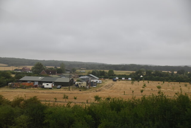
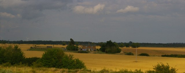
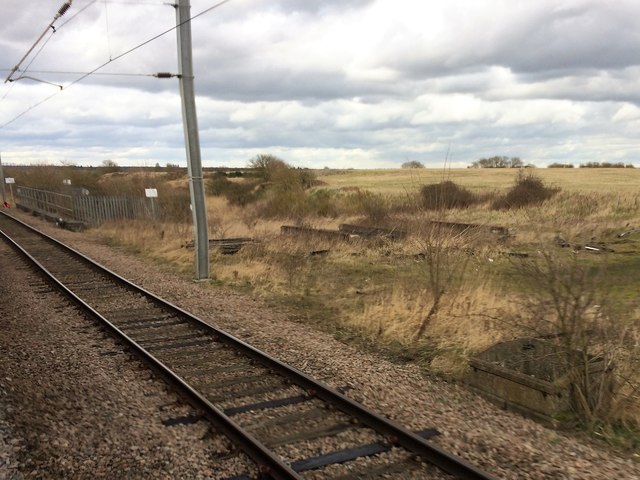
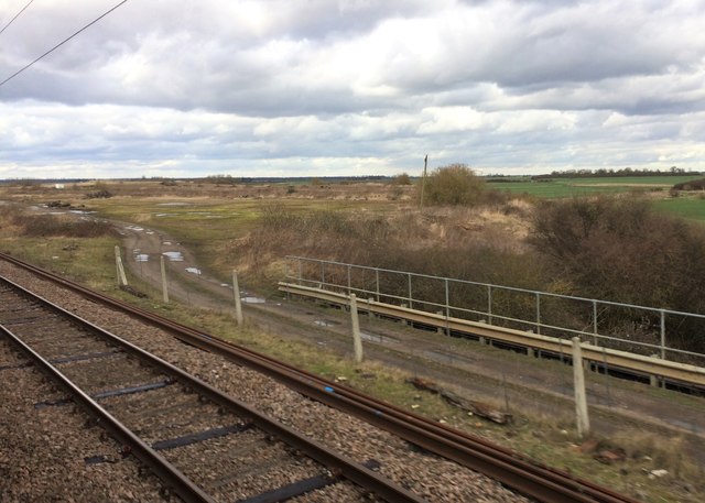
Church End Images

Images are sourced within 2km of 52.428285/-0.222578 or Grid Reference TL2082. Thanks to Geograph Open Source API. All images are credited.

Wood Walton, St Andrew
Solar Farm near Sawtry At Double Bank Lane off the B1090, south east of Sawtry. A 40,000-panel installation on farmland off Double Bank Lane, Woodwalton, it is estimated the panels will generate nine megawatts of electricity a year, enough to power 3,000 homes.
Solar Farm near Sawtry
At Double Bank Lane off the B1090, south east of Sawtry. A 40,000-panel installation on farmland off Double Bank Lane, Woodwalton, it is estimated the panels will generate nine megawatts of electricity a year, enough to power 3,000 homes.
Red House Farm
Red House Farm
Reservoir
Reservoir
Higney Grange Cottages, from the railway
View from a Peterborough-London train - Disused railway land
View from a Peterborough-London train - Disused railway land This area was formerly a civil engineer's tip for spent railway ballast.
View from a Peterborough-London train - Disused railway land
This area was formerly a civil engineer's tip for spent railway ballast.
View from a Peterborough-London train - St. Andrew's church, Wood Walton Now disused. More details can be found at <span class="nowrap"><a title="http://friendsoffriendlesschurches.org.uk/wood-walton/" rel="nofollow ugc noopener" href="http://friendsoffriendlesschurches.org.uk/wood-walton/">Link</a><img style="margin-left:2px;" alt="External link" title="External link - shift click to open in new window" src="https://s1.geograph.org.uk/img/external.png" width="10" height="10"/></span> .
View from a Peterborough-London train - St. Andrew's church, Wood Walton
Now disused. More details can be found at LinkExternal link .
View from a Peterborough-London train - Fields around St. Andrew's church
View from a Peterborough-London train - Wood Walton
Middle Level Catchwater Drain The footpath supposedly crosses the drain at this point, but without a bridge (or boat) that seems tricky. Situation was similar eleven years ago: <a href="https://www.geograph.org.uk/photo/389766">TL2182 : Middle Level Catchwater Drain</a>
Middle Level Catchwater Drain
The footpath supposedly crosses the drain at this point, but without a bridge (or boat) that seems tricky. Situation was similar eleven years ago: TL2182 : Middle Level Catchwater Drain
Middle Level Catchwater Drain Looking towards Woodwalton Fen.
Middle Level Catchwater Drain
Looking towards Woodwalton Fen.
Footpath from Riddy Wood
Ditch towards Woodwalton Fen
Footpath to Moat Farm
Dwellings at Moat Farm
Wheat field Looking towards Woodwalton Fen.
Wheat field
Looking towards Woodwalton Fen.
Show me another place!

Church End is located at Grid Ref: TL2082 (Lat: 52.428285, Lng: -0.222578)

Administrative County: Cambridgeshire

District: Huntingdonshire

Police Authority: Cambridgeshire

What 3 Words

///direction.stiletto.trout. Near Sawtry, Cambridgeshire

Nearby Locations

Church End

Related Wikis

Woodwalton Castle

Woodwalton Castle was a small motte and bailey castle at Church End, the northern end of the parish of Woodwalton, Huntingdonshire. Located on a natural...

St Andrew's Church, Woodwalton

St Andrew's Church is a redundant Anglican church standing in an isolated position in fields about 2 kilometres (1.2 mi) to the north of the village of...

Sawtry Abbey

Sawtry Abbey was a Cistercian abbey located between Sawtry and Woodwalton in Cambridgeshire, England. The abbey was founded in 1147 by Simon II de Senlis...

Woodwalton Marsh

Woodwalton Marsh is a 0.8-hectare (2.0-acre) biological Site of Special Scientific Interest north-east of Woodwalton in Cambridgeshire. It is managed by...

Nearby Amenities

Located within 500m of 52.428285,-0.222578
Barrier: stile
Lat/Long: 52.4291876/-0.2297286
Power: pole
Lat/Long: 52.4309051/-0.222351
Material: wood
Power: pole
Lat/Long: 52.4266234/-0.2230819
Material: wood
Power: pole
Lat/Long: 52.4242665/-0.2224006
Power: pole
Lat/Long: 52.428344/-0.2223389
Power: pole
Lat/Long: 52.4292112/-0.222341
Power: pole
Lat/Long: 52.4274182/-0.2227439
Power: pole
Lat/Long: 52.4300964/-0.2223644
Material: wood
Power: pole
Lat/Long: 52.4250615/-0.2226098
Material: wood
Power: pole
Lat/Long: 52.4258448/-0.2228512
Power: pole
Lat/Long: 52.4273545/-0.2238624
Power: pole
Lat/Long: 52.4280724/-0.2246295
Power: pole
Lat/Long: 52.428788/-0.2253766
Power: pole
Lat/Long: 52.4303952/-0.2270885
Power: pole
Lat/Long: 52.4295938/-0.2262463
Power: pole
Lat/Long: 52.4312242/-0.2279665
Woodwalton Castle
Historic: archaeological_site
Wikidata: Q8033546
Wikipedia: en:Woodwalton Castle
Lat/Long: 52.4295886/-0.2207404
Church End
Place: hamlet
Lat/Long: 52.4282335/-0.2228487
The data included in this document is from www.openstreetmap.org. The data is made available under ODbL.

Have you been to Church End?

Leave your review of Church End below (or comments, questions and feedback).