Anfield

Settlement in Lancashire

England

Anfield
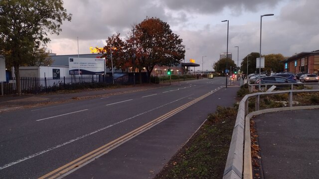
Great Homer Street Great Homer Street heading up past Sainsbury's
Great Homer Street Credit: Shaun Ferguson

Anfield is a small village located in the county of Lancashire, in the northwest of England. Situated approximately 3 miles northeast of the city of Liverpool, Anfield is primarily known for being the home of Liverpool Football Club's famous stadium.

Anfield gained prominence in the late 19th century when Everton Football Club, Liverpool's local rival, moved to the area and named their stadium after the village. However, in 1892, due to a rent dispute, Everton relocated to Goodison Park, leaving Anfield stadium vacant. Subsequently, Liverpool Football Club was formed and took over the stadium, making it their home ground ever since.

The village of Anfield itself is a residential area, with rows of Victorian terraced houses surrounding the stadium. The local community is diverse, comprising a mix of families, students, and football enthusiasts. The area has seen some regeneration efforts in recent years, with improvements made to housing and infrastructure.

Aside from the football stadium, Anfield is also home to Anfield Cemetery, which dates back to the early 19th century. The cemetery contains the final resting places of many notable figures, including former Liverpool FC manager Bill Shankly.

Overall, Anfield is a place steeped in football history and a vibrant community that revolves around the sport. It continues to attract locals and tourists alike, who flock to the stadium to witness the thrilling atmosphere of a Liverpool FC match.

If you have any feedback on the listing, please let us know in the comments section below.

Anfield Images

Images are sourced within 2km of 53.430806/-2.960982 or Grid Reference SJ3693. Thanks to Geograph Open Source API. All images are credited.

Great Homer Street Great Homer Street heading up past Sainsbury's
Great Homer Street
Great Homer Street heading up past Sainsbury's
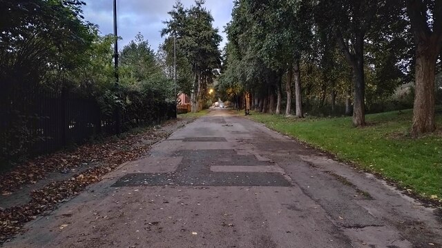
Path to Roscommon Street Path from Great Homer Street to Roscommon Street
Path to Roscommon Street
Path from Great Homer Street to Roscommon Street
Anfield Stadium, The Paisley Gateway The Paisley Gateway was erected outside the Kop end of the stadium in 1999 as a tribute to one of Liverpool FC's most successful former managers, Bob Paisley (1918–1996). It includes a depiction of the three European Cups won by the club during his tenure.
Anfield Stadium, The Paisley Gateway
The Paisley Gateway was erected outside the Kop end of the stadium in 1999 as a tribute to one of Liverpool FC's most successful former managers, Bob Paisley (1918–1996). It includes a depiction of the three European Cups won by the club during his tenure.
Walton Breck Road, The Paisley Gates and the Kop End of the Liverpool FC Stadium The Paisley Gateway was erected outside the Kop end of the stadium in 1999 as a tribute to one of Liverpool FC's most successful former managers, Bob Paisley (1918–1996). It includes a depiction of the three European Cups won by the club during his tenure.
Walton Breck Road, The Paisley Gates and the Kop End of the Liverpool FC Stadium
The Paisley Gateway was erected outside the Kop end of the stadium in 1999 as a tribute to one of Liverpool FC's most successful former managers, Bob Paisley (1918–1996). It includes a depiction of the three European Cups won by the club during his tenure.
Anfield Stadium - The 'Kop' End The stand which backs onto Walton Breck Road is called "The Kop". It was built in 1906 along Walton Breck Road. Local journalist Ernest Edwards, the sports editor of newspapers the Liverpool Daily Post and Echo, named the then-new stand the Spion Kop after a famous hill in South Africa where a local regiment had suffered heavy losses during the Boer War in 1900. More than 300 men had died, many of them from Liverpool.
Many other English football clubs and some rugby league clubs (such as Wigan's former home Central Park) applied the same name to stands but Anfield’s is probably the most famous.
Spion Kop (stadiums). (2022, October 8). In Wikipedia. <span class="nowrap"><a title="https://en.wikipedia.org/wiki/Spion_Kop_(stadiums)" rel="nofollow ugc noopener" href="https://en.wikipedia.org/wiki/Spion_Kop_(stadiums)">Link</a><img style="margin-left:2px;" alt="External link" title="External link - shift click to open in new window" src="https://s1.geograph.org.uk/img/external.png" width="10" height="10"/></span>
Anfield Stadium - The 'Kop' End
The stand which backs onto Walton Breck Road is called "The Kop". It was built in 1906 along Walton Breck Road. Local journalist Ernest Edwards, the sports editor of newspapers the Liverpool Daily Post and Echo, named the then-new stand the Spion Kop after a famous hill in South Africa where a local regiment had suffered heavy losses during the Boer War in 1900. More than 300 men had died, many of them from Liverpool. Many other English football clubs and some rugby league clubs (such as Wigan's former home Central Park) applied the same name to stands but Anfield’s is probably the most famous. Spion Kop (stadiums). (2022, October 8). In Wikipedia. LinkExternal link
Bob Paisley Statue, Anfield Stadium The bronze statue of Bob Paisley, one of Liverpool FC’s most successful managers, was unveiled in Paisley Square, outside the Main Stand, on 30 January 2020. The statue is 8 feet tall and depicts an iconic image of the club's history, Paisley carrying future club captain Emlyn Hughes off the field during a match against Tottenham Hotspur at Anfield in April 1968 (<span class="nowrap"><a title="https://www.bbc.co.uk/news/uk-england-merseyside-51312368" rel="nofollow ugc noopener" href="https://www.bbc.co.uk/news/uk-england-merseyside-51312368">Link</a><img style="margin-left:2px;" alt="External link" title="External link - shift click to open in new window" src="https://s1.geograph.org.uk/img/external.png" width="10" height="10"/></span> BBC Merseyside News).
Bob Paisley Statue, Anfield Stadium
The bronze statue of Bob Paisley, one of Liverpool FC’s most successful managers, was unveiled in Paisley Square, outside the Main Stand, on 30 January 2020. The statue is 8 feet tall and depicts an iconic image of the club's history, Paisley carrying future club captain Emlyn Hughes off the field during a match against Tottenham Hotspur at Anfield in April 1968 (LinkExternal link BBC Merseyside News).
Bob Paisley and Emlyn Hughes, Paisley Square The bronze statue of Bob Paisley, one of Liverpool FC’s most successful managers, was unveiled in Paisley Square, outside the Main Stand, on 30 January 2020. The statue is 8 feet tall and depicts an iconic image of the club's history, Paisley carrying future club captain Emlyn Hughes off the field during a match against Tottenham Hotspur at Anfield in April 1968 (<span class="nowrap"><a title="https://www.bbc.co.uk/news/uk-england-merseyside-51312368" rel="nofollow ugc noopener" href="https://www.bbc.co.uk/news/uk-england-merseyside-51312368">Link</a><img style="margin-left:2px;" alt="External link" title="External link - shift click to open in new window" src="https://s1.geograph.org.uk/img/external.png" width="10" height="10"/></span> BBC Merseyside News).

See <a href="https://www.geograph.org.uk/photo/7321114">SJ3693 : Bob Paisley Statue, Anfield Stadium</a> for a closer look at this statue.
Bob Paisley and Emlyn Hughes, Paisley Square
The bronze statue of Bob Paisley, one of Liverpool FC’s most successful managers, was unveiled in Paisley Square, outside the Main Stand, on 30 January 2020. The statue is 8 feet tall and depicts an iconic image of the club's history, Paisley carrying future club captain Emlyn Hughes off the field during a match against Tottenham Hotspur at Anfield in April 1968 (LinkExternal link BBC Merseyside News). See SJ3693 : Bob Paisley Statue, Anfield Stadium for a closer look at this statue.
Anfield Stadium, The Main Stand
Crest of Liverpool FC A large depiction of the current version of the Liverpool FC crest is mounted on the outside wall of the main stand (see <a href="https://www.geograph.org.uk/photo/7321158">SJ3693 : Anfield Stadium, The Main Stand (from Anfield Road)</a>). It features the club anthem, "You'll Never Walk Alone". There have been a total of eight different crests, with the only mainstay being the Liver bird, a mythical creature symbol synonymous with the city of Liverpool.
Crest of Liverpool FC
A large depiction of the current version of the Liverpool FC crest is mounted on the outside wall of the main stand (see SJ3693 : Anfield Stadium, The Main Stand (from Anfield Road)). It features the club anthem, "You'll Never Walk Alone". There have been a total of eight different crests, with the only mainstay being the Liver bird, a mythical creature symbol synonymous with the city of Liverpool.
Anfield Stadium, The Main Stand (from Anfield Road)
Anfield Stadium, The Main Stand (from Stanley Park)
Stanley Park, Anfield Stanley Park is a large park which was opened on 14 May 1870 in the Anfield district of Liverpool. It is known for lying between the home grounds of rival Merseyside football clubs Everton and Liverpool.
Stanley Park, Anfield
Stanley Park is a large park which was opened on 14 May 1870 in the Anfield district of Liverpool. It is known for lying between the home grounds of rival Merseyside football clubs Everton and Liverpool.
The Hillsborough Memorial at Anfield The Hillsborough memorial was originally situated alongside the Shankly Gates before it was moved next to its present position on 96 Avenue in front of the redeveloped main stand in 2016. The memorial is always decorated with flowers and tributes to the 96 people who died in 1989 as a result of the disaster <span class="nowrap"><a title="https://en.wikipedia.org/wiki/Hillsborough_disaster" rel="nofollow ugc noopener" href="https://en.wikipedia.org/wiki/Hillsborough_disaster">Link</a><img style="margin-left:2px;" alt="External link" title="External link - shift click to open in new window" src="https://s1.geograph.org.uk/img/external.png" width="10" height="10"/></span> . At the centre of the memorial is an eternal flame, signifying that those who died will never be forgotten
The Hillsborough Memorial at Anfield
The Hillsborough memorial was originally situated alongside the Shankly Gates before it was moved next to its present position on 96 Avenue in front of the redeveloped main stand in 2016. The memorial is always decorated with flowers and tributes to the 96 people who died in 1989 as a result of the disaster LinkExternal link . At the centre of the memorial is an eternal flame, signifying that those who died will never be forgotten
Shanks Bill Shankly became manager of Liverpool FC when they were in the Second Division and rebuilt the team into a major force in English and European football. Most people agree that he laid the foundations on which his successors were able to build, developing the club to the position it is in today as one of England’s largest football clubs.

A bronze statue of Shankly was unveiled at the visitors' centre in front of the Kop on 4 December 1997. Shankly was a charismatic, iconic figure at the club and the statue which stands at over 8 feet tall, depicts him with a fan's scarf around his neck, in a familiar pose he adopted when receiving applause from fans.

Inscribed on the statue are the words "Bill Shankly – He Made The People Happy"
Shanks
Bill Shankly became manager of Liverpool FC when they were in the Second Division and rebuilt the team into a major force in English and European football. Most people agree that he laid the foundations on which his successors were able to build, developing the club to the position it is in today as one of England’s largest football clubs. A bronze statue of Shankly was unveiled at the visitors' centre in front of the Kop on 4 December 1997. Shankly was a charismatic, iconic figure at the club and the statue which stands at over 8 feet tall, depicts him with a fan's scarf around his neck, in a familiar pose he adopted when receiving applause from fans. Inscribed on the statue are the words "Bill Shankly – He Made The People Happy"
The Shankly Statue, Anfield Stadium Bill Shankly became manager of Liverpool FC when they were in the Second Division and rebuilt the team into a major force in English and European football. Most people agree that he laid the foundations on which his successors were able to build, developing the club to the position it is in today as one of England’s largest football clubs.

A bronze statue of Shankly was unveiled at the visitors' centre in front of the Kop stand on 4 December 1997. Shankly was a charismatic, iconic figure at the club and the statue which stands at over 8 feet tall, depicts him with a fan's scarf around his neck, in a familiar pose he adopted when receiving applause from fans.

Inscribed on the statue are the words "Bill Shankly – He made the people happy"
The Shankly Statue, Anfield Stadium
Bill Shankly became manager of Liverpool FC when they were in the Second Division and rebuilt the team into a major force in English and European football. Most people agree that he laid the foundations on which his successors were able to build, developing the club to the position it is in today as one of England’s largest football clubs. A bronze statue of Shankly was unveiled at the visitors' centre in front of the Kop stand on 4 December 1997. Shankly was a charismatic, iconic figure at the club and the statue which stands at over 8 feet tall, depicts him with a fan's scarf around his neck, in a familiar pose he adopted when receiving applause from fans. Inscribed on the statue are the words "Bill Shankly – He made the people happy"
Esso Rontec Anfield The Esso filling station on Oakfield Road.
Esso Rontec Anfield
The Esso filling station on Oakfield Road.
Sleepers Hill, Anfield Nineteenth century terraced houses in the Anfield area of Liverpool.
Sleepers Hill, Anfield
Nineteenth century terraced houses in the Anfield area of Liverpool.
Liverpool, Robson Street
Show me another place!

Anfield is located at Grid Ref: SJ3693 (Lat: 53.430806, Lng: -2.960982)

Unitary Authority: Liverpool

Police Authority: Merseyside

What 3 Words

///songs.lines.ally. Near Clubmoor, Merseyside

Nearby Locations

Anfield

Related Wikis

Anfield

Anfield is a football stadium in Anfield, Liverpool, England, which has a seating capacity of 61,276, making it the fifth largest football stadium in England...

Anfield (Liverpool ward)

Anfield ward is an electoral district of Liverpool City Council centred on the Anfield district of Liverpool. The ward is within the Liverpool Walton Parliamentary...

Stanley Park railway station

Stanley Park is a proposed new railway station in Anfield, Liverpool, England. The proposed station would coincide with the expansion of nearby Anfield...

Stanley Park Stadium

Stanley Park was a proposed football stadium in Stanley Park, Liverpool. If built, it would have become home to the Liverpool Football Club. It would have...

Nearby Amenities

Located within 500m of 53.430806,-2.960982
Traffic Signals
Traffic Signals: signal
Lat/Long: 53.4324899/-2.9549297
Traffic Calming: table
Lat/Long: 53.429615/-2.9563153
Traffic Calming: table
Lat/Long: 53.4291698/-2.9554144
Traffic Signals
Lat/Long: 53.4309379/-2.9678535
Fixme: continue
Lat/Long: 53.4305106/-2.9683055
Bus Stop
WALTON BRECK ROAD/VENICE STREET
Bus: yes
Naptan AtcoCode: 2800S40126A
Naptan Bearing: W
Naptan CommonName: WALTON BRECK ROAD/VENICE STREET
Naptan Indicator: WALTON BRECK ROAD/OAKFIELD ROAD
Naptan Landmark: CORNER VENICE STREET NR PEDESTRIAN LIGHTS
Naptan NaptanCode: merdapad
Naptan Notes: No Notes
Naptan PlusbusZoneRef: LVRPLCH
Naptan ShortCommonName: Venice St
Naptan Street: WALTON BRECK ROAD
Naptan Verified: no
Public Transport: platform
Source: naptan_import
Lat/Long: 53.4303694/-2.9641886
Bus Stop
WALTON BRECK ROAD/BURLEIGH STREET
Bus: yes
Naptan AtcoCode: 2800S40054A
Naptan Bearing: W
Naptan CommonName: WALTON BRECK ROAD/BURLEIGH STREET
Naptan Indicator: WALTON BRECK ROAD/ROBSON STREET
Naptan Landmark: NR CORNER BURLEIGH ROAD RTH O/S 9
Naptan NaptanCode: merdadtm
Naptan Notes: No Notes
Naptan PlusbusZoneRef: LVRPLCH
Naptan ShortCommonName: The Salisbury
Naptan Street: WALTON BRECK ROAD
Naptan Verified: no
Public Transport: platform
Source: naptan_import
Lat/Long: 53.4307816/-2.9665761
Bus Stop
WALTON BRECK ROAD/BLESSINGTON ROAD
Bus: yes
Naptan AtcoCode: 2800S40054B
Naptan Bearing: E
Naptan CommonName: WALTON BRECK ROAD/BLESSINGTON ROAD
Naptan Indicator: WALTON BRECK ROAD/ROBSON STREET
Naptan Landmark: CORNER BLESSINGTON ROAD NEAR 85
Naptan NaptanCode: merdadtp
Naptan Notes: No Notes
Naptan PlusbusZoneRef: LVRPLCH
Naptan ShortCommonName: The Salisbury
Naptan Street: WALTON BRECK ROAD
Naptan Verified: no
Public Transport: platform
Source: naptan_import
Lat/Long: 53.4309468/-2.9672722
Bus Stop
ROBSON STREET/WALTON BRECK ROAD
Bus: yes
Naptan AtcoCode: 2800S40054C
Naptan Bearing: S
Naptan CommonName: ROBSON STREET/WALTON BRECK ROAD
Naptan Indicator: ROBSON STREET/WALTON BRECK ROAD
Naptan Landmark: O/S 88 CORNER BURLEIGH ROAD RTH
Naptan NaptanCode: merdadtw
Naptan Notes: No Notes
Naptan PlusbusZoneRef: LVRPLCH
Naptan ShortCommonName: Robson St
Naptan Street: ROBSON STREET
Naptan Verified: no
Public Transport: platform
Source: naptan_import
Lat/Long: 53.4298547/-2.9673964
Bus Stop
ROBSON STREET/WALTON BRECK ROAD
Bus: yes
Naptan AtcoCode: 2800S40054D
Naptan Bearing: N
Naptan CommonName: ROBSON STREET/WALTON BRECK ROAD
Naptan Indicator: ROBSON STREET/WALTON BRECK ROAD
Naptan Landmark: OPP 98 ROBSON STREET CORNER WYRE RD O/S STOREY
Naptan NaptanCode: merdadwa
Naptan Notes: No Notes
Naptan PlusbusZoneRef: LVRPLCH
Naptan ShortCommonName: Robson St
Naptan Street: ROBSON STREET
Naptan Verified: no
Public Transport: platform
Source: naptan_import
Lat/Long: 53.4302225/-2.967756
Bus Stop
WALTON BRECK ROAD/LIVERPOOL FC
Bus: yes
Naptan AtcoCode: 2800S40055A
Naptan Bearing: W
Naptan CommonName: WALTON BRECK ROAD/LIVERPOOL FC
Naptan Indicator: WALTON BRECK ROAD
Naptan Landmark: OPP LIVERPOOL FOOTBALL CLUB
Naptan NaptanCode: merdadwd
Naptan Notes: No Notes
Naptan PlusbusZoneRef: LVRPLCH
Naptan ShortCommonName: Walton Breck Rd/Lfc
Naptan Street: WALTON BRECK ROAD
Naptan Verified: no
Public Transport: platform
Source: naptan_import
Lat/Long: 53.4297355/-2.9614199
Bus Stop
WALTON BRECK ROAD/LIVERPOOL FC
Bus: yes
Naptan AtcoCode: 2800S40055B
Naptan Bearing: E
Naptan CommonName: WALTON BRECK ROAD/LIVERPOOL FC
Naptan Indicator: WALTON BRECK ROAD
Naptan Landmark: O/S LIVERPOOL FOOTBALL CLUB GATES 20 AND 19
Naptan NaptanCode: merdadwg
Naptan Notes: No Notes
Naptan PlusbusZoneRef: LVRPLCH
Naptan ShortCommonName: Walton Breck Rd/Lfc
Naptan Street: WALTON BRECK ROAD
Naptan Verified: no
Public Transport: platform
Source: naptan_import
Lat/Long: 53.4299288/-2.9618289
Bus Stop
FOOTBALL SERVICES STOP
Bus: yes
Naptan AtcoCode: 2800S40055C
Naptan Bearing: E
Naptan CommonName: FOOTBALL SERVICES STOP
Naptan Indicator: WALTON BRECK ROAD/OLDFIELD ROAD
Naptan Landmark: CORNER TINSLEY STREET O/S SHOPS 173/175
Naptan NaptanCode: mergmgag
Naptan Notes: No Notes
Naptan PlusbusZoneRef: LVRPLCH
Naptan ShortCommonName: Walton Breck Rd
Naptan Street: WALTON BRECK ROAD
Naptan Verified: no
Public Transport: platform
Source: naptan_import
Lat/Long: 53.4302316/-2.9632139
Bus Stop
PRIORY ROAD/SPORTS CENTRE
Bus: yes
Naptan AtcoCode: 2800S40057A
Naptan Bearing: NW
Naptan CommonName: PRIORY ROAD/SPORTS CENTRE
Naptan Indicator: PRIORY ROAD/UTTING AVENUE
Naptan Landmark: O/S STANLEY PARK/VERN SANGSTER SPORTS CENTRE
Naptan NaptanCode: merdadwp
Naptan Notes: No Notes
Naptan PlusbusZoneRef: LVRPLCH
Naptan ShortCommonName: Vernon Sangster
Naptan Street: PRIORY ROAD
Naptan Verified: no
Public Transport: platform
Source: naptan_import
Lat/Long: 53.4332132/-2.955341
Bus Stop
UTTING AVENUE/PRIORY ROAD
Bus: yes
Naptan AtcoCode: 2800S40057B
Naptan Bearing: SW
Naptan CommonName: UTTING AVENUE/PRIORY ROAD
Naptan Indicator: ARKLES LANE/PRIORY ROAD
Naptan Landmark: O/S 88
Naptan NaptanCode: merdadwt
Naptan Notes: No Notes
Naptan PlusbusZoneRef: LVRPLCH
Naptan ShortCommonName: Utting Av/Priory Rd
Naptan Street: ARKLES LANE
Naptan Verified: no
Public Transport: platform
Source: naptan_import
Lat/Long: 53.4322404/-2.9549018
Bus Stop
PRIORY ROAD/PRIORY COMPREHENSIVE
Bus: yes
Naptan AtcoCode: 2800S40057C
Naptan Bearing: SE
Naptan CommonName: PRIORY ROAD/PRIORY COMPREHENSIVE
Naptan Indicator: PRIORY ROAD/UTTING AVENUE
Naptan Landmark: O/S PRIORY COMMUNITY SCHOOL
Naptan NaptanCode: merdagad
Naptan Notes: No Notes
Naptan PlusbusZoneRef: LVRPLCH
Naptan ShortCommonName: Priory Rd/Comp Sch
Naptan Street: PRIORY ROAD
Naptan Verified: no
Public Transport: platform
Source: naptan_import
Lat/Long: 53.433111/-2.9549226
Post Box
Collection Times: Mo-Fr 09:00; Sa 07:00
Description: EIIR Type B post box L4 574 on Blessington Road, Anfield at junction with Gurnall Street
Operator: Royal Mail
Operator Wikidata: Q638098
Post Box Design: type_b
Post Box Type: pillar
Ref: L4 574
Royal Cypher: EIIR
Royal Cypher Wikidata: Q33102113
Wikimedia Commons: File:Post box on Blessington Road, Anfield.jpg
Lat/Long: 53.432167/-2.9665337
Post Box
Collection Times: Mo-Fr 09:00; Sa 07:00
Description: Edward VII Type B post box L4 464 on Priory Road near Watford Road, Anfield.
Operator: Royal Mail
Operator Wikidata: Q638098
Post Box Design: type_b
Post Box Type: pillar
Ref: L4 464
Royal Cypher: EVIIR
Royal Cypher Wikidata: Q33102324
Wikimedia Commons: File:Post box on Priory Road, Anfield.jpg
Lat/Long: 53.432118/-2.9538444
Bill Shankly statue
Artwork Type: statue
Inscription: Bill Shankly he made the people happy
Material: bronze
Memorial Type: statue
Name Zh: 比尔·香克利的雕塑
Tourism: artwork
Wikimedia Commons: File:Shankly statue out front.jpg
Lat/Long: 53.4301258/-2.9620504
Hillsborough Memorial
Historic: monument
Lat/Long: 53.4317317/-2.9619841
Traffic Calming: table
Lat/Long: 53.4303302/-2.9578037
Traffic Calming: table
Lat/Long: 53.428693/-2.9547281
Crossing
Crossing: traffic_signals
Crossing Ref: puffin
Kerb: lowered
Tactile Paving: yes
Lat/Long: 53.427423/-2.9580446
Bicycle Parking
Bicycle Parking: stands
Capacity: 6
Covered: no
Lat/Long: 53.4274118/-2.9581276
Bicycle Parking
Bicycle Parking: stands
Capacity: 6
Covered: no
Lat/Long: 53.4277889/-2.9585728
Crossing
Button Operated: yes
Crossing: traffic_signals
Crossing Island: no
Crossing Ref: pelican
Kerb: lowered
Tactile Paving: yes
Lat/Long: 53.429478/-2.9601484
LFC Ticket Office
Shop: ticket
Lat/Long: 53.4306722/-2.9620742
LFC Museum
Addr City: Liverpool
Addr Housename: Anfield Stadium
Addr Postcode: L4 0TF
Addr Street: Anfield Road
Museum: local_history
Name En: Liverpool FC Museum
Tourism: museum
Website: https://stadiumtours.liverpoolfc.com/tours
Lat/Long: 53.4302124/-2.9619309
site of Anfield Lodge
Historic: yes
Lat/Long: 53.4286659/-2.9543575
turnstile A
Entrance: yes
Lat/Long: 53.430701/-2.9621679
Player's entrance
Entrance: yes
Lat/Long: 53.4318728/-2.961783
Entrance: yes
Lat/Long: 53.4301482/-2.9626001
Man Made: flagpole
Lat/Long: 53.4300349/-2.9622273
Man Made: flagpole
Lat/Long: 53.4300286/-2.9621843
Man Made: flagpole
Lat/Long: 53.4300198/-2.9621374
Man Made: flagpole
Lat/Long: 53.430011/-2.9620905
turnstile C
Entrance: yes
Lat/Long: 53.430264/-2.9620209
tunstile W
Entrance: yes
Lat/Long: 53.4310451/-2.9625475
turnstile B
Entrance: yes
Lat/Long: 53.4304645/-2.9622314
turnstile D
Entrance: yes
Lat/Long: 53.4299486/-2.9613626
turnstile F
Entrance: yes
Lat/Long: 53.4299656/-2.9608931
turnstile E
Entrance: yes
Lat/Long: 53.4298938/-2.9609941
Pub
Addr Postcode: L4 0RF
Check Date: 2017-04-02
Lat/Long: 53.4308775/-2.9680521
The Glenbuck Hotel Anfield
Addr Postcode: L4 0RF
Check Date: 2017-04-02
Tourism: guest_house
Lat/Long: 53.4308146/-2.9681422
William Hill
Brand: William Hill
Brand Wikidata: Q4053147
Brand Wikipedia: en:William Hill (bookmaker)
Shop: bookmaker
Lat/Long: 53.4307794/-2.9653923
Pub
The Twelfth Man
Lat/Long: 53.4308113/-2.9655773
Restaurant
Boot Room Sports Cafe
Website: https://bootroom.liverpoolfc.com/
Lat/Long: 53.4301361/-2.9617098
Entrance: yes
Lat/Long: 53.4305048/-2.9634813
Fast Food
Quick-Bite
Lat/Long: 53.4300066/-2.9625389
Fast Food
Lucky Fryer
Lat/Long: 53.4288488/-2.9671182
Discount Booze
Shop: wine
Lat/Long: 53.430975/-2.967627
Fast Food
Green Kitchen
Lat/Long: 53.4307942/-2.9659285
Fast Food
The Golden Chippery
Lat/Long: 53.4308144/-2.9660291
Waste Basket
Lat/Long: 53.4312193/-2.9632285
Waste Basket
Lat/Long: 53.4310912/-2.9629435
Waste Basket
Lat/Long: 53.4314011/-2.9630922
tunstile W
Entrance: yes
Lat/Long: 53.430932/-2.9626945
Access: private
Door: hinged
Entrance: home
Lat/Long: 53.4274764/-2.9617716
Access: private
Door: hinged
Entrance: home
Lat/Long: 53.4274354/-2.9617368
Bicycle Parking
Bicycle Parking: stands
Covered: no
Lat/Long: 53.4308758/-2.9633528
Atm
Fee: £1.85
Operator: Cashzone
Lat/Long: 53.4298178/-2.9612876
Telephone
Booth: KXCash
Operator: BT
Operator Wikidata: Q593786
Lat/Long: 53.4298223/-2.961304
Cafe
Homebaked
Addr City: Liverpool
Addr Housenumber: 197
Addr Postcode: L4 0UF
Addr Street: Oakfield Road
Note: community bakery, pies, rolls etc
Url: http://homebaked.org.uk/
Lat/Long: 53.4294089/-2.9603388
Fast Food
Sing Fong
Cuisine: chinese;english;fish
Lat/Long: 53.4295895/-2.9608564
Post Box
Collection Times: Mo-Fr 09:00; Sa 07:00
Description: EIIR Type B post box L4 299 on the corner of Anfield Road and Arkles Lane opposite Wylva Road.
Operator: Royal Mail
Operator Wikidata: Q638098
Post Box Design: type_b
Post Box Type: pillar
Ref: L4 299
Royal Cypher: EIIR
Royal Cypher Wikidata: Q33102113
Wikimedia Commons: File:Post box at Wylva Road, Anfield.jpg
Lat/Long: 53.4306096/-2.9581424
Post Box
Collection Times: Mo-Fr 09:00; Sa 07:00
Description: QEII Type K post box L4 584 on Oakfield Road, Anfield, near Hawkesworth Street.
Operator: Royal Mail
Operator Wikidata: Q638098
Post Box Design: type_k
Post Box Type: pillar
Ref: L4 584
Royal Cypher: EIIR
Royal Cypher Wikidata: Q33102113
Wikimedia Commons: File:Post box on Oakfield Road, Anfield.jpg
Lat/Long: 53.4281857/-2.9587347
Fuel
Lat/Long: 53.434186/-2.9562517
Anfield
Place: suburb
Lat/Long: 53.432468/-2.9545427
The Arc Hotel
Addr City: Liverpool
Addr Housenumber: 95
Addr Street: Anfield Road
Tourism: hotel
Lat/Long: 53.4297469/-2.9563642
Ali's
Shop: convenience
Lat/Long: 53.4297696/-2.9564619
Pub
Arkles
Brand: Greene King
Brand Wikidata: Q5564162
Website: https://www.greeneking.co.uk/pubs/merseyside/arkles
Lat/Long: 53.4303023/-2.9574847
Traffic Signals
Traffic Signals: crossing
Traffic Signals Direction: forward
Lat/Long: 53.4295017/-2.9601817
Traffic Signals
Traffic Signals: crossing
Traffic Signals Direction: backward
Lat/Long: 53.4294499/-2.9601154
Crossing
Button Operated: yes
Crossing: traffic_signals
Tactile Paving: yes
Lat/Long: 53.4328707/-2.9544059
Cycleway: asl
Lat/Long: 53.4329193/-2.9548091
Traffic Signals
Traffic Signals: signal
Lat/Long: 53.432398/-2.9541921
Crossing
Button Operated: yes
Crossing: traffic_signals
Tactile Paving: yes
Lat/Long: 53.4327529/-2.9542177
Crossing
Button Operated: yes
Crossing: traffic_signals
Tactile Paving: yes
Lat/Long: 53.4328005/-2.9547898
Crossing
Button Operated: yes
Crossing: traffic_signals
Tactile Paving: yes
Lat/Long: 53.4328877/-2.9547594
Crossing
Button Operated: yes
Crossing: traffic_signals
Crossing Island: no
Tactile Paving: yes
Lat/Long: 53.432552/-2.954837
Crossing
Button Operated: yes
Crossing: traffic_signals
Crossing Island: no
Tactile Paving: yes
Lat/Long: 53.4324739/-2.9546492
Crossing
Button Operated: yes
Crossing: traffic_signals
Tactile Paving: yes
Lat/Long: 53.4325415/-2.9542305
Crossing
Button Operated: yes
Crossing: traffic_signals
Tactile Paving: yes
Lat/Long: 53.4324591/-2.9542876
Cycleway: asl
Lat/Long: 53.4324286/-2.9542399
Traffic Signals
Traffic Signals: signal
Lat/Long: 53.4329518/-2.9548619
Cycleway: asl
Lat/Long: 53.4325209/-2.9548834
Traffic Calming: hump
Lat/Long: 53.429444/-2.9557758
Traffic Calming: table
Lat/Long: 53.4299439/-2.9570104
Fuel
Esso
Brand: Esso
Brand Wikidata: Q867662
Operator: Rontec
Operator Website: http://www.rontec-servicestations.co.uk/ss_results-id.cfm?id=6978
Operator Wikidata: Q107439152
Lat/Long: 53.4291036/-2.9593684
Bob Paisley & Emlyn Hughes Statue
Artwork Type: statue
Tourism: artwork
Lat/Long: 53.4306895/-2.963156
The Champions Wall
Historic: memorial
Memorial: plaque
Lat/Long: 53.4305925/-2.9631613
Artist Name: Paul Curtis
Artwork Type: mural
Description: Missy Bo Kearns
Tourism: artwork
Lat/Long: 53.4331369/-2.9638242
The data included in this document is from www.openstreetmap.org. The data is made available under ODbL.

Have you been to Anfield?

Leave your review of Anfield below (or comments, questions and feedback).