Church End

Settlement in Bedfordshire

England

Church End

Fields near Castle farm Washers Wood in the distance.
Fields near Castle farm Credit: James Emmans

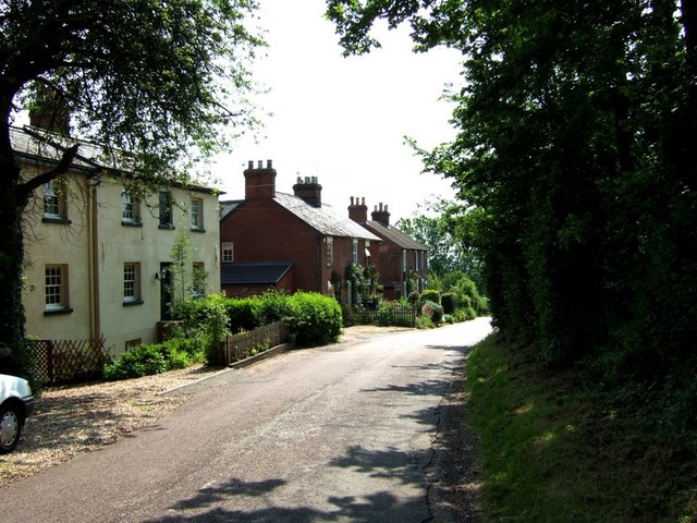
Church End is a small village located in Bedfordshire, England. Situated approximately 5 miles northeast of the town of Bedford, it is a rural community with a population of around 300 people. The village is known for its picturesque countryside, charming cottages, and peaceful atmosphere.

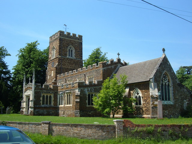
The focal point of Church End is the St. Mary's Church, a beautiful medieval structure dating back to the 12th century. The church is renowned for its stunning architecture, including a Norman doorway and a 14th-century tower. It serves as a gathering place for religious services and community events.

The village itself features a small number of amenities to cater to its residents' needs. These include a local pub, The Church End Inn, which offers a cozy atmosphere and traditional British fare. There is also a village hall which hosts various social activities and gatherings.

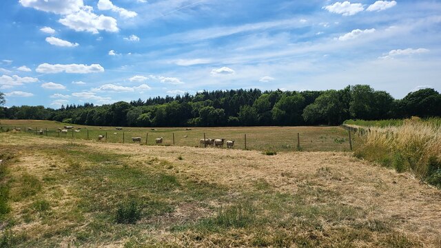
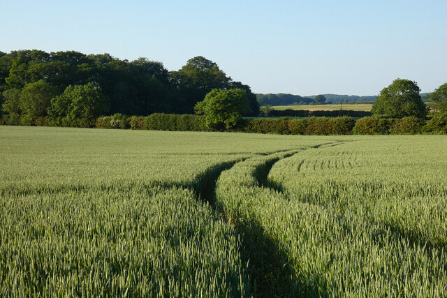
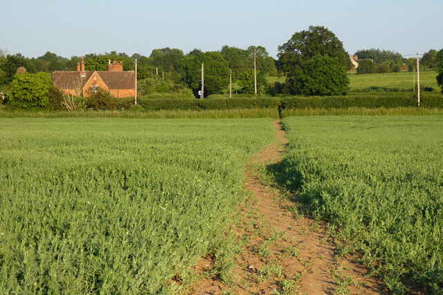
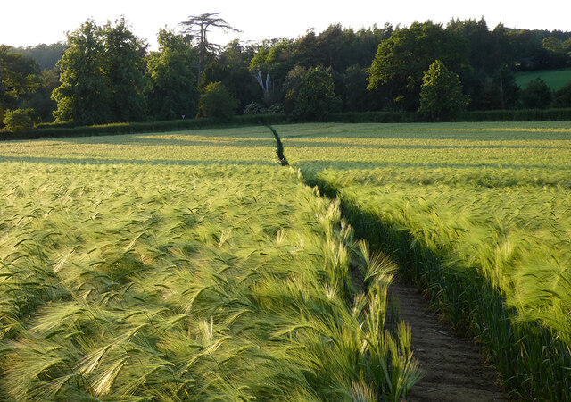
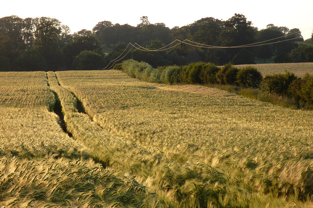
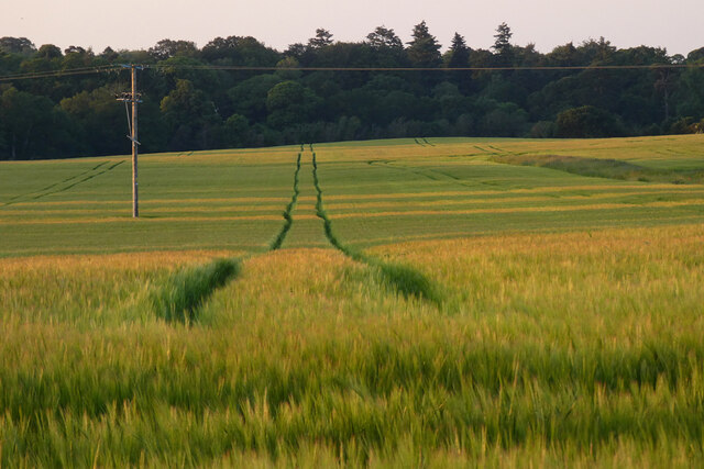
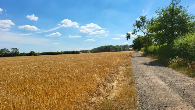
Surrounded by rolling fields and farmland, Church End is an ideal destination for those seeking a peaceful countryside experience. The area offers ample opportunities for outdoor activities such as walking, cycling, and horse riding. The nearby countryside also provides stunning views and a chance to observe local wildlife.

Despite its small size, Church End benefits from its proximity to the larger town of Bedford. This allows residents to access a wider range of amenities, including supermarkets, shops, and healthcare facilities. Overall, Church End offers a tranquil and close-knit community, appealing to those seeking a rural lifestyle in the heart of Bedfordshire.

If you have any feedback on the listing, please let us know in the comments section below.

Church End Images

Images are sourced within 2km of 51.982279/-0.568067 or Grid Reference SP9832. Thanks to Geograph Open Source API. All images are credited.

Fields near Castle farm Washers Wood in the distance.
Fields near Castle farm
Washers Wood in the distance.
Chinese Dairy and Pond On the Woburn Abbey Estate, a folly dairy
Chinese Dairy and Pond
On the Woburn Abbey Estate, a folly dairy
Farmland, Milton Bryan A footpath through wheat to the north-east of the village.
Farmland, Milton Bryan
A footpath through wheat to the north-east of the village.
Farmland, Toddington Oats to the north-west of Happy Land Farm.
Farmland, Toddington
Oats to the north-west of Happy Land Farm.
Farmland, Eversholt Wheat to the east of Berry End Farm.
Farmland, Eversholt
Wheat to the east of Berry End Farm.
Farmland, Eversholt A footpath through peas on the approach to Water End.
Farmland, Eversholt
A footpath through peas on the approach to Water End.
Farmland, Eversholt A footpath through barley on the approach to Berrystead.
Farmland, Eversholt
A footpath through barley on the approach to Berrystead.
Farmland, Eversholt Barley and power lines catch the evening light below Hills End.
Farmland, Eversholt
Barley and power lines catch the evening light below Hills End.
Farmland, Tingrith Spring barley to the north of Castle Farm.
Farmland, Tingrith
Spring barley to the north of Castle Farm.
Field access track Wood House is in Daintry Wood uses this track.
Field access track
Wood House is in Daintry Wood uses this track.
Woburn Abbey and Estate
St. John the Baptist, Eversholt One of the many chocolate-brown churches in this part of Bedfordshire. The blue shape in the foreground is not an apparition of the Holy Grail, but more prosaically lens glare !
More information about Eversholt and its church here <span class="nowrap"><a title="http://www.british-history.ac.uk/report.asp?compid=42449" rel="nofollow ugc noopener" href="http://www.british-history.ac.uk/report.asp?compid=42449">Link</a><img style="margin-left:2px;" alt="External link" title="External link - shift click to open in new window" src="https://s1.geograph.org.uk/img/external.png" width="10" height="10"/></span>
St. John the Baptist, Eversholt
One of the many chocolate-brown churches in this part of Bedfordshire. The blue shape in the foreground is not an apparition of the Holy Grail, but more prosaically lens glare ! More information about Eversholt and its church here LinkExternal link
St John the Baptist - Tower & Porch Eversholt is quite a straggly village, the church here is (unsurprisingly) at Church End but near to Brook End. Another part of the village is called Witts End - which I've been at many times! 
More information about Eversholt and its church here <span class="nowrap"><a title="http://www.british-history.ac.uk/report.asp?compid=42449" rel="nofollow ugc noopener" href="http://www.british-history.ac.uk/report.asp?compid=42449">Link</a><img style="margin-left:2px;" alt="External link" title="External link - shift click to open in new window" src="https://s1.geograph.org.uk/img/external.png" width="10" height="10"/></span>
St John the Baptist - Tower & Porch
Eversholt is quite a straggly village, the church here is (unsurprisingly) at Church End but near to Brook End. Another part of the village is called Witts End - which I've been at many times! More information about Eversholt and its church here LinkExternal link
The Green Man, Eversholt A solid looking pub directly opposite the church in Eversholt. Apparently it dates from 1835 
Own website - <span class="nowrap"><a title="http://www.greenmaneversholt.com/Home.html" rel="nofollow ugc noopener" href="http://www.greenmaneversholt.com/Home.html">Link</a><img style="margin-left:2px;" alt="External link" title="External link - shift click to open in new window" src="https://s1.geograph.org.uk/img/external.png" width="10" height="10"/></span>
The Green Man, Eversholt
A solid looking pub directly opposite the church in Eversholt. Apparently it dates from 1835 Own website - LinkExternal link
Milton Wood This view of Milton Wood was taken from the Eastern edge of Fourteen Acre Spinney on the road from Eversholt to Milton Bryan.
Milton Wood
This view of Milton Wood was taken from the Eastern edge of Fourteen Acre Spinney on the road from Eversholt to Milton Bryan.
War Memorial, Eversholt In the churchyard of St.John the Baptist, Eversholt is this quite unusual war memorial topped by an angel (St. Michael perhaps) rather than the more usual cross.
War Memorial, Eversholt
In the churchyard of St.John the Baptist, Eversholt is this quite unusual war memorial topped by an angel (St. Michael perhaps) rather than the more usual cross.
View towards Tyrell's End Taken next to St. John the Baptist's church in Eversholt looking down the lane towards Tyrell's End.
View towards Tyrell's End
Taken next to St. John the Baptist's church in Eversholt looking down the lane towards Tyrell's End.
Hills End, Eversholt Eversholt is a very scattered village with numerous "ends". This row of houses the best part of a mile from the centre of the village, is called Hills End.
Hills End, Eversholt
Eversholt is a very scattered village with numerous "ends". This row of houses the best part of a mile from the centre of the village, is called Hills End.
Show me another place!

Church End is located at Grid Ref: SP9832 (Lat: 51.982279, Lng: -0.568067)

Unitary Authority: Central Bedfordshire

Police Authority: Bedfordshire

What 3 Words

///uniform.expansion.trudges. Near Eversholt, Bedfordshire

Nearby Locations

Church End

Related Wikis

Froxfield, Bedfordshire

Froxfield is a small hamlet in Bedfordshire, England. == References == The geographic coordinates are from the Ordnance Survey.

Eversholt

Eversholt is a village and civil parish located in Bedfordshire, England. It was mentioned in the Domesday Book and is over 1000 years old. "Eversholt...

Woburn Abbey

Woburn Abbey (), occupying the east of the village of Woburn, Bedfordshire, England, is a country house, the family seat of the Duke of Bedford. Although...

Church of St Peter, Milton Bryan

Church of St Peter is a Grade I listed church in Milton Bryan, Bedfordshire, England. It became a listed building on 23 January 1961. == History == St...

Nearby Amenities

Located within 500m of 51.982279,-0.568067
Eversholt
Place: village
Source: npe
Wikidata: Q1520400
Lat/Long: 51.983113/-0.5706176
Prow Ref: Eversholt BW19
Lat/Long: 51.9848521/-0.5678179
Eversholt Swimming Pool
Access: yes
Covered: no
Leisure: swimming_pool
Motor Vehicle: yes
Sport: swimming
Lat/Long: 51.9836687/-0.5720795
Leisure: playground
Lat/Long: 51.9834308/-0.5720795
Post Box
Brand: Royal Mail
Brand Wikidata: Q638098
Brand Wikipedia: en:Royal Mail
Collection Times: Mo-Fr 17:00; Sa 10:00
Operator: Royal Mail
Operator Wikidata: Q638098
Post Box Type: wall
Ref: MK17 70
Royal Cypher: GR
Royal Cypher Wikidata: Q33102273
Source: survey
Lat/Long: 51.9817083/-0.569455
Barrier: kissing_gate
Lat/Long: 51.9853277/-0.5701692
Barrier: kissing_gate
Lat/Long: 51.9851813/-0.5676825
Barrier: kissing_gate
Lat/Long: 51.9847934/-0.568009
Barrier: kissing_gate
Lat/Long: 51.9857664/-0.5715422
Barrier: kissing_gate
Lat/Long: 51.986305/-0.5665679
Barrier: kissing_gate
Lat/Long: 51.9865156/-0.5666357
Tourism: information
Lat/Long: 51.9796912/-0.5722916
Barrier: kissing_gate
Foot: yes
Source: GPS, observation
Lat/Long: 51.9797189/-0.5721279
Telephone
Booth: K6
Covered: booth
Listed Status: Grade II
Man Made: telephone_box
Tourism: information
Lat/Long: 51.9820972/-0.5696982
The data included in this document is from www.openstreetmap.org. The data is made available under ODbL.

Have you been to Church End?

Leave your review of Church End below (or comments, questions and feedback).