Church End

Settlement in Bedfordshire

England

Church End

Dunstable Cemetery entrance On West Street [B489], the road to Tring and Aston Clinton from Dunstable.
Dunstable Cemetery entrance Credit: M J Richardson

Church End is a small village located in the county of Bedfordshire, England. Situated approximately 3 miles south of the town of Marston Moretaine, it is a rural settlement surrounded by picturesque countryside. The village is often characterized by its quaint and charming atmosphere, with a number of traditional thatched-roof cottages dating back to the 17th and 18th centuries.

The centerpiece of Church End is the St. Mary's Church, an ancient place of worship that has stood since medieval times. This historic church features a beautiful 14th-century tower and is known for its stunning stained glass windows and intricate architectural details.

The village is primarily a residential area, with a close-knit community that takes pride in its local heritage. There are a few small businesses, including a local pub and a convenience store, which serve the needs of the residents. The surrounding fields and meadows offer a tranquil setting for countryside walks, and there are several footpaths and bridleways that can be explored.

Despite its relatively small size, Church End enjoys a vibrant community spirit and hosts various events throughout the year. These include summer fairs, village fetes, and seasonal celebrations. The village also benefits from its proximity to larger towns and cities, with easy access to amenities and transport links.

Overall, Church End provides a peaceful and idyllic retreat for those seeking a rural lifestyle, while still offering the convenience of nearby amenities and a strong sense of community.

If you have any feedback on the listing, please let us know in the comments section below.

Church End Images

Images are sourced within 2km of 51.8788/-0.55974958 or Grid Reference SP9921. Thanks to Geograph Open Source API. All images are credited.

Dunstable Cemetery entrance On West Street [B489], the road to Tring and Aston Clinton from Dunstable.
Dunstable Cemetery entrance
On West Street [B489], the road to Tring and Aston Clinton from Dunstable.
Dunstable Downs car park
Part of the Dunstable Downs in the summer of 2022 Glorious.
Part of the Dunstable Downs in the summer of 2022
Glorious.
Scene on the Dunstable Downs in summer 2022 This elegant and independent woman has settled herself into a most comfortable and commodious looking chair and is drinking in the exceptional views laid out in front of her. My type of person! No boring sea view. No sitting in her back garden and looking at the Downs. She has picked up her mat and walked. She knows that she needs the scale of a JMW Turner or Constable painting and subject matter to match. She is aloof but also very much central to the scene. I envied her her vision, insight and depth of thought. More of this please!
Scene on the Dunstable Downs in summer 2022
This elegant and independent woman has settled herself into a most comfortable and commodious looking chair and is drinking in the exceptional views laid out in front of her. My type of person! No boring sea view. No sitting in her back garden and looking at the Downs. She has picked up her mat and walked. She knows that she needs the scale of a JMW Turner or Constable painting and subject matter to match. She is aloof but also very much central to the scene. I envied her her vision, insight and depth of thought. More of this please!
View from Dunstable Downs Dunstable Downs Airfield is below, much used by gliders.
View from Dunstable Downs
Dunstable Downs Airfield is below, much used by gliders.
Kite flying on Dunstable Downs Looking north. Although they are not easy to see on the photograph, the sky was full of kites.
Kite flying on Dunstable Downs
Looking north. Although they are not easy to see on the photograph, the sky was full of kites.
Dunstable Downs Gliding Club A view of the airfield from the downs.   Gliders and tug aircraft await their turn next to the yellow control caravan.  The gliding club buildings and parking area are visible beyond, in the next square.  The downs continue north along the right hand side of the picture towards Pascomb Pit and Five Knolls, (the promontory on the horizon).   The chalky nature of the soil is evident in the ploughed field behind the gliding club buildings.
Dunstable Downs Gliding Club
A view of the airfield from the downs. Gliders and tug aircraft await their turn next to the yellow control caravan. The gliding club buildings and parking area are visible beyond, in the next square. The downs continue north along the right hand side of the picture towards Pascomb Pit and Five Knolls, (the promontory on the horizon). The chalky nature of the soil is evident in the ploughed field behind the gliding club buildings.
Bloke flying a kite or Kite Flying a bloke This was a loon who, with a number of kites tied together, used the kites to lift him off the ground.  At this stage he is about 10m off the ground.  He is tied to the ground.

Taken at the Dunstable kite festival on the downs
Bloke flying a kite or Kite Flying a bloke
This was a loon who, with a number of kites tied together, used the kites to lift him off the ground. At this stage he is about 10m off the ground. He is tied to the ground. Taken at the Dunstable kite festival on the downs
Dunstable Downs A young girl acting as a wing-runner assisting with the launch of a glider at the London Gliding Club, with the 'Bowl' and Dunstable Downs in the background.
Dunstable Downs
A young girl acting as a wing-runner assisting with the launch of a glider at the London Gliding Club, with the 'Bowl' and Dunstable Downs in the background.
Chilterns Gateway Centre
Chilterns Gateway Centre Front aspect view - capturing the setting sun on the new visitors centre.
Chilterns Gateway Centre
Front aspect view - capturing the setting sun on the new visitors centre.
Two walkers on the Icknield Way In the background is the Chilterns Gateway visitor centre - for those who like their country views with a roof and a cappuccino.
Two walkers on the Icknield Way
In the background is the Chilterns Gateway visitor centre - for those who like their country views with a roof and a cappuccino.
Litter and rubbish bins At the car park on Dunstable Downs.
Litter and rubbish bins
At the car park on Dunstable Downs.
Dunstable Downs View south across the flat top of the Chiltern scarp.
Dunstable Downs
View south across the flat top of the Chiltern scarp.
Dunstable Downs. A glider from the nearby London Gliding Club swoops on the thermals around the downs. Some visitors watch, others seem oblivious to it.
Dunstable Downs.
A glider from the nearby London Gliding Club swoops on the thermals around the downs. Some visitors watch, others seem oblivious to it.
Show me another place!

Church End is located at Grid Ref: SP9921 (Lat: 51.8788, Lng: -0.55974958)

Unitary Authority: Central Bedfordshire

Police Authority: Bedfordshire

What 3 Words

///blitz.cheer.spider. Near Totternhoe, Bedfordshire

Nearby Locations

Totternhoe Church End

Related Wikis

Totternhoe Roman villa

Totternhoe Roman villa is on Church Farm, Church Road, in Totternhoe, Bedfordshire, England. No sign of it is now visible, as it has been filled in and...

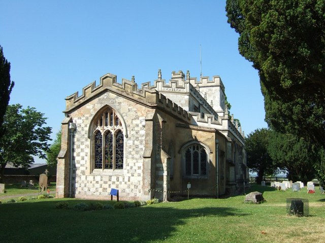
Church of St Giles, Totternhoe

The Church of St Giles is a Grade I listed church in Totternhoe, Bedfordshire, England. It became a listed building on 3 February 1967. The church was...

Lancot Park

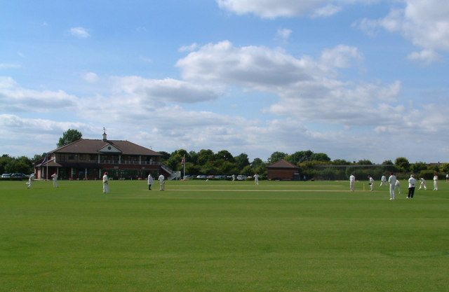
Lancot Park is a cricket ground in Dunstable, Bedfordshire. Situated at the foot of Dunstable Downs, on the outskirts of the village of Totternhoe, Lancot...

Totternhoe F.C.

Totternhoe Football Club is a football club based in Totternhoe, near Dunstable, Bedfordshire, England. The club is affiliated to the Bedfordshire County...
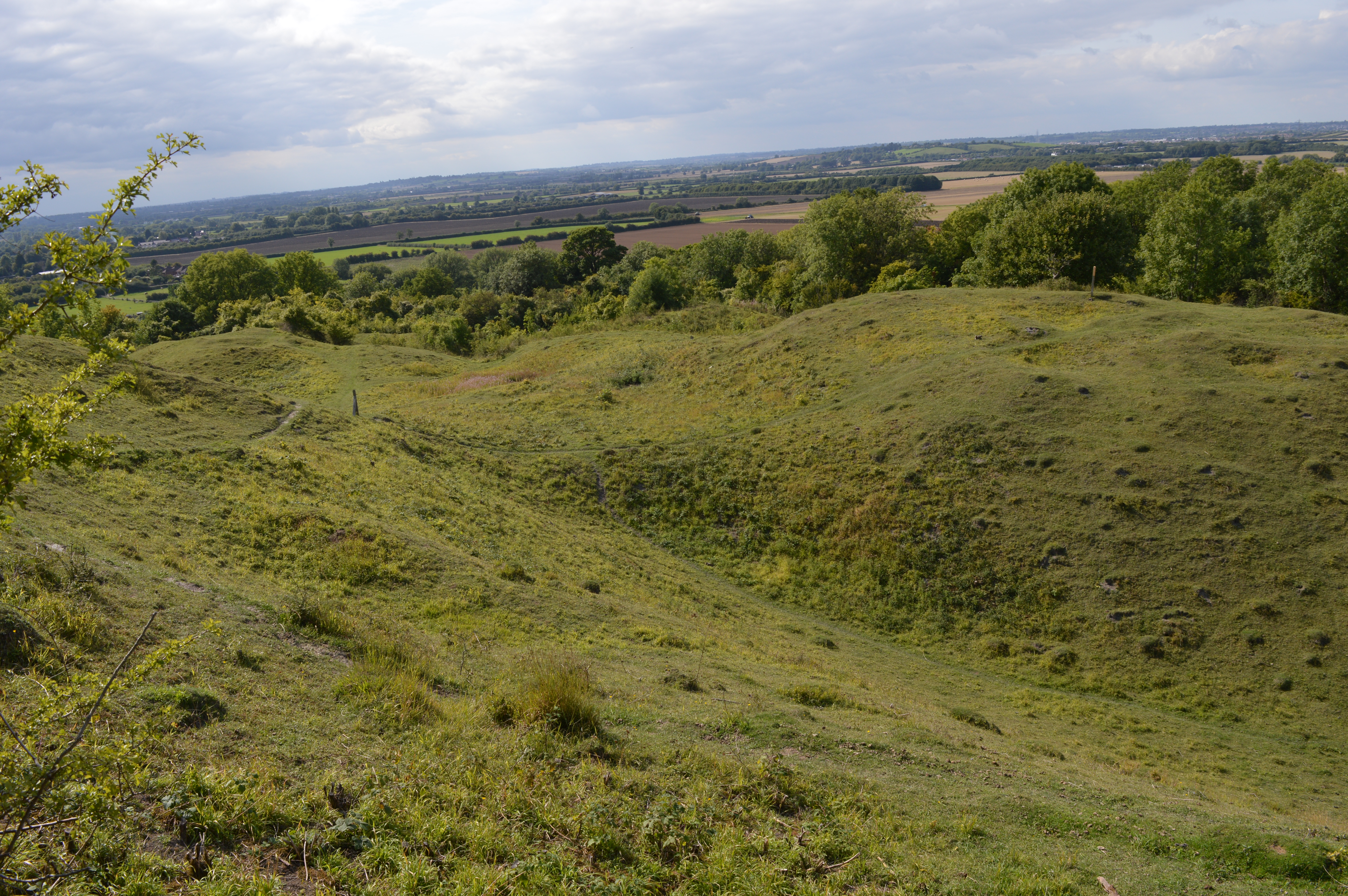
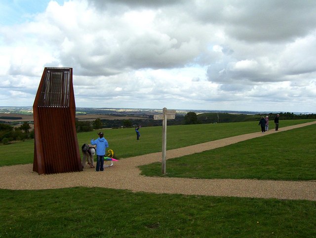
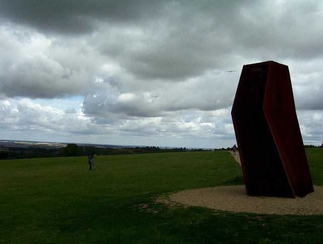
Totternhoe Knolls

Totternhoe Knolls is a 13.1-hectare (32-acre) Site of Special Scientific Interest (SSSI) in Totternhoe in Bedfordshire. It is also a local nature reserve...

Totternhoe

Totternhoe is a village and civil parish in the Manshead hundred of the county of Bedfordshire, England. == Overview == Totternhoe is an ancient village...

Church End, Totternhoe

Church End is a hamlet located in Bedfordshire, England. The settlement forms part of the wider Totternhoe village (where the 2011 Census population was...
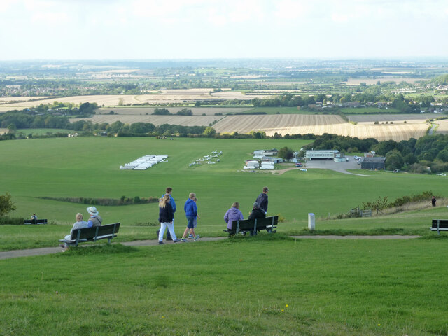
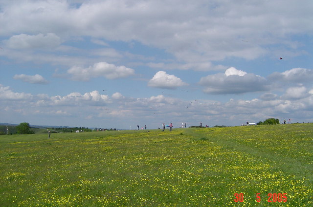
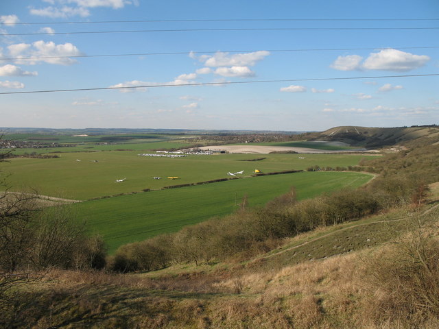
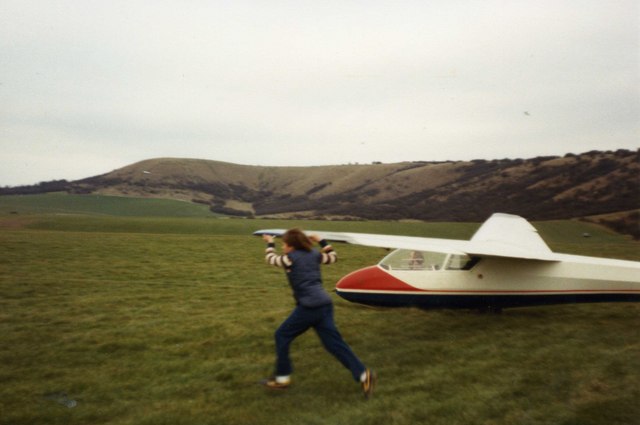
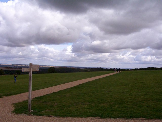
London Gliding Club

The London Gliding Club (LGC) is a members' club whose airfield is located at the foot of the Dunstable Downs. Many privately owned gliders are based there...

Nearby Amenities

Located within 500m of 51.8788,-0.55974958
Church End
Place: village
Wikidata: Q1522670
Wikipedia: en:Church End, Totternhoe
Lat/Long: 51.8808601/-0.5602575
Barrier: kissing_gate
Foot: yes
Lat/Long: 51.8771772/-0.5648772
Barrier: kissing_gate
Bicycle: no
Foot: yes
Horse: no
Motor Vehicle: no
Lat/Long: 51.8783617/-0.5656178
Access: no
Barrier: kissing_gate
Foot: yes
Material: wood
Lat/Long: 51.8806542/-0.5647954
Turning Circle
Turning Circle: hammer
Lat/Long: 51.8796459/-0.557111
Turning Circle
Turning Circle: square
Lat/Long: 51.8784072/-0.5601318
Post Box
Collection Times: Mo-Fr 17:30; Sa 09:00
Operator: Royal Mail
Ref: LU6 55
Source: survey
Lat/Long: 51.8802478/-0.5623506
Building: yes
Lat/Long: 51.8817252/-0.5569012
Leisure: pitch
Sport: cricket
Surface: grass
Lat/Long: 51.8826107/-0.5579531
Bench
Backrest: yes
Lat/Long: 51.8814045/-0.5619697
Bar
Dunstable Town Cricket Club
Addr City: Totternhoe
Addr Country: GB
Addr Housename: Lancot Park
Addr Postcode: LU6 1QP
Addr Street: Dunstable Road
Fhrs Authority: Central Bedfordshire
Fhrs Id: 450681
Fhrs Local Authority Id: 67095
Lat/Long: 51.8820875/-0.5591869
Barrier: kissing_gate
Bicycle: no
Foot: yes
Horse: no
Motor Vehicle: no
Lat/Long: 51.8790952/-0.5653998
Barrier: kissing_gate
Bicycle: no
Foot: yes
Horse: no
Motor Vehicle: no
Lat/Long: 51.8786573/-0.5639208
Barrier: kissing_gate
Bicycle: no
Foot: yes
Horse: no
Material: steel
Motor Vehicle: no
Lat/Long: 51.8792544/-0.5661174
Site of Roman Villa
Archaeological Site: roman_villa
Historic: archaeological_site
Historic Civilization: ancient_roman
Url: https://en.wikipedia.org/wiki/Totternhoe_Roman_villa
Lat/Long: 51.8771729/-0.563949
Pub
The Old Farm Inn
Addr City: Totternhoe
Addr Country: GB
Addr Housenumber: 16
Addr Postcode: LU6 1RE
Addr Street: Church Road
Beer Garden: yes
Brand: Fuller's
Brand Wikidata: Q5253950
Brewery: Fullers
Fhrs Authority: Central Bedfordshire
Fhrs Id: 450263
Fhrs Local Authority Id: 16199
Food: yes
Listed Status: Grade II
Opening Hours: Mo-Th 12:00-15:00, 17:00-23:00, Fr-Sa 12:00-00:00, Su 12:00-23:00
Outdoor Seating: yes
Phone: +44 1582 674053
Real Ale: yes
Website: https://www.oldfarminndunstable.co.uk/
Wikidata: Q26408545
Lat/Long: 51.8798476/-0.5631387
Direction: 215
Generator Method: photovoltaic
Generator Output Electricity: yes
Generator Solar Modules: 16
Generator Source: solar
Generator Type: solar_photovoltaic_panel
Location: roof
Power: generator
Lat/Long: 51.8793326/-0.5610741
Direction: forward
Traffic Calming: chicane
Lat/Long: 51.881706/-0.558637
Give Way
Direction: forward
Lat/Long: 51.8817159/-0.5585299
Direction: 205
Generator Method: photovoltaic
Generator Output Electricity: yes
Generator Solar Modules: 14
Generator Source: solar
Generator Type: solar_photovoltaic_panel
Location: roof
Power: generator
Lat/Long: 51.8818712/-0.563579
Direction: 120
Generator Method: photovoltaic
Generator Output Electricity: yes
Generator Solar Modules: 10
Generator Source: solar
Generator Type: solar_photovoltaic_panel
Location: roof
Power: generator
Lat/Long: 51.8827959/-0.56277
Bus Stop
Bus: yes
Naptan AtcoCode: 021016007
Naptan NaptanCode: ahlagamd
Public Transport: platform
Lat/Long: 51.8814139/-0.5613652
The data included in this document is from www.openstreetmap.org. The data is made available under ODbL.

Have you been to Church End?

Leave your review of Church End below (or comments, questions and feedback).