Christchurch

Settlement in Gloucestershire Forest of Dean

England

Christchurch

Wall mural of David and Robert Mushet Wall mural of David and Robert Mushet pioneering metallurgists who experimented and developed the production of iron and steel at the Darkhill Ironworks <a href="https://www.geograph.org.uk/photo/6906703">SO5908 : Darkhill Ironworks</a>.  This artwork was commissioned by Coleford Town Council and was painted by Tom Cousins in 2014.
Wall mural of David and Robert Mushet Credit: Philip Halling

Christchurch is a small village located in the Cotswold district of Gloucestershire, England. Situated on the banks of the River Coln, it is a picturesque and charming place with a rich history.

The village is known for its stunning architecture, particularly the Christchurch Mansion, a Grade I listed building built in the 18th century. The mansion boasts exquisite Georgian features and is surrounded by beautiful gardens, making it a popular spot for tourists and locals alike.

In addition to its architectural wonders, Christchurch offers a peaceful and idyllic setting. The village is surrounded by rolling hills and lush green countryside, providing ample opportunities for outdoor activities such as walking, hiking, and picnicking.

Christchurch is also home to a tight-knit community, with a population of approximately 1,000 residents. The village has a strong sense of community spirit, with regular events and gatherings taking place throughout the year. The annual Christchurch Music Festival, for example, brings together local musicians and artists for a weekend of celebration and entertainment.

Despite its small size, Christchurch offers amenities for its residents, including a primary school, a village hall, and a few local shops and pubs. For more extensive amenities, the nearby town of Cirencester is just a short drive away.

Overall, Christchurch, Gloucestershire, is a charming and historic village with a strong sense of community and a stunning natural landscape, making it an appealing place to visit or call home.

If you have any feedback on the listing, please let us know in the comments section below.
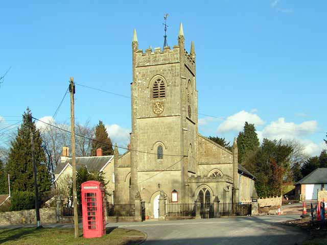
Christchurch Images

Images are sourced within 2km of 51.810397/-2.6217373 or Grid Reference SO5712. Thanks to Geograph Open Source API. All images are credited.

Wall mural of David and Robert Mushet Wall mural of David and Robert Mushet pioneering metallurgists who experimented and developed the production of iron and steel at the Darkhill Ironworks <a href="https://www.geograph.org.uk/photo/6906703">SO5908 : Darkhill Ironworks</a>.  This artwork was commissioned by Coleford Town Council and was painted by Tom Cousins in 2014.
Wall mural of David and Robert Mushet
Wall mural of David and Robert Mushet pioneering metallurgists who experimented and developed the production of iron and steel at the Darkhill Ironworks SO5908 : Darkhill Ironworks. This artwork was commissioned by Coleford Town Council and was painted by Tom Cousins in 2014.
Literary mural, Coleford Painted in 2018 by artist Tom Cousins on behalf of <span class="nowrap"><a title="www.readingtheforest.co.uk," rel="nofollow ugc noopener" href="http://www.readingtheforest.co.uk,">Link</a><img style="margin-left:2px;" alt="External link" title="External link - shift click to open in new window" src="https://s1.geograph.org.uk/img/external.png" width="10" height="10"/></span> featuring three local literary celebrities, Joyce Latham, FW Harvey and Dennis Potter.
Literary mural, Coleford
Painted in 2018 by artist Tom Cousins on behalf of LinkExternal link featuring three local literary celebrities, Joyce Latham, FW Harvey and Dennis Potter.
Coleford Town Morning over Coleford
Coleford Town
Morning over Coleford
Sunday Carboot Coleford Carboot on a Sunday
Sunday Carboot
Coleford Carboot on a Sunday
Towards Berry Hill Golfcourse in the foreground
Towards Berry Hill
Golfcourse in the foreground
Bracelands Campsite Popular Caravan and Camping site.
Bracelands Campsite
Popular Caravan and Camping site.
Forest Holidays Site, Forest of Dean
New Build - Berry Hill - Five Acres Development of many new houses at Berry Hill
New Build - Berry Hill - Five Acres
Development of many new houses at Berry Hill
Berry Hill & Five Acres - Housing Development Planned Green Fields earmarked for new houses
Berry Hill & Five Acres - Housing Development Planned
Green Fields earmarked for new houses
Ruined barn
Ruined barn
Houses on Bicknor Street
View at Hillersland
View at Hillersland
Santa Claus
Santa Claus
Xmas tree near Coleford Clock Tower
Xmas tree Xmas tree in Coleford town centre.
Xmas tree
Xmas tree in Coleford town centre.
House on Woodland Road
Christchurch, Berry Hill
Bug Hotel Accommodation for insects at Forest Holidays.
Bug Hotel
Accommodation for insects at Forest Holidays.
Show me another place!

Christchurch is located at Grid Ref: SO5712 (Lat: 51.810397, Lng: -2.6217373)

Administrative County: Gloucestershire

District: Forest of Dean

Police Authority: Gloucestershire

What 3 Words

///dirt.shortens.hushed. Near Coleford, Gloucestershire

Related Wikis

Nearby Amenities

Located within 500m of 51.810397,-2.6217373
Bus Stop
Woodland Rd
Naptan AtcoCode: 1600GL1155
Naptan Bearing: NW
Naptan BusStopType: CUS
Naptan CommonName: Woodland Rd
Naptan NaptanCode: gloadmpj
Naptan Street: Woodland Rd
Naptan Verified: no
Source: naptan_import
Lat/Long: 51.8136431/-2.6238774
Bus Stop
Woodland Rd
Naptan AtcoCode: 1600GL1156
Naptan Bearing: SE
Naptan BusStopType: CUS
Naptan CommonName: Woodland Rd
Naptan NaptanCode: gloadmpt
Naptan Street: Woodland Rd
Naptan Verified: no
Source: naptan_import
Lat/Long: 51.813671/-2.6236892
Bus Stop
Crossroads
Naptan AtcoCode: 1600GL1159
Naptan Bearing: W
Naptan CommonName: Crossroads
Naptan NaptanCode: gloadmwg
Naptan Street: Park Rd
Naptan Verified: no
Source: naptan_import
Lat/Long: 51.8127513/-2.622487
Bus Stop
Crossroads
Naptan AtcoCode: 1600GL1160
Naptan Bearing: E
Naptan CommonName: Crossroads
Naptan NaptanCode: gloadmwt
Naptan Street: Park Rd
Naptan Verified: no
Source: naptan_import
Lat/Long: 51.812864/-2.6222958
Bus Stop
Post Office
Naptan AtcoCode: 1600GL385
Naptan Bearing: N
Naptan CommonName: Post Office
Naptan NaptanCode: gloadpwt
Naptan Street: Park Rd
Naptan Verified: no
Source: naptan_import
Lat/Long: 51.8108783/-2.6161948
Bus Stop
Post Office
Naptan AtcoCode: 1600GL386
Naptan Bearing: SE
Naptan CommonName: Post Office
Naptan Indicator: Opp
Naptan NaptanCode: gloadtag
Naptan Street: Park Rd
Naptan Verified: no
Source: naptan_import
Lat/Long: 51.8109686/-2.6161235
Bus Stop
King's Head
Naptan AtcoCode: 1600GL5499
Naptan Bearing: N
Naptan CommonName: King's Head
Naptan Indicator: Opp
Naptan NaptanCode: gloadmwd
Naptan Street: Grove Rd
Naptan Verified: no
Source: naptan_import
Lat/Long: 51.8070239/-2.6224662
Bus Stop
King's Head
Naptan AtcoCode: 1600GL5500
Naptan Bearing: S
Naptan BusStopType: CUS
Naptan CommonName: King's Head
Naptan NaptanCode: gloadmwm
Naptan Street: Grove Rd
Naptan Verified: no
Source: naptan_import
Lat/Long: 51.8069978/-2.6223062
Bus Stop
King's Head
Naptan AtcoCode: 1600GL5723
Naptan Bearing: NE
Naptan CommonName: King's Head
Naptan NaptanCode: gloadpap
Naptan Street: Coverham Rd
Naptan Verified: no
Source: naptan_import
Lat/Long: 51.8069376/-2.6217833
Bus Stop
King's Head
Naptan AtcoCode: 1600GL5724
Naptan Bearing: SW
Naptan CommonName: King's Head
Naptan Indicator: Opp
Naptan NaptanCode: gloadpam
Naptan Street: Coverham Rd
Naptan Verified: no
Source: naptan_import
Lat/Long: 51.8068475/-2.6218255
Bus Stop
Eastville Caravan Park
Naptan AtcoCode: 1600GL9160
Naptan Bearing: SE
Naptan CommonName: Eastville Caravan Park
Naptan NaptanCode: gloadpjm
Naptan Street: Coopers Rd
Naptan Verified: no
Source: naptan_import
Lat/Long: 51.8142263/-2.6190112
Bus Stop
Christchurch Camp Sites
Naptan AtcoCode: 1600GLA36772
Naptan Bearing: NW
Naptan CommonName: Christchurch Camp Sites
Naptan NaptanCode: glogmpdw
Naptan Street: Broom Hill
Naptan Verified: no
Source: naptan_import
Lat/Long: 51.8133289/-2.6271516
Bus Stop
The Horsepool
Naptan AtcoCode: 1600GLA56975
Naptan Bearing: N
Naptan CommonName: The Horsepool
Naptan NaptanCode: glogmpwd
Naptan Street: Tudor Walk
Naptan Verified: no
Source: naptan_import
Lat/Long: 51.8118414/-2.6211254
Bus Stop
The Horsepool
Naptan AtcoCode: 1600GLA56976
Naptan Bearing: S
Naptan CommonName: The Horsepool
Naptan Indicator: Opp
Naptan NaptanCode: glogmpwg
Naptan Street: Tudor Walk
Naptan Verified: no
Source: naptan_import
Lat/Long: 51.8117883/-2.6209651
Bus Stop
Coverham Rd
Naptan AtcoCode: 1600GLA56977
Naptan Bearing: NW
Naptan CommonName: Coverham Rd
Naptan NaptanCode: glogmpwj
Naptan Street: Hillcrest Rd
Naptan Verified: no
Source: naptan_import
Lat/Long: 51.8088551/-2.6179368
Bus Stop
Coverham Rd
Naptan AtcoCode: 1600GLA56978
Naptan Bearing: SE
Naptan CommonName: Coverham Rd
Naptan NaptanCode: glogmpwm
Naptan Street: Hillcrest Rd
Naptan Verified: no
Source: naptan_import
Lat/Long: 51.8088739/-2.6177775
Bus Stop
Lakers Rd
Naptan AtcoCode: 1600GLA56999
Naptan Bearing: NW
Naptan CommonName: Lakers Rd
Naptan Indicator: Opp
Naptan NaptanCode: glogmtgp
Naptan Street: Park Rd
Naptan Verified: no
Source: naptan_import
Lat/Long: 51.8099159/-2.6145426
Bus Stop
Christ Church
Naptan AtcoCode: 1600GLF399
Naptan Bearing: S
Naptan CommonName: Christ Church
Naptan NaptanCode: gloadmtg
Naptan Street: Ross Rd
Naptan Verified: no
Source: naptan_import
Lat/Long: 51.8136741/-2.623109
Bus Stop
Christ Church
Naptan AtcoCode: 1600GLF400
Naptan Bearing: N
Naptan CommonName: Christ Church
Naptan Indicator: Opp
Naptan NaptanCode: gloadmtd
Naptan Street: Ross Rd
Naptan Verified: no
Source: naptan_import
Lat/Long: 51.8138443/-2.6232419
Bus Stop
The Crescent
Naptan AtcoCode: 1600GLF401
Naptan Bearing: NE
Naptan CommonName: The Crescent
Naptan Indicator: Opp
Naptan NaptanCode: gloadpjd
Naptan Street: Coverham Rd
Naptan Verified: no
Source: naptan_import
Lat/Long: 51.8081365/-2.619508
Bus Stop
Crow Ash Rd
Naptan AtcoCode: 1600GLF402
Naptan Bearing: SW
Naptan CommonName: Crow Ash Rd
Naptan NaptanCode: gloadpgm
Naptan Street: Coverham Rd
Naptan Verified: no
Source: naptan_import
Lat/Long: 51.8075744/-2.6203851
Bus Stop
Kells Rd
Naptan AtcoCode: 1600GLF403
Naptan Bearing: NE
Naptan CommonName: Kells Rd
Naptan NaptanCode: gloadpmg
Naptan Street: Coverham Rd
Naptan Verified: no
Source: naptan_import
Lat/Long: 51.8093205/-2.6183493
Bus Stop
Kells Rd
Naptan AtcoCode: 1600GLF404
Naptan Bearing: SW
Naptan CommonName: Kells Rd
Naptan Indicator: Opp
Naptan NaptanCode: gloadpmj
Naptan Street: Coverham Rd
Naptan Verified: no
Source: naptan_import
Lat/Long: 51.8092578/-2.6182904
Bus Stop
Post Office
Naptan AtcoCode: 1600GLF405
Naptan Bearing: NE
Naptan CommonName: Post Office
Naptan Indicator: Opp
Naptan NaptanCode: gloadpwm
Naptan Street: Coverham Rd
Naptan Verified: no
Source: naptan_import
Lat/Long: 51.8110374/-2.6167192
Bus Stop
Post Office
Naptan AtcoCode: 1600GLF406
Naptan Bearing: SW
Naptan CommonName: Post Office
Naptan NaptanCode: gloadpwj
Naptan Street: Coverham Rd
Naptan Verified: no
Source: naptan_import
Lat/Long: 51.8109024/-2.6167318
Turning Circle
Lat/Long: 51.8086694/-2.6207758
Christchurch
Place: village
Lat/Long: 51.8129502/-2.6229464
The Dairy
Shop: convenience
Lat/Long: 51.8126255/-2.6210725
Atm
Lat/Long: 51.8126438/-2.6210204
Historic Amenity: toilets
Lat/Long: 51.8128674/-2.6267457
Restaurant
Yo Wah House
Cuisine: chinese
Lat/Long: 51.8108149/-2.6161886
Telephone
Defibrillator
Booth: K6
Colour: blue
Covered: booth
Defibrillator Location: inside blue phone box outside The Globe, Park Road, Berry Hill
Emergency: defibrillator
Man Made: telephone_box
Lat/Long: 51.8110939/-2.6162348
Robert Davies
Shop: chemist
Lat/Long: 51.8113652/-2.61653
Premier
Brand: Premier
Brand Wikidata: Q7240340
Shop: convenience
Website: https://www.premier-stores.co.uk/our-stores/berry-hill-news
Lat/Long: 51.8107305/-2.6160715
Pub
The Globe
Addr Place: Berry Hill
Addr Postcode: GL16 7BB
Addr Street: Park Road
Fhrs Id: 657000
Lat/Long: 51.8111786/-2.6159968
Post Box
Post Box Design: type_k
Post Box Type: pillar
Royal Cypher: EIIR
Royal Cypher Wikidata: Q33102113
Lat/Long: 51.8110744/-2.6164566
Fusion
Shop: hairdresser
Lat/Long: 51.8113169/-2.6164569
Berry Hill
Place: village
Wikidata: Q4894804
Lat/Long: 51.8112006/-2.6165539
Noexit: yes
Lat/Long: 51.8112406/-2.6162603
Public Bookcase
Defibrillator
Booth: K6
Colour: red
Covered: booth
Defibrillator Location: inside red phone box (that is now used as book exchange) opposite Christchurch, Ross Road, Berry Hill
Disused Amenity: telephone
Emergency: defibrillator
Man Made: telephone_box
Public Bookcase Type: phone_box
Lat/Long: 51.8134869/-2.6233557
Fire Extinguisher
Emergency: fire_extinguisher
Lat/Long: 51.8109193/-2.6288633
Fire Extinguisher
Emergency: fire_extinguisher
Lat/Long: 51.8122698/-2.6255491
Waste Basket
Waste: dog_excrement
Lat/Long: 51.8111785/-2.6265199
Fire Extinguisher
Emergency: fire_extinguisher
Lat/Long: 51.8115933/-2.6282523
Fire Extinguisher
Emergency: fire_extinguisher
Lat/Long: 51.8110607/-2.6271858
Bench
Lat/Long: 51.8130288/-2.627607
Charging Station
Brand: Pod Point
Brand Wikidata: Q42888154
Description: "Zach-Elle" 7kW
Operator: Pod Point
Operator Wikidata: Q42888154
Lat/Long: 51.8127535/-2.6274635
Grit Bin
Lat/Long: 51.8128549/-2.6275854
Waste Basket
Waste: dog_excrement
Lat/Long: 51.8121652/-2.62659
Fire Extinguisher
Emergency: fire_extinguisher
Lat/Long: 51.8122745/-2.6281277
The data included in this document is from www.openstreetmap.org. The data is made available under ODbL.

Have you been to Christchurch?

Leave your review of Christchurch below (or comments, questions and feedback).