Corringdon Wood

Wood, Forest in Devon South Hams

England

Corringdon Wood

Old Boundary Marker or Wayside Cross between Piles Hill and Ugborough Beacon Parish Boundary Marker called Hobajohn's Cross on moorland 400 metres southwest of Piles Hill. On the boundary of Harford and Ugborough parishes. A Scheduled Monument details <span class="nowrap"><a title="https://historicengland.org.uk/listing/the-list/list-entry/1012486" rel="nofollow ugc noopener" href="https://historicengland.org.uk/listing/the-list/list-entry/1012486">Link</a><img style="margin-left:2px;" alt="External link" title="External link - shift click to open in new window" src="https://s1.geograph.org.uk/img/external.png" width="10" height="10"/></span>. See also <a title="https://www.geograph.org.uk/photo/2618013," href="https://www.geograph.org.uk/photo/2618013,">Link</a> <a title="https://www.geograph.org.uk/photo/1756182" href="https://www.geograph.org.uk/photo/1756182">Link</a> and <a title="https://www.geograph.org.uk/photo/1130015" href="https://www.geograph.org.uk/photo/1130015">Link</a>.

Milestone Society National ID: DV_HFUG05pb
Old Boundary Marker or Wayside Cross between Piles Hill and Ugborough Beacon Credit: A Rosevear

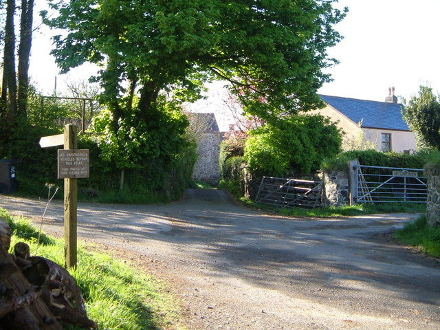
Corringdon Wood is a picturesque forest located in the county of Devon, England. Spanning over 100 acres, this enchanting woodland is nestled within the scenic South Hams district, just a few miles away from the charming village of Diptford.

With its rich biodiversity and serene atmosphere, Corringdon Wood attracts nature enthusiasts and hikers alike. The forest is predominantly composed of native broadleaf trees, including oak, ash, birch, and beech, creating a diverse and vibrant ecosystem. The woodland floor is adorned with a carpet of bluebells in the spring, adding a splash of color to the already enchanting scenery.

The forest offers a network of well-maintained footpaths and trails, allowing visitors to explore its beauty at their own pace. As they wander through the woods, visitors may encounter a variety of wildlife, including deer, badgers, foxes, and an array of bird species. The peaceful ambiance of the forest provides a haven for birdwatchers and wildlife photographers.

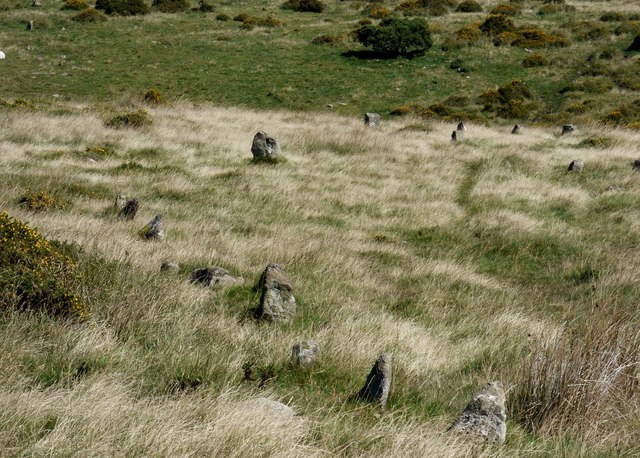
In addition to its natural beauty, Corringdon Wood also holds cultural significance. The forest is home to a number of ancient archaeological sites, including remnants of Bronze Age settlements and burial mounds. These historical features add an extra layer of intrigue to the area, making it a fascinating destination for history enthusiasts.

Corringdon Wood, with its captivating scenery and rich history, offers visitors an opportunity to immerse themselves in the tranquil beauty of nature and discover the secrets of the past.

If you have any feedback on the listing, please let us know in the comments section below.

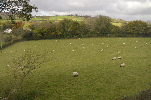
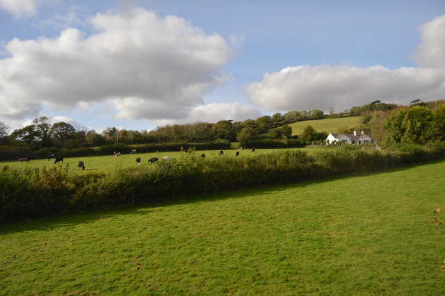
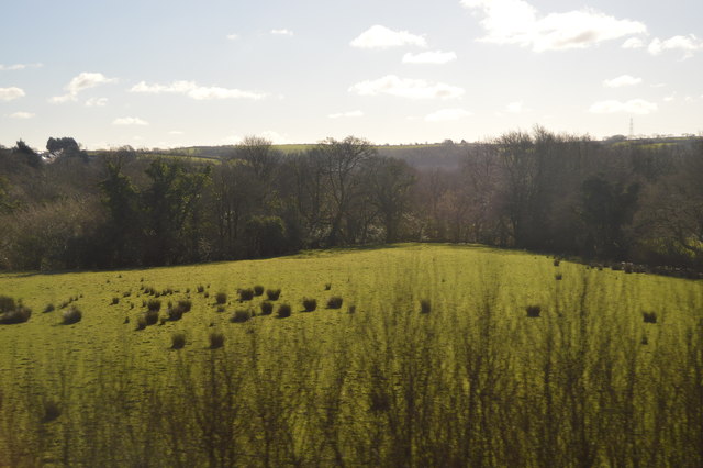
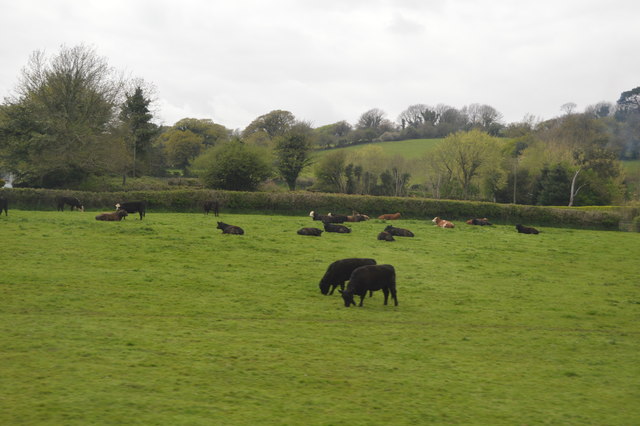
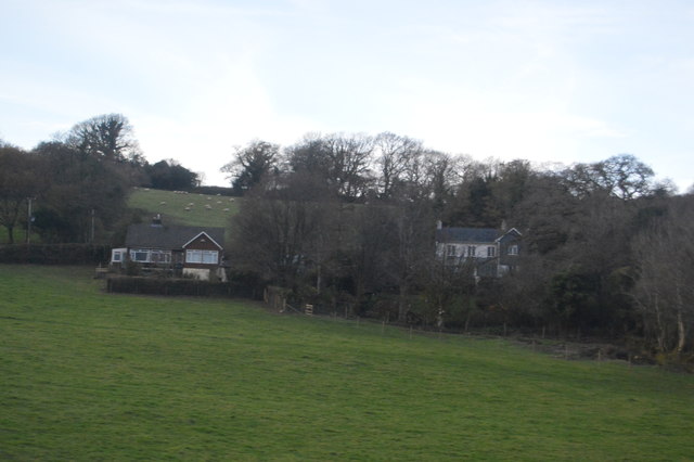
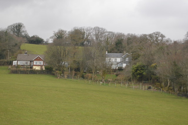
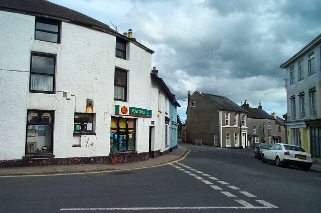
Corringdon Wood Images

Images are sourced within 2km of 50.425752/-3.8710074 or Grid Reference SX6760. Thanks to Geograph Open Source API. All images are credited.

Old Boundary Marker or Wayside Cross between Piles Hill and Ugborough Beacon Parish Boundary Marker called Hobajohn's Cross on moorland 400 metres southwest of Piles Hill. On the boundary of Harford and Ugborough parishes. A Scheduled Monument details <span class="nowrap"><a title="https://historicengland.org.uk/listing/the-list/list-entry/1012486" rel="nofollow ugc noopener" href="https://historicengland.org.uk/listing/the-list/list-entry/1012486">Link</a><img style="margin-left:2px;" alt="External link" title="External link - shift click to open in new window" src="https://s1.geograph.org.uk/img/external.png" width="10" height="10"/></span>. See also <a title="https://www.geograph.org.uk/photo/2618013," href="https://www.geograph.org.uk/photo/2618013,">Link</a> <a title="https://www.geograph.org.uk/photo/1756182" href="https://www.geograph.org.uk/photo/1756182">Link</a> and <a title="https://www.geograph.org.uk/photo/1130015" href="https://www.geograph.org.uk/photo/1130015">Link</a>.

Milestone Society National ID: DV_HFUG05pb
Old Boundary Marker or Wayside Cross between Piles Hill and Ugborough Beacon
Parish Boundary Marker called Hobajohn's Cross on moorland 400 metres southwest of Piles Hill. On the boundary of Harford and Ugborough parishes. A Scheduled Monument details LinkExternal link. See also Link Link and Link. Milestone Society National ID: DV_HFUG05pb
Sheep grazing
Sheep grazing
Farmland near South Brent
Longstone, Piles Hill
Cattle
Cattle
Houses on Ash Lane
Houses on Ash Lane
Houses on Aish Lane
Houses on Aish Lane
Brent Fore Hill prehistoric stone row A double prehistoric stone row measuring 120m long, including at least 32 small and medium-sized stones. The row is orientated north east to south west and there is a kerbed cairn at the upper north eastern end. <span class="nowrap"><a title="https://stonerows.wordpress.com/gazetteer/region/dartmoor/brent-fore-hill/" rel="nofollow ugc noopener" href="https://stonerows.wordpress.com/gazetteer/region/dartmoor/brent-fore-hill/">Link</a><img style="margin-left:2px;" alt="External link" title="External link - shift click to open in new window" src="https://s1.geograph.org.uk/img/external.png" width="10" height="10"/></span>
Brent Fore Hill prehistoric stone row
A double prehistoric stone row measuring 120m long, including at least 32 small and medium-sized stones. The row is orientated north east to south west and there is a kerbed cairn at the upper north eastern end. LinkExternal link
Corringdon Ball, North prehistoric stone row A single prehistoric stone row measuring 132m long, including at least 21 small and medium-sized stones. The row is orientated north east to south west and there is a kerbed cairn at the lower north eastern end. The large stone in the middle distance forms part of the kerbed cairn at the end of this row. The stones to the right form part of Corringdon Ball, South stone row and its terminal cairn. <span class="nowrap"><a title="https://stonerows.wordpress.com/gazetteer/region/dartmoor/corringdon-ball-north/" rel="nofollow ugc noopener" href="https://stonerows.wordpress.com/gazetteer/region/dartmoor/corringdon-ball-north/">Link</a><img style="margin-left:2px;" alt="External link" title="External link - shift click to open in new window" src="https://s1.geograph.org.uk/img/external.png" width="10" height="10"/></span>
Corringdon Ball, North prehistoric stone row
A single prehistoric stone row measuring 132m long, including at least 21 small and medium-sized stones. The row is orientated north east to south west and there is a kerbed cairn at the lower north eastern end. The large stone in the middle distance forms part of the kerbed cairn at the end of this row. The stones to the right form part of Corringdon Ball, South stone row and its terminal cairn. LinkExternal link
Corringdon Ball, South prehistoric stone row A multiple prehistoric stone row measuring 178m long, including at least 247 mainly small-sized together with some medium-sized stones arranged in at least 7 separate lines. The row is orientated north east to south west and there is a kerbed cairn at the lower north eastern end. This row is of a rare multiple row type, consisting as it does of parallel lines of stones rather than the usual fan-shaped arrangement. <span class="nowrap"><a title="https://stonerows.wordpress.com/gazetteer/region/dartmoor/corringdon-ball-south/" rel="nofollow ugc noopener" href="https://stonerows.wordpress.com/gazetteer/region/dartmoor/corringdon-ball-south/">Link</a><img style="margin-left:2px;" alt="External link" title="External link - shift click to open in new window" src="https://s1.geograph.org.uk/img/external.png" width="10" height="10"/></span>
Corringdon Ball, South prehistoric stone row
A multiple prehistoric stone row measuring 178m long, including at least 247 mainly small-sized together with some medium-sized stones arranged in at least 7 separate lines. The row is orientated north east to south west and there is a kerbed cairn at the lower north eastern end. This row is of a rare multiple row type, consisting as it does of parallel lines of stones rather than the usual fan-shaped arrangement. LinkExternal link
Glasscombe Ball prehistoric stone row A combination single and double prehistoric stone row measuring 84.5m long, including 24 recumbent stones of different sizes.  The row is orientated north east to south west and is in the vicinity of six stone rows and  several cairns. <span class="nowrap"><a title="https://stonerows.wordpress.com/gazetteer/region/dartmoor/glasscombe-ball-north/" rel="nofollow ugc noopener" href="https://stonerows.wordpress.com/gazetteer/region/dartmoor/glasscombe-ball-north/">Link</a><img style="margin-left:2px;" alt="External link" title="External link - shift click to open in new window" src="https://s1.geograph.org.uk/img/external.png" width="10" height="10"/></span>
Glasscombe Ball prehistoric stone row
A combination single and double prehistoric stone row measuring 84.5m long, including 24 recumbent stones of different sizes. The row is orientated north east to south west and is in the vicinity of six stone rows and several cairns. LinkExternal link
Glasscombe Corner prehistoric stone row A combination single and double prehistoric stone row measuring 173m long, including at least 82 small and medium-sized stones. The row is orientated north east to south west and there is a kerbed cairn at the lower north eastern end. <span class="nowrap"><a title="https://stonerows.wordpress.com/gazetteer/region/dartmoor/glasscombe-corner/" rel="nofollow ugc noopener" href="https://stonerows.wordpress.com/gazetteer/region/dartmoor/glasscombe-corner/">Link</a><img style="margin-left:2px;" alt="External link" title="External link - shift click to open in new window" src="https://s1.geograph.org.uk/img/external.png" width="10" height="10"/></span>
Glasscombe Corner prehistoric stone row
A combination single and double prehistoric stone row measuring 173m long, including at least 82 small and medium-sized stones. The row is orientated north east to south west and there is a kerbed cairn at the lower north eastern end. LinkExternal link
Corringdon Ball prehistoric enclosed settlements Prehistoric agglomerated enclosures that were probably built and lived in during the Middle Bronze Age (1400 - 1000 BC). <span class="nowrap"><a title="https://historicengland.org.uk/listing/the-list/list-entry/1010208" rel="nofollow ugc noopener" href="https://historicengland.org.uk/listing/the-list/list-entry/1010208">Link</a><img style="margin-left:2px;" alt="External link" title="External link - shift click to open in new window" src="https://s1.geograph.org.uk/img/external.png" width="10" height="10"/></span>
Corringdon Ball prehistoric enclosed settlements
Prehistoric agglomerated enclosures that were probably built and lived in during the Middle Bronze Age (1400 - 1000 BC). LinkExternal link
Corringdon Ball chambered cairn The mutilated remains of the chamber at the southern end of the mound (Scale 1m). <span class="nowrap"><a title="https://www.megalithic.co.uk/article.php?sid=4619" rel="nofollow ugc noopener" href="https://www.megalithic.co.uk/article.php?sid=4619">Link</a><img style="margin-left:2px;" alt="External link" title="External link - shift click to open in new window" src="https://s1.geograph.org.uk/img/external.png" width="10" height="10"/></span>
Corringdon Ball chambered cairn
The mutilated remains of the chamber at the southern end of the mound (Scale 1m). LinkExternal link
Gates by lane above Aish On the no through lane towards Aish Ridge.
Gates by lane above Aish
On the no through lane towards Aish Ridge.
Track, Treeland Downs Seen from South Brent bridleway 20 near a spring that is the source of a headwater of the Badworthy Brook, hence the valley. The trees on the right are along the western edge of the access land on Aish Ridge.
Track, Treeland Downs
Seen from South Brent bridleway 20 near a spring that is the source of a headwater of the Badworthy Brook, hence the valley. The trees on the right are along the western edge of the access land on Aish Ridge.
Approaching Ball Gate From the open moor. South Brent bridleway 18 arrives from the left; after passing through the gate it becomes South Brent bridleway 20.
Approaching Ball Gate
From the open moor. South Brent bridleway 18 arrives from the left; after passing through the gate it becomes South Brent bridleway 20.
Show me another place!

Corringdon Wood is located at Grid Ref: SX6760 (Lat: 50.425752, Lng: -3.8710074)

Administrative County: Devon

District: South Hams

Police Authority: Devon and Cornwall

What 3 Words

///grad.dined.august. Near South Brent, Devon

Related Wikis

Badworthy

Badworthy is a village in Devon, England.

Glazebrook House, South Brent

Glazebrook House is a building of historical significance in South Brent, Devon. Part of the house was built in about 1650 and was successively added to...

Aish, South Brent

Aish is a relatively small hamlet in the English county of Devon. It is near the large village of South Brent. This Aish is not to be confused with the...

Butterdon Hill

Butterdon Hill is on Dartmoor, in southwest England. The remains of a small stone circle and a stone row can be found on the summit. The name Butterdon...

South Brent

South Brent is a large village on the southern edge of Dartmoor, England, in the valley of the River Avon. The parish includes the small hamlets of Aish...

Lutton, South Brent

Lutton is a small farming hamlet on the outskirts of South Brent, Devon, England. It is a hillside community on the side of Brent Hill. It is only a small...

Moorhaven Hospital

Moorhaven Hospital, built as Plymouth Asylum and initially names the Plymouth Borough Asylum, was a mental health facility in Ivybridge, Devon, England...

Redlake Tramway

The Redlake Tramway was a railway built to carry supplies and workers between Bittaford and the clay workings at Redlake, near the centre of the southern...

Nearby Amenities

Located within 500m of 50.425752,-3.8710074
Owley Corner
Wpt Symbol: Dot
Lat/Long: 50.4226974/-3.8740346
Glaze Meet
Source: OS_OpenData_StreetView
Lat/Long: 50.4281589/-3.8762765
Owley
Place: hamlet
Lat/Long: 50.4282615/-3.865454
Ford: yes
Lat/Long: 50.4241153/-3.8761498
Ford: yes
Lat/Long: 50.4249428/-3.874874
Ford: yes
Lat/Long: 50.4249597/-3.874859
Ford: yes
Lat/Long: 50.4250822/-3.8750433
Ford: yes
Lat/Long: 50.4253295/-3.8754621
The data included in this document is from www.openstreetmap.org. The data is made available under ODbL.

Have you been to Corringdon Wood?

Leave your review of Corringdon Wood below (or comments, questions and feedback).