West Hill Plantation

Wood, Forest in Devon North Devon

England

West Hill Plantation
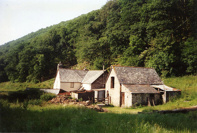
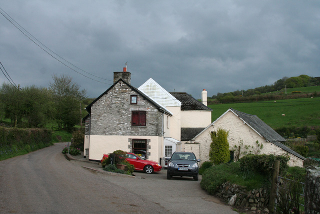
Martinhoe: Mill Farm In the Heddon Valley above Hunter’s Inn. There was probably a mill here – a fulling mill, or tucking mill, as they were known in the west country – involved in the production of cloth. A roundel in the gable carries an image of a pair of shears, once used in the industry
Martinhoe: Mill Farm Credit: Martin Bodman

The requested URL returned error: 429 Too Many Requests

If you have any feedback on the listing, please let us know in the comments section below.

West Hill Plantation Images

Images are sourced within 2km of 51.192618/-3.9269685 or Grid Reference SS6545. Thanks to Geograph Open Source API. All images are credited.
Martinhoe: Mill Farm In the Heddon Valley above Hunter’s Inn. There was probably a mill here – a fulling mill, or tucking mill, as they were known in the west country – involved in the production of cloth. A roundel in the gable carries an image of a pair of shears, once used in the industry
Martinhoe: Mill Farm
In the Heddon Valley above Hunter’s Inn. There was probably a mill here – a fulling mill, or tucking mill, as they were known in the west country – involved in the production of cloth. A roundel in the gable carries an image of a pair of shears, once used in the industry
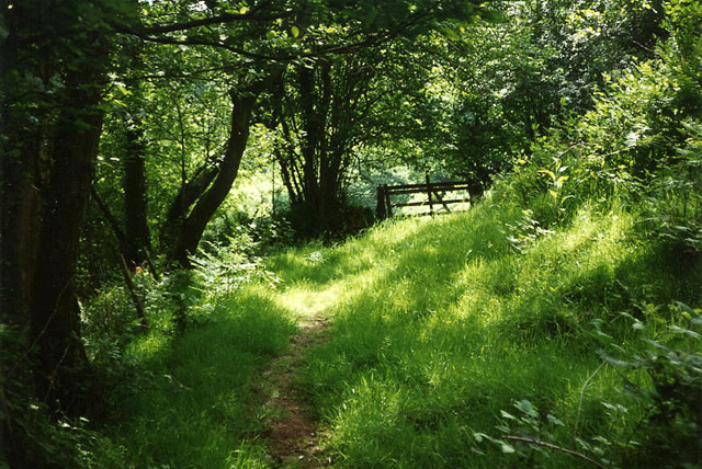
Parracombe: near Bumsley Mill Footpath in the Heddon valley
Parracombe: near Bumsley Mill
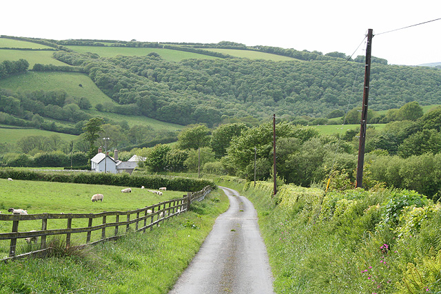
Footpath in the Heddon valley
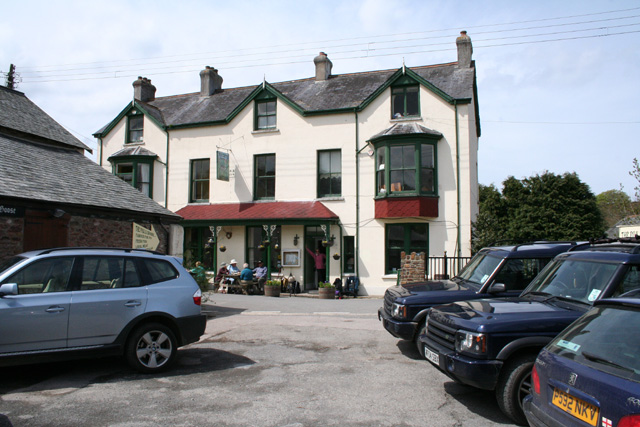
Parracombe: The Fox & Goose Inn A pub with an entry in the Good Pub Guide 2005. Looking north west from the car park across the street
Parracombe: The Fox & Goose Inn
A pub with an entry in the Good Pub Guide 2005. Looking north west from the car park across the street
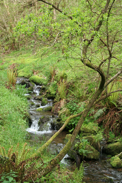
Martinhoe: stream near Kittitoe Looking east-south-east by the road from Hunters Inn to Killington Cross and the A39.
Martinhoe: stream near Kittitoe
Looking east-south-east by the road from Hunters Inn to Killington Cross and the A39.
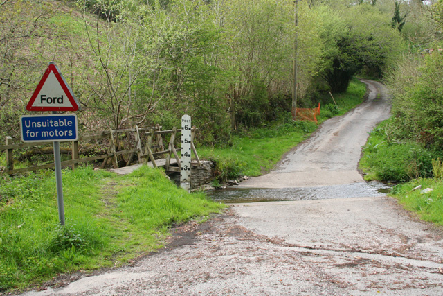
Martinhoe: ford near Kittitoe Looking north on a lane to Kemacott
Martinhoe: ford near Kittitoe
Looking north on a lane to Kemacott
Martinhoe: house at Killington Looking south east by the road from Hunters Inn to Killington Cross and the A39.
Martinhoe: house at Killington
Looking south east by the road from Hunters Inn to Killington Cross and the A39.
Martinhoe: towards Higher Bodley Beyond the field boundary lie old quarry workings. Looking south-south-west
Martinhoe: towards Higher Bodley
Beyond the field boundary lie old quarry workings. Looking south-south-west
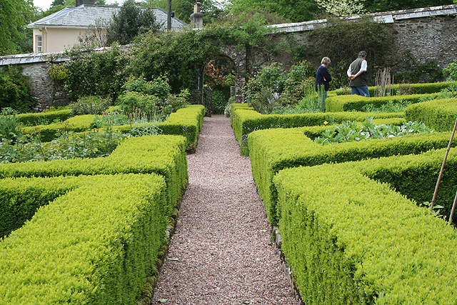
Parracombe: Heddon Hall The walled garden seen here was designed by Penelope Hobhouse. Looking west-south-west. See also <span class="nowrap"><a title="http://www.heddonhallgardens.co.uk" rel="nofollow ugc noopener" href="http://www.heddonhallgardens.co.uk">Link</a><img style="margin-left:2px;" alt="External link" title="External link - shift click to open in new window" src="https://s1.geograph.org.uk/img/external.png" width="10" height="10"/></span> - the gardens are now only open to groups of 10 or more. In Parracombe parish
Parracombe: Heddon Hall
The walled garden seen here was designed by Penelope Hobhouse. Looking west-south-west. See also LinkExternal link - the gardens are now only open to groups of 10 or more. In Parracombe parish
Parracombe: below Rowley Down On the bridleway to Brockenbarrow. Looking south
Parracombe: below Rowley Down
On the bridleway to Brockenbarrow. Looking south
Parracombe: at Rowley Gate The access lane to Rowley Barton. Looking west-north-west
Parracombe: at Rowley Gate
The access lane to Rowley Barton. Looking west-north-west
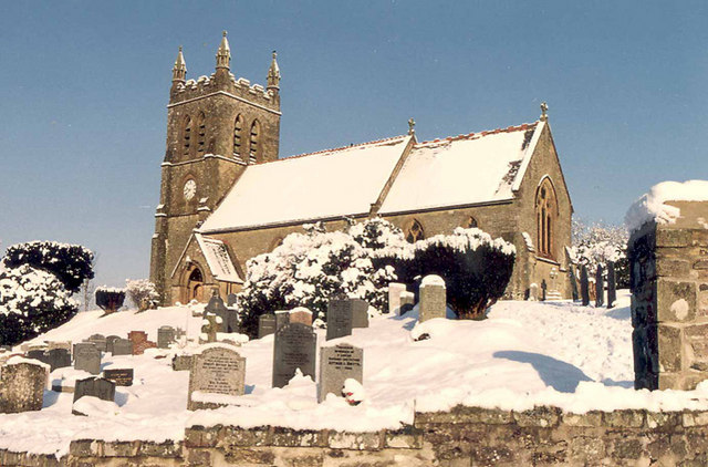
Christ Church, Parracombe The new Church built in 1878 when St.Petrocks Churchtown was abandoned.
Christ Church, Parracombe
The new Church built in 1878 when St.Petrocks Churchtown was abandoned.
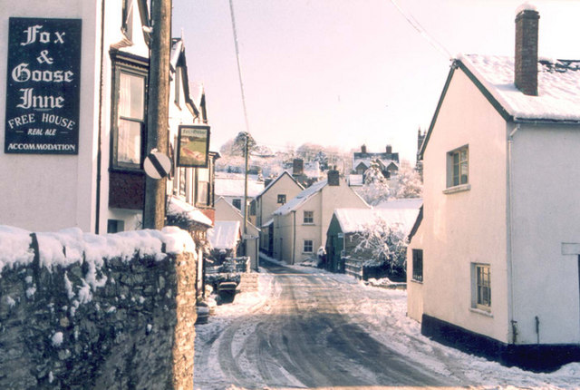
The Centre of Parracombe in winter Very occasionally snow prevented vehicles getting up the 1:4 and 1:5 hills out of the village.
The Centre of Parracombe in winter
Very occasionally snow prevented vehicles getting up the 1:4 and 1:5 hills out of the village.
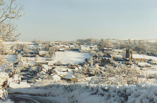
A Winter landscape of Parracombe A delightful village on the River Heddon. Population in the village around 110 and in the Parish around 310.
A Winter landscape of Parracombe
A delightful village on the River Heddon. Population in the village around 110 and in the Parish around 310.
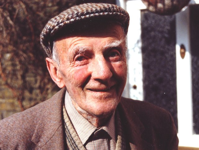
Dick Smythe One time Exmoor shepherd, a Parracombe postman, an innumerable odd jobs man and a great raconteur - that is if you could understand the local dialect. R.I.P
Dick Smythe
One time Exmoor shepherd, a Parracombe postman, an innumerable odd jobs man and a great raconteur - that is if you could understand the local dialect. R.I.P
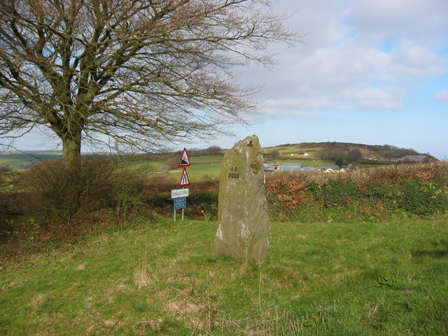
Millennium standing stone Views over the village of Parracombe.
Millennium standing stone
Views over the village of Parracombe.
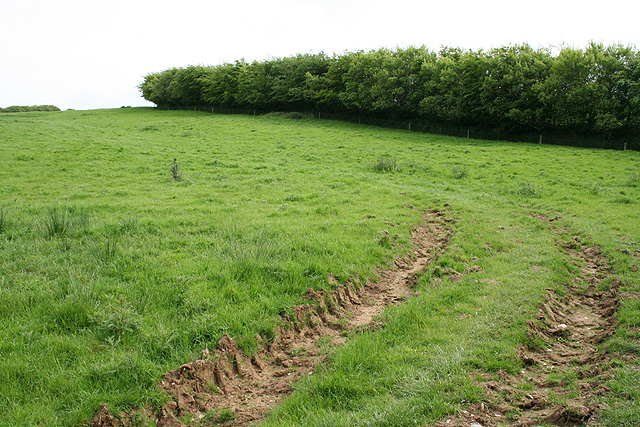
Minniemoor View Composite of three images looking easterly across the square from a gateway on Minniemoor Lane hence the tracks in the foreground. The A399 skirts around the hill (Kentisbury Down) to the left.
Minniemoor View
Composite of three images looking easterly across the square from a gateway on Minniemoor Lane hence the tracks in the foreground. The A399 skirts around the hill (Kentisbury Down) to the left.
Footpath junction Where the footpath from Heale branches left to Trentishoe Down and right towards the Heddon Valley.
Footpath junction
Where the footpath from Heale branches left to Trentishoe Down and right towards the Heddon Valley.
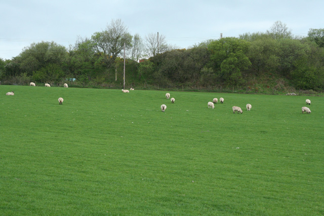
Sheep Grazing Sea mist still at the higher levels. View from 263m above sea level.
Sheep Grazing
Sea mist still at the higher levels. View from 263m above sea level.
Show me another place!

West Hill Plantation is located at Grid Ref: SS6545 (Lat: 51.192618, Lng: -3.9269685)

Administrative County: Devon

District: North Devon

Police Authority: Devon and Cornwall

What 3 Words

///scouting.innovate.vest. Near Combe Martin, Devon

Related Wikis

Voley Castle

Voley Castle is an Iron Age hill fort situated close to Parracombe in north Devon, England. The fort is situated on a promontory on the eastern side of...

Beacon Castle

Beacon Castle is an Iron Age hill fort close to Parracombe in Devon, England. It is situated on a hilltop some 290 metres (950 ft) above sea level, overlooking...

Parracombe

Parracombe is a rural settlement 4 miles (6 km) south-west of Lynton, in Devon, England. It is situated in the Heddon Valley, on Exmoor. The population...

Killington Lane railway station

Killington Lane is a temporary terminus about one mile (1.6 km) southwest of Woody Bay on the Lynton and Barnstaple Railway (L&B), the narrow gauge line...

Nearby Amenities

Located within 500m of 51.192618,-3.9269685
Higher Bumsley
Building: yes
Lat/Long: 51.1964935/-3.9263104
Power: pole
Lat/Long: 51.1906535/-3.9304501
Power: pole
Lat/Long: 51.1908838/-3.9282346
Power: pole
Lat/Long: 51.1911115/-3.9257804
Power: pole
Lat/Long: 51.191399/-3.9248121
Power: pole
Lat/Long: 51.1919386/-3.9228621
Power: pole
Lat/Long: 51.191868/-3.9207324
The data included in this document is from www.openstreetmap.org. The data is made available under ODbL.

Have you been to West Hill Plantation?

Leave your review of West Hill Plantation below (or comments, questions and feedback).