Chilton Trinity

Settlement in Somerset Sedgemoor

England

Chilton Trinity

Hallicks Farm
Hallicks Farm Credit: Adrian and Janet Quantock

Chilton Trinity is a small village located in the county of Somerset, England. Situated approximately 3 miles north-west of the town of Bridgwater, it falls within the Sedgemoor district. The village is surrounded by picturesque countryside, with the River Parrett running to its north.

The origin of the name "Chilton Trinity" is believed to come from the Old English words "cild," meaning child, and "tun," meaning farm or settlement. This suggests that the village was once a settlement associated with children, possibly a place where young people were educated or cared for.

Chilton Trinity is primarily a residential area, with a mix of old and new houses. The village has a close-knit community and a friendly atmosphere. It offers a peaceful and tranquil environment for its residents, away from the hustle and bustle of larger towns.

The village has a few amenities to cater to the needs of its residents, including a village hall and a local pub. For more extensive shopping and entertainment options, residents can easily access the nearby town of Bridgwater.

Nature enthusiasts can enjoy the beautiful countryside surrounding Chilton Trinity, with numerous walking and cycling routes available in the area. The village also benefits from its proximity to the Quantock Hills, an Area of Outstanding Natural Beauty, which offers stunning landscapes and outdoor activities.

Overall, Chilton Trinity is a charming village that provides a peaceful and idyllic setting for its residents, while still offering easy access to nearby amenities and natural beauty spots.

If you have any feedback on the listing, please let us know in the comments section below.

Chilton Trinity Images

Images are sourced within 2km of 51.148684/-3.005803 or Grid Reference ST2939. Thanks to Geograph Open Source API. All images are credited.

Perry Green Lake Fishing Pond
Dairy House Farm
Dairy House Farm
End of the track [2]
End of the track [3] The road north from Perry Green becomes a muddy track, which then becomes a path to Hallicks Farm.
End of the track [3]
The road north from Perry Green becomes a muddy track, which then becomes a path to Hallicks Farm.
Trees and pylons This is near to where the line from Hinckley Point power station crosses the road north from Perry Green. Taken from just east of the crossing point, near the start of the footpath to Chilton Trinity.
Trees and pylons
This is near to where the line from Hinckley Point power station crosses the road north from Perry Green. Taken from just east of the crossing point, near the start of the footpath to Chilton Trinity.
Roadside drain [1]
Roadside drain [1]
Roadside drain [2]
Roadside drain [2]
Dunball Wharf Taken from Starland Outfall on the River Parrett.
Dunball Wharf
Taken from Starland Outfall on the River Parrett.
The Admiral's Table This substantial bar/hotel/restaurant/carvery has a prominent position on the A38 just south of junction23 of the M5. The admiral in question is Admiral Blake who is one of Bridgwater's most famous sons.
The Admiral's Table
This substantial bar/hotel/restaurant/carvery has a prominent position on the A38 just south of junction23 of the M5. The admiral in question is Admiral Blake who is one of Bridgwater's most famous sons.
Dunball Wharf in early evening This small industrial wharf on the River Parrett estuary north of Bridgwater was once part of the Bristol & Exeter Railway and later the Great Western Railway. the rails have long since gone but it is still used to handle building materials and animal feedstuffs.
A public footpath runs through the site.
Dunball Wharf in early evening
This small industrial wharf on the River Parrett estuary north of Bridgwater was once part of the Bristol & Exeter Railway and later the Great Western Railway. the rails have long since gone but it is still used to handle building materials and animal feedstuffs. A public footpath runs through the site.
Dunball Sand Wharf Part of the Port of Bridgwater, this small tidal wharf is operated by Hanson Aggregates and sees about 70 ship movements each year.  "Arco Dart" navigated the serpentine R. Parrett, at high Spring tide, with a cargo of sand dredged from Culver Sands in the Bristol Channel.
To the right is Dunball Clyce where the King's Sedgemoor Drain flows into the river.
Dunball Sand Wharf
Part of the Port of Bridgwater, this small tidal wharf is operated by Hanson Aggregates and sees about 70 ship movements each year. "Arco Dart" navigated the serpentine R. Parrett, at high Spring tide, with a cargo of sand dredged from Culver Sands in the Bristol Channel. To the right is Dunball Clyce where the King's Sedgemoor Drain flows into the river.
The Balmoral docks at Dunball Wharf The Balmoral prepares to dock at The Dunball Wharf for a trip down the River Parrett to Lundy Island
The Balmoral docks at Dunball Wharf
The Balmoral prepares to dock at The Dunball Wharf for a trip down the River Parrett to Lundy Island
M.V. Balmoral M.V. Balmoral approaches Dunball Wharf prior to picking up passengers for a cruise to Lundy Island via Ilfracombe.
M.V. Balmoral
M.V. Balmoral approaches Dunball Wharf prior to picking up passengers for a cruise to Lundy Island via Ilfracombe.
Bank of the River Parrett near Dunball View south along the river bank just west of Dunball. This is close to the western edge of the square and the opposite banks are in ST2941.
Bank of the River Parrett near Dunball
View south along the river bank just west of Dunball. This is close to the western edge of the square and the opposite banks are in ST2941.
River Parrett near Dunball View south (upstream) along the river bank near Dunball. The river here goes through some very tight bends just before it empties into the Bristol Channel.
River Parrett near Dunball
View south (upstream) along the river bank near Dunball. The river here goes through some very tight bends just before it empties into the Bristol Channel.
Pillbox on the bank of the River Parrett
High water mark, River Parrett
Show me another place!

Chilton Trinity is located at Grid Ref: ST2939 (Lat: 51.148684, Lng: -3.005803)

Administrative County: Somerset

District: Sedgemoor

Police Authority: Avon and Somerset

What 3 Words

///october.agree.pedicure. Near Bridgwater, Somerset

Related Wikis

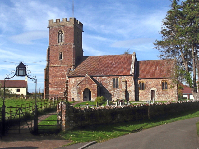
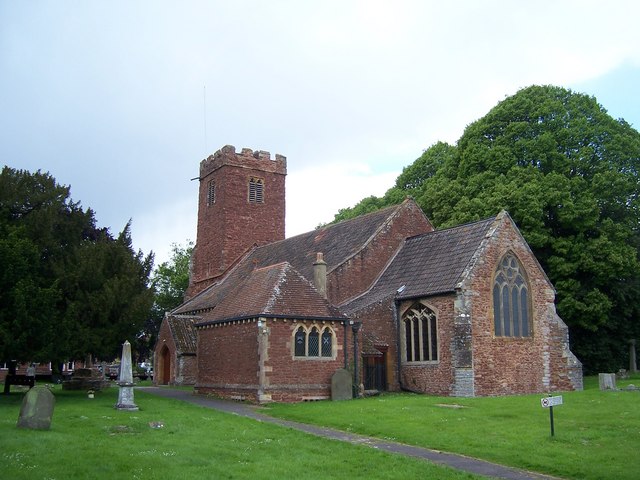
Church of the Holy Trinity, Chilton Trinity

The Anglican Church of the Holy Trinity at Chilton Trinity in the English county of Somerset was established in the 13th century. It is a Grade II* listed...

Chilton Trinity

Chilton Trinity is a village and civil parish on the River Parrett, 2 miles (3 km) north of Bridgwater in Somerset, England. == History == Iron Age and...

Chilton Trinity School

Chilton Trinity School is a coeducational secondary school located at Chilton Trinity, Bridgwater, Somerset, England. Bridgwater was selected as the 1st...

Bridgwater Castle

Bridgwater Castle was a castle in the town of Bridgwater, Somerset, England. The stone castle was built around 1220 and contributed to the development...

St George's Church, Wembdon

The Anglican St George's Church was founded in the 13th century in the village of Wembdon within the English county of Somerset. The current building dates...
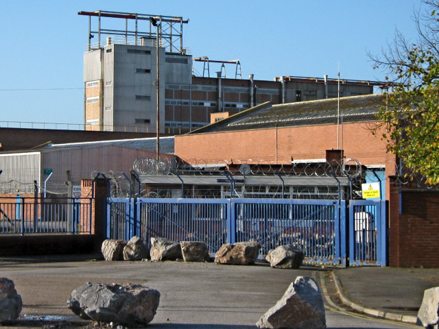
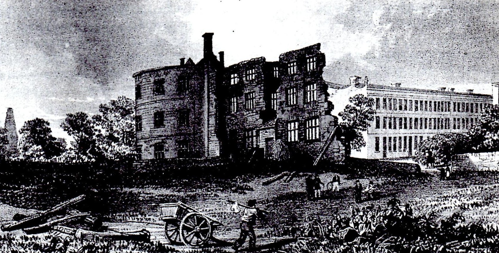
British Cellophane

British Cellophane Ltd (BCL) was a joint venture company formed in 1935 between La Cellophane SA and Courtaulds, when they began building a major factory...

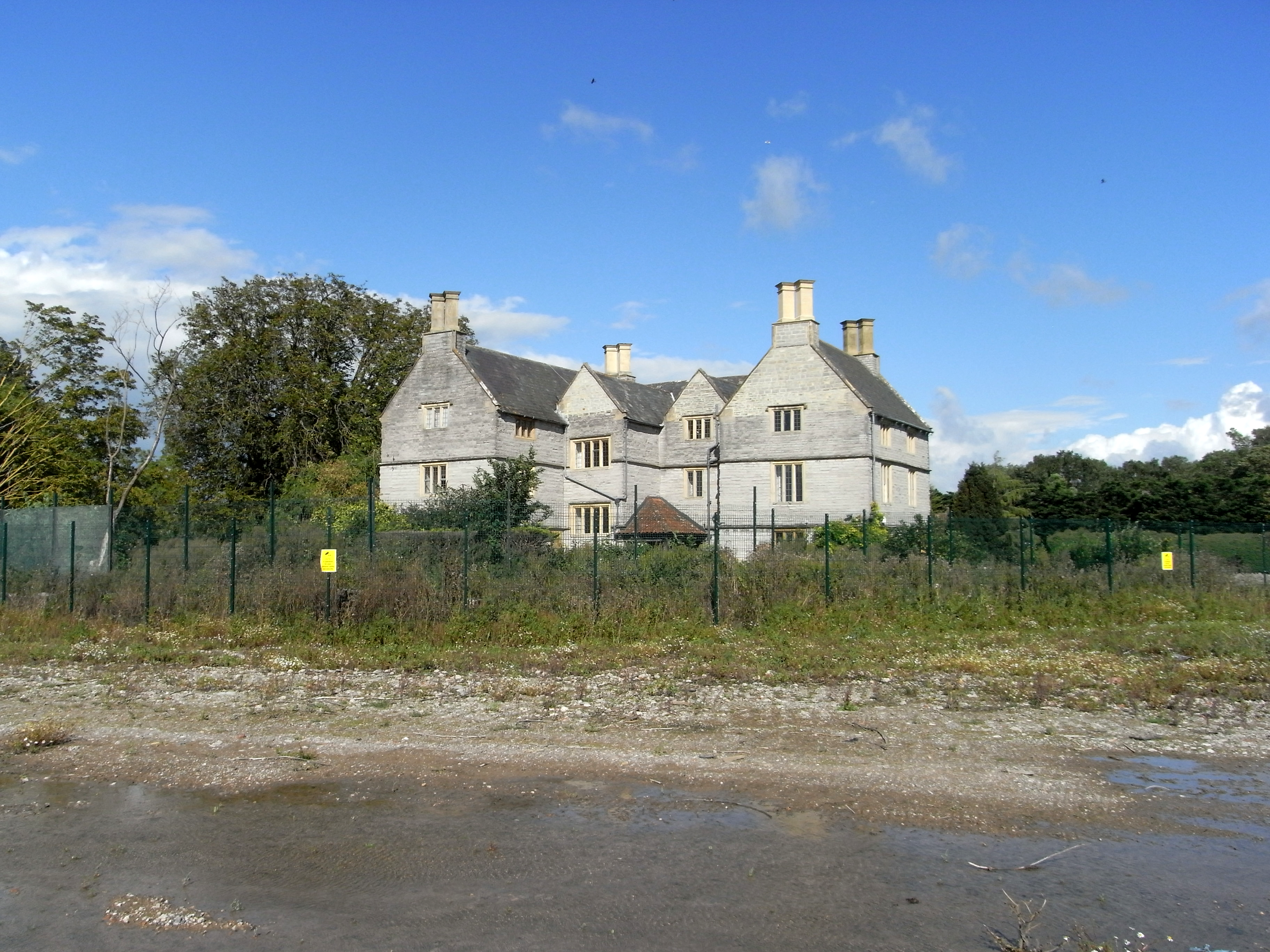
Sydenham House, Somerset

Sydenham House, the manor house of the ancient manor of Sydenham in the parish of Wembdon, Somerset, England, is a grade II listed building, constructed...

Willow Man

Willow Man is a large outdoor sculpture by Serena de la Hey. It is in a field to the west of the M5 motorway, near Bridgwater in Somerset, South West England...

Nearby Amenities

Located within 500m of 51.148684,-3.005803
Chilton Trinity
Is In: Somerset, England, UK
Place: village
Population: 250
Source: New Popular Edition
Lat/Long: 51.1470707/-3.007454
Entrance: yes
Lat/Long: 51.1474087/-3.0071897
Post Box
Operator: Royal Mail
Operator Wikidata: Q638098
Post Box Type: lamp
Ref: TA5 76
Royal Cypher: EIIR
Royal Cypher Wikidata: Q33102113
Lat/Long: 51.147042/-3.007039
Turning Loop
Lat/Long: 51.1473872/-3.010743
Trinity Waters Fishery
Leisure: fishing
Lat/Long: 51.1514349/-3.0026716
Poplars Equestrian
Leisure: horse_riding
Lat/Long: 51.1486199/-3.0097992
Natural: shrub
Lat/Long: 51.1473921/-3.0111149
Natural: shrub
Lat/Long: 51.1473955/-3.0110585
Natural: shrub
Lat/Long: 51.1474014/-3.0109969
Natural: shrub
Lat/Long: 51.1474022/-3.0109311
Natural: shrub
Lat/Long: 51.147345/-3.0111108
Natural: shrub
Lat/Long: 51.1473509/-3.0110143
Natural: shrub
Lat/Long: 51.1473534/-3.0109378
Public Bookcase
Booth: K6
Disused Amenity: telephone
Man Made: telephone_box
Public Bookcase Type: phone_box
Lat/Long: 51.1471987/-3.0047277
Advertising: board
Lat/Long: 51.1471967/-3.0047693
The data included in this document is from www.openstreetmap.org. The data is made available under ODbL.

Have you been to Chilton Trinity?

Leave your review of Chilton Trinity below (or comments, questions and feedback).