Chesterton

Settlement in Oxfordshire Cherwell

England

Chesterton

The road through Little Chesterton meets the A41
The road through Little Chesterton meets the A41 Credit: David Howard

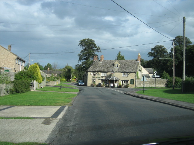
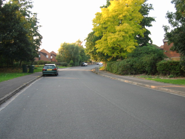
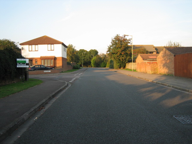
Chesterton is a charming village located in the county of Oxfordshire, England. Situated approximately 8 miles northwest of the historic city of Oxford, it lies on the eastern bank of the River Cherwell. With a population of around 1,000 residents, Chesterton offers a tranquil and idyllic setting for those seeking a peaceful retreat from city life.

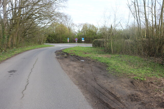
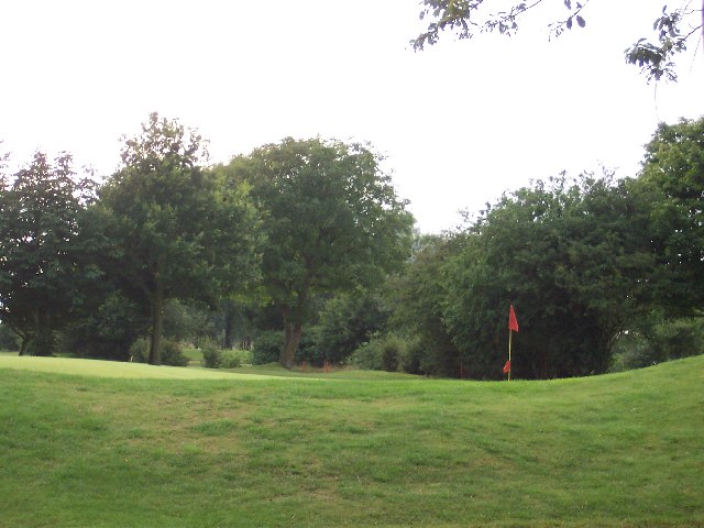
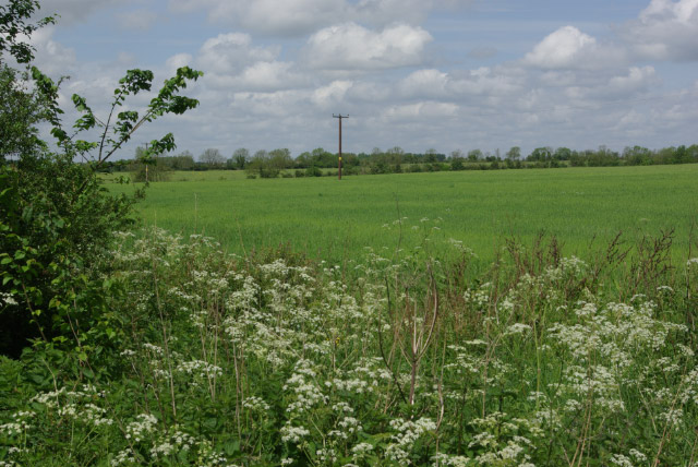
The village is known for its picturesque landscape, characterized by rolling hills, green pastures, and quaint cottages. It is surrounded by beautiful countryside, making it a popular destination for nature lovers and walkers. The nearby Cherwell Valley provides ample opportunities for outdoor activities such as hiking, cycling, and fishing.

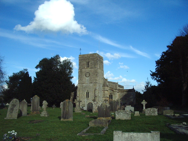
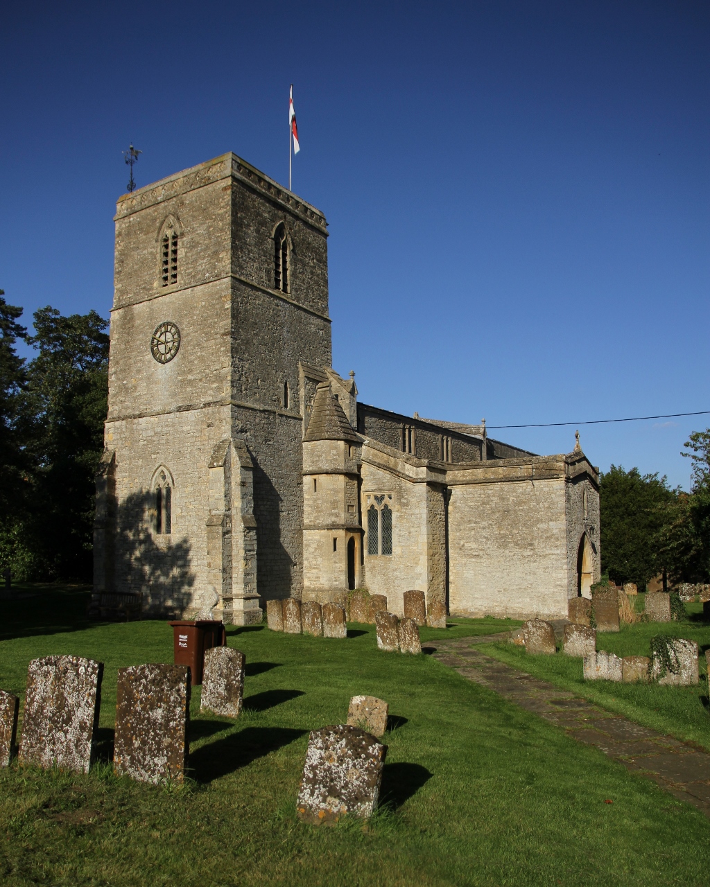
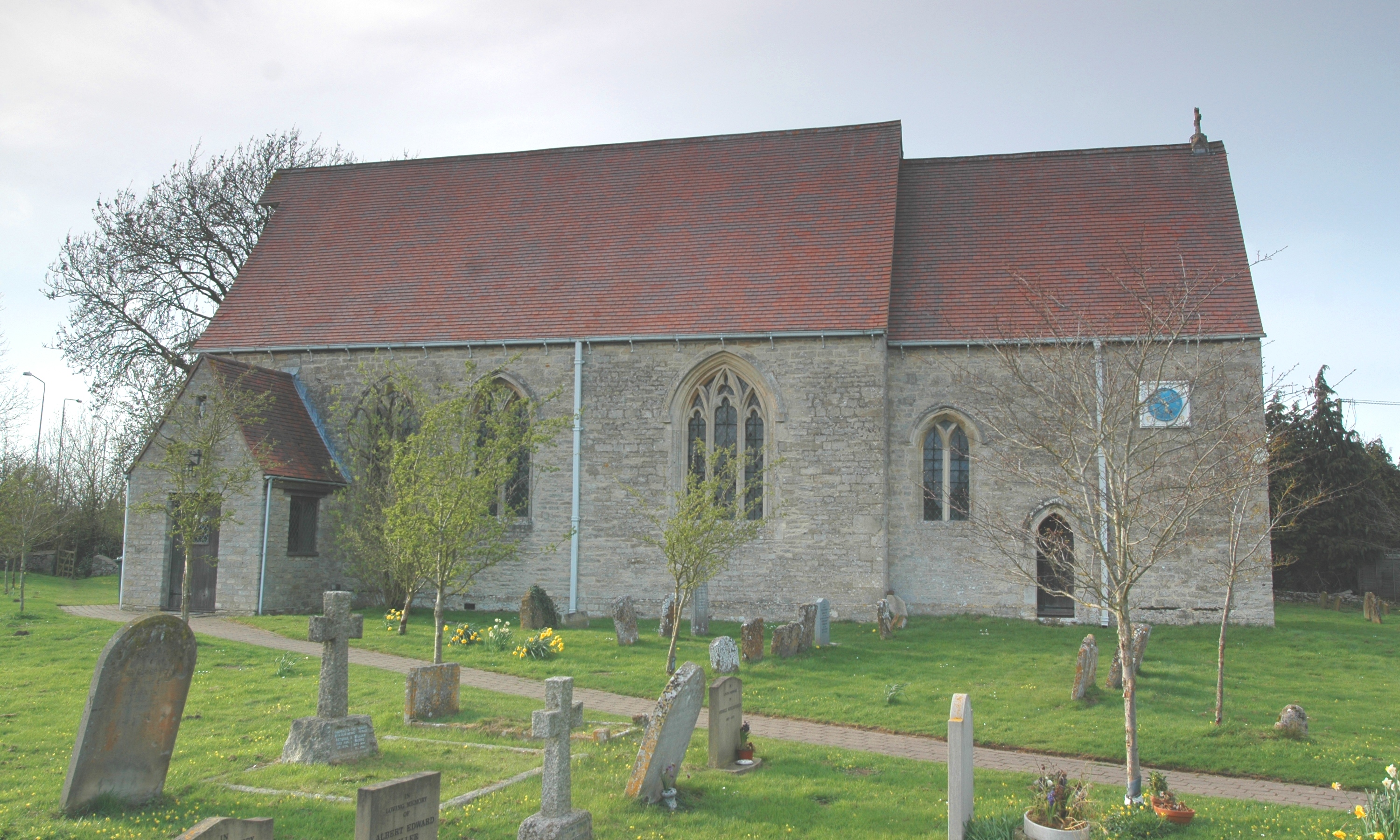
Chesterton is home to the Grade II listed St. Mary's Church, a notable landmark that dates back to the 12th century. The church features stunning architectural details, including a Norman doorway and a remarkable 14th-century stained glass window.

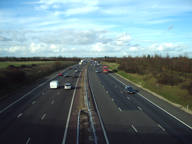
In terms of amenities, Chesterton boasts a primary school, a village hall, and a local pub, providing a close-knit community atmosphere. The village is well-connected to Oxford and other nearby towns via a network of roads, making it easily accessible for commuters.

Overall, Chesterton offers a peaceful and picturesque setting, combined with a rich historical heritage and a strong sense of community. It provides an ideal location for those seeking a tranquil lifestyle in the heart of the Oxfordshire countryside.

If you have any feedback on the listing, please let us know in the comments section below.

Chesterton Images

Images are sourced within 2km of 51.890741/-1.1886225 or Grid Reference SP5521. Thanks to Geograph Open Source API. All images are credited.

The road through Little Chesterton meets the A41
The Holiday Inn on Oxford Road, Bicester
The 18th Green This is the 18th Green at Bicester Golf an Country Club, Bicester, Oxfordshire
The 18th Green
This is the 18th Green at Bicester Golf an Country Club, Bicester, Oxfordshire
The Red Cow pub, Chesterton
Blooms Garden Centre
King's End looking north-east
Road near roman town of Alchester
Postbox in Little Chesterton
A4095 in Chesterton looking north
Footpath to Bicester from Bignell House
Wansbeck Drive looking west
Dryden Avenue looking north
M40 Looking N from the bridge of the A4095
M40
Looking N from the bridge of the A4095
The Road to Spring Well Farm
St Mary's Church, Chesterton
Weston-on-the-Green grass airfield for parachuting and gliding The airfield is used for military parachuting, also by Oxford Gliding Club  who warn "With the level of parachute activity described, it would be foolhardy to blunder into the airspace above the airfield without knowing what is going on."
Weston-on-the-Green grass airfield for parachuting and gliding
The airfield is used for military parachuting, also by Oxford Gliding Club who warn "With the level of parachute activity described, it would be foolhardy to blunder into the airspace above the airfield without knowing what is going on."
Farmland east of Middleton Stoney Farmland north of the B4030 Bicester - Enstone road.
Farmland east of Middleton Stoney
Farmland north of the B4030 Bicester - Enstone road.
Bicester Avenue
Bicester Avenue
Show me another place!

Chesterton is located at Grid Ref: SP5521 (Lat: 51.890741, Lng: -1.1886225)

Administrative County: Oxfordshire

District: Cherwell

Police Authority: Thames Valley

What 3 Words

///awakening.dignify.perusing. Near Bicester, Oxfordshire

Related Wikis

Chesterton, Oxfordshire

Chesterton is a village and civil parish on Gagle Brook, a tributary of the Langford Brook in north Oxfordshire. The village is about 1+1⁄2 miles (2.4...
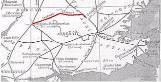
Akeman Street

Akeman Street is a Roman road in southern England between the modern counties of Hertfordshire and Gloucestershire. It is approximately 117 kilometres...

Bicester Avenue

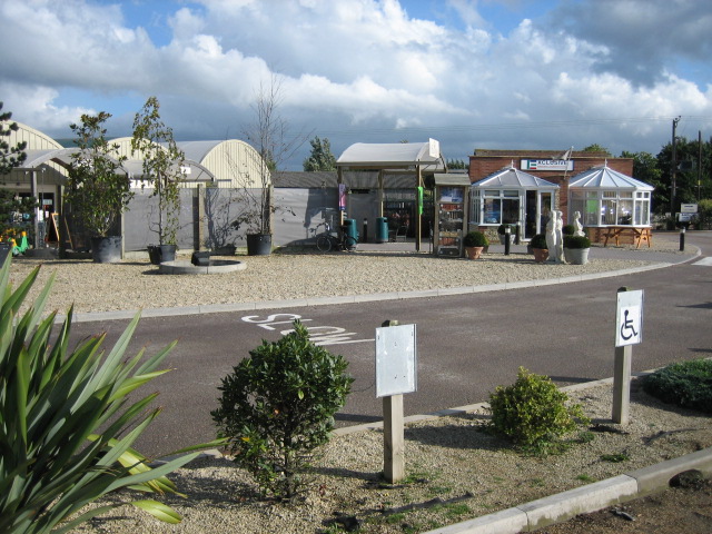
Bicester Avenue Home and Garden Centre is a shopping centre in Bicester, Oxfordshire, England, that opened in May 2007. Some of the stores at Bicester...

Alchester (Roman town)

Alchester is the site of an ancient Roman town. The site is not included in any ancient references; hence, the Roman name is not known. However, Eilert...

Wendlebury

Wendlebury is a village and civil parish about 2 miles (3 km) southwest of Bicester and about 1⁄2 mile (800 m) from Junction 9 of the M40. Junction 9 is...

Wendlebury Halt railway station

Wendlebury Halt was a railway station on the Varsity Line, located 0.5 miles (800 m) east of the village of Wendlebury in Alchester. The London and North...

The Bicester School

The Bicester School (previously Bicester Community College) is a mixed, multi-heritage, secondary school, with 963 students (including a sixth form). It...
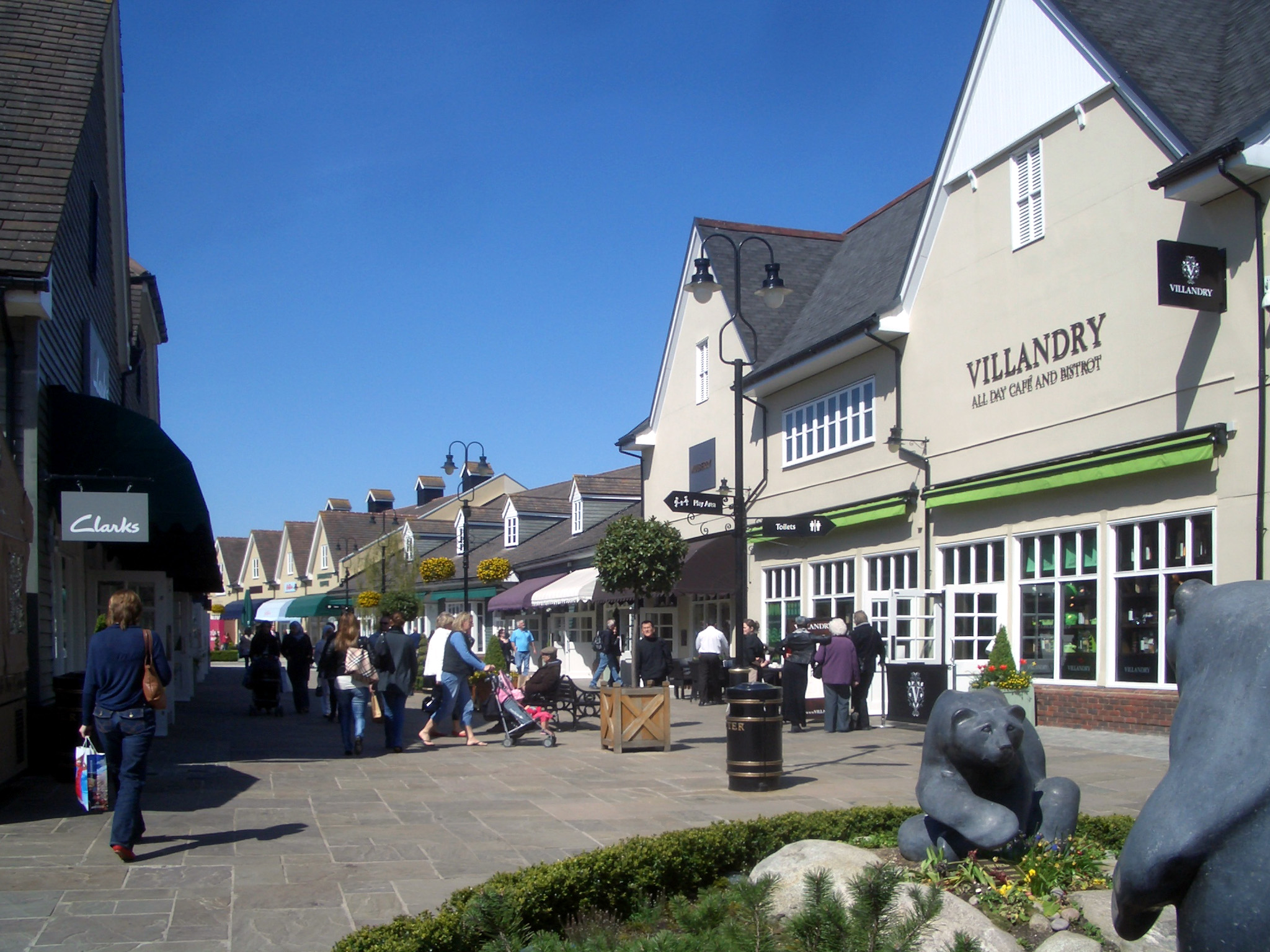
Bicester Village

Bicester Village is a designer outlet shopping centre on the outskirts of Bicester, a town in Oxfordshire, England. It is owned by Value Retail plc. The...

Nearby Amenities

Located within 500m of 51.890741,-1.1886225
Chesterton
Is In: Oxfordshire, England, UK
Place: village
Lat/Long: 51.8871011/-1.1857238
Barrier: bollard
Lat/Long: 51.891808/-1.1901458
Old Phone: +44 1869 252223
Postal Code: OX6 8UU
Removed Amenity: telephone
Lat/Long: 51.8916836/-1.190195
Post Box
Post Box Type: lamp
Lat/Long: 51.8916668/-1.1901708
Barrier: stile
Lat/Long: 51.8940887/-1.1839898
Barrier: stile
Lat/Long: 51.8939391/-1.1861926
Barrier: stile
Lat/Long: 51.893727/-1.1886483
Post Box
Postal Code: OX26
Ref: OX26 335
Lat/Long: 51.8894259/-1.1871384
Barrier: kissing_gate
Lat/Long: 51.8884684/-1.1879601
Bignell Park
Tourism: hotel
Lat/Long: 51.8931217/-1.1887173
Bus Stop
Green
Bus: yes
Naptan AtcoCode: 340000195ALC
Naptan Bearing: E
Naptan CommonName: Green
Naptan Indicator: Alchester Road
Naptan Landmark: Green
Naptan NaptanCode: oxfajtgt
Naptan Street: Alchester Road
Naptan Verified: no
Public Transport: platform
Source: naptan_import
Lat/Long: 51.891561/-1.1900412
Bus Stop
Green
Bus: yes
Naptan AtcoCode: 340000195OPP
Naptan Bearing: W
Naptan CommonName: Green
Naptan Indicator: Opposite
Naptan Landmark: Green
Naptan NaptanCode: oxfajtgp
Naptan Street: Alchester Road
Naptan Verified: no
Public Transport: platform
Source: naptan_import
Lat/Long: 51.891471/-1.1900282
Bus Stop
Red Cow
Bus: yes
Naptan AtcoCode: 340001813OPP
Naptan Bearing: N
Naptan BusStopType: CUS
Naptan CommonName: Red Cow
Naptan Indicator: Opposite
Naptan Landmark: Red Cow
Naptan NaptanCode: oxfgjgtd
Naptan Street: Alchester Road
Naptan Verified: no
Public Transport: platform
Source: naptan_import
Lat/Long: 51.8872584/-1.1858053
Bus Stop
Red Cow
Bus: yes
Naptan AtcoCode: 340001813OUT
Naptan Bearing: S
Naptan CommonName: Red Cow
Naptan Indicator: Outside
Naptan Landmark: Red Cow
Naptan NaptanCode: oxfgjgwg
Naptan Street: Alchester Road
Naptan Verified: no
Public Transport: platform
Source: naptan_import
Lat/Long: 51.8873403/-1.1855981
Bus Stop
Orchard Rise
Bus: yes
Naptan AtcoCode: 340003148CNR
Naptan Bearing: N
Naptan CommonName: Orchard Rise
Naptan Indicator: Corner
Naptan Landmark: Orchard Rise
Naptan NaptanCode: oxfatjdw
Naptan Street: Alchester Road
Naptan Verified: no
Public Transport: platform
Source: naptan_import
Lat/Long: 51.8897072/-1.1874636
Orchard Rise
Naptan AtcoCode: 340003148OPP
Naptan Bearing: S
Naptan BusStopType: CUS
Naptan CommonName: Orchard Rise
Naptan Indicator: Opposite
Naptan Landmark: Orchard Rise
Naptan NaptanCode: oxfatjdt
Naptan Street: Alchester Road
Naptan Verified: no
Source: naptan_import
Lat/Long: 51.8896601/-1.1872869
Give Way
Direction: forward
Lat/Long: 51.891494/-1.1903272
Generator Method: photovoltaic
Generator Output Electricity: yes
Generator Source: solar
Generator Type: solar_photovoltaic_panel
Location: roof
Power: generator
Lat/Long: 51.8907037/-1.1901055
Generator Method: photovoltaic
Generator Output Electricity: yes
Generator Source: solar
Generator Type: solar_photovoltaic_panel
Location: roof
Power: generator
Lat/Long: 51.8906565/-1.1900237
Generator Method: photovoltaic
Generator Output Electricity: yes
Generator Source: solar
Generator Type: solar_photovoltaic_panel
Location: roof
Power: generator
Lat/Long: 51.8906192/-1.1899406
Generator Method: photovoltaic
Generator Output Electricity: yes
Generator Source: solar
Generator Type: solar_photovoltaic_panel
Location: roof
Power: generator
Lat/Long: 51.890582/-1.1898802
Generator Method: photovoltaic
Generator Output Electricity: yes
Generator Source: solar
Generator Type: solar_photovoltaic_panel
Location: roof
Power: generator
Lat/Long: 51.890539/-1.189781
Generator Method: photovoltaic
Generator Output Electricity: yes
Generator Source: solar
Generator Type: solar_photovoltaic_panel
Location: roof
Power: generator
Lat/Long: 51.8904901/-1.189722
Generator Method: photovoltaic
Generator Output Electricity: yes
Generator Source: solar
Generator Type: solar_photovoltaic_panel
Location: roof
Power: generator
Lat/Long: 51.8904595/-1.1896482
Generator Method: photovoltaic
Generator Output Electricity: yes
Generator Source: solar
Generator Type: solar_photovoltaic_panel
Location: roof
Power: generator
Lat/Long: 51.8904264/-1.1896013
Generator Method: photovoltaic
Generator Output Electricity: yes
Generator Source: solar
Generator Type: solar_photovoltaic_panel
Location: roof
Power: generator
Lat/Long: 51.8903726/-1.1895329
Generator Method: photovoltaic
Generator Output Electricity: yes
Generator Source: solar
Generator Type: solar_photovoltaic_panel
Location: roof
Power: generator
Lat/Long: 51.8862828/-1.1895597
Generator Method: photovoltaic
Generator Output Electricity: yes
Generator Source: solar
Generator Type: solar_photovoltaic_panel
Location: roof
Power: generator
Lat/Long: 51.8862878/-1.1894819
Generator Method: photovoltaic
Generator Output Electricity: yes
Generator Source: solar
Generator Type: solar_photovoltaic_panel
Location: roof
Power: generator
Lat/Long: 51.8863358/-1.1887041
Generator Method: photovoltaic
Generator Output Electricity: yes
Generator Source: solar
Generator Type: solar_photovoltaic_panel
Location: roof
Power: generator
Lat/Long: 51.8863557/-1.1885244
Generator Method: photovoltaic
Generator Output Electricity: yes
Generator Source: solar
Generator Type: solar_photovoltaic_panel
Location: roof
Power: generator
Lat/Long: 51.8863755/-1.1882374
Generator Method: photovoltaic
Generator Output Electricity: yes
Generator Source: solar
Generator Type: solar_photovoltaic_panel
Location: roof
Power: generator
Lat/Long: 51.8863821/-1.1881676
Generator Method: photovoltaic
Generator Output Electricity: yes
Generator Source: solar
Generator Type: solar_photovoltaic_panel
Location: roof
Power: generator
Lat/Long: 51.8863904/-1.188055
Generator Method: photovoltaic
Generator Output Electricity: yes
Generator Source: solar
Generator Type: solar_photovoltaic_panel
Location: roof
Power: generator
Lat/Long: 51.8864219/-1.1876714
Generator Method: photovoltaic
Generator Output Electricity: yes
Generator Source: solar
Generator Type: solar_photovoltaic_panel
Location: roof
Power: generator
Lat/Long: 51.8885839/-1.1879906
Generator Method: photovoltaic
Generator Output Electricity: yes
Generator Source: solar
Generator Type: solar_photovoltaic_panel
Location: roof
Power: generator
Lat/Long: 51.8882793/-1.1868078
Turning Loop
Lat/Long: 51.8949655/-1.1900058
Advertising: board
Lat/Long: 51.8915567/-1.1901547
Public Bookcase
Location: inside bus shelter
Public Bookcase Type: shelf
Lat/Long: 51.8915653/-1.1900823
Defibrillator
Defibrillator Location: inside bus shelter, Alchester Road, Chesterton
Emergency: defibrillator
Lat/Long: 51.8915547/-1.1901006
Crossing
Lat/Long: 51.8883873/-1.1903969
The data included in this document is from www.openstreetmap.org. The data is made available under ODbL.

Have you been to Chesterton?

Leave your review of Chesterton below (or comments, questions and feedback).