Anchor
Settlement in Shropshire
England
Anchor

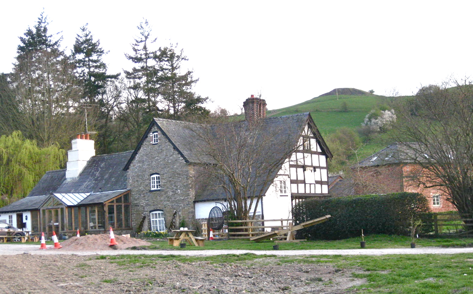
Anchor is a small village located in the county of Shropshire, England. Situated in the West Midlands region, it is nestled within the beautiful countryside, offering a picturesque and tranquil setting for its residents and visitors. The village is positioned near the border of Wales, providing easy access to explore both England and its neighboring country.
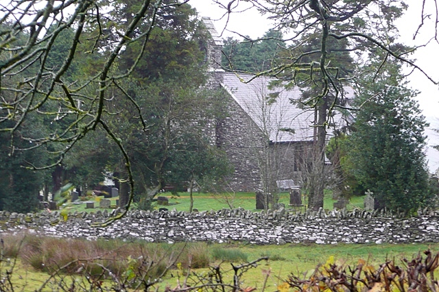
Despite its small size, Anchor boasts a rich history dating back centuries. The village is known for its close-knit community and friendly atmosphere. It has retained its traditional charm, with a collection of well-preserved historic buildings, including the local church, which dates back to the medieval era.
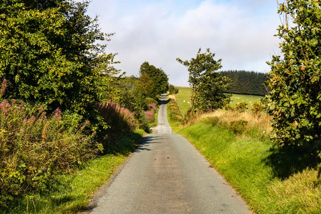
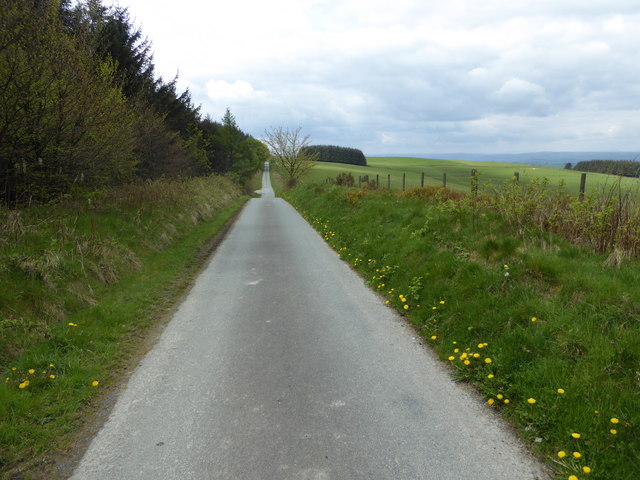
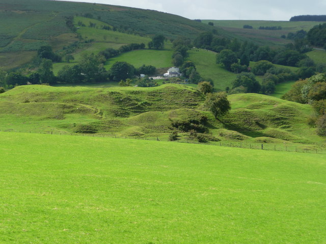
The surrounding landscape of Anchor is characterized by rolling hills, green fields, and scenic views. It is an ideal location for outdoor enthusiasts to engage in activities such as hiking, cycling, and horseback riding. The nearby Shropshire Hills Area of Outstanding Natural Beauty is a haven for nature lovers, offering stunning landscapes, diverse wildlife, and countless walking trails.
While Anchor may be a peaceful village, it is conveniently located near larger towns and cities. The market town of Oswestry is just a short distance away, providing residents with access to various amenities, shops, and services. Additionally, the city of Shrewsbury is within easy reach, offering a wider range of cultural attractions, shopping opportunities, and transportation links.
In summary, Anchor is a charming village in Shropshire that offers a tranquil setting, rich history, and close proximity to both natural beauty and urban amenities. It is a place to enjoy the best of both worlds, making it an appealing destination for residents and visitors alike.
If you have any feedback on the listing, please let us know in the comments section below.
Anchor Images
Images are sourced within 2km of 52.457555/-3.216786 or Grid Reference SO1785. Thanks to Geograph Open Source API. All images are credited.


Anchor is located at Grid Ref: SO1785 (Lat: 52.457555, Lng: -3.216786)
Unitary Authority: Shropshire
Police Authority: West Mercia
What 3 Words
///freshest.food.typist. Near Newtown, Powys
Nearby Locations
Related Wikis

Anchor, Shropshire
Anchor is a remote hamlet in southwest Shropshire, England. The hamlet is the most westerly place in Shropshire. == Geography == Anchor lies only 400 metres...
Bryn Amlwg Castle
Bryn Amlwg Castle (Welsh: Castell Bryn Amlwg, lit. 'castle on a prominent hill') was an enclosure castle near Anchor, Shropshire, abutting the England...
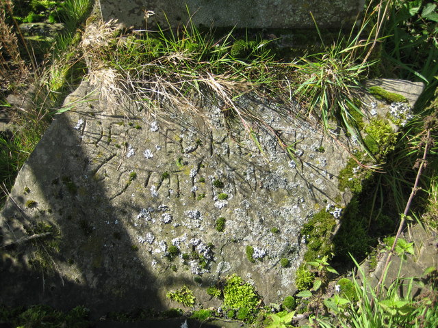
Cantlin Stone
The Cantlin Stone is a rough stone approximately two feet across with an inscription recording the death of one Willam Cantlin in the place where it is...

Garthmyl Hall, Berriew
Garthmyl Hall is a Grade II listed house in Berriew, in the historic county of Montgomeryshire, now Powys. The house stood close to the site of a large...
Cilthriew, Kerry (Montgomeryshire)
Cilthriew is a Grade II listed house and former farm in Kerry, Powys, in the historic county of Montgomeryshire, now Powys. Cilthriew was used by the...
Bettws-y-Crwyn
Bettws-y-Crwyn (Welsh: Betws-y-crwyn / Betwsycrowyn) is a small, remote village and civil parish in south-west Shropshire, England. It is close to the...

Ale Oak
Ale Oak is a hamlet in Shropshire, England. == External links == Media related to Ale Oak at Wikimedia Commons

East Wales
East Wales (Welsh: Dwyrain Cymru) is either a ITL 3 statistical region of Wales or generally a region encompassing the easternmost parts of the country...
Nearby Amenities
Located within 500m of 52.457555,-3.216786Have you been to Anchor?
Leave your review of Anchor below (or comments, questions and feedback).