Anchor Corner

Settlement in Norfolk Breckland

England

Anchor Corner

Great Ellingham: Houses in Poppy Way
Great Ellingham: Houses in Poppy Way Credit: Michael Garlick

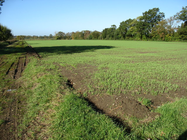
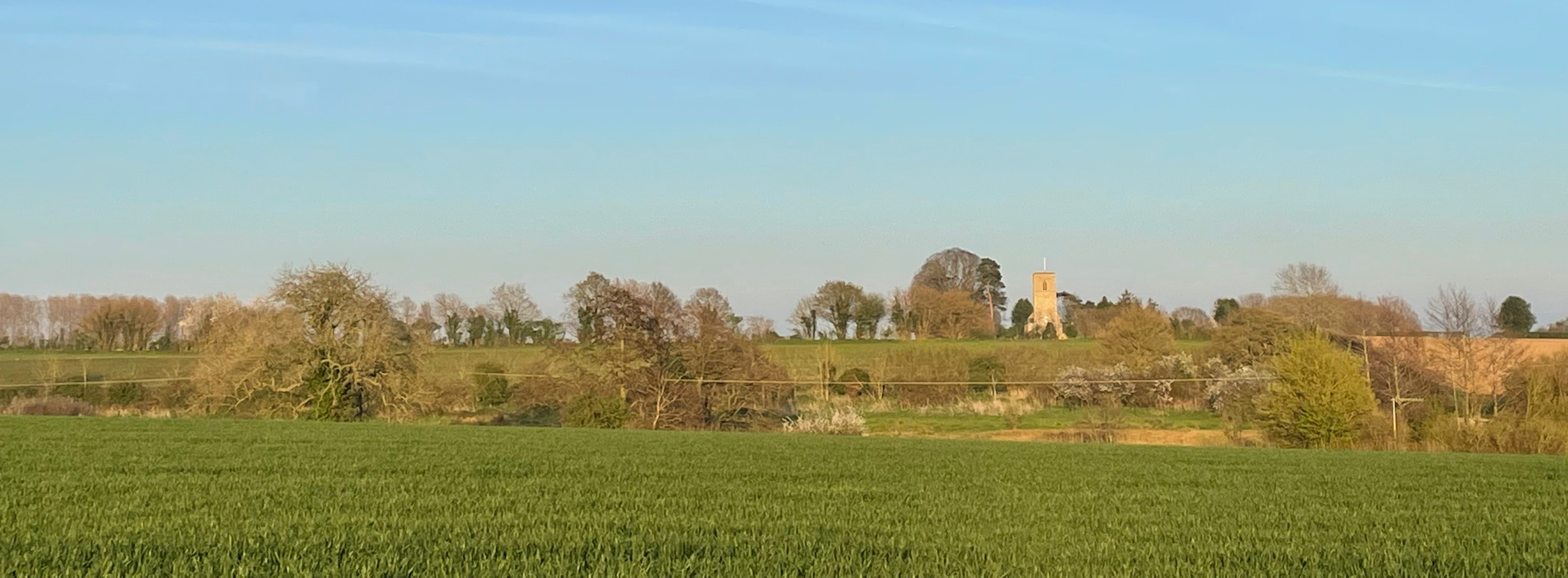
Anchor Corner is a small hamlet located in Norfolk, England. Situated in the East Anglian region, it occupies a rural setting amidst the picturesque Norfolk countryside. The hamlet is nestled between the larger villages of Fakenham and Holt, and is surrounded by lush green fields, charming woodlands, and peaceful streams.

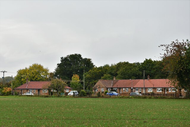
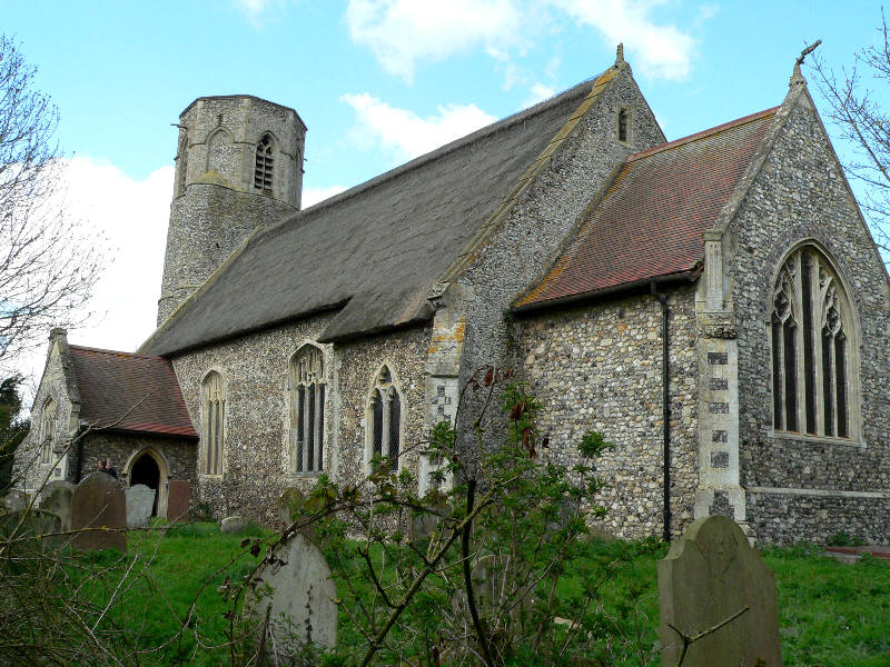
With a population of only a few hundred residents, Anchor Corner offers a tranquil and close-knit community atmosphere. The hamlet consists mainly of period cottages and farmhouses, adding to its quaint and traditional charm. The architecture showcases the region's rich heritage and provides a glimpse into its historical past.

Despite its small size, Anchor Corner boasts a number of amenities for its residents. There is a local pub, The Anchor Inn, which serves as a popular gathering spot for locals and visitors alike. It offers a warm and friendly atmosphere, serving traditional British pub food and a wide selection of beverages.

In terms of recreational activities, Anchor Corner benefits from its proximity to the stunning Norfolk coastline and the Norfolk Broads, a network of navigable rivers and lakes. This allows residents to enjoy various water sports, fishing, and boating opportunities. The surrounding countryside also provides ample opportunities for walking, cycling, and exploring nature.

Overall, Anchor Corner offers a peaceful and idyllic setting for those seeking a rural lifestyle. Its proximity to larger towns and natural attractions ensures that residents have access to essential services and a range of recreational activities.

If you have any feedback on the listing, please let us know in the comments section below.

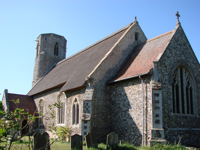
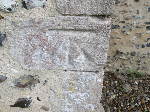
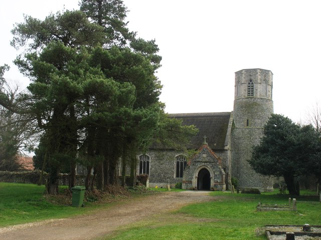
Anchor Corner Images

Images are sourced within 2km of 52.542924/0.953886 or Grid Reference TM0098. Thanks to Geograph Open Source API. All images are credited.

Great Ellingham: Houses in Poppy Way
The Scoulton Road From Little Ellingham.
The Scoulton Road
From Little Ellingham.
St. Peter's church, Rockland St. Peter The 13th c. tower is round with a stair turret leading up to the belfry stage, above which is an octagonal top. Just inside the nave, set in the wall, is half a stoup bowl, broken as a result of a fire in 1947 which gutted the church and destroyed almost everything in it. Consequently most of the furnishings and fittings are salvaged from other churches either redundant or unused. The screen, for example, is from Tottington St Andrew in the battle area and looks completely wrong here. The pulpit was from there too, but has been since reclaimed. At the time of writing the church has no pulpit. Because the original benches were burned, the seating is now individual chairs, giving the unfortunate appearance of a schoolroom. The large octagonal 14th c. font with quatrefoil tracery designs was undamaged in the fire.
St. Peter's church, Rockland St. Peter
The 13th c. tower is round with a stair turret leading up to the belfry stage, above which is an octagonal top. Just inside the nave, set in the wall, is half a stoup bowl, broken as a result of a fire in 1947 which gutted the church and destroyed almost everything in it. Consequently most of the furnishings and fittings are salvaged from other churches either redundant or unused. The screen, for example, is from Tottington St Andrew in the battle area and looks completely wrong here. The pulpit was from there too, but has been since reclaimed. At the time of writing the church has no pulpit. Because the original benches were burned, the seating is now individual chairs, giving the unfortunate appearance of a schoolroom. The large octagonal 14th c. font with quatrefoil tracery designs was undamaged in the fire.
Ordnance Survey Cut Mark This OS cut mark can be found on the north face of St Peter's Church. It marks a point 54.035m above mean sea level.
Ordnance Survey Cut Mark
This OS cut mark can be found on the north face of St Peter's Church. It marks a point 54.035m above mean sea level.
St Peter's church, Rockland I am relying on the Explorer (1:25,000) map to place this church about 20 metres inside <a href="https://www.geograph.org.uk/gridref/TL9897">TL9897</a>, although I note that earlier contributors (perhaps using the Landranger map?) have located it in <a href="https://www.geograph.org.uk/gridref/TL9997">TL9997</a>.
There is an interesting, and rare, octagonal top to the tower.
St Peter's church, Rockland
I am relying on the Explorer (1:25,000) map to place this church about 20 metres inside TL9897, although I note that earlier contributors (perhaps using the Landranger map?) have located it in TL9997. There is an interesting, and rare, octagonal top to the tower.
Rockland All Saints: Houses in Wayland Road
Postbox at Rockland St Peter NR17 1727. Royal Mail list this box as 'Chapel Street (D)'.
Postbox at Rockland St Peter
NR17 1727. Royal Mail list this box as 'Chapel Street (D)'.
Industrial shed by Bush Green
Industrial shed east of Hingham Road, Bush Green
St. Peter: the parish church of Little Ellingham This church dates back to the 13th century. Its interior was completely restored after a fire burnt out the nave and chancel in 1867.
St. Peter: the parish church of Little Ellingham
This church dates back to the 13th century. Its interior was completely restored after a fire burnt out the nave and chancel in 1867.
Farmland near Little Ellingham
St Peter's church, Little Ellingham On the Attleborough Road.
St Peter's church, Little Ellingham
On the Attleborough Road.
Track into the Sub-ordnance depot site This concreted road leads into the former depot site which formed part of RAF Deopham Green when it was an active airfield during WW2.
Track into the Sub-ordnance depot site
This concreted road leads into the former depot site which formed part of RAF Deopham Green when it was an active airfield during WW2.
Hardstanding north of Attleborough Road Now used for farm storage, this hardstanding was part of one of the dispersed Accommodation sites (Site 7) associated with RAF Deopham Green.
Hardstanding north of Attleborough Road
Now used for farm storage, this hardstanding was part of one of the dispersed Accommodation sites (Site 7) associated with RAF Deopham Green.
Bean crop by Stallard Farm
Entrance to Broadland Poultry Limited The concreted access road gives this location away as having been one of the former dispersed campsites associated with RAF Deopham Green.  This was the location of Site 7, an Accommodation site. The small white building seen in the background is one of the original buildings that have survived here.


The site is currently occupied by Broadland Poultry, one of the poultry farms belonging to Banham Poultry Ltd. The company made headlines when disturbing scenes of suffering and abuse on eight of their farms were filmed and the films made public several years ago.   They received further media attention when it could be shown that chickens supplied to supermarkets and stores had suffered from hock burns and chest blisters, lesions sustained when chickens are forced to put on as much weight as possible in the shortest possible time.  With the legs unable to support their bodies, many are reduced to dragging themselves around to reach food and water and have no choice but to crouch on filthy, ammonium-soaked floors.  The most recent news report noxious smells emanating from the company's Attleborough plant where the chickens are slaughtered and processed.  Banham Poultry Ltd have been in the poultry business for 45 years and the company currently sells about 650,000 chickens per week.
Entrance to Broadland Poultry Limited
The concreted access road gives this location away as having been one of the former dispersed campsites associated with RAF Deopham Green. This was the location of Site 7, an Accommodation site. The small white building seen in the background is one of the original buildings that have survived here. The site is currently occupied by Broadland Poultry, one of the poultry farms belonging to Banham Poultry Ltd. The company made headlines when disturbing scenes of suffering and abuse on eight of their farms were filmed and the films made public several years ago. They received further media attention when it could be shown that chickens supplied to supermarkets and stores had suffered from hock burns and chest blisters, lesions sustained when chickens are forced to put on as much weight as possible in the shortest possible time. With the legs unable to support their bodies, many are reduced to dragging themselves around to reach food and water and have no choice but to crouch on filthy, ammonium-soaked floors. The most recent news report noxious smells emanating from the company's Attleborough plant where the chickens are slaughtered and processed. Banham Poultry Ltd have been in the poultry business for 45 years and the company currently sells about 650,000 chickens per week.
Old concreted road The concreted access road gives this location away as having been one of the former dispersed campsites associated with RAF Deopham Green.  This was the location of Site 7, an Accommodation site. The small white building seen in the background is one of the original buildings that have survived here.

The site is currently occupied by Broadland Poultry, one of the poultry farms belonging to Banham Poultry Ltd. The company made headlines when disturbing scenes of suffering and abuse on eight of their farms were filmed and the films made public several years ago.   They received further media attention when it could be shown that chickens supplied to supermarkets and stores had suffered from hock burns and chest blisters, lesions sustained when chickens are forced to put on as much weight as possible in the shortest possible time.  With the legs unable to support their bodies, many are reduced to dragging themselves around to reach food and water and have no choice but to crouch on filthy, ammonium-soaked floors.  The most recent news report noxious smells emanating from the company's Attleborough plant where the chickens are slaughtered and processed.  Banham Poultry Ltd have been in the poultry business for 45 years and the company currently sells about 650,000 chickens per week.
Old concreted road
The concreted access road gives this location away as having been one of the former dispersed campsites associated with RAF Deopham Green. This was the location of Site 7, an Accommodation site. The small white building seen in the background is one of the original buildings that have survived here. The site is currently occupied by Broadland Poultry, one of the poultry farms belonging to Banham Poultry Ltd. The company made headlines when disturbing scenes of suffering and abuse on eight of their farms were filmed and the films made public several years ago. They received further media attention when it could be shown that chickens supplied to supermarkets and stores had suffered from hock burns and chest blisters, lesions sustained when chickens are forced to put on as much weight as possible in the shortest possible time. With the legs unable to support their bodies, many are reduced to dragging themselves around to reach food and water and have no choice but to crouch on filthy, ammonium-soaked floors. The most recent news report noxious smells emanating from the company's Attleborough plant where the chickens are slaughtered and processed. Banham Poultry Ltd have been in the poultry business for 45 years and the company currently sells about 650,000 chickens per week.
Old RAF building It is situated on the edge of a hardstanding which formed part of Site 7, one of the dispersed sites associated with RAF Deopham Green when it was an active airfield during WW2 - one of only a few buildings that would seem to have survived on this site.
Old RAF building
It is situated on the edge of a hardstanding which formed part of Site 7, one of the dispersed sites associated with RAF Deopham Green when it was an active airfield during WW2 - one of only a few buildings that would seem to have survived on this site.
Show me another place!

Anchor Corner is located at Grid Ref: TM0098 (Lat: 52.542924, Lng: 0.953886)

Administrative County: Norfolk

District: Breckland

Police Authority: Norfolk

What 3 Words

///plunger.grafted.recur. Near Hingham, Norfolk

Nearby Locations

Anchor Corner

Related Wikis

Anchor Corner

Anchor Corner is a village in Norfolk, England.

Little Ellingham

Little Ellingham is a village and civil parish in the English county of Norfolk. The village is 4.6 miles (7.4 km) north-west of Attleborough, 2 miles...

Great Ellingham

Great Ellingham is a village and civil parish in the Breckland District of Norfolk. The village lies 2.5 miles north-west of Attleborough, 2 miles south...

Great Ellingham Windmill

Great Ellingham Windmill is a Grade II listed tower mill in Great Ellingham, Norfolk, England which has been converted to residential accommodation....

Rockland St Peter

Rockland St Peter is a village and former civil parish, now in the parish of Rocklands, in the Breckland district, in the county of Norfolk, England. Its...

Rockland All Saints

Rockland All Saints is a village and former civil parish, now in the parish of Rocklands, in the Breckland district, in the county of Norfolk, England...

Rocklands

Rocklands is a civil parish in the English county of Norfolk which encompasses the villages of Rockland All Saints and Rockland St Peter. It covers an...
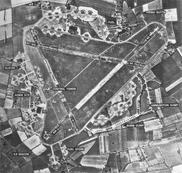
RAF Deopham Green

Royal Air Force Deopham Green or more simply RAF Deopham Green is a former Royal Air Force station located near Deopham Green 2 miles (3.2 km) north of...

Nearby Amenities

Located within 500m of 52.542924,0.953886
Barrier: kissing_gate
Bicycle: no
Foot: yes
Lat/Long: 52.5434781/0.9513875
Anchor Corner
Place: hamlet
Source: OS 1:25k
Wikidata: Q4752675
Lat/Long: 52.5418971/0.9533776
Post Box
Collection Times: Mo-Fr 16:45; Sa 10:00
Operator: Royal Mail
Post Box Mounting: pier
Post Box Type: lamp
Ref: NR17 1716
Royal Cypher: EIIR
Royal Cypher Wikidata: Q33102113
Lat/Long: 52.5425839/0.9548321
Barrier: kissing_gate
Bicycle: no
Foot: yes
Lat/Long: 52.5454041/0.9482222
Barrier: kissing_gate
Bicycle: no
Foot: yes
Lat/Long: 52.5444618/0.9503227
Fixme: incomplete
Lat/Long: 52.5447101/0.9483486
Fixme: incomplete
Lat/Long: 52.5442713/0.9504837
Fixme: incomplete
Lat/Long: 52.5443745/0.9477977
Give Way
Lat/Long: 52.5426068/0.9550045
Power: pole
Lat/Long: 52.540283/0.9523438
Power: pole
Lat/Long: 52.5405865/0.9520715
Power: pole
Lat/Long: 52.5421525/0.9508431
Power: pole
Lat/Long: 52.5438155/0.9495342
Power: pole
Lat/Long: 52.5453374/0.9483419
The data included in this document is from www.openstreetmap.org. The data is made available under ODbL.

Have you been to Anchor Corner?

Leave your review of Anchor Corner below (or comments, questions and feedback).