Yappers Wood

Wood, Forest in Devon South Hams

England

Yappers Wood

Seven Stars Lane and pub - Tamerton Foliot
Seven Stars Lane and pub - Tamerton Foliot Credit: Mick Lobb

Yappers Wood is a picturesque woodland located in Devon, England, known for its natural beauty and diverse range of flora and fauna. Stretching over an area of approximately 100 acres, this enchanting forest is a haven for nature enthusiasts and outdoor adventurers alike.

The woodland is characterized by its dense canopy of towering trees, predominantly consisting of oak, beech, and ash. These majestic trees provide a serene and shady atmosphere, perfect for leisurely walks and bird-watching. The forest floor is adorned with a rich carpet of wildflowers, ferns, and mosses, creating a vibrant and colorful landscape, especially during the spring and summer months.

Yappers Wood is home to a myriad of wildlife, making it a popular destination for animal lovers. Visitors may spot various species of birds, including woodpeckers, owls, and thrushes, as well as small mammals like squirrels, badgers, and foxes. The wood also supports a diverse range of insects, making it an ideal habitat for butterflies and dragonflies.

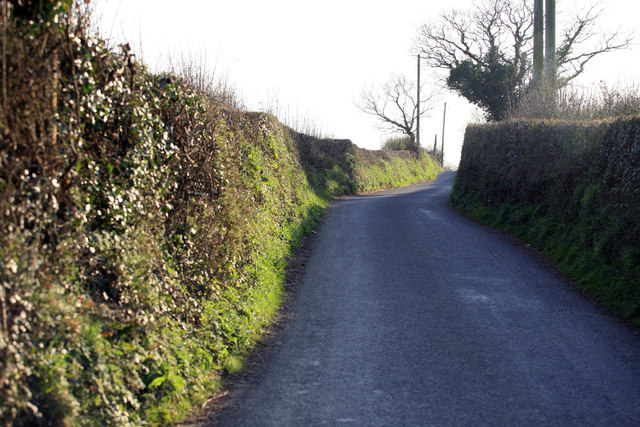
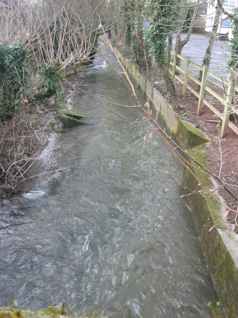
The wood offers several well-marked trails, enabling visitors to explore its beauty at their own pace. These paths wind through the forest, providing breathtaking views of the surrounding countryside and glimpses of nearby streams and ponds. Nature enthusiasts can engage in activities such as birdwatching, photography, or simply enjoying a peaceful picnic amidst the tranquil surroundings.

Yappers Wood is easily accessible, with a well-maintained car park located nearby for visitors' convenience. The forest is open to the public throughout the year, and admission is free, making it a popular destination for families, hikers, and nature lovers seeking a peaceful retreat in the heart of Devon's natural beauty.

If you have any feedback on the listing, please let us know in the comments section below.

Yappers Wood Images

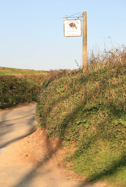
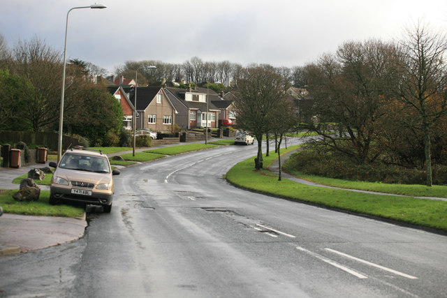
Images are sourced within 2km of 50.434908/-4.1430958 or Grid Reference SX4761. Thanks to Geograph Open Source API. All images are credited.

Seven Stars Lane and pub - Tamerton Foliot
Upstream of Tamerton Foliot Stream
Downstream Tamerton Foliot Stream
St Mary's Church - Tamerton Foliot
The Co Op car park entrance The entrance to the Co Op car park at Southway just off Southway drive
The Co Op car park entrance
The entrance to the Co Op car park at Southway just off Southway drive
Tamerton Foliot stream Station Road Tamerton Foliot stream as it flows towards Tamerton Creek.
Tamerton Foliot stream Station Road
Tamerton Foliot stream as it flows towards Tamerton Creek.
Stream, Milford Lane Stream at Milford Lane, Tamerton Foliot.
Stream, Milford Lane
Stream at Milford Lane, Tamerton Foliot.
Porsham Farm Lane and sign Narrow Devon lane leading to Tamerton Foliot
Porsham Farm Lane and sign
Narrow Devon lane leading to Tamerton Foliot
Sopers Hill A great view along this Devon Lane nr Porsham farm. In the far distance the Gunnislake Railway crosses the Tavy on an iron bridge.
Sopers Hill
A great view along this Devon Lane nr Porsham farm. In the far distance the Gunnislake Railway crosses the Tavy on an iron bridge.
Roborough Lane Looking towards Tamerton Foliot.
Roborough Lane
Looking towards Tamerton Foliot.
City and Countryside A view across the valley , Southway part of Plymouth meets the countryside as seen from the Tamerton Road.
City and Countryside
A view across the valley , Southway part of Plymouth meets the countryside as seen from the Tamerton Road.
Waterfall,  Tamerton Foliot stream
Waterfall, Tamerton Foliot stream
Tamerton Foliot Stream Culvert Tamerton Foliot stream culvert
Tamerton Foliot Stream Culvert
Tamerton Foliot stream culvert
Tamerton Foliot Stream Tamerton Foliot stream flowing through Wadlands Meadow
Tamerton Foliot Stream
Tamerton Foliot stream flowing through Wadlands Meadow
New house, Warleigh Crescent
Traffic at Southway
Traffic at Southway
Southway Drive Looking towards the main road to Tavistock and the George Public House
Southway Drive
Looking towards the main road to Tavistock and the George Public House
Tamerton Foliot stream Tamerton Foliot stream
Tamerton Foliot stream
Show me another place!

Yappers Wood is located at Grid Ref: SX4761 (Lat: 50.434908, Lng: -4.1430958)

Administrative County: Devon

District: South Hams

Police Authority: Devon and Cornwall

What 3 Words

///hatch.curvy.smashes. Near Bere Alston, Devon

Related Wikis

Southway Community College

Southway Community College was a comprehensive school for ages 11–18 in Southway, Plymouth, England. It was opened in 1962 as Southway Comprehensive School...

Southway

Southway is a large suburban housing estate in north-west Plymouth in the English county of Devon. The name is believed to have derived from the route...

Tamerton Foliot

Tamerton Foliot is a village and former civil parish situated in the north of Plymouth, in the Plymouth district, in the ceremonial county of Devon, England...

Notre Dame Catholic School

Notre Dame RC School is a Roman Catholic school for girls in Derriford, Plymouth, England. Its sister school is St Boniface's Catholic College. The former...

Nearby Amenities

Located within 500m of 50.434908,-4.1430958
Power: pole
Lat/Long: 50.4336937/-4.1363663
Power: pole
Lat/Long: 50.4337641/-4.1376632
Power: pole
Lat/Long: 50.4339231/-4.1406509
Power: pole
Lat/Long: 50.4340351/-4.1428142
Power: pole
Lat/Long: 50.4340996/-4.1439867
Power: pole
Lat/Long: 50.4345082/-4.1448178
Power: pole
Lat/Long: 50.4356568/-4.1470994
Poles: bipole
Power: pole
Source: bing
Lat/Long: 50.4363075/-4.148273
Poles: bipole
Power: pole
Source: bing
Lat/Long: 50.4366105/-4.1495243
Generator Method: photovoltaic
Generator Output Electricity: yes
Generator Source: solar
Generator Type: solar_photovoltaic_panel
Location: roof
Power: generator
Lat/Long: 50.4307827/-4.1408142
Generator Method: photovoltaic
Generator Output Electricity: yes
Generator Source: solar
Generator Type: solar_photovoltaic_panel
Location: roof
Power: generator
Lat/Long: 50.4306647/-4.1418186
Generator Method: photovoltaic
Generator Output Electricity: yes
Generator Source: solar
Generator Type: solar_photovoltaic_panel
Location: roof
Power: generator
Lat/Long: 50.4320262/-4.140858
Generator Method: photovoltaic
Generator Output Electricity: yes
Generator Source: solar
Generator Type: solar_photovoltaic_panel
Location: roof
Power: generator
Lat/Long: 50.4327779/-4.1397026
Material: wood
Power: pole
Source: bing
Lat/Long: 50.4326404/-4.1400003
Material: wood
Power: pole
Source: bing
Lat/Long: 50.4323832/-4.1403061
Material: wood
Power: pole
Source: bing
Transformer: distribution
Lat/Long: 50.4321167/-4.1405958
Material: wood
Power: pole
Source: bing
Lat/Long: 50.432514/-4.1405958
Power: pole
Source: bing
Lat/Long: 50.433428/-4.1405596
Power: pole
Source: bing
Lat/Long: 50.4344104/-4.1405435
Power: pole
Source: bing
Transformer: distribution
Lat/Long: 50.4357472/-4.140522
Power: pole
Source: bing
Lat/Long: 50.4365502/-4.1405167
Power: pole
Source: bing
Lat/Long: 50.4372788/-4.1398005
Power: pole
Source: bing
Lat/Long: 50.438162/-4.1389918
Power: pole
Source: bing
Lat/Long: 50.4351706/-4.1498105
Power: pole
Source: bing
Lat/Long: 50.436135/-4.1495651
Power: pole
Source: bing
Lat/Long: 50.4369824/-4.1493586
Barrier: kissing_gate
Lat/Long: 50.4328143/-4.137757
Man Made: utility_pole
Material: wood
Survey Date: 2022-05-12
Lat/Long: 50.4327714/-4.138675
Man Made: utility_pole
Material: wood
Survey Date: 2022-05-12
Lat/Long: 50.4313109/-4.1444562
Man Made: utility_pole
Material: wood
Survey Date: 2022-05-12
Lat/Long: 50.4315501/-4.1438157
Man Made: utility_pole
Material: wood
Survey Date: 2022-05-12
Lat/Long: 50.4318153/-4.143018
Man Made: utility_pole
Material: wood
Survey Date: 2022-05-12
Lat/Long: 50.4318659/-4.1431914
Man Made: utility_pole
Material: wood
Survey Date: 2022-05-12
Lat/Long: 50.4322169/-4.141677
Man Made: utility_pole
Material: wood
Survey Date: 2022-05-12
Lat/Long: 50.4323489/-4.1410611
Man Made: utility_pole
Material: wood
Survey Date: 2022-05-12
Lat/Long: 50.4326188/-4.1402155
Man Made: utility_pole
Material: wood
Survey Date: 2022-05-12
Lat/Long: 50.4307968/-4.145559
Man Made: utility_pole
Material: wood
Survey Date: 2022-05-12
Lat/Long: 50.4310412/-4.1450841
Man Made: utility_pole
Material: wood
Survey Date: 2022-05-12
Lat/Long: 50.4327012/-4.1395002
Man Made: utility_pole
Material: wood
Survey Date: 2022-07-18
Lat/Long: 50.4320003/-4.142503
Addr Housename: Coombe Cottage
Addr Street: Coombe Lane
Lat/Long: 50.4327221/-4.1397483
Addr Housename: Keepers Cottage
Addr Housenumber: 100
Addr Street: Coombe Lane
Lat/Long: 50.4320707/-4.1409987
Addr Housename: Coombe Farm
Addr Street: Coombe Lane
Lat/Long: 50.4330694/-4.1378804
The data included in this document is from www.openstreetmap.org. The data is made available under ODbL.

Have you been to Yappers Wood?

Leave your review of Yappers Wood below (or comments, questions and feedback).