Chesterblade

Settlement in Somerset Mendip

England

Chesterblade

Maes Down Farm
Maes Down Farm Credit: Roger Cornfoot

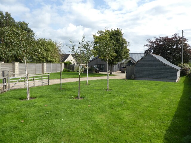
Chesterblade is a small village located in the county of Somerset, England. Nestled in the picturesque countryside, it is situated approximately 5 miles east of Shepton Mallet and 13 miles south of Bath. The village is part of the Mendip Hills Area of Outstanding Natural Beauty, offering stunning views and ample opportunities for outdoor activities.

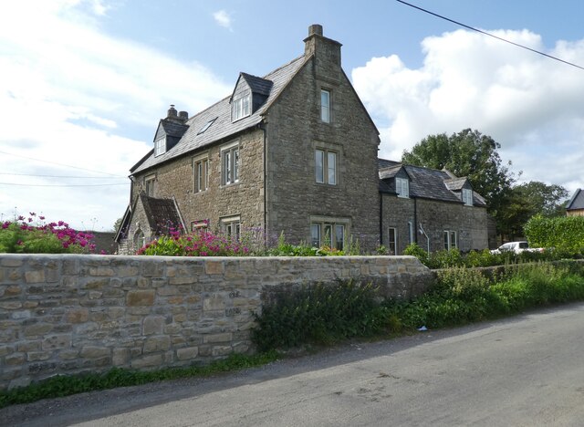
With a population of just over 100 residents, Chesterblade retains its quaint, traditional charm. The village is characterized by its collection of historic stone cottages, many of which date back to the 17th century. These buildings, along with the local church of St. Philip and St. James, contribute to the village's rich architectural heritage.

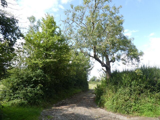
Chesterblade is surrounded by rolling hills, green pastures, and dense woodlands, making it a paradise for nature enthusiasts and hikers. The nearby River Frome adds to the village's natural beauty, providing a peaceful spot for fishing or leisurely walks along its banks.

Although small in size, Chesterblade benefits from a close-knit community spirit. The village has a village hall, which serves as a venue for social gatherings and community events. Additionally, the local pub offers a cozy atmosphere for residents and visitors to enjoy traditional British cuisine and ales.

While Chesterblade lacks many commercial amenities, the neighboring towns of Shepton Mallet and Bath provide easy access to a wider range of facilities, including shops, supermarkets, schools, and healthcare services.

Overall, Chesterblade offers a tranquil and idyllic rural setting, making it an appealing destination for those seeking a peaceful retreat in the beautiful Somerset countryside.

If you have any feedback on the listing, please let us know in the comments section below.

Chesterblade Images

Images are sourced within 2km of 51.168276/-2.481261 or Grid Reference ST6641. Thanks to Geograph Open Source API. All images are credited.

Maes Down Farm
Maes Down Farm
'Hilltops'
'Hilltops'
Farm track, north of Chesterblade Road
2011 : Westcombe Road looking east Toward Westcombe.
A maizefield shows its rigid lines and cows scatter themselves across a field.
2011 : Westcombe Road looking east
Toward Westcombe. A maizefield shows its rigid lines and cows scatter themselves across a field.
2011 : Farmland with barn North west from Westcombe Road.
2011 : Farmland with barn
North west from Westcombe Road.
Hail storm on Small Down Farm I sheltered under a tree on the southern edge of Upper Woolgrove Wood whilst the storm swept towards me from across the valley. The village of Stoney Stratton is in the valley beyond the trees slightly to the right.
Hail storm on Small Down Farm
I sheltered under a tree on the southern edge of Upper Woolgrove Wood whilst the storm swept towards me from across the valley. The village of Stoney Stratton is in the valley beyond the trees slightly to the right.
Hail storm on Small Down Farm Looking across the valley which lies between Small Down and Creech Hill (seen at left in distance) as a brief hail storm swept towards me. The village of Stoney Stratton can be glimpsed beyond the trees at right.
Hail storm on Small Down Farm
Looking across the valley which lies between Small Down and Creech Hill (seen at left in distance) as a brief hail storm swept towards me. The village of Stoney Stratton can be glimpsed beyond the trees at right.
Southeastern corner of Upper Woolgrove Wood Seen from the footpath.
Southeastern corner of Upper Woolgrove Wood
Seen from the footpath.
View of Stoney Stratton from Small Down hill fort
View along the top of Small Down From Small Down hill fort. Looking towards Westcomb (unseen), with Small Down Farm in the foreground.
View along the top of Small Down
From Small Down hill fort. Looking towards Westcomb (unseen), with Small Down Farm in the foreground.
Tree in field on Small Down farm Seen from footpath.
Tree in field on Small Down farm
Seen from footpath.
Dung heap beside footpath to Stoney Stratton
Footpath going towards Parsonage Farm, Stoney Stratton
Track to Parsonage Farm, Stoney Stratton
Stream in Stoney Stratton Flowing towards the camera and thence beneath Back Lane.
Stream in Stoney Stratton
Flowing towards the camera and thence beneath Back Lane.
Memorial on stone gate post at Stoney Stratton The left plaque reads:
THE NEILL ORCHARD
The family intend that this green open space
in the heart of Stoney Stratton
where David lived and which he loved,
shall remain always as such in his memory

The plaque has no date, and the internet is silent on the question who David Neill was.

The right plaque reads:
This medlar tree was planted by the residents of Stoney Stratton
to commemorate the
Diamond Jubilee of Queen Elizabeth II 2012

The orchard itself did not look too prepossessing on a dull day in March, but I imagine it may look much better when the blossom is out.
Memorial on stone gate post at Stoney Stratton
The left plaque reads: THE NEILL ORCHARD The family intend that this green open space in the heart of Stoney Stratton where David lived and which he loved, shall remain always as such in his memory The plaque has no date, and the internet is silent on the question who David Neill was. The right plaque reads: This medlar tree was planted by the residents of Stoney Stratton to commemorate the Diamond Jubilee of Queen Elizabeth II 2012 The orchard itself did not look too prepossessing on a dull day in March, but I imagine it may look much better when the blossom is out.
Stoney Stratton Ford at Back Lane over Stoney Brook in Stoney Stratton
Stoney Stratton
Ford at Back Lane over Stoney Brook in Stoney Stratton
Stoney Brook at Stoney Stratton
Show me another place!

Chesterblade is located at Grid Ref: ST6641 (Lat: 51.168276, Lng: -2.481261)

Administrative County: Somerset

District: Mendip

Police Authority: Avon and Somerset

What 3 Words

///novels.intruders.clings. Near Evercreech, Somerset

Nearby Locations

Chesterblade

Related Wikis

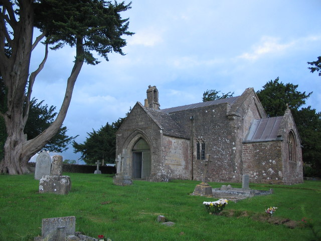
Church of St Mary, Chesterblade

The Anglican Church of St Mary in Chesterblade, Somerset, England was built in the 12th century. It is a Grade II* listed building. It is located 3 miles...
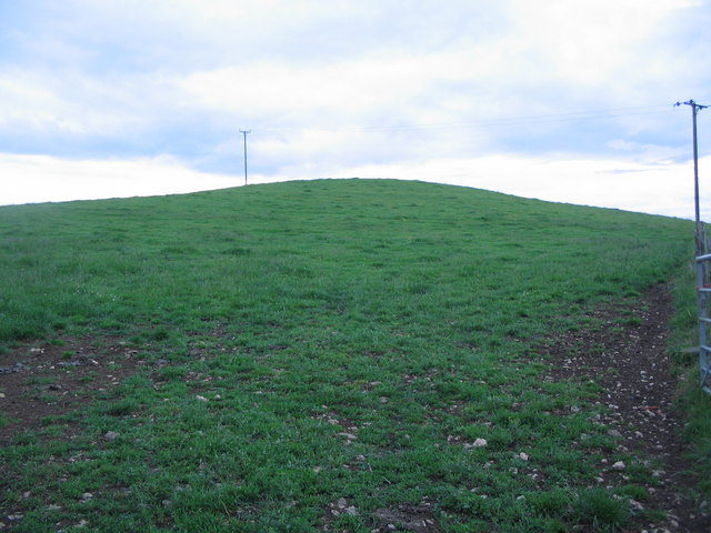
Small Down Knoll

Small Down Knoll, or Small Down Camp, is a Bronze Age hill fort near Evercreech in Somerset, England. The hill is on the southern edge of the Mendip Hills...

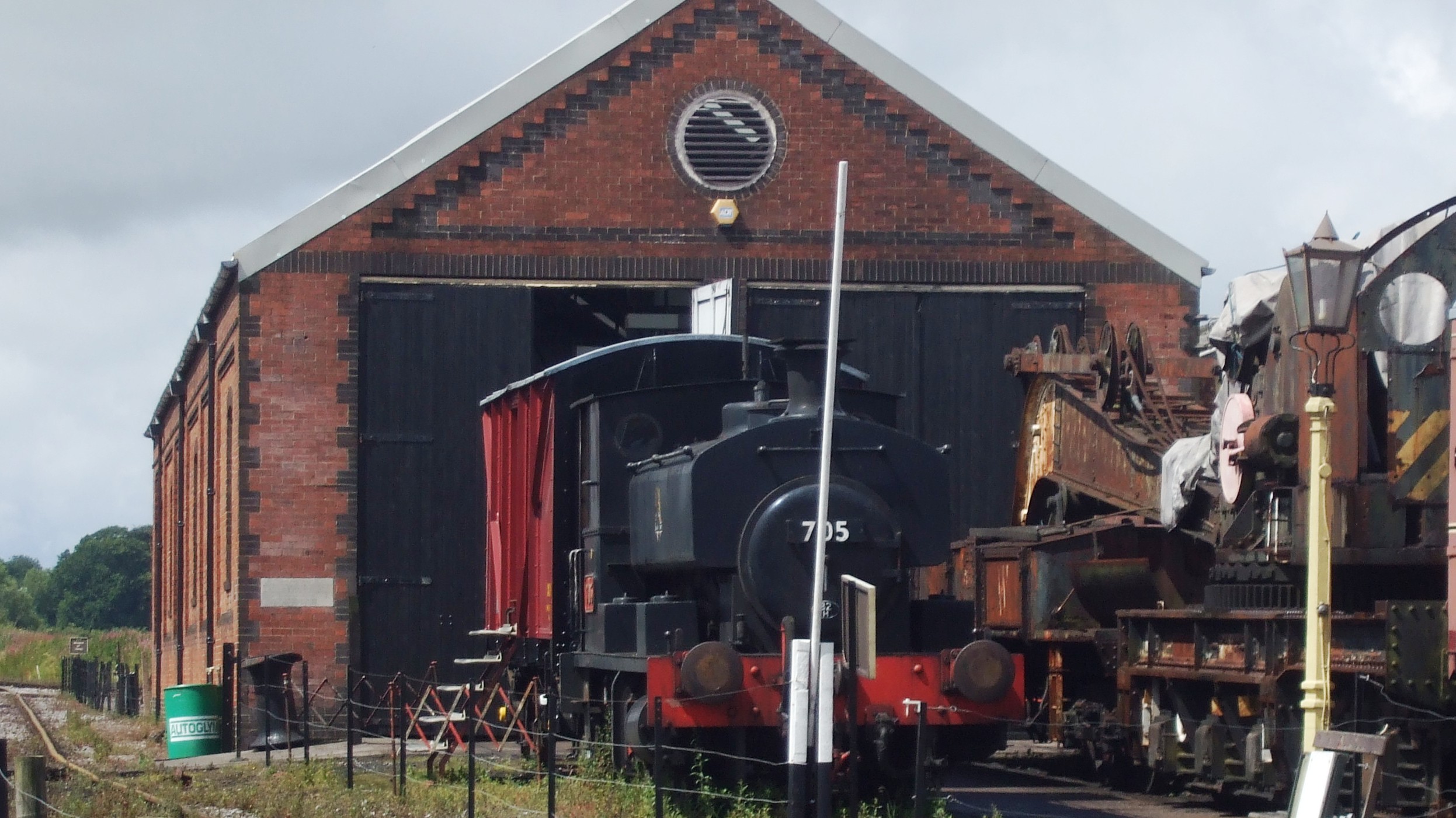
Cranmore West railway station

Cranmore West is a disused railway station on the East Somerset Railway. == Services == Services ceased calling at the beginning of the 2022 season, pending...

Maes Down

Maes Down (grid reference ST647406) is a 0.2 hectare geological Site of Special Scientific Interest between Shepton Mallet and Stoney Stratton in Somerset...

Merryfield Lane railway station

Merryfield Lane Halt is a railway station at the summit of the East Somerset Railway. It was built in 1981 and originally served as the terminus of the...

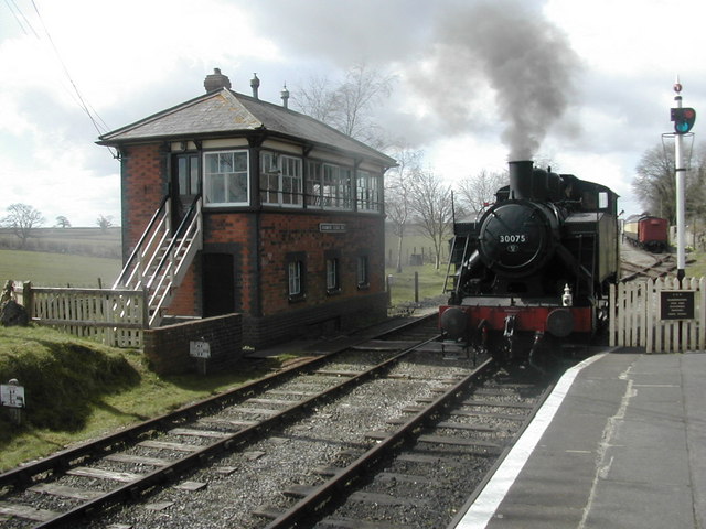
Cranmore railway station

Cranmore is the main railway station (and also the headquarters) of the preserved East Somerset Railway, in Somerset, England. == Services == Various services...

Doulting Railway Cutting

Doulting Railway Cutting (grid reference ST648424) is a 2.8 hectare geological Site of Special Scientific Interest in Somerset, notified in 1971. The cutting...

Cranmore, Somerset

Cranmore is a village and civil parish east of Shepton Mallet, in the Mendip district of Somerset, England. The parish includes the hamlets of Waterlip...

Nearby Amenities

Located within 500m of 51.168276,-2.481261
Small Down Knoll
Ele: 222
Natural: peak
Source: NPE
Wikidata: Q7542758
Wikipedia: en:Small Down Knoll
Lat/Long: 51.1638489/-2.4802522
Chesterblade
Is In: Somerset, England, UK
Place: hamlet
Source: OS7
Lat/Long: 51.1697579/-2.4854205
The data included in this document is from www.openstreetmap.org. The data is made available under ODbL.

Have you been to Chesterblade?

Leave your review of Chesterblade below (or comments, questions and feedback).