Cheshunt

Settlement in Hertfordshire Broxbourne

England

Cheshunt

The Great Cambridge Road, Cheshunt
The Great Cambridge Road, Cheshunt Credit: David Howard

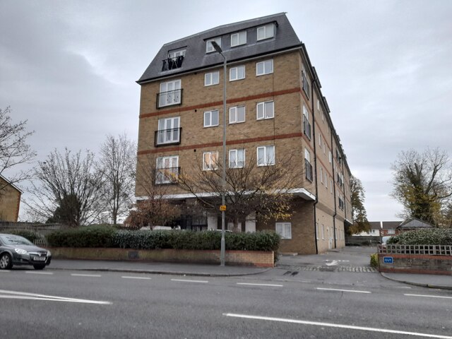
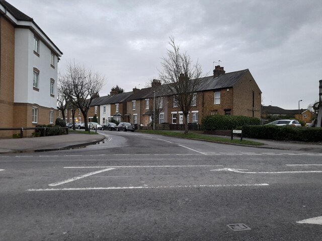
Cheshunt is a town located in the county of Hertfordshire, England. It lies approximately 17 miles north of central London and is part of the London commuter belt. With a population of around 52,000, it is a bustling and vibrant community.

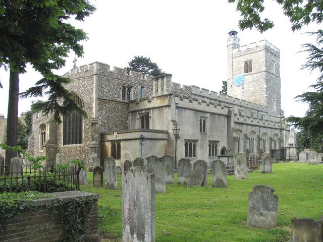
The town has a rich history, dating back to the medieval period. It was once an important coaching stop on the route between London and Cambridge, and remnants of its historical past can still be seen today. One notable landmark is the Grade I listed Cheshunt Great House, a former manor house that dates back to the 16th century.

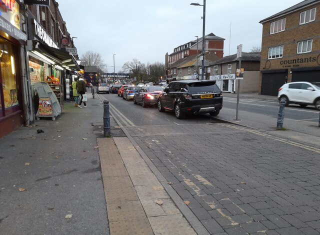
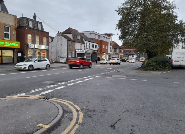
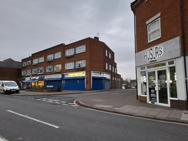
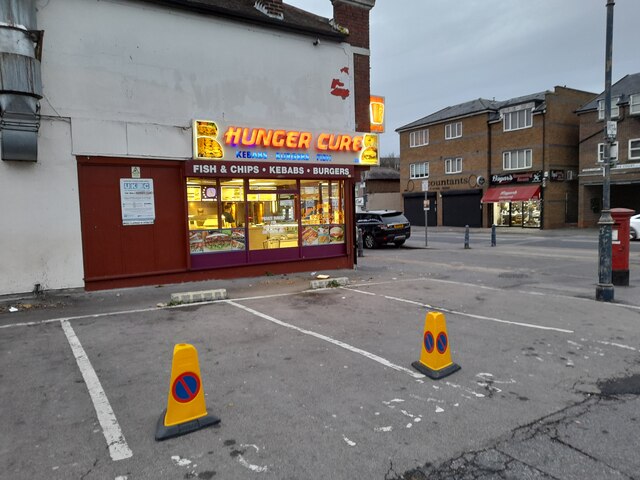
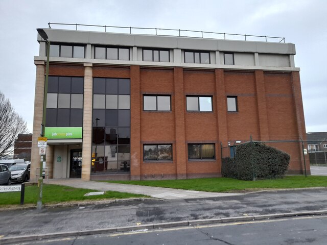
Cheshunt offers a wide range of amenities and attractions for both residents and visitors. The town center boasts a variety of shops, restaurants, and cafes, catering to diverse tastes. For outdoor enthusiasts, there are several parks and green spaces, including Cheshunt Park and Cedars Park, providing opportunities for leisurely walks and recreational activities.

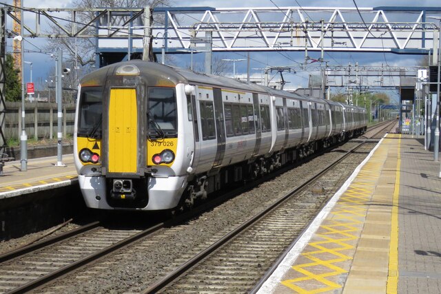
Transportation links are excellent, with Cheshunt being well-connected to neighboring towns and London. It has its own railway station, providing regular services to Liverpool Street Station in the heart of the capital. The town is also conveniently located near major road networks, including the M25 motorway, allowing for easy access to other parts of the country.

Cheshunt is home to a number of schools, making it an attractive place for families. It also benefits from a strong sense of community, with various local events and activities organized throughout the year. Overall, Cheshunt offers a balanced mix of historical charm, modern amenities, and convenient transportation links, making it an appealing place to live or visit.

If you have any feedback on the listing, please let us know in the comments section below.
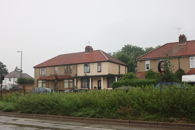
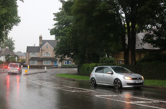
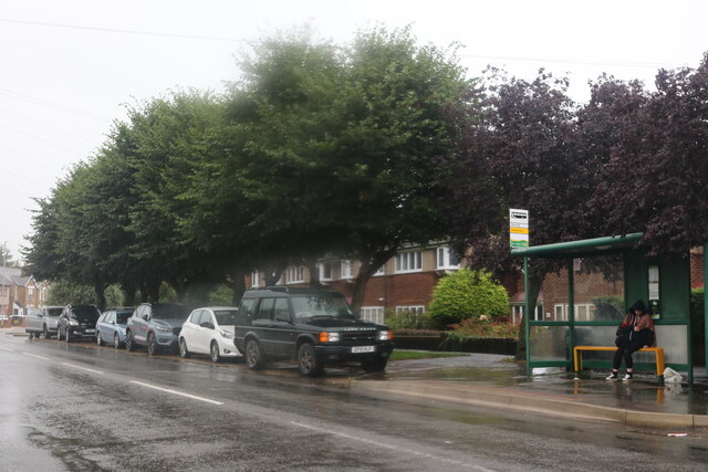
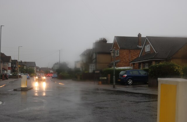
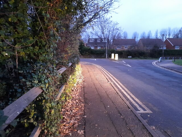
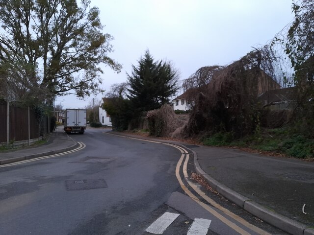
Cheshunt Images

Images are sourced within 2km of 51.702623/-0.042755845 or Grid Reference TL3502. Thanks to Geograph Open Source API. All images are credited.

The Great Cambridge Road, Cheshunt
College Road, Cheshunt
Churchgate, Cheshunt Wet wet wet
Churchgate, Cheshunt
Wet wet wet
Roundabout on Churchgate, Cheshunt
Cheshunt Railway Station A class 379 Electric Multiple Unit departing from Cheshunt.
Cheshunt Railway Station
A class 379 Electric Multiple Unit departing from Cheshunt.
High Street, Waltham Cross
Shops on High Street, Cheshunt
Hunger Cure cafe on High Street, Waltham Cross
Waltham Cross Job Centre
Flats on Crossbrook Street, Cheshunt
Mill Lane at the junction of High Street, Cheshunt
Brookfield Lane West, Turnford The road is split in two by the A10
Brookfield Lane West, Turnford
The road is split in two by the A10
Field by Brookfield Lane West, Turnford
Brookfield Lane West, Turnford
Houses on Brookfield Lane West, Turnford
Southbrook Drive, Turnford
Brookfield Lane West, Turnford
Show me another place!

Cheshunt is located at Grid Ref: TL3502 (Lat: 51.702623, Lng: -0.042755845)

Administrative County: Hertfordshire

District: Broxbourne

Police Authority: Hertfordshire

What 3 Words

///broad.reply.bland. Near Cheshunt, Hertfordshire

Nearby Locations

Cheshunt

Related Wikis

Goffs-Churchgate Academy

Goffs-Churchgate Academy is a secondary school with academy status located in Cheshunt, Hertfordshire, England with around 600 students. == History... ==

Bishops' College, Cheshunt

Bishops' College, Cheshunt was an Anglican theological College set up to train clergy to serve in the Church of England. It was housed in buildings formerly...

Cheshunt

Cheshunt ( CHEZ-ənt) is a town in the Borough of Broxbourne in Hertfordshire, England, 13 miles (21 km) north of London on the River Lea and Lee Navigation...

F.C. Romania

Football Club Romania is a football club based in Cheshunt, Hertfordshire, England. The club are members of the Spartan South Midlands League Premier Division...

Cheshunt F.C.

Cheshunt Football Club is a football club based in Cheshunt, Hertfordshire, England. They are currently members of the Isthmian League Premier Division...

Goffs Academy

Goffs Academy is a selective secondary school and sixth form with academy status located in Cheshunt, Hertfordshire, England with around 1,300 students...

Tesco

Tesco plc () is a British multinational groceries and general merchandise retailer headquartered in Welwyn Garden City, England. In 2011, it was the third...

St Mary's Church of England High School

St Mary's Church of England High School is a mixed secondary school and sixth form located in Cheshunt, Hertfordshire, England. It is a Church of England...

Nearby Amenities

Located within 500m of 51.702623,-0.042755845
Created By: YahooApplet 1.0
Lat/Long: 51.7063235/-0.043306
Mini Roundabout
Direction: clockwise
Lat/Long: 51.7020332/-0.0459536
Created By: YahooApplet 1.0
Lat/Long: 51.70257/-0.0483561
Created By: YahooApplet 1.0
Lat/Long: 51.7054391/-0.038362
Created By: YahooApplet 1.0
Lat/Long: 51.705961/-0.0436139
Churchgate
Created By: POI Editor
Place: village
Source: npe
Lat/Long: 51.7036997/-0.0486377
Noexit: yes
Lat/Long: 51.7066856/-0.0421052
Noexit: yes
Lat/Long: 51.7055154/-0.0428353
Noexit: yes
Lat/Long: 51.7066363/-0.0403263
Noexit: yes
Lat/Long: 51.7063629/-0.0391369
Barrier: bollard
Lat/Long: 51.6994804/-0.0391863
Noexit: yes
Lat/Long: 51.7001724/-0.0370662
Noexit: yes
Lat/Long: 51.6998687/-0.0381725
Noexit: yes
Lat/Long: 51.6989755/-0.0391306
Crossing
Lat/Long: 51.70266/-0.0385452
Crossing
Crossing: traffic_signals
Crossing Ref: pelican
Lat/Long: 51.7022323/-0.0357807
Fire Station
Cheshunt Fire Station
Lat/Long: 51.7023362/-0.0379415
Noexit: yes
Lat/Long: 51.7014161/-0.0418143
Noexit: yes
Lat/Long: 51.7053011/-0.0447539
Post Box
Created By: Potlatch 0.9c
Lat/Long: 51.7044508/-0.0483443
Bus Stop
Elgin Road
Naptan AtcoCode: 210021700320
Naptan Bearing: W
Naptan CommonName: Elgin Road
Naptan Crossing: Great Cambridge Road
Naptan Indicator: adj
Naptan Landmark: Great Cambridge Road
Naptan NaptanCode: hrtamgwg
Naptan PlusbusZoneRef: CHESHNT
Naptan ShortCommonName: NA
Naptan Street: College Road
Naptan Verified: no
Public Transport: platform
Source: naptan_import
Lat/Long: 51.702665/-0.0419071
Bus Stop
Bishops' College
Naptan AtcoCode: 210021700340
Naptan Bearing: W
Naptan CommonName: Bishops' College
Naptan Crossing: Cromwell Avenue
Naptan Indicator: opp
Naptan Landmark: Cromwell Avenue
Naptan NaptanCode: hrtamgwj
Naptan PlusbusZoneRef: CHESHNT
Naptan ShortCommonName: NA
Naptan Street: College Road
Naptan Verified: no
Public Transport: platform
Source: naptan_import
Lat/Long: 51.7019314/-0.0480751
Bus Stop
Bishops' College
Local Ref: NR
Naptan AtcoCode: 210021703240
Naptan Bearing: S
Naptan CommonName: Bishops' College
Naptan Crossing: Council Offices
Naptan Indicator: nr
Naptan Landmark: Council Offices
Naptan NaptanCode: hrtajwga
Naptan PlusbusZoneRef: CHESHNT
Naptan ShortCommonName: NA
Naptan Street: Churchgate
Naptan Verified: no
Public Transport: platform
Source: naptan_import
Lat/Long: 51.7026447/-0.048247
Bus Stop
The Crocodile PH
Local Ref: NR
Naptan AtcoCode: 210021703260
Naptan Bearing: E
Naptan CommonName: The Crocodile PH
Naptan Indicator: nr
Naptan Landmark: Unknown
Naptan NaptanCode: hrtajwgj
Naptan PlusbusZoneRef: CHESHNT
Naptan ShortCommonName: NA
Naptan Street: College Road
Naptan Verified: no
Public Transport: platform
Source: naptan_import
Wheelchair: yes
Lat/Long: 51.7023817/-0.0448718
Bus Stop
Elgin Road
Naptan AtcoCode: 210021703280
Naptan Bearing: E
Naptan CommonName: Elgin Road
Naptan Crossing: Blindman's Lane
Naptan Indicator: opp
Naptan Landmark: Blindman's Lane
Naptan NaptanCode: hrtajwgm
Naptan PlusbusZoneRef: CHESHNT
Naptan ShortCommonName: NA
Naptan Street: College Road
Naptan Verified: no
Public Transport: platform
Source: naptan_import
Lat/Long: 51.7027894/-0.0411563
Parking
Parking: street_side
Lat/Long: 51.6995271/-0.0441583
Noexit: yes
Lat/Long: 51.7041002/-0.0445271
Noexit: yes
Lat/Long: 51.7037332/-0.0444126
Pub
The Crocodile
Toilets: yes
Toilets Access: customers
Lat/Long: 51.7027715/-0.0442702
Noexit: yes
Lat/Long: 51.7031719/-0.0390804
Pub
The Green Dragon
Addr Housename: The Green Dragon
Addr Housenumber: 62
Addr Postcode: EN8 9NF
Addr Street: Churchgate
Source: Local Knowledge
Wikidata: Q26393035
Lat/Long: 51.7039894/-0.048064
Mini Roundabout
Direction: clockwise
Lat/Long: 51.7022056/-0.0456181
Huntingdon Suite
Lat/Long: 51.7037118/-0.0479219
Bench
Lat/Long: 51.703069/-0.0463599
Bench
Lat/Long: 51.7039426/-0.0451467
Bench
Lat/Long: 51.7029358/-0.0464971
Noexit: yes
Lat/Long: 51.7032968/-0.0440551
Noexit: yes
Lat/Long: 51.7030464/-0.0368543
Noexit: yes
Lat/Long: 51.7019795/-0.0438591
Noexit: yes
Lat/Long: 51.701159/-0.0438435
Noexit: yes
Lat/Long: 51.7017134/-0.043669
Noexit: yes
Lat/Long: 51.7015658/-0.0457071
Noexit: yes
Lat/Long: 51.7069187/-0.0420479
Noexit: yes
Lat/Long: 51.7018193/-0.0436127
Ambulance Station
Emergency: ambulance_station
Lat/Long: 51.7023532/-0.0376837
Noexit: yes
Lat/Long: 51.7018593/-0.0356457
Noexit: yes
Lat/Long: 51.7021767/-0.0381381
Noexit: yes
Lat/Long: 51.7044994/-0.0386938
Noexit: yes
Lat/Long: 51.7031347/-0.044035
Noexit: yes
Lat/Long: 51.7029678/-0.0439705
Noexit: yes
Lat/Long: 51.7016749/-0.0485533
Traffic Signals
Traffic Signals Direction: backward
Lat/Long: 51.70222/-0.035711
Traffic Signals
Traffic Signals Direction: forward
Lat/Long: 51.7022462/-0.0358622
Noexit: yes
Lat/Long: 51.7046688/-0.0468925
Noexit: yes
Lat/Long: 51.7014594/-0.0478867
Noexit: yes
Lat/Long: 51.7054113/-0.0377516
Noexit: yes
Lat/Long: 51.7052204/-0.0479255
Nicholas Shoe Reparis
Addr City: Cheshunt
Addr Housenumber: 18
Addr Postcode: EN8 9NU
Addr Street: Newnham Parade
Phone: +1 01992 636622
Shop: shoe_repair
Lat/Long: 51.7024309/-0.0359598
Fast Food
Domino's
Addr City: Cheshunt
Addr Housenumber: 17
Addr Postcode: EN8 9NU
Addr Street: Newnham Parade
Brand: Domino's
Brand Wikidata: Q839466
Cuisine: pizza
Takeaway: yes
Lat/Long: 51.7024238/-0.0358884
Noexit: yes
Lat/Long: 51.7028332/-0.035553
Nisa Local
Addr City: Cheshunt
Addr Housenumber: 16
Addr Postcode: EN8 9NU
Addr Street: Newnham Parade
Brand: Nisa Local
Brand Wikidata: Q16999069
Shop: convenience
Lat/Long: 51.7024045/-0.035781
Restaurant
Pizza Hut
Addr City: Cheshunt
Addr Housenumber: 15
Addr Postcode: EN8 9NU
Addr Street: Newnham Parade
Brand: Pizza Hut
Brand Wikidata: Q191615
Cuisine: pizza
Fhrs Id: 166620
Lat/Long: 51.7023876/-0.0356929
Fast Food
Fishy Delishy
Addr City: Cheshunt
Addr Housenumber: 14
Addr Postcode: EN8 9NU
Addr Street: Newnham Parade
Cuisine: fish_and_chips
Lat/Long: 51.7023719/-0.0355806
Noexit: yes
Lat/Long: 51.7024975/-0.0405443
Noexit: yes
Lat/Long: 51.7010603/-0.0425457
Noexit: yes
Lat/Long: 51.7026292/-0.0437179
Traffic Signals
Traffic Signals: signal
Lat/Long: 51.702716/-0.042875
Traffic Signals
Traffic Signals: signal
Lat/Long: 51.7027238/-0.0429969
Traffic Signals
Traffic Signals: signal
Lat/Long: 51.7026088/-0.0427083
Traffic Signals
Traffic Signals: signal
Lat/Long: 51.7023902/-0.0432327
Traffic Signals
Traffic Signals: signal
Lat/Long: 51.702397/-0.0431398
Crossing
Crossing: unmarked
Lat/Long: 51.7019258/-0.0474691
Traffic Signals
Traffic Signals: signal
Lat/Long: 51.702389/-0.0430594
Traffic Signals
Traffic Signals: signal
Lat/Long: 51.7025749/-0.0432894
Addr Housename: Newnham Parade
Addr Housenumber: 19-28
Addr Street: College Road
Lat/Long: 51.7024191/-0.0359854
The data included in this document is from www.openstreetmap.org. The data is made available under ODbL.

Have you been to Cheshunt?

Leave your review of Cheshunt below (or comments, questions and feedback).