Chesham Bois

Settlement in Buckinghamshire

England

Chesham Bois

Chess Business Park, Moor Road, Chesham Showing Units 27 (left) and 33 (right). The car with one of its wheels off is mine.
Chess Business Park, Moor Road, Chesham Credit: David Kemp

Chesham Bois is a picturesque village located in the Chiltern Hills, Buckinghamshire, England. Situated just over 2 miles southeast of the town of Chesham, it is a desirable residential area known for its natural beauty and peaceful ambiance.

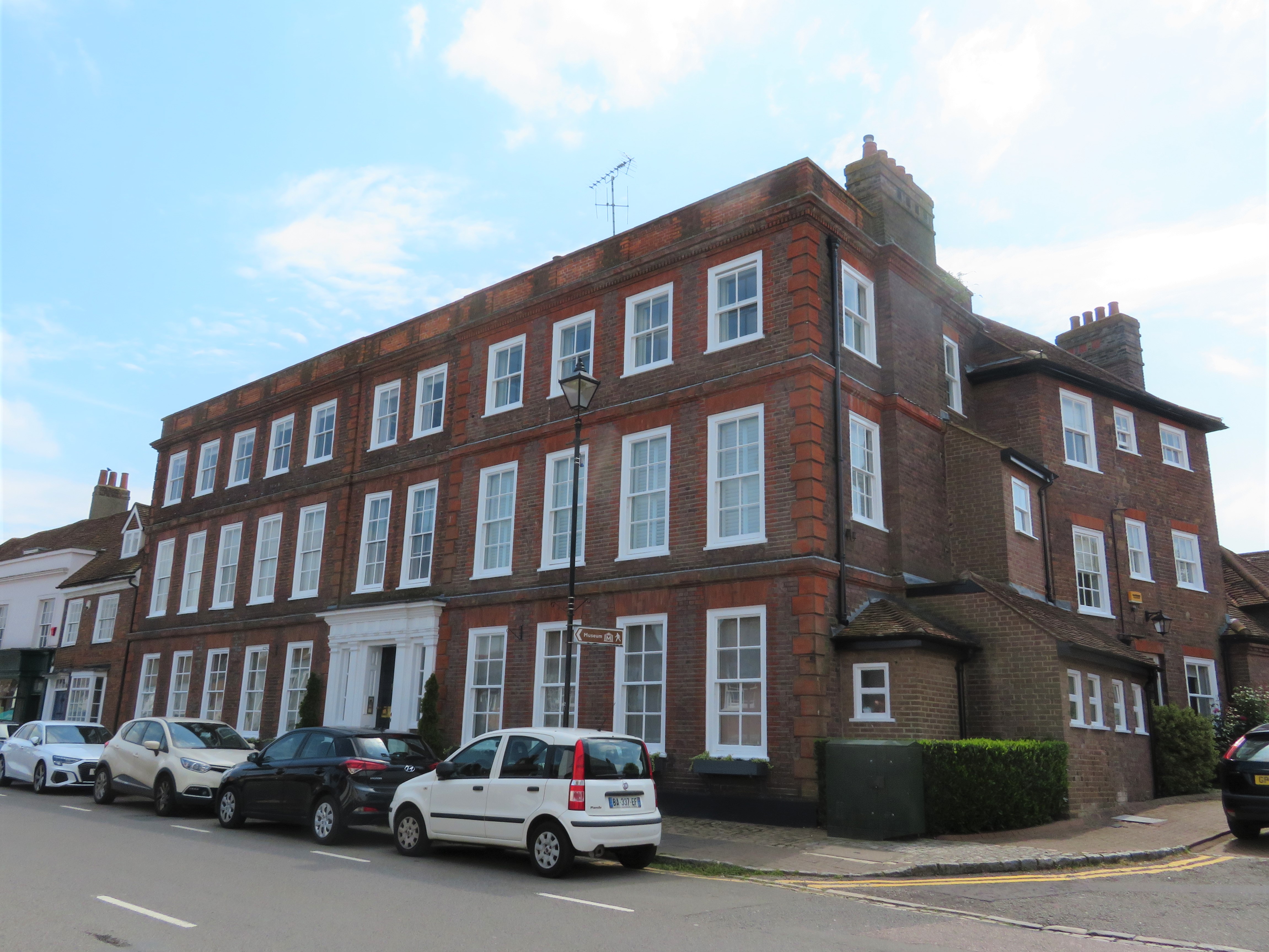
The village is characterized by its tree-lined streets, charming cottages, and well-maintained gardens. It offers a mix of architectural styles, ranging from traditional brick and flint buildings to more modern designs. The lush greenery of the surrounding countryside, including the nearby Chesham Bois Woods and Lowndes Park, adds to the village's appeal.

Chesham Bois has a strong sense of community, with various local amenities catering to its residents. These include a well-regarded primary school, a village hall, a local convenience store, and a selection of quaint shops and cafes. The area also benefits from excellent transport links, with Chesham Underground station providing easy access to Central London.

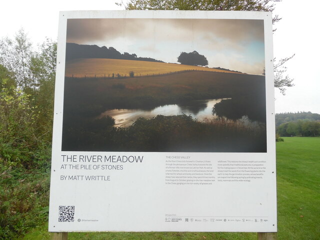
Nature enthusiasts are drawn to Chesham Bois for its abundance of outdoor activities. The nearby woods offer scenic walking trails, while the nearby River Chess provides opportunities for fishing and boating. The village is also home to several sports clubs, including cricket, tennis, and golf, catering to those with athletic interests.

Overall, Chesham Bois offers a tranquil and idyllic setting for those seeking a peaceful village lifestyle, while still being within easy reach of urban amenities.

If you have any feedback on the listing, please let us know in the comments section below.
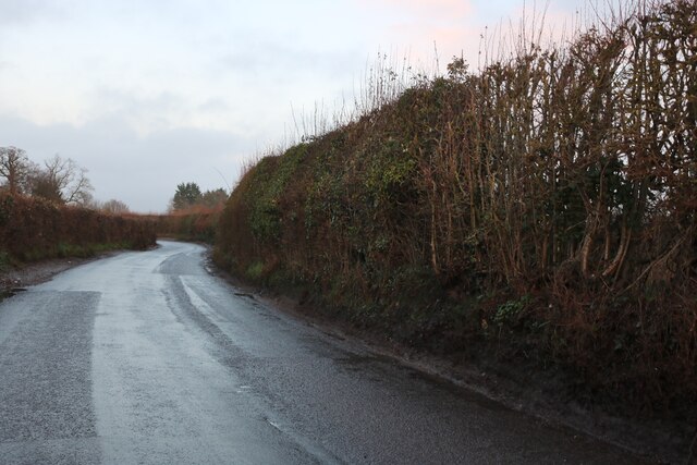
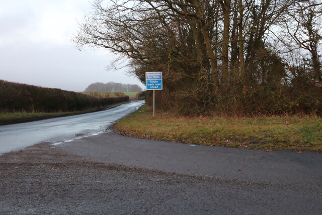
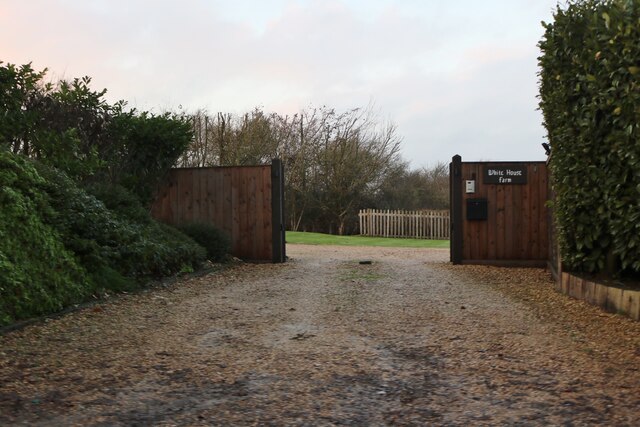
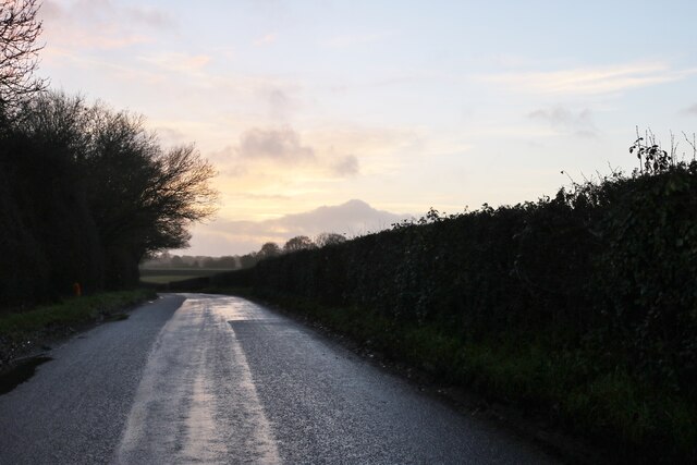
Chesham Bois Images

Images are sourced within 2km of 51.683572/-0.607788 or Grid Reference SU9699. Thanks to Geograph Open Source API. All images are credited.

Chess Business Park, Moor Road, Chesham Showing Units 27 (left) and 33 (right). The car with one of its wheels off is mine.
Chess Business Park, Moor Road, Chesham
Showing Units 27 (left) and 33 (right). The car with one of its wheels off is mine.
Fullers Hill, Chesham
Fullers Lane at the junction of Copperkins Lane
The entrance to White House Farm, Chesham
Fullers Hill, Chesham
Pasture, Chesham A view across a dry valley from the footpath to the east of Hill Farm.
Pasture, Chesham
A view across a dry valley from the footpath to the east of Hill Farm.
Information Board at Cannon Mill This information board is on the Chess Valley Walk near Latimer Road in Waterside. It has the following wording:

       Cannon Mill
 Mentioned in the Domesday Book, Cannon Mill was named after the Canons of Missenden 
 Abbey, its 13th century owners. Originally a corn mill, it was later converted to produce animal
 feed. It ceased working in 1936 and was demolished c.1960. The brick foundations, weir and
 mill race can still be seen.
  
 Left column
 The diverted river
 The river once flowed along the valley bottom through what is now the Moor Recreation 
 Ground. When the mill was built, the river was diverted into an artificial channel known as a
 leat, to create a head of water to drive the mill wheel. A small channel, which bypassed the 
 mill, can still be seen flowing parallel to the leat. This channel was used to take excess water
 around the mill.
 Photo of Alfred Gee (left) and some of his mill workers.
 Sheep dipping
 Sheep dipping was an interesting sight at Cannon Mill in the early 20th century. Alfred Gee, 
 who was miller from the 1870s to 1936, would board up a section of the bypass stream to
 form a trough, into which the sheep dip was poured and the sheep were taken in.
 Image of Greater willowherb

 Middle Column
 Photo: Cannon Mill was disused from the 1930s
 Brown trout
 Brown trout live in this part of the Chess and you may be lucky to see them darting between 
 the ripples. Trout need oxygen-rich, fast-flowing water and a clean gravel bed to spawn. In
 the winter months, you may spot a redd; a small depression in the gravel bed that the female
 excavates to lay her eggs in. 
 Cannon Mill was one of 13 mills along the Chess, each having its own system of weirs and 
 sluices. These structures prevent fish from moving up or downstream, making populations
 vulnerable to dying out if there is drought or pollution. To rectify this, in 2008 small pipes
 were removed which had linked the bypass to the main river, and were replaced with an open 
 channel. This means fish can now move freely around the old mill weir.
 Riverflies
 Riverflies thrive in clean, fast-flowing chalk streams like the Chess. They play a vital role in 
 maintaining the habitat, helping to break down organic matter such as leaves and branches, 
 and provide a food source for fish, birds and mammals. Many are sensitive to pollution and so
 can be monitored to assess the health of rivers.
 Photo of Mayfly (baetis)
 There are 51 species of mayfly found in the UK.
 They are herbivores, feeding on algae that they scrape from gravel and river weed.
 Photo of Stonefly
 Stonefly nymphs are poor swimmers preferring to cling to the weed or undersides of rocks in
 fast-flowing water.
 Photo of Cased caddifly
 Cased caddisfly larvae live with a protective case that they construct from materials such as
 and, gravel and vegetation.
 From left to right  Mayfly (baetis) length     Stonefly length          Caddisfly length
                                    12mm approx                   10mm approx               25mm approx

  Right column
  Image of Grey heron
  Fish facts!   Photo of Brown trout
  • Brown trout can live for up to 20 years, but most die before they are a year old.
  • Brown trout are predators, eating insects, fish and even small mammals.
  • Trout have teeth, even on the roofs of their mouths.
  • Trout can change colour to match their mood!
  Map of the Chess Valley Walk from Chesham to Rickmansworth
 
 Foot of the board from left to right
 QR Code,  chilternstreams.org, Chiltern Chalk Streams Project, Chiltern Society, Chilterns
 Conservation Board.
 This board was produced as part of the Chalk Streams and Wetland Meadows Project a
 partnership between the Chilterns Chalk Streams Project, Chiltern Society and the Chilterns
 Conservation Board. It was funded by the Green Recovery Challenge Fund, Chesham Town
 Council and the Chilterns Chalk Streams Project. Design: Amanda Carroll studiobeam.co.uk
 Green Recovery Challenge Fund: Department for Environment, Food & Rural Affairs, The
 National Lottery Heritage Fund, Environment Agency, Natural England
 Meadows
 
                                  12mm approx
Information Board at Cannon Mill
This information board is on the Chess Valley Walk near Latimer Road in Waterside. It has the following wording: Cannon Mill Mentioned in the Domesday Book, Cannon Mill was named after the Canons of Missenden Abbey, its 13th century owners. Originally a corn mill, it was later converted to produce animal feed. It ceased working in 1936 and was demolished c.1960. The brick foundations, weir and mill race can still be seen. Left column The diverted river The river once flowed along the valley bottom through what is now the Moor Recreation Ground. When the mill was built, the river was diverted into an artificial channel known as a leat, to create a head of water to drive the mill wheel. A small channel, which bypassed the mill, can still be seen flowing parallel to the leat. This channel was used to take excess water around the mill. Photo of Alfred Gee (left) and some of his mill workers. Sheep dipping Sheep dipping was an interesting sight at Cannon Mill in the early 20th century. Alfred Gee, who was miller from the 1870s to 1936, would board up a section of the bypass stream to form a trough, into which the sheep dip was poured and the sheep were taken in. Image of Greater willowherb Middle Column Photo: Cannon Mill was disused from the 1930s Brown trout Brown trout live in this part of the Chess and you may be lucky to see them darting between the ripples. Trout need oxygen-rich, fast-flowing water and a clean gravel bed to spawn. In the winter months, you may spot a redd; a small depression in the gravel bed that the female excavates to lay her eggs in. Cannon Mill was one of 13 mills along the Chess, each having its own system of weirs and sluices. These structures prevent fish from moving up or downstream, making populations vulnerable to dying out if there is drought or pollution. To rectify this, in 2008 small pipes were removed which had linked the bypass to the main river, and were replaced with an open channel. This means fish can now move freely around the old mill weir. Riverflies Riverflies thrive in clean, fast-flowing chalk streams like the Chess. They play a vital role in maintaining the habitat, helping to break down organic matter such as leaves and branches, and provide a food source for fish, birds and mammals. Many are sensitive to pollution and so can be monitored to assess the health of rivers. Photo of Mayfly (baetis) There are 51 species of mayfly found in the UK. They are herbivores, feeding on algae that they scrape from gravel and river weed. Photo of Stonefly Stonefly nymphs are poor swimmers preferring to cling to the weed or undersides of rocks in fast-flowing water. Photo of Cased caddifly Cased caddisfly larvae live with a protective case that they construct from materials such as and, gravel and vegetation. From left to right Mayfly (baetis) length Stonefly length Caddisfly length 12mm approx 10mm approx 25mm approx Right column Image of Grey heron Fish facts! Photo of Brown trout • Brown trout can live for up to 20 years, but most die before they are a year old. • Brown trout are predators, eating insects, fish and even small mammals. • Trout have teeth, even on the roofs of their mouths. • Trout can change colour to match their mood! Map of the Chess Valley Walk from Chesham to Rickmansworth Foot of the board from left to right QR Code, chilternstreams.org, Chiltern Chalk Streams Project, Chiltern Society, Chilterns Conservation Board. This board was produced as part of the Chalk Streams and Wetland Meadows Project a partnership between the Chilterns Chalk Streams Project, Chiltern Society and the Chilterns Conservation Board. It was funded by the Green Recovery Challenge Fund, Chesham Town Council and the Chilterns Chalk Streams Project. Design: Amanda Carroll studiobeam.co.uk Green Recovery Challenge Fund: Department for Environment, Food & Rural Affairs, The National Lottery Heritage Fund, Environment Agency, Natural England Meadows 12mm approx
The River Meadow at the Pile of Stones Board-Weirhouse Mill This board is one of ten together on Chesham Moor with photographs by Matt Writtle. It has the following wording:
                          THE RIVER MEADOW
                          AT THE PILE OF STONES
 
  WEIRHOUSE MILL 
  As the River Chess meanders downstream and leaves the residential streets of Chesham 
 behind, the last of the big four - and best preserved- mills stands proudly as the flow of the 
 river's channels forms around it. Over the centuries, Weirhouse Mill was mainly used for
 grinding corn and making paper, but what it set aside from the other mills was its highly
 valuable brown trout farm, which continued until the late 20th century.
 The site is now home to construction and industrial supplies distribution company Decco Ltd.
 The Chesham branch is one of fifteen locations around the UK that together employ over 250
 workers in three distinct markets: high street retailers, garden centres and building and
 engineering.
The River Meadow at the Pile of Stones Board-Weirhouse Mill
This board is one of ten together on Chesham Moor with photographs by Matt Writtle. It has the following wording: THE RIVER MEADOW AT THE PILE OF STONES WEIRHOUSE MILL As the River Chess meanders downstream and leaves the residential streets of Chesham behind, the last of the big four - and best preserved- mills stands proudly as the flow of the river's channels forms around it. Over the centuries, Weirhouse Mill was mainly used for grinding corn and making paper, but what it set aside from the other mills was its highly valuable brown trout farm, which continued until the late 20th century. The site is now home to construction and industrial supplies distribution company Decco Ltd. The Chesham branch is one of fifteen locations around the UK that together employ over 250 workers in three distinct markets: high street retailers, garden centres and building and engineering.
The River Meadow at the Pile of Stones Board- The Chess Valley This board is one of ten on Chesham Moor with photographs by Matt Writtle. It has the following wording:
 THE RIVER MEADOW AT THE PILE OF STONES.

 THE CHESS VALLEY
 As the River Chess bids farewell to Chesham, it flows through the picturesque Chess Valley 
 towards the site of a Roman Villa now known as Latimer Park. As well as a hotel, fisheries,
 charities and small businesses, the land is farmed for wheat and barley and livestock. Once
 the sheep have weaned their lambs, they spend three months, from August to October, grazing
 on the river meadow next to the Chess, gorging on the rich variety of grasses and wildflower.
 This restores the sheep's health and condition more speedily than traditional pastures, in
 preparation for the mating season in November. At the same time the sheep tread the seeds
 from the flowering plants into the earth to help the germination process, whose benefits are
 reaped the following spring by pollinating insects, birds, mammals and the wider ecology.
The River Meadow at the Pile of Stones Board- The Chess Valley
This board is one of ten on Chesham Moor with photographs by Matt Writtle. It has the following wording: THE RIVER MEADOW AT THE PILE OF STONES. THE CHESS VALLEY As the River Chess bids farewell to Chesham, it flows through the picturesque Chess Valley towards the site of a Roman Villa now known as Latimer Park. As well as a hotel, fisheries, charities and small businesses, the land is farmed for wheat and barley and livestock. Once the sheep have weaned their lambs, they spend three months, from August to October, grazing on the river meadow next to the Chess, gorging on the rich variety of grasses and wildflower. This restores the sheep's health and condition more speedily than traditional pastures, in preparation for the mating season in November. At the same time the sheep tread the seeds from the flowering plants into the earth to help the germination process, whose benefits are reaped the following spring by pollinating insects, birds, mammals and the wider ecology.
The River Meadow at the Pile of Stones Board-Hollywell Spring This board is one of ten on Chesham Moor with photographs by Matt Writtle. It has the following wording:
           THE RIVER MEADOW
           AT THE PILE OF STONES
           BY MATT WRITTLE

 HOLLYWELL SPRING
 Sitting alongside the path of the Chess Valley Walk in Waterside is the boundary of Hollywell
 Spring. The site is owned by Eccleston Properties Inc. of Chicago, Illinois, USA, which has 
 been rumoured to have had designs on developing it as a luxury housing complex complete
 with an environmental wonderland. Within its borders are several artesian wells which were
 originally dug in the Victorian era to farm watercress but was also successfully used as a trout
 farm. More recently it was owned by PowWow Water Company Ltd, a subsidiary of
 confectionery giant Nestlé, who used the wells to supply spring drinking water for 
 watercoolers in businesses across Britain. In 2003, the company was allowed to double its
 extraction quota - much to the consternation of residents and local councillor Justine Fulford,
 who campaigned to prevent the extension of the licence to extract water on the grounds that it
 was hurting the local environment. The total amount PowWow abstracted from the local
 catchment was 0.16%. The company went into administration in 2010.
The River Meadow at the Pile of Stones Board-Hollywell Spring
This board is one of ten on Chesham Moor with photographs by Matt Writtle. It has the following wording: THE RIVER MEADOW AT THE PILE OF STONES BY MATT WRITTLE HOLLYWELL SPRING Sitting alongside the path of the Chess Valley Walk in Waterside is the boundary of Hollywell Spring. The site is owned by Eccleston Properties Inc. of Chicago, Illinois, USA, which has been rumoured to have had designs on developing it as a luxury housing complex complete with an environmental wonderland. Within its borders are several artesian wells which were originally dug in the Victorian era to farm watercress but was also successfully used as a trout farm. More recently it was owned by PowWow Water Company Ltd, a subsidiary of confectionery giant Nestlé, who used the wells to supply spring drinking water for watercoolers in businesses across Britain. In 2003, the company was allowed to double its extraction quota - much to the consternation of residents and local councillor Justine Fulford, who campaigned to prevent the extension of the licence to extract water on the grounds that it was hurting the local environment. The total amount PowWow abstracted from the local catchment was 0.16%. The company went into administration in 2010.
The River Meadow at the Pile of Stones Board - Cannon Mill This board is one of ten on Chesham Moor with photographs by Matt Writtle. It has the following wording:

   THE RIVER MEADOW
   AT THE PILE OF STONES
   BY MATT WRITTLE

  CANNON MILL
  Cannon Mill was one of the most productive of the corn mills along the Chesham stretch of 
 the River Chess. It acquired its name when it belonged to the canons of the local Missenden
 Abbey. A combined farmstead and mill, it latterly belonged to the Cheynes family, who also
 owned adjoining land to the west called Cannon Mead. The mill had grandeur. It was built on
 to the mill-house with an adjoining cottage below the right bank, with whitewashed brick 
 walls, wooden upper walls and a shallow slate roof. The mill's position was unusual, as the
 cottage below the right bank was almost face-to-face with the weir and sluice-gate, making it
 appear that a flood would wash the cottage away. However, the bypass turned and led away
 behind the cottage and mill, powered by an iron overshot wheel. By the 1930s, the mill was felt
 to be too unprofitable and it was demolished in 1960.
The River Meadow at the Pile of Stones Board - Cannon Mill
This board is one of ten on Chesham Moor with photographs by Matt Writtle. It has the following wording: THE RIVER MEADOW AT THE PILE OF STONES BY MATT WRITTLE CANNON MILL Cannon Mill was one of the most productive of the corn mills along the Chesham stretch of the River Chess. It acquired its name when it belonged to the canons of the local Missenden Abbey. A combined farmstead and mill, it latterly belonged to the Cheynes family, who also owned adjoining land to the west called Cannon Mead. The mill had grandeur. It was built on to the mill-house with an adjoining cottage below the right bank, with whitewashed brick walls, wooden upper walls and a shallow slate roof. The mill's position was unusual, as the cottage below the right bank was almost face-to-face with the weir and sluice-gate, making it appear that a flood would wash the cottage away. However, the bypass turned and led away behind the cottage and mill, powered by an iron overshot wheel. By the 1930s, the mill was felt to be too unprofitable and it was demolished in 1960.
The River Meadow at the Pile of Stones Board - Blue Mind This board is one of ten on Chesham Moor with photographs by Matt Writtle. It has the following wording:
                                         THE RIVER MEADOW
                                          AT THE PILE OF STONES 
                                          BY MATT WRITTLE

                                           BLUE MIND
  With the River chess mills long gone, a new industry is pervading life in the 21st century
  digital culture. The technological revolution has changed the way we use our time and the
  demands put upon it. Mental health is a widely recognised condition to arise from the frenetic
  pace of modern living. with 1 in 4 adults in the UK experiencing mental health issues each 
  year.
  According to NHS England, green environments can reduce stress, fatigue, anxiety and
  depression. Contact with nature has a positive impact on heart rate and blood pressure.
  Greenness in residential areas and the use of natural places for recreation are linked with 
  lower levels of cortisol, the body's main stress hormone. Treatments such as tree-bathing,
  meditation and aromatherapy, which were once met with scepticism, are now commonplace.
  Scientists are now also quantifying the positive cognitive and physical effects of water.
  According to Dr Wallace J Nichols, marine biologist and author of Blue Mind, being close to 
  water can bring about a meditative state that makes us happier, healthier, calmer and more
  creative.
  Water is considered the elixir and source of life. This deep biological connection has been
  shown to trigger an immediate response in our brains when near water and can induce a
  flood of neurochemicals that promote wellness, increase blood flow to the brain and heart and
  induce relaxation.
The River Meadow at the Pile of Stones Board - Blue Mind
This board is one of ten on Chesham Moor with photographs by Matt Writtle. It has the following wording: THE RIVER MEADOW AT THE PILE OF STONES BY MATT WRITTLE BLUE MIND With the River chess mills long gone, a new industry is pervading life in the 21st century digital culture. The technological revolution has changed the way we use our time and the demands put upon it. Mental health is a widely recognised condition to arise from the frenetic pace of modern living. with 1 in 4 adults in the UK experiencing mental health issues each year. According to NHS England, green environments can reduce stress, fatigue, anxiety and depression. Contact with nature has a positive impact on heart rate and blood pressure. Greenness in residential areas and the use of natural places for recreation are linked with lower levels of cortisol, the body's main stress hormone. Treatments such as tree-bathing, meditation and aromatherapy, which were once met with scepticism, are now commonplace. Scientists are now also quantifying the positive cognitive and physical effects of water. According to Dr Wallace J Nichols, marine biologist and author of Blue Mind, being close to water can bring about a meditative state that makes us happier, healthier, calmer and more creative. Water is considered the elixir and source of life. This deep biological connection has been shown to trigger an immediate response in our brains when near water and can induce a flood of neurochemicals that promote wellness, increase blood flow to the brain and heart and induce relaxation.
The River Meadow at the Pile of Stones board - Stepping Stones This board is one of ten on Chesham Moor with photographs by Matt Writtle. It has the following wording:
                                                  THE RIVER MEADOW
                                                  AT THE PILE OF STONES
                                                  BY MATT WRITTLE

 Located at the south east of Chesham Moor, stepping stones provide safe passage across a 
 bend in the River Chess. Initially installed by the community in the 1990s, the stones have 
 been maintained with the help of Chesham Environmental Group and River Chess 
 Association. This is a popular spot for visitors to the Moor to cross from the open playing
 field into the woodland that envelopes the many channels of the river and continues onwards
 through the Chess Valley.
The River Meadow at the Pile of Stones board - Stepping Stones
This board is one of ten on Chesham Moor with photographs by Matt Writtle. It has the following wording: THE RIVER MEADOW AT THE PILE OF STONES BY MATT WRITTLE Located at the south east of Chesham Moor, stepping stones provide safe passage across a bend in the River Chess. Initially installed by the community in the 1990s, the stones have been maintained with the help of Chesham Environmental Group and River Chess Association. This is a popular spot for visitors to the Moor to cross from the open playing field into the woodland that envelopes the many channels of the river and continues onwards through the Chess Valley.
The River Meadow at the Pile of Stones board-The Balks This board is one of ten on Chesham Moor with photographs by Matt Writtle. It has the following 
wording:

                                   THE RIVER MEADOW
                                   AT THE PILE OF STONES
                                   BY MATT WRITTLE
 
 The Balks, as they are known locally, are a series of cultivation terraces, rumoured to have
 been created by the Saxons to farm crops without being affected by the springs and marshes
 below. Many of the terraces have been destroyed: the upper slopes were ploughed for
 livestock farming and the lower slopes demolished to accommodate the Metropolitan train
 line. In 1869, the middle section became the site of Chesham Hospital and retained so until its
 closure in 2005. With the hospital buildings demolished, the site is now subject to planning
 permission for development as a residential care home.
The River Meadow at the Pile of Stones board-The Balks
This board is one of ten on Chesham Moor with photographs by Matt Writtle. It has the following wording: THE RIVER MEADOW AT THE PILE OF STONES BY MATT WRITTLE The Balks, as they are known locally, are a series of cultivation terraces, rumoured to have been created by the Saxons to farm crops without being affected by the springs and marshes below. Many of the terraces have been destroyed: the upper slopes were ploughed for livestock farming and the lower slopes demolished to accommodate the Metropolitan train line. In 1869, the middle section became the site of Chesham Hospital and retained so until its closure in 2005. With the hospital buildings demolished, the site is now subject to planning permission for development as a residential care home.
The River Meadow at the Pile of Stones board - Rewilding This board is one of ten on Chesham Moor with photographs by Matt Writtle. It has the following wording:
                                THE RIVER MEADOW
                                AT THE PILE OF STONES
                                BY MATT WRITTLE

  REWILDING
  Despite the many man-made developments alongside the River Chess in Chesham, areas 
  remain where the landscape appears similar to a time before human habitation. This section
  of the Chess, which flows through the hamlet of Waterside, was renowned for its two corn 
  mills - Lord's Mill and Cannon Mill. The echoes of their legacy are still visible through
  waterfalls, channels and millponds. But, as time passes, nature shifts, evolves and reclaims,
 and in an area where the prominence of rewilding is widely known, this could be an 
 opportunity to let nature manage itself.
The River Meadow at the Pile of Stones board - Rewilding
This board is one of ten on Chesham Moor with photographs by Matt Writtle. It has the following wording: THE RIVER MEADOW AT THE PILE OF STONES BY MATT WRITTLE REWILDING Despite the many man-made developments alongside the River Chess in Chesham, areas remain where the landscape appears similar to a time before human habitation. This section of the Chess, which flows through the hamlet of Waterside, was renowned for its two corn mills - Lord's Mill and Cannon Mill. The echoes of their legacy are still visible through waterfalls, channels and millponds. But, as time passes, nature shifts, evolves and reclaims, and in an area where the prominence of rewilding is widely known, this could be an opportunity to let nature manage itself.
The River Meadow at the Pile of Stones board-The Vale This board is one of ten on Chesham Moor with photographs by Matt Writtle. It has the following wording:  
                                                           THE RIVER MEADOW
                                                           AT THE PILE OF STONES
                                                           BY MATT WRITTLE

  THE VALE
  The Chiltern Hills town of Chesham is situated at the confluence of four dry valleys, formed by
  the meltwater at the end of the last Ice Age. The first recorded reference to the town was in the
  will of Lady Elgiva, wife of the King of England, in 970. She referred to it by its Old English
  name of Cæstæleshamm, meaning 'The River Meadow at the Pile of Stones'.
  In the valley, three springs appear and form the River Chess - a chalk stream whose very 
  existence is under threat from excessive water use, winter droughts and the imminent
  development of HS2. The average household water use for washing and drinking in the UK is
  about 140 litres a person, whereas in the Chess catchment it is 170 litres. Recent unusually
  hot summers and dry winters have added to the strain on the River Chess, with the entire
  river area in Chesham sometimes dry throughout the summer months.
The River Meadow at the Pile of Stones board-The Vale
This board is one of ten on Chesham Moor with photographs by Matt Writtle. It has the following wording: THE RIVER MEADOW AT THE PILE OF STONES BY MATT WRITTLE THE VALE The Chiltern Hills town of Chesham is situated at the confluence of four dry valleys, formed by the meltwater at the end of the last Ice Age. The first recorded reference to the town was in the will of Lady Elgiva, wife of the King of England, in 970. She referred to it by its Old English name of Cæstæleshamm, meaning 'The River Meadow at the Pile of Stones'. In the valley, three springs appear and form the River Chess - a chalk stream whose very existence is under threat from excessive water use, winter droughts and the imminent development of HS2. The average household water use for washing and drinking in the UK is about 140 litres a person, whereas in the Chess catchment it is 170 litres. Recent unusually hot summers and dry winters have added to the strain on the River Chess, with the entire river area in Chesham sometimes dry throughout the summer months.
The River Meadow at the Pile of Stones board-Chesham Moor This board is one of ten on Chesham Moor with photographs by Matt Writtle. It has the following wording:
                                             THE RIVER MEADOW
                                             AT THE PILE OF STONES
                                             BY MATT WRITTLE

 CHESHAM MOOR
 Located at the start of the picturesque Chess Valley Walk, Chesham Moor is an attractive 17- 
 acre stretch of common land at the south-eastern end of the town. The Moor contains a 
 football pitch and is popular with dog walkers and runners and ideal for picnicking. However,
 life on the Moor wasn't always so idyllic: during the Victorian period it was the town's
 domestic refuse site, which has since been land filled and smoothed over to create the image
 we see today. Consequently. the level of the land is higher than it was originally, and it is
 technically an island, being completely surrounded by the River Chess.
The River Meadow at the Pile of Stones board-Chesham Moor
This board is one of ten on Chesham Moor with photographs by Matt Writtle. It has the following wording: THE RIVER MEADOW AT THE PILE OF STONES BY MATT WRITTLE CHESHAM MOOR Located at the start of the picturesque Chess Valley Walk, Chesham Moor is an attractive 17- acre stretch of common land at the south-eastern end of the town. The Moor contains a football pitch and is popular with dog walkers and runners and ideal for picnicking. However, life on the Moor wasn't always so idyllic: during the Victorian period it was the town's domestic refuse site, which has since been land filled and smoothed over to create the image we see today. Consequently. the level of the land is higher than it was originally, and it is technically an island, being completely surrounded by the River Chess.
The River Meadow at the Pile of Stones Board-The Lord's Mill Situated in Moor Road, this board has a photograph by Matt Writtle. It also has the following wording:
   
                   THE RIVER MEADOW
                   AT THE PILE OF STONES
                    BY MATT WRITTLE
 
 THE LORD'S MILL
 Industry forms a huge part of the history of Chesham and its valuable water source the River
 Chess. In the 10th century the Saxons diverted the course of the river to create the millpond
 that would power the Lord's Mill. Over the centuries industry continued to thrive and in 1889
 demand facilitated the arrival of the Metropolitan Railway. By the mid-20th century the
 population had exploded from just over 7,000 in 1901 to over 16,000. This increase created
 greater demand for water and led to inconsistent river flows and so industry began to decline.
 Lord's Mill was forced to use steam, then electricity, before finally grinding to a halt in 1955.
 Today the factories are long gone and what industry remains, resides in a handful of business
 parks one of which - the aptly named Chess Business Park - stands opposite a dry, redundant
 millpond that was once a symbol of the town's prosperity.
The River Meadow at the Pile of Stones Board-The Lord's Mill
Situated in Moor Road, this board has a photograph by Matt Writtle. It also has the following wording: THE RIVER MEADOW AT THE PILE OF STONES BY MATT WRITTLE THE LORD'S MILL Industry forms a huge part of the history of Chesham and its valuable water source the River Chess. In the 10th century the Saxons diverted the course of the river to create the millpond that would power the Lord's Mill. Over the centuries industry continued to thrive and in 1889 demand facilitated the arrival of the Metropolitan Railway. By the mid-20th century the population had exploded from just over 7,000 in 1901 to over 16,000. This increase created greater demand for water and led to inconsistent river flows and so industry began to decline. Lord's Mill was forced to use steam, then electricity, before finally grinding to a halt in 1955. Today the factories are long gone and what industry remains, resides in a handful of business parks one of which - the aptly named Chess Business Park - stands opposite a dry, redundant millpond that was once a symbol of the town's prosperity.
Show me another place!

Chesham Bois is located at Grid Ref: SU9699 (Lat: 51.683572, Lng: -0.607788)

Unitary Authority: Buckinghamshire

Police Authority: Thames Valley

What 3 Words

///deaf.those.loses. Near Amersham on the Hill, Buckinghamshire

Related Wikis

Chesham Bois

Chesham Bois (traditionally , but now more commonly ) is a village in the Chiltern Hills, in Buckinghamshire, England, adjacent to both Amersham and Chesham...

The Quiet Garden Trust

The Quiet Garden Trust is a non-profit organisation which encourages the provision of gardens where people can set aside time for contemplation, prayer...

Burnham Hundred

Burnham Hundred is a hundred in the ceremonial county of Buckinghamshire, England. It is situated towards the south of the county and is bounded on the...

Amersham Rural District

Amersham Rural District was a rural district in the administrative county of Buckinghamshire, England from 1894 to 1974, covering an area in the south...

Nearby Amenities

Located within 500m of 51.683572,-0.607788
Mini Roundabout
Direction: clockwise
Lat/Long: 51.6800882/-0.6084969
Mini Roundabout
Direction: clockwise
Lat/Long: 51.6821664/-0.6103271
Post Box
Collection Times: Mo-Fr 17:00; Sa 12:15
Post Box Type: pillar
Ref: HP6 37
Lat/Long: 51.685818/-0.605682
Post Box
Collection Times: Mo-Fr 09:00; Sa 07:00
Operator: Royal Mail
Post Box Type: pillar
Ref: HP6 1D
Royal Cypher: GR
Royal Cypher Wikidata: Q33102273
Source: survey
Survey Date: 2016-12-27
Lat/Long: 51.680271/-0.608844
Chesham Bois war memorial
Description: Dedicated in 1920, Grade II listed in 2014
Historic: memorial
Memorial: war_memorial
Wikidata: Q26676977
Lat/Long: 51.6831359/-0.6020558
Turning Circle
Turning Circle: hammer
Lat/Long: 51.6847594/-0.6091018
Turning Circle
Turning Circle: hammer
Lat/Long: 51.684896/-0.6039283
Crossing
Crossing: uncontrolled
Crossing Ref: zebra
Lat/Long: 51.6817089/-0.6028905
Traffic Calming: island
Lat/Long: 51.680088/-0.6082918
Chesham Bois
Place: village
Lat/Long: 51.6859524/-0.6129058
Post Box
Collection Times: Mo-Fr 17:45; Sa 12:15
Operator: Royal Mail
Post Box Type: wall
Ref: HP6 17
Royal Cypher: GVIR
Royal Cypher Wikidata: Q33102169
Source: survey
Survey Date: 2015-12-08
Lat/Long: 51.6835702/-0.6012816
Bench
Lat/Long: 51.680505/-0.6102463
Direction: 235
Generator Method: photovoltaic
Generator Output Electricity: yes
Generator Solar Modules: 16
Generator Source: solar
Generator Type: solar_photovoltaic_panel
Location: roof
Power: generator
Lat/Long: 51.68621/-0.6081146
Direction: 145
Generator Method: photovoltaic
Generator Output Electricity: yes
Generator Solar Modules: 16
Generator Source: solar
Generator Type: solar_photovoltaic_panel
Location: roof
Power: generator
Lat/Long: 51.6862657/-0.6087786
Direction: 185
Fixme: need survey for module count verification
Generator Method: photovoltaic
Generator Output Electricity: yes
Generator Solar Modules: 18
Generator Source: solar
Generator Type: solar_photovoltaic_panel
Location: roof
Power: generator
Lat/Long: 51.684516/-0.6026506
Direction: 200
Generator Method: photovoltaic
Generator Output Electricity: yes
Generator Solar Modules: 10
Generator Source: solar
Generator Type: solar_photovoltaic_panel
Location: roof
Power: generator
Lat/Long: 51.6847082/-0.6042813
Direction: 180
Generator Method: photovoltaic
Generator Output Electricity: yes
Generator Solar Modules: 19
Generator Source: solar
Generator Type: solar_photovoltaic_panel
Location: roof
Power: generator
Lat/Long: 51.6850233/-0.6041853
Direction: 195
Generator Method: photovoltaic
Generator Output Electricity: yes
Generator Solar Modules: 12
Generator Source: solar
Generator Type: solar_photovoltaic_panel
Location: roof
Power: generator
Lat/Long: 51.6855473/-0.6026261
Direction: 245
Generator Method: photovoltaic
Generator Output Electricity: yes
Generator Solar Modules: 16
Generator Source: solar
Generator Type: solar_photovoltaic_panel
Location: roof
Power: generator
Lat/Long: 51.6861207/-0.602983
Direction: 115
Fixme: need survey to verify module count
Generator Method: photovoltaic
Generator Output Electricity: yes
Generator Solar Modules: 6
Generator Source: solar
Generator Type: solar_photovoltaic_panel
Location: roof
Power: generator
Lat/Long: 51.6847005/-0.6043693
Direction: 85
Fixme: need survey for module count
Generator Method: photovoltaic
Generator Output Electricity: yes
Generator Solar Modules: 14
Generator Source: solar
Generator Type: solar_photovoltaic_panel
Location: roof
Power: generator
Lat/Long: 51.68477/-0.6036358
Direction: 155
Generator Method: photovoltaic
Generator Output Electricity: yes
Generator Solar Modules: 18
Generator Source: solar
Generator Type: solar_photovoltaic_panel
Location: roof
Power: generator
Lat/Long: 51.684637/-0.6062245
Direction: 180
Generator Method: photovoltaic
Generator Output Electricity: yes
Generator Solar Modules: 14
Generator Source: solar
Generator Type: solar_photovoltaic_panel
Location: roof
Power: generator
Lat/Long: 51.6798806/-0.6100293
Direction: 205
Generator Method: photovoltaic
Generator Output Electricity: yes
Generator Solar Modules: 16
Generator Source: solar
Generator Type: solar_photovoltaic_panel
Location: roof
Power: generator
Lat/Long: 51.6815808/-0.6101817
Direction: 205
Generator Method: photovoltaic
Generator Output Electricity: yes
Generator Solar Modules: 14
Generator Source: solar
Generator Type: solar_photovoltaic_panel
Location: roof
Power: generator
Lat/Long: 51.6815443/-0.6099277
Direction: 185
Generator Method: photovoltaic
Generator Output Electricity: yes
Generator Solar Modules: 7
Generator Source: solar
Generator Type: solar_photovoltaic_panel
Location: roof
Power: generator
Lat/Long: 51.6804324/-0.6036934
Direction: 120
Generator Method: photovoltaic
Generator Output Electricity: yes
Generator Solar Modules: 14
Generator Source: solar
Generator Type: solar_photovoltaic_panel
Location: roof
Power: generator
Lat/Long: 51.682945/-0.6006708
Fixme: solar panels? need survey
Lat/Long: 51.6808308/-0.6026451
Direction: 170
Generator Method: photovoltaic
Generator Output Electricity: yes
Generator Solar Modules: 11
Generator Source: solar
Generator Type: solar_photovoltaic_panel
Location: roof
Power: generator
Lat/Long: 51.6799495/-0.6088712
Direction: 110
Generator Method: photovoltaic
Generator Output Electricity: yes
Generator Solar Modules: 16
Generator Source: solar
Generator Type: solar_photovoltaic_panel
Location: roof
Power: generator
Lat/Long: 51.6844071/-0.6072055
Direction: 150
Generator Method: photovoltaic
Generator Output Electricity: yes
Generator Solar Modules: 21
Generator Source: solar
Generator Type: solar_photovoltaic_panel
Location: roof
Power: generator
Lat/Long: 51.6843079/-0.6099253
Direction: 240
Generator Method: photovoltaic
Generator Output Electricity: yes
Generator Solar Modules: 13
Generator Source: solar
Generator Type: solar_photovoltaic_panel
Location: roof
Power: generator
Lat/Long: 51.6846987/-0.6059734
Generator Method: photovoltaic
Generator Output Electricity: yes
Generator Solar Modules: 8
Generator Source: solar
Generator Type: solar_photovoltaic_panel
Location: roof
Power: generator
Tilted: no
Lat/Long: 51.6845077/-0.6035322
Direction: 100
Generator Method: photovoltaic
Generator Output Electricity: yes
Generator Solar Modules: 8
Generator Source: solar
Generator Type: solar_photovoltaic_panel
Location: roof
Power: generator
Lat/Long: 51.6844154/-0.6035544
Fixme: solar panel?
Lat/Long: 51.6853194/-0.6035738
Direction: 140
Generator Method: photovoltaic
Generator Output Electricity: yes
Generator Solar Modules: 9
Generator Source: solar
Generator Type: solar_photovoltaic_panel
Location: roof
Power: generator
Lat/Long: 51.6856653/-0.6040549
Direction: 210
Generator Method: photovoltaic
Generator Output Electricity: yes
Generator Solar Modules: 12
Generator Source: solar
Generator Type: solar_photovoltaic_panel
Location: roof
Power: generator
Lat/Long: 51.6854192/-0.6013291
Direction: 100
Generator Method: photovoltaic
Generator Output Electricity: yes
Generator Solar Modules: 14
Generator Source: solar
Generator Type: solar_photovoltaic_panel
Location: roof
Power: generator
Lat/Long: 51.6859692/-0.6022679
Turning Circle
Turning Circle: knuckle
Lat/Long: 51.6800503/-0.605476
Direction: 275
Generator Method: photovoltaic
Generator Output Electricity: yes
Generator Solar Modules: 9
Generator Source: solar
Generator Type: solar_photovoltaic_panel
Location: roof
Power: generator
Lat/Long: 51.680472/-0.6036802
Direction: 190
Fixme: survey for panel count
Generator Method: photovoltaic
Generator Output Electricity: yes
Generator Solar Modules: 13
Generator Source: solar
Generator Type: solar_photovoltaic_panel
Location: roof
Power: generator
Lat/Long: 51.6811229/-0.6037221
Direction: 285
Generator Method: photovoltaic
Generator Output Electricity: yes
Generator Solar Modules: 4
Generator Source: solar
Generator Type: solar_photovoltaic_panel
Location: roof
Power: generator
Lat/Long: 51.6814499/-0.6063134
Direction: 200
Fixme: survey for panel type
Generator Method: photovoltaic
Generator Output Electricity: yes
Generator Solar Modules: 2
Generator Source: solar
Generator Type: solar_photovoltaic_panel
Location: roof
Power: generator
Lat/Long: 51.6812598/-0.6059035
Traffic Calming: island
Lat/Long: 51.6801674/-0.6085941
Turning Circle
Turning Circle: knuckle
Lat/Long: 51.6809392/-0.6079192
Turning Circle
Turning Circle: knuckle
Lat/Long: 51.6806947/-0.6075916
Turning Circle
Turning Circle: knuckle
Lat/Long: 51.6808882/-0.6050235
Turning Circle
Turning Circle: knuckle
Lat/Long: 51.6861619/-0.6026635
Turning Circle
Turning Circle: knuckle
Lat/Long: 51.6861714/-0.6083658
Turning Circle
Turning Circle: knucklew\
Lat/Long: 51.6848391/-0.6105741
Fixme: solar panels?
Lat/Long: 51.6799096/-0.609561
The data included in this document is from www.openstreetmap.org. The data is made available under ODbL.

Have you been to Chesham Bois?

Leave your review of Chesham Bois below (or comments, questions and feedback).