Treninnow Plantation

Wood, Forest in Cornwall

England

Treninnow Plantation

Rame, near Plymouth Rame, from the sea off the western side of the Rame peninsula.
Rame, near Plymouth Credit: Jacko

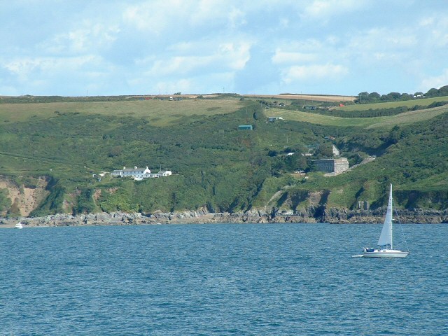
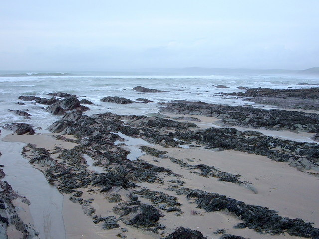
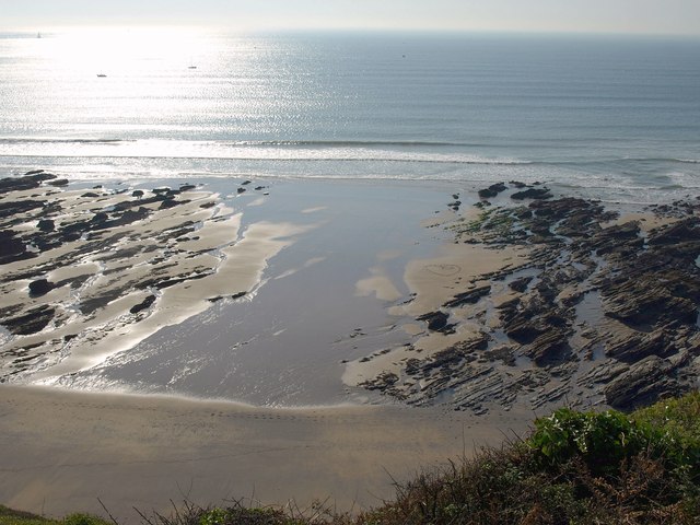
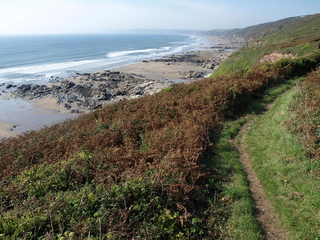
Treninnow Plantation is a picturesque woodland area nestled in the heart of Cornwall, England. Covering an expansive area of approximately 100 acres, this lush plantation is a haven of tranquility and natural beauty. Located near the charming village of Treninnow, the plantation attracts nature enthusiasts, hikers, and wildlife lovers alike.

The woodland is predominantly composed of native broadleaf trees such as oak, beech, and ash, which form a dense canopy above the forest floor. This creates a cool and shaded environment, perfect for exploring on warm summer days. The plantation also boasts a variety of smaller trees, shrubs, and wildflowers, adding a burst of color to the landscape during spring and summer.

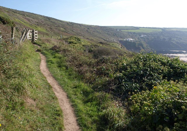
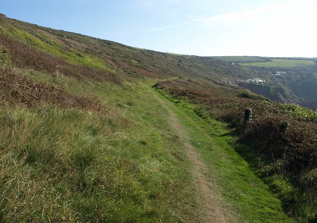
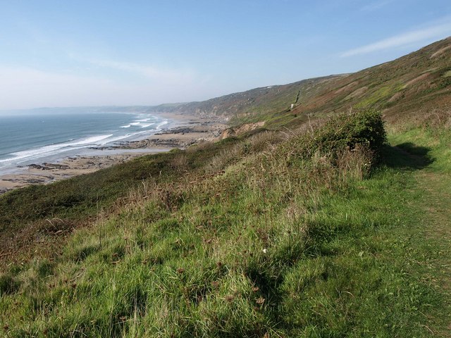
Treninnow Plantation is crisscrossed with well-maintained walking trails, allowing visitors to immerse themselves in the natural surroundings. The trails wind through the forest, revealing stunning vistas, babbling streams, and occasional glimpses of wildlife. Birdwatchers will be delighted to spot a wide array of species, including woodpeckers, thrushes, and owls, making the plantation a popular spot for birdwatching enthusiasts.

The plantation is also home to a diverse range of animal life, including deer, foxes, and rabbits, which can often be spotted during a leisurely stroll. The tranquil atmosphere of Treninnow Plantation provides the perfect escape from the hustle and bustle of everyday life, making it an ideal destination for those seeking solace in nature.

If you have any feedback on the listing, please let us know in the comments section below.

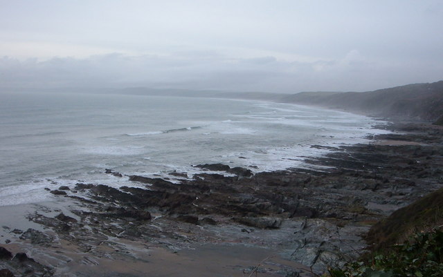
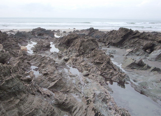
Treninnow Plantation Images

Images are sourced within 2km of 50.340258/-4.2151746 or Grid Reference SX4251. Thanks to Geograph Open Source API. All images are credited.

Rame, near Plymouth Rame, from the sea off the western side of the Rame peninsula.
Rame, near Plymouth
Rame, from the sea off the western side of the Rame peninsula.
View over Reefs towards Looe at Captain Blake's Point View over reefs in foreground - as detailed on the map - looking out across Whitsand Bay towards Looe.
View over Reefs towards Looe at Captain Blake's Point
View over reefs in foreground - as detailed on the map - looking out across Whitsand Bay towards Looe.
Great Britain!!!!!!!! I like this one of a Union Jack - perhaps an identifying flag from a small vessel - now in tatters stranded helplessly on a jagged rock, its former glory drained away with no one left to salute it - which perhaps represents the state of the UK at the moment?.
Great Britain!!!!!!!!
I like this one of a Union Jack - perhaps an identifying flag from a small vessel - now in tatters stranded helplessly on a jagged rock, its former glory drained away with no one left to salute it - which perhaps represents the state of the UK at the moment?.
Close up of Reef at low tide Like the caption says.
Close up of Reef at low tide
Like the caption says.
Reef at Low Tide Wouldn't like to be thrown onto these in a gale.
Reef at Low Tide
Wouldn't like to be thrown onto these in a gale.
Knatterbury and Polhawn Cove From the clifftop lane at Knatterbury looking southwards across the cove to the little chapel on Rame Head.
Knatterbury and Polhawn Cove
From the clifftop lane at Knatterbury looking southwards across the cove to the little chapel on Rame Head.
View over Whitsand Bay View over Whitsand Bay from near the entrance to the drive to Polhawn Fort.
View over Whitsand Bay
View over Whitsand Bay from near the entrance to the drive to Polhawn Fort.
Low tide in Whitsand Bay Low tide in Whitsand Bay to the north of Polhawn Cove viewed from the coast path.
Low tide in Whitsand Bay
Low tide in Whitsand Bay to the north of Polhawn Cove viewed from the coast path.
Polhawn Cove Low tide in Polhawn Cove.
Polhawn Cove
Low tide in Polhawn Cove.
Coast path south of Cawsand Between Penlee Point and Cawsand the South West Coast Path passes through sheltered woodland.
Coast path south of Cawsand
Between Penlee Point and Cawsand the South West Coast Path passes through sheltered woodland.
Kingsand viewed from the south Kingsand viewed from through the trees beside the South West Coast Path.
Kingsand viewed from the south
Kingsand viewed from through the trees beside the South West Coast Path.
Green canopy of Earl's Drive Earl's Drive leads from Cawsand past Pier Cellars to Penlee Point. Paths then carry on around the rest of the Rame Peninsula. Earl's Drive is not open to traffic other than for access and some of the land around Pier Cellars is owned by the MOD and strictly off limits. The fresh Spring foliage gives the path an overwhelming green aura at this time of year.
Green canopy of Earl's Drive
Earl's Drive leads from Cawsand past Pier Cellars to Penlee Point. Paths then carry on around the rest of the Rame Peninsula. Earl's Drive is not open to traffic other than for access and some of the land around Pier Cellars is owned by the MOD and strictly off limits. The fresh Spring foliage gives the path an overwhelming green aura at this time of year.
Beach at Wiggle Sandway The next cove of sand east of <a href="https://www.geograph.org.uk/photo/2635104">SX4150 : Beach at Wiggle Sandway</a>. On the left are rocks below  Captain Blake's Point.
Beach at Wiggle Sandway
The next cove of sand east of SX4150 : Beach at Wiggle Sandway. On the left are rocks below Captain Blake's Point.
Coast path at Wiggle Sandway The path above <a href="https://www.geograph.org.uk/photo/2635151">SX4149 : Beach at Wiggle Sandway</a>, with Whitsand Bay stretching away beyond.
Coast path at Wiggle Sandway
The path above SX4149 : Beach at Wiggle Sandway, with Whitsand Bay stretching away beyond.
Building above Captain Blake's Point I have no idea what this building is for. The coast path (following footpath 617/13/1) runs in front of it.
Building above Captain Blake's Point
I have no idea what this building is for. The coast path (following footpath 617/13/1) runs in front of it.
South West Coast Path near Captain Blake's Point Approaching a gate on the way to Polhawn.
South West Coast Path near Captain Blake's Point
Approaching a gate on the way to Polhawn.
South West Coast Path near Captain Blake's Point Taken from just beyond the gate shown in <a href="https://www.geograph.org.uk/photo/2635237">SX4249 : South West Coast Path near Captain Blake's Point</a>, with the coast path following footpath 617/13 towards Polhawn Fort and cottages.
South West Coast Path near Captain Blake's Point
Taken from just beyond the gate shown in SX4249 : South West Coast Path near Captain Blake's Point, with the coast path following footpath 617/13 towards Polhawn Fort and cottages.
South West Coast Path approaching Captain Blake's Point A reverse view along the area shown in <a href="https://www.geograph.org.uk/photo/2635413">SX4249 : South West Coast Path near Captain Blake's Point</a>, with the building shown in <a href="https://www.geograph.org.uk/photo/2635186">SX4249 : Building above Captain Blake's Point</a> visible, and Whitsand Bay stretching away on the left.
South West Coast Path approaching Captain Blake's Point
A reverse view along the area shown in SX4249 : South West Coast Path near Captain Blake's Point, with the building shown in SX4249 : Building above Captain Blake's Point visible, and Whitsand Bay stretching away on the left.
Show me another place!

Treninnow Plantation is located at Grid Ref: SX4251 (Lat: 50.340258, Lng: -4.2151746)

Unitary Authority: Cornwall

Police Authority: Devon and Cornwall

What 3 Words

///slid.coasters.screen. Near Millbrook, Cornwall

Related Wikis

Millbrook, Cornwall

Millbrook (Cornish: Govermelin) is a civil parish and village in southeast Cornwall, England, United Kingdom. The village is situated on the Rame Peninsula...

Anderton, Cornwall

Anderton is a settlement in south-east Cornwall, England, United Kingdom, located at grid reference SW 431 519. There are also places called Anderton in...

St Paul's Church, Kingsand

St Paul's Church is a former Church of England church in Kingsand, Cornwall, England, UK. Built in 1881–82, the church ceased use as a place of worship...

All Saints Church, Millbrook

All Saints Church is a Church of England parish church in Millbrook, Cornwall, England, UK. It was built in 1893–95 and has been Grade II listed since...

Nearby Amenities

Located within 500m of 50.340258,-4.2151746
Bus Stop
Cawsands School
Bus: yes
Naptan AtcoCode: 0800COB20076
Naptan Bearing: SW
Naptan CommonName: Cawsands School
Naptan NaptanCode: corgagja
Naptan Street: B3247
Naptan Verified: no
Public Transport: platform
Shelter: no
Source: naptan_import
Lat/Long: 50.3403053/-4.2084618
Bus Stop
Four Lanes End
Bus: yes
Naptan AtcoCode: 0800COZ06191
Naptan Bearing: NE
Naptan CommonName: Four Lanes End
Naptan NaptanCode: corgagdm
Naptan Street: Hat Lane
Naptan Verified: no
Public Transport: platform
Shelter: no
Source: naptan_import
Lat/Long: 50.3400573/-4.2087314
Barrier: stile
Material: stone
Stile: stepover
Lat/Long: 50.343281/-4.2169173
Barrier: stile
Material: stone
Stile: stepover
Lat/Long: 50.3421549/-4.2171116
Barrier: stile
Material: stone
Stile: stepover
Lat/Long: 50.340919/-4.2175301
Kerb: no
Lat/Long: 50.3408851/-4.2174831
Barrier: stile
Material: wood
Step Count: 3
Stile: stepover
Lat/Long: 50.3404669/-4.2170674
Barrier: stile
Material: stone
Step Count: 11
Stile: stepover
Lat/Long: 50.3394365/-4.2167898
Generator Method: photovoltaic
Generator Output Electricity: yes
Generator Source: solar
Generator Type: solar_photovoltaic_panel
Location: roof
Power: generator
Lat/Long: 50.3403584/-4.2081988
Power: pole
Lat/Long: 50.3383462/-4.2209119
Power: pole
Lat/Long: 50.3392638/-4.2203835
Power: pole
Lat/Long: 50.3402181/-4.2196821
Power: pole
Lat/Long: 50.3410663/-4.2188305
Power: pole
Lat/Long: 50.3418161/-4.217948
Power: pole
Lat/Long: 50.3426087/-4.2172493
Power: pole
Lat/Long: 50.343331/-4.2166217
Power: pole
Lat/Long: 50.3411554/-4.210285
Power: pole
Lat/Long: 50.3386954/-4.2095554
Power: pole
Lat/Long: 50.3395188/-4.2102823
Power: pole
Lat/Long: 50.3404244/-4.2113203
Power: pole
Lat/Long: 50.3407993/-4.211736
Power: pole
Lat/Long: 50.3414618/-4.2124414
Power: pole
Lat/Long: 50.3419291/-4.2132783
Power: pole
Lat/Long: 50.3428149/-4.214779
Power: pole
Lat/Long: 50.3440209/-4.2169328
Material: wood
Power: pole
Lat/Long: 50.3441895/-4.2150392
Power: pole
Lat/Long: 50.3435416/-4.2161429
Power: pole
Lat/Long: 50.3432814/-4.2170924
Power: pole
Lat/Long: 50.3432592/-4.2199704
Power: pole
Lat/Long: 50.3392518/-4.2083618
Power: pole
Lat/Long: 50.3388007/-4.2092939
Power: pole
Lat/Long: 50.3387382/-4.209424
Waste Basket
Survey Date: 2022-02-20
Lat/Long: 50.3403386/-4.2086988
Bench
Survey Date: 2022-02-20
Lat/Long: 50.3403687/-4.2086527
Fire Hydrant
Emergency: fire_hydrant
Fire Hydrant Type: underground
Survey Date: 2022-02-20
Lat/Long: 50.3402763/-4.2196649
Grit Bin
Survey Date: 2022-02-20
Lat/Long: 50.3401483/-4.2086902
The data included in this document is from www.openstreetmap.org. The data is made available under ODbL.

Have you been to Treninnow Plantation?

Leave your review of Treninnow Plantation below (or comments, questions and feedback).