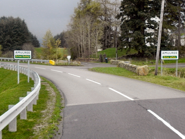
Amulree

Settlement in Perthshire

Scotland

Amulree

Clashcat on the way The cottage Clashcat is one of the few distractions on this straight dirt track towards Loch Freuchie - just visible glittering on the left.
Clashcat on the way Credit: Aleks Scholz

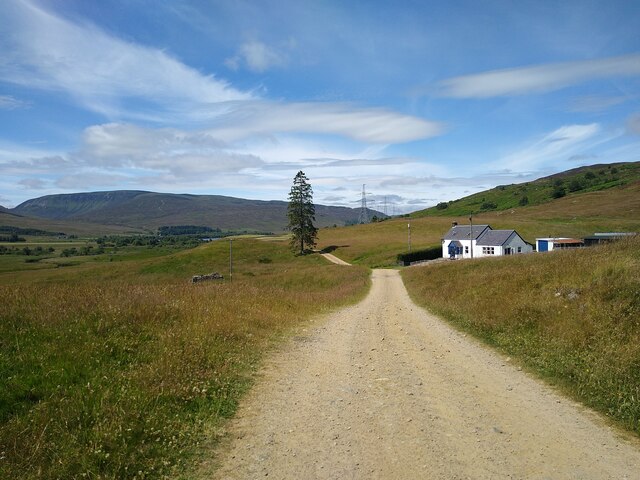
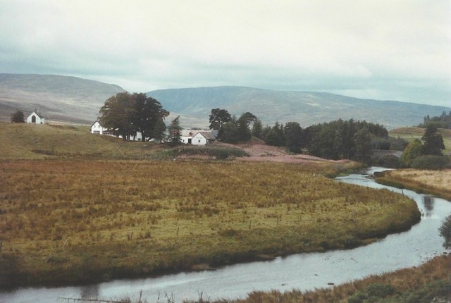
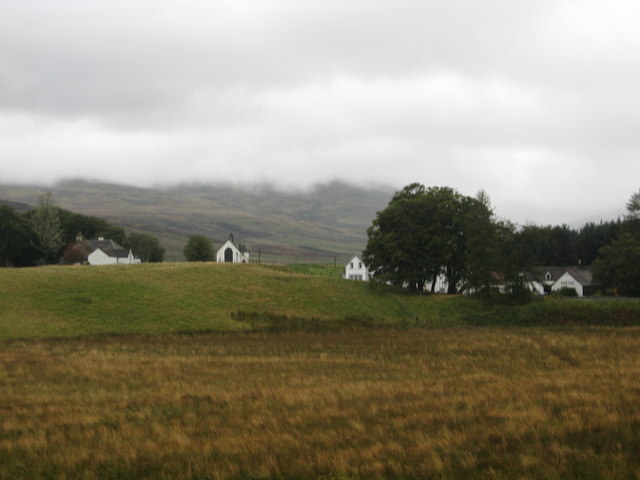
Amulree is a small village located in the picturesque region of Perthshire, Scotland. Situated amidst the breathtaking scenery of the Scottish Highlands, this charming village offers a peaceful and idyllic retreat for visitors seeking tranquility and natural beauty.

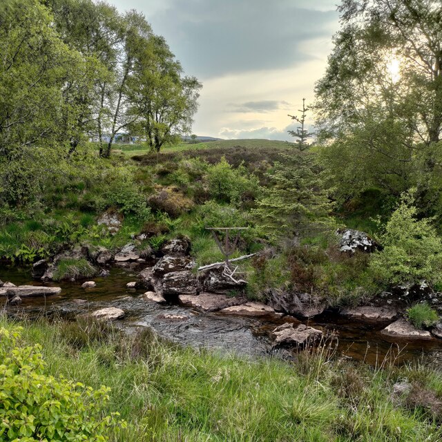
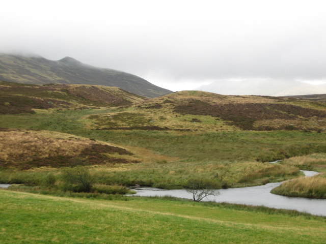
Nestled between the rugged hills and dense forests, Amulree boasts a sense of seclusion and remoteness that is highly valued by those looking to escape the hustle and bustle of modern life. The village is surrounded by an abundance of wildlife, including red deer, golden eagles, and red squirrels, making it a haven for nature enthusiasts and avid birdwatchers.

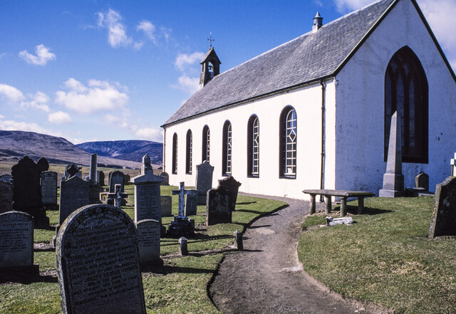
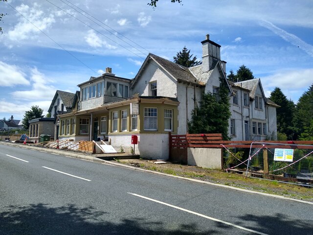
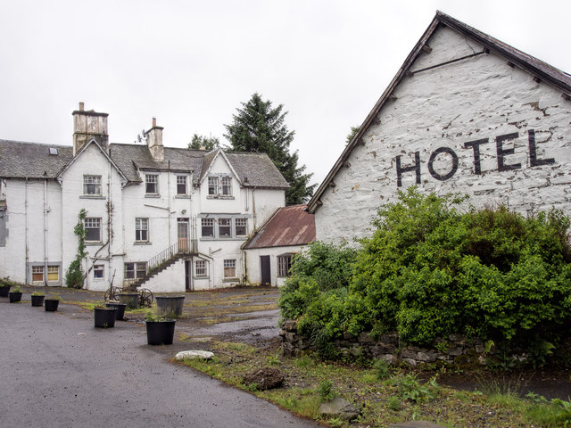
The village itself is quaint and traditional, with a handful of houses, a small church, and a local inn. The inn, dating back to the 18th century, serves as a popular gathering place for both locals and tourists, offering a warm and friendly atmosphere along with delicious traditional Scottish cuisine.

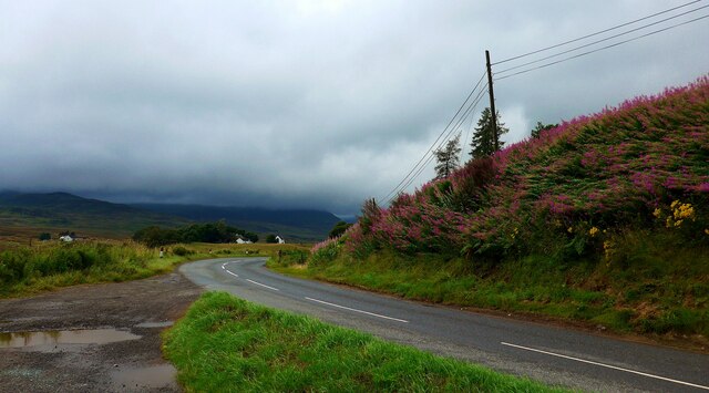
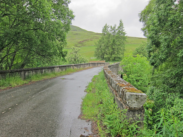
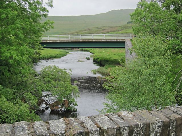
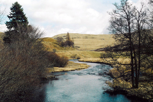
Outdoor activities are a major draw for visitors to Amulree, with numerous walking trails and hiking routes that cater to all levels of experience. The nearby Loch Freuchie provides opportunities for fishing and boating, while the surrounding hills offer stunning panoramic views that are simply awe-inspiring.

Although Amulree may be small in size, it is big on charm and natural beauty. Whether it's exploring the unspoiled wilderness, immersing oneself in the local culture, or simply enjoying the tranquility of the surroundings, Amulree has something to offer every visitor seeking an authentic Scottish experience.

If you have any feedback on the listing, please let us know in the comments section below.
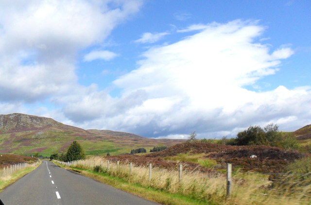
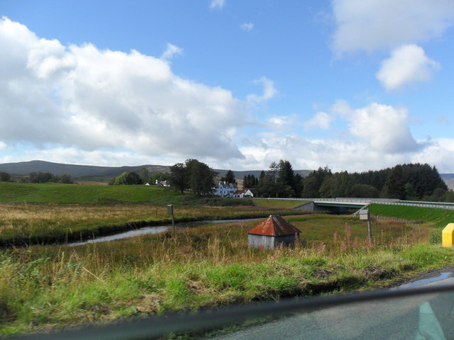
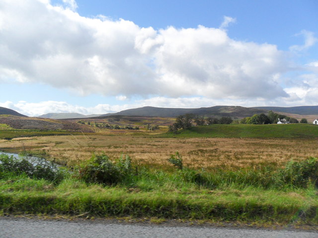
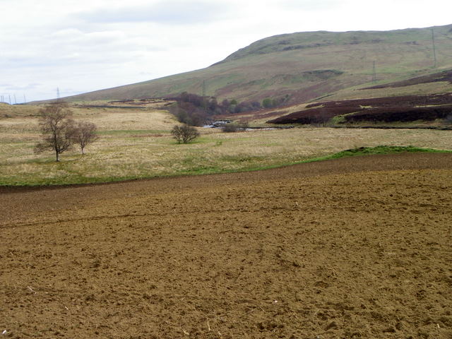
Amulree Images

Images are sourced within 2km of 56.51054/-3.789961 or Grid Reference NN8936. Thanks to Geograph Open Source API. All images are credited.

Clashcat on the way The cottage Clashcat is one of the few distractions on this straight dirt track towards Loch Freuchie - just visible glittering on the left.
Clashcat on the way
The cottage Clashcat is one of the few distractions on this straight dirt track towards Loch Freuchie - just visible glittering on the left.
Church and gravestones at Amulree The Church of Scotland's place of worship for the district of Amulree and Strathbraan.
Church and gravestones at Amulree
The Church of Scotland's place of worship for the district of Amulree and Strathbraan.
The A822 approaching Amulree This has been a day of torrential showers; the first heavy rain in the area for weeks.
The A822 approaching Amulree
This has been a day of torrential showers; the first heavy rain in the area for weeks.
Lonely Inn Gallery The hotel in Amulree is hopefully in the process of being refurbished, but there is no actual work happening right now. The progress compared to <a href="https://www.geograph.org.uk/photo/6550469">NN9036 : The Amulree Hotel in a sorry state</a> is incremental, at best. The sign reads 'The Lonely Inn Gallery'. Very lonely indeed.
Lonely Inn Gallery
The hotel in Amulree is hopefully in the process of being refurbished, but there is no actual work happening right now. The progress compared to NN9036 : The Amulree Hotel in a sorry state is incremental, at best. The sign reads 'The Lonely Inn Gallery'. Very lonely indeed.
Site of former footbridge Old maps show a path crossing the Girron Burn here. There isn't much left!
Site of former footbridge
Old maps show a path crossing the Girron Burn here. There isn't much left!
Amulree in 1984 As seen from the A822 across the River Braan, with the church on the left side of the frame
Amulree in 1984
As seen from the A822 across the River Braan, with the church on the left side of the frame
A822, Amulree
A822, Amulree
Bridge Over River Braan, Amulree The bridge carrying the A822 over the River Braan, at Amulree
Bridge Over River Braan, Amulree
The bridge carrying the A822 over the River Braan, at Amulree
The A822 south of Amulree
The River Braan at Amulree
Upland scenery at Amulree
Plough near Amulree The earliest form of cultivation consisted simply of scratching the soil with a branch or antler to enable a seed to be buried.  Early ploughs did no more than this.  Later models were designed to bury the remains of the previous crop and surface debris.

The Romans designed a plough with stout iron teeth mounted on a wooden sole which turned the soil.  Celts and Romans, using light ploughs, adopted the practice of cross-ploughing, so that their fields tended to be almost square.  The Saxons, using a heavy, eight-oxen plough, made their fields long to reduce the number of turns.  The old English furlong, one-eighth of a mile, is derived from ‘furrow long’.

The earliest mould-board plough, similar to that used today, dates from Saxon times.  But the really modern mould-board dates from the 18th century with the introduction of iron.  Double-furrow ploughs, pulled by two horses, were common until tractors were introduced.  Today, powerful tractors pull banks of ploughs which cut many furrows at the same time.
Plough near Amulree
The earliest form of cultivation consisted simply of scratching the soil with a branch or antler to enable a seed to be buried. Early ploughs did no more than this. Later models were designed to bury the remains of the previous crop and surface debris. The Romans designed a plough with stout iron teeth mounted on a wooden sole which turned the soil. Celts and Romans, using light ploughs, adopted the practice of cross-ploughing, so that their fields tended to be almost square. The Saxons, using a heavy, eight-oxen plough, made their fields long to reduce the number of turns. The old English furlong, one-eighth of a mile, is derived from ‘furrow long’. The earliest mould-board plough, similar to that used today, dates from Saxon times. But the really modern mould-board dates from the 18th century with the introduction of iron. Double-furrow ploughs, pulled by two horses, were common until tractors were introduced. Today, powerful tractors pull banks of ploughs which cut many furrows at the same time.
Looking back across the Sma' Glen to Amulree Cottages, church and hotel can be seen.
Looking back across the Sma' Glen to Amulree
Cottages, church and hotel can be seen.
The River Braan cutting its way through the hills near Amulree
Amulree Hotel closed Amulree Hotel closed in 2007. The outbuildings are in poor repair.

In January 2011 the Perthshire Advertiser reported on plans to redevelop the site as a smaller hotel, a heritage centre and houses. At the time of this photograph (June 2013) the building is for sale.
Amulree Hotel closed
Amulree Hotel closed in 2007. The outbuildings are in poor repair. In January 2011 the Perthshire Advertiser reported on plans to redevelop the site as a smaller hotel, a heritage centre and houses. At the time of this photograph (June 2013) the building is for sale.
Old bridge at Amulree The growth of vegetation shows that this has not been the main road bridge for a few years now. Compare with <a href="https://www.geograph.org.uk/photo/157424">NN9036 : Bridge at Amulree</a> , taken before the new bridge was built.
Old bridge at Amulree
The growth of vegetation shows that this has not been the main road bridge for a few years now. Compare with NN9036 : Bridge at Amulree , taken before the new bridge was built.
New bridge viewed from old bridge The old bridge makes a pleasant start to a circuit of Loch Freuchie now traffic uses the new bridge just downstream.
New bridge viewed from old bridge
The old bridge makes a pleasant start to a circuit of Loch Freuchie now traffic uses the new bridge just downstream.
Ath Maol Ruibhe Ath Maol Ruibhe, "Maol Rubha's ford", on the river Braan.
Ath Maol Ruibhe
Ath Maol Ruibhe, "Maol Rubha's ford", on the river Braan.
Show me another place!

Amulree is located at Grid Ref: NN8936 (Lat: 56.51054, Lng: -3.789961)

Unitary Authority: Perth and Kinross

Police Authority: Tayside

What 3 Words

///boost.bogus.overlaid. Near Aberfeldy, Perth & Kinross

Nearby Locations

Amulree

Related Wikis

Amulree

Amulree (Scottish Gaelic: Àth Maol Ruibhe, 'Ford of [St.] Maelrubha') is a small hamlet in Perth and Kinross, Scotland. It lies in hilly country on the...

Achnafauld

Achnafauld (, Scottish Gaelic: Achadh na Follt) is a settlement in the Scottish Highlands, about 15 miles (24 km) northwest of Perth. It is located in...
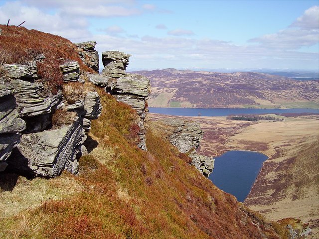
Loch Freuchie

Loch Freuchie, also known as Fraoch, the heatherly loch, is a large freshwater loch on a north-west to south-east orientation, within Glen Quaich in Perth...

Loch Fender

Loch Fender is a small irregular shaped freshwater loch that lies to the north of Loch Freuchie and three miles south-south-east of Amulree and 2+1⁄2 miles...

Glen Quaich

Glen Quaich is a glen in Perth and Kinross and is situated almost midway between Crieff and Aberfeldy. The upper reaches of the glen approach Loch Tay...
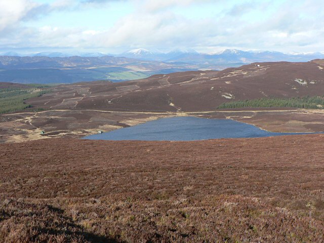
Loch Hoil

Loch Hoil is a small freshwater lochan located between the shallow hills between Strath Braan and Strath Tay valley's in Perth and Kinross. Aberfeldy is...

Loch Kennard

Loch Kennard is freshwater loch located south-east of Aberfeldy, situated on Grandtully Hill in Perth and Kinross within Griffin Forest in Scotland....

Nearby Amenities

Located within 500m of 56.51054,-3.789961
Barrier: bollard
Bicycle: yes
Foot: yes
Horse: yes
Motor Vehicle: no
Lat/Long: 56.5097405/-3.7878808
Barrier: bollard
Bicycle: yes
Description: Bollards block vehicular access over bridge. No restrictions for non-vehicular access.
Foot: yes
Horse: yes
Lat/Long: 56.5105006/-3.7882142
Post Box
Collection Times: Mo-Fr 11:30; Sa 11:30
Operator: Royal Mail
Post Box Mounting: pier
Post Box Type: lamp
Ref: PH8 148
Royal Cypher: scottish_crown
Source: survey;local knowledge
Lat/Long: 56.5093097/-3.7881283
Amulree
Name Gd: Àth Maol Ruibhe
Place: hamlet
Wikidata: Q3776658
Wikipedia: en:Amulree
Lat/Long: 56.5088801/-3.7885871
Power: pole
Lat/Long: 56.5120792/-3.79593
Power: pole
Lat/Long: 56.511942/-3.7951282
Power: pole
Lat/Long: 56.5116925/-3.7942814
Power: pole
Lat/Long: 56.5135713/-3.7863809
Power: pole
Lat/Long: 56.5129669/-3.7869754
Power: pole
Lat/Long: 56.5122701/-3.7876583
Power: pole
Lat/Long: 56.5115662/-3.788352
Power: pole
Lat/Long: 56.5110721/-3.7888384
Power: pole
Lat/Long: 56.5103653/-3.7895303
Power: pole
Lat/Long: 56.5095451/-3.7903447
Power: pole
Lat/Long: 56.508877/-3.7910149
Power: pole
Lat/Long: 56.5086404/-3.7912707
Power: pole
Lat/Long: 56.5078659/-3.7914888
Power: pole
Lat/Long: 56.5070874/-3.7917266
Power: pole
Lat/Long: 56.5063496/-3.791941
Power: pole
Lat/Long: 56.509398/-3.7886637
Power: pole
Lat/Long: 56.5090609/-3.7897951
Power: pole
Lat/Long: 56.5136648/-3.7849413
Power: pole
Lat/Long: 56.5134759/-3.7876583
Power: pole
Lat/Long: 56.5133755/-3.7888997
Power: pole
Lat/Long: 56.513295/-3.7898978
Power: pole
Lat/Long: 56.5131966/-3.7913644
Power: pole
Lat/Long: 56.5131021/-3.7926383
Power: pole
Lat/Long: 56.5129868/-3.7941589
Power: pole
Lat/Long: 56.5129033/-3.7953156
Power: pole
Lat/Long: 56.5132751/-3.784462
Power: pole
Lat/Long: 56.5128805/-3.7839558
Power: pole
Lat/Long: 56.5124261/-3.7833702
Power: pole
Lat/Long: 56.5117511/-3.7833774
Power: pole
Lat/Long: 56.511089/-3.7833738
Power: pole
Lat/Long: 56.510588/-3.782718
Power: pole
Lat/Long: 56.5113893/-3.7866728
Power: pole
Lat/Long: 56.5116497/-3.7869592
Power: pole
Lat/Long: 56.5118058/-3.7871412
Communication Mobile Phone: yes
Man Made: mast
Tower Type: communication
Lat/Long: 56.5106904/-3.7820415
Barrier: cattle_grid
Lat/Long: 56.5107159/-3.7864869
The data included in this document is from www.openstreetmap.org. The data is made available under ODbL.

Have you been to Amulree?

Leave your review of Amulree below (or comments, questions and feedback).