Amroth

Settlement in Pembrokeshire

Wales

Amroth

Barriers on pedestrian route to Colby Lodge Barriers either side of minor road from the upper car park (behind camera) down to main area of Colby Woodland Garden, National Trust.
Barriers on pedestrian route to Colby Lodge Credit: M J Roscoe

Amroth is a quaint coastal village located in the county of Pembrokeshire, Wales. Situated at the eastern edge of the beautiful Pembrokeshire Coast National Park, Amroth offers visitors stunning views of the rugged coastline and the expansive sandy beach that stretches for miles.

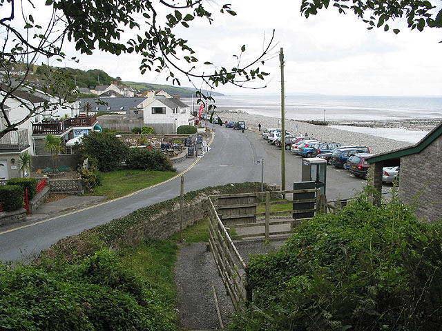
The village itself is small and peaceful, with a population of around 700 inhabitants. It is known for its charming cottages and traditional Welsh architecture, giving it a timeless and picturesque atmosphere. Visitors can explore the narrow lanes and discover local shops, cafes, and pubs that offer a warm welcome.

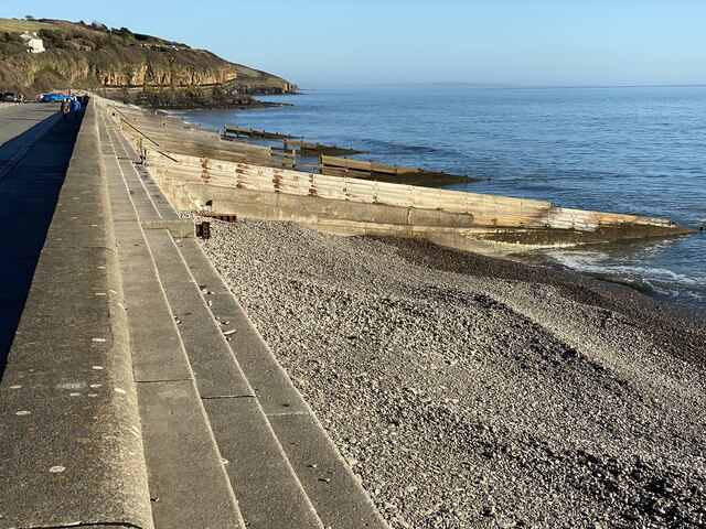
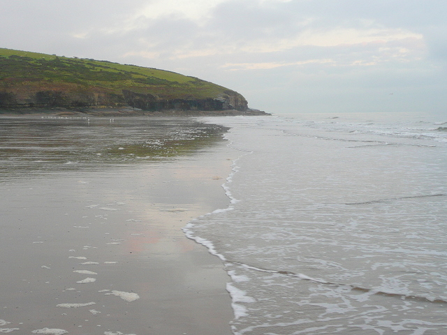
One of the main attractions of Amroth is its beach, which is a popular destination for both locals and tourists. The sandy shores provide ample space for sunbathing, picnicking, and taking leisurely strolls. At low tide, the beach reveals ancient petrified forests, offering a unique glimpse into the area's prehistoric past.

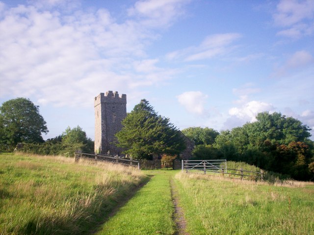
For those interested in history, Amroth is also home to a medieval fortress known as Amroth Castle. Although now privately owned, the castle can still be admired from the outside and adds to the village's historical charm.

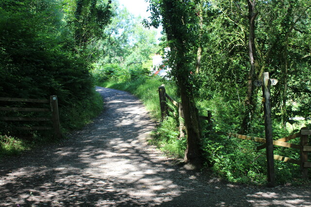
Nature enthusiasts will be delighted by the abundance of wildlife in the area. The nearby Pembrokeshire Coast Path offers breathtaking walks along the cliffs, allowing visitors to spot seabirds, seals, and dolphins that frequent the waters.

Overall, Amroth is a tranquil coastal village that provides a perfect escape from the hustle and bustle of everyday life. Its natural beauty, charming architecture, and friendly atmosphere make it a must-visit destination for anyone exploring Pembrokeshire.

If you have any feedback on the listing, please let us know in the comments section below.

Amroth Images

Images are sourced within 2km of 51.732916/-4.655211 or Grid Reference SN1607. Thanks to Geograph Open Source API. All images are credited.

Barriers on pedestrian route to Colby Lodge Barriers either side of minor road from the upper car park (behind camera) down to main area of Colby Woodland Garden, National Trust.
Barriers on pedestrian route to Colby Lodge
Barriers either side of minor road from the upper car park (behind camera) down to main area of Colby Woodland Garden, National Trust.
Bella the Bee, walled garden, Colby Woodland Garden Wickerwork bee in willow to celebrate the role of bees. The roof of the gazebo can be seen behind.
Bella the Bee, walled garden, Colby Woodland Garden
Wickerwork bee in willow to celebrate the role of bees. The roof of the gazebo can be seen behind.
Wildflower meadow, Colby Woodland Meadow A footbridge crosses a stream running across the picture. In the background is part of the West Wood.
Wildflower meadow, Colby Woodland Meadow
A footbridge crosses a stream running across the picture. In the background is part of the West Wood.
Track to The Cwms, Colby Woodland Garden Two bridges over stream on the approach to a National Trust holiday home.
Track to The Cwms, Colby Woodland Garden
Two bridges over stream on the approach to a National Trust holiday home.
Stream in Colby Woodland Garden Upstream from bridges <a href="https://www.geograph.org.uk/photo/6911749">SN1507 : Track to The Cwms, Colby Woodland Garden</a> to The Cwms; low water in a stony stream after a few days of hot weather.
Stream in Colby Woodland Garden
Upstream from bridges SN1507 : Track to The Cwms, Colby Woodland Garden to The Cwms; low water in a stony stream after a few days of hot weather.
The Cwms, Colby Woodland Garden A National Trust holiday home on the floor of a wooded valley.
The Cwms, Colby Woodland Garden
A National Trust holiday home on the floor of a wooded valley.
Track behind The Cwms, Colby Woodland Garden Track on edge of East Wood behind holiday home <a href="https://www.geograph.org.uk/photo/6911758">SN1507 : The Cwms, Colby Woodland Garden</a>.
Track behind The Cwms, Colby Woodland Garden
Track on edge of East Wood behind holiday home SN1507 : The Cwms, Colby Woodland Garden.
RLC Bomb Disposal Unit at Amroth Five minutes after this photograph there was a small explosion on the foreshore <a href="https://www.geograph.org.uk/photo/7005286">SN1607 : Groynes, Amroth Beach</a>.
RLC Bomb Disposal Unit at Amroth
Five minutes after this photograph there was a small explosion on the foreshore SN1607 : Groynes, Amroth Beach.
Steps and groyne below Amroth Castle The uppermost storey of the castle (a former mansion) is on the left. To the right is a small turret in the perimeter wall of the Castle's holiday homes site.
Steps and groyne below Amroth Castle
The uppermost storey of the castle (a former mansion) is on the left. To the right is a small turret in the perimeter wall of the Castle's holiday homes site.
Groynes, Amroth Beach Series of wood and concrete groynes from sea wall to sandy beach. The column of smoke is from a controlled explosion on the shore beyond the groynes.
Groynes, Amroth Beach
Series of wood and concrete groynes from sea wall to sandy beach. The column of smoke is from a controlled explosion on the shore beyond the groynes.
Slipway at Amroth Gated slipway from seafront road at low tide.
Slipway at Amroth
Gated slipway from seafront road at low tide.
Outfall of stream onto Amroth foreshore Much water after heavy rain.
Outfall of stream onto Amroth foreshore
Much water after heavy rain.
Stream outfall at Amroth village Water emerging from culvert pouring onto the shingly shore after heavy rain.
Stream outfall at Amroth village
Water emerging from culvert pouring onto the shingly shore after heavy rain.
Amroth Castle Amroth Castle holiday park in Pembrokeshire offers self-catering accommodation in the grounds of an 18th Century castle.
Amroth Castle
Amroth Castle holiday park in Pembrokeshire offers self-catering accommodation in the grounds of an 18th Century castle.
Groynes at Amroth beach
View across Amroth Beach
A glimpse of Amroth Amroth and Amroth beach glimpsed through woodland on the cliff path from Wiseman’s Bridge.
A glimpse of Amroth
Amroth and Amroth beach glimpsed through woodland on the cliff path from Wiseman’s Bridge.
Coastal path towards Amroth
Show me another place!

Amroth is located at Grid Ref: SN1607 (Lat: 51.732916, Lng: -4.655211)

Unitary Authority: Pembrokeshire

Police Authority: Dyfed Powys

What 3 Words

///posts.scores.stockpile. Near Saundersfoot, Pembrokeshire

Nearby Locations

Amroth Castle Wood

Related Wikis

Amroth

Amroth is a village, parish and community 7 miles (11 km) northeast of Tenby, Pembrokeshire, Wales. Located on Carmarthen Bay, Amroth is noted for its...

Colby Woodland Garden

Colby Woodland Garden (Welsh: Gardd Goedwig Colby) is a National Trust woodland garden in a secluded valley, approximately ¾ of a mile north of Amroth...

Summerhill, Pembrokeshire

Summerhill is a small settlement 1 mile (1.6 km) northwest of Amroth, in Pembrokeshire, Wales, in Amroth parish and community. == History == Summerhill...

Telpyn Point

Telpyn Point is a headland on the Carmarthenshire coast, Wales. Set at the back of Carmarthen Bay, to its east are Marros Sands and to the west a beach...

Wisemans Bridge

Wisemans Bridge is a coastal hamlet between Amroth and Saundersfoot in Pembrokeshire, Wales. The small beachfront settlement, which is part of the parish...

Stepaside, Pembrokeshire

Stepaside is a village six miles north of Tenby, Pembrokeshire, in the community and parish of Amroth. The population in the 2011 census was 619. Once...

Sardis, southeast Pembrokeshire

Sardis is a small village in Pembrokeshire, belonging to the Community of Saundersfoot. It lies just south of Stepaside and northwest of Wisemans Bridge...

Llanteg

Llanteg (also previously known, and still regularly pronounced, as Lanteague) is a small village in Pembrokeshire, Wales, belonging to the community of...

Nearby Amenities

Located within 500m of 51.732916,-4.655211
Amroth
Is In: Pembrokeshire,Wales,UK
Place: village
Wikidata: Q4748719
Lat/Long: 51.732782/-4.6612136
Bicycle Parking
Bicycle Parking: stands
Capacity: 6
Covered: no
Lat/Long: 51.7318359/-4.6612273
Give Way
Direction: forward
Lat/Long: 51.7322529/-4.6609744
Give Way
Direction: forward
Lat/Long: 51.7320519/-4.6604977
Give Way
Direction: forward
Lat/Long: 51.7330077/-4.6551372
Leisure: picnic_table
Lat/Long: 51.7337854/-4.6524739
Leisure: picnic_table
Lat/Long: 51.7337748/-4.6525641
Leisure: picnic_table
Lat/Long: 51.7338269/-4.6525775
Leisure: picnic_table
Lat/Long: 51.7338745/-4.6525861
Leisure: picnic_table
Lat/Long: 51.733885/-4.652502
Leisure: picnic_table
Lat/Long: 51.7338337/-4.6524873
Direction: 175
Generator Method: photovoltaic
Generator Output Electricity: yes
Generator Solar Modules: 8
Generator Source: solar
Generator Type: solar_photovoltaic_panel
Location: roof
Power: generator
Lat/Long: 51.732238/-4.6595684
Direction: 175
Generator Method: photovoltaic
Generator Output Electricity: yes
Generator Solar Modules: 8
Generator Source: solar
Generator Type: solar_photovoltaic_panel
Location: roof
Power: generator
Lat/Long: 51.7322629/-4.6595711
Direction: ENE
Generator Method: photovoltaic
Generator Output Electricity: yes
Generator Solar Modules: 8
Generator Source: solar
Generator Type: solar_photovoltaic_panel
Location: roof
Power: generator
Lat/Long: 51.7319269/-4.6613847
Direction: WSW
Generator Method: photovoltaic
Generator Output Electricity: yes
Generator Solar Modules: 8
Generator Source: solar
Generator Type: solar_photovoltaic_panel
Location: roof
Power: generator
Lat/Long: 51.7319127/-4.6614291
The data included in this document is from www.openstreetmap.org. The data is made available under ODbL.

Have you been to Amroth?

Leave your review of Amroth below (or comments, questions and feedback).