Cornish Wood
Wood, Forest in Cornwall
England
Cornish Wood
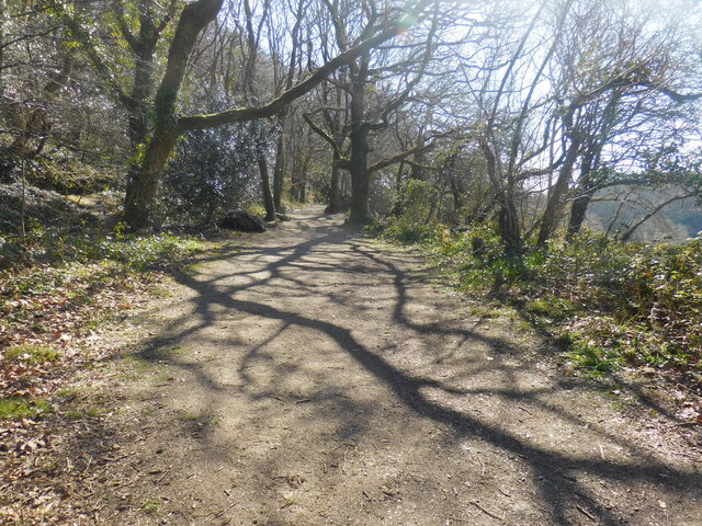
Cornish Wood is a picturesque forest located in the county of Cornwall, England. Covering an area of approximately 100 acres, it is a natural haven known for its lush greenery and diverse wildlife. The wood is situated in a secluded location, surrounded by rolling hills and scenic landscapes, making it a popular destination for nature lovers and outdoor enthusiasts.
The woodland is predominantly composed of native trees such as oak, beech, and ash, which create a dense canopy, providing shade and shelter for a variety of plant and animal species. The forest floor is adorned with vibrant wildflowers during the spring and summer seasons, adding bursts of color to the serene surroundings.
Cornish Wood offers a range of walking trails and paths, allowing visitors to explore its beauty at their own pace. These paths wind through the forest, taking visitors on a journey through ancient woodlands, babbling brooks, and peaceful glades. Along the way, one may encounter squirrels, rabbits, and a variety of bird species, including woodpeckers and owls.
The wood also boasts a rich history, with remnants of old structures and archaeological sites scattered throughout. It is believed that the wood has been inhabited for thousands of years, and artifacts from the Iron Age have been discovered in the area.
Overall, Cornish Wood in Cornwall is a captivating destination, offering a tranquil escape from the hustle and bustle of everyday life. Its natural beauty, diverse flora and fauna, and historical significance make it a must-visit for those seeking to connect with nature and immerse themselves in the rich heritage of the region.
If you have any feedback on the listing, please let us know in the comments section below.
Cornish Wood Images
Images are sourced within 2km of 50.366067/-4.7380249 or Grid Reference SX0555. Thanks to Geograph Open Source API. All images are credited.
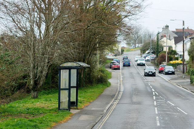
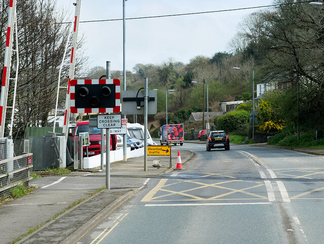
![Bridge Street, St Blazey St Blazey (Cornish: Lanndreth) is a small town in Cornwall, 3 miles (4.8 km) east of St Austell. The town takes its name from the Armenian Saint Blaise who, in Christian tradition, is believed to have &quot;cure[d] toothache, sore throats and cattle diseases&quot;.
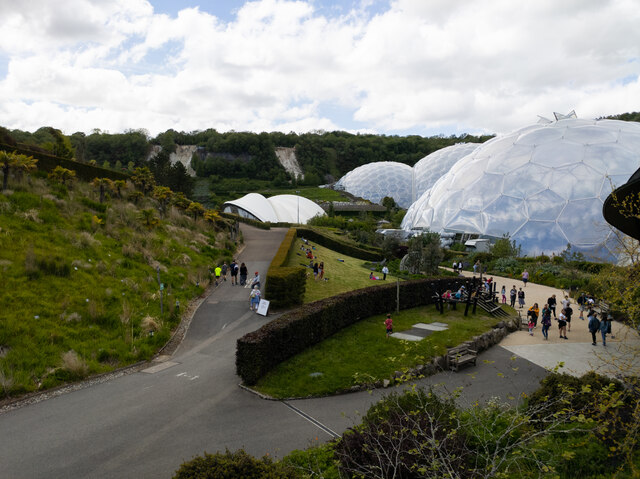
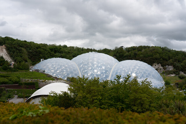
The local mining industries once dominated the town; historically copper and tin were mined in and around the parish, whilst more recently china clay has been the principal commodity mined. <a href="https://www.geograph.org.uk/photo/1701065">SX0554 : The Eden Project</a> is located about a mile and a half (2 km) from the centre of the town and the large number of visitors this attracts has led to the development of tourism in the town.
St Blazey. (2022, April 23). In Wikipedia. <span class="nowrap"><a title="https://en.wikipedia.org/wiki/St_Blazey" rel="nofollow ugc noopener" href="https://en.wikipedia.org/wiki/St_Blazey">Link</a><img style="margin-left:2px;" alt="External link" title="External link - shift click to open in new window" src="https://s1.geograph.org.uk/img/external.png" width="10" height="10"/></span>](https://s3.geograph.org.uk/geophotos/07/34/75/7347531_986ab475.jpg)
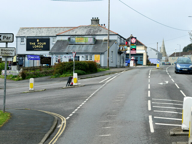
![Rose Hill, St Blazey St Blazey (Cornish: Lanndreth) is a small town in Cornwall, 3 miles (4.8 km) east of St Austell. The town takes its name from the Armenian Saint Blaise who, in Christian tradition, is believed to have &quot;cure[d] toothache, sore throats and cattle diseases&quot;.
The local mining industries once dominated the town; historically copper and tin were mined in and around the parish, whilst more recently china clay has been the principal commodity mined. <a href="https://www.geograph.org.uk/photo/1701065">SX0554 : The Eden Project</a> is located about a mile and a half (2 km) from the centre of the town and the large number of visitors this attracts has led to the development of tourism in the town.
St Blazey. (2022, April 23). In Wikipedia. <span class="nowrap"><a title="https://en.wikipedia.org/wiki/St_Blazey" rel="nofollow ugc noopener" href="https://en.wikipedia.org/wiki/St_Blazey">Link</a><img style="margin-left:2px;" alt="External link" title="External link - shift click to open in new window" src="https://s1.geograph.org.uk/img/external.png" width="10" height="10"/></span>](https://s1.geograph.org.uk/geophotos/07/34/75/7347541_fcb16d1e.jpg)
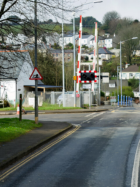
![Church Hill, St Blazey St Blazey (Cornish: Lanndreth) is a small town in Cornwall, 3 miles (4.8 km) east of St Austell. The town takes its name from the Armenian Saint Blaise who, in Christian tradition, is believed to have &quot;cure[d] toothache, sore throats and cattle diseases&quot;. The church, which was built between 1440 and 1445, is dedicated to Saint Blaise. It is a Grade II* listed building (List Entry Number:
1289700 <span class="nowrap"><a title="https://historicengland.org.uk/listing/the-list/list-entry/1289700" rel="nofollow ugc noopener" href="https://historicengland.org.uk/listing/the-list/list-entry/1289700">Link</a><img style="margin-left:2px;" alt="External link" title="External link - shift click to open in new window" src="https://s1.geograph.org.uk/img/external.png" width="10" height="10"/></span> Historic England).
The local mining industries once dominated the town; historically copper and tin were mined in and around the parish, whilst more recently china clay has been the principal commodity mined. <a href="https://www.geograph.org.uk/photo/1701065">SX0554 : The Eden Project</a> is located about a mile and a half (2 km) from the centre of the town and the large number of visitors this attracts has led to the development of tourism in the town.
St Blazey. (2022, April 23). In Wikipedia. <span class="nowrap"><a title="https://en.wikipedia.org/wiki/St_Blazey" rel="nofollow ugc noopener" href="https://en.wikipedia.org/wiki/St_Blazey">Link</a><img style="margin-left:2px;" alt="External link" title="External link - shift click to open in new window" src="https://s1.geograph.org.uk/img/external.png" width="10" height="10"/></span>](https://s3.geograph.org.uk/geophotos/07/34/75/7347543_38528efc.jpg)
Cornish Wood is located at Grid Ref: SX0555 (Lat: 50.366067, Lng: -4.7380249)
Unitary Authority: Cornwall
Police Authority: Devon and Cornwall
What 3 Words
///motive.guesswork.investors. Near Par, Cornwall
Nearby Locations
Related Wikis

Bodelva
Bodelva (Cornish: Boselwydh) is a hamlet in south Cornwall, England, UK, in the civil parish of St Blaise. It is about 1 mile (1.6 km) west of St Blazey...
Prideaux Castle
Prideaux Castle is a multivallate Iron Age hillfort situated atop a 133 m (435 ft) high conical hill near the southern boundary of the parish of Luxulyan...

World Pasty Championships
The World Pasty Championships were an annual event held in Cornwall to celebrate the Cornish Pasty and its variants, with entrants from around the world...

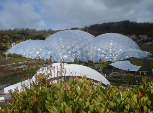
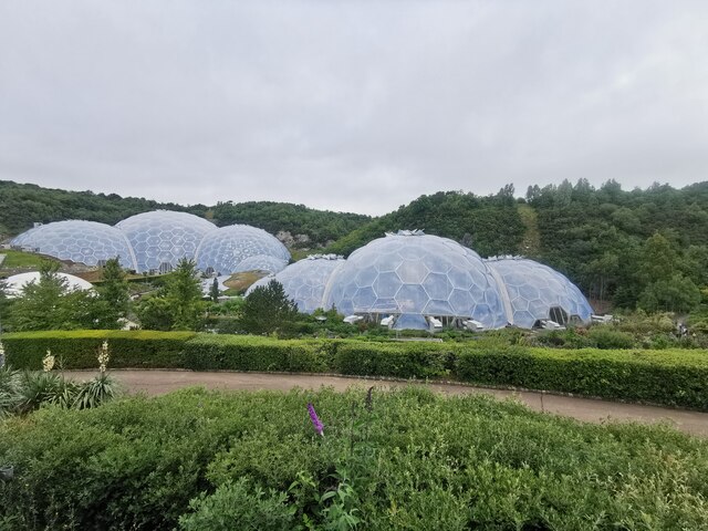
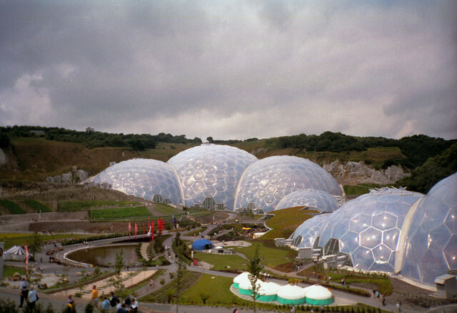
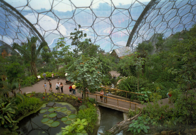
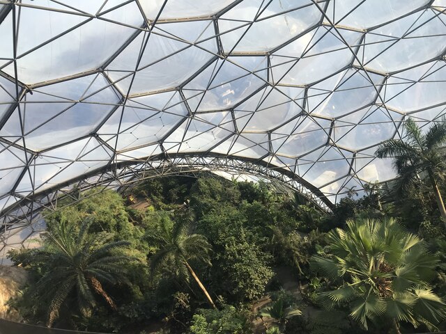
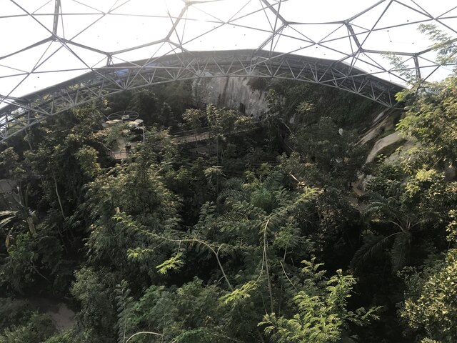
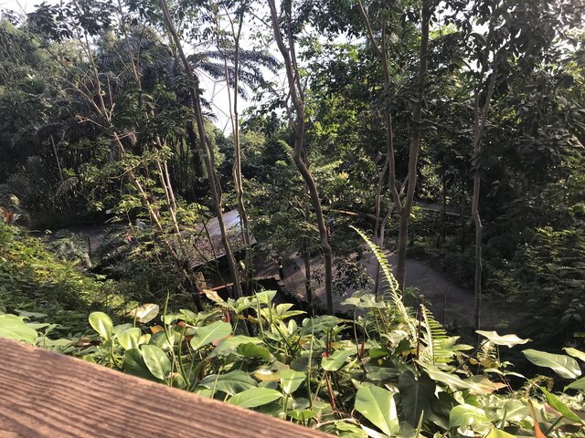
Eden Project
The Eden Project (Cornish: Edenva) is a visitor attraction in Cornwall, England. The project is located in a reclaimed china clay pit, located 2 km (1...
Nearby Amenities
Located within 500m of 50.366067,-4.7380249Have you been to Cornish Wood?
Leave your review of Cornish Wood below (or comments, questions and feedback).