Heywards Heath
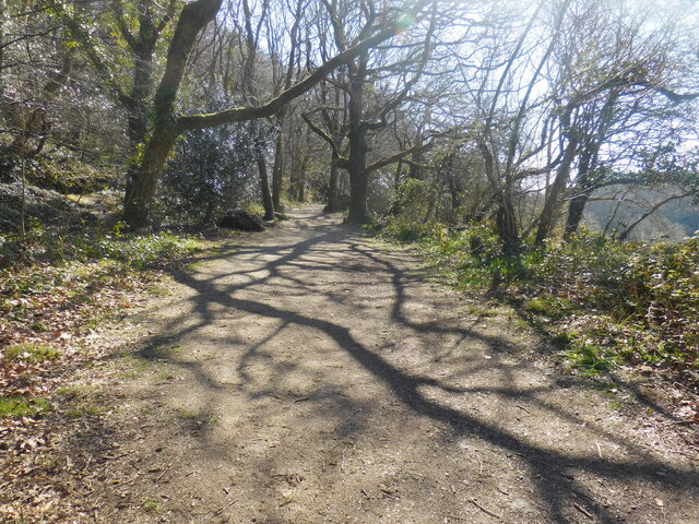
Downs, Moorland in Cornwall
England
Heywards Heath
Heywards Heath is a picturesque town located in West Sussex, England. Situated on the edge of the stunning South Downs, this idyllic town offers a perfect blend of natural beauty and modern amenities. With a population of around 40,000, Heywards Heath is known for its friendly community and welcoming atmosphere.
The town is surrounded by breathtaking countryside, including the famous Ashdown Forest, which inspired A.A. Milne's Winnie-the-Pooh stories. The South Downs National Park is also just a stone's throw away, offering visitors and residents alike the chance to explore miles of rolling hills, ancient woodlands, and stunning coastal views.
In addition to its natural wonders, Heywards Heath boasts a wide range of amenities and facilities. The town center is home to a variety of shops, boutiques, and restaurants, providing a vibrant and bustling atmosphere. The town also has excellent transportation links, with a train station that offers frequent services to London and Brighton.
For those seeking outdoor activities, Heywards Heath offers an array of opportunities. The nearby Sussex Moorland is perfect for hiking and birdwatching, while the local golf courses provide a challenge for golf enthusiasts. The town also has several parks and open spaces, ideal for picnics and leisurely strolls.
Overall, Heywards Heath, Cornwall is a charming town that offers a mix of natural beauty and modern conveniences. Whether you are looking to relax in the tranquil countryside or explore the bustling town center, Heywards Heath has something for everyone.
If you have any feedback on the listing, please let us know in the comments section below.
Heywards Heath Images
Images are sourced within 2km of 50.365359/-4.7371544 or Grid Reference SX0555. Thanks to Geograph Open Source API. All images are credited.
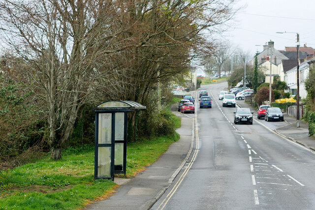
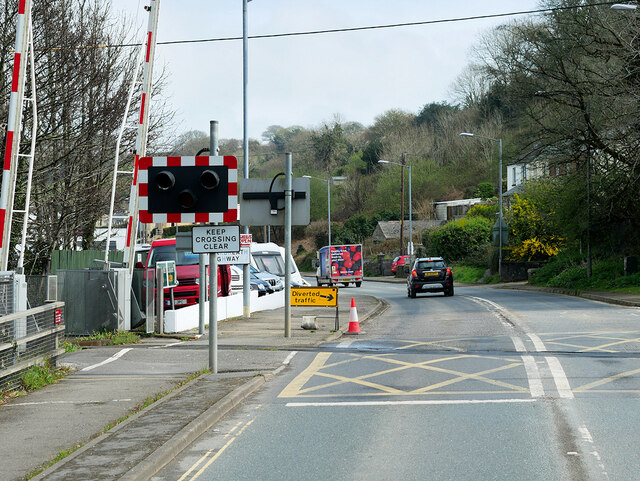
![Bridge Street, St Blazey St Blazey (Cornish: Lanndreth) is a small town in Cornwall, 3 miles (4.8 km) east of St Austell. The town takes its name from the Armenian Saint Blaise who, in Christian tradition, is believed to have &quot;cure[d] toothache, sore throats and cattle diseases&quot;.
The local mining industries once dominated the town; historically copper and tin were mined in and around the parish, whilst more recently china clay has been the principal commodity mined. <a href="https://www.geograph.org.uk/photo/1701065">SX0554 : The Eden Project</a> is located about a mile and a half (2 km) from the centre of the town and the large number of visitors this attracts has led to the development of tourism in the town.
St Blazey. (2022, April 23). In Wikipedia. <span class="nowrap"><a title="https://en.wikipedia.org/wiki/St_Blazey" rel="nofollow ugc noopener" href="https://en.wikipedia.org/wiki/St_Blazey">Link</a><img style="margin-left:2px;" alt="External link" title="External link - shift click to open in new window" src="https://s1.geograph.org.uk/img/external.png" width="10" height="10"/></span>](https://s3.geograph.org.uk/geophotos/07/34/75/7347531_986ab475.jpg)
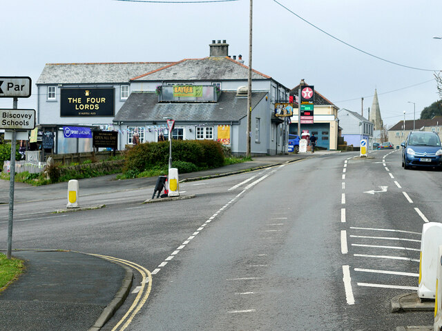
![Rose Hill, St Blazey St Blazey (Cornish: Lanndreth) is a small town in Cornwall, 3 miles (4.8 km) east of St Austell. The town takes its name from the Armenian Saint Blaise who, in Christian tradition, is believed to have &quot;cure[d] toothache, sore throats and cattle diseases&quot;.
The local mining industries once dominated the town; historically copper and tin were mined in and around the parish, whilst more recently china clay has been the principal commodity mined. <a href="https://www.geograph.org.uk/photo/1701065">SX0554 : The Eden Project</a> is located about a mile and a half (2 km) from the centre of the town and the large number of visitors this attracts has led to the development of tourism in the town.
St Blazey. (2022, April 23). In Wikipedia. <span class="nowrap"><a title="https://en.wikipedia.org/wiki/St_Blazey" rel="nofollow ugc noopener" href="https://en.wikipedia.org/wiki/St_Blazey">Link</a><img style="margin-left:2px;" alt="External link" title="External link - shift click to open in new window" src="https://s1.geograph.org.uk/img/external.png" width="10" height="10"/></span>](https://s1.geograph.org.uk/geophotos/07/34/75/7347541_fcb16d1e.jpg)
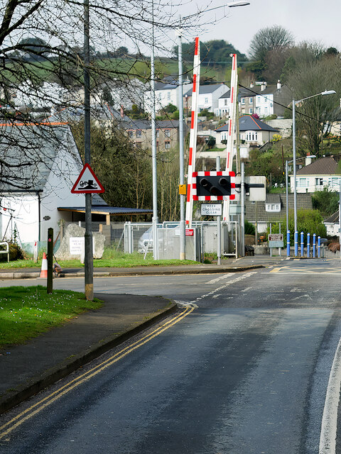
![Church Hill, St Blazey St Blazey (Cornish: Lanndreth) is a small town in Cornwall, 3 miles (4.8 km) east of St Austell. The town takes its name from the Armenian Saint Blaise who, in Christian tradition, is believed to have &quot;cure[d] toothache, sore throats and cattle diseases&quot;. The church, which was built between 1440 and 1445, is dedicated to Saint Blaise. It is a Grade II* listed building (List Entry Number:
1289700 <span class="nowrap"><a title="https://historicengland.org.uk/listing/the-list/list-entry/1289700" rel="nofollow ugc noopener" href="https://historicengland.org.uk/listing/the-list/list-entry/1289700">Link</a><img style="margin-left:2px;" alt="External link" title="External link - shift click to open in new window" src="https://s1.geograph.org.uk/img/external.png" width="10" height="10"/></span> Historic England).
The local mining industries once dominated the town; historically copper and tin were mined in and around the parish, whilst more recently china clay has been the principal commodity mined. <a href="https://www.geograph.org.uk/photo/1701065">SX0554 : The Eden Project</a> is located about a mile and a half (2 km) from the centre of the town and the large number of visitors this attracts has led to the development of tourism in the town.
St Blazey. (2022, April 23). In Wikipedia. <span class="nowrap"><a title="https://en.wikipedia.org/wiki/St_Blazey" rel="nofollow ugc noopener" href="https://en.wikipedia.org/wiki/St_Blazey">Link</a><img style="margin-left:2px;" alt="External link" title="External link - shift click to open in new window" src="https://s1.geograph.org.uk/img/external.png" width="10" height="10"/></span>](https://s3.geograph.org.uk/geophotos/07/34/75/7347543_38528efc.jpg)
Heywards Heath is located at Grid Ref: SX0555 (Lat: 50.365359, Lng: -4.7371544)
Unitary Authority: Cornwall
Police Authority: Devon and Cornwall
What 3 Words
///exonerate.slim.remix. Near Par, Cornwall
Nearby Locations
Related Wikis

Bodelva
Bodelva (Cornish: Boselwydh) is a hamlet in south Cornwall, England, UK, in the civil parish of St Blaise. It is about 1 mile (1.6 km) west of St Blazey...
Prideaux Castle
Prideaux Castle is a multivallate Iron Age hillfort situated atop a 133 m (435 ft) high conical hill near the southern boundary of the parish of Luxulyan...

World Pasty Championships
The World Pasty Championships were an annual event held in Cornwall to celebrate the Cornish Pasty and its variants, with entrants from around the world...

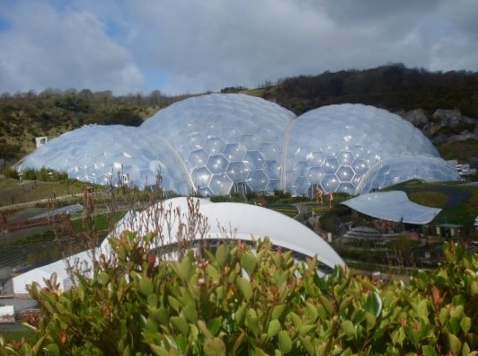
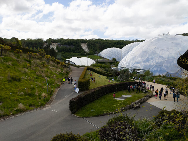
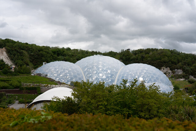
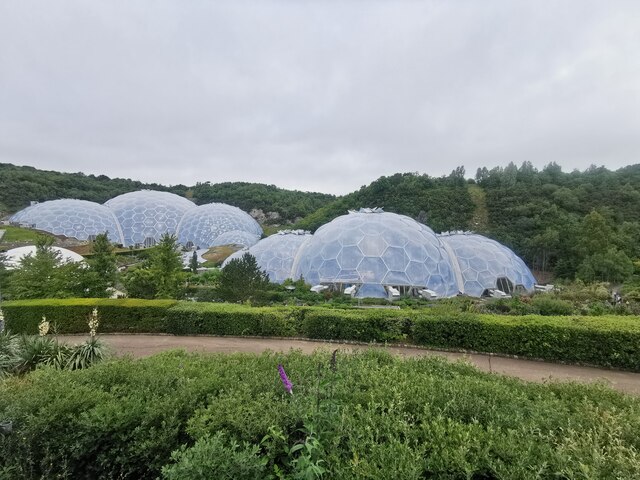
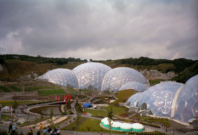
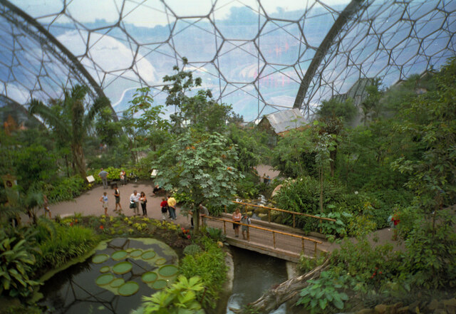
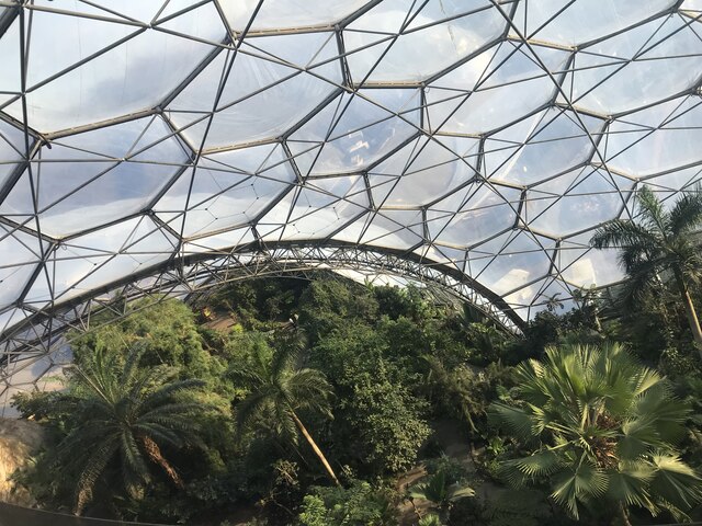
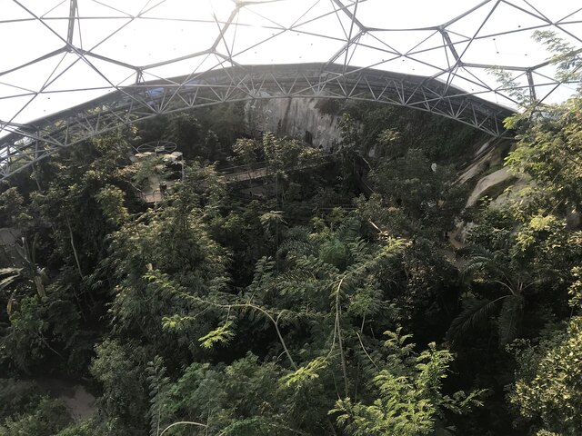
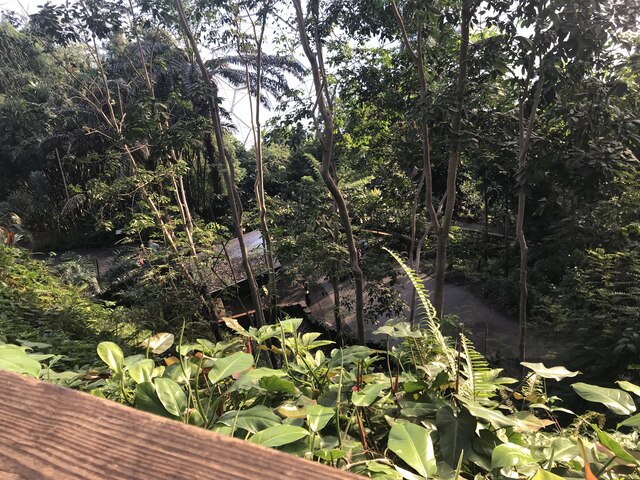
Eden Project
The Eden Project (Cornish: Edenva) is a visitor attraction in Cornwall, England. The project is located in a reclaimed china clay pit, located 2 km (1...
Related Videos
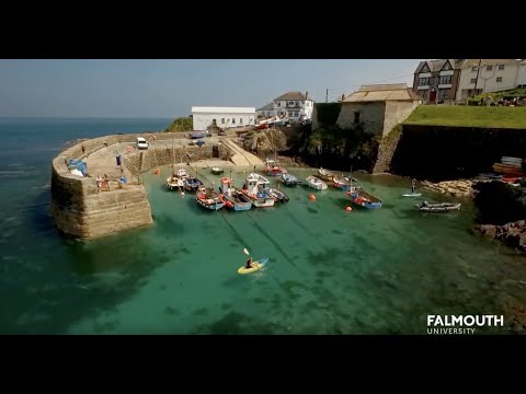
BA(Hons) Sustainable Tourism Management
Find out what it's like to study BA(Hons) Sustainable Tourism Management at Falmouth. See more about the course on the ...

We discover more about Par and Tywardreath Cornwall 3.5 mile circular walk
Join us on a superb walk starting at Par Beach. With the industrial backdrop of the working docks, Par is overlooked by most ...

Tropical Rainforest in Cornwall! Exploring the incredible Eden Project!
The Eden Project is an absolute must for anyone visiting Cornwall or Devon! Whether you're here on vacation or calling in to one ...

#edenproject #travel #nature #cornwall #calm #shorts #holiday #travelvlog #greenhouse #amazon
The outer areas of the Biomes of the Eden Project Watch full video: https://youtu.be/h2t9vk65SlM @edenprojecttv ...
Nearby Amenities
Located within 500m of 50.365359,-4.7371544Have you been to Heywards Heath?
Leave your review of Heywards Heath below (or comments, questions and feedback).