Rick Park Wood

Wood, Forest in Cornwall

England

Rick Park Wood

Stone Stile SX0575b Wetherham Lodge.
A granite stile with no gaps between the steps. Two steps up to the top stone on wood side.  Three steps up to the top stone on Wetherham lodge side.  The land is lower on the Wetherham Lodge side.  
Height 1.2m on wood side, 0.3m Wetherham Lodge side. Width 1m wide at top. 0.55m wide base. Usage Good (some barbed wire at sides).
Public footpath 551/1/4 (gold) Tremeer cross-path to Wetherham Lodge
Stone Stile SX0575b Credit: Paul Tucker

Rick Park Wood is a picturesque forest located in Cornwall, England. Covering an area of approximately 100 acres, it is known for its natural beauty and diverse range of flora and fauna. The wood is situated near the village of Rick, hence its name, and offers visitors a peaceful retreat from the hustle and bustle of city life.

The woodland is predominantly made up of deciduous trees, including oak, beech, and ash, creating a stunning display of colors during the autumn months. The forest floor is covered in a carpet of wildflowers, such as bluebells and primroses, adding to the enchanting atmosphere.

Rick Park Wood is a haven for wildlife, providing a habitat for various species. Birdwatchers can spot a variety of birds, including woodpeckers, owls, and buzzards, while nature enthusiasts may come across squirrels, foxes, and even deer. The forest is also home to a wide range of insects, including butterflies and dragonflies.

Visitors to Rick Park Wood can enjoy a variety of activities. There are several well-maintained walking trails that lead through the forest, allowing visitors to explore the wood at their own pace. The peaceful surroundings make it an ideal spot for picnics or simply relaxing amidst nature. Additionally, the wood is popular with photographers, who are drawn to its natural beauty and the opportunity to capture stunning images.

In conclusion, Rick Park Wood is a charming woodland in Cornwall, offering visitors a tranquil and idyllic setting to enjoy nature at its finest.

If you have any feedback on the listing, please let us know in the comments section below.

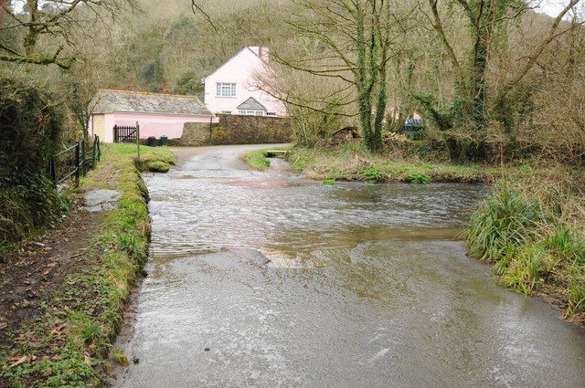
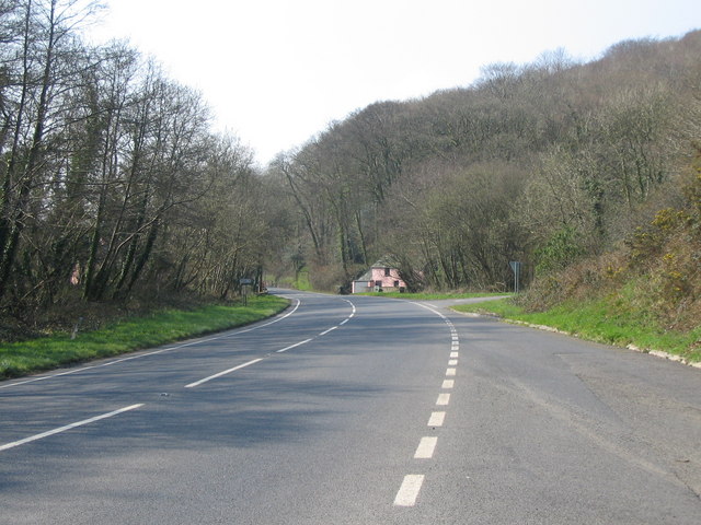
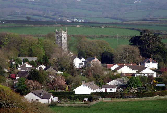
Rick Park Wood Images

Images are sourced within 2km of 50.566753/-4.7491254 or Grid Reference SX0577. Thanks to Geograph Open Source API. All images are credited.

Stone Stile SX0575b Wetherham Lodge.
A granite stile with no gaps between the steps. Two steps up to the top stone on wood side.  Three steps up to the top stone on Wetherham lodge side.  The land is lower on the Wetherham Lodge side.  
Height 1.2m on wood side, 0.3m Wetherham Lodge side. Width 1m wide at top. 0.55m wide base. Usage Good (some barbed wire at sides).
Public footpath 551/1/4 (gold) Tremeer cross-path to Wetherham Lodge
Stone Stile SX0575b
Wetherham Lodge. A granite stile with no gaps between the steps. Two steps up to the top stone on wood side. Three steps up to the top stone on Wetherham lodge side. The land is lower on the Wetherham Lodge side. Height 1.2m on wood side, 0.3m Wetherham Lodge side. Width 1m wide at top. 0.55m wide base. Usage Good (some barbed wire at sides). Public footpath 551/1/4 (gold) Tremeer cross-path to Wetherham Lodge
Stone Stile SX0576a At the roadside. Part of footpath out of the village to Kelly Green.
A granite stile with no gaps between stones.  One step either side. The land is lower on the road side. Situated in corner of a field.
Height 0.45m on road side, 1.00m on field side. Width 1m slate stone.
Usage: Overgrown at time of survey
Public footpath 551/2/4 (silver) Tremeer cross-path to Kelly Green Road
Stone Stile SX0576a
At the roadside. Part of footpath out of the village to Kelly Green. A granite stile with no gaps between stones. One step either side. The land is lower on the road side. Situated in corner of a field. Height 0.45m on road side, 1.00m on field side. Width 1m slate stone. Usage: Overgrown at time of survey Public footpath 551/2/4 (silver) Tremeer cross-path to Kelly Green Road
Stone Stile SX0676a Between Recreation Field and Glebe Parc. Section of footpath from village to Wetherham House.
A granite cattle type stile with gap under top stone.                                                    
One step either side of stile.  The land is slightly lower on Glebe Parc side of stile.  
Height 0.65m Recreation side, 0.45m Glebe Parc side. Width 0.85m. Usage Good. 
Public footpath 551/2/1 (gold) Michaels Cottage to Wetherham Lane.
Stone Stile SX0676a
Between Recreation Field and Glebe Parc. Section of footpath from village to Wetherham House. A granite cattle type stile with gap under top stone. One step either side of stile. The land is slightly lower on Glebe Parc side of stile. Height 0.65m Recreation side, 0.45m Glebe Parc side. Width 0.85m. Usage Good. Public footpath 551/2/1 (gold) Michaels Cottage to Wetherham Lane.
Stone Stile SX0676b Between Glebe Parc and footpath to Wetherham Lane.
A granite cattle stile.  Only top stone clear but gap is obstructed by a large bolder.  Two steps up to the top stone on both sides.  The land is slightly lower on the Maenne Parc footpath side.
Height 0.6m Glebe Parc side, 0.8m Maenne Parc footpath. Width 1.3m at top. 0.5m at base. Usage Good. 
Public footpath 551/2/1 (gold) Michaels Cottage to Wetherham Lane.
Stone Stile SX0676b
Between Glebe Parc and footpath to Wetherham Lane. A granite cattle stile. Only top stone clear but gap is obstructed by a large bolder. Two steps up to the top stone on both sides. The land is slightly lower on the Maenne Parc footpath side. Height 0.6m Glebe Parc side, 0.8m Maenne Parc footpath. Width 1.3m at top. 0.5m at base. Usage Good. Public footpath 551/2/1 (gold) Michaels Cottage to Wetherham Lane.
Stone Stile SX0676c Between footpath from Glebe Parc and Wetherham Lane.
A granite cattle stile. One step up on footpath side.  Four steps up from Wetherham Lane.  Land lower on Wetherham Lane side.
Height 0.85m Maenne Parc footpath, 1.6m Wetherham Lane side. Width 1m.
Usage Difficult due to height from road
Public footpath 551/2/1 (gold) Michaels Cottage to Wetherham Lane.
Stone Stile SX0676c
Between footpath from Glebe Parc and Wetherham Lane. A granite cattle stile. One step up on footpath side. Four steps up from Wetherham Lane. Land lower on Wetherham Lane side. Height 0.85m Maenne Parc footpath, 1.6m Wetherham Lane side. Width 1m. Usage Difficult due to height from road Public footpath 551/2/1 (gold) Michaels Cottage to Wetherham Lane.
Stone Stile SX0676d Adjacent to North-West end of Recreation Field.
Very low stile missing top stone and side banks. One step on village side and two on other side.  The ground slightly lower on the far side.  
Height 0.3m on village side, 0.45m on west side. Width 0.60m.
Public footpath 551/2/3 (gold) West end of New Cemetery to Tremeer cross-path.
Stone Stile SX0676d
Adjacent to North-West end of Recreation Field. Very low stile missing top stone and side banks. One step on village side and two on other side. The ground slightly lower on the far side. Height 0.3m on village side, 0.45m on west side. Width 0.60m. Public footpath 551/2/3 (gold) West end of New Cemetery to Tremeer cross-path.
Stone Stile SX0676e North-East corner of Fairview House field.
A granite cattle stile with only a gap under the top stone.  Two steps up from both sides.  The land is slightly lower on the side away from the village.   
Height 0.95m on village side, 1.15m on west side. Width 1.5m top stone.
Public footpath 551/2/3 (gold) West end of New Cemetery to Tremeer cross-path.
Stone Stile SX0676e
North-East corner of Fairview House field. A granite cattle stile with only a gap under the top stone. Two steps up from both sides. The land is slightly lower on the side away from the village. Height 0.95m on village side, 1.15m on west side. Width 1.5m top stone. Public footpath 551/2/3 (gold) West end of New Cemetery to Tremeer cross-path.
Stone Stile SX0676f Bottom of Tremeer Valley.
Slate-on-edge pedestrian stile.  Adjacent to footbridge / boardwalk over Tremeer Stream.  One step on side nearest village.  Three steps on side away from village.
Height 0.8m on village side, 1.35m on west side. Width 1m slate stone.
Public footpath 551/2/3 (gold) West end of New Cemetery to Tremeer cross-path.
Stone Stile SX0676f
Bottom of Tremeer Valley. Slate-on-edge pedestrian stile. Adjacent to footbridge / boardwalk over Tremeer Stream. One step on side nearest village. Three steps on side away from village. Height 0.8m on village side, 1.35m on west side. Width 1m slate stone. Public footpath 551/2/3 (gold) West end of New Cemetery to Tremeer cross-path.
Stone Stile SX0676g Between Oke Cottage and Haypark Corner.
A granite sheep stile.  Two remaining steps on village side.  Four small steps on side away from village.  The land is lower on the side away from village.   
Height 0.90m on St Tudy side, 2.65m on Haypark Corner side. Width 0.80m
Usage: Very difficult - overgrown & very high
Public footpath 551/5/1 (gold) Oke Cottage to Haypark Corner.
Stone Stile SX0676g
Between Oke Cottage and Haypark Corner. A granite sheep stile. Two remaining steps on village side. Four small steps on side away from village. The land is lower on the side away from village. Height 0.90m on St Tudy side, 2.65m on Haypark Corner side. Width 0.80m Usage: Very difficult - overgrown & very high Public footpath 551/5/1 (gold) Oke Cottage to Haypark Corner.
Stone Stile SX0676j Between Hengar Lane roadside and Barn Field.
A granite coffen stile with added top granite horizontal stone.  Four steps up from road.  Only coffen step on field side.  The land is lower on road side of stile.
Height 0.80m road side, 0.80m on Barn field side. Width 0.80m.
Public footpath 551/7/1 (silver) Hengar Lane to B3266.
Coffen stile – a stile built over a pit – like a granite cattle grid.
Coffen is a Cornish word for a man-made hole in the ground.
Stone Stile SX0676j
Between Hengar Lane roadside and Barn Field. A granite coffen stile with added top granite horizontal stone. Four steps up from road. Only coffen step on field side. The land is lower on road side of stile. Height 0.80m road side, 0.80m on Barn field side. Width 0.80m. Public footpath 551/7/1 (silver) Hengar Lane to B3266. Coffen stile – a stile built over a pit – like a granite cattle grid. Coffen is a Cornish word for a man-made hole in the ground.
St Tudy Methodist Church
Ford at Penvose and Rock Gin Penvose is a location to the east of the A39 near the village of Trelill. The pink building ahead is Penvose Cottages which is the home of Rock Gin - see <span class="nowrap"><a title="https://www.rockgincornish.com" rel="nofollow ugc noopener" href="https://www.rockgincornish.com">Link</a><img style="margin-left:2px;" alt="External link" title="External link - shift click to open in new window" src="https://s1.geograph.org.uk/img/external.png" width="10" height="10"/></span>
The river is the Allen which flows alongside the A39 for several miles from Kellygreen (east of St Kew Highway) to Knightsmill.
Ford at Penvose and Rock Gin
Penvose is a location to the east of the A39 near the village of Trelill. The pink building ahead is Penvose Cottages which is the home of Rock Gin - see LinkExternal link The river is the Allen which flows alongside the A39 for several miles from Kellygreen (east of St Kew Highway) to Knightsmill.
Feeding rack in a field A feeding rack in a field near the hamlet of Treburgett.
Feeding rack in a field
A feeding rack in a field near the hamlet of Treburgett.
The A39 near Treburgett The A39 viewed from the turning the for the hamlet of Treburgett.
The A39 near Treburgett
The A39 viewed from the turning the for the hamlet of Treburgett.
Ford on the River Allen An unsignposted road off the A39 to St Tudy negotiates this ford on the River Allen.
Ford on the River Allen
An unsignposted road off the A39 to St Tudy negotiates this ford on the River Allen.
Farmland above St Tudy
Country road near St Tudy
Entrance to Trewen Farm The entrance to the drive to Trewen Farm near St Tudy.
Entrance to Trewen Farm
The entrance to the drive to Trewen Farm near St Tudy.
Show me another place!

Rick Park Wood is located at Grid Ref: SX0577 (Lat: 50.566753, Lng: -4.7491254)

Unitary Authority: Cornwall

Police Authority: Devon and Cornwall

What 3 Words

///daylight.taster.corrects. Near Delabole, Cornwall

Related Wikis

Willapark (Tintagel)

50.574°N 4.743°W / 50.574; -4.743 Willapark (not to be confused with Willapark (Boscastle)) is a headland just north of Tintagel on the north coast of...

Trelill

Trelill (Cornish: Traughlille) is a hamlet in North Cornwall, United Kingdom. Trelill Tunnel carries the disused railway line to Wadebridge and Trelill...

Treburgett

Treburgett is a hamlet in the parish of St Teath, Cornwall, England, United Kingdom.Treburgett Mine (grid reference SX055796) was a lead and silver mine...

St Tudy

St Tudy (Cornish: Eglostudi) is a civil parish and village in north Cornwall, England, United Kingdom. The village is situated in the River Camel valley...

Nearby Amenities

Located within 500m of 50.566753,-4.7491254
Ford: yes
Lat/Long: 50.5670667/-4.7505857
Cornish Rock Gin
Addr Housename: Penvose Cottage
Addr Street: Atlantic Highway, Rock, Bodmin PL30 3NP
Craft: distillery
Website: https://www.rockgincornish.com/
Lat/Long: 50.5671423/-4.744551
Lamellen Barn
Place: isolated_dwelling
Lat/Long: 50.563534/-4.747337
Power: pole
Lat/Long: 50.5642623/-4.7450766
Power: pole
Lat/Long: 50.5636201/-4.7446366
Power: pole
Lat/Long: 50.5633768/-4.7536303
Power: pole
Lat/Long: 50.5643635/-4.7533951
Power: pole
Lat/Long: 50.5650502/-4.7526649
The data included in this document is from www.openstreetmap.org. The data is made available under ODbL.

Have you been to Rick Park Wood?

Leave your review of Rick Park Wood below (or comments, questions and feedback).