Charlbury

Settlement in Oxfordshire West Oxfordshire

England

Charlbury

Trains cross at Charlbury Ex LMS Pacific No. 6233 'Duchess of Sutherland' waits to depart from Charlbury with the return leg of the 'Cotswold Venturer' railtour from Worcester to Paddington.  A GWR class 802 IET approaches on its way to Worcester.  6233 was built in 1938 at Crewe, and after withdrawal in 1964 went to Butlin's Holiday Camp at Points of Ayr in Scotland.  She was moved in 1996 to Bressingham Steam Museum in Norfolk and is presently owned by The Princess Royal Class Locomotive Trust.  The locomotive was restored and returned to the main line in 2001.
Trains cross at Charlbury Credit: Bob Walters

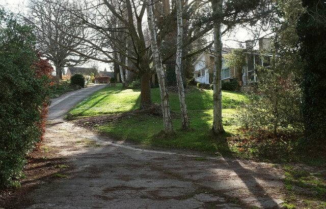
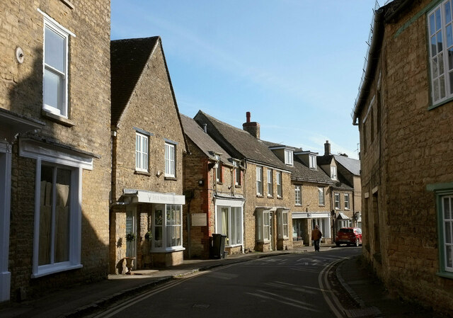
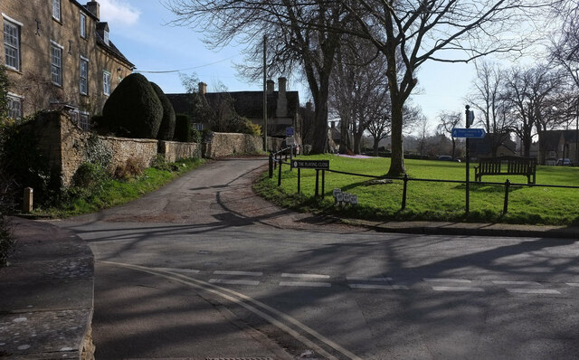
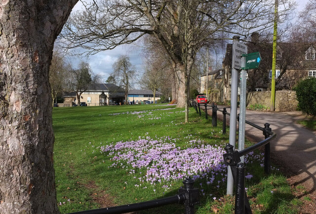
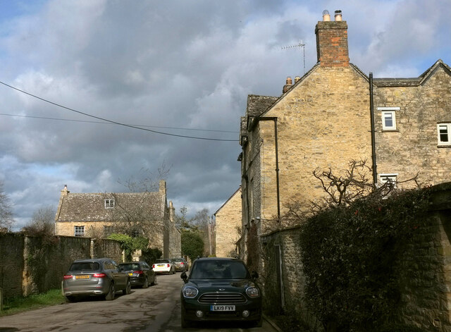
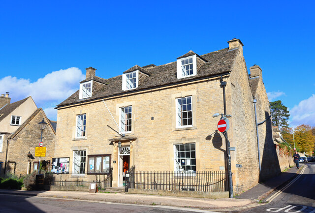
Charlbury is a picturesque town located in the West Oxfordshire district of Oxfordshire, England. Situated on the banks of the River Evenlode, it lies approximately 16 miles northwest of the historic city of Oxford. The town is nestled within the beautiful Cotswolds Area of Outstanding Natural Beauty, surrounded by rolling hills and scenic landscapes.

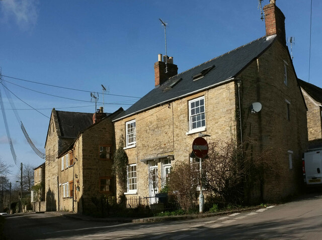
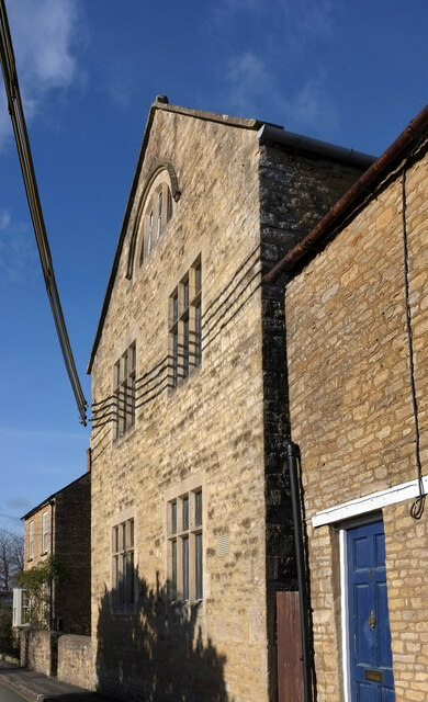
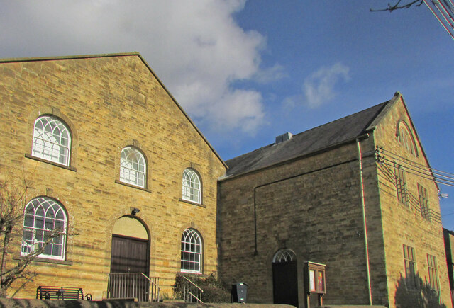
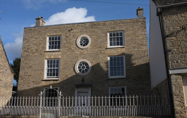
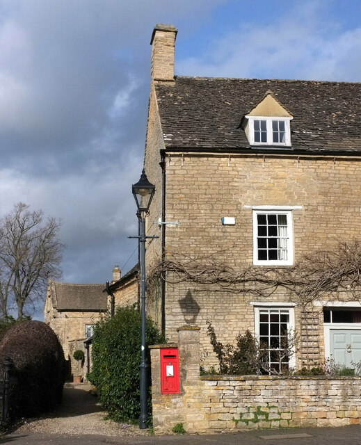
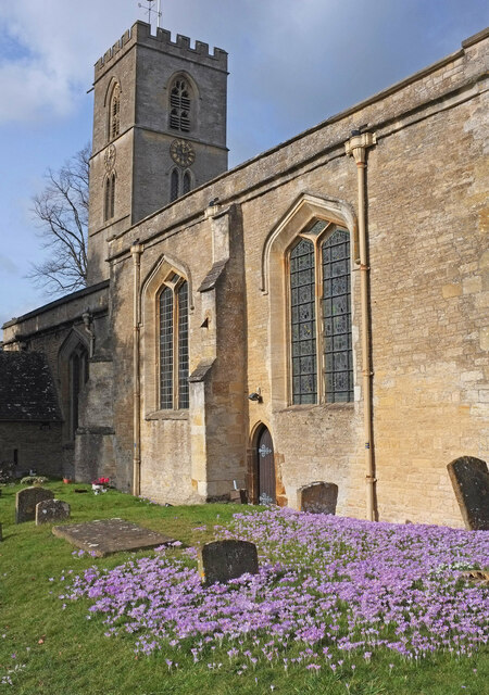
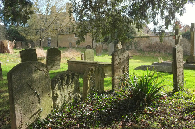
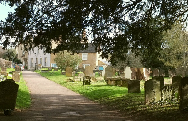
With a population of around 2,830 residents, Charlbury retains a close-knit community feel. The town's architecture is a charming mix of traditional Cotswold stone buildings, including historic houses, cottages, and the iconic St. Mary's Church, which dates back to the 13th century.

Charlbury is well-served by amenities, including a library, a primary school, and a community centre. The town also boasts a range of independent shops, cafes, and pubs, providing a vibrant and welcoming atmosphere for both residents and visitors.

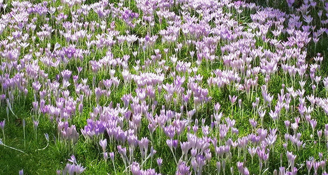
The area offers a wealth of outdoor activities, with several footpaths and bridleways that wind through the surrounding countryside. The nearby Cornbury Park, a magnificent country estate, provides ample opportunities for outdoor pursuits such as walking, cycling, and wildlife spotting.

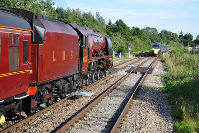
Transport links in Charlbury are excellent, with regular train services connecting the town to Oxford, London, and other major cities. Additionally, the town is served by local bus routes, facilitating convenient travel within the region.

Overall, Charlbury is a charming and idyllic town that offers a tranquil escape from the hustle and bustle of city life, combined with easy access to nearby urban centers.

If you have any feedback on the listing, please let us know in the comments section below.

Charlbury Images

Images are sourced within 2km of 51.871056/-1.474172 or Grid Reference SP3619. Thanks to Geograph Open Source API. All images are credited.

Trains cross at Charlbury Ex LMS Pacific No. 6233 'Duchess of Sutherland' waits to depart from Charlbury with the return leg of the 'Cotswold Venturer' railtour from Worcester to Paddington.  A GWR class 802 IET approaches on its way to Worcester.  6233 was built in 1938 at Crewe, and after withdrawal in 1964 went to Butlin's Holiday Camp at Points of Ayr in Scotland.  She was moved in 1996 to Bressingham Steam Museum in Norfolk and is presently owned by The Princess Royal Class Locomotive Trust.  The locomotive was restored and returned to the main line in 2001.
Trains cross at Charlbury
Ex LMS Pacific No. 6233 'Duchess of Sutherland' waits to depart from Charlbury with the return leg of the 'Cotswold Venturer' railtour from Worcester to Paddington. A GWR class 802 IET approaches on its way to Worcester. 6233 was built in 1938 at Crewe, and after withdrawal in 1964 went to Butlin's Holiday Camp at Points of Ayr in Scotland. She was moved in 1996 to Bressingham Steam Museum in Norfolk and is presently owned by The Princess Royal Class Locomotive Trust. The locomotive was restored and returned to the main line in 2001.
Cornbury Park Charlbury
Crocuses, Charlbury We have arrived from Hook Norton where it was all snowdrops; Charlbury, it seems, is all crocuses. These are beside The Slade.
Crocuses, Charlbury
We have arrived from Hook Norton where it was all snowdrops; Charlbury, it seems, is all crocuses. These are beside The Slade.
Sandford Park, Charlbury Seen from footpath 156 15/10.
Sandford Park, Charlbury
Seen from footpath 156 15/10.
Buildings on Fisher's Lane, Charlbury A view from Pooles Lane. The tall building on the left is the Wesleyan Sunday School adjoining the Methodist Chapel and described at <span class="nowrap"><a title="https://historicengland.org.uk/listing/the-list/list-entry/1053240?section=official-listing" rel="nofollow ugc noopener" href="https://historicengland.org.uk/listing/the-list/list-entry/1053240?section=official-listing">Link</a><img style="margin-left:2px;" alt="External link" title="External link - shift click to open in new window" src="https://s1.geograph.org.uk/img/external.png" width="10" height="10"/></span> .
Buildings on Fisher's Lane, Charlbury
A view from Pooles Lane. The tall building on the left is the Wesleyan Sunday School adjoining the Methodist Chapel and described at LinkExternal link .
Wesleyan Sunday School, Charlbury The building adjoins the Methodist Chapel and they are listed and described together at <span class="nowrap"><a title="https://historicengland.org.uk/listing/the-list/list-entry/1053240?section=official-listing" rel="nofollow ugc noopener" href="https://historicengland.org.uk/listing/the-list/list-entry/1053240?section=official-listing">Link</a><img style="margin-left:2px;" alt="External link" title="External link - shift click to open in new window" src="https://s1.geograph.org.uk/img/external.png" width="10" height="10"/></span> .
Wesleyan Sunday School, Charlbury
The building adjoins the Methodist Chapel and they are listed and described together at LinkExternal link .
Methodist chapel and Sunday school, Charlbury "1823 on gable of chapel; 1844 on school ..." <span class="nowrap"><a title="https://historicengland.org.uk/listing/the-list/list-entry/1053240?section=official-listing" rel="nofollow ugc noopener" href="https://historicengland.org.uk/listing/the-list/list-entry/1053240?section=official-listing">Link</a><img style="margin-left:2px;" alt="External link" title="External link - shift click to open in new window" src="https://s1.geograph.org.uk/img/external.png" width="10" height="10"/></span> .
Methodist chapel and Sunday school, Charlbury
"1823 on gable of chapel; 1844 on school ..." LinkExternal link .
Sheep Street, Charlbury The building houses Four Shires Kitchen is listed and described at <span class="nowrap"><a title="https://historicengland.org.uk/listing/the-list/list-entry/1367841?section=official-listing" rel="nofollow ugc noopener" href="https://historicengland.org.uk/listing/the-list/list-entry/1367841?section=official-listing">Link</a><img style="margin-left:2px;" alt="External link" title="External link - shift click to open in new window" src="https://s1.geograph.org.uk/img/external.png" width="10" height="10"/></span> . The building on the left is also listed <span class="nowrap"><a title="https://historicengland.org.uk/listing/the-list/list-entry/1198459?section=official-listing" rel="nofollow ugc noopener" href="https://historicengland.org.uk/listing/the-list/list-entry/1198459?section=official-listing">Link</a><img style="margin-left:2px;" alt="External link" title="External link - shift click to open in new window" src="https://s1.geograph.org.uk/img/external.png" width="10" height="10"/></span> . Sheep Street, the old main route through the town, is followed by the Oxfordshire Way.
Sheep Street, Charlbury
The building houses Four Shires Kitchen is listed and described at LinkExternal link . The building on the left is also listed LinkExternal link . Sheep Street, the old main route through the town, is followed by the Oxfordshire Way.
Grandchester House, Charlbury "Once a school for young ladies" <span class="nowrap"><a title="https://www.britainexpress.com/photo.htm?photo=222" rel="nofollow ugc noopener" href="https://www.britainexpress.com/photo.htm?photo=222">Link</a><img style="margin-left:2px;" alt="External link" title="External link - shift click to open in new window" src="https://s1.geograph.org.uk/img/external.png" width="10" height="10"/></span> . The house, with twin bulls-eye windows, is listed and described at <span class="nowrap"><a title="https://historicengland.org.uk/listing/the-list/list-entry/1053217?section=official-listing" rel="nofollow ugc noopener" href="https://historicengland.org.uk/listing/the-list/list-entry/1053217?section=official-listing">Link</a><img style="margin-left:2px;" alt="External link" title="External link - shift click to open in new window" src="https://s1.geograph.org.uk/img/external.png" width="10" height="10"/></span> . Also listed are the "dwarf stone wall with coping has spearhead iron railings and gate with overthrow and small urn-shaped finial" <span class="nowrap"><a title="https://historicengland.org.uk/listing/the-list/list-entry/1198536?section=official-listing" rel="nofollow ugc noopener" href="https://historicengland.org.uk/listing/the-list/list-entry/1198536?section=official-listing">Link</a><img style="margin-left:2px;" alt="External link" title="External link - shift click to open in new window" src="https://s1.geograph.org.uk/img/external.png" width="10" height="10"/></span> .
Grandchester House, Charlbury
"Once a school for young ladies" LinkExternal link . The house, with twin bulls-eye windows, is listed and described at LinkExternal link . Also listed are the "dwarf stone wall with coping has spearhead iron railings and gate with overthrow and small urn-shaped finial" LinkExternal link .
The Playing Close, Charlbury The north corner of the green. On the left is Sycamore Close <span class="nowrap"><a title="https://historicengland.org.uk/listing/the-list/list-entry/1367819?section=official-listing" rel="nofollow ugc noopener" href="https://historicengland.org.uk/listing/the-list/list-entry/1367819?section=official-listing">Link</a><img style="margin-left:2px;" alt="External link" title="External link - shift click to open in new window" src="https://s1.geograph.org.uk/img/external.png" width="10" height="10"/></span> . The C19 iron railings surrounding the green are also listed <span class="nowrap"><a title="https://historicengland.org.uk/listing/the-list/list-entry/1283874?section=official-listing" rel="nofollow ugc noopener" href="https://historicengland.org.uk/listing/the-list/list-entry/1283874?section=official-listing">Link</a><img style="margin-left:2px;" alt="External link" title="External link - shift click to open in new window" src="https://s1.geograph.org.uk/img/external.png" width="10" height="10"/></span> .
The Playing Close, Charlbury
The north corner of the green. On the left is Sycamore Close LinkExternal link . The C19 iron railings surrounding the green are also listed LinkExternal link .
Crocuses, The Playing Close, Charlbury At the eastern corner of the green; the north corner appears in <a href="https://www.geograph.org.uk/photo/7094375">SP3519 : The Playing Close, Charlbury</a>. The railings are described at <span class="nowrap"><a title="https://historicengland.org.uk/listing/the-list/list-entry/1283874?section=official-listing" rel="nofollow ugc noopener" href="https://historicengland.org.uk/listing/the-list/list-entry/1283874?section=official-listing">Link</a><img style="margin-left:2px;" alt="External link" title="External link - shift click to open in new window" src="https://s1.geograph.org.uk/img/external.png" width="10" height="10"/></span> . At the far end of the green is the memorial fountain described at <span class="nowrap"><a title="https://historicengland.org.uk/listing/the-list/list-entry/1283841?section=official-listing" rel="nofollow ugc noopener" href="https://historicengland.org.uk/listing/the-list/list-entry/1283841?section=official-listing">Link</a><img style="margin-left:2px;" alt="External link" title="External link - shift click to open in new window" src="https://s1.geograph.org.uk/img/external.png" width="10" height="10"/></span> .
Crocuses, The Playing Close, Charlbury
At the eastern corner of the green; the north corner appears in SP3519 : The Playing Close, Charlbury. The railings are described at LinkExternal link . At the far end of the green is the memorial fountain described at LinkExternal link .
The Manor House, Charlbury The listed house <span class="nowrap"><a title="https://historicengland.org.uk/listing/the-list/list-entry/1053273?section=official-listing" rel="nofollow ugc noopener" href="https://historicengland.org.uk/listing/the-list/list-entry/1053273?section=official-listing">Link</a><img style="margin-left:2px;" alt="External link" title="External link - shift click to open in new window" src="https://s1.geograph.org.uk/img/external.png" width="10" height="10"/></span> is on Church Street beside the eastern entrance to the churchyard. Glimpsed down the side alley, Minster Cottage is also listed <span class="nowrap"><a title="https://historicengland.org.uk/listing/the-list/list-entry/1283962?section=official-listing" rel="nofollow ugc noopener" href="https://historicengland.org.uk/listing/the-list/list-entry/1283962?section=official-listing">Link</a><img style="margin-left:2px;" alt="External link" title="External link - shift click to open in new window" src="https://s1.geograph.org.uk/img/external.png" width="10" height="10"/></span> . The George V postbox is numbered OX7 165.
The Manor House, Charlbury
The listed house LinkExternal link is on Church Street beside the eastern entrance to the churchyard. Glimpsed down the side alley, Minster Cottage is also listed LinkExternal link . The George V postbox is numbered OX7 165.
Crocuses by the church, Charlbury St Mary's church is grade I listed <span class="nowrap"><a title="https://historicengland.org.uk/listing/the-list/list-entry/1053232?section=official-listing" rel="nofollow ugc noopener" href="https://historicengland.org.uk/listing/the-list/list-entry/1053232?section=official-listing">Link</a><img style="margin-left:2px;" alt="External link" title="External link - shift click to open in new window" src="https://s1.geograph.org.uk/img/external.png" width="10" height="10"/></span> .
Crocuses by the church, Charlbury
St Mary's church is grade I listed LinkExternal link .
Houses, Charlbury On Church Lane. Just ahead is Queen's Own, "an early-C18 house raised in the C19 with a fine, three-storey stone facade in the centre of Charlbury and next to the Grade II St. Mary's Church" <span class="nowrap"><a title="https://historicengland.org.uk/listing/the-list/list-entry/1061367?section=official-listing" rel="nofollow ugc noopener" href="https://historicengland.org.uk/listing/the-list/list-entry/1061367?section=official-listing">Link</a><img style="margin-left:2px;" alt="External link" title="External link - shift click to open in new window" src="https://s1.geograph.org.uk/img/external.png" width="10" height="10"/></span> . Also listed on the left is The Willows <span class="nowrap"><a title="https://historicengland.org.uk/listing/the-list/list-entry/1053268?section=official-listing" rel="nofollow ugc noopener" href="https://historicengland.org.uk/listing/the-list/list-entry/1053268?section=official-listing">Link</a><img style="margin-left:2px;" alt="External link" title="External link - shift click to open in new window" src="https://s1.geograph.org.uk/img/external.png" width="10" height="10"/></span> .
Houses, Charlbury
On Church Lane. Just ahead is Queen's Own, "an early-C18 house raised in the C19 with a fine, three-storey stone facade in the centre of Charlbury and next to the Grade II St. Mary's Church" LinkExternal link . Also listed on the left is The Willows LinkExternal link .
Headstones, Charlbury This groups of memorials are close to the door of St Mary's church. Behind the wall is a listed house <span class="nowrap"><a title="https://historicengland.org.uk/listing/the-list/list-entry/1053251?section=official-listing" rel="nofollow ugc noopener" href="https://historicengland.org.uk/listing/the-list/list-entry/1053251?section=official-listing">Link</a><img style="margin-left:2px;" alt="External link" title="External link - shift click to open in new window" src="https://s1.geograph.org.uk/img/external.png" width="10" height="10"/></span> on Park Street with a date stone of 1666.
Headstones, Charlbury
This groups of memorials are close to the door of St Mary's church. Behind the wall is a listed house LinkExternal link on Park Street with a date stone of 1666.
Crocuses, Charlbury churchyard These are close to Church Lane.
Crocuses, Charlbury churchyard
These are close to Church Lane.
Churchyard path, Charlbury From close to the church entrance, with houses on the bend of Church Street and Park Street. On the right are some of the headstones shown in <a href="https://www.geograph.org.uk/photo/7094823">SP3519 : Headstones, Charlbury</a>.
Churchyard path, Charlbury
From close to the church entrance, with houses on the bend of Church Street and Park Street. On the right are some of the headstones shown in SP3519 : Headstones, Charlbury.
Charlbury Museum Off Brown's Lane, Charlbury.
Charlbury Museum
Off Brown's Lane, Charlbury.
Show me another place!

Charlbury is located at Grid Ref: SP3619 (Lat: 51.871056, Lng: -1.474172)

Administrative County: Oxfordshire

District: West Oxfordshire

Police Authority: Thames Valley

What 3 Words

///clashing.image.expiring. Near Charlbury, Oxfordshire

Nearby Locations

Charlbury Charlbury

Related Wikis

Blenheim Farm

Blenheim Farm is a 1-hectare (2.5-acre) nature reserve near Charlbury in Oxfordshire. It is owned and managed by the Berkshire, Buckinghamshire and Oxfordshire...

Charlbury

Charlbury () is a town and civil parish in the Evenlode valley, about 6 miles (10 km) north of Witney in the West Oxfordshire district of Oxfordshire,...

Charlbury Museum

Charlbury Museum is a local museum in the town of Charlbury, Oxfordshire, England. The museum and collections are organized and run by the Charlbury Society...

Charlbury railway station

Charlbury railway station is a railway station serving the town of Charlbury in Oxfordshire, England. This station and all trains serving it are operated...

Cornbury and Wychwood

Cornbury and Wychwood is a civil parish in West Oxfordshire. It includes the country estate of Cornbury Park (Ordnance Survey grid reference SP350181)...

Fawler

Fawler is a hamlet and civil parish in the valley of the River Evenlode, 1.5 miles (2.4 km) southeast of Charlbury in Oxfordshire, England. There are...

Finstock railway station

Finstock railway station serves the village of Finstock and the hamlet of Fawler in Oxfordshire, England. It is some distance from Finstock itself, being...

Salt Way, Ditchley

Salt Way, Ditchley is a 2-hectare (4.9-acre) biological Site of Special Scientific Interest (SSSI) east of Charlbury in Oxfordshire. It is also a Local...

Nearby Amenities

Located within 500m of 51.871056,-1.474172
Barrier: entrance
Lat/Long: 51.8716429/-1.4741387
Barrier: stile
Lat/Long: 51.8695142/-1.4724348
Barrier: stile
Foot: yes
Lat/Long: 51.8717291/-1.4773957
Post Box
Post Box Type: lamp
Ref: OX7 952
Royal Cypher: EIIR
Royal Cypher Wikidata: Q33102113
Lat/Long: 51.8742865/-1.476144
Bus Stop
Bus: yes
Naptan AtcoCode: 340000900SOU
Naptan NaptanCode: oxfgmpga
Public Transport: platform
Lat/Long: 51.8677082/-1.4772589
Traffic Signals
Crossing: traffic_signals
Crossing Ref: toucan
Lat/Long: 51.8681663/-1.4771462
Bus Stop
Sturt Close
Bus: yes
Naptan AtcoCode: 340000900NOR
Naptan Bearing: N
Naptan CommonName: Sturt Close
Naptan Indicator: Opposite
Naptan Landmark: Shop
Naptan NaptanCode: oxfapdmd
Naptan Street: Sturt Road
Naptan Verified: no
Public Transport: platform
Source: naptan_import
Lat/Long: 51.8677433/-1.477521
Bus Stop
Sturt Close
Bus: yes
Naptan AtcoCode: 340000900SOU
Naptan Bearing: S
Naptan BusStopType: CUS
Naptan CommonName: Sturt Close
Naptan Indicator: Corner
Naptan Landmark: Shop
Naptan NaptanCode: oxfgmpga
Naptan Street: Sturt Road
Naptan Verified: no
Public Transport: platform
Source: naptan_import
Lat/Long: 51.8682267/-1.4770361
Bus Stop
Dancers Hill
Bus: yes
Naptan AtcoCode: 340000901DAN
Naptan Bearing: N
Naptan CommonName: Dancers Hill
Naptan Indicator: Adjacent
Naptan Landmark: Dancers Hill
Naptan NaptanCode: oxfgpgjg
Naptan Street: Sturt Road
Naptan Verified: no
Public Transport: platform
Source: naptan_import
Wheelchair: limited
Lat/Long: 51.8705534/-1.4765879
Wychwood Close
Naptan AtcoCode: 340001817STU
Naptan Bearing: S
Naptan BusStopType: CUS
Naptan CommonName: Wychwood Close
Naptan Indicator: Opposite
Naptan Landmark: Wychwood Close
Naptan NaptanCode: oxfgmpdp
Naptan Street: The Slade
Naptan Verified: no
Source: naptan_import
Lat/Long: 51.8745728/-1.4766575
Bus Stop
Wychwood Close
Bus: yes
Naptan AtcoCode: 340001818NOR
Naptan Bearing: N
Naptan CommonName: Wychwood Close
Naptan Indicator: Corner
Naptan Landmark: Wychwood Close
Naptan NaptanCode: oxfgjmgp
Naptan Street: The Slade
Naptan Verified: no
Public Transport: platform
Source: naptan_import
Lat/Long: 51.8745734/-1.4767882
Roof Shape: gabled
Source: Bing
Lat/Long: 51.8682176/-1.4754998
Parking
Access: private
Operator: Charlbury Primary School
Lat/Long: 51.8733984/-1.4764083
Crossing
Crossing: unmarked
Kerb: lowered
Surface: sett
Lat/Long: 51.8683529/-1.4769149
Post Box
Post Box Type: wall
Ref: OX7 40D
Royal Cypher: EIIR
Royal Cypher Wikidata: Q33102113
Lat/Long: 51.871723/-1.4809924
Turning Circle
Lat/Long: 51.8695653/-1.4741503
Addr Housenumber: 4
Addr Postcode: OX7 3DU
Addr Street: Bartlett Close
Lat/Long: 51.8690937/-1.4747264
Addr Housenumber: 3
Addr Postcode: OX7 3DU
Addr Street: Bartlett Close
Lat/Long: 51.8690605/-1.4747927
Addr Housenumber: 2
Addr Postcode: OX7 3DU
Addr Street: Bartlett Close
Lat/Long: 51.8690648/-1.474811
Bicycle Parking
Bicycle Parking: stands
Covered: no
Lat/Long: 51.8682937/-1.4769935
Fixme: new houses under construction here (Vanderbilt Homes)
Lat/Long: 51.8714478/-1.4813104
Power: pole
Lat/Long: 51.8709962/-1.4709371
Power: pole
Lat/Long: 51.8732955/-1.4725855
Natural: spring
Source: OS-OpenData_StreetView_2016_04
Lat/Long: 51.871798/-1.4747109
The data included in this document is from www.openstreetmap.org. The data is made available under ODbL.

Have you been to Charlbury?

Leave your review of Charlbury below (or comments, questions and feedback).