Big Sheep-park Wood

Wood, Forest in Kincardineshire

Scotland

Big Sheep-park Wood

Approaching Knock Hill from the east Approaching Knock Hill from the east along the path leading up from East Mondynes beside the A90.
Approaching Knock Hill from the east Credit: Andrew McMahon

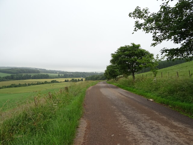
Big Sheep-park Wood, located in Kincardineshire, Scotland, is a picturesque forest known for its natural beauty and rich biodiversity. The wood covers an extensive area of approximately 500 acres, providing a serene and tranquil environment for visitors to explore.

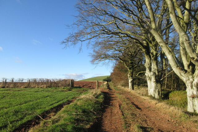
The forest is predominantly composed of deciduous trees such as oak, birch, and beech, which create a stunning tapestry of colors during autumn. The dense canopy provides a cool and shaded atmosphere, making it a perfect retreat during hot summer days.

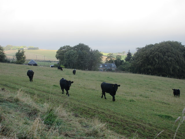
Big Sheep-park Wood is home to a diverse range of wildlife, including several bird species such as woodpeckers, owls, and various songbirds. Nature enthusiasts can also spot mammals like deer, foxes, and rabbits, further enhancing the natural experience.

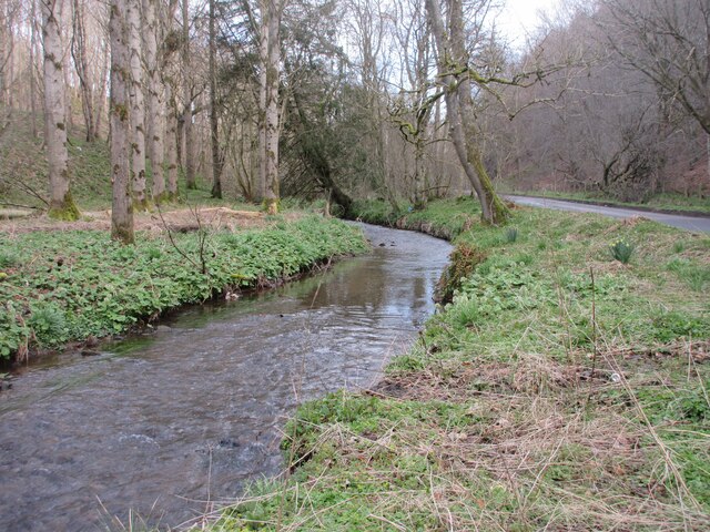
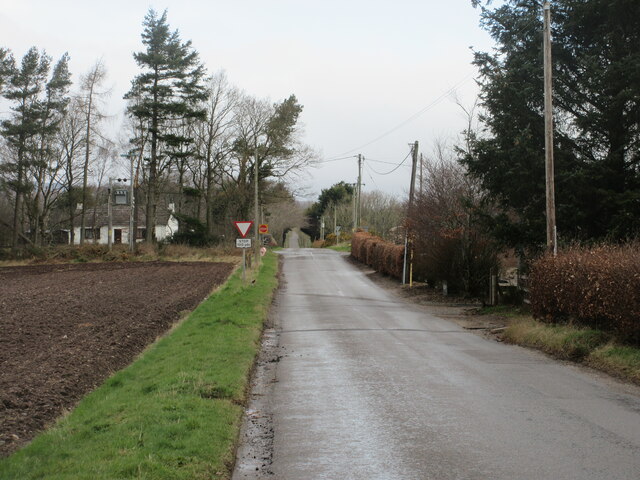
The wood offers various walking trails that cater to different fitness levels and interests. Visitors can choose from short, leisurely strolls along well-maintained paths or more challenging hikes that take them deeper into the heart of the forest. Along the way, they can discover hidden gems like babbling brooks, enchanting clearings, and ancient stone ruins.

For those interested in history, Big Sheep-park Wood holds significant cultural value. It was once part of a large estate owned by local landowners and has witnessed centuries of human activity. Explorers may stumble upon remnants of old buildings, stone walls, or even evidence of former settlements.

Overall, Big Sheep-park Wood offers a delightful escape for nature lovers, hikers, and history enthusiasts alike. Its stunning landscapes, diverse flora and fauna, and historical significance make it a must-visit destination in Kincardineshire.

If you have any feedback on the listing, please let us know in the comments section below.

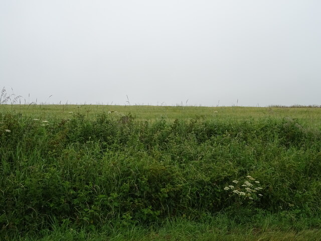
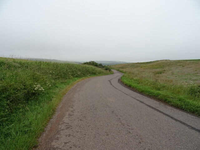
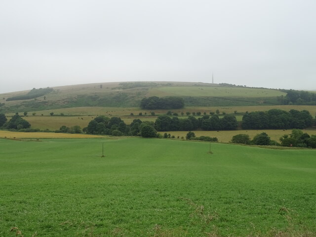
Big Sheep-park Wood Images

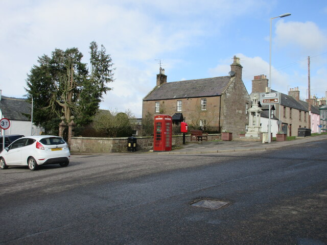
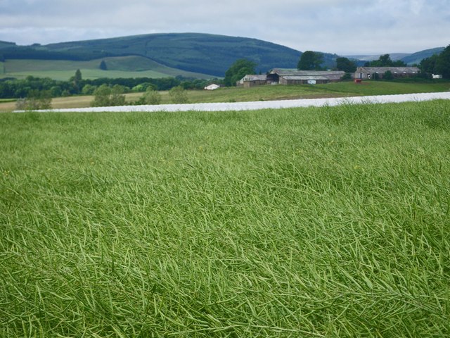
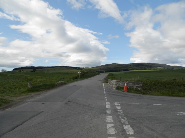
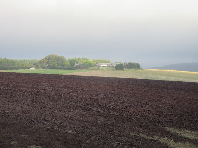
Images are sourced within 2km of 56.898857/-2.4191284 or Grid Reference NO7478. Thanks to Geograph Open Source API. All images are credited.

Approaching Knock Hill from the east Approaching Knock Hill from the east along the path leading up from East Mondynes beside the A90.
Approaching Knock Hill from the east
Approaching Knock Hill from the east along the path leading up from East Mondynes beside the A90.
Luther Water The Luther Water on the west side of the road heading north into Auchenblae.
Luther Water
The Luther Water on the west side of the road heading north into Auchenblae.
Heading to Crossroads Minor road heading northwards to the B966 at Crossroads.
Heading to Crossroads
Minor road heading northwards to the B966 at Crossroads.
Milestone on the old A94 Stonehaven/Laurencekirk milestone on the spur of the B966 near Castleton, formerly the A94.
Milestone on the old A94
Stonehaven/Laurencekirk milestone on the spur of the B966 near Castleton, formerly the A94.
Play area at Castleton Playground adjacent to Castleton Farm Shop.
Play area at Castleton
Playground adjacent to Castleton Farm Shop.
Cushnie Farm Cottages Cottages at the entrance drive to Cushnie, viewed from the south-east.
Cushnie Farm Cottages
Cottages at the entrance drive to Cushnie, viewed from the south-east.
Scarecrow at Bankhead Rudimentary scarecrow in a field to the east of Bankhead.
Scarecrow at Bankhead
Rudimentary scarecrow in a field to the east of Bankhead.
Fordoun War Memorial Fordoun War Memorial on Gilbert's Hill overlooking Auchenblae from the south.
Fordoun War Memorial
Fordoun War Memorial on Gilbert's Hill overlooking Auchenblae from the south.
Former telephone box in Auchenblae Red telephone box now housing a defibrillator in the centre of Auchenblae.
Former telephone box in Auchenblae
Red telephone box now housing a defibrillator in the centre of Auchenblae.
Rivet benchmark, Auchenblae Church Ordnance Survey rivet benchmark. For database entry, see <span class="nowrap"><a title="https://www.bench-marks.org.uk/bm192328" rel="nofollow ugc noopener" href="https://www.bench-marks.org.uk/bm192328">Link</a><img style="margin-left:2px;" alt="External link" title="External link - shift click to open in new window" src="https://s1.geograph.org.uk/img/external.png" width="10" height="10"/></span>.
Rivet benchmark, Auchenblae Church
Ordnance Survey rivet benchmark. For database entry, see LinkExternal link.
Waist deep in rapeseed Blooms are gone from the rapeseed.
Waist deep in rapeseed
Blooms are gone from the rapeseed.
Burnmouth Brig over Burnie Shag
Mid Blairs A distant view of Mid Blairs from the roadside to the south-east.
Mid Blairs
A distant view of Mid Blairs from the roadside to the south-east.
Cattle at Auchtochter Black cattle, with Auchtochter in the background.
Cattle at Auchtochter
Black cattle, with Auchtochter in the background.
Field above the Glenbervie Road
Glenbervie Road From Kinkell towards Glenbervie.
Glenbervie Road
From Kinkell towards Glenbervie.
Grazing, Auchtochter Towards a distant Droop Hill.
Grazing, Auchtochter
Towards a distant Droop Hill.
Glenbervie Road, Auchtochter Looking east.
Glenbervie Road, Auchtochter
Looking east.
Show me another place!

Big Sheep-park Wood is located at Grid Ref: NO7478 (Lat: 56.898857, Lng: -2.4191284)

Unitary Authority: Aberdeenshire

Police Authority: North East

What 3 Words

///remains.sprinting.powerful. Near Laurencekirk, Aberdeenshire

Related Wikis

Fordoun Stone

The Fordoun Stone is a class II Pictish cross slab in Fordoun parish church, Auchenblae, Aberdeenshire, Scotland. == Description == A slab of Old Red Sandstone...

Abbeyton Bridge

Abbeyton Bridge was a road bridge that carried the B966 road over the Dundee–Aberdeen line. == History == In June 2018, Aberdeenshire Council introduced...

Auchenblae

Auchenblae (, Scottish Gaelic: Achadh nam Blàth) is a village in the Kincardine and Mearns area of Aberdeenshire, formerly in Kincardineshire, Scotland...

Glenbervie House

Glenbervie House is a mansion house, which has incorporated parts of an earlier castle, located near Glenbervie, Kincardine and Mearns, Scotland. ��2...

Nearby Amenities

Located within 500m of 56.898857,-2.4191284
Monboddo
Place: hamlet
Lat/Long: 56.8952402/-2.4211126
Power: pole
Lat/Long: 56.9031219/-2.4194793
Power: pole
Lat/Long: 56.9023867/-2.4192464
Power: pole
Lat/Long: 56.9016963/-2.4190357
Power: pole
Lat/Long: 56.9009103/-2.418998
Power: pole
Lat/Long: 56.9003519/-2.4189692
Power: pole
Lat/Long: 56.8994253/-2.4189137
Power: pole
Lat/Long: 56.8989165/-2.420005
Power: pole
Lat/Long: 56.8983981/-2.4211384
Power: pole
Lat/Long: 56.8979124/-2.4222097
Power: pole
Lat/Long: 56.8975078/-2.4230725
Power: pole
Lat/Long: 56.8971117/-2.4239353
Power: pole
Lat/Long: 56.8967349/-2.4247471
Power: pole
Lat/Long: 56.8962211/-2.4157457
Power: pole
Lat/Long: 56.8963416/-2.4148505
Power: pole
Lat/Long: 56.8965089/-2.4136245
Power: pole
Lat/Long: 56.8966824/-2.4123302
Power: pole
Lat/Long: 56.897683/-2.4213241
Power: pole
Lat/Long: 56.8974494/-2.420473
Power: pole
Lat/Long: 56.8972122/-2.419666
Power: pole
Lat/Long: 56.8969304/-2.4185922
Power: pole
Lat/Long: 56.896568/-2.417137
Power: pole
Lat/Long: 56.8959333/-2.4145528
Power: pole
Lat/Long: 56.8956419/-2.4133732
Power: pole
Lat/Long: 56.8966077/-2.420021
Power: pole
Lat/Long: 56.8959875/-2.4203804
Power: pole
Lat/Long: 56.8954131/-2.4207112
The data included in this document is from www.openstreetmap.org. The data is made available under ODbL.

Have you been to Big Sheep-park Wood?

Leave your review of Big Sheep-park Wood below (or comments, questions and feedback).