Chapelhill

Settlement in Perthshire

Scotland

Chapelhill

Glendoick Garden Centre A handy stop for a light meal as well as a garden centre with all the trimmings.
Glendoick Garden Centre Credit: Anne Burgess

Chapelhill is a small village located in the Perth and Kinross council area of Scotland. Situated in the beautiful region of Perthshire, it lies approximately 10 miles northwest of the town of Perth.

The village is characterized by its picturesque surroundings and idyllic countryside views. Nestled amidst rolling hills and farmland, Chapelhill offers residents and visitors a peaceful and tranquil atmosphere. The nearby River Almond adds to the charm of the area, with its crystal-clear waters and calming presence.

Chapelhill is a tight-knit community with a population of around 200 people. The village retains a strong sense of community spirit, and locals often come together for various social events and activities. The residents take pride in maintaining the village's clean and well-kept appearance.

While Chapelhill is a small village, it benefits from its proximity to larger towns and cities. Perth, with its array of amenities including shops, restaurants, and leisure facilities, is just a short drive away. Additionally, the village enjoys good road connections, making it easily accessible for those who commute or wish to explore the surrounding areas.

For outdoor enthusiasts, Chapelhill offers an abundance of opportunities for leisure activities. The surrounding countryside provides ample space for walking, cycling, and horse riding. There are also several golf courses in the vicinity, allowing golf enthusiasts to indulge in their passion.

In summary, Chapelhill in Perthshire is a charming village that offers a peaceful and close-knit community, stunning natural scenery, and convenient access to amenities and nearby towns. It is an ideal location for those seeking a tranquil rural lifestyle.

If you have any feedback on the listing, please let us know in the comments section below.
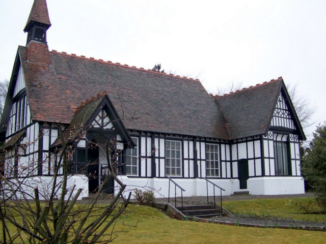
Chapelhill Images

Images are sourced within 2km of 56.376769/-3.2873258 or Grid Reference NO2021. Thanks to Geograph Open Source API. All images are credited.

Glendoick Garden Centre A handy stop for a light meal as well as a garden centre with all the trimmings.
Glendoick Garden Centre
A handy stop for a light meal as well as a garden centre with all the trimmings.
Cairnie Road at Tayfield Farm Looking southward.
Cairnie Road at Tayfield Farm
Looking southward.
Glendoick Garden Centre Situated alongside the very busy dual-carriageway (A90) that runs from Perth to Dundee.
Glendoick Garden Centre
Situated alongside the very busy dual-carriageway (A90) that runs from Perth to Dundee.
Pitlowie Neatly stacked logs at a bend in the road just below Pitlowie, looking southeast across the Tay valley.
Pitlowie
Neatly stacked logs at a bend in the road just below Pitlowie, looking southeast across the Tay valley.
Bus stop in Chapelhill On the B958 between St Madoes and Errol, looking west.
Bus stop in Chapelhill
On the B958 between St Madoes and Errol, looking west.
Agriculture in Leetown The field containing this machinery store is occupied by a few sheep. Looking northwards across Glencarse.
Agriculture in Leetown
The field containing this machinery store is occupied by a few sheep. Looking northwards across Glencarse.
Track in Carse of Gowrie Looking south towards Paddockmuir Wood, backed by the hills above Newburgh on the opposite bank of the Tay.
Track in Carse of Gowrie
Looking south towards Paddockmuir Wood, backed by the hills above Newburgh on the opposite bank of the Tay.
Pump This fine pump stands outside a farm on the edge of Leetown.
Pump
This fine pump stands outside a farm on the edge of Leetown.
Farm sale A displenish sale at Gallowflat Farm.
Farm sale
A displenish sale at Gallowflat Farm.
Gallowflat Farm Seen from the south.
Gallowflat Farm
Seen from the south.
Reed beds and woodland The Tay to the south is just visible across a wide reed bed.
Reed beds and woodland
The Tay to the south is just visible across a wide reed bed.
Levee This embankment separates reed beds to the left from farmland to the right. looking south towards the Tay.
Levee
This embankment separates reed beds to the left from farmland to the right. looking south towards the Tay.
Polytunnels This large area of plastic tunnel greenhouses is next to the Tay. It is probably used for growing strawberries. Taken from the levee <a href="https://www.geograph.org.uk/photo/84533">NO2019 : Levee</a> that protects it from flooding, and looking west.
Polytunnels
This large area of plastic tunnel greenhouses is next to the Tay. It is probably used for growing strawberries. Taken from the levee NO2019 : Levee that protects it from flooding, and looking west.
A View of Glencarse Village
Slip road The new slip road at Glendoick runs alongside the Dundee bound carriageway of the A90, this green barrier has been erected to prevent glare from oncoming car headlights. <a href="https://www.geograph.org.uk/photo/324959">NO2123 : New Flyover</a>
Slip road
The new slip road at Glendoick runs alongside the Dundee bound carriageway of the A90, this green barrier has been erected to prevent glare from oncoming car headlights. NO2123 : New Flyover
Poly tunnels This area which is known as The Carse of Gowrie is renowned for the growing of soft fruit in its fertile soil, these poly tunnels at Glendoick await the start of the new growing season.
Poly tunnels
This area which is known as The Carse of Gowrie is renowned for the growing of soft fruit in its fertile soil, these poly tunnels at Glendoick await the start of the new growing season.
Hedge Recently cut hedge on minor road near Glendoick.
Hedge
Recently cut hedge on minor road near Glendoick.
Road The A90 at Glendoick looking towards Dundee.<a href="https://www.geograph.org.uk/photo/324959">NO2123 : New Flyover</a>
Road
The A90 at Glendoick looking towards Dundee.NO2123 : New Flyover
Show me another place!

Chapelhill is located at Grid Ref: NO2021 (Lat: 56.376769, Lng: -3.2873258)

Unitary Authority: Perth and Kinross

Police Authority: Tayside

What 3 Words

///repaying.kiosk.takeovers. Near Newburgh, Fife

Nearby Locations

Cottown Chapelhill

Related Wikis

Cottown, Perth and Kinross

Cottown is a village in Perth and Kinross, Scotland, east of the village of St.Madoes and approximately 8 miles (13 kilometres) east of Perth. This area...

Leetown, Perth and Kinross

Leetown is a small community located at the western end of the Carse of Gowrie along the eastern seaboard of Scotland. It lies between the A90 road and...

Pitfour Castle

Pitfour Castle is an 18th-century country house situated on the southeast edge of the village of St Madoes in the Carse of Gowrie, Perthshire, Scotland...

Glencarse railway station

Glencarse railway station served the village of Glencarse, Perth and Kinross, Scotland from 1847 to 1956 on the Dundee and Perth Railway. == History... ==

St Madoes

St. Madoes () is a village in the Carse of Gowrie, Scotland. It was developed near Pitfour Castle. It is believed that there have been settlements since...

All Saints Church, Glencarse

All Saints Church is an Episcopal church in the Diocese of Brechin, located in the Scottish village of Glencarse, Perth and Kinross. Still in use as a...

Glencarse

Glencarse () is a village in the Scottish council area of Perth and Kinross.The village is situated 4 miles (6 kilometres) east of Perth, lying alongside...

Inchyra

Inchyra (; Scottish Gaelic: An Innis Iarach "the west isle") is a hamlet in the Carse of Gowrie in Scotland. It lies on the northern bank of the River...

Nearby Amenities

Located within 500m of 56.376769,-3.2873258
Chapelhill
Place: hamlet
Source: npe
Lat/Long: 56.3771298/-3.2870923
Leetown
Place: hamlet
Source: npe
Lat/Long: 56.3785824/-3.2800812
Cottown
Place: village
Wikidata: Q5175856
Wikipedia: en:Cottown, Perth and Kinross
Lat/Long: 56.3751623/-3.2876736
Power: tower
Lat/Long: 56.3733012/-3.2847408
Power: tower
Lat/Long: 56.3724811/-3.289236
Power: tower
Lat/Long: 56.3739092/-3.2849614
Power: tower
Source: Bing
Lat/Long: 56.3763155/-3.284047
Power: tower
Lat/Long: 56.3786802/-3.2832275
Hawkstane Standing Stone
Historic: monument
Lat/Long: 56.3765099/-3.2894674
Hawkstane
Place: hamlet
Lat/Long: 56.376397/-3.2899708
NTS Information Board
Tourism: information
Lat/Long: 56.3747823/-3.2876312
Cottown Old Schoolhouse
Historic: monument
Lat/Long: 56.3758319/-3.2884519
Bus Stop
Naptan AtcoCode: 64802236
Naptan NaptanCode: 73725686
Lat/Long: 56.3776487/-3.2831316
Power: tower
Source: Bing
Lat/Long: 56.374768/-3.2806444
Post Box
Collection Times: Mo-Fr 16:45; Sa 08:30
Manufacturer: W.T.Allen & Co. London
Operator: Royal Mail
Post Box Mounting: brick_pillar
Post Box Type: wall
Ref: PH2 198
Royal Cypher: GVIR
Royal Cypher Wikidata: Q33102169
Source: survey;local knowledge
Lat/Long: 56.3776386/-3.2832284
Power: pole
Lat/Long: 56.373768/-3.2814494
Bus Stop
Cottown
Bus: yes
Naptan AtcoCode: 64803021
Naptan NaptanCode: 73727975
Public Transport: platform
Lat/Long: 56.3762928/-3.2892772
Bus Stop
Leetown
Bus: yes
Naptan AtcoCode: 64803018
Naptan NaptanCode: 73753539
Public Transport: platform
Lat/Long: 56.377693/-3.2834383
Power: pole
Lat/Long: 56.377346/-3.2857881
Power: pole
Lat/Long: 56.3778868/-3.2851716
Power: pole
Lat/Long: 56.3786868/-3.2841165
Power: pole
Lat/Long: 56.3791994/-3.2833433
Power: pole
Lat/Long: 56.3797003/-3.2826145
Power: pole
Lat/Long: 56.377895/-3.2844492
Power: pole
Lat/Long: 56.3778352/-3.2856991
Power: pole
Lat/Long: 56.3777237/-3.2870296
Power: pole
Lat/Long: 56.3775994/-3.2883516
Power: pole
Lat/Long: 56.3774903/-3.2895697
Power: pole
Lat/Long: 56.3773882/-3.2907731
Power: pole
Lat/Long: 56.3772791/-3.2919828
Power: pole
Lat/Long: 56.3771782/-3.2930908
Power: pole
Lat/Long: 56.3770621/-3.294328
Power: pole
Lat/Long: 56.3772076/-3.2879787
Power: pole
Lat/Long: 56.3766128/-3.2922285
Power: pole
Lat/Long: 56.3762444/-3.2916841
Power: pole
Lat/Long: 56.3757224/-3.2909065
Power: pole
Lat/Long: 56.3752461/-3.2901884
Power: pole
Lat/Long: 56.3747099/-3.2893812
Power: pole
Lat/Long: 56.3742559/-3.2884596
Power: pole
Lat/Long: 56.37427/-3.2903663
Power: pole
Lat/Long: 56.3738201/-3.2913027
Power: pole
Lat/Long: 56.377309/-3.2832045
Power: pole
Lat/Long: 56.3769289/-3.2828973
Power: pole
Lat/Long: 56.3765254/-3.2825626
Power: pole
Lat/Long: 56.3761711/-3.2822702
Power: pole
Lat/Long: 56.3757992/-3.2819567
Power: pole
Lat/Long: 56.3755165/-3.2816325
Power: pole
Lat/Long: 56.3751387/-3.2811325
The data included in this document is from www.openstreetmap.org. The data is made available under ODbL.

Have you been to Chapelhill?

Leave your review of Chapelhill below (or comments, questions and feedback).