Jubilee Plantation

Wood, Forest in Berwickshire

Scotland

Jubilee Plantation

Farmland near Stichill Bridge
Farmland near Stichill Bridge Credit: Walter Baxter

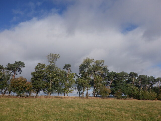
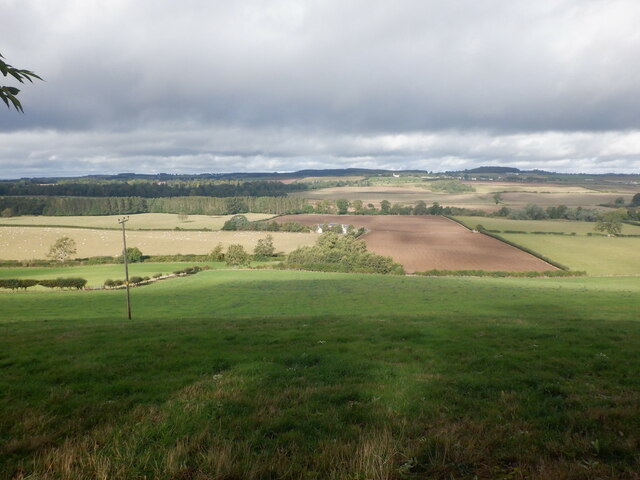
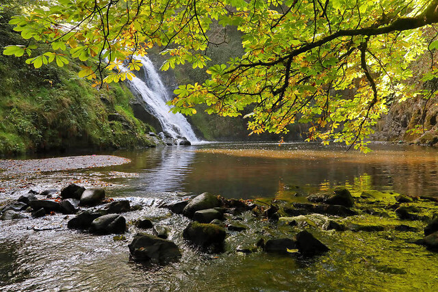
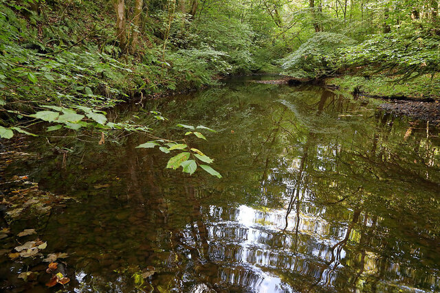
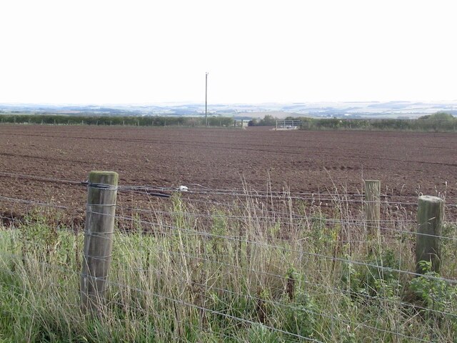
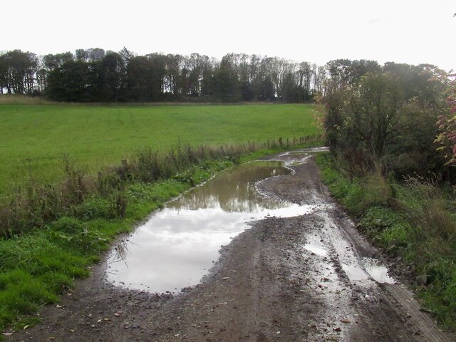
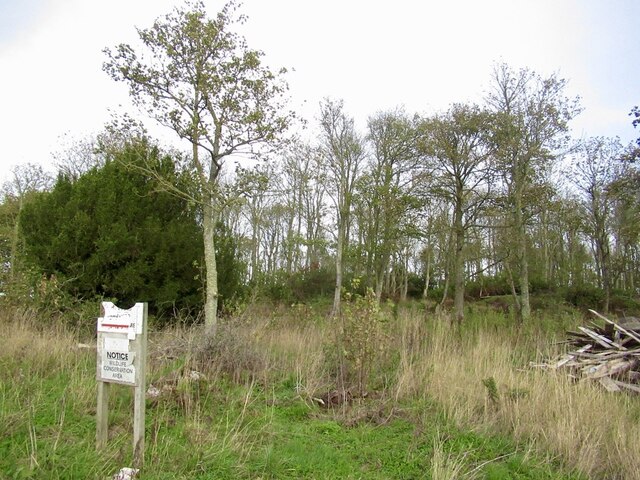
Jubilee Plantation is a picturesque woodland area located in Berwickshire, Scotland. Covering a vast area of approximately 1,500 acres, it is nestled in the beautiful countryside and offers a tranquil retreat for nature enthusiasts and outdoor enthusiasts alike.

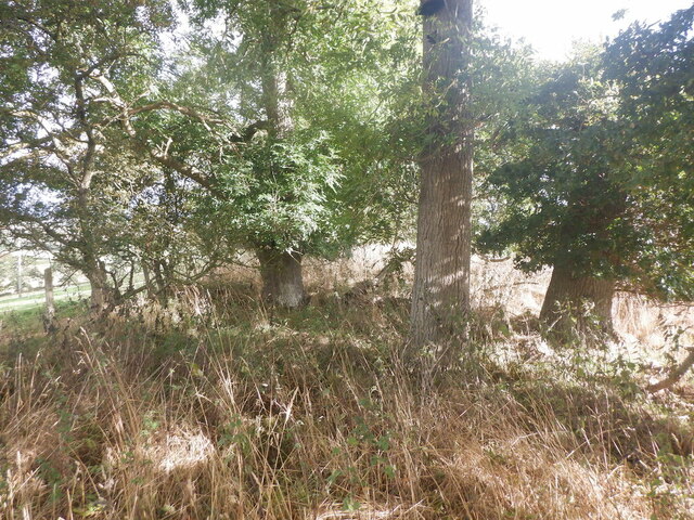
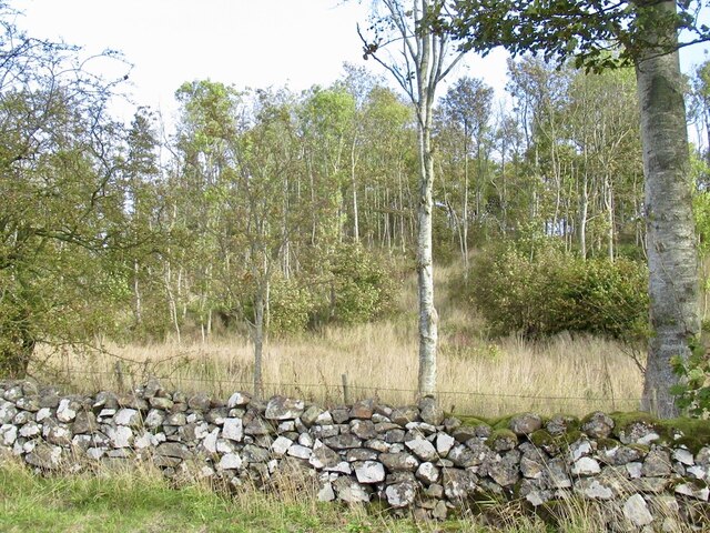
The plantation was established in 1977 to commemorate the Queen's Silver Jubilee, and it has since become a popular destination for visitors seeking solace amidst the serene surroundings. The woodland is predominantly made up of coniferous trees, such as spruce and pine, which create a dense and lush forest canopy.

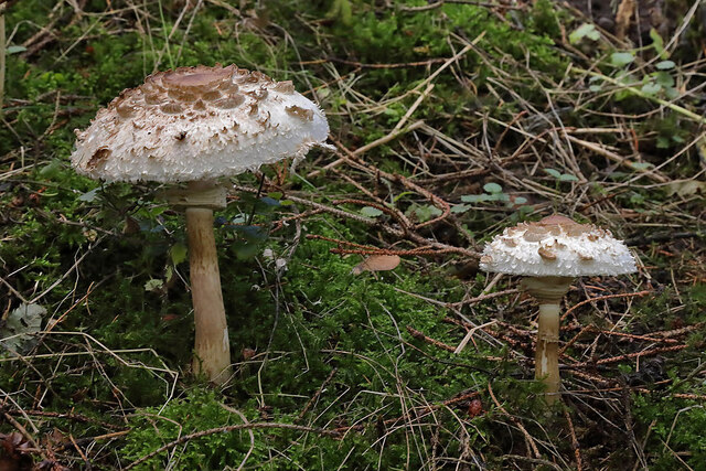
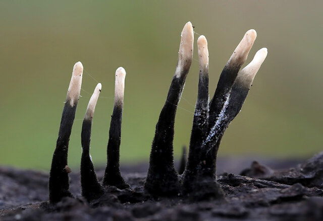
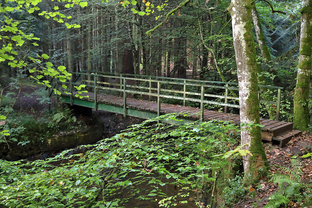
Visitors to Jubilee Plantation can enjoy a variety of recreational activities. There are several well-maintained walking trails that wind through the woodland, offering stunning views of the surrounding landscape and opportunities to spot local wildlife. The plantation is home to an array of bird species, including owls, woodpeckers, and various songbirds, making it a haven for birdwatchers.

In addition to walking trails, Jubilee Plantation also features picnic areas and designated camping spots, allowing visitors to fully immerse themselves in the natural beauty of the woodland. The peaceful atmosphere and abundant wildlife make it an ideal spot for photography enthusiasts.

Jubilee Plantation is easily accessible, with ample parking available for visitors. The plantation is open year-round, although it is particularly enchanting during the autumn months when the trees don their vibrant hues of red, orange, and gold.

Overall, Jubilee Plantation is a hidden gem in Berwickshire, offering a tranquil escape from the bustle of everyday life. Its natural beauty, diverse wildlife, and recreational opportunities make it a must-visit destination for nature lovers and those seeking a peaceful retreat.

If you have any feedback on the listing, please let us know in the comments section below.

Jubilee Plantation Images

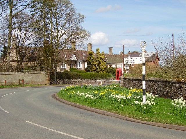
Images are sourced within 2km of 55.629509/-2.4588809 or Grid Reference NT7137. Thanks to Geograph Open Source API. All images are credited.

Farmland near Stichill Bridge
Strip, Berry Hill A ridgeline stripwood.
Strip, Berry Hill
A ridgeline stripwood.
Berry Hill summit A stripwood at the top of a germinating winter cereal field.
Berry Hill summit
A stripwood at the top of a germinating winter cereal field.
Over the Eden Water View north from Berry Hill near Kelso.
Over the Eden Water
View north from Berry Hill near Kelso.
Shaggy parasol mushrooms (Chlorophyllum rhacodes) The mushrooms were photographed at Mill Haugh on the Newton Don Estate.
Shaggy parasol mushrooms (Chlorophyllum rhacodes)
The mushrooms were photographed at Mill Haugh on the Newton Don Estate.
Stichill Linn The pool below the waterfall is popular with wild swimmers.
Stichill Linn
The pool below the waterfall is popular with wild swimmers.
The Eden Water This upstream view is at Newton Don.
The Eden Water
This upstream view is at Newton Don.
Candlesnuff fungus (Xylaria hypoxylon) With a white tip and black base this fungus looks like a snuffed candle wick, hence its name. The 20mm high fruiting bodies were on a piece of dead wood.
Candlesnuff fungus (Xylaria hypoxylon)
With a white tip and black base this fungus looks like a snuffed candle wick, hence its name. The 20mm high fruiting bodies were on a piece of dead wood.
A footbridge over the Eden Water The bridge links up with a path to Stichill Linn on the Newton Don Estate.
A footbridge over the Eden Water
The bridge links up with a path to Stichill Linn on the Newton Don Estate.
New houses, Stitchil The fierce fence is protecting children in the park from the road.
New houses, Stitchil
The fierce fence is protecting children in the park from the road.
Ploughed field, Stitchil
Telephone exchange, Stichill Entrance to Queenscairn Farm.
Telephone exchange, Stichill
Entrance to Queenscairn Farm.
Woodland, Queenscairn Hill
Bank Park to Stitchill
Woodland, Stitchill The battered remains of a "heritage" keep out sign.
Woodland, Stitchill
The battered remains of a "heritage" keep out sign.
Old milepost The 2 miles from Kelso post on the A6089 was in a sorry state <a href="https://www.geograph.org.uk/photo/6043558">NT7035 : Old Milepost by the A6089, north west of Kelso, Nenthorn Parish</a> sunken and very rusty.   In 2021 two locals dug it out and repainted it.  They even painted inside the back to help preserve this post made at the Smith Patterson & Co foundry in Blaydon, Co. Durham.
Old milepost
The 2 miles from Kelso post on the A6089 was in a sorry state NT7035 : Old Milepost by the A6089, north west of Kelso, Nenthorn Parish sunken and very rusty. In 2021 two locals dug it out and repainted it. They even painted inside the back to help preserve this post made at the Smith Patterson & Co foundry in Blaydon, Co. Durham.
Old milepost The view, looking towards Kelso, of the milestone 2 miles from the town, on a very wet day.
Old milepost
The view, looking towards Kelso, of the milestone 2 miles from the town, on a very wet day.
Direction Sign – Signpost by the B6364 in Stichill Located on the northeast side of the T junction of the B6364 and Ednam Road in Stichill. 2 arms and spike finial. The arms and finial were made at the Thomas Brown & Sons, Cammo Foundry in Duns prior to road numbering. The foundry operated from the 1850s to 1920s. See also <a title="https://www.geograph.org.uk/photo/6043397" href="https://www.geograph.org.uk/photo/6043397">Link</a> , <a title="https://www.geograph.org.uk/photo/6428222" href="https://www.geograph.org.uk/photo/6428222">Link</a> , <a title="https://www.geograph.org.uk/photo/2593563" href="https://www.geograph.org.uk/photo/2593563">Link</a>.

Milestone Society National ID: RX_NT7138A
Direction Sign – Signpost by the B6364 in Stichill
Located on the northeast side of the T junction of the B6364 and Ednam Road in Stichill. 2 arms and spike finial. The arms and finial were made at the Thomas Brown & Sons, Cammo Foundry in Duns prior to road numbering. The foundry operated from the 1850s to 1920s. See also Link , Link , Link. Milestone Society National ID: RX_NT7138A
Show me another place!

Jubilee Plantation is located at Grid Ref: NT7137 (Lat: 55.629509, Lng: -2.4588809)

Unitary Authority: The Scottish Borders

Police Authority: The Lothians and Scottish Borders

What 3 Words

///dialects.napkins.scoping. Near Kelso, Scottish Borders

Related Wikis

Stichill Kirk

Stichill Kirk is an ancient church situated in the village of Stichill in the old county of Roxburghshire, now part of the Scottish Borders Council in...

Stichill

Stichill is a village and civil parish in the historic county of Roxburghshire, a division of the Scottish Borders. Situated 2 miles (3.2 km) north of...

Kelso Racecourse

Kelso Racecourse is a thoroughbred horse racing venue located in Kelso, Scotland. Frequently described as "Britain's Friendliest Racecourse", the racecourse...
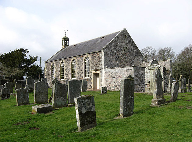
Ednam Church

Ednam Church is a member church (Scots: kirk) of the Church of Scotland and is co–joined with Kelso North Church in Kelso. Ednam is in the old county of...

Nearby Amenities

Located within 500m of 55.629509,-2.4588809
Turning Circle
Lat/Long: 55.6283771/-2.4650522
Newton Don
Place: hamlet
Lat/Long: 55.6281012/-2.4649462
Information: guidepost
Tourism: information
Lat/Long: 55.629813/-2.4642626
Parking
Capacity: 4
Surface: grass
Lat/Long: 55.6269714/-2.4532977
The data included in this document is from www.openstreetmap.org. The data is made available under ODbL.

Have you been to Jubilee Plantation?

Leave your review of Jubilee Plantation below (or comments, questions and feedback).