Chapel End

Settlement in Huntingdonshire Huntingdonshire

England

Chapel End

St Andrew's church, Steeple Gidding The village was named Steeple Gidding by 1260 but this church was not built until C14, so there must have been an earlier steepled church on this site. The church is now redundant.
St Andrew's church, Steeple Gidding Credit: Bikeboy

Chapel End is a small village located in the district of Huntingdonshire, in the county of Cambridgeshire, England. Situated approximately 3 miles north-east of the market town of Huntingdon, Chapel End is a tranquil and picturesque settlement within a rural setting.

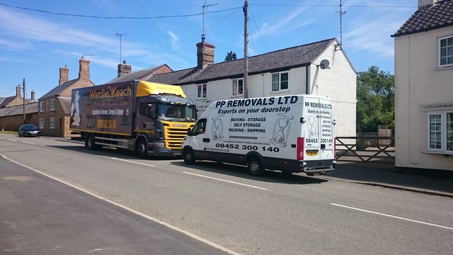
The village is known for its charming and historic character, with a population of around 500 residents. The architecture of Chapel End reflects its long history, with a mix of traditional thatched cottages, Georgian houses, and modern developments. The village is surrounded by beautiful countryside, offering residents and visitors an abundance of scenic walks and cycling routes.

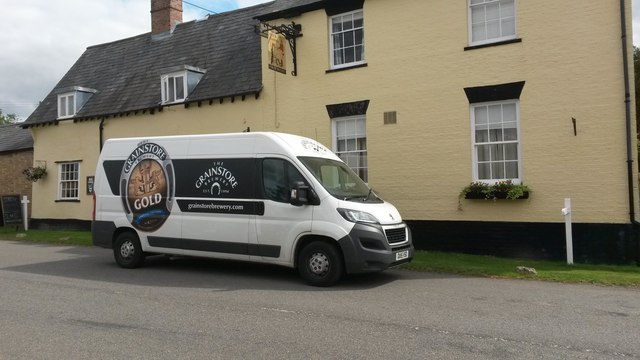
Chapel End benefits from a close-knit community, with a village hall serving as a hub for various social events and gatherings. There is also a local pub, providing a cozy and welcoming atmosphere for residents and visitors to enjoy.

While Chapel End is primarily a residential area, it benefits from its proximity to Huntingdon, which offers a range of amenities including supermarkets, shops, restaurants, and leisure facilities. The village is also conveniently located for commuting, with easy access to major road networks such as the A14 and A1, as well as regular train services from Huntingdon station.

Overall, Chapel End offers a peaceful and idyllic countryside lifestyle, combined with excellent transport links and access to nearby amenities, making it an attractive place to live for those seeking a rural retreat within easy reach of urban amenities.

If you have any feedback on the listing, please let us know in the comments section below.
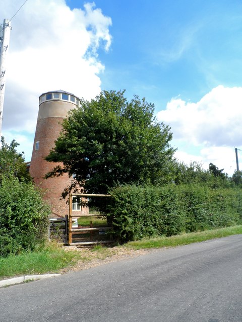
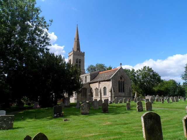
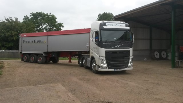
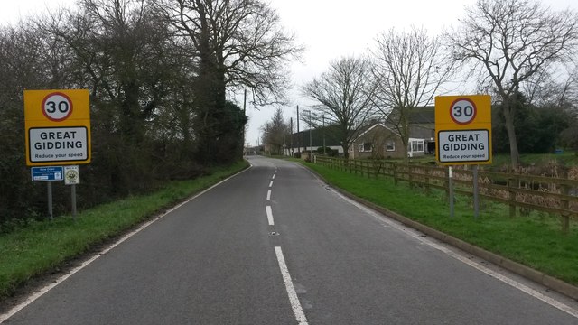
Chapel End Images

Images are sourced within 2km of 52.431232/-0.354068 or Grid Reference TL1282. Thanks to Geograph Open Source API. All images are credited.

St Andrew's church, Steeple Gidding The village was named Steeple Gidding by 1260 but this church was not built until C14, so there must have been an earlier steepled church on this site. The church is now redundant.
St Andrew's church, Steeple Gidding
The village was named Steeple Gidding by 1260 but this church was not built until C14, so there must have been an earlier steepled church on this site. The church is now redundant.
Tower Mill, Great Gidding Built in the mid C19 and last active as a mill in 1920. See <span class="nowrap"><a title="http://www.britishlistedbuildings.co.uk/en-54773-tower-mill-great-gidding-cambridgeshire#.Vdh37PlViko" rel="nofollow ugc noopener" href="http://www.britishlistedbuildings.co.uk/en-54773-tower-mill-great-gidding-cambridgeshire#.Vdh37PlViko">Link</a><img style="margin-left:2px;" alt="External link" title="External link - shift click to open in new window" src="https://s1.geograph.org.uk/img/external.png" width="10" height="10"/></span> for entry in British Listed Buildings. The mill is currently undergoing restoration. See <a title="https://www.geograph.org.uk/photo/4492246" href="https://www.geograph.org.uk/photo/4492246">Link</a> and others for a series of photos by Michael Trolove.
Tower Mill, Great Gidding
Built in the mid C19 and last active as a mill in 1920. See LinkExternal link for entry in British Listed Buildings. The mill is currently undergoing restoration. See Link and others for a series of photos by Michael Trolove.
St Michael's church, Great Gidding The chancel was built in C13. The nave and the chancel arch were rebuilt around 1400. The tower was added later in C14 but did not acquire its spire until C16.
St Michael's church, Great Gidding
The chancel was built in C13. The nave and the chancel arch were rebuilt around 1400. The tower was added later in C14 but did not acquire its spire until C16.
Important delivery Grainstore brewery vehicle delivering important liquid refreshment to the Fox and Hounds public house.
Important delivery
Grainstore brewery vehicle delivering important liquid refreshment to the Fox and Hounds public house.
Grain lorry Volvo bulker operated by Pytchley Farms Ltd
Grain lorry
Volvo bulker operated by Pytchley Farms Ltd
Highfield Transport Retford based haulier of farm produce.
Highfield Transport
Retford based haulier of farm produce.
Stennetts Transport Bury St Edmunds based haulier of farm produce.
Stennetts Transport
Bury St Edmunds based haulier of farm produce.
Supercrete 8 Wheeler Tipper lorry delivering aggregate to the farm.
Supercrete 8 Wheeler
Tipper lorry delivering aggregate to the farm.
A lift crane hire Crane on lifting duty at a building site in the village.
A lift crane hire
Crane on lifting duty at a building site in the village.
Palletways Distribution A rigid curtainsider from the PC Howard fleet sign written for the Palletways Distribution franchise.
Palletways Distribution
A rigid curtainsider from the PC Howard fleet sign written for the Palletways Distribution franchise.
Brick haulier Foley & Miles, brick hauliers and general goods based in Essex and Kent.
Brick haulier
Foley & Miles, brick hauliers and general goods based in Essex and Kent.
Steward Haulage Kent based haulier speacilising in bricks and blocks.
Steward Haulage
Kent based haulier speacilising in bricks and blocks.
Midday New Year's Day 2016 A drab overcast day following the lightest of overnight frost. 
The speed limit sign now has an addition, along with the Neighbour Hood Watch scheme we now have Community Speed Watch signage.
Midday New Year's Day 2016
A drab overcast day following the lightest of overnight frost. The speed limit sign now has an addition, along with the Neighbour Hood Watch scheme we now have Community Speed Watch signage.
2015 Tour of Cambridgeshire The first Tour of Cambridgeshire took place in stunning sunny weather. It was the first time a mass participant charity cycle ride had been run as a Gran Fondo event 
<span class="nowrap"><a title="http://www.sueryder.org/Get-involved/Events/All-events/2016/June/Tour%20of%20Cambs?gclid=CjwKEAiA5Ji0BRC5huTCyOTR3wISJACH4Bx43RO5cVMOgMp29smBCM7kBm6sM1vJKixdynKaBwhaTxoCQ1rw_wcB" rel="nofollow ugc noopener" href="http://www.sueryder.org/Get-involved/Events/All-events/2016/June/Tour%20of%20Cambs?gclid=CjwKEAiA5Ji0BRC5huTCyOTR3wISJACH4Bx43RO5cVMOgMp29smBCM7kBm6sM1vJKixdynKaBwhaTxoCQ1rw_wcB">Link</a><img style="margin-left:2px;" alt="External link" title="External link - shift click to open in new window" src="https://s1.geograph.org.uk/img/external.png" width="10" height="10"/></span>

The pre organisation in notifying the communities affected by road closures was a bit off the mark causing a few disgruntled residents along the route. Something if repeated I'm sure the organisers will get right because from a spectators point of view it was a unique and satisfying experience sitting on the verge consuming a picnic, clapping for ever and anticipating what 5000 cyclist might look like storming through the village. Next time round they will be lucky to get such a glorious day.
2015 Tour of Cambridgeshire
The first Tour of Cambridgeshire took place in stunning sunny weather. It was the first time a mass participant charity cycle ride had been run as a Gran Fondo event LinkExternal link The pre organisation in notifying the communities affected by road closures was a bit off the mark causing a few disgruntled residents along the route. Something if repeated I'm sure the organisers will get right because from a spectators point of view it was a unique and satisfying experience sitting on the verge consuming a picnic, clapping for ever and anticipating what 5000 cyclist might look like storming through the village. Next time round they will be lucky to get such a glorious day.
Welcome sign (hastily done) for the Gran Fondo Welcoming sign to counter the negative vibe about road closures and show support en route for a huge cycle event.
The first Tour of Cambridgeshire took place in stunning sunny weather. It was the first time a mass participant charity cycle ride had been run as a Gran Fondo event 
<span class="nowrap"><a title="http://www.sueryder.org/Get-involved/Events/All-events/2016/June/Tour%20of%20Cambs?gclid=CjwKEAiA5Ji0BRC5huTCyOTR3wISJACH4Bx43RO5cVMOgMp29smBCM7kBm6sM1vJKixdynKaBwhaTxoCQ1rw_wcB" rel="nofollow ugc noopener" href="http://www.sueryder.org/Get-involved/Events/All-events/2016/June/Tour%20of%20Cambs?gclid=CjwKEAiA5Ji0BRC5huTCyOTR3wISJACH4Bx43RO5cVMOgMp29smBCM7kBm6sM1vJKixdynKaBwhaTxoCQ1rw_wcB">Link</a><img style="margin-left:2px;" alt="External link" title="External link - shift click to open in new window" src="https://s1.geograph.org.uk/img/external.png" width="10" height="10"/></span>

The pre organisation in notifying the communities affected by road closures was a bit off the mark causing a few disgruntled residents along the route. Something if repeated I'm sure the organisers will get right because from a spectators point of view it was a unique and satisfying experience sitting on the verge consuming a picnic, clapping for ever and anticipating what 5000 cyclist might look like storming through the village. Next time round they will be lucky to get such a glorious day.
Welcome sign (hastily done) for the Gran Fondo
Welcoming sign to counter the negative vibe about road closures and show support en route for a huge cycle event. The first Tour of Cambridgeshire took place in stunning sunny weather. It was the first time a mass participant charity cycle ride had been run as a Gran Fondo event LinkExternal link The pre organisation in notifying the communities affected by road closures was a bit off the mark causing a few disgruntled residents along the route. Something if repeated I'm sure the organisers will get right because from a spectators point of view it was a unique and satisfying experience sitting on the verge consuming a picnic, clapping for ever and anticipating what 5000 cyclist might look like storming through the village. Next time round they will be lucky to get such a glorious day.
Outriders for the 2015 Gran Fondo The first Tour of Cambridgeshire took place in stunning sunny weather. It was the first time a mass participant charity cycle ride had been run as a Gran Fondo event 
<span class="nowrap"><a title="http://www.sueryder.org/Get-involved/Events/All-events/2016/June/Tour%20of%20Cambs?gclid=CjwKEAiA5Ji0BRC5huTCyOTR3wISJACH4Bx43RO5cVMOgMp29smBCM7kBm6sM1vJKixdynKaBwhaTxoCQ1rw_wcB" rel="nofollow ugc noopener" href="http://www.sueryder.org/Get-involved/Events/All-events/2016/June/Tour%20of%20Cambs?gclid=CjwKEAiA5Ji0BRC5huTCyOTR3wISJACH4Bx43RO5cVMOgMp29smBCM7kBm6sM1vJKixdynKaBwhaTxoCQ1rw_wcB">Link</a><img style="margin-left:2px;" alt="External link" title="External link - shift click to open in new window" src="https://s1.geograph.org.uk/img/external.png" width="10" height="10"/></span>

The pre organisation in notifying the communities affected by road closures was a bit off the mark causing a few disgruntled residents along the route. Something if repeated I'm sure the organisers will get right because from a spectators point of view it was a unique and satisfying experience sitting on the verge consuming a picnic, clapping for ever and anticipating what 5000 cyclist might look like storming through the village. Next time round they will be lucky to get such a glorious day.
Outriders for the 2015 Gran Fondo
The first Tour of Cambridgeshire took place in stunning sunny weather. It was the first time a mass participant charity cycle ride had been run as a Gran Fondo event LinkExternal link The pre organisation in notifying the communities affected by road closures was a bit off the mark causing a few disgruntled residents along the route. Something if repeated I'm sure the organisers will get right because from a spectators point of view it was a unique and satisfying experience sitting on the verge consuming a picnic, clapping for ever and anticipating what 5000 cyclist might look like storming through the village. Next time round they will be lucky to get such a glorious day.
Clap clap clap clap With up to 5000 cyclists going past, that was a lot of clapping. We shall have to study the Tour de France for alternative roadside expressions of support although I'll rule out a Mankini!

The first Tour of Cambridgeshire took place in stunning sunny weather. It was the first time a mass participant charity cycle ride had been run as a Gran Fondo event 
<span class="nowrap"><a title="http://www.sueryder.org/Get-involved/Events/All-events/2016/June/Tour%20of%20Cambs?gclid=CjwKEAiA5Ji0BRC5huTCyOTR3wISJACH4Bx43RO5cVMOgMp29smBCM7kBm6sM1vJKixdynKaBwhaTxoCQ1rw_wcB" rel="nofollow ugc noopener" href="http://www.sueryder.org/Get-involved/Events/All-events/2016/June/Tour%20of%20Cambs?gclid=CjwKEAiA5Ji0BRC5huTCyOTR3wISJACH4Bx43RO5cVMOgMp29smBCM7kBm6sM1vJKixdynKaBwhaTxoCQ1rw_wcB">Link</a><img style="margin-left:2px;" alt="External link" title="External link - shift click to open in new window" src="https://s1.geograph.org.uk/img/external.png" width="10" height="10"/></span>

The pre organisation in notifying the communities affected by road closures was a bit off the mark causing a few disgruntled residents along the route. Something if repeated I'm sure the organisers will get right because from a spectators point of view it was a unique and satisfying experience sitting on the verge consuming a picnic, clapping for ever and anticipating what 5000 cyclist might look like storming through the village. Next time round they will be lucky to get such a glorious day.
Clap clap clap clap
With up to 5000 cyclists going past, that was a lot of clapping. We shall have to study the Tour de France for alternative roadside expressions of support although I'll rule out a Mankini! The first Tour of Cambridgeshire took place in stunning sunny weather. It was the first time a mass participant charity cycle ride had been run as a Gran Fondo event LinkExternal link The pre organisation in notifying the communities affected by road closures was a bit off the mark causing a few disgruntled residents along the route. Something if repeated I'm sure the organisers will get right because from a spectators point of view it was a unique and satisfying experience sitting on the verge consuming a picnic, clapping for ever and anticipating what 5000 cyclist might look like storming through the village. Next time round they will be lucky to get such a glorious day.
Removal trucks on main Street Removal men waiting for the key holder.
Removal trucks on main Street
Removal men waiting for the key holder.
Show me another place!

Chapel End is located at Grid Ref: TL1282 (Lat: 52.431232, Lng: -0.354068)

Administrative County: Cambridgeshire

District: Huntingdonshire

Police Authority: Cambridgeshire

What 3 Words

///chained.famed.afraid. Near Sawtry, Cambridgeshire

Related Wikis

Great Gidding

Great Gidding is a village and civil parish in the Huntingdonshire district of Cambridgeshire, England.Great Gidding lies approximately 10 miles (16 km...

Luddington-in-the-Brook

Luddington-in-the-Brook or Luddington in the Brook is a village in North Northamptonshire, England. The name of its civil parish is Luddington. Owing to...

St Andrew's Church, Steeple Gidding

St Andrew's Church is a redundant Anglican church in the hamlet of Steeple Gidding, about 10 miles (16 km) northwest of Huntingdon, Cambridgeshire, England...

Little Gidding

Little Gidding is a small village and civil parish in Cambridgeshire, England. It lies approximately 9 miles (14 km) northwest of Huntingdon, near Sawtry...

Nearby Amenities

Located within 500m of 52.431232,-0.354068
Created By: Merkaartor 0.12
Lat/Long: 52.4340597/-0.3513693
Created By: Merkaartor 0.12
Lat/Long: 52.4336688/-0.3519943
Created By: Merkaartor 0.12
Lat/Long: 52.4325731/-0.354427
Created By: Merkaartor 0.12
Lat/Long: 52.4320777/-0.3548106
Created By: Merkaartor 0.12
Lat/Long: 52.4318438/-0.3550681
Created By: Merkaartor 0.12
Lat/Long: 52.4327776/-0.3562187
Created By: Merkaartor 0.12
Lat/Long: 52.4326582/-0.356841
Created By: Merkaartor 0.12
Man Made: windmill
Lat/Long: 52.4347301/-0.3495239
Great Gidding
Place: village
Lat/Long: 52.4333001/-0.3582802
Bus Stop
Winwick Road
Alt Name: Post Office
Bus: yes
Naptan AltCommonName: Post Office
Naptan AtcoCode: 0500HGALG003
Naptan Bearing: NW
Naptan BusStopType: CUS
Naptan CommonName: Winwick Road
Naptan Indicator: near
Naptan Landmark: Winwick Road
Naptan NaptanCode: cmbdpamj
Naptan ShortCommonName: Winwick Road
Naptan Street: Luddington Road
Naptan Verified: no
Public Transport: platform
Source: naptan_import
Lat/Long: 52.4333013/-0.3590715
Bus Stop
Winwick Road
Alt Name: Post Office
Bus: yes
Naptan AltCommonName: Post Office
Naptan AtcoCode: 0500HGALG006
Naptan Bearing: SE
Naptan BusStopType: CUS
Naptan CommonName: Winwick Road
Naptan Indicator: opp
Naptan Landmark: Winwick Road
Naptan NaptanCode: cmbgjgap
Naptan ShortCommonName: Winwick Road
Naptan Street: Luddington Road
Naptan Verified: no
Public Transport: platform
Source: naptan_import
Lat/Long: 52.4333356/-0.3589525
Bus Stop
Primary School
Bus: yes
Local Ref: OS
Naptan AtcoCode: 0500HGALG007
Naptan Bearing: N
Naptan BusStopType: CUS
Naptan CommonName: Primary School
Naptan Indicator: os
Naptan Landmark: Primary School
Naptan NaptanCode: cmbgjptj
Naptan ShortCommonName: Primary School
Naptan Street: Main Street
Naptan Verified: no
Public Transport: platform
Source: naptan_import
Lat/Long: 52.434947/-0.357804
Bus Stop
Primary School
Bus: yes
Naptan AtcoCode: 0500HGALG008
Naptan Bearing: S
Naptan BusStopType: CUS
Naptan CommonName: Primary School
Naptan Indicator: opp
Naptan Landmark: Primary School
Naptan NaptanCode: cmbgjptm
Naptan ShortCommonName: Primary School
Naptan Street: Main Street
Naptan Verified: no
Public Transport: platform
Source: naptan_import
Lat/Long: 52.4349991/-0.3576697
Post Box
Brand: Royal Mail
Brand Wikidata: Q638098
Collection Times: Mo-Fr 16:45; Sa 10:00; Su off
Operator: Royal Mail
Operator Wikidata: Q638098
Ref: PE28 171
Royal Cypher: EIIR
Royal Cypher Wikidata: Q33102113
Lat/Long: 52.433308/-0.3587262
Woodway Farm
Landuse: farm
Note Retag: CS #48756035
Lat/Long: 52.4332131/-0.3539319
Power: pole
Lat/Long: 52.4301756/-0.3475765
Power: pole
Lat/Long: 52.4344356/-0.3529894
Power: pole
Lat/Long: 52.4350701/-0.3546872
Power: pole
Lat/Long: 52.4315527/-0.3488506
Power: pole
Lat/Long: 52.4347235/-0.3537967
Power: pole
Lat/Long: 52.4329084/-0.35057
Power: pole
Lat/Long: 52.4337162/-0.3518575
Power: pole
Lat/Long: 52.4333205/-0.3512325
Power: pole
Lat/Long: 52.4345886/-0.356782
Power: pole
Lat/Long: 52.4340677/-0.3524181
Power: pole
Lat/Long: 52.4340441/-0.3574727
Power: pole
Lat/Long: 52.4354331/-0.355626
Power: pole
Lat/Long: 52.4322722/-0.3495266
Power: pole
Lat/Long: 52.4308625/-0.3482042
Power: pole
Lat/Long: 52.4351659/-0.3560485
Power: pole
Lat/Long: 52.435479/-0.3555214
Place: farm
Lat/Long: 52.4325442/-0.353279
The data included in this document is from www.openstreetmap.org. The data is made available under ODbL.

Have you been to Chapel End?

Leave your review of Chapel End below (or comments, questions and feedback).