Chapel End

Settlement in Huntingdonshire

England

Chapel End

Brook Farmhouse, Lutton Has late sixteenth century origins <span class="nowrap"><a title="https://historicengland.org.uk/listing/the-list/list-entry/1040230" rel="nofollow ugc noopener" href="https://historicengland.org.uk/listing/the-list/list-entry/1040230">Link</a><img style="margin-left:2px;" alt="External link" title="External link - shift click to open in new window" src="https://s1.geograph.org.uk/img/external.png" width="10" height="10"/></span>
Brook Farmhouse, Lutton Credit: Jonathan Thacker

Chapel End is a small, picturesque village located in the county of Huntingdonshire, in the eastern region of England. Situated about 5 miles southeast of the town of Huntingdon, Chapel End is surrounded by beautiful countryside and offers a peaceful and idyllic setting for residents and visitors alike.

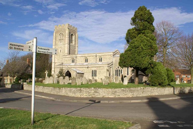
The village is characterized by its charming thatched-roof cottages and historic buildings, which give Chapel End a timeless and traditional feel. The centerpiece of the village is the St. Mary's Church, a stunning example of medieval architecture that dates back to the 13th century. The church boasts a striking tower and beautiful stained glass windows, attracting those interested in history and architecture.

Despite its small size, Chapel End is a close-knit community that values its heritage and traditions. The village hosts various events throughout the year, including a summer fete and a Christmas market, which bring residents together and foster a sense of camaraderie.

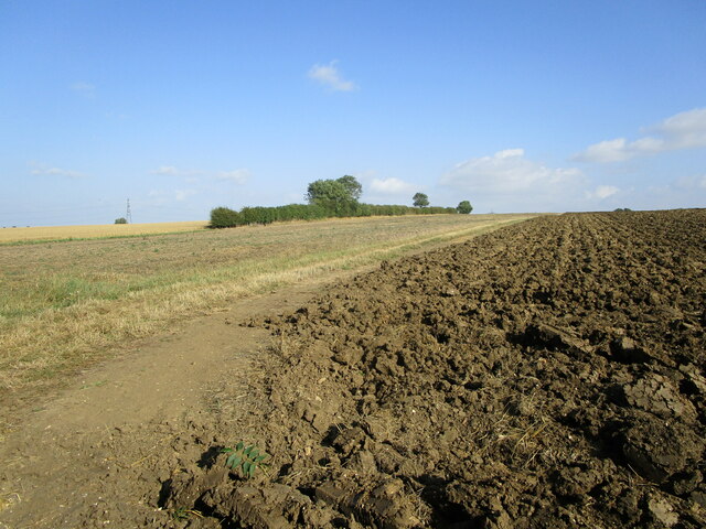
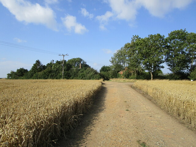
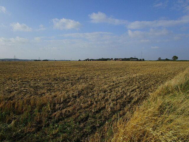
Surrounded by rolling hills and lush green fields, Chapel End offers ample opportunities for outdoor activities. The village is well-connected to a network of footpaths and bridleways, allowing residents and visitors to explore the stunning countryside on foot, by bike, or on horseback.

In terms of amenities, Chapel End has a small village shop and a cozy country pub, providing essential services and a place for locals to meet and socialize.

Overall, Chapel End is a hidden gem in Huntingdonshire, offering a quintessentially English village experience with its historic charm, natural beauty, and strong sense of community.

If you have any feedback on the listing, please let us know in the comments section below.

Chapel End Images

Images are sourced within 2km of 52.477235/-0.358242 or Grid Reference TL1187. Thanks to Geograph Open Source API. All images are credited.

Brook Farmhouse, Lutton Has late sixteenth century origins <span class="nowrap"><a title="https://historicengland.org.uk/listing/the-list/list-entry/1040230" rel="nofollow ugc noopener" href="https://historicengland.org.uk/listing/the-list/list-entry/1040230">Link</a><img style="margin-left:2px;" alt="External link" title="External link - shift click to open in new window" src="https://s1.geograph.org.uk/img/external.png" width="10" height="10"/></span>
Brook Farmhouse, Lutton
Has late sixteenth century origins LinkExternal link
Wheat field near Lutton
Bridleway by a ploughed field Near Papley Coppice.
Bridleway by a ploughed field
Near Papley Coppice.
Bridleway and Lodge Farm
Wheat field and Ringmoor Spinney
Harrowed field and Ongutein Manor
Road leaving Lutton
Road leaving Lutton
Brook Farm
Brook Farm
New hedge planting and established hedgerow
Grass field near Papley
Wheat field near Lutton Hovels
Cross roads on the edge of Ashton Wold Nothing spectacular to show here only highlighting the fact that the trees and scrub have been cut back hard to the edge of the Wold all the way through to Polebrook. Estate maintenance at work.
Cross roads on the edge of Ashton Wold
Nothing spectacular to show here only highlighting the fact that the trees and scrub have been cut back hard to the edge of the Wold all the way through to Polebrook. Estate maintenance at work.
U.S.A.A.F. Memorial at R.A.F. Polebrook / USAAF Station 110 - (Photo 1) See <span class="nowrap"><a title="https://en.wikipedia.org/wiki/RAF_Polebrook" rel="nofollow ugc noopener" href="https://en.wikipedia.org/wiki/RAF_Polebrook">Link</a><img style="margin-left:2px;" alt="External link" title="External link - shift click to open in new window" src="https://s1.geograph.org.uk/img/external.png" width="10" height="10"/></span> for more information and for an aerial photo of this former airfield see <a title="https://www.geograph.org.uk/photo/4038994" href="https://www.geograph.org.uk/photo/4038994">Link</a>
See wartime video footage on this airfield here  <span class="nowrap"><a title="https://www.youtube.com/watch?v=1LUkfkWM-Ro" rel="nofollow ugc noopener" href="https://www.youtube.com/watch?v=1LUkfkWM-Ro">Link</a><img style="margin-left:2px;" alt="External link" title="External link - shift click to open in new window" src="https://s1.geograph.org.uk/img/external.png" width="10" height="10"/></span>
U.S.A.A.F. Memorial at R.A.F. Polebrook / USAAF Station 110 - (Photo 1)
See LinkExternal link for more information and for an aerial photo of this former airfield see Link See wartime video footage on this airfield here LinkExternal link
U.S.A.A.F. Memorial at R.A.F. Polebrook / USAAF Station 110 - (Photo 2) See <span class="nowrap"><a title="https://en.wikipedia.org/wiki/RAF_Polebrook" rel="nofollow ugc noopener" href="https://en.wikipedia.org/wiki/RAF_Polebrook">Link</a><img style="margin-left:2px;" alt="External link" title="External link - shift click to open in new window" src="https://s1.geograph.org.uk/img/external.png" width="10" height="10"/></span> for more information and for an aerial photo of this former airfield see <a title="https://www.geograph.org.uk/photo/4038994" href="https://www.geograph.org.uk/photo/4038994">Link</a>
See wartime video footage on this airfield here <span class="nowrap"><a title="https://www.youtube.com/watch?v=1LUkfkWM-Ro" rel="nofollow ugc noopener" href="https://www.youtube.com/watch?v=1LUkfkWM-Ro">Link</a><img style="margin-left:2px;" alt="External link" title="External link - shift click to open in new window" src="https://s1.geograph.org.uk/img/external.png" width="10" height="10"/></span>
U.S.A.A.F. Memorial at R.A.F. Polebrook / USAAF Station 110 - (Photo 2)
See LinkExternal link for more information and for an aerial photo of this former airfield see Link See wartime video footage on this airfield here LinkExternal link
U.S.A.A.F. Memorial at R.A.F. Polebrook / USAAF Station 110 - (Photo 3) See <span class="nowrap"><a title="https://en.wikipedia.org/wiki/RAF_Polebrook" rel="nofollow ugc noopener" href="https://en.wikipedia.org/wiki/RAF_Polebrook">Link</a><img style="margin-left:2px;" alt="External link" title="External link - shift click to open in new window" src="https://s1.geograph.org.uk/img/external.png" width="10" height="10"/></span> for more information and for an aerial photo of this former airfield see <a title="https://www.geograph.org.uk/photo/4038994" href="https://www.geograph.org.uk/photo/4038994">Link</a> 
 See wartime video footage on this airfield here <span class="nowrap"><a title="https://www.youtube.com/watch?v=1LUkfkWM-Ro" rel="nofollow ugc noopener" href="https://www.youtube.com/watch?v=1LUkfkWM-Ro">Link</a><img style="margin-left:2px;" alt="External link" title="External link - shift click to open in new window" src="https://s1.geograph.org.uk/img/external.png" width="10" height="10"/></span>
U.S.A.A.F. Memorial at R.A.F. Polebrook / USAAF Station 110 - (Photo 3)
See LinkExternal link for more information and for an aerial photo of this former airfield see Link See wartime video footage on this airfield here LinkExternal link
U.S.A.A.F. Memorial at R.A.F. Polebrook / USAAF Station 110 - (Photo 4) See <span class="nowrap"><a title="https://en.wikipedia.org/wiki/RAF_Polebrook" rel="nofollow ugc noopener" href="https://en.wikipedia.org/wiki/RAF_Polebrook">Link</a><img style="margin-left:2px;" alt="External link" title="External link - shift click to open in new window" src="https://s1.geograph.org.uk/img/external.png" width="10" height="10"/></span> for more information and for an aerial photo of this former airfield see <a title="https://www.geograph.org.uk/photo/4038994" href="https://www.geograph.org.uk/photo/4038994">Link</a>
 See wartime video footage on this airfield here <span class="nowrap"><a title="https://www.youtube.com/watch?v=1LUkfkWM-Ro" rel="nofollow ugc noopener" href="https://www.youtube.com/watch?v=1LUkfkWM-Ro">Link</a><img style="margin-left:2px;" alt="External link" title="External link - shift click to open in new window" src="https://s1.geograph.org.uk/img/external.png" width="10" height="10"/></span>
U.S.A.A.F. Memorial at R.A.F. Polebrook / USAAF Station 110 - (Photo 4)
See LinkExternal link for more information and for an aerial photo of this former airfield see Link See wartime video footage on this airfield here LinkExternal link
U.S.A.A.F. Memorial at R.A.F. Polebrook / USAAF Station 110 - (Photo 5) See <span class="nowrap"><a title="https://en.wikipedia.org/wiki/RAF_Polebrook" rel="nofollow ugc noopener" href="https://en.wikipedia.org/wiki/RAF_Polebrook">Link</a><img style="margin-left:2px;" alt="External link" title="External link - shift click to open in new window" src="https://s1.geograph.org.uk/img/external.png" width="10" height="10"/></span> for more information and for an aerial photo of this former airfield see <a title="https://www.geograph.org.uk/photo/4038994" href="https://www.geograph.org.uk/photo/4038994">Link</a>
 See wartime video footage on this airfield here <span class="nowrap"><a title="https://www.youtube.com/watch?v=1LUkfkWM-Ro" rel="nofollow ugc noopener" href="https://www.youtube.com/watch?v=1LUkfkWM-Ro">Link</a><img style="margin-left:2px;" alt="External link" title="External link - shift click to open in new window" src="https://s1.geograph.org.uk/img/external.png" width="10" height="10"/></span>
U.S.A.A.F. Memorial at R.A.F. Polebrook / USAAF Station 110 - (Photo 5)
See LinkExternal link for more information and for an aerial photo of this former airfield see Link See wartime video footage on this airfield here LinkExternal link
U.S.A.A.F. Memorial at R.A.F. Polebrook / USAAF Station 110 - (Photo 6) See <span class="nowrap"><a title="https://en.wikipedia.org/wiki/RAF_Polebrook" rel="nofollow ugc noopener" href="https://en.wikipedia.org/wiki/RAF_Polebrook">Link</a><img style="margin-left:2px;" alt="External link" title="External link - shift click to open in new window" src="https://s1.geograph.org.uk/img/external.png" width="10" height="10"/></span> for more information and for an aerial photo of this former airfield see <a title="https://www.geograph.org.uk/photo/4038994" href="https://www.geograph.org.uk/photo/4038994">Link</a>
 See wartime video footage on this airfield here <span class="nowrap"><a title="https://www.youtube.com/watch?v=1LUkfkWM-Ro" rel="nofollow ugc noopener" href="https://www.youtube.com/watch?v=1LUkfkWM-Ro">Link</a><img style="margin-left:2px;" alt="External link" title="External link - shift click to open in new window" src="https://s1.geograph.org.uk/img/external.png" width="10" height="10"/></span>
U.S.A.A.F. Memorial at R.A.F. Polebrook / USAAF Station 110 - (Photo 6)
See LinkExternal link for more information and for an aerial photo of this former airfield see Link See wartime video footage on this airfield here LinkExternal link
Show me another place!

Chapel End is located at Grid Ref: TL1187 (Lat: 52.477235, Lng: -0.358242)

Unitary Authority: North Northamptonshire

Police Authority: Northamptonshire

What 3 Words

///slang.whips.masks. Near Stilton, Cambridgeshire

Nearby Locations

Chapel End Lutton

Related Wikis

Lutton, Northamptonshire

Lutton is a village and civil parish in North Northamptonshire, England. The 2011 Census recorded its parish population as 186.The villages name means...

St Peter's Church, Lutton

St Peter's Church, Lutton is a Grade I Listed medieval church, which stands on the highest point in the village of Lutton, Northamptonshire, England. It...

Washingley

Washingley is a hamlet and former civil parish, now in the parish of Folksworth and Washingley, in Cambridgeshire, England. Washingley lies approximately...
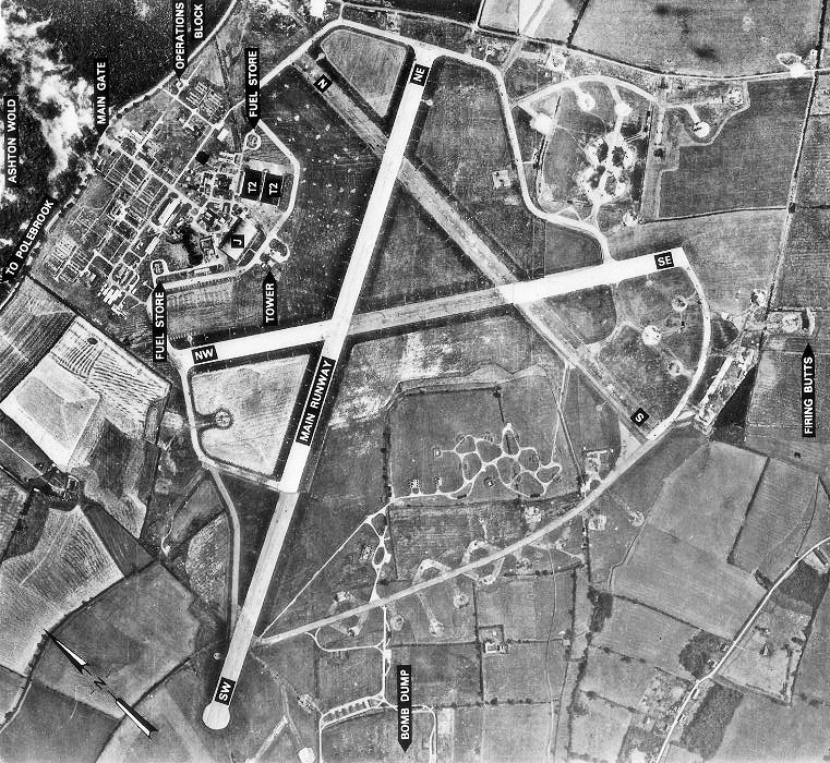
RAF Polebrook

Royal Air Force Polebrook or more simply RAF Polebrook is a former Royal Air Force station located 3.5 miles (5.6 km) east-south-east of Oundle, at Polebrook...

Ashton Wold

Ashton Wold is a 54.0-hectare (133-acre) biological Site of Special Scientific Interest (SSSI) east of the market town Oundle in Northamptonshire.It is...

Caldecote, Huntingdonshire

Caldecote is a village and former civil parish, now in the parish of Denton and Caldecote, in Cambridgeshire, England. Caldecote lies approximately 7 miles...

Denton and Caldecote

Denton and Caldecote – in Huntingdonshire (now part of Cambridgeshire), England – is a civil parish near Glatton south west of Yaxley. The parish was formed...

Folksworth and Washingley

Folksworth and Washingley is a civil parish near Peterborough in Cambridgeshire, England, comprising the villages of Folksworth and Washingley.The parish...

Nearby Amenities

Located within 500m of 52.477235,-0.358242
Lutton
Is In: Northamptonshire
Place: village
Lat/Long: 52.475164/-0.3618364
Design: barrel
Line Attachment: suspension
Material: steel
Power: tower
Structure: lattice
Lat/Long: 52.4757087/-0.3553497
Design: barrel
Line Attachment: suspension
Material: steel
Power: tower
Structure: lattice
Lat/Long: 52.479653/-0.3559675
Manor Farm
Place: farm
Lat/Long: 52.4759355/-0.3630399
Building: yes
Lat/Long: 52.478582/-0.3611194
Post Box
Brand: Royal Mail
Brand Wikidata: Q638098
Brand Wikipedia: en:Royal Mail
Operator: Royal Mail
Operator Wikidata: Q638098
Post Box Type: wall
Royal Cypher: GR
Royal Cypher Wikidata: Q33102273
Lat/Long: 52.4769054/-0.3650206
Telephone
Booth: K6
Covered: booth
Listed Status: Grade II
Operator: BT
Phone: +44 1832 272252
Lat/Long: 52.4766414/-0.3634779
The data included in this document is from www.openstreetmap.org. The data is made available under ODbL.

Have you been to Chapel End?

Leave your review of Chapel End below (or comments, questions and feedback).