Castleton Belt

Wood, Forest in Kincardineshire

Scotland

Castleton Belt

Landends between woodland and a field of polytunnels Looking north-westward. To my untrained eye it looked like a crop of blueberries were being raised. Happy to be corrected.
Landends between woodland and a field of polytunnels Credit: Peter Wood

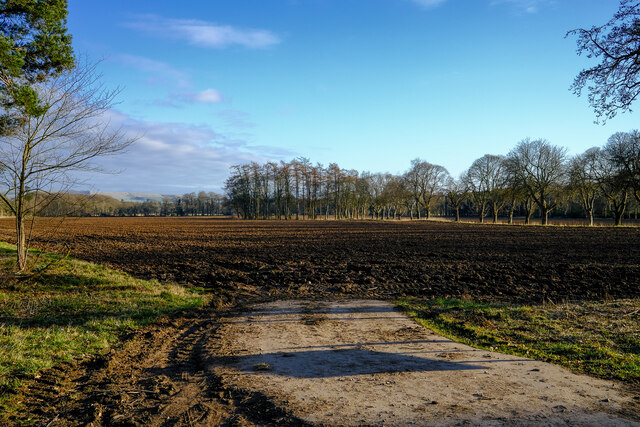
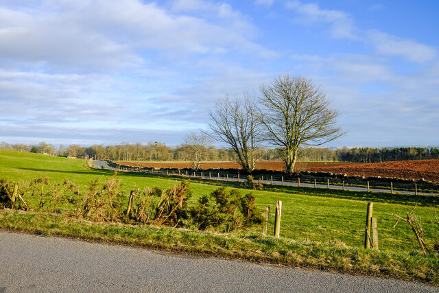
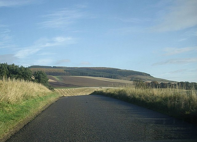
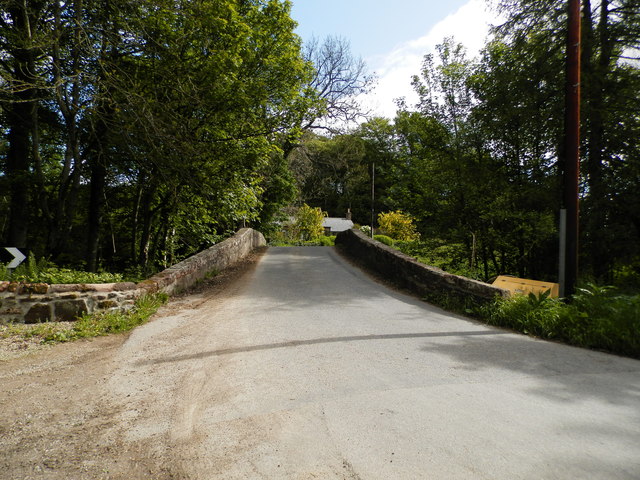
Castleton Belt is a picturesque woodland area located in Kincardineshire, Scotland. Encompassing an area of approximately 100 acres, this ancient forest is renowned for its natural beauty and diverse ecosystem. It is situated near the village of Castleton, with easy access from nearby towns like Stonehaven and Aberdeen.

The woodland comprises a mix of broadleaf and coniferous trees, including oak, beech, pine, and spruce. The dense canopy provides a cool and shaded environment, making it a popular destination for nature enthusiasts and hikers looking for a serene escape from the hustle and bustle of city life.

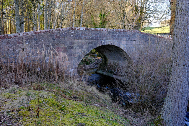
Castleton Belt is home to a wide variety of flora and fauna. The forest floor is adorned with carpets of bluebells and wild garlic during the spring months, while ferns and mosses thrive in the damp and shady areas. Birdwatchers will delight in the sight of native species such as woodpeckers, owls, and warblers, while lucky visitors may even spot red squirrels or roe deer.

Several marked trails wind their way through the forest, allowing visitors to explore its enchanting beauty. These paths offer opportunities for leisurely walks, jogging, and cycling. The tranquil atmosphere and natural surroundings make Castleton Belt a perfect spot for picnics, family outings, and photography enthusiasts.

Overall, Castleton Belt in Kincardineshire is a captivating woodland sanctuary that offers a delightful escape into nature. Its vibrant flora, diverse wildlife, and well-maintained trails make it a cherished destination for locals and tourists alike.

If you have any feedback on the listing, please let us know in the comments section below.

Castleton Belt Images

Images are sourced within 2km of 56.865941/-2.5449756 or Grid Reference NO6675. Thanks to Geograph Open Source API. All images are credited.

Landends between woodland and a field of polytunnels Looking north-westward. To my untrained eye it looked like a crop of blueberries were being raised. Happy to be corrected.
Landends between woodland and a field of polytunnels
Looking north-westward. To my untrained eye it looked like a crop of blueberries were being raised. Happy to be corrected.
Minor road and housing under construction at Pitnamoon Looking north-westward. Obviously a sale has been agreed since this picture was taken : <a title="https://www.geograph.org.uk/photo/5462828" href="https://www.geograph.org.uk/photo/5462828">Link</a>
Minor road and housing under construction at Pitnamoon
Looking north-westward. Obviously a sale has been agreed since this picture was taken : Link
Ready to sow fields A field already for this years crops
Ready to sow fields
A field already for this years crops
Craigmoston Bridge The bridge over the Craigmoston Burn
Craigmoston Bridge
The bridge over the Craigmoston Burn
Two roads and a field Just a simple roadside view of this square
Two roads and a field
Just a simple roadside view of this square
Covered reservoir On hunters hill
Covered reservoir
On hunters hill
B974 by Bank of Gallowhillston On road between Fettercairn and Banchory.
B974 by Bank of Gallowhillston
On road between Fettercairn and Banchory.
Minor road at Pitnamoon
Track into Landends Plantation
Minor road past Landends Plantation
Minor road past Greenbottom Wood
Couper's Road through Greenbottom Wood
Craigmoston Bridge
Craigmoston Bridge
Woodhead junction A minor road meeting the B966 between Laurencekirk and Fettercairn.
Woodhead junction
A minor road meeting the B966 between Laurencekirk and Fettercairn.
Former schoolhouse, Woodhead By B966.
Former schoolhouse, Woodhead
By B966.
Mill of Kincardine From a minor link road between B966 and B974.
Mill of Kincardine
From a minor link road between B966 and B974.
Terraced rural cottages Off minor road close to Kincardine Castle.
Terraced rural cottages
Off minor road close to Kincardine Castle.
A copse containing the remains of Kincardine Castle Off the track to Castleton farm.
A copse containing the remains of Kincardine Castle
Off the track to Castleton farm.
Show me another place!

Castleton Belt is located at Grid Ref: NO6675 (Lat: 56.865941, Lng: -2.5449756)

Unitary Authority: Aberdeenshire

Police Authority: North East

What 3 Words

///cuddled.gums.pickle. Near Laurencekirk, Aberdeenshire

Related Wikis

Kincardine, Aberdeenshire

Kincardine was a burgh in Scotland, near the present-day village of Fettercairn. It served as the first county town of Kincardineshire. The settlement...

Fasque House

Fasque, also known as Fasque House or Fasque Castle, is a mansion in Aberdeenshire, Scotland, situated near the village of Fettercairn, in the former county...

Fettercairn

Fettercairn (, Scottish Gaelic: Fothair Chàrdain) is a small village in Aberdeenshire, Scotland, northwest of Laurencekirk in Aberdeenshire on the B966...

Fettercairn distillery

Fettercairn distillery is a whisky distillery in Fettercairn. Situated under the Grampian foothills in the Howe of Mearns, Fettercairn town’s name is...

Nearby Amenities

Located within 500m of 56.865941,-2.5449756
Power: pole
Lat/Long: 56.8692736/-2.5396515
Power: pole
Lat/Long: 56.8686322/-2.5391348
Power: pole
Lat/Long: 56.86801/-2.5386337
Power: pole
Lat/Long: 56.8674006/-2.5381429
Power: pole
Lat/Long: 56.8671114/-2.5379099
Power: pole
Lat/Long: 56.8667353/-2.5376069
Power: pole
Lat/Long: 56.8661564/-2.5371406
Power: pole
Lat/Long: 56.8667862/-2.5389686
Power: pole
Lat/Long: 56.8656526/-2.5426364
Power: pole
Lat/Long: 56.8652348/-2.5415875
Power: pole
Lat/Long: 56.864894/-2.5407072
Power: pole
Lat/Long: 56.864567/-2.5399153
Power: pole
Lat/Long: 56.8648595/-2.5389486
Power: pole
Lat/Long: 56.86513/-2.5380914
Power: pole
Lat/Long: 56.8653533/-2.5374006
The data included in this document is from www.openstreetmap.org. The data is made available under ODbL.

Have you been to Castleton Belt?

Leave your review of Castleton Belt below (or comments, questions and feedback).