Chantry

Settlement in Somerset Mendip

England

Chantry

Whatley Church Church at Whatley.
Whatley Church Credit: Wayland Smith

Chantry is a small village located in the county of Somerset, England. Situated in the picturesque Mendip Hills, it is a part of the Mendip District Council. The village is surrounded by rolling countryside, offering stunning views and a tranquil environment for its residents and visitors.

Chantry is known for its rich history, dating back to the Roman times. The area has been inhabited for centuries, and evidence of this can be seen in the various archaeological sites and artifacts discovered in the vicinity. The village itself has a charming and quaint atmosphere, with traditional stone cottages and a sense of community.

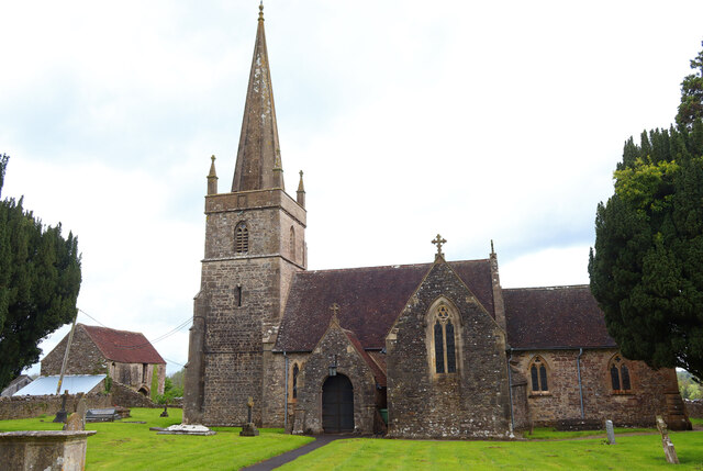
Despite its small size, Chantry offers a range of amenities and facilities to cater to the needs of its residents. These include a local pub, a primary school, a village hall, and a church. The village is also well-connected to neighboring towns and cities, with good transportation links.

Nature lovers will find plenty to explore in Chantry and its surrounding areas. The Mendip Hills, a designated Area of Outstanding Natural Beauty, provide ample opportunities for walking, hiking, and enjoying the great outdoors. The nearby Cheddar Gorge, a dramatic limestone gorge, is a popular tourist attraction and offers breathtaking views.

Overall, Chantry offers a peaceful and idyllic setting for those seeking a rural lifestyle, while still providing access to essential amenities and natural beauty.

If you have any feedback on the listing, please let us know in the comments section below.

Chantry Images

Images are sourced within 2km of 51.220541/-2.404483 or Grid Reference ST7146. Thanks to Geograph Open Source API. All images are credited.
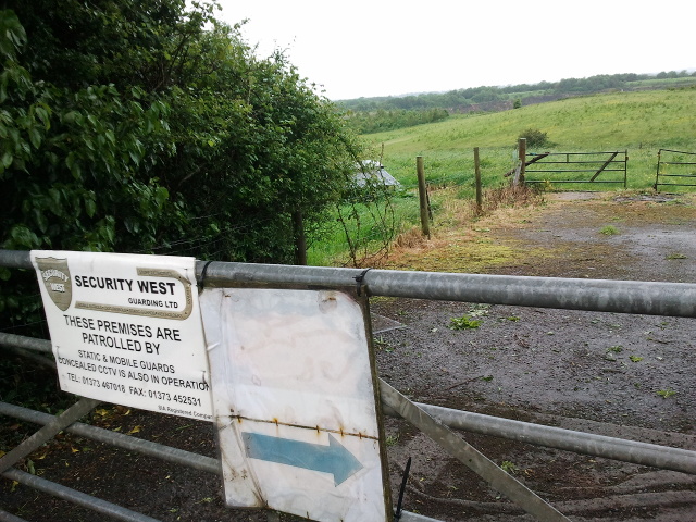
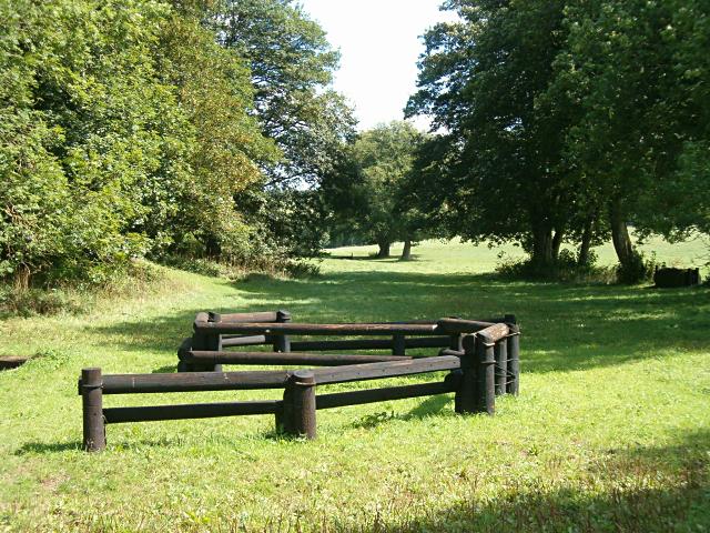
Whatley Church Church at Whatley.
Whatley Church
Church at Whatley.
Old Milestone West of Whatley Crossroads The Milestone is located on grass verge and hedge on the South of the road.  Parish of Whatley (Mendip District). Metal plate attached to stone post, Frome square iron plate design, erected by the Frome turnpike trust in the 18th Century. An earlier photograph can be found here: <a title="https://www.geograph.org.uk/photo/6051504" href="https://www.geograph.org.uk/photo/6051504">Link</a> 

Inscription reads:-  
FROME / 3 / WELLS / 12 

Grade II listed. List Entry Number: 1295398 <span class="nowrap"><a title="https://historicengland.org.uk/listing/the-list/list-entry/1295398" rel="nofollow ugc noopener" href="https://historicengland.org.uk/listing/the-list/list-entry/1295398">Link</a><img style="margin-left:2px;" alt="External link" title="External link - shift click to open in new window" src="https://s1.geograph.org.uk/img/external.png" width="10" height="10"/></span> 

Milestone Society National ID: SO_FRWL03
Old Milestone West of Whatley Crossroads
The Milestone is located on grass verge and hedge on the South of the road.  Parish of Whatley (Mendip District). Metal plate attached to stone post, Frome square iron plate design, erected by the Frome turnpike trust in the 18th Century. An earlier photograph can be found here: Link  Inscription reads:- FROME / 3 / WELLS / 12 Grade II listed. List Entry Number: 1295398 LinkExternal link Milestone Society National ID: SO_FRWL03
2011 : Track through Asham Wood Wikipedia has this to say:
"Asham Wood is the largest and most diverse of the ancient semi-natural woods in the Mendips. It has been the subject of controversy and attempts to protect the environment from increased quarrying activity in the area.
The wood occupies 2 deep valleys and the intervening plateau. Most of the underlying rocks are calcareous Carboniferous Limestone and Shales, but Devonian Portishead Beds outcrop along the northern valley. There [is] a range of unusual flora and fauna.
At Asham Wood near Frome coppicing and 50 dormouse boxes have been introduced in order to encourage nesting. The boxes are monitored and dormice numbers are recorded."  <span class="nowrap"><a title="http://en.wikipedia.org/wiki/Asham_Wood" rel="nofollow ugc noopener" href="http://en.wikipedia.org/wiki/Asham_Wood">Link</a><img style="margin-left:2px;" alt="External link" title="External link - shift click to open in new window" src="https://s1.geograph.org.uk/img/external.png" width="10" height="10"/></span>

The only access to Asham Wood from the road is on the north east edge near Dead Womans Bottom, otherwise it is by footpath.
2011 : Track through Asham Wood
Wikipedia has this to say: "Asham Wood is the largest and most diverse of the ancient semi-natural woods in the Mendips. It has been the subject of controversy and attempts to protect the environment from increased quarrying activity in the area. The wood occupies 2 deep valleys and the intervening plateau. Most of the underlying rocks are calcareous Carboniferous Limestone and Shales, but Devonian Portishead Beds outcrop along the northern valley. There [is] a range of unusual flora and fauna. At Asham Wood near Frome coppicing and 50 dormouse boxes have been introduced in order to encourage nesting. The boxes are monitored and dormice numbers are recorded." LinkExternal link The only access to Asham Wood from the road is on the north east edge near Dead Womans Bottom, otherwise it is by footpath.
Road at Park Corner
Road at Park Corner
Gate on Limekiln Lane onto guarded property
Finger Farm yard
Finger Farm yard
Road to Mells at Finger Farm
A wet field entrance
This way, not that way A footpath signpost, leaning in a somewhat rustic fashion, points to the right - although the worn path is actually to the left on Little Green, Mells.
This way, not that way
A footpath signpost, leaning in a somewhat rustic fashion, points to the right - although the worn path is actually to the left on Little Green, Mells.
The Old Forge An extensive house in Mells, proclaiming itself as the Old Forge.
The Old Forge
An extensive house in Mells, proclaiming itself as the Old Forge.
Peeling back the years The phone box in Mells Green, showing some of its various layers of paint over time.
Peeling back the years
The phone box in Mells Green, showing some of its various layers of paint over time.
Either way across the field Two footpaths lead from Little Green up the hill below Whatley Quarry. See <a href="https://www.geograph.org.uk/photo/4054934">ST7248 : A few degrees off course</a> for an extra bit of woodwork
Either way across the field
Two footpaths lead from Little Green up the hill below Whatley Quarry. See ST7248 : A few degrees off course for an extra bit of woodwork
A few degrees off course Take either path and you will go uphill, but the two paths then diverge along the ridge of the hill. See <a href="https://www.geograph.org.uk/photo/4054931">ST7248 : Either way across the field</a> for a look up the field.
A few degrees off course
Take either path and you will go uphill, but the two paths then diverge along the ridge of the hill. See ST7248 : Either way across the field for a look up the field.
Thatched row A row of cottages in Little Green, all with a thatch on top.
Thatched row
A row of cottages in Little Green, all with a thatch on top.
Quarry nr Holwell One of several smallish quarries at the Eastern end of the Mendips.
Quarry nr Holwell
One of several smallish quarries at the Eastern end of the Mendips.
Cross-country obstacle A footpath runs down here through the trees to the Nunney Brook.
Cross-country obstacle
A footpath runs down here through the trees to the Nunney Brook.
Macmillan Way The Macmillan Way descends from Whatley into the combe below just beyond the next hedge.
Macmillan Way
The Macmillan Way descends from Whatley into the combe below just beyond the next hedge.
St George's Church, Whatley
Show me another place!

Chantry is located at Grid Ref: ST7146 (Lat: 51.220541, Lng: -2.404483)

Administrative County: Somerset

District: Mendip

Police Authority: Avon and Somerset

What 3 Words

///loitering.artichoke.preparing. Near Frome, Somerset

Related Wikis

Whatley Quarry

Whatley Quarry, grid reference ST731479 is a limestone quarry owned by Hanson plc, near the village of Whatley on the Mendip Hills, Somerset, England....

Asham Wood

Asham Wood (grid reference ST705460) is a 140.6-hectare (347-acre) biological Site of Special Scientific Interest east of Downhead and south of Leigh-on...

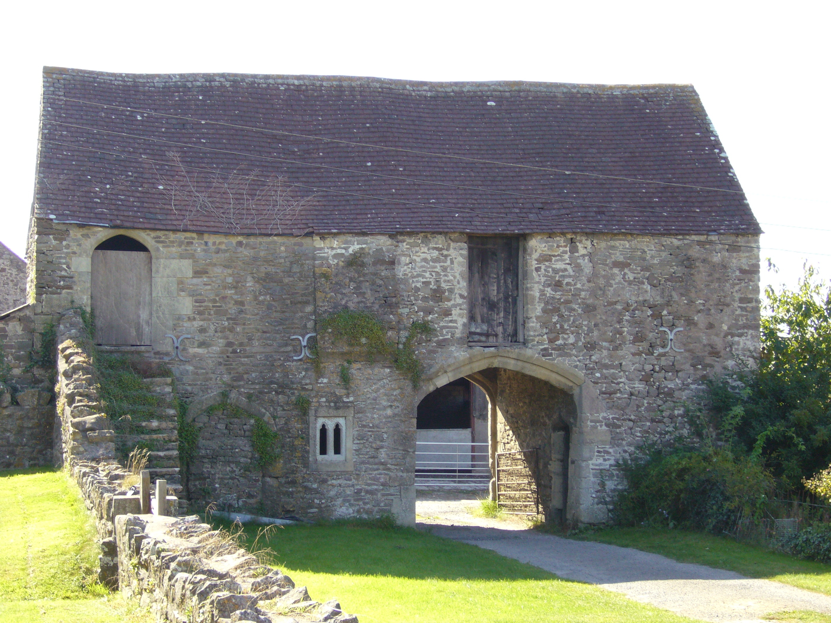
Manor Farmhouse Gatehouse, Whatley

The Manor Farmhouse Gatehouse in Whatley, Somerset, England, was built around 1500 and has been designated as a Grade I listed building.The two-storey...

Church of St George, Whatley

The Anglican Church of St George in Whatley, within the English county of Somerset, dates from the 14th century. It is a Grade II* listed building.Parts...

Colemans Quarry

Colemans Quarry, grid reference ST726452 is a limestone quarry at Holwell, near Nunney on the Mendip Hills, Somerset, England. The Colemans Quarry complex...
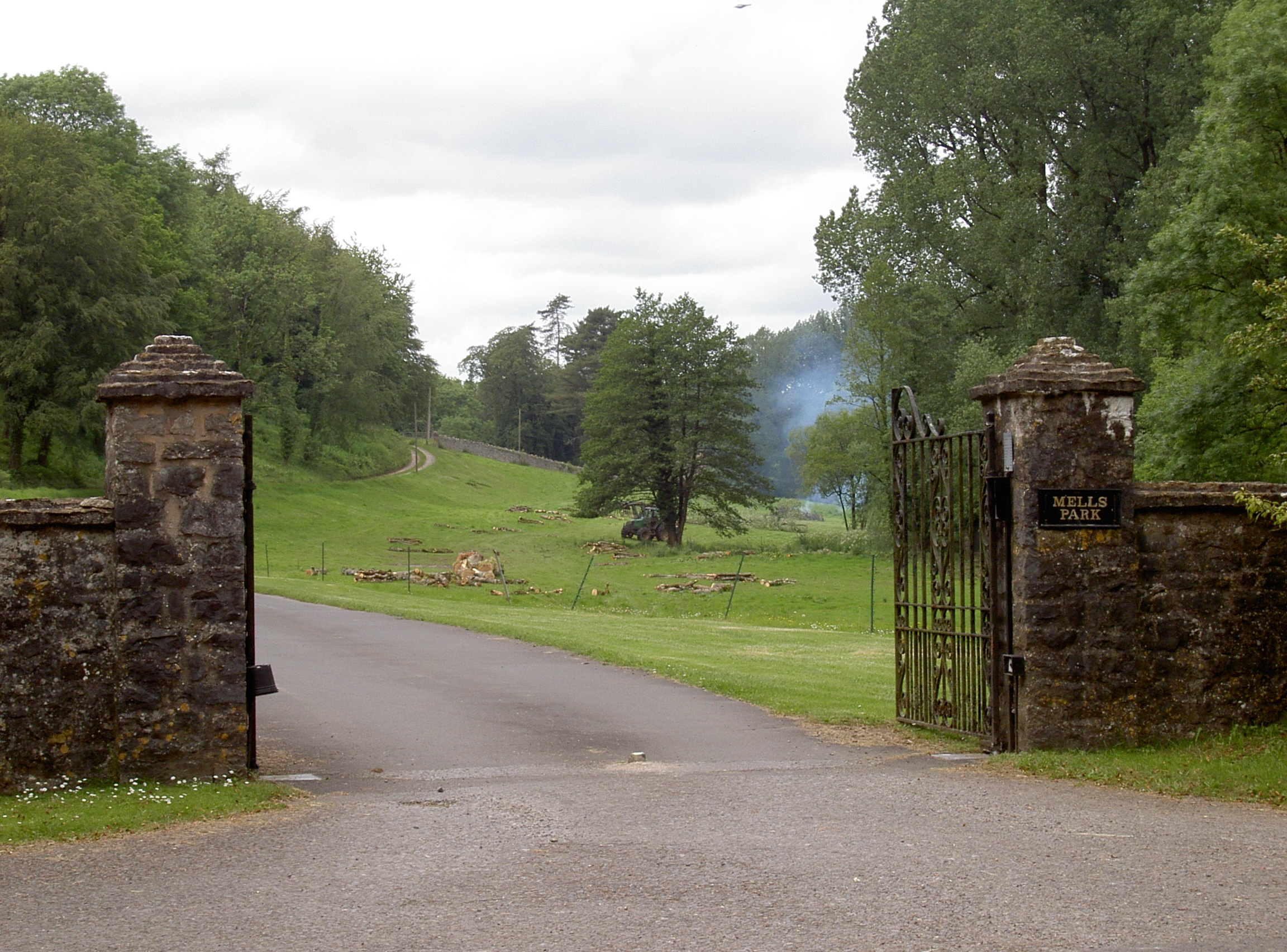
Mells Park

Mells Park is a country estate of 140 hectares (350 acres) near Mells, Somerset, England. It originated as a 17th-century deer park, probably created by...

Whatley, Mendip

Whatley is a small rural village and civil parish about 2.5 miles (4 km) west of Frome in the English county of Somerset. The parish lies south of Mells...

Holwell Quarries

Holwell Quarries (grid reference ST726450) is a 1.3-hectare (3.2-acre) geological Site of Special Scientific Interest at Holwell near Nunney on the Mendip...

Nearby Amenities

Located within 500m of 51.220541,-2.404483
Source: Bing
Lat/Long: 51.2224088/-2.4022111
Chantry
Place: village
Source Ref: NPE
Lat/Long: 51.2222141/-2.4025342
Source: Bing
Lat/Long: 51.2231887/-2.3998727
Source: Bing
Lat/Long: 51.221815/-2.4014645
Source: Bing
Lat/Long: 51.2222741/-2.4020352
Source: Bing
Lat/Long: 51.2223876/-2.4024017
Source: Bing
Lat/Long: 51.2219869/-2.4016392
Source: Bing
Lat/Long: 51.2221351/-2.4018506
Source: Bing
Lat/Long: 51.2221525/-2.4033795
Source: Bing
Lat/Long: 51.2223604/-2.4021731
Source: Bing
Lat/Long: 51.2223672/-2.402701
Source: Bing
Lat/Long: 51.2225345/-2.4014453
Source: Bing
Lat/Long: 51.2224928/-2.4025773
Source: Bing
Lat/Long: 51.2228206/-2.4007251
Bus Stop
Bell View
Bus: yes
Naptan AtcoCode: 3600SOB21668
Naptan Bearing: E
Naptan CommonName: Bell View
Naptan Indicator: E-bound
Naptan NaptanCode: sotdjpdj
Naptan Verified: no
Public Transport: platform
Lat/Long: 51.2204929/-2.4079458
Bus Stop
Bell View
Bus: yes
Naptan AtcoCode: 3600SOB21667
Naptan Bearing: W
Naptan CommonName: Bell View
Naptan Indicator: W-bound
Naptan NaptanCode: sotdjpdm
Naptan Verified: no
Public Transport: platform
Lat/Long: 51.2204289/-2.4079703
The data included in this document is from www.openstreetmap.org. The data is made available under ODbL.

Have you been to Chantry?

Leave your review of Chantry below (or comments, questions and feedback).