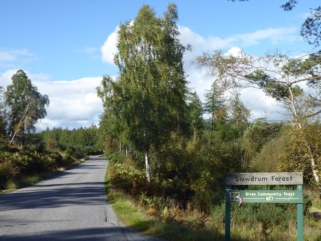
Slewdrum Forest

Wood, Forest in Aberdeenshire

Scotland

Slewdrum Forest

Open Woodland in Shannel SSSI Grassland and native broadleaved trees on part of the Site of Special Scientific Interest at Shannel.
Open Woodland in Shannel SSSI Credit: Anne Burgess

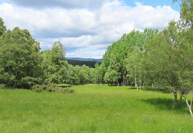
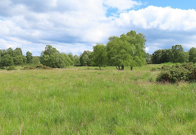
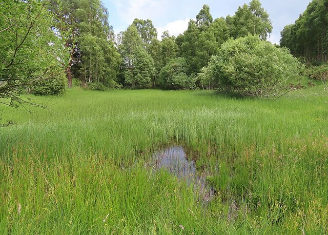
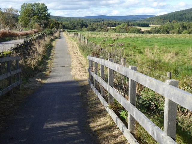
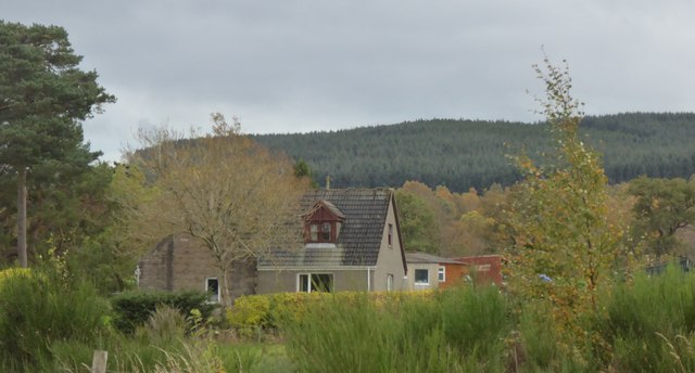
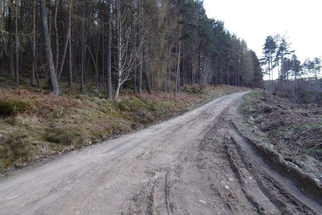
Slewdrum Forest is a picturesque woodland located in the Aberdeenshire region of Scotland. Spread over an area of approximately 500 acres, this enchanting forest offers a tranquil retreat for nature enthusiasts and hikers alike.

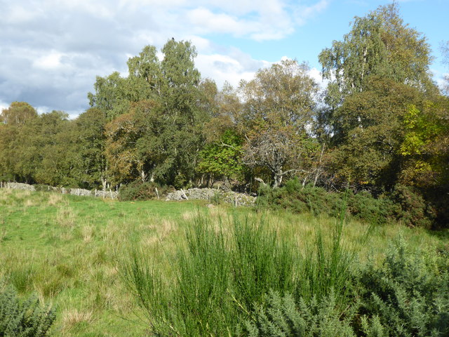
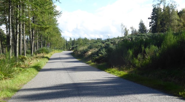
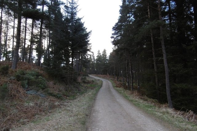
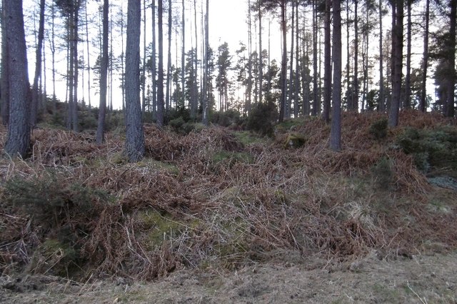
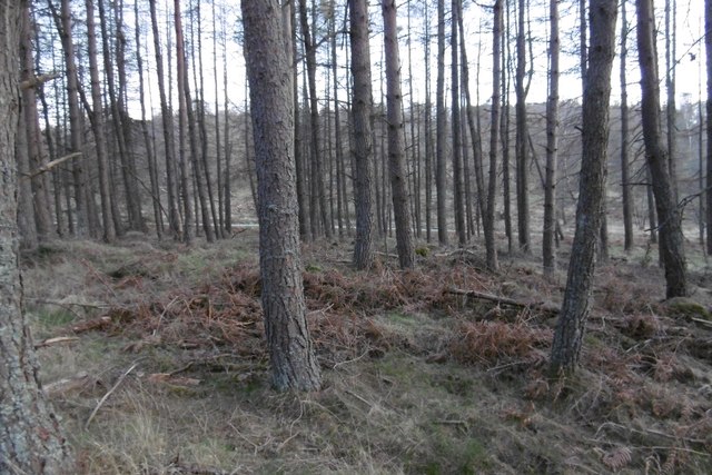
The forest is predominantly composed of native Scottish tree species, including Scots pine, birch, and rowan. The dense canopy provides a haven for various wildlife, making it a popular spot for birdwatching. Visitors often catch glimpses of red squirrels, roe deer, and the occasional golden eagle soaring above the treetops.

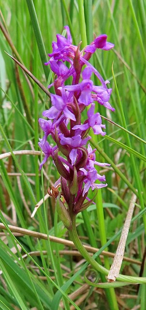
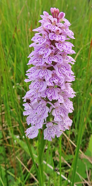
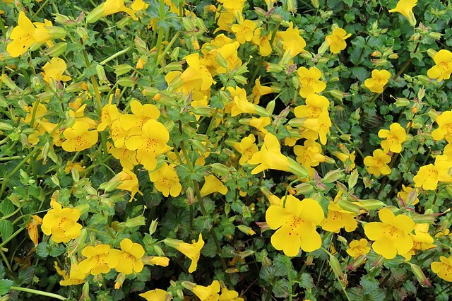
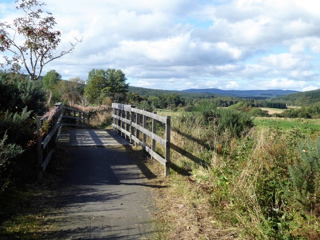
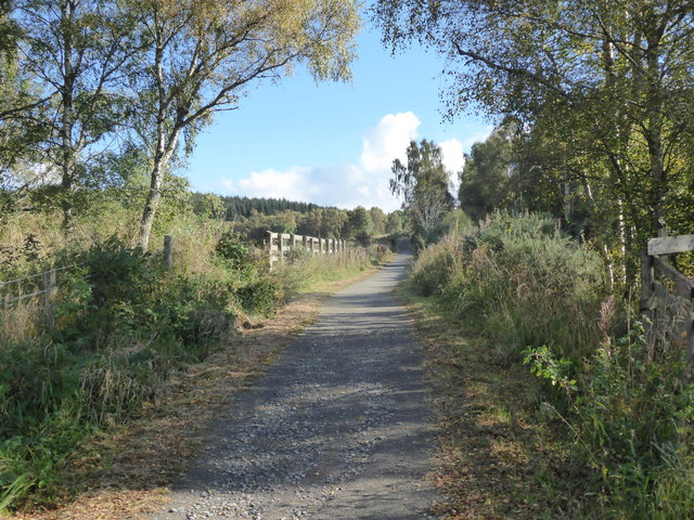
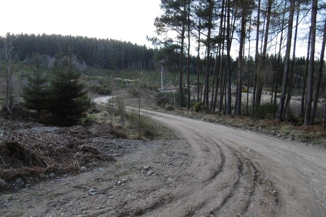
Trails meander through the forest, leading visitors on a journey of discovery. The paths are well-maintained, allowing for easy exploration of the diverse flora and fauna. The forest floor is adorned with mosses, ferns, and wildflowers, creating a vibrant tapestry of colors throughout the seasons.

One of the highlights of Slewdrum Forest is the Slewdrum Castle ruins, nestled amidst the trees. This historic structure dates back to the 13th century and adds an air of mystery to the forest, as visitors can explore its crumbling walls and imagine the tales of its past.

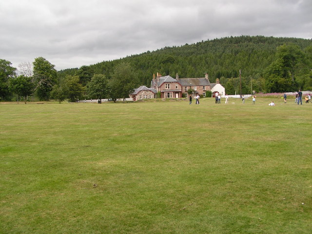
For those seeking adventure, Slewdrum Forest offers opportunities for camping and picnicking. There are designated camping areas with basic facilities, providing a chance to reconnect with nature in a serene environment.

Overall, Slewdrum Forest in Aberdeenshire is a captivating destination for nature enthusiasts, history lovers, and those in search of a peaceful escape. Its lush woodlands, abundant wildlife, and rich history make it a must-visit location for anyone exploring the region.

If you have any feedback on the listing, please let us know in the comments section below.

Slewdrum Forest Images

Images are sourced within 2km of 57.047881/-2.6114918 or Grid Reference NO6295. Thanks to Geograph Open Source API. All images are credited.

Open Woodland in Shannel SSSI Grassland and native broadleaved trees on part of the Site of Special Scientific Interest at Shannel.
Open Woodland in Shannel SSSI
Grassland and native broadleaved trees on part of the Site of Special Scientific Interest at Shannel.
Fragrant Orchid (Gymnadenia conopsea) There are many of these in the grassy parts of the Shannel Site of Scientific Interest.
Fragrant Orchid (Gymnadenia conopsea)
There are many of these in the grassy parts of the Shannel Site of Scientific Interest.
Heath Spotted-orchid (Dactylorhiza maculata) One of many fine spikes found in the grassy parts of Shannel SSSI.
Heath Spotted-orchid (Dactylorhiza maculata)
One of many fine spikes found in the grassy parts of Shannel SSSI.
Grassland near Tillenteach This are of grassland and scattered trees is part of the Shannel SSSI.
Grassland near Tillenteach
This are of grassland and scattered trees is part of the Shannel SSSI.
Monkeyflower (Mimulus guttatus) A well-established non-native that likes damp places.
Monkeyflower (Mimulus guttatus)
A well-established non-native that likes damp places.
Disappearing Pond This pond near Tillenteach is becoming overgrown with vegetation, and it may not be long before it disappears altogether.
Disappearing Pond
This pond near Tillenteach is becoming overgrown with vegetation, and it may not be long before it disappears altogether.
Cycle path bridge Over the Burn of Grennoch; a tributary of the Burn of Cattie, and thence the River Dee.
Cycle path bridge
Over the Burn of Grennoch; a tributary of the Burn of Cattie, and thence the River Dee.
Western edge of Slewdrum Forest As seen from the cycle path bridge over the Burn of Grennoch.
Western edge of Slewdrum Forest
As seen from the cycle path bridge over the Burn of Grennoch.
Cycle path downhill towards Potarch From a bridge over the Burn of Grennoch.
Cycle path downhill towards Potarch
From a bridge over the Burn of Grennoch.
Cycle path uphill towards Shooting Greens pass From a bridge over the Burn of Grennoch.
Cycle path uphill towards Shooting Greens pass
From a bridge over the Burn of Grennoch.
Near summit of an Old Military Road (188m asl) Passing between Glack's Hill (276m) and Muckle Ord (220m).
Near summit of an Old Military Road (188m asl)
Passing between Glack's Hill (276m) and Muckle Ord (220m).
Access to Slewdrum Forest car park From the Old Military Road at Shooting Greens.
Access to Slewdrum Forest car park
From the Old Military Road at Shooting Greens.
Belhangie cottage As seen by the minor road from Potarch to Tillygarmond.
Belhangie cottage
As seen by the minor road from Potarch to Tillygarmond.
Blackhall Forest Entering terrain covered on the latest Mar Orienteering Club Shooting Greens map.  The road crosses the entire forest from the Scolty car park and is used by the National Cycle Network.
Blackhall Forest
Entering terrain covered on the latest Mar Orienteering Club Shooting Greens map. The road crosses the entire forest from the Scolty car park and is used by the National Cycle Network.
Scots pines, Blackhall Forest
Logging road, Blackhall Forest Lots of place names and names of orienteering maps here. The whole block from the Scolty car park to the Military Road goes by Blackhall Forest. Much of that is Wood of Goauch or Goauch Wood.  In this picture the road leaves the Forestry Commission estate and the community woodland(bought from the FC) is known as Slewdrum Forest.  Orienteering maps of the western end of the forest are often titled Shooting Greens, events here are usually put on by Mar OC, while Grampian have the eastern end, often titled Scolty.
Logging road, Blackhall Forest
Lots of place names and names of orienteering maps here. The whole block from the Scolty car park to the Military Road goes by Blackhall Forest. Much of that is Wood of Goauch or Goauch Wood. In this picture the road leaves the Forestry Commission estate and the community woodland(bought from the FC) is known as Slewdrum Forest. Orienteering maps of the western end of the forest are often titled Shooting Greens, events here are usually put on by Mar OC, while Grampian have the eastern end, often titled Scolty.
Logging road, Blackhall Forest On the slopes of Hill of Tillybath, heading for the exit onto the Military Road.
Logging road, Blackhall Forest
On the slopes of Hill of Tillybath, heading for the exit onto the Military Road.
Shooting Greens / Slewdrum Forest Larches overlooking the Military Road.
Shooting Greens / Slewdrum Forest
Larches overlooking the Military Road.
Show me another place!

Slewdrum Forest is located at Grid Ref: NO6295 (Lat: 57.047881, Lng: -2.6114918)

Unitary Authority: Aberdeenshire

Police Authority: North East

What 3 Words

///speeches.decreased.submitted. Near Torphins, Aberdeenshire

Related Wikis

Mounth

The Mounth ( MUNTH) is the broad upland in northeast Scotland between the Highland Boundary and the River Dee, at the eastern end of the Grampians....

Potarch

Potarch ( pot-ARKH) is a hamlet in Aberdeenshire, Scotland, with a bridge across the River Dee.It is a popular location with tourists and day-trippers...

Dinnie Stones

The Dinnie Stones (also called Stanes or Steens) are a pair of Scottish lifting stones located in Potarch, Aberdeenshire. They were made famous by strongman...

Finzean

Finzean (; Scottish Gaelic: Fìnnean) is a rural community, electoral polling district, community council area and former ecclesiastical parish, which forms...

Nearby Amenities

Located within 500m of 57.047881,-2.6114918
Muckle of Ord
Natural: peak
Lat/Long: 57.0453202/-2.6115693
The data included in this document is from www.openstreetmap.org. The data is made available under ODbL.

Have you been to Slewdrum Forest?

Leave your review of Slewdrum Forest below (or comments, questions and feedback).