Haybogs Wood

Wood, Forest in Aberdeenshire

Scotland

Haybogs Wood

Moorland of Red Hill with fence, boundary stone and woodland The fence crosses the north end of Red Hill on Corrennie Moor. The boundary stone is unmarked - others seen in the area are cut with letters. Beyond the trees can be seen Green Hill.
Moorland of Red Hill with fence, boundary stone and woodland Credit: Trevor Littlewood

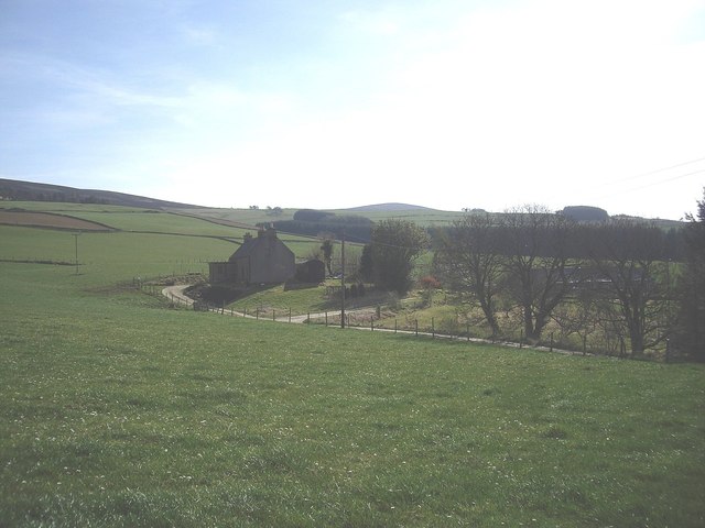
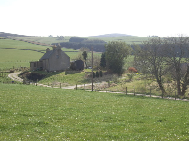
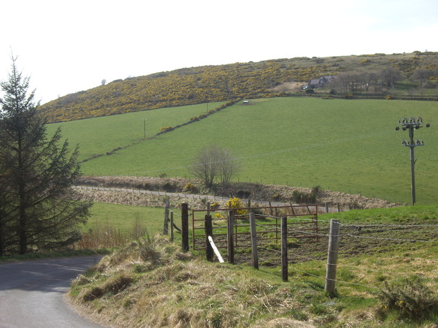
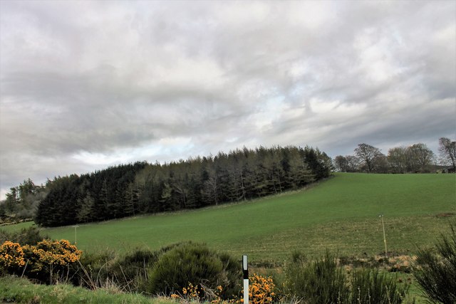
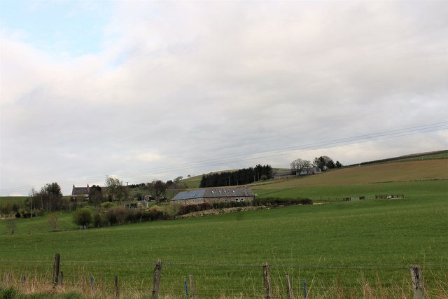
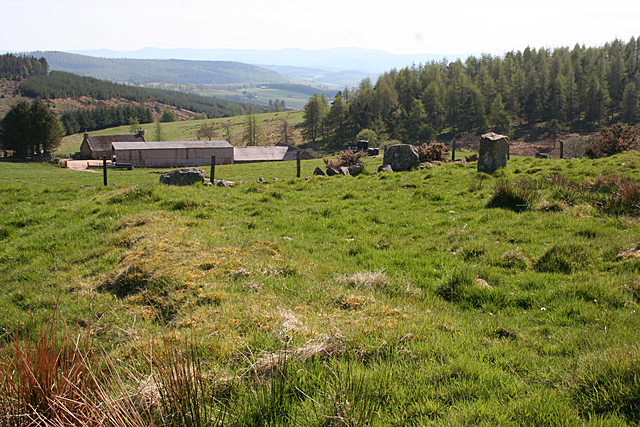
Haybogs Wood is a beautiful forest located in Aberdeenshire, Scotland. It spans over an area of approximately 100 acres and is known for its stunning natural landscapes and diverse wildlife. The wood is situated near the town of Insch, making it easily accessible for both locals and tourists.

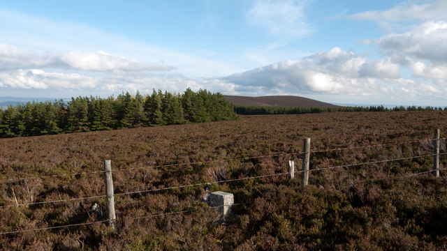
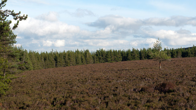
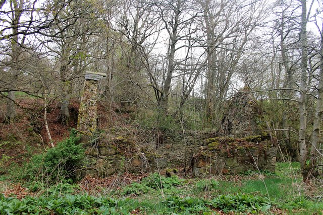
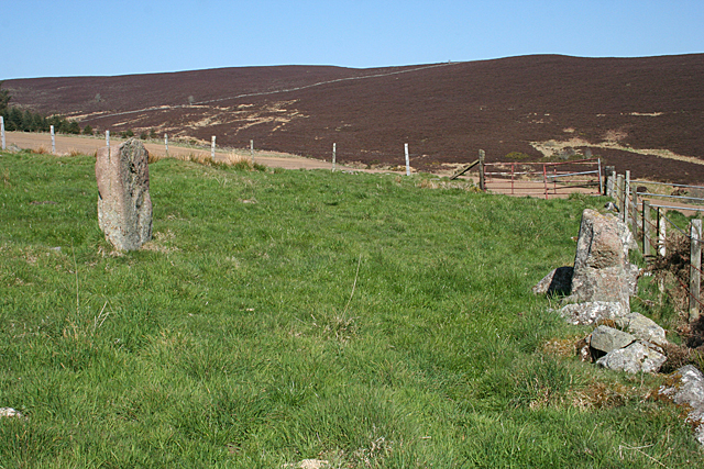
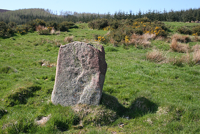
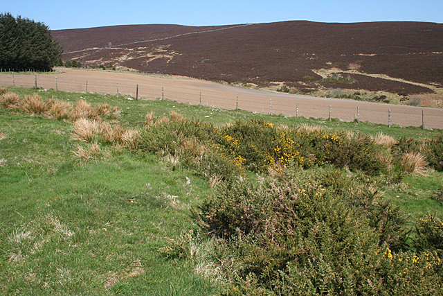
The woodland consists mainly of broadleaf trees such as oak, birch, and beech, which create a dense canopy overhead. The forest floor is covered with a thick carpet of ferns, moss, and wildflowers, adding to its enchanting atmosphere. Haybogs Wood is also home to a small stream that meanders through the forest, adding to its serene ambiance.

The wood is a haven for a wide range of wildlife species. Visitors can often spot various birds, including woodpeckers, owls, and buzzards, among others. Mammals such as deer, foxes, and squirrels are also commonly seen in the area. The wood's diverse ecosystem provides ample opportunities for nature enthusiasts and photographers to observe and capture the beauty of these animals in their natural habitat.

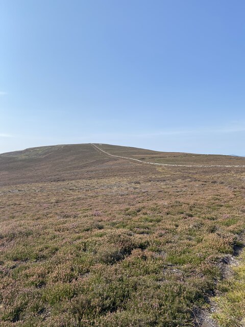
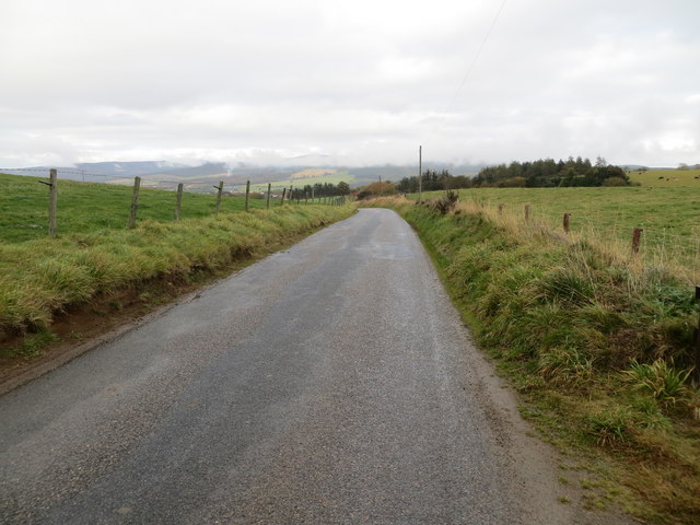
Haybogs Wood offers several walking trails and paths that allow visitors to explore its enchanting surroundings. These trails are well-maintained and offer breathtaking views of the wood's flora and fauna. The wood also has picnic areas and benches, providing a perfect spot for visitors to relax and enjoy the tranquility of nature.

Overall, Haybogs Wood is a picturesque forest that offers a peaceful retreat for nature lovers. Its stunning landscapes, diverse wildlife, and well-maintained trails make it a must-visit destination for anyone seeking to connect with nature in Aberdeenshire.

If you have any feedback on the listing, please let us know in the comments section below.

Haybogs Wood Images

Images are sourced within 2km of 57.187213/-2.6363761 or Grid Reference NJ6110. Thanks to Geograph Open Source API. All images are credited.

Moorland of Red Hill with fence, boundary stone and woodland The fence crosses the north end of Red Hill on Corrennie Moor. The boundary stone is unmarked - others seen in the area are cut with letters. Beyond the trees can be seen Green Hill.
Moorland of Red Hill with fence, boundary stone and woodland
The fence crosses the north end of Red Hill on Corrennie Moor. The boundary stone is unmarked - others seen in the area are cut with letters. Beyond the trees can be seen Green Hill.
Heather moorland surrounded by trees North-east of Red Hill, part of Corrennie Moor, conifer plantings surround an area of heather moorland. A rogue tree stands alone.
Heather moorland surrounded by trees
North-east of Red Hill, part of Corrennie Moor, conifer plantings surround an area of heather moorland. A rogue tree stands alone.
Ardgowse Seen from the minor road between Tough and Craigievar.
Ardgowse
Seen from the minor road between Tough and Craigievar.
Former railway carriage by Ardgowse Serving as a steading, behind the farmhouse.
Former railway carriage by Ardgowse
Serving as a steading, behind the farmhouse.
Double bend in road near Ardgowse
View to Benaquhallie
Hillside Woodland A conifer copse near Tillyfour.
Hillside Woodland
A conifer copse near Tillyfour.
Stone Shelter A dry stone shelter (or hide?) constructed at the summit of the hill (not named on OS map, but possibly "Lynturk Hill"?). It sits among other stones, some much larger in size. A line of such stones runs down hill in a roughly southerly direction. Not clear if the position of the surrounding stones is a natural phenomenon, a result of fairly modern field clearance, or something else?
Stone Shelter
A dry stone shelter (or hide?) constructed at the summit of the hill (not named on OS map, but possibly "Lynturk Hill"?). It sits among other stones, some much larger in size. A line of such stones runs down hill in a roughly southerly direction. Not clear if the position of the surrounding stones is a natural phenomenon, a result of fairly modern field clearance, or something else?
Eastern elevation of Tough Church From inside the kirkyard.
Eastern elevation of Tough Church
From inside the kirkyard.
Ardgowse Farm Ardgowse in its surrounding fields
Ardgowse Farm
Ardgowse in its surrounding fields
Ruin amongst Trees A ruined cottage by Garden Croft.
Ruin amongst Trees
A ruined cottage by Garden Croft.
Fence-lined minor road heading in the direction of Kirton of Tough Looking north-eastward.
Fence-lined minor road heading in the direction of Kirton of Tough
Looking north-eastward.
Corrennie Moor Looking towards Benaquhallie.
Corrennie Moor
Looking towards Benaquhallie.
Old Kirk o' Tough Recumbent Stone Circle (1) The stone on the left is the only stone still in situ of this circle. The one on the right is possibly the recumbent, moved from its original site and built into the field dyke. See <span class="nowrap"><a title="https://canmore.org.uk/site/18006/old-kirk-of-tough" rel="nofollow ugc noopener" href="https://canmore.org.uk/site/18006/old-kirk-of-tough">Link</a><img style="margin-left:2px;" alt="External link" title="External link - shift click to open in new window" src="https://s1.geograph.org.uk/img/external.png" width="10" height="10"/></span> for more details. <a href="https://www.geograph.org.uk/photo/4955947">NJ6209 : Old Kirk o' Tough Recumbent Stone Circle (2)</a>
Old Kirk o' Tough Recumbent Stone Circle (1)
The stone on the left is the only stone still in situ of this circle. The one on the right is possibly the recumbent, moved from its original site and built into the field dyke. See LinkExternal link for more details. NJ6209 : Old Kirk o' Tough Recumbent Stone Circle (2)
Old Kirk o' Tough Recumbent Stone Circle (2) This is the sole remaining stone still in its original position. The rest were carried off in the late 19th century and mostly used for building. See <span class="nowrap"><a title="https://canmore.org.uk/site/18006/old-kirk-of-tough" rel="nofollow ugc noopener" href="https://canmore.org.uk/site/18006/old-kirk-of-tough">Link</a><img style="margin-left:2px;" alt="External link" title="External link - shift click to open in new window" src="https://s1.geograph.org.uk/img/external.png" width="10" height="10"/></span> for more details. <a href="https://www.geograph.org.uk/photo/4955957">NJ6209 : Old Kirk o' Tough Recumbent Stone Circle (3)</a>
Old Kirk o' Tough Recumbent Stone Circle (2)
This is the sole remaining stone still in its original position. The rest were carried off in the late 19th century and mostly used for building. See LinkExternal link for more details. NJ6209 : Old Kirk o' Tough Recumbent Stone Circle (3)
Old Kirk o' Tough Recumbent Stone Circle (3) The only stone in its original position is nearest the camera. To its right, on top of the dyke, is possibly the recumbent, and there are other stones also built into the dyke which may or may not have been part of the circle. See <span class="nowrap"><a title="https://canmore.org.uk/site/18006/old-kirk-of-tough" rel="nofollow ugc noopener" href="https://canmore.org.uk/site/18006/old-kirk-of-tough">Link</a><img style="margin-left:2px;" alt="External link" title="External link - shift click to open in new window" src="https://s1.geograph.org.uk/img/external.png" width="10" height="10"/></span> for more details. <a href="https://www.geograph.org.uk/photo/4955963">NJ6209 : Old Kirk o' Tough Recumbent Stone Circle (4)</a>
Old Kirk o' Tough Recumbent Stone Circle (3)
The only stone in its original position is nearest the camera. To its right, on top of the dyke, is possibly the recumbent, and there are other stones also built into the dyke which may or may not have been part of the circle. See LinkExternal link for more details. NJ6209 : Old Kirk o' Tough Recumbent Stone Circle (4)
Old Kirk o' Tough Recumbent Stone Circle (4) One distinguishing feature of this circle is a low bank, marked by whin bushes, right round what may have been the circumference of the circle. Archaeologists debate whether this is part of a cairn associated with the circle, or whether it is rubble discarded when the circle was dismantled. See <span class="nowrap"><a title="https://canmore.org.uk/site/18006/old-kirk-of-tough" rel="nofollow ugc noopener" href="https://canmore.org.uk/site/18006/old-kirk-of-tough">Link</a><img style="margin-left:2px;" alt="External link" title="External link - shift click to open in new window" src="https://s1.geograph.org.uk/img/external.png" width="10" height="10"/></span> for more details. <a href="https://www.geograph.org.uk/photo/4955970">NJ6209 : Old Kirk o' Tough Recumbent Stone Circle (5)</a>
Old Kirk o' Tough Recumbent Stone Circle (4)
One distinguishing feature of this circle is a low bank, marked by whin bushes, right round what may have been the circumference of the circle. Archaeologists debate whether this is part of a cairn associated with the circle, or whether it is rubble discarded when the circle was dismantled. See LinkExternal link for more details. NJ6209 : Old Kirk o' Tough Recumbent Stone Circle (5)
Old Kirk o' Tough Recumbent Stone Circle (5) Part of the low bank round the site of the circle is on the left. The only stone still in situ is on the right, and other stones, possibly including the recumbent, are built into the wall to its left. See <span class="nowrap"><a title="https://canmore.org.uk/site/18006/old-kirk-of-tough" rel="nofollow ugc noopener" href="https://canmore.org.uk/site/18006/old-kirk-of-tough">Link</a><img style="margin-left:2px;" alt="External link" title="External link - shift click to open in new window" src="https://s1.geograph.org.uk/img/external.png" width="10" height="10"/></span> for more details. <a href="https://www.geograph.org.uk/photo/4955978">NJ6209 : Old Kirk o' Tough Recumbent Stone Circle (6)</a>
Old Kirk o' Tough Recumbent Stone Circle (5)
Part of the low bank round the site of the circle is on the left. The only stone still in situ is on the right, and other stones, possibly including the recumbent, are built into the wall to its left. See LinkExternal link for more details. NJ6209 : Old Kirk o' Tough Recumbent Stone Circle (6)
Show me another place!

Haybogs Wood is located at Grid Ref: NJ6110 (Lat: 57.187213, Lng: -2.6363761)

Unitary Authority: Aberdeenshire

Police Authority: North East

What 3 Words

///emails.scam.craziest. Near Alford, Aberdeenshire

Nearby Locations

Haybogs Wood Braeside Wood

Related Wikis

Kirkton of Tough

Kirkton of Tough, usually shortened to Tough ( TUUKH), is a settlement in the Marr area of Aberdeenshire, Scotland at grid reference NJ615129. It is about...

Aberdeenshire (historic)

Aberdeenshire or the County of Aberdeen (Scots: Coontie o Aiberdeen, Scottish Gaelic: Siorrachd Obar Dheathain) is a historic county and registration county...

Tillyfourie

Tillyfourie is a hamlet in Aberdeenshire, Scotland. It is situated at the junction between the A944 road and the B993 road. A disused quarry and a stone...

Tillyfourie railway station

Tillyfourie railway station was a railway station serving Tillyfourie, Aberdeenshire, Scotland. The station opened on 2 June 1860 on the Alford Valley...

Whitehouse railway station (Scotland)

Whitehouse railway station was a station in Whitehouse, Aberdeenshire. It opened with the along with the rest of the Alford Valley Railway line from Kintore...

Tillycairn Castle

Tillycairn Castle is an L-plan castle, dating from the 16th century, standing on high ground around 2.0 miles (3.2 km) south-east of Cluny in Aberdeenshire...

Tornaveen

Tornaveen (Scottish Gaelic: Tòrr nam Fiann) is a district to the north of the small village of Lumphanan, Aberdeenshire, Scotland. It is on the Tarland...

Balfluig Castle

Balfluig Castle is an L-plan tower house, dating from the mid-16th century, a mile south of Alford, in the Howe of Alford, Aberdeenshire, Scotland. The...

Have you been to Haybogs Wood?

Leave your review of Haybogs Wood below (or comments, questions and feedback).