Correnie Moor

Wood, Forest in Aberdeenshire

Scotland

Correnie Moor

Moorland of Red Hill with fence, boundary stone and woodland The fence crosses the north end of Red Hill on Corrennie Moor. The boundary stone is unmarked - others seen in the area are cut with letters. Beyond the trees can be seen Green Hill.
Moorland of Red Hill with fence, boundary stone and woodland Credit: Trevor Littlewood

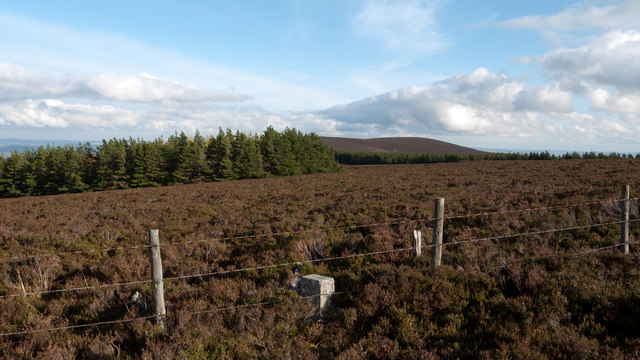
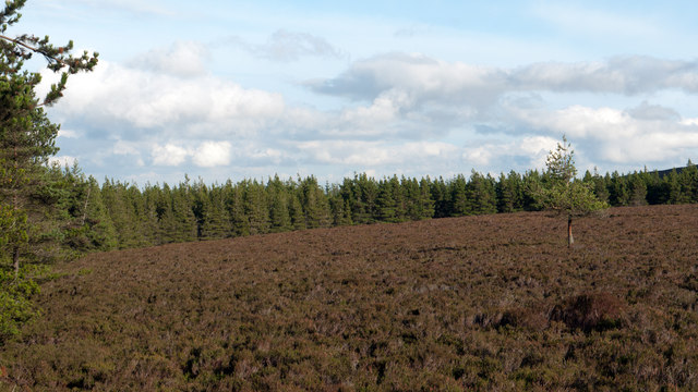
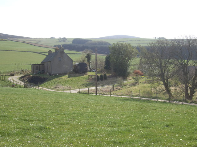
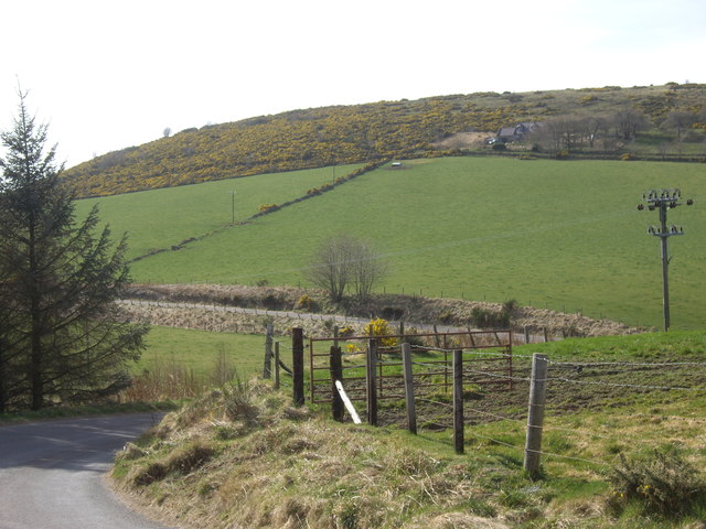
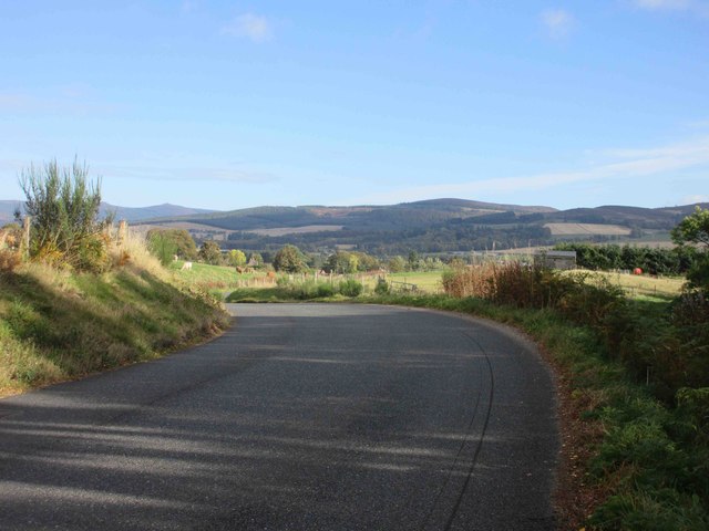
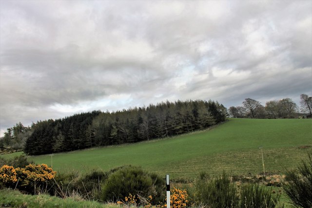
Correnie Moor is a picturesque woodland area located in Aberdeenshire, Scotland. Situated near the village of Fettercairn, this serene moorland is known for its lush forests and beautiful scenery. Spanning over a vast expanse of approximately 200 acres, Correnie Moor offers a peaceful retreat for visitors seeking tranquility and natural beauty.

The moor is predominantly covered with a variety of trees, including oak, birch, and pine, which create a dense and enchanting forest. The towering trees provide a habitat for numerous bird species, making it a popular destination for birdwatchers and nature enthusiasts. Additionally, the moorland is home to several mammals, such as red squirrels and deer, adding to the biodiversity of the area.

Correnie Moor offers a network of well-maintained walking trails, allowing visitors to explore its captivating woodland. These trails wind through the forest, offering glimpses of stunning vistas and hidden gems along the way. The peaceful atmosphere, combined with the fresh scent of pine, creates a truly immersive experience in nature.

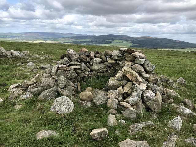
The moorland is also steeped in history, with remnants of ancient settlements and burial sites scattered throughout. Archaeological enthusiasts can discover traces of the area's rich past, adding an extra layer of fascination to their visit.

Overall, Correnie Moor is a haven for those seeking solace in nature. Its dense forests, diverse wildlife, and tranquil ambiance make it a must-visit destination for anyone exploring Aberdeenshire.

If you have any feedback on the listing, please let us know in the comments section below.

Correnie Moor Images

Images are sourced within 2km of 57.191065/-2.6367236 or Grid Reference NJ6111. Thanks to Geograph Open Source API. All images are credited.

Moorland of Red Hill with fence, boundary stone and woodland The fence crosses the north end of Red Hill on Corrennie Moor. The boundary stone is unmarked - others seen in the area are cut with letters. Beyond the trees can be seen Green Hill.
Moorland of Red Hill with fence, boundary stone and woodland
The fence crosses the north end of Red Hill on Corrennie Moor. The boundary stone is unmarked - others seen in the area are cut with letters. Beyond the trees can be seen Green Hill.
Heather moorland surrounded by trees North-east of Red Hill, part of Corrennie Moor, conifer plantings surround an area of heather moorland. A rogue tree stands alone.
Heather moorland surrounded by trees
North-east of Red Hill, part of Corrennie Moor, conifer plantings surround an area of heather moorland. A rogue tree stands alone.
The church at Kirkton of Tough
Ardgowse Seen from the minor road between Tough and Craigievar.
Ardgowse
Seen from the minor road between Tough and Craigievar.
Former railway carriage by Ardgowse Serving as a steading, behind the farmhouse.
Former railway carriage by Ardgowse
Serving as a steading, behind the farmhouse.
Double bend in road near Ardgowse
C43M (Aberdeenshire) road heading east The C43M road eastbound near Denmill, about to start dropping into the Howe of Alford.
C43M (Aberdeenshire) road heading east
The C43M road eastbound near Denmill, about to start dropping into the Howe of Alford.
Hillside Woodland A conifer copse near Tillyfour.
Hillside Woodland
A conifer copse near Tillyfour.
Stone Shelter A dry stone shelter (or hide?) constructed at the summit of the hill (not named on OS map, but possibly "Lynturk Hill"?). It sits among other stones, some much larger in size. A line of such stones runs down hill in a roughly southerly direction. Not clear if the position of the surrounding stones is a natural phenomenon, a result of fairly modern field clearance, or something else?
Stone Shelter
A dry stone shelter (or hide?) constructed at the summit of the hill (not named on OS map, but possibly "Lynturk Hill"?). It sits among other stones, some much larger in size. A line of such stones runs down hill in a roughly southerly direction. Not clear if the position of the surrounding stones is a natural phenomenon, a result of fairly modern field clearance, or something else?
Tough Kirk Standing above its Kirton , Tough church might still be proud but is now twinned with Cushnie.
Tough Kirk
Standing above its Kirton , Tough church might still be proud but is now twinned with Cushnie.
Steps to War Memorial in Kirkton of Tough With metal gates to the parish church and graveyard on the left.
Steps to War Memorial in Kirkton of Tough
With metal gates to the parish church and graveyard on the left.
Kirkyard roadway, Kirkton of Tough Between Church north door and the cemetery gates.
Kirkyard roadway, Kirkton of Tough
Between Church north door and the cemetery gates.
An old metal 'mort safe' in Tough kirkyard 'An iron frame placed over a coffin or at the entrance to a grave as a protection against resurrectionists' [Shorter OED, 1944]
An old metal 'mort safe' in Tough kirkyard
'An iron frame placed over a coffin or at the entrance to a grave as a protection against resurrectionists' [Shorter OED, 1944]
Cushnie and Tough Parish Church (Church of Scotland) View of its east wall, from the graveyard.
Cushnie and Tough Parish Church (Church of Scotland)
View of its east wall, from the graveyard.
South end of Tough Kirk, and Vestry With the kirkyard stone wall on the left of the gravestones
South end of Tough Kirk, and Vestry
With the kirkyard stone wall on the left of the gravestones
A dwelling house in Kirkton of Tough Viewed from over the boundary wall of the adjacent kirkyard.
A dwelling house in Kirkton of Tough
Viewed from over the boundary wall of the adjacent kirkyard.
View of some of the houses in Kirkton of Tough Seen looking ESE from inside the Kirkyard boundary wall.
View of some of the houses in Kirkton of Tough
Seen looking ESE from inside the Kirkyard boundary wall.
Eastern elevation of Tough Church From inside the kirkyard.
Eastern elevation of Tough Church
From inside the kirkyard.
Show me another place!

Correnie Moor is located at Grid Ref: NJ6111 (Lat: 57.191065, Lng: -2.6367236)

Unitary Authority: Aberdeenshire

Police Authority: North East

What 3 Words

///arranger.polishing.impeached. Near Alford, Aberdeenshire

Nearby Locations

Correnie Moor

Related Wikis

Kirkton of Tough

Kirkton of Tough, usually shortened to Tough ( TUUKH), is a settlement in the Marr area of Aberdeenshire, Scotland at grid reference NJ615129. It is about...

Tillyfourie railway station

Tillyfourie railway station was a railway station serving Tillyfourie, Aberdeenshire, Scotland. The station opened on 2 June 1860 on the Alford Valley...

Aberdeenshire (historic)

Aberdeenshire or the County of Aberdeen (Scots: Coontie o Aiberdeen, Scottish Gaelic: Siorrachd Obar Dheathain) is a historic county and registration county...

Tillyfourie

Tillyfourie is a hamlet in Aberdeenshire, Scotland. It is situated at the junction between the A944 road and the B993 road. A disused quarry and a stone...

Whitehouse railway station (Scotland)

Whitehouse railway station was a station in Whitehouse, Aberdeenshire. It opened with the along with the rest of the Alford Valley Railway line from Kintore...

Balfluig Castle

Balfluig Castle is an L-plan tower house, dating from the mid-16th century, a mile south of Alford, in the Howe of Alford, Aberdeenshire, Scotland. The...

Tillycairn Castle

Tillycairn Castle is an L-plan castle, dating from the 16th century, standing on high ground around 2.0 miles (3.2 km) south-east of Cluny in Aberdeenshire...
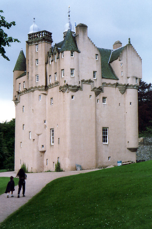
Craigievar Castle

Craigievar Castle is a pinkish harled castle or fortified country house 6 miles (9.7 km) south of Alford, Aberdeenshire, Scotland. It was the seat of Clan...

Related Videos

Climbing Benaquhallie

Benaquhallie is the highest summit of the Corrennie Moor, midway between the middle parts of Strathdon and Deeside.

Have you been to Correnie Moor?

Leave your review of Correnie Moor below (or comments, questions and feedback).