Bartlemuir Wood

Wood, Forest in Aberdeenshire

Scotland

Bartlemuir Wood

Looking towards the River Dee
Looking towards the River Dee Credit: Ralph Greig

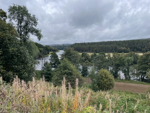
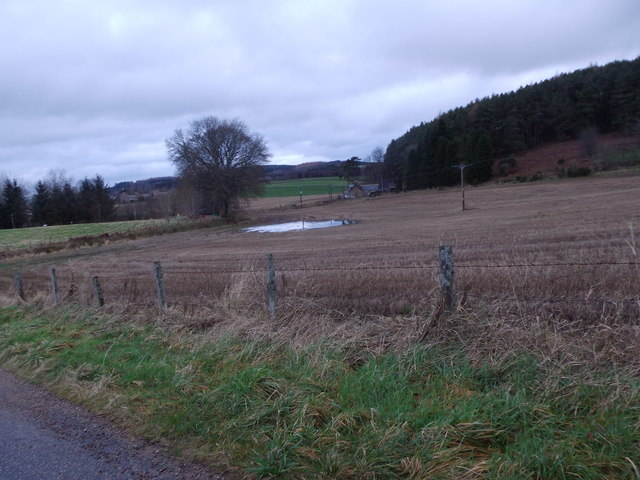
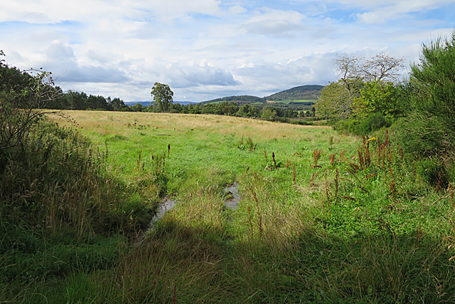
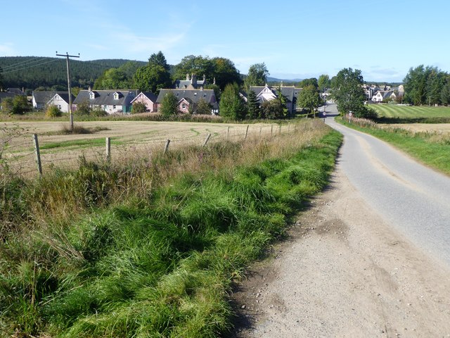
Bartlemuir Wood is a picturesque forest located in Aberdeenshire, Scotland. With an area of approximately 120 hectares, it offers visitors a serene and enchanting natural environment to explore. The wood is situated near the village of Tornaveen, just a short distance from the larger town of Banchory.

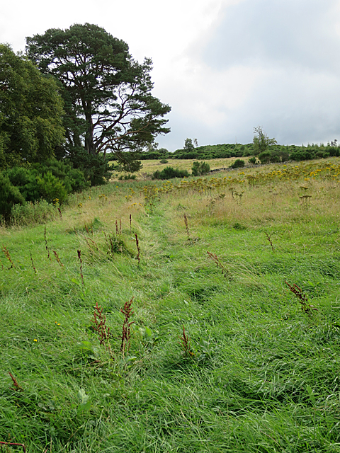
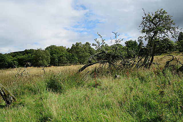
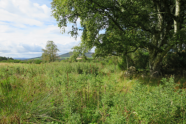
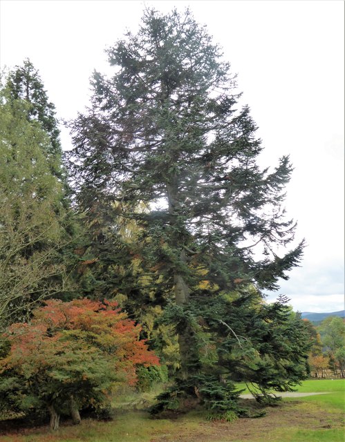
This ancient woodland boasts a diverse range of tree species, including oak, birch, and pine. The dense canopy created by these towering trees provides a haven for a variety of wildlife, making it an ideal spot for nature enthusiasts and wildlife watchers. Visitors may be lucky enough to spot red squirrels, roe deer, and a multitude of bird species, including woodpeckers and owls.

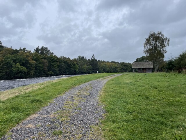
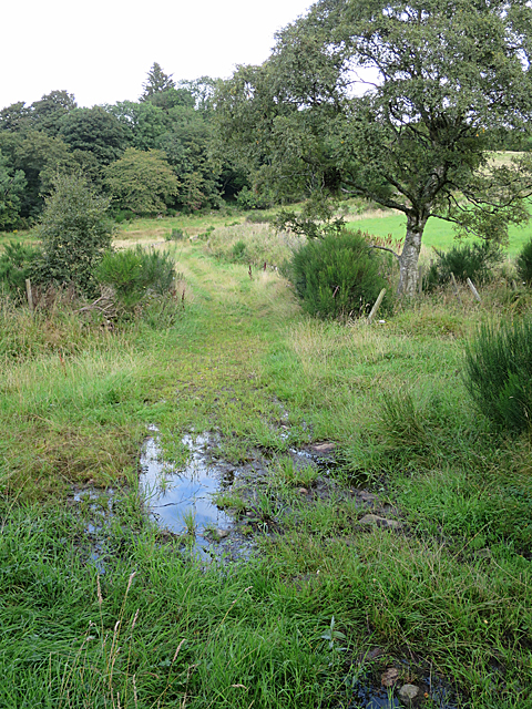
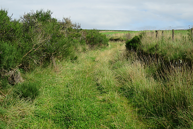
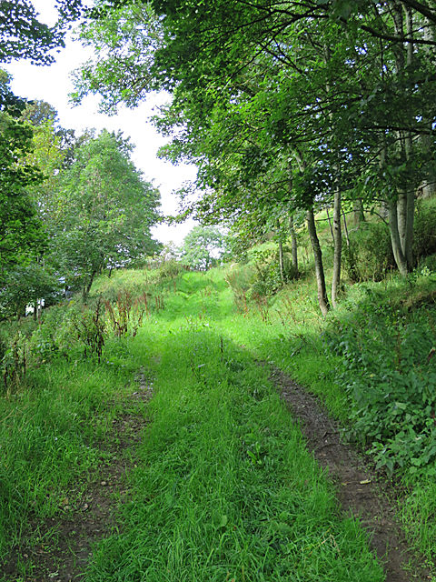
The wood is crisscrossed by a network of well-maintained trails, making it easily accessible to walkers and hikers of all abilities. These paths wind through the forest, passing by babbling streams and offering breathtaking views of the surrounding countryside. For those seeking a longer adventure, the wood is also connected to the larger Deeside Way, a popular long-distance walking route.

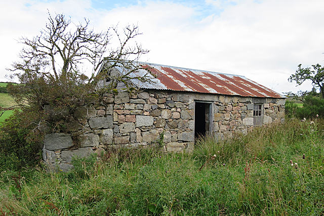
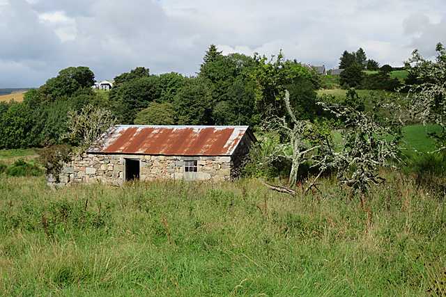
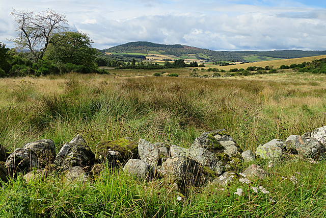
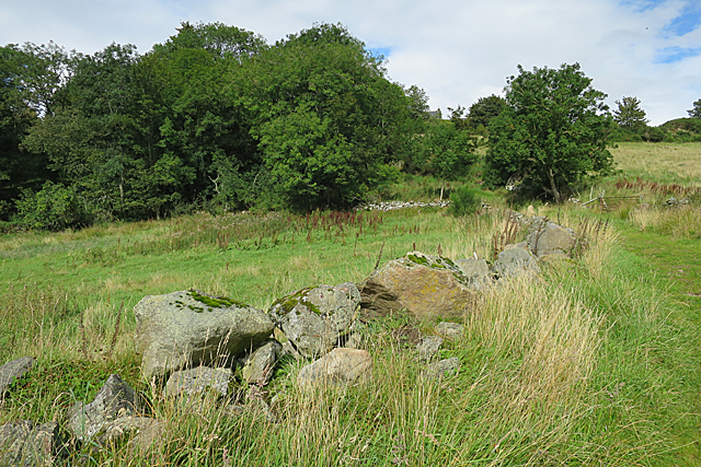
In addition to its natural beauty, Bartlemuir Wood is also steeped in history. The remains of an ancient fort can be found within its boundaries, providing a fascinating glimpse into the area's past. Interpretive signage is scattered throughout the wood, offering insights into the forest's ecology and history.

Overall, Bartlemuir Wood is a tranquil and captivating destination, providing a perfect escape from the hustle and bustle of everyday life. Whether you are an avid nature lover, a history enthusiast, or simply seeking a peaceful retreat, this woodland sanctuary is sure to leave a lasting impression.

If you have any feedback on the listing, please let us know in the comments section below.

Bartlemuir Wood Images

Images are sourced within 2km of 57.094463/-2.6787668 or Grid Reference NJ5800. Thanks to Geograph Open Source API. All images are credited.

Looking towards the River Dee
Fishermans Bothy
Fishermans Bothy
Flood water pool, January spate 2016 Near St Erchard's well, Kincardine O'Neil.
Flood water pool, January spate 2016
Near St Erchard's well, Kincardine O'Neil.
Faint Path The faint path over Hill of Dess is waymarked as part of the local path network.
Faint Path
The faint path over Hill of Dess is waymarked as part of the local path network.
Wet for Walking The waymarked route here is suddenly very wet indeed. Fortunately someone has been tipping boulders into the mud so that it is possible, with care, to hop across without getting ankle deep in the dubs (muddy pool).
Wet for Walking
The waymarked route here is suddenly very wet indeed. Fortunately someone has been tipping boulders into the mud so that it is possible, with care, to hop across without getting ankle deep in the dubs (muddy pool).
Woodend If you look carefully in the long grass there are remains of other buildings around this one, which was probably the farm or croft house of Woodend. It isn't named on the 1:50,000 map but it is named on the larger scale maps and on the old maps.
Woodend
If you look carefully in the long grass there are remains of other buildings around this one, which was probably the farm or croft house of Woodend. It isn't named on the 1:50,000 map but it is named on the larger scale maps and on the old maps.
Woodend If you look carefully in the long grass there are remains of other buildings around this one, which was probably one end the farm or croft house of Woodend. It isn't named on the 1:50,000 map but it is named on the larger scale maps and on the old maps. Oldtown is on the skyline above. This Woodend is in the parish of Lumphanan and not to be confused with any other Woodends in other parishes.
Woodend
If you look carefully in the long grass there are remains of other buildings around this one, which was probably one end the farm or croft house of Woodend. It isn't named on the 1:50,000 map but it is named on the larger scale maps and on the old maps. Oldtown is on the skyline above. This Woodend is in the parish of Lumphanan and not to be confused with any other Woodends in other parishes.
Wet Land at Woodend The rushes betray the fact that this land is wet. No doubt when Woodend was being worked, the grassy area was a cultivated field, kept drained by a lot of hard work. The gnarled branches look like the remnant of the sheltering clump of trees that was traditionally planted round a farm house.
Wet Land at Woodend
The rushes betray the fact that this land is wet. No doubt when Woodend was being worked, the grassy area was a cultivated field, kept drained by a lot of hard work. The gnarled branches look like the remnant of the sheltering clump of trees that was traditionally planted round a farm house.
Woodend Lurking below the mature silver birch tree are the remains of walls which, on the mid-19th century map, are shown as a building, probably a byre. These days there is a fine crop of nettles and creeping thistles.
Woodend
Lurking below the mature silver birch tree are the remains of walls which, on the mid-19th century map, are shown as a building, probably a byre. These days there is a fine crop of nettles and creeping thistles.
Field Entrance at Woodend I am inclined to doubt that this field is much used. It has clearly not been sown with a crop, and the absence of fences means that it isn't used for grazing either. The entrance is very wet, with water-filled ruts in the grass.
Field Entrance at Woodend
I am inclined to doubt that this field is much used. It has clearly not been sown with a crop, and the absence of fences means that it isn't used for grazing either. The entrance is very wet, with water-filled ruts in the grass.
Bog by the Track The maps show a minor burn here, and that is borne out by the patch of rushes just over the makeshift dyke. The hill on the skyline is Mortlich.
Bog by the Track
The maps show a minor burn here, and that is borne out by the patch of rushes just over the makeshift dyke. The hill on the skyline is Mortlich.
Grassy Road The old road down from Oldtown to Woodend is flanked by fairly solid dykes of field boulders. To my surprise, it was firm and dry underfoot.
Grassy Road
The old road down from Oldtown to Woodend is flanked by fairly solid dykes of field boulders. To my surprise, it was firm and dry underfoot.
Boulder Dyke The rough dyke on the side of the old road is made up of assorted boulders that were probably cleared from the fields nearby. They are almost certainly erratics dumped by glaciers when the area was last covered by ice.
Boulder Dyke
The rough dyke on the side of the old road is made up of assorted boulders that were probably cleared from the fields nearby. They are almost certainly erratics dumped by glaciers when the area was last covered by ice.
Track at Oldtown The old road from Woodend climbs a tree-shaded slope to Oldtown.
Track at Oldtown
The old road from Woodend climbs a tree-shaded slope to Oldtown.
Oldtown Farm House The house stands above the waymarked path, and enjoys a fine view to the south and west.
Oldtown Farm House
The house stands above the waymarked path, and enjoys a fine view to the south and west.
Steading at Oldtown The farm buildings at Oldtown are solidly built of large blocks of pink and grey granite.
Steading at Oldtown
The farm buildings at Oldtown are solidly built of large blocks of pink and grey granite.
Part of a shelter belt around Kincardine Castle Enclosing the Castle, and the sloping 'meadow' in front of it.
Part of a shelter belt around Kincardine Castle
Enclosing the Castle, and the sloping 'meadow' in front of it.
Entry into Kincardine O'Neil By minor road from Lower Craigton.
Entry into Kincardine O'Neil
By minor road from Lower Craigton.
Show me another place!

Bartlemuir Wood is located at Grid Ref: NJ5800 (Lat: 57.094463, Lng: -2.6787668)

Unitary Authority: Aberdeenshire

Police Authority: North East

What 3 Words

///overgrown.tugging.durations. Near Torphins, Aberdeenshire

Related Wikis

Kincardine O'Neil

Kincardine O'Neil (Scottish Gaelic: Cinn Chàrdainn, Scots: Kinker) is a village in Aberdeenshire, Scotland. It is situated between the towns of Banchory...

Kincardine O'Neil Hospital, Aberdeenshire

Kincardine O'Neil Hospital was founded in the 13th century in the village of Kincardine O'Neil in Scotland. Almost certainly it served as a traveler's...

Kincardine Castle, Royal Deeside

Kincardine Castle is a Victorian country house in Royal Deeside, Scotland. Formerly known as Kincardine House, it is the private home of the Bradford family...

Dess railway station

Dess railway station was opened on 2 December 1859 on the Deeside Extension Railway and served the rural area around Dess House and estate from 1859 to...

Battle of Lumphanan

The Battle of Lumphanan was fought on 15 August 1057, between Macbeth, King of Scots, and the future King Malcolm III. Macbeth would die from wounds sustained...

Peel of Lumphanan

The Peel of Lumphanan, also known as the Peel Ring or Peel Bog of Lumphanan, is a defensive structure dating back to the 13th century. It is located near...

Torphins

Torphins ( tor-FINZ; Scottish Gaelic: Tòrr Fionn) is a village in Royal Deeside, Aberdeenshire, Scotland which lies about 22 miles (35 km) west of Aberdeen...

Dinnie Stones

The Dinnie Stones (also called Stanes or Steens) are a pair of Scottish lifting stones located in Potarch, Aberdeenshire. They were made famous by strongman...

Nearby Amenities

Located within 500m of 57.094463,-2.6787668
Target Wood
Natural: wood
Lat/Long: 57.0957659/-2.673672
Bartlemuir Wood
Natural: wood
Lat/Long: 57.0946157/-2.6793583
Power: pole
Lat/Long: 57.0902194/-2.6801505
Power: pole
Lat/Long: 57.0986285/-2.6771161
The data included in this document is from www.openstreetmap.org. The data is made available under ODbL.

Have you been to Bartlemuir Wood?

Leave your review of Bartlemuir Wood below (or comments, questions and feedback).