Deanpark Covert

Wood, Forest in Berwickshire

Scotland

Deanpark Covert

Ditch, Corsbie Moor The water runs off the plateau here towards the Eden Water, but by a rather circuitous route. There were sheep and cattle grazing on various parts of the "moor". There are also wind survey masts here.
Ditch, Corsbie Moor Credit: Richard Webb

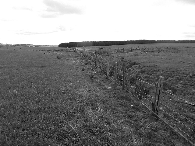
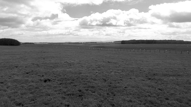
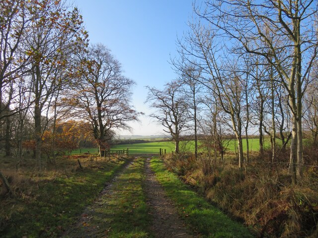
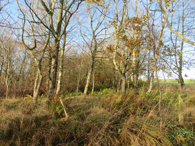
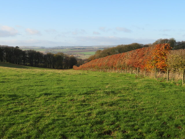
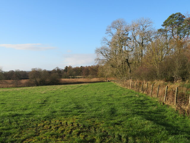
Deanpark Covert is a picturesque woodland located in the region of Berwickshire, Scotland. Covering an area of approximately xx hectares, it is known for its dense forests and diverse range of flora and fauna. The covert is situated in a secluded location, providing a tranquil and serene environment for visitors to enjoy.

The woodland consists primarily of broadleaf trees, including oak, beech, and birch, which create a dense canopy above. These trees provide a habitat for a variety of wildlife, such as red squirrels, roe deer, and various bird species. The forest floor is covered in a carpet of moss, ferns, and wildflowers, adding to the natural beauty of the area.

There are several walking trails that wind through Deanpark Covert, allowing visitors to explore the woodland at their own pace. The trails are well-maintained and offer breathtaking views of the surrounding countryside. Along the way, informative signs provide details about the different tree species and wildlife that can be found in the area.

In addition to its natural beauty, Deanpark Covert also holds historical significance. It is believed that the woodland has been in existence for centuries, and remnants of ancient settlements have been discovered within its boundaries. These historical artifacts add another layer of interest to the covert, attracting both nature enthusiasts and history buffs.

Overall, Deanpark Covert in Berwickshire is a haven for nature lovers and those seeking a peaceful retreat. Its diverse range of flora and fauna, coupled with its historical significance, make it a truly unique and enchanting woodland experience.

If you have any feedback on the listing, please let us know in the comments section below.

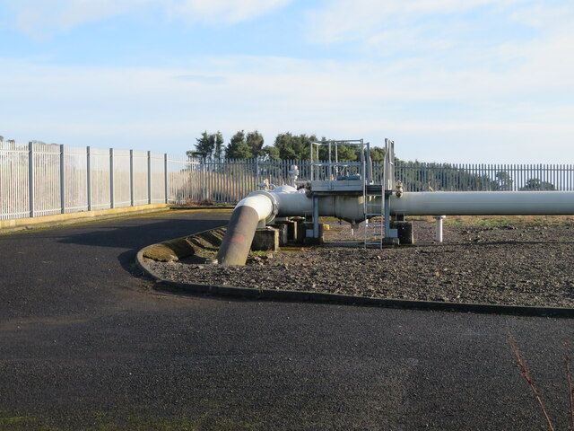
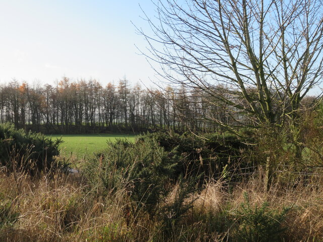
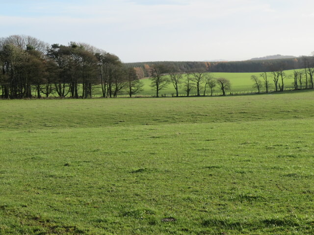
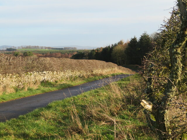
Deanpark Covert Images

Images are sourced within 2km of 55.698221/-2.6546148 or Grid Reference NT5845. Thanks to Geograph Open Source API. All images are credited.

Ditch, Corsbie Moor The water runs off the plateau here towards the Eden Water, but by a rather circuitous route. There were sheep and cattle grazing on various parts of the "moor". There are also wind survey masts here.
Ditch, Corsbie Moor
The water runs off the plateau here towards the Eden Water, but by a rather circuitous route. There were sheep and cattle grazing on various parts of the "moor". There are also wind survey masts here.
Corsbie Moor The head of the Eden Burn which later becomes the Eden Water, a tributary of the Tweed. The Cheviot can be seen on the horizon.
Corsbie Moor
The head of the Eden Burn which later becomes the Eden Water, a tributary of the Tweed. The Cheviot can be seen on the horizon.
Milepost, Corsbie Moor Typical of those found between Kelso and Lauder. They are quite low and must make verge mowing interesting.
Milepost, Corsbie Moor
Typical of those found between Kelso and Lauder. They are quite low and must make verge mowing interesting.
Field access near Boon Through a shelter belt from the track between Boon and Legerwood. See two earlier images from the same location - <a href="https://www.geograph.org.uk/photo/526605">NT5744 : Barley field</a> from 2007, <a href="https://www.geograph.org.uk/photo/2848537">NT5744 : Field access track</a> from 2012.
Field access near Boon
Through a shelter belt from the track between Boon and Legerwood. See two earlier images from the same location - NT5744 : Barley field from 2007, NT5744 : Field access track from 2012.
Shelter belt near Boon A deciduous woodland strip between track and field between Boon and Legerwood.
Shelter belt near Boon
A deciduous woodland strip between track and field between Boon and Legerwood.
Country road by Old Boon With a right [left?]-angle bend and passing place, and good pasture.
Country road by Old Boon
With a right [left?]-angle bend and passing place, and good pasture.
Beech hedge and landscape Farmland near Boon, with a long view over the Leader Valley and beyond.
Beech hedge and landscape
Farmland near Boon, with a long view over the Leader Valley and beyond.
Old Boon A fine farm building and cattle feeding under cover.
Old Boon
A fine farm building and cattle feeding under cover.
National Grid gas installation Boon 4937 - presumably the ID. I was struck by the spelling of 'unodourised'; it did not look right, although odour is the normal British spelling. <span class="nowrap"><a title="https://www.gasodorizer.com/what-is-natural-gas-odorization/" rel="nofollow ugc noopener" href="https://www.gasodorizer.com/what-is-natural-gas-odorization/">Link</a><img style="margin-left:2px;" alt="External link" title="External link - shift click to open in new window" src="https://s1.geograph.org.uk/img/external.png" width="10" height="10"/></span>
National Grid gas installation
Boon 4937 - presumably the ID. I was struck by the spelling of 'unodourised'; it did not look right, although odour is the normal British spelling. LinkExternal link
National Grid gas installation Gas pipes at the installation on the country road between Dods and Legerwood.
National Grid gas installation
Gas pipes at the installation on the country road between Dods and Legerwood.
Field and shelterbelt near Boon On the road from Dods to Legerwood.
Field and shelterbelt near Boon
On the road from Dods to Legerwood.
Grass field at Old Boon Looking east to a small wood and roadside trees.
Grass field at Old Boon
Looking east to a small wood and roadside trees.
Country road near Old Boon A narrow road with wide verges, a dense hedge, and a gnarled Hawthorn. A small flock of Redwing left the hedge as I went by.
Country road near Old Boon
A narrow road with wide verges, a dense hedge, and a gnarled Hawthorn. A small flock of Redwing left the hedge as I went by.
Pasture near Legerwood Looking west from just north of Legerwood.
Pasture near Legerwood
Looking west from just north of Legerwood.
Legerwood Parish Church With an interesting stile, although the gate worked perfectly well.
Legerwood Parish Church
With an interesting stile, although the gate worked perfectly well.
Entrance to Legerwood Kirk With a smart information board - much refreshed from when it was recorded by Walter Baxter in 2008 <a href="https://www.geograph.org.uk/photo/902086">NT5943 : Legerwood Kirk signboard</a>.
Entrance to Legerwood Kirk
With a smart information board - much refreshed from when it was recorded by Walter Baxter in 2008 NT5943 : Legerwood Kirk signboard.
Legerwood Church - west gable window With an inscription below that says:- 
REPAIRED
17    17
It is not clear if that refers to the gable, the window or the bell chain leading to the belfry.
Legerwood Church - west gable window
With an inscription below that says:- REPAIRED 17 17 It is not clear if that refers to the gable, the window or the bell chain leading to the belfry.
Memorial stone bench at Legerwood Parish Church 1913    1988
in memory of
W-SELBY TULLOCH
beloved SURGEON in
the City of EDINBURGH

decorated with a Bishop's mitre at the top and a Swan and two Swifts to the left and right. He was born in Australia, but became an eminent Urologist in Edinburgh, specialising in male infertility. <span class="nowrap"><a title="https://ancestors.familysearch.org/en/LXWH-SPC/william-selby-tulloch-1913-1988" rel="nofollow ugc noopener" href="https://ancestors.familysearch.org/en/LXWH-SPC/william-selby-tulloch-1913-1988">Link</a><img style="margin-left:2px;" alt="External link" title="External link - shift click to open in new window" src="https://s1.geograph.org.uk/img/external.png" width="10" height="10"/></span>
Memorial stone bench at Legerwood Parish Church
1913 1988 in memory of W-SELBY TULLOCH beloved SURGEON in the City of EDINBURGH decorated with a Bishop's mitre at the top and a Swan and two Swifts to the left and right. He was born in Australia, but became an eminent Urologist in Edinburgh, specialising in male infertility. LinkExternal link
Show me another place!

Deanpark Covert is located at Grid Ref: NT5845 (Lat: 55.698221, Lng: -2.6546148)

Unitary Authority: The Scottish Borders

Police Authority: The Lothians and Scottish Borders

What 3 Words

///forgotten.football.liberty. Near Lauder, Scottish Borders

Nearby Locations

Cribbs Law Deanpark Covert

Related Wikis

Legerwood

Legerwood is a village by the Eden Water, in the Scottish Borders area of Scotland, near Lauder, near the Southern Upland Way. Legerwood Kirk is outside...

Boon Farm

Boon is a farm and former barony located near Lauder, Scotland. == History == === Name origins === Boon (aka "Boune" or "Bounn"), derives from the Breton...
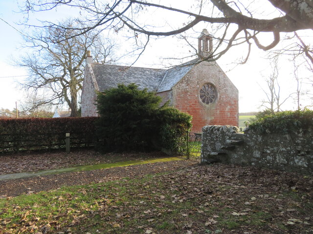
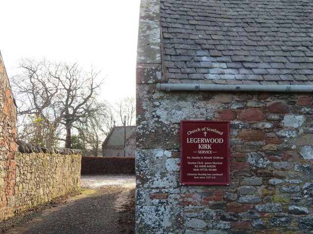
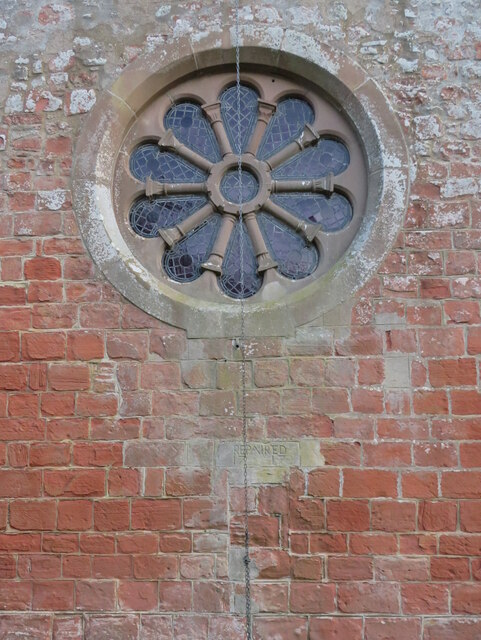
Legerwood Kirk

Legerwood Kirk is an ancient and historic Church of Scotland church in the former county of Berwickshire, Scotland. It is situated half a mile east of...

Corsbie Castle

Corsbie Castle is a ruined 16th-century tower house, about 2.5 miles (4.0 km) west of Gordon, Scottish Borders, Scotland, and north of the Eden Water....

Whitslaid Tower

Whitslaid Tower was an ancient Berwickshire seat of the Lauder family for over 300 years. It is today a ruin high above the eastern bank of the Leader...

Bassendean, Scottish Borders

Bassendean is a village in the Scottish Borders area of Scotland, 4 kilometres (2.5 mi) south of Westruther and 3 kilometres (1.9 mi) north-west of Gordon...

Birkenside, Scottish Borders

Birkenside is a village in the Scottish Borders, Scotland.

Houndslow

Houndslow is a hamlet in the Scottish Borders area of Scotland. It is situated on the A697, about 5 miles (8.0 km) west of Greenlaw, and 3 miles (4.8 km...

Have you been to Deanpark Covert?

Leave your review of Deanpark Covert below (or comments, questions and feedback).