Gilboa Wood

Wood, Forest in Roxburghshire

Scotland

Gilboa Wood

Farm access at Bedrule
Farm access at Bedrule Credit: Alan Reid

Gilboa Wood is a beautiful forest located in the county of Roxburghshire, Scotland. It covers an area of approximately 500 acres and is renowned for its stunning natural scenery and diverse wildlife. The wood is situated near the village of Gilboa and is easily accessible by a well-maintained network of walking trails.

One of the key features of Gilboa Wood is its rich variety of tree species. It is predominantly composed of native broadleaf trees, such as oak, beech, and birch, which create a vibrant and colorful canopy throughout the year. The wood is also home to several rare and endangered plant species, making it an important conservation area.

The forest provides a haven for a wide range of wildlife. Visitors may spot red squirrels, roe deer, and a variety of bird species, including woodpeckers and owls. The wood also supports a diverse insect population, with butterflies and dragonflies being particularly abundant.

For nature enthusiasts, Gilboa Wood offers a tranquil and peaceful setting to explore and appreciate the beauty of the natural world. There are several well-marked trails that wind through the forest, providing opportunities for leisurely walks and wildlife spotting. Picnic areas and benches are scattered throughout the wood, allowing visitors to relax and take in the breathtaking surroundings.

Gilboa Wood is a popular destination for both locals and tourists seeking to immerse themselves in nature. Its unique combination of diverse tree species, rare plants, and abundant wildlife make it a truly special place to visit in Roxburghshire.

If you have any feedback on the listing, please let us know in the comments section below.

Gilboa Wood Images

Images are sourced within 2km of 55.443072/-2.6504621 or Grid Reference NT5816. Thanks to Geograph Open Source API. All images are credited.

Farm access at Bedrule
New house at Bedrule
Fulton Tower This telephoto shot of the ruined 16th century tower house was taken from the summit area of Rubers Law. For a closer view of the tower, see <a href="https://www.geograph.org.uk/photo/255052">NT6015 : The remains of Fulton Tower</a>.
Fulton Tower
This telephoto shot of the ruined 16th century tower house was taken from the summit area of Rubers Law. For a closer view of the tower, see NT6015 : The remains of Fulton Tower.
War memorial, Bedrule At the road junction south of the village.
War memorial, Bedrule
At the road junction south of the village.
Bedrule Village Hall A spacious hall for this small village, though I expect it caters for people from a wide area in these scattered communities. Rubers Law is in the background.
Bedrule Village Hall
A spacious hall for this small village, though I expect it caters for people from a wide area in these scattered communities. Rubers Law is in the background.
Minor road heading towards Huntly Hill Looking south-eastward.
Minor road heading towards Huntly Hill
Looking south-eastward.
Minor road approaching Fulton Farm and Huntly Hill Looking southward.
Minor road approaching Fulton Farm and Huntly Hill
Looking southward.
Field containing the remains of Fulton Tower Looking north-eastward
Field containing the remains of Fulton Tower
Looking north-eastward
Road  into  Bedrule
Road into Bedrule
Road  junction  at  War  Memorial  near  Bedrule Borders Abbeys Way goes right here down to the river, Rule Water
Road junction at War Memorial near Bedrule
Borders Abbeys Way goes right here down to the river, Rule Water
War  Memorial  Bedrule Commemorating both world wars. The B A Way turns at this junction
War Memorial Bedrule
Commemorating both world wars. The B A Way turns at this junction
Fulton Tower The remains of a 16th century tower house.
Fulton Tower
The remains of a 16th century tower house.
Futon Farm In the valley of the Rule Water.
Futon Farm
In the valley of the Rule Water.
Farm road at Bedrule Forming part of the Border Abbeys Way.
Farm road at Bedrule
Forming part of the Border Abbeys Way.
Severely pruned trees Severely pruned mature trees at Bedrule Farm.
Severely pruned trees
Severely pruned mature trees at Bedrule Farm.
Track above Bedrule On the route of the Borders Abbeys Way between Denholm and Jedburgh, giving views across Teviotdale to the west. Compare with <a href="https://www.geograph.org.uk/photo/107716">NT6017 : On the Borders Abbey Way near Bedrule</a> taken in October 2005 - the gate is the same.
Track above Bedrule
On the route of the Borders Abbeys Way between Denholm and Jedburgh, giving views across Teviotdale to the west. Compare with NT6017 : On the Borders Abbey Way near Bedrule taken in October 2005 - the gate is the same.
Rubers Law from the lower slopes of Black Law The sprawling volcanic hill of Rubers Law, one of several remnants of Carboniferous volcanoes in this area, seen from a gate on the Borders Abbeys Way.
Rubers Law from the lower slopes of Black Law
The sprawling volcanic hill of Rubers Law, one of several remnants of Carboniferous volcanoes in this area, seen from a gate on the Borders Abbeys Way.
A festive wrapped bale at Bedrule Farm This seasonal bale was photographed on the 19th December from the entrance to the farm.
A festive wrapped bale at Bedrule Farm
This seasonal bale was photographed on the 19th December from the entrance to the farm.
Show me another place!

Gilboa Wood is located at Grid Ref: NT5816 (Lat: 55.443072, Lng: -2.6504621)

Unitary Authority: The Scottish Borders

Police Authority: The Lothians and Scottish Borders

What 3 Words

///makeup.womb.mediate. Near Jedburgh, Scottish Borders

Related Wikis

Rubers Law

Rubers Law is a prominent, conical hill in the Scottish Borders area of south-east Scotland. It stands on the south bank of the River Teviot, between the...
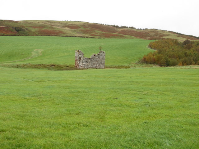
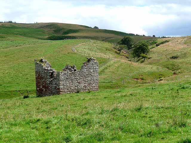
Bedrule Castle

Bedrule Castle is a ruined 13th-century castle in the Rule Valley, in the Scottish Borders area of Scotland.The castle was built in the 13th century by...

Bedrule

Bedrule (Scottish Gaelic: Ruail Bheathaig) is a hamlet and civil parish in the historic county of Roxburghshire in the Scottish Borders area of Scotland...
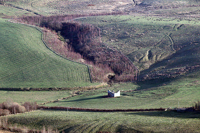
Fulton Tower

Fulton Tower is a ruined 16th century tower house, about 4.5 miles (7.2 km) south west of Jedburgh, Scottish Borders, Scotland, and about 2 miles (3.2...

Westgate Hall, Denholm

Westgate Hall is located in Westgate in the village of Denholm, Roxburghshire, in the Scottish Borders. It stands at the western and south-western approaches...

Spittal-on-Rule

Spittal-on-Rule is a farm in the council area of Scottish Borders in Scotland. As the name suggests it is situated on the river Rule Water, and the Spittal...

Denholm

Denholm is a small village located between Jedburgh and Hawick in the Scottish Borders region of Scotland, UK. The estimated population of Denholm is 600...

Hallrule

Hallrule is a hamlet on the B6357 road, in the Scottish Borders area of Scotland, on the Rule Water, near Abbotrule, Bedrule Bonchester Bridge, Denholm...

Nearby Amenities

Located within 500m of 55.443072,-2.6504621
Barrier: stile
Lat/Long: 55.4463281/-2.6499393
Power: pole
Lat/Long: 55.4441982/-2.6449043
Power: pole
Lat/Long: 55.4445612/-2.6453255
Power: pole
Lat/Long: 55.4452801/-2.6461895
Power: pole
Lat/Long: 55.4456295/-2.6466337
Power: pole
Lat/Long: 55.4457976/-2.6470943
Power: pole
Lat/Long: 55.445973/-2.6475639
Power: pole
Lat/Long: 55.446139/-2.6480398
The data included in this document is from www.openstreetmap.org. The data is made available under ODbL.

Have you been to Gilboa Wood?

Leave your review of Gilboa Wood below (or comments, questions and feedback).