Pickie Moss

Wood, Forest in Berwickshire

Scotland

Pickie Moss

Pasture lands at Corsbie 17th. century Corsbie Tower, built by the Cranstouns of Oxenfoord (north of Pathhead in Midlothian) can be seen in the background.
Pasture lands at Corsbie Credit: James Denham

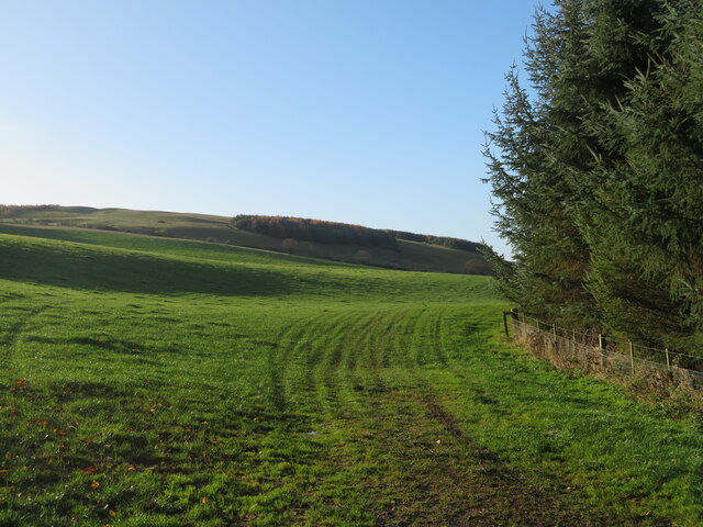
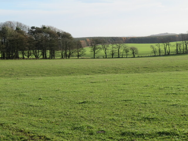
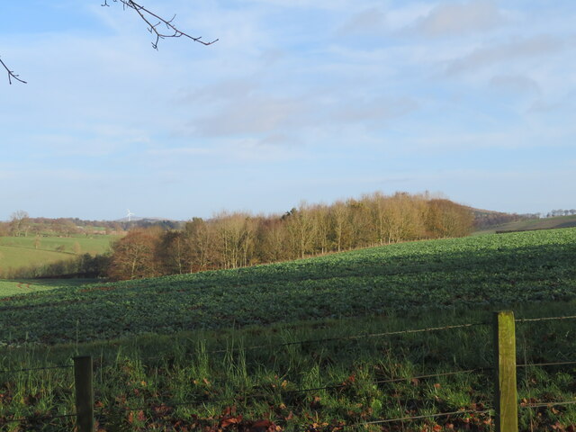
Pickie Moss is a wood located in the county of Berwickshire, Scotland. It is situated in the southeastern part of the country, near the town of Eyemouth. Covering an area of approximately 200 acres, Pickie Moss is a picturesque forest that attracts visitors due to its natural beauty and diverse wildlife.

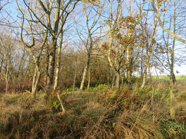
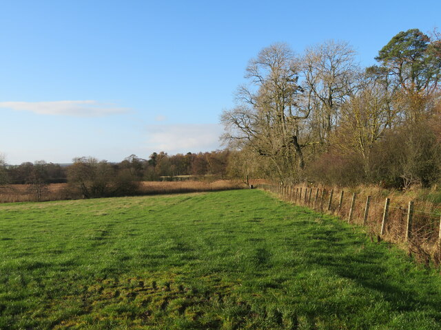
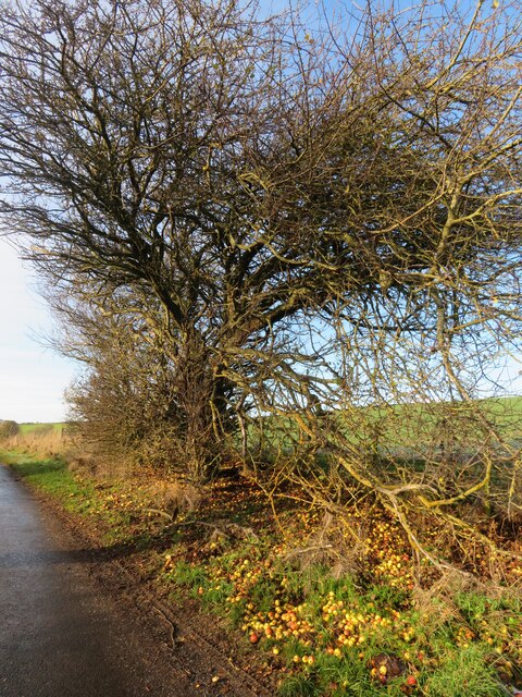
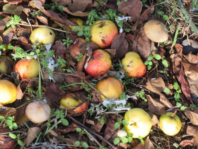
The wood consists mainly of deciduous trees, including oak, birch, and beech, which create a stunning canopy of foliage during the summer months and offer a vibrant display of colors in autumn. The forest floor is covered with a rich carpet of moss, hence its name, which adds to its enchanting atmosphere.

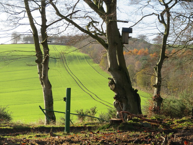
Pickie Moss is a haven for wildlife enthusiasts, as it is home to a variety of animal species. Visitors may spot deer, foxes, badgers, and a wide range of bird species such as woodpeckers, owls, and various songbirds. The wood also boasts a small pond, attracting frogs, newts, and dragonflies.

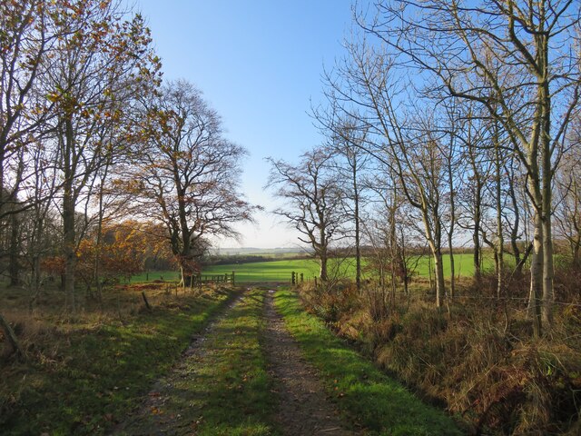
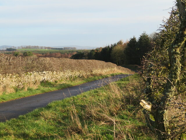
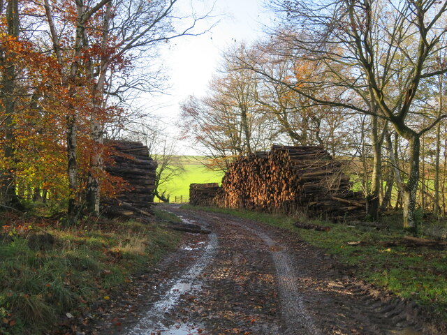
Throughout the wood, there are numerous well-maintained walking paths and trails, making it an ideal location for leisurely strolls and nature hikes. These paths offer visitors the opportunity to immerse themselves in the peaceful surroundings and enjoy the tranquility of the forest.

Pickie Moss is also a popular spot for picnics and outdoor activities. The wood provides several designated picnic areas, equipped with benches and tables, where visitors can relax and enjoy a meal surrounded by nature.

Overall, Pickie Moss in Berwickshire is a captivating woodland that offers breathtaking scenery, diverse wildlife, and a peaceful escape from the bustling city life.

If you have any feedback on the listing, please let us know in the comments section below.

Pickie Moss Images

Images are sourced within 2km of 55.689348/-2.6554209 or Grid Reference NT5844. Thanks to Geograph Open Source API. All images are credited.

Pasture lands at Corsbie 17th. century Corsbie Tower, built by the Cranstouns of Oxenfoord (north of Pathhead in Midlothian) can be seen in the background.
Pasture lands at Corsbie
17th. century Corsbie Tower, built by the Cranstouns of Oxenfoord (north of Pathhead in Midlothian) can be seen in the background.
Field access near Boon Through a shelter belt from the track between Boon and Legerwood. See two earlier images from the same location - <a href="https://www.geograph.org.uk/photo/526605">NT5744 : Barley field</a> from 2007, <a href="https://www.geograph.org.uk/photo/2848537">NT5744 : Field access track</a> from 2012.
Field access near Boon
Through a shelter belt from the track between Boon and Legerwood. See two earlier images from the same location - NT5744 : Barley field from 2007, NT5744 : Field access track from 2012.
Shelter belt near Boon A deciduous woodland strip between track and field between Boon and Legerwood.
Shelter belt near Boon
A deciduous woodland strip between track and field between Boon and Legerwood.
Old Boon A fine farm building and cattle feeding under cover.
Old Boon
A fine farm building and cattle feeding under cover.
Pasture south of Legerwood Looking southwest to hillside plantations, overlooking the valley of the Legerwood Burn.
Pasture south of Legerwood
Looking southwest to hillside plantations, overlooking the valley of the Legerwood Burn.
National Grid gas installation Boon 4937 - presumably the ID. I was struck by the spelling of 'unodourised'; it did not look right, although odour is the normal British spelling. <span class="nowrap"><a title="https://www.gasodorizer.com/what-is-natural-gas-odorization/" rel="nofollow ugc noopener" href="https://www.gasodorizer.com/what-is-natural-gas-odorization/">Link</a><img style="margin-left:2px;" alt="External link" title="External link - shift click to open in new window" src="https://s1.geograph.org.uk/img/external.png" width="10" height="10"/></span>
National Grid gas installation
Boon 4937 - presumably the ID. I was struck by the spelling of 'unodourised'; it did not look right, although odour is the normal British spelling. LinkExternal link
National Grid gas installation Gas pipes at the installation on the country road between Dods and Legerwood.
National Grid gas installation
Gas pipes at the installation on the country road between Dods and Legerwood.
Field and shelterbelt near Boon On the road from Dods to Legerwood.
Field and shelterbelt near Boon
On the road from Dods to Legerwood.
Grass field at Old Boon Looking east to a small wood and roadside trees.
Grass field at Old Boon
Looking east to a small wood and roadside trees.
Country road near Old Boon A narrow road with wide verges, a dense hedge, and a gnarled Hawthorn. A small flock of Redwing left the hedge as I went by.
Country road near Old Boon
A narrow road with wide verges, a dense hedge, and a gnarled Hawthorn. A small flock of Redwing left the hedge as I went by.
Pasture near Legerwood Looking west from just north of Legerwood.
Pasture near Legerwood
Looking west from just north of Legerwood.
Field access through a shelter belt With stacks of harvested timber waiting to be collected.
Field access through a shelter belt
With stacks of harvested timber waiting to be collected.
The valley of the Legerwood Burn With a small mixed wood and a crop of unidentified brassicas.
The valley of the Legerwood Burn
With a small mixed wood and a crop of unidentified brassicas.
Nest box in the Prison Strip A large bird box in a Beech tree on the edge of the woodland, possibly for an owl or other raptor, with a winter cereal crop beyond.
Nest box in the Prison Strip
A large bird box in a Beech tree on the edge of the woodland, possibly for an owl or other raptor, with a winter cereal crop beyond.
A venerable Crab Apple near Legerwood The mass of windfalls was providing a good feast for some Fieldfares. For a close-up see <a href="https://www.geograph.org.uk/photo/7359166">NT5742 : Crab Apple windfalls</a>. They were just a little too tart to be worth collecting. The tree looks much the same as it did when Walter Baxter recorded it 16 years earlier <a href="https://www.geograph.org.uk/photo/259973">NT5742 : Crab apple tree by the Legerwood road</a>.
A venerable Crab Apple near Legerwood
The mass of windfalls was providing a good feast for some Fieldfares. For a close-up see NT5742 : Crab Apple windfalls. They were just a little too tart to be worth collecting. The tree looks much the same as it did when Walter Baxter recorded it 16 years earlier NT5742 : Crab apple tree by the Legerwood road.
Crab Apple windfalls Abundant fruit from an old tree on the road to Legerwood <a href="https://www.geograph.org.uk/photo/7359161">NT5742 : A venerable Crab Apple near Legerwood</a>. And three toadstools.
Crab Apple windfalls
Abundant fruit from an old tree on the road to Legerwood NT5742 : A venerable Crab Apple near Legerwood. And three toadstools.
Roadside harvest A closer view of some of the Crab Apples, and two of the toadstools, in <a href="https://www.geograph.org.uk/photo/7359166">NT5742 : Crab Apple windfalls</a>. I think they are species of Conocybe, which are fragile, with brown caps and spores.
Roadside harvest
A closer view of some of the Crab Apples, and two of the toadstools, in NT5742 : Crab Apple windfalls. I think they are species of Conocybe, which are fragile, with brown caps and spores.
Legerwood Parish Church With an interesting stile, although the gate worked perfectly well.
Legerwood Parish Church
With an interesting stile, although the gate worked perfectly well.
Show me another place!

Pickie Moss is located at Grid Ref: NT5844 (Lat: 55.689348, Lng: -2.6554209)

Unitary Authority: The Scottish Borders

Police Authority: The Lothians and Scottish Borders

What 3 Words

///smart.binders.cooked. Near Earlston, Scottish Borders

Related Wikis

Legerwood

Legerwood is a village by the Eden Water, in the Scottish Borders area of Scotland, near Lauder, near the Southern Upland Way. Legerwood Kirk is outside...
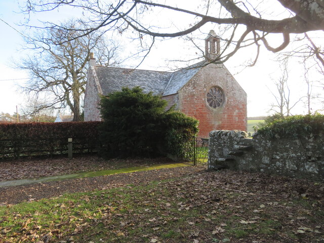
Legerwood Kirk

Legerwood Kirk is an ancient and historic Church of Scotland church in the former county of Berwickshire, Scotland. It is situated half a mile east of...
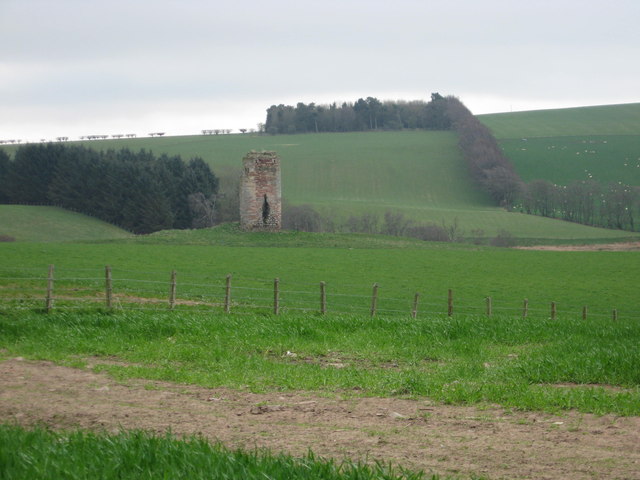
Corsbie Castle

Corsbie Castle is a ruined 16th-century tower house, about 2.5 miles (4.0 km) west of Gordon, Scottish Borders, Scotland, and north of the Eden Water....
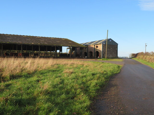
Boon Farm

Boon is a farm and former barony located near Lauder, Scotland. == History == === Name origins === Boon (aka "Boune" or "Bounn"), derives from the Breton...

Nearby Amenities

Located within 500m of 55.689348,-2.6554209
How Law
Natural: peak
Lat/Long: 55.685764/-2.6555107
The data included in this document is from www.openstreetmap.org. The data is made available under ODbL.

Have you been to Pickie Moss?

Leave your review of Pickie Moss below (or comments, questions and feedback).