Chagford

Settlement in Devon West Devon

England

Chagford

Chagford - Otter Floral decorated otter model on Mill Street.
Chagford - Otter Credit: Colin Smith

Chagford is a charming market town located in the heart of Devon, England. Situated on the north-eastern edge of Dartmoor National Park, it offers a picturesque setting with rolling hills, lush green landscapes, and the River Teign flowing through its center. With a population of around 1,800 residents, Chagford maintains a tight-knit community atmosphere.

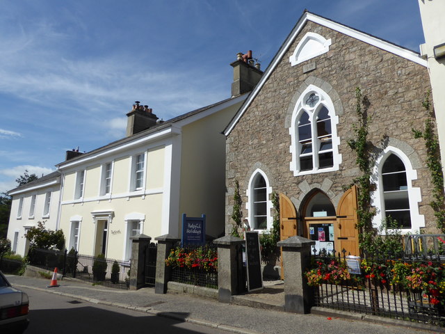
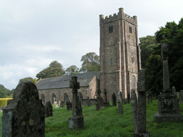
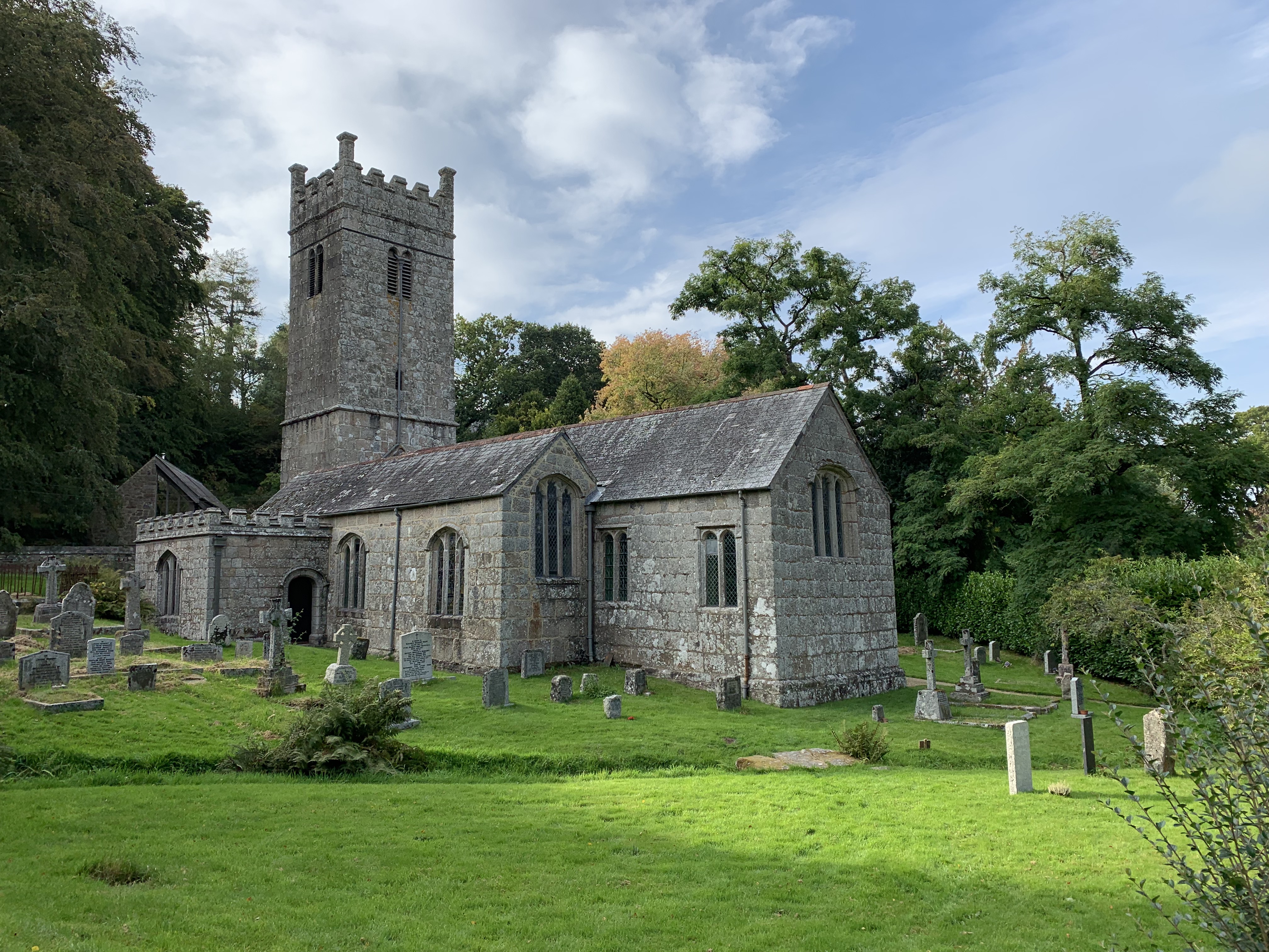
The town is known for its historic architecture, particularly its granite buildings that showcase its rich heritage. The Church of St. Michael, dating back to the 13th century, stands as a prominent landmark in the town center. Chagford is also home to the famous Chagford Market Charter, which has been in operation since the 13th century, making it one of the oldest markets in the country.

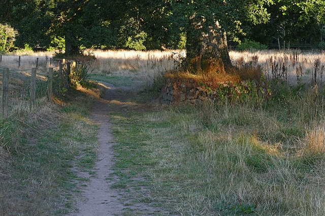
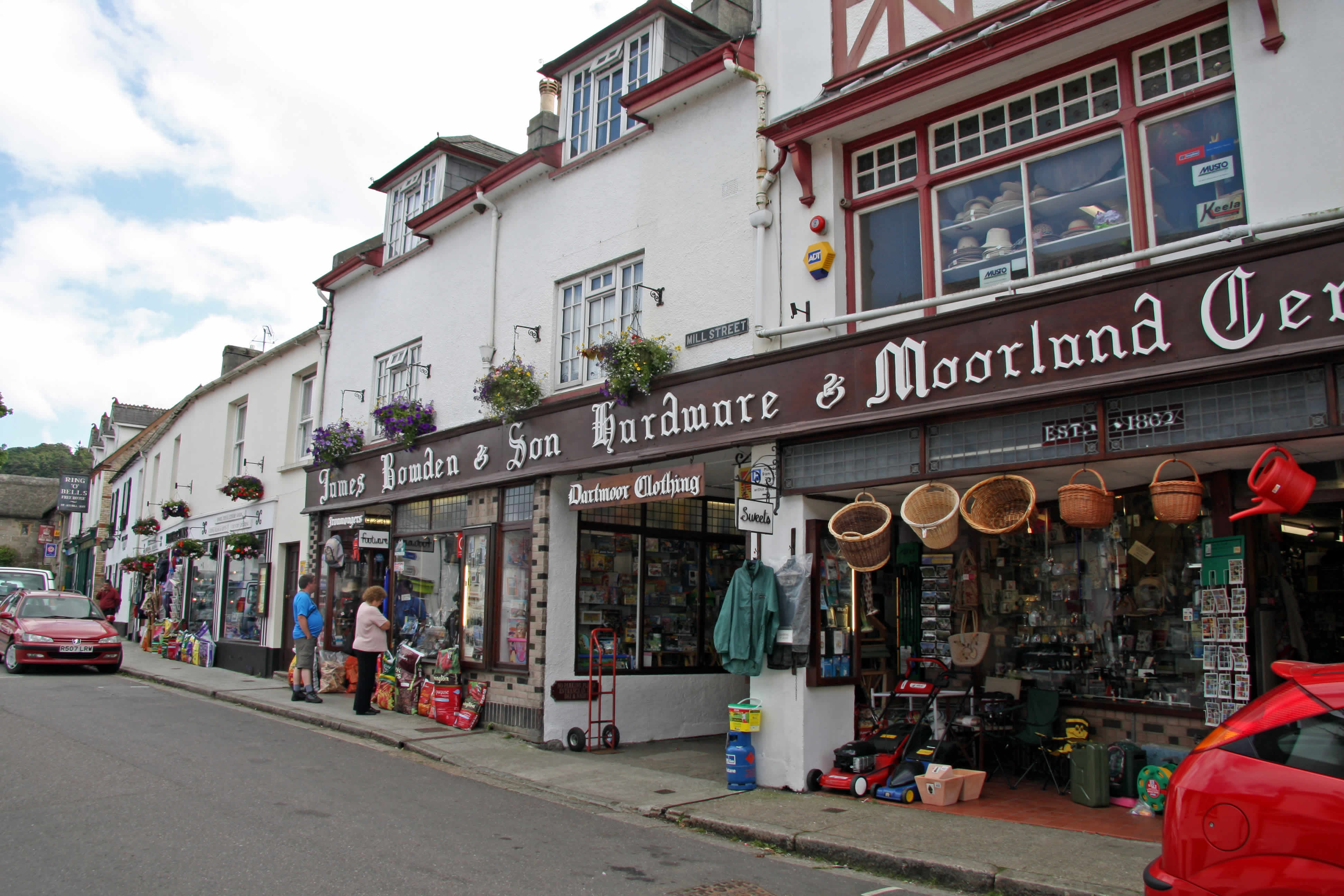
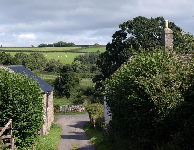
Chagford is a popular destination for tourists and outdoor enthusiasts due to its proximity to Dartmoor. The area offers an array of activities such as hiking, cycling, and horseback riding, with various trails and paths leading to stunning viewpoints and ancient landmarks. The town itself provides a range of independent shops, art galleries, and cozy cafes, making it an ideal place to explore and relax.

In addition to its natural beauty, Chagford hosts several annual events that draw visitors from near and far. The Two Moors Festival, held in October, celebrates classical music and attracts renowned musicians from around the world. The Chagford Show, held in August, showcases local agriculture, crafts, and livestock, offering a glimpse into the town's rural heritage.

With its idyllic setting, rich history, and vibrant community, Chagford is a delightful destination for those seeking a tranquil escape in the heart of Devon.

If you have any feedback on the listing, please let us know in the comments section below.
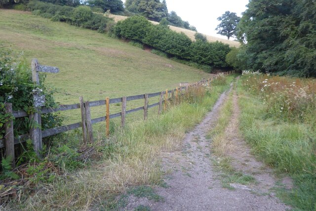
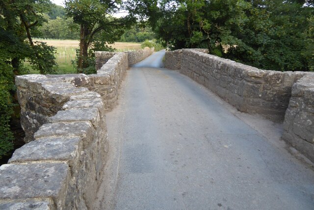
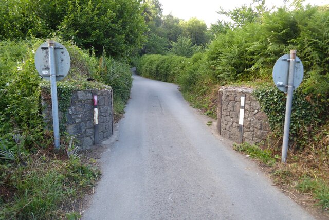
Chagford Images

Images are sourced within 2km of 50.672772/-3.840353 or Grid Reference SX7087. Thanks to Geograph Open Source API. All images are credited.

Chagford - Otter Floral decorated otter model on Mill Street.
Chagford - Otter
Floral decorated otter model on Mill Street.
Track in the Teign valley The Taw-Teign Link a long distance footpath connecting the rivers Taw and Teign.
Track in the Teign valley
The Taw-Teign Link a long distance footpath connecting the rivers Taw and Teign.
Chagford Bridge Chagford Bridge crossing the River Teign.
Chagford Bridge
Chagford Bridge crossing the River Teign.
Narrow road Road width restriction bollards on the approach Chagford Bridge.
Narrow road
Road width restriction bollards on the approach Chagford Bridge.
Houses in Mill Street Chagford
Looking down Mill Street Chagford
Near Chagford An oak illuminated by the evening sun on farmland near the old wool mill on the River Teign.
Near Chagford
An oak illuminated by the evening sun on farmland near the old wool mill on the River Teign.
Chagford Bridge The old stone bridge over the River Teign near Chagford.
Chagford Bridge
The old stone bridge over the River Teign near Chagford.
Chagford Wool Mill The old wool mill on the River Teign now converted to a hotel.
Chagford Wool Mill
The old wool mill on the River Teign now converted to a hotel.
Mill Street, Chagford Looking east towards the town square.
Mill Street, Chagford
Looking east towards the town square.
Two Moors Way, Chagford The Two Moors Way running north of the River Teign near Chagford Bridge.
Two Moors Way, Chagford
The Two Moors Way running north of the River Teign near Chagford Bridge.
View from the Two Moors Way Looking across the fields from the Two Moors Way towards the houses near Chagford Bridge.
View from the Two Moors Way
Looking across the fields from the Two Moors Way towards the houses near Chagford Bridge.
Evening sunlight, Two Moors Way Evening sunlight on the Two Moors Way along the River Teign east of Chagford Bridge.
Evening sunlight, Two Moors Way
Evening sunlight on the Two Moors Way along the River Teign east of Chagford Bridge.
Mill Street and former chapel, Chagford The former chapel is now Helpful Holidays.
Mill Street and former chapel, Chagford
The former chapel is now Helpful Holidays.
Path through the gorse, Meldon Hill A tiny path descends the steep western slopes of the hill.
Path through the gorse, Meldon Hill
A tiny path descends the steep western slopes of the hill.
Lane on Meldon Hill From close to the top of the green lane down past Yellands Farm, with fragments of snow by the wall.
Lane on Meldon Hill
From close to the top of the green lane down past Yellands Farm, with fragments of snow by the wall.
Path up Meldon Hill From above where <a href="https://www.geograph.org.uk/photo/5699935">SX6986 : Path through the gorse, Meldon Hill</a> was taken, looking in the opposite direction up the steep slope.
Path up Meldon Hill
From above where SX6986 : Path through the gorse, Meldon Hill was taken, looking in the opposite direction up the steep slope.
Path down Meldon Hill Looking in the opposite direction from where <a href="https://www.geograph.org.uk/photo/5701703">SX6986 : Path up Meldon Hill</a> to where <a href="https://www.geograph.org.uk/photo/5699935">SX6986 : Path through the gorse, Meldon Hill</a> was taken. Off the open moor, lines of snow linger beside field boundaries. On the skyline to the right is Kestor.
Path down Meldon Hill
Looking in the opposite direction from where SX6986 : Path up Meldon Hill to where SX6986 : Path through the gorse, Meldon Hill was taken. Off the open moor, lines of snow linger beside field boundaries. On the skyline to the right is Kestor.
Show me another place!

Chagford is located at Grid Ref: SX7087 (Lat: 50.672772, Lng: -3.840353)

Administrative County: Devon

District: West Devon

Police Authority: Devon and Cornwall

What 3 Words

///organist.smug.green. Near Chagford, Devon

Related Wikis

Chagford

Chagford is a market town and civil parish on the north-east edge of Dartmoor, in Devon, England, close to the River Teign and the A382, 4 miles (6 km...

The Three Crowns Hotel

The Three Crowns Hotel, also Three Crowns Chagford, is a historical hotel in Chagford, Devon, England. The hotel, noted for its granite facade and 13th...

St Michael the Archangel's Church, Chagford

St Michael the Archangel's Church, Chagford is a Grade I listed parish church in the Church of England Diocese of Exeter in Chagford, Devon. == History... ==

Gidleigh Park

Gidleigh Park is a hotel and restaurant located in Gidleigh, near Chagford, Devon, England. Chris Eden joined as Executive Head Chef in September 2019...

Batworthy

Batworthy is a village in Devon, England. == References ==

Gidleigh

Gidleigh is a village and civil parish in the West Devon district of Devon, England. Located within Dartmoor National Park, the parish is surrounded clockwise...

Frenchbeer

Frenchbeer is a settlement in Devon, England. It is in Dartmoor national park. Fernworthy reservoir is to the south and so is the South Teign river. Chagford...

Holy Trinity Church, Gidleigh

Holy Trinity Church, Gidleigh dates from the late 15th-century, and is a Grade I listed parish church in the Church of England Diocese of Exeter in Gidleigh...

Nearby Amenities

Located within 500m of 50.672772,-3.840353
Chagford
Place: town
Wikidata: Q643877
Wikipedia: en:Chagford
Lat/Long: 50.6731365/-3.8402295
Recycling
Lat/Long: 50.6719927/-3.8383877
Turning Circle
Lat/Long: 50.6715039/-3.8432883
Bench
Lat/Long: 50.6741965/-3.8451338
Restaurant
22 Mill St
Lat/Long: 50.6732925/-3.8417131
Pub
Chagford Inn
Old Name: Bullers Arms
Lat/Long: 50.6732037/-3.8410961
Bank
Lloyds Bank
Atm: no
Brand Wikidata: Q1152847
Lat/Long: 50.6730254/-3.8406986
Toilets
Fee: no
Female: yes
Lat/Long: 50.6730796/-3.8403067
Pub
Ring O' Bells
Addr Housenumber: 44
Addr Postcode: TQ13 8AH
Addr Street: The Square
Fhrs Id: 809014
Source Addr: FHRS Open Data
Wikidata: Q80476743
Lat/Long: 50.6727892/-3.8405111
Pharmacy
Chagford Pharmacy
Addr City: Chagford
Addr Housename: Canon House
Addr Postcode: TQ13 8AA
Addr Street: The Square
Healthcare: pharmacy
Lat/Long: 50.6732254/-3.8399667
Cafe
The New Forge
Note: Tea Room
Old Name: The Old Forge
Lat/Long: 50.6736059/-3.839772
Veterinary
Okeford Veterinary Centre
Website: https://www.okefordvets.co.uk/
Lat/Long: 50.6734342/-3.8401019
Restaurant
Whiddons
Lat/Long: 50.6725309/-3.8396445
Globe Inn
Addr Housenumber: 9
Addr Postcode: TQ13 8AJ
Addr Street: High Street
Fhrs Id: 812962
Source Addr: FHRS Open Data
Tourism: hotel
Wikidata: Q26440198
Lat/Long: 50.6724578/-3.8394882
James Bowden & Son
Shop: hardware
Lat/Long: 50.6729196/-3.8408214
Bank
NatWest
Atm: yes
Brand: NatWest
Brand Wikidata: Q2740021
Brand Wikipedia: en:NatWest
Lat/Long: 50.6736867/-3.8397451
Bus Station
Lat/Long: 50.6730173/-3.8401854
Blacks Delicatessen
Building: yes
Lat/Long: 50.6731067/-3.8397873
AL Martins & Son Family Butchers
Addr Housenumber: 7
Addr Postcode: TQ13 8AA
Addr Street: The Square
Fhrs Id: 809012
Shop: butcher
Source Addr: FHRS Open Data
Lat/Long: 50.6731844/-3.8400246
Sally's Newsagents
Building: yes
Lat/Long: 50.6731284/-3.8400826
Parking
Capacity: 4
Lat/Long: 50.670982/-3.845477
Barrier: kissing_gate
Lat/Long: 50.6697674/-3.8447795
Barrier: kissing_gate
Lat/Long: 50.6710047/-3.8453821
Thomas Bakery
Addr Housenumber: 11
Addr Postcode: TQ13 8AA
Addr Street: The Square
Fhrs Id: 808921
Shop: bakery
Source Addr: FHRS Open Data
Lat/Long: 50.6732646/-3.8402618
Spar
Brand: Spar
Brand Wikidata: Q610492
Brand Wikipedia: en:Spar (retailer)
Shop: convenience
Website: https://www.spar.co.uk/store-locator/awl20108-spar-chagford/
Lat/Long: 50.6728695/-3.8406458
Cafe
The Birdcage
Addr Housenumber: 11
Addr Postcode: TQ13 8AA
Addr Street: The Square
Fhrs Id: 808894
Source Addr: FHRS Open Data
Lat/Long: 50.6731866/-3.8402123
Generator Method: photovoltaic
Generator Output Electricity: yes
Generator Source: solar
Generator Type: solar_photovoltaic_panel
Location: roof
Power: generator
Lat/Long: 50.6703407/-3.8395223
Generator Method: photovoltaic
Generator Output Electricity: yes
Generator Source: solar
Generator Type: solar_photovoltaic_panel
Location: roof
Power: generator
Lat/Long: 50.6703526/-3.8394713
Generator Method: photovoltaic
Generator Output Electricity: yes
Generator Source: solar
Generator Type: solar_photovoltaic_panel
Location: roof
Power: generator
Lat/Long: 50.6716911/-3.8426135
Generator Method: photovoltaic
Generator Output Electricity: yes
Generator Source: solar
Generator Type: solar_photovoltaic_panel
Location: roof
Power: generator
Lat/Long: 50.6718747/-3.8433672
Generator Method: photovoltaic
Generator Output Electricity: yes
Generator Source: solar
Generator Type: solar_photovoltaic_panel
Location: roof
Power: generator
Lat/Long: 50.6722878/-3.8446601
Generator Method: photovoltaic
Generator Output Electricity: yes
Generator Source: solar
Generator Type: solar_photovoltaic_panel
Location: roof
Power: generator
Lat/Long: 50.6728488/-3.8433806
Generator Method: photovoltaic
Generator Output Electricity: yes
Generator Source: solar
Generator Type: solar_photovoltaic_panel
Location: roof
Power: generator
Lat/Long: 50.673595/-3.8430185
Generator Method: photovoltaic
Generator Output Electricity: yes
Generator Source: solar
Generator Type: solar_photovoltaic_panel
Location: roof
Power: generator
Lat/Long: 50.6737599/-3.8419805
Generator Method: photovoltaic
Generator Output Electricity: yes
Generator Source: solar
Generator Type: solar_photovoltaic_panel
Location: roof
Power: generator
Lat/Long: 50.6736494/-3.8410444
Generator Method: photovoltaic
Generator Output Electricity: yes
Generator Source: solar
Generator Type: solar_photovoltaic_panel
Location: roof
Power: generator
Lat/Long: 50.675116/-3.8405865
Generator Method: photovoltaic
Generator Output Electricity: yes
Generator Source: solar
Generator Type: solar_photovoltaic_panel
Location: roof
Power: generator
Lat/Long: 50.6750616/-3.8406616
Generator Method: photovoltaic
Generator Output Electricity: yes
Generator Source: solar
Generator Type: solar_photovoltaic_panel
Location: roof
Power: generator
Lat/Long: 50.6757822/-3.8375494
Generator Method: photovoltaic
Generator Output Electricity: yes
Generator Source: solar
Generator Type: solar_photovoltaic_panel
Location: roof
Power: generator
Lat/Long: 50.6757477/-3.8376465
Generator Method: photovoltaic
Generator Output Electricity: yes
Generator Source: solar
Generator Type: solar_photovoltaic_panel
Location: roof
Power: generator
Lat/Long: 50.6756471/-3.8378692
Generator Method: photovoltaic
Generator Output Electricity: yes
Generator Source: solar
Generator Type: solar_photovoltaic_panel
Location: roof
Power: generator
Lat/Long: 50.6756096/-3.8379592
Generator Method: photovoltaic
Generator Output Electricity: yes
Generator Source: solar
Generator Type: solar_photovoltaic_panel
Location: roof
Power: generator
Lat/Long: 50.6754985/-3.8374618
Generator Method: photovoltaic
Generator Output Electricity: yes
Generator Source: solar
Generator Type: solar_photovoltaic_panel
Location: roof
Power: generator
Lat/Long: 50.6758528/-3.8374002
Generator Method: photovoltaic
Generator Output Electricity: yes
Generator Source: solar
Generator Type: solar_photovoltaic_panel
Location: roof
Power: generator
Lat/Long: 50.6755998/-3.8372166
Generator Method: photovoltaic
Generator Output Electricity: yes
Generator Source: solar
Generator Type: solar_photovoltaic_panel
Location: roof
Power: generator
Lat/Long: 50.6750064/-3.8381195
Post Office
Chagford Post Office
Addr City: Chagford
Addr Housenumber: 46-48
Addr Postcode: TQ13 8AQ
Addr Street: The Square
Brand: Post Office
Brand Wikidata: Q1783168
Opening Hours: Mo-Su 08:00-20:00
Operator: Spar
Ref Pol Id: 147183
Source: pol_branch_list_2020‑11‑13
Website: https://www.postoffice.co.uk/branch-finder/4385497/chagford
Lat/Long: 50.6728845/-3.8406797
Post Box
Brand: Royal Mail
Brand Wikidata: Q638098
Brand Wikipedia: en:Royal Mail
Collection Times: Mo-Fr 12:00; Sa 09:30; Su off
Drive Through: no
Operator: Royal Mail
Operator Wikidata: Q638098
Post Box Design: type_c
Post Box Mounting: stone_wall
Post Box Type: wall
Ref: TQ13 115
Royal Cypher: EVIIR
Royal Cypher Wikidata: Q33102324
Source: survey;streetlevel imagery;aerial imagery
Lat/Long: 50.6699888/-3.8390701
Post Box
Brand: Royal Mail
Brand Wikidata: Q638098
Collection Times: Mo-Fr 16:30; Sa 11:15; Su off
Drive Through: no
Operator: Royal Mail
Operator Wikidata: Q638098
Post Box Design: type_b
Post Box Type: pillar
Ref: TQ13 245
Royal Cypher: GVIR
Royal Cypher Wikidata: Q33102169
Source: survey;streetlevel imagery;aerial imagery;local knowledge
Lat/Long: 50.6731726/-3.8398516
Post Box
Collection Times: Mo-Fr 16:30; Sa 11:15
Drive Through: no
Operator: Royal Mail
Operator Wikidata: Q638098
Post Box Design: type_b
Post Box Mounting: building
Post Box Type: wall
Ref: TQ13 277
Royal Cypher: EIIR
Royal Cypher Wikidata: Q33102113
Source: survey;aerial imagery;streetlevel imagery;local knowledge
Lat/Long: 50.6730779/-3.8399328
Drinking Water
Bottle: yes
Fee: no
Lat/Long: 50.6735157/-3.8399291
D & T Wannell Greengrocers
Addr City: Chagford
Addr Housename: Market House
Addr Postcode: TQ13 8AB
Addr Street: The Square
Phone: +44 1647 433296
Shop: greengrocer
Lat/Long: 50.6730319/-3.8403583
Casa Magnolia
Shop: clothes
Lat/Long: 50.6729074/-3.840135
Fowlers
Office: estate_agent
Lat/Long: 50.6728562/-3.8401766
Bench
Backrest: yes
Lat/Long: 50.6730202/-3.840242
Bench
Backrest: yes
Lat/Long: 50.6730016/-3.8402921
Toilets
Fee: no
Male: yes
Lat/Long: 50.6730568/-3.8402551
Fat Mouse Dairy
Shop: dairy
Lat/Long: 50.6729504/-3.8400772
Telephone
Booth: K6
Colour: red
Covered: booth
Listed Status: Grade II
Phone: +44 1647 433418
Lat/Long: 50.6730941/-3.8399004
Leisure: picnic_table
Lat/Long: 50.6715341/-3.8380862
Waste Basket
Colour: black
Material: metal
Waste: mixed
Lat/Long: 50.6730747/-3.8403452
Waste Basket
Colour: black
Material: metal
Waste: mixed
Lat/Long: 50.6730328/-3.8402352
The data included in this document is from www.openstreetmap.org. The data is made available under ODbL.

Have you been to Chagford?

Leave your review of Chagford below (or comments, questions and feedback).