Chadwell St Mary

Settlement in Essex

England

Chadwell St Mary

Drive to Heath Place This is the tree-lined drive to Heath Place located off Hornsby Lane between Orsett Heath and  the A1013
Drive to Heath Place Credit: Glyn Baker

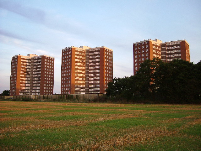
Chadwell St Mary is a small village located in the county of Essex, England. Situated near the town of Grays, it lies within the borough of Thurrock and has a population of around 12,000 residents. The village is primarily residential, with a mix of housing types including detached houses, semi-detached houses, and some apartment buildings.

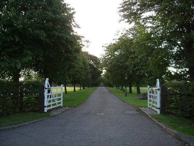
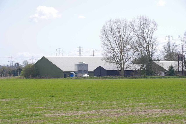
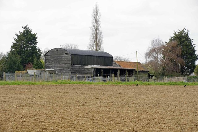
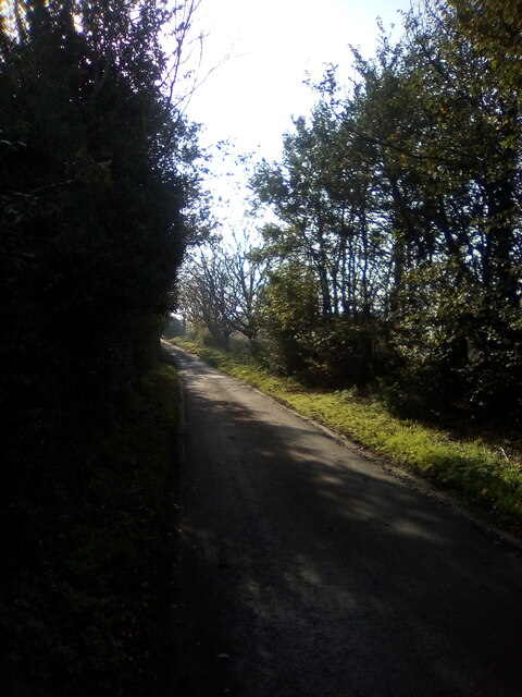
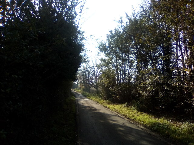
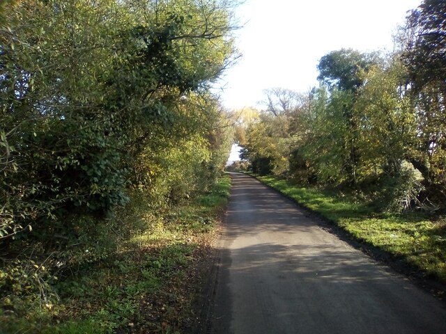
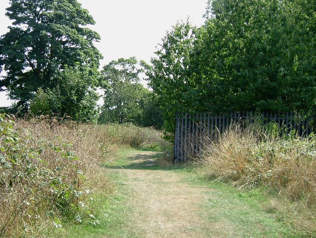
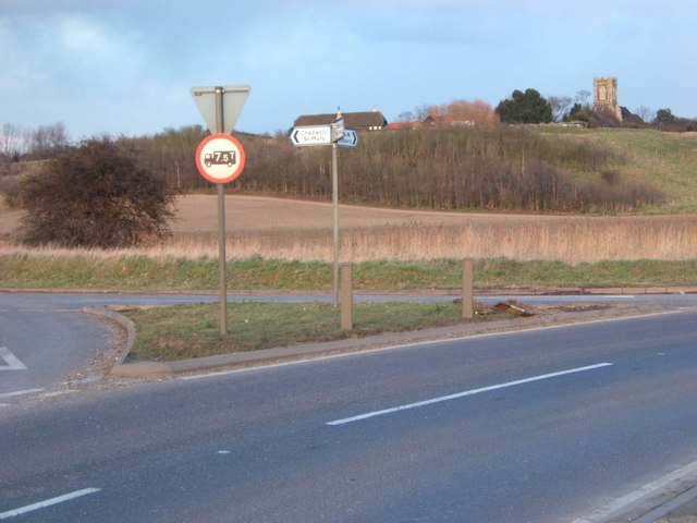
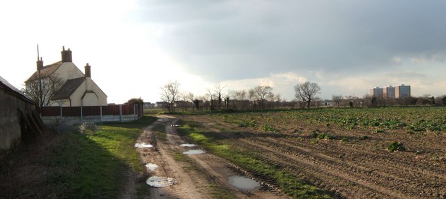
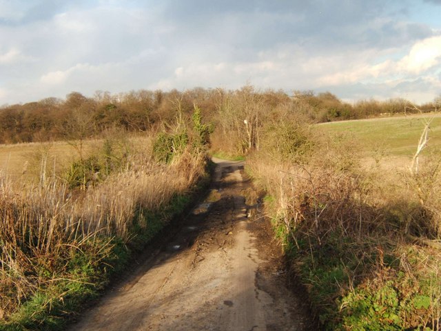
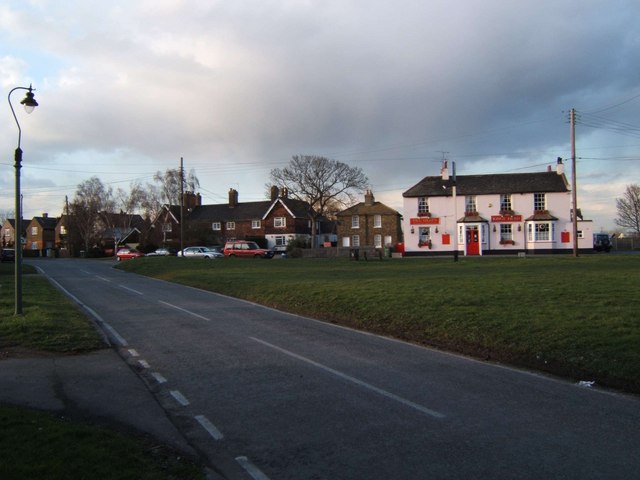
Chadwell St Mary is known for its picturesque countryside, surrounded by fields and farmland. The village itself is characterized by its quaint and charming atmosphere, with a few local shops, pubs, and amenities serving the community. A central focal point of the village is St Mary's Church, a historic building dating back to the 12th century, which adds a sense of heritage and cultural significance to the area.

For those seeking recreational activities, Chadwell St Mary offers several green spaces and parks where residents can enjoy outdoor activities such as walking, jogging, or picnicking. The village is also well-connected to nearby towns and cities, with good transportation links including bus services and a train station in nearby Grays.

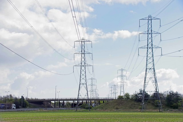
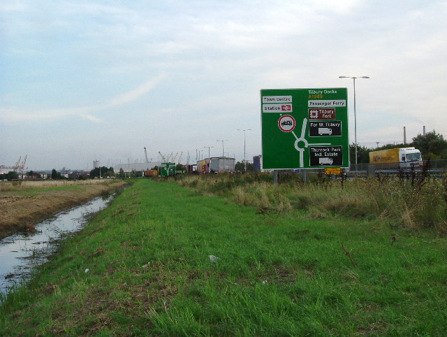
Chadwell St Mary benefits from its proximity to major road networks, including the A13 and M25, providing easy access to London and other parts of Essex. This makes it an attractive location for commuters who work in the city but prefer a quieter and more rural lifestyle.

In summary, Chadwell St Mary is a peaceful and picturesque village in Essex, offering a close-knit community, stunning countryside surroundings, and convenient transport links to nearby areas.

If you have any feedback on the listing, please let us know in the comments section below.

Chadwell St Mary Images

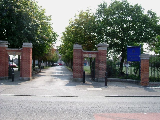
Images are sourced within 2km of 51.481635/0.368876 or Grid Reference TQ6478. Thanks to Geograph Open Source API. All images are credited.

Drive to Heath Place This is the tree-lined drive to Heath Place located off Hornsby Lane between Orsett Heath and  the A1013
Drive to Heath Place
This is the tree-lined drive to Heath Place located off Hornsby Lane between Orsett Heath and the A1013
Pylons, Legumes & A1013 Flyover The flyover carries the A1013 Stanford Road over the A1089 Dock Approach Road. The field has been planted with beans but they might be peas.
Pylons, Legumes & A1013 Flyover
The flyover carries the A1013 Stanford Road over the A1089 Dock Approach Road. The field has been planted with beans but they might be peas.
The Farm at Heath Place It hardly seems like 15 years since I took <a href="https://www.geograph.org.uk/photo/42315">TQ6480 : Drive to Heath Place</a>
The Farm at Heath Place
It hardly seems like 15 years since I took TQ6480 : Drive to Heath Place
Barns Off Hornsby Lane The barns don't look much like they are in active agricultural use any more.
Barns Off Hornsby Lane
The barns don't look much like they are in active agricultural use any more.
Hornsby Lane A view of Hornsby Lane. Unlikely to survive the next few years as obstructing the planned Thames Crossing route.
Hornsby Lane
A view of Hornsby Lane. Unlikely to survive the next few years as obstructing the planned Thames Crossing route.
Hornsby Lane
Hornsby Lane
Hornsby Lane
Hornsby Lane
Palmers College Palmers College was founded in 1706 by William Palmer as a school for the poor to teach the 3R's accounting and Latin. It has been a sixth form college since 1971.
Palmers College
Palmers College was founded in 1706 by William Palmer as a school for the poor to teach the 3R's accounting and Latin. It has been a sixth form college since 1971.
Terrells Heath / Hangmans Wood Grays The galvanized fence protects the public from falling into a Denehole. There is great debate as to what a Denehole is. It has not been conclusively proved if they are natural or man made. The name derives from Dane Hole a place where people hid during Viking raids although there is little proof they were used for this reason.
Terrells Heath / Hangmans Wood Grays
The galvanized fence protects the public from falling into a Denehole. There is great debate as to what a Denehole is. It has not been conclusively proved if they are natural or man made. The name derives from Dane Hole a place where people hid during Viking raids although there is little proof they were used for this reason.
Field Drain Near The A1089 This drain is parallel to the A1089 approach to Tilbury.
Field Drain Near The A1089
This drain is parallel to the A1089 approach to Tilbury.
“Three So Wild in Their Attire” Poole, George Tilbury & Gooderham Houses Chadwell St Mary. These three brutalist tower blocks are a landmark for miles in the flatlands of South Essex.
“Three So Wild in Their Attire”
Poole, George Tilbury & Gooderham Houses Chadwell St Mary. These three brutalist tower blocks are a landmark for miles in the flatlands of South Essex.
St Mary 's Chadwell St Mary St Mary's stands on a hill with commanding views across the countryside towards Tilbury.
St Mary 's Chadwell St Mary
St Mary's stands on a hill with commanding views across the countryside towards Tilbury.
Bend on A126 Tilbury Junction of A126 from Chadwell to Tilbury and a minor road onto an estate of 1930’s council houses (many private these days). Examples of these can be seen in the background.
Bend on A126 Tilbury
Junction of A126 from Chadwell to Tilbury and a minor road onto an estate of 1930’s council houses (many private these days). Examples of these can be seen in the background.
Junction in the Marshes This is the junction of Fort Rd, Gun Hill and Coopers Shaw in West Tilbury Marshes. The church on the Hill in the background is St James Low Street. It is now redundant as a church, planning permission has been sought to convert it into a dwelling.
Junction in the Marshes
This is the junction of Fort Rd, Gun Hill and Coopers Shaw in West Tilbury Marshes. The church on the Hill in the background is St James Low Street. It is now redundant as a church, planning permission has been sought to convert it into a dwelling.
High House Farm This is High House a farm between Chadwell St Mary & Lindford. The towers <a href="https://www.geograph.org.uk/photo/42309">TQ6479 : “Three So Wild in Their Attire”</a> are in Chadwell.
High House Farm
This is High House a farm between Chadwell St Mary & Lindford. The towers TQ6479 : “Three So Wild in Their Attire” are in Chadwell.
Rain Not Required! This irrigation equipment is on Mill House Farm West Tilbury
Rain Not Required!
This irrigation equipment is on Mill House Farm West Tilbury
Hoford Rd This is Hoford Rd it runs between Mill House Farm and East Tilbury Rd north of Linford. It is now closed to motor vehicles (except farm traffic) and is designated as a cyclepath. The photo was taken looking northeast. See further up the road at <a href="https://www.geograph.org.uk/photo/2386341">TQ6680 : Hoford Rd (North End)</a>
Hoford Rd
This is Hoford Rd it runs between Mill House Farm and East Tilbury Rd north of Linford. It is now closed to motor vehicles (except farm traffic) and is designated as a cyclepath. The photo was taken looking northeast. See further up the road at TQ6680 : Hoford Rd (North End)
West Tilbury Village Green This is the village green at West Tilbury. The GR is for the King's Head pub sign.
West Tilbury Village Green
This is the village green at West Tilbury. The GR is for the King's Head pub sign.
Show me another place!

Chadwell St Mary is located at Grid Ref: TQ6478 (Lat: 51.481635, Lng: 0.368876)

Unitary Authority: Thurrock

Police Authority: Essex

What 3 Words

///struck.rider.cigar. Near Chadwell St Mary, Essex

Related Wikis

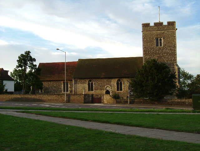
St Mary's Church, Chadwell St Mary

The Church of St Mary is a Church of England parish church in Chadwell St Mary, Thurrock, Essex. The church is a Grade I listed building. Together with...

Chadwell St Mary

Chadwell St Mary is an area of the unitary authority of Thurrock in Essex, England. It is one of the traditional (Church of England) parishes in Thurrock...

The Gateway Academy

The Gateway Academy, formerly The Gateway Community College, is a coeducational academy secondary school in Grays, Essex, England. It became an academy...

Biggin, Essex

Biggin is a hamlet and manor in Chadwell St Mary, part of the borough of Thurrock, in the ceremonial county of Essex, England. It is about 2 miles (3.2...

Nearby Amenities

Located within 500m of 51.481635,0.368876
Created By: YahooApplet 1.0
Lat/Long: 51.4815168/0.3622263
Traffic Calming: island
Lat/Long: 51.4783084/0.3642279
Created By: YahooApplet 1.0
Lat/Long: 51.4816236/0.3666607
Created By: YahooApplet 1.0
Lat/Long: 51.4814953/0.364824
Created By: YahooApplet 1.0
Lat/Long: 51.4804291/0.3752688
Crossing
Crossing: marked
Crossing Island: no
Crossing Ref: tiger
Kerb: lowered
Tactile Paving: yes
Lat/Long: 51.4860446/0.3697601
Crossing
Button Operated: yes
Crossing: traffic_signals
Crossing Island: yes
Tactile Paving: yes
Traffic Signals Sound: yes
Lat/Long: 51.4817188/0.3691045
Pharmacy
River View Pharmacy
Addr City: Chadwell St Mary
Addr Housenumber: 22
Addr Interpolation: even
Addr Postcode: RM16 4BJ
Addr Street: River View
Dispensing: yes
Drive Through: no
Healthcare: pharmacy
Level: 0
Opening Hours: Mo-Fr 09:00-13:00, 14:00-18:00; Sa-Su off
Operator: E-Nova Healthcare
Phone: +44 1375 842470
Lat/Long: 51.4817194/0.3665572
Bus Stop
River View
Bench: yes
Bin: no
Bus: yes
Departures Board: timetable
Lit: yes
Naptan AtcoCode: 1590029401
Naptan Bearing: E
Naptan CommonName: River View
Naptan Indicator: Eastbound
Naptan Landmark: Ruskin Road
Naptan NaptanCode: thuapmp
Naptan Street: River View
Naptan Verified: no
Public Transport: platform
Shelter: yes
Source: naptan_import
Tactile Paving: yes
Lat/Long: 51.4815785/0.3629261
Bus Stop
River View
Bench: yes
Bin: yes
Bus: yes
Departures Board: timetable
Lit: yes
Naptan AtcoCode: 1590029501
Naptan Bearing: W
Naptan CommonName: River View
Naptan Indicator: Westbound
Naptan Landmark: Ruskin Road
Naptan NaptanCode: thudjpm
Naptan Street: River View
Naptan Verified: no
Public Transport: platform
Shelter: yes
Source: naptan_import
Tactile Paving: yes
Lat/Long: 51.4814646/0.3624916
Bus Stop
River View Cross Keys
Bench: yes
Bin: yes
Bus: yes
Departures Board: realtime
Lit: yes
Naptan AtcoCode: 1590029601
Naptan Bearing: W
Naptan CommonName: River View Cross Keys
Naptan Indicator: Westbound
Naptan Landmark: Oxford Avenue
Naptan NaptanCode: thudjpt
Naptan Street: River View
Naptan Verified: no
Public Transport: platform
Shelter: yes
Source: naptan_import
Tactile Paving: yes
Lat/Long: 51.4815935/0.3668723
Bus Stop
River View Cross Keys
Bench: yes
Bin: yes
Bus: yes
Departures Board: realtime
Lit: yes
Naptan AtcoCode: 1590029701
Naptan Bearing: E
Naptan CommonName: River View Cross Keys
Naptan Indicator: Eastbound
Naptan Landmark: Cross Keys
Naptan NaptanCode: thudjpw
Naptan Street: River View
Naptan Verified: no
Public Transport: platform
Shelter: yes
Source: naptan_import
Tactile Paving: yes
Lat/Long: 51.4817065/0.3679827
Bus Stop
Rigby Gardens
Bus: yes
Naptan AtcoCode: 1590029801
Naptan Bearing: N
Naptan CommonName: Rigby Gardens
Naptan Indicator: Northbound
Naptan Landmark: Rigby Gardens
Naptan NaptanCode: thuapmt
Naptan Street: Brentwood Road
Naptan Verified: no
Public Transport: platform
Source: naptan_import
Lat/Long: 51.4847836/0.3692209
Bus Stop
Vigerons Way
Bus: yes
Naptan AtcoCode: 1590033801
Naptan Bearing: W
Naptan CommonName: Vigerons Way
Naptan Indicator: Westbound
Naptan Landmark: Sabina Road
Naptan NaptanCode: thudjwj
Naptan Street: Waterson Road
Naptan Verified: no
Public Transport: platform
Source: naptan_import
Lat/Long: 51.482311/0.3741259
Bus Stop
Vigerons Way
Bus: yes
Naptan AtcoCode: 1590033901
Naptan Bearing: E
Naptan CommonName: Vigerons Way
Naptan Indicator: Eastbound
Naptan Landmark: Waterson Road
Naptan NaptanCode: thuatdw
Naptan Street: Longhouse Road
Naptan Verified: no
Public Transport: platform
Source: naptan_import
Lat/Long: 51.4824327/0.3724306
Bus Stop
Aluric Close
Bus: yes
Naptan AtcoCode: 1590034001
Naptan Bearing: S
Naptan CommonName: Aluric Close
Naptan Indicator: Southbound
Naptan Landmark: Aluric Close
Naptan NaptanCode: thuatga
Naptan Street: Waterson Road
Naptan Verified: no
Public Transport: platform
Source: naptan_import
Lat/Long: 51.4818729/0.3716509
Bus Stop
Linford Road
Bench: no
Bin: no
Bus: yes
Departures Board: timetable
Naptan AtcoCode: 1590034101
Naptan Bearing: W
Naptan CommonName: Linford Road
Naptan Indicator: Westbound
Naptan Landmark: St Michael's Road
Naptan NaptanCode: thuatgd
Naptan Street: Linford Road
Naptan Verified: no
Public Transport: platform
Shelter: no
Source: naptan_import
Tactile Paving: yes
Lat/Long: 51.480942/0.37598
Bus Stop
Linford Road
Bench: no
Bin: no
Bus: yes
Departures Board: timetable
Naptan AtcoCode: 1590034201
Naptan Bearing: E
Naptan CommonName: Linford Road
Naptan Indicator: E-bound
Naptan Landmark: St Michael's Road
Naptan NaptanCode: thuatgj
Naptan Street: Linford Road
Naptan Verified: no
Public Transport: platform
Shelter: no
Source: naptan_import
Tactile Paving: no
Lat/Long: 51.4809977/0.3744317
Traffic Signals
Traffic Signals: traffic_lights
Traffic Signals Direction: forward
Lat/Long: 51.4814854/0.3688257
Chadwell St Mary
Alt Name: Chadwell
Place: village
Population: 9631
Source: https://en.wikipedia.org/wiki/Chadwell_St_Mary
Wikidata: Q2270700
Lat/Long: 51.4856951/0.3672556
Crossing
Crossing: marked
Crossing Island: no
Crossing Ref: zebra
Direction: both
Kerb: lowered
Surface: paving_stones
Tactile Paving: yes
Traffic Calming: table
Lat/Long: 51.4814774/0.3638068
Kerb: raised
Tactile Paving: no
Lat/Long: 51.4818985/0.3622458
Kerb: raised
Tactile Paving: no
Lat/Long: 51.4806811/0.3641997
Kerb: raised
Tactile Paving: no
Lat/Long: 51.4800308/0.3641082
Atm
Cash In: no
Check Date: 2022-03-12
Drive Through: no
Operator: Post Office
Lat/Long: 51.4813925/0.3642404
Post Box
Brand: Royal Mail
Brand Wikidata: Q638098
Brand Wikipedia: en:Royal Mail
Collection Times: Mo-Fr 17:00; Sa 12:00
Drive Through: no
Operator: Royal Mail
Operator Wikidata: Q638098
Royal Cypher: EVIIR
Royal Cypher Wikidata: Q33102324
Lat/Long: 51.4814269/0.3642695
Chadwell Motorcycles
Addr City: Chadwell St Mary
Addr Housenumber: 101 & 107
Addr Postcode: RM16 4BD
Addr Street: River View
Email: info@chadwellmotorcycles.co.uk
Level: 0
Phone: +44 1375 842601
Shop: motorcycle
Website: https://chadwellmotorcycles.co.uk/
Lat/Long: 51.4814084/0.3624477
Fisher's
Addr City: Chadwell St Mary
Addr Housenumber: 93 & 99
Addr Postcode: RM16 4BD
Addr Street: River View
Level: 0
Opening Hours: Mo,We-Sa 07:00-17:00; Tu 08:00-17:00; Su off
Phone: +44 1375 850888;+44 1375 887373
Phone 1: +44 1375 850888
Shop: florist
Website: http://www.fishers-florist.co.uk/
Lat/Long: 51.4813986/0.3626435
Chadwell Food and Wine
Level: 0
Shop: newsagent
Lat/Long: 51.4813952/0.3627956
Lemon Fresh UK
Addr City: Chadwell St Mary
Addr Housenumber: 85
Addr Postcode: RM16 4BD
Addr Street: River View
Email: info@lemonfreshuk.com
Level: 0
Phone: +44 1375 800987
Shop: cosmetics
Website: https://www.lemonfreshuk.com/
Lat/Long: 51.4813913/0.3629176
Chandler Clarke
Addr City: Chadwell St Mary
Addr Housenumber: 83
Addr Postcode: RM16 4BD
Addr Street: River View
Email: info@chandlerclarkeopticians.co.uk
Level: 0
Opening Hours: Mo-Th 09:30-13:00, 14:00-17:30; Fr 09:30-13:00, 14:00-16:30; Sa 09:30-12:30; Su off
Phone: +44 1375 842103
Shop: optician
Website: https://www.chandlerclarkeopticians.co.uk/
Lat/Long: 51.4813884/0.3630252
Essex Barbers
Addr City: Chadwell St Mary
Addr Housenumber: 77
Addr Postcode: RM16 4BD
Addr Street: River View
Facebook: https://www.facebook.com/pages/category/Beauty--cosmetic---personal-care/Essex-barbers-Chadwell-399668877254767/
Level: 0
Old Name: Chadwell DIY
Opening Hours: Mo off; Tu-Sa 09:00-18:30; Su 10:00-16:00
Phone: +44 1375 251715
Shop: hairdresser
Lat/Long: 51.4813851/0.3631421
Fast Food
Essex Grill
Addr City: Chadwell St Mary
Addr Housenumber: 115
Addr Postcode: RM16 4BA
Addr Street: River View
Cuisine: kebab
Delivery: yes
Drive Through: no
Level: 0
Phone: +44 1375 401131
Smoking: outside
Takeaway: only
Lat/Long: 51.481453/0.3620412
Fast Food
Hing Long
Addr City: Chadwell St Mary
Addr Housenumber: 113
Addr Postcode: RM16 4BA
Addr Street: River View
Cuisine: chinese
Delivery: yes
Drive Through: no
Level: 0
Phone: +44 1375 840911
Smoking: outside
Takeaway: only
Lat/Long: 51.481449/0.3621074
Cafe
Amareta Cafe
Addr City: Chadwell St Mary
Addr Housenumber: 53
Addr Postcode: RM16 4BJ
Addr Street: River View
Level: 0
Opening Hours: Mo-Sa 06:30-15:30; Su off
Phone: +44 1375 843409
Lat/Long: 51.4813733/0.3649063
Fast Food
New Wings
Addr City: Chadwell St Mary
Addr Housenumber: 51
Addr Postcode: RM16 4BJ
Addr Street: River View
Cuisine: chinese
Delivery: yes
Drive Through: no
Level: 0
Opening Hours: Mo-Su 17:00-23:00
Phone: +44 1375 844198
Smoking: outside
Takeaway: only
Lat/Long: 51.4813824/0.3650056
Fast Food
Essex Fish Bar
Addr City: Chadwell St Mary
Addr Housenumber: 49
Addr Postcode: RM16 4BJ
Addr Street: River View
Cuisine: fish_and_chips
Delivery: yes
Drive Through: no
Level: 0
Opening Hours: Mo-Sa 12:00-22:00; Su 13:00-21:00
Phone: +44 1375 407115
Phone 1: +44 1375 843377
Smoking: outside
Takeaway: yes
Website: https://www.essexfishbar.co.uk/
Lat/Long: 51.4813905/0.3650708
Direction: both
Surface: asphalt
Traffic Calming: table
Lat/Long: 51.4816548/0.3682095
Crossing
Crossing: marked
Crossing Ref: zebra
Kerb: raised
Tactile Paving: no
Lat/Long: 51.48249/0.3685209
Burlesque
Addr City: Chadwell St Mary
Addr Housenumber: 24
Addr Interpolation: even
Addr Postcode: RM16 4BJ
Addr Street: River View
Level: 0
Opening Hours: Tu-We 09:00-20:00; Th 09:00-19:00; Fr 09:00-17:00; Sa 08:00-17:00; Mo, Su off
Phone: +44 1375 843192
Shop: hairdresser
Lat/Long: 51.4817179/0.3664672
Coral
Addr City: Chadwell St Mary
Addr Housenumber: 26
Addr Interpolation: even
Addr Postcode: RM16 4BJ
Addr Street: River View
Brand: Coral
Brand Wikidata: Q54621344
Brand Wikipedia: en:Coral (bookmaker)
Level: 0
Opening Hours: Mo-Fr 10:00-20:00; Sa 08:30-21:00; Su 10:00-18:00
Phone: +44 800 440011
Shop: bookmaker
Website: https://www.coral.co.uk/
Lat/Long: 51.4817154/0.3663802
Charley's
Addr City: Chadwell St Mary
Addr Housenumber: 28
Addr Interpolation: even
Addr Postcode: RM16 4BJ
Addr Street: River View
Facebook: https://www.facebook.com/Charleys-Florist-791542017677064/
Level: 0
Opening Hours: Mo-Tu; Th-Sa 09:00-18:00; We 09:00-13:00; Su off
Phone: +44 1375 855979
Shop: florist
Lat/Long: 51.4817157/0.3662999
Dentist
Chadwell Dental Practice
Addr City: Chadwell St Mary
Addr Housenumber: 30
Addr Interpolation: even
Addr Postcode: RM16 4BJ
Addr Street: River View
Fax: +44 1375 841619
Healthcare: dentist
Level: 0
Opening Hours: Mo, We-Th 09:00-17:30; Tu 09:00-18:00; Fr 09:00-14:00; Sa 09:30-13:30; Su off
Phone: +44 1375 842620
Website: https://www.chadwelldentalpractice.co.uk/
Lat/Long: 51.4817152/0.3662173
Thamesview News
Addr City: Chadwell St Mary
Addr Housenumber: 32
Addr Interpolation: even
Addr Postcode: RM16 4BJ
Addr Street: River View
Level: 0
Phone: +44 1375 843248
Shop: newsagent
Lat/Long: 51.4817143/0.3661371
Fast Food
KK Fish Bar
Addr City: Chadwell St Mary
Addr Housenumber: 3
Addr Postcode: RM16 4JD
Addr Street: Brentwood Road
Delivery: no
Drive Through: no
Facebook: https://www.facebook.com/kkfishbar/
Level: 0
Opening Hours: Mo-Fr 11:30-14:00, 17:00-23:00; Sa 12:00-16:00, 17:00-23:00; Su off
Phone: +44 1375 859538
Smoking: outside
Takeaway: only
Lat/Long: 51.4821119/0.3687382
The Cutting Edge Hair Studio
Addr City: Chadwell St Mary
Addr Housenumber: 7
Addr Postcode: RM16 4JD
Addr Street: Brentwood Road
Level: 0
Opening Hours: Tu-Fr 09:00-18:00; Sa 08:30-16:30; Su 10:00-14:00
Phone: +44 1375 844984
Shop: hairdresser
Lat/Long: 51.4822242/0.368769
Fast Food
Aksah
Addr City: Chadwell St Mary
Addr Housenumber: 9
Addr Postcode: RM16 4JD
Addr Street: Brentwood Road
Cuisine: indian
Delivery: no
Drive Through: no
Level: 0
Opening Hours: Mo-Su 17:30-23:00
Phone: +44 1375 858444
Smoking: outside
Takeaway: yes
Website: https://www.akashgrays.co.uk/
Lat/Long: 51.4823032/0.3687955
Clarendon Home Improvement
Addr City: Chadwell St Mary
Addr Housenumber: 47
Addr Street: River View
Level: 0
Shop: doityourself
Lat/Long: 51.4814015/0.3651648
Direction: 180
Enforcement: traffic_signals
Lat/Long: 51.4818621/0.3687934
Chadwell Convenience Store
Addr City: Chadwell St Mary
Addr Housenumber: 5
Addr Postcode: RM16 4JD
Addr Street: Brentwood Road
Level: 0
Opening Hours: Mo-Su 08:00-22:00
Shop: convenience
Lat/Long: 51.482162/0.3687515
Atm
Cash In: no
Check Date: 2022-03-12
Drive Through: no
Operator: Tesco Bank
Lat/Long: 51.4827659/0.3685353
Crossing
Crossing: marked
Crossing Island: no
Crossing Ref: tiger
Kerb: lowered
Tactile Paving: yes
Lat/Long: 51.4842982/0.3692072
Crossing
Crossing: unmarked
Crossing Island: yes
Tactile Paving: yes
Lat/Long: 51.4808877/0.3754936
Crossing
Crossing: unmarked
Crossing Island: yes
Tactile Paving: yes
Lat/Long: 51.480739/0.3753062
Crossing
Button Operated: yes
Crossing: traffic_signals
Crossing Island: no
Tactile Paving: yes
Traffic Signals Sound: yes
Lat/Long: 51.481667/0.368572
Traffic Signals
Traffic Signals: traffic_lights
Traffic Signals Direction: forward
Lat/Long: 51.481911/0.3689174
Crossing
Crossing: unmarked
Crossing Island: no
Direction: both
Surface: paving_stones
Tactile Paving: yes
Traffic Calming: table
Lat/Long: 51.4815628/0.365654
Direction: both
Surface: asphalt
Traffic Calming: hump
Lat/Long: 51.481979/0.3622513
Barrier: bollard
Lat/Long: 51.4815256/0.3753369
Crossing
Crossing: marked
Crossing Island: no
Crossing Ref: tiger
Tactile Paving: yes
Lat/Long: 51.4835977/0.3691436
Traffic Calming: island
Lat/Long: 51.4777165/0.3656865
Tanning Salon by Soliel
Addr City: Chadwell St Mary
Addr Housenumber: 109
Addr Postcode: RM16 4BD
Addr Street: River View
Beauty: tanning
Level: 0
Operator: Soliel Tanning
Phone: +44 1375 844855
Shop: beauty
Website: https://www.soleiltanning.co.uk/
Lat/Long: 51.4814426/0.3622326
Direction: both
Surface: paving_stones
Traffic Calming: table
Lat/Long: 51.4815116/0.3623797
Post Office
Chadwell St Mary Post Office
Addr City: Chadwell St Mary
Addr Country: GB
Addr Housenumber: 67
Addr Postcode: RM16 4BJ
Addr Street: River View
Brand: Post Office
Brand Wikidata: Q1783168
Brand Wikipedia: en:Post Office Ltd
Check Date Opening Hours: 2022-03-12
Contact Website: https://www.postoffice.co.uk/branch-finder/1320262/chadwell-st-mary
Opening Hours: Mo-Sa 06:30-20:00; Su 08:00-14:00
Ref Pol Id: 19007
Lat/Long: 51.4813425/0.3642432
Crossing
Crossing: unmarked
Crossing Island: no
Direction: both
Surface: paving_stones
Tactile Paving: yes
Traffic Calming: table
Lat/Long: 51.4816334/0.3671457
Man Made: street_cabinet
Street Cabinet: traffic_control
Lat/Long: 51.4818647/0.3690195
Man Made: street_cabinet
Street Cabinet: cable_tv
Lat/Long: 51.4817613/0.3692714
Man Made: street_cabinet
Street Cabinet: broadband
Lat/Long: 51.4817709/0.3692046
Colour: green
Man Made: street_cabinet
Operator: Openreach
Operator Wikidata: Q7096543
Ref: 7
Street Cabinet: telecom
Lat/Long: 51.4820419/0.3621144
Colour: green
Man Made: street_cabinet
Operator: Openreach
Operator Wikidata: Q7096543
Street Cabinet: telecom
Lat/Long: 51.482079/0.3621155
Bench
Backrest: no
Lat/Long: 51.4818651/0.3690753
Board Type: notice
Information: board
Tourism: information
Lat/Long: 51.4818702/0.3690988
Waste Basket
Lat/Long: 51.4818848/0.369057
Street Lamp
Direction: 270
Lamp Mount: bent_mast
Lamp Type: led
Ref: 5
Lat/Long: 51.4826712/0.3623306
Street Lamp
Direction: 90
Lamp Mount: bent_mast
Lamp Type: led
Ref: 4
Lat/Long: 51.4823505/0.3622018
Street Lamp
Direction: 90
Lamp Mount: bent_mast
Lamp Type: led
Ref: 1
Lat/Long: 51.4817108/0.3621616
Street Lamp
Direction: 0
Lamp Mount: bent_mast
Lamp Type: led
Ref: 2
Lat/Long: 51.4827547/0.3625908
Street Lamp
Direction: 0
Lamp Mount: bent_mast
Lamp Type: led
Ref: 1
Lat/Long: 51.4827213/0.3635805
Street Lamp
Direction: 135
Lamp Mount: bent_mast
Lamp Type: led
Ref: 2
Lat/Long: 51.4828817/0.3638407
Street Lamp
Direction: 270
Lamp Mount: bent_mast
Lamp Type: led
Ref: 1
Lat/Long: 51.4827631/0.3641116
Street Lamp
Direction: 90
Lamp Mount: bent_mast
Lamp Type: led
Ref: 3
Lat/Long: 51.4830504/0.3639748
Street Lamp
Direction: 270
Lamp Mount: bent_mast
Lamp Type: led
Ref: 4
Lat/Long: 51.4834379/0.3641143
Street Lamp
Direction: 270
Lamp Mount: bent_mast
Lamp Type: led
Ref: 5
Lat/Long: 51.4838087/0.3641196
Street Lamp
Direction: 90
Lamp Mount: bent_mast
Lamp Type: led
Ref: 6
Lat/Long: 51.4841227/0.3640177
Street Lamp
Direction: 90
Lamp Mount: bent_mast
Lamp Type: led
Ref: 7
Lat/Long: 51.4844935/0.3640445
Street Lamp
Direction: 270
Lamp Mount: bent_mast
Lamp Type: led
Ref: 8
Lat/Long: 51.4847992/0.3641679
Street Lamp
Direction: 90
Lamp Mount: bent_mast
Lamp Type: led
Ref: 7
Lat/Long: 51.4833214/0.3622501
Street Lamp
Direction: 90
Lamp Mount: bent_mast
Lamp Type: led
Ref: 6
Lat/Long: 51.4829122/0.3622206
Bus Stop
Felicia Way
Bus: yes
Naptan AtcoCode: 15900705135
Naptan NaptanCode: thuawj
Naptan Verified: no
Public Transport: platform
Source: naptan
Lat/Long: 51.4852665/0.3695507
Generator Method: photovoltaic
Generator Output Electricity: yes
Generator Source: solar
Generator Type: solar_photovoltaic_panel
Location: roof
Power: generator
Lat/Long: 51.4843661/0.3679991
Generator Method: photovoltaic
Generator Output Electricity: yes
Generator Source: solar
Generator Type: solar_photovoltaic_panel
Location: roof
Power: generator
Lat/Long: 51.4831017/0.3679267
Generator Method: photovoltaic
Generator Output Electricity: yes
Generator Source: solar
Generator Type: solar_photovoltaic_panel
Location: roof
Power: generator
Lat/Long: 51.4826774/0.3625837
Generator Method: photovoltaic
Generator Output Electricity: yes
Generator Source: solar
Generator Type: solar_photovoltaic_panel
Location: roof
Power: generator
Lat/Long: 51.4825104/0.3638256
Defibrillator
Defibrillator Location: Outside library, round the corner from the entrance
Emergency: defibrillator
Indoor: no
Not Ref GB The Circuit: 0D3E946A-1072-404D-9A4B-AE2400DACEF2
Lat/Long: 51.4819561/0.3692395
Crossing
Crossing: unmarked
Crossing Island: no
Tactile Paving: yes
Lat/Long: 51.4815376/0.364327
Crossing
Crossing: unmarked
Crossing Island: no
Tactile Paving: yes
Lat/Long: 51.4814397/0.3634029
Crossing
Crossing: unmarked
Crossing Island: no
Tactile Paving: yes
Lat/Long: 51.4814909/0.3629952
Crossing
Crossing: unmarked
Crossing Island: no
Tactile Paving: yes
Lat/Long: 51.4815966/0.3622304
Waste Basket
Lat/Long: 51.4814754/0.3624542
Grit Bin
Lat/Long: 51.48148/0.3624931
Crossing
Crossing: unmarked
Crossing Island: no
Tactile Paving: yes
Lat/Long: 51.481543/0.3660937
Crossing
Crossing: unmarked
Crossing Island: no
Tactile Paving: yes
Lat/Long: 51.4816859/0.3666571
Crossing
Crossing: unmarked
Crossing Island: no
Tactile Paving: yes
Lat/Long: 51.481622/0.3682098
Waste Basket
Lat/Long: 51.4815924/0.3669221
Waste Basket
Lat/Long: 51.4817114/0.367948
Waste Basket
Lat/Long: 51.4816696/0.3661308
Barrier: bollard
Bollard: fixed
Colour: black
Material: metal
Lat/Long: 51.4816542/0.3660973
Barrier: bollard
Bollard: fixed
Colour: black
Material: metal
Lat/Long: 51.4816567/0.3661422
Barrier: bollard
Bollard: fixed
Colour: black
Material: metal
Lat/Long: 51.4816592/0.3661878
Barrier: bollard
Bollard: fixed
Colour: black
Material: metal
Lat/Long: 51.4816621/0.3662321
Barrier: bollard
Bollard: fixed
Colour: black
Material: metal
Lat/Long: 51.4816642/0.366277
Barrier: bollard
Bollard: fixed
Colour: black
Material: metal
Lat/Long: 51.4816663/0.3663206
Barrier: bollard
Bollard: fixed
Colour: black
Material: metal
Lat/Long: 51.4816684/0.3663649
Barrier: bollard
Bollard: fixed
Colour: black
Material: metal
Lat/Long: 51.4816717/0.3664091
Barrier: bollard
Bollard: fixed
Colour: black
Material: metal
Lat/Long: 51.481673/0.366454
Barrier: bollard
Bollard: fixed
Colour: black
Material: metal
Lat/Long: 51.4816755/0.3665003
Street Lamp
Direction: 175
Lamp Mount: bent_mast
Lamp Type: led
Lat/Long: 51.481668/0.3661114
Barrier: bollard
Bollard: fixed
Colour: black
Material: metal
Lat/Long: 51.4816613/0.3665372
Barrier: bollard
Bollard: fixed
Colour: black
Material: metal
Lat/Long: 51.4816629/0.3665875
Barrier: bollard
Bollard: fixed
Colour: black
Material: metal
Lat/Long: 51.481593/0.3663689
Barrier: bollard
Bollard: fixed
Colour: black
Material: metal
Lat/Long: 51.4815953/0.3664192
Barrier: bollard
Bollard: fixed
Colour: black
Material: metal
Lat/Long: 51.4815976/0.3664628
Barrier: bollard
Bollard: fixed
Colour: black
Material: metal
Lat/Long: 51.4815995/0.3665084
Barrier: bollard
Bollard: fixed
Colour: black
Material: metal
Lat/Long: 51.4816016/0.3665536
Street Lamp
Direction: 0
Lamp Mount: bent_mast
Lamp Type: led
Lat/Long: 51.4815796/0.3666787
Street Lamp
Direction: 180
Lamp Mount: bent_mast
Lamp Type: led
Lat/Long: 51.4816849/0.3671843
Street Lamp
Direction: 180
Lamp Mount: bent_mast
Lamp Type: led
Lat/Long: 51.481692/0.3677113
Street Lamp
Direction: 0
Lamp Mount: bent_mast
Lamp Type: led
Lat/Long: 51.481613/0.367991
Street Lamp
Direction: 0
Lamp Mount: bent_mast
Lamp Type: led
Lat/Long: 51.4816193/0.3684416
Street Lamp
Direction: 180
Lamp Mount: bent_mast
Lamp Type: led
Lat/Long: 51.4817179/0.3681995
Colour: green
Man Made: street_cabinet
Lat/Long: 51.4816761/0.3668658
Street Lamp
Direction: 0
Lamp Mount: bent_mast
Lamp Type: led
Lat/Long: 51.4815416/0.3658908
Colour: green
Man Made: street_cabinet
Lat/Long: 51.481542/0.3658733
Street Lamp
Direction: -5
Lamp Mount: bent_mast
Lamp Type: led
Lat/Long: 51.4815408/0.3656266
Street Lamp
Direction: 175
Lamp Mount: bent_mast
Lamp Type: led
Lat/Long: 51.481616/0.3652833
Man Made: utility_pole
Material: metal
Utility: telecom
Lat/Long: 51.4815663/0.3648313
Man Made: utility_pole
Material: wood
Utility: telecom
Lat/Long: 51.481687/0.3672218
Man Made: utility_pole
Material: wood
Utility: telecom
Lat/Long: 51.4816385/0.3655676
Man Made: utility_pole
Material: wood
Utility: telecom
Lat/Long: 51.4814272/0.3645799
Barrier: bollard
Bollard: fixed
Colour: black
Material: metal
Lat/Long: 51.4814498/0.364555
Barrier: bollard
Bollard: fixed
Colour: black
Material: metal
Lat/Long: 51.4814481/0.3645054
Barrier: bollard
Bollard: fixed
Colour: black
Material: metal
Lat/Long: 51.4814481/0.3644578
Barrier: bollard
Bollard: fixed
Colour: black
Material: metal
Lat/Long: 51.4814477/0.3644055
Barrier: bollard
Bollard: fixed
Colour: black
Material: metal
Lat/Long: 51.4814481/0.3643559
Barrier: bollard
Bollard: fixed
Colour: black
Material: metal
Lat/Long: 51.4814502/0.364309
Street Lamp
Direction: 0
Lamp Mount: bent_mast
Lamp Type: led
Lat/Long: 51.4814447/0.3643063
Barrier: bollard
Bollard: fixed
Colour: Grey
Material: concrete
Lat/Long: 51.4814723/0.3646985
Waste Basket
Colour: black
Waste: trash
Lat/Long: 51.4814318/0.3643056
Waste Basket
Lat/Long: 51.4814493/0.3649413
Barrier: bollard
Bollard: fixed
Colour: yellow
Material: metal
Lat/Long: 51.4813875/0.3642285
Barrier: bollard
Bollard: fixed
Colour: yellow
Material: metal
Lat/Long: 51.481388/0.3642506
Street Lamp
Direction: 0
Lamp Mount: bent_mast
Lamp Type: led
Lat/Long: 51.4814389/0.363861
Street Lamp
Direction: 180
Lamp Mount: bent_mast
Lamp Type: led
Lat/Long: 51.4815512/0.3637571
Street Lamp
Direction: 180
Lamp Mount: bent_mast
Lamp Type: led
Lat/Long: 51.4815625/0.3633869
Street Lamp
Direction: 5
Lamp Mount: bent_mast
Lamp Type: led
Lat/Long: 51.4814364/0.3630798
Barrier: bollard
Bollard: fixed
Colour: black
Material: metal
Lat/Long: 51.4814773/0.3630248
Barrier: bollard
Bollard: fixed
Colour: black
Material: metal
Lat/Long: 51.4814782/0.3629578
Colour: green
Man Made: street_cabinet
Lat/Long: 51.4815617/0.3633541
Street Lamp
Direction: 180
Lamp Mount: bent_mast
Lamp Type: led
Lat/Long: 51.4815817/0.3627855
Street Lamp
Direction: 5
Lamp Mount: bent_mast
Lamp Type: led
Lat/Long: 51.4814681/0.3624535
Street Lamp
Direction: 5
Lamp Mount: bent_mast
Lamp Type: led
Lat/Long: 51.4814982/0.3621444
Man Made: utility_pole
Material: wood
Utility: telecom
Lat/Long: 51.4815738/0.3631167
Man Made: utility_pole
Material: wood
Utility: telecom
Lat/Long: 51.481618/0.3621578
Man Made: utility_pole
Material: wood
Utility: telecom
Lat/Long: 51.4816239/0.362369
Waste Basket
Lat/Long: 51.4814919/0.3621397
Barrier: bollard
Bollard: fixed
Colour: black
Material: metal
Lat/Long: 51.4815917/0.3621089
Barrier: bollard
Bollard: fixed
Colour: black
Material: metal
Lat/Long: 51.4815934/0.3620894
Barrier: bollard
Bollard: fixed
Colour: black
Material: metal
Lat/Long: 51.4815525/0.3618876
Barrier: bollard
Bollard: fixed
Colour: black
Material: metal
Lat/Long: 51.4815575/0.3618594
Barrier: bollard
Bollard: fixed
Colour: black
Material: metal
Lat/Long: 51.4815625/0.3618306
Barrier: bollard
Bollard: fixed
Colour: black
Material: metal
Lat/Long: 51.4815663/0.3618038
Barrier: bollard
Bollard: fixed
Colour: black
Material: metal
Lat/Long: 51.4815725/0.3617756
Barrier: bollard
Bollard: fixed
Colour: black
Material: metal
Lat/Long: 51.4815759/0.3617474
Barrier: bollard
Bollard: fixed
Colour: black
Material: metal
Lat/Long: 51.48157/0.3617287
Street Lamp
Direction: 195
Lamp Mount: bent_mast
Lamp Type: led
Lat/Long: 51.4816932/0.361665
Parcel Locker
Brand: InPost
Brand Wikidata: Q3182097
Operator: InPost
Parcel Mail In: yes
Parcel Pickup: yes
Lat/Long: 51.4815132/0.3617548
Barrier: bollard
Lat/Long: 51.4811128/0.375199
Traffic Signals
Traffic Signals: traffic_lights
Traffic Signals Direction: forward
Lat/Long: 51.4816651/0.3685141
Crossing
Button Operated: yes
Crossing: traffic_signals
Crossing Island: no
Tactile Paving: yes
Traffic Signals Sound: yes
Lat/Long: 51.4815444/0.36884
Crossing
Button Operated: yes
Crossing: traffic_signals
Crossing Island: no
Tactile Paving: yes
Traffic Signals Sound: yes
Lat/Long: 51.4818586/0.3689076
Traffic Signals
Traffic Signals: traffic_lights
Traffic Signals Direction: backward
Lat/Long: 51.4817138/0.3691616
Colour: green
Man Made: street_cabinet
Lat/Long: 51.4813945/0.3662032
Colour: green
Man Made: street_cabinet
Street Cabinet: cable_tv
Lat/Long: 51.4812995/0.3661912
Entrance: main
Lat/Long: 51.4821531/0.3683154
Crossing
Crossing: unmarked
Crossing Island: yes
Tactile Paving: yes
Lat/Long: 51.4813243/0.3710788
Crossing
Crossing: unmarked
Crossing Island: yes
Tactile Paving: yes
Lat/Long: 51.4808101/0.3749947
Crossing
Crossing: unmarked
Crossing Island: yes
Tactile Paving: yes
Lat/Long: 51.4808876/0.3749957
Crossing
Crossing: unmarked
Crossing Island: yes
Tactile Paving: yes
Lat/Long: 51.4809395/0.3754531
Crossing
Crossing: unmarked
Crossing Island: yes
Tactile Paving: yes
Lat/Long: 51.4807238/0.3751835
Traffic Calming: island
Lat/Long: 51.4798793/0.3690543
Traffic Calming: island
Lat/Long: 51.4792094/0.3690748
Flats
Access: private
Entrance: staircase
Lat/Long: 51.4814315/0.3624379
Flats
Access: private
Entrance: staircase
Lat/Long: 51.4814172/0.3628526
Flats
Access: private
Entrance: staircase
Lat/Long: 51.4814067/0.3630929
Generator Method: photovoltaic
Generator Output Electricity: yes
Generator Source: solar
Generator Type: solar_photovoltaic_panel
Location: roof
Power: generator
Lat/Long: 51.4841699/0.3743643
Generator Method: photovoltaic
Generator Output Electricity: yes
Generator Source: solar
Generator Type: solar_photovoltaic_panel
Location: roof
Power: generator
Lat/Long: 51.4835823/0.3742158
Generator Method: photovoltaic
Generator Output Electricity: yes
Generator Source: solar
Generator Type: solar_photovoltaic_panel
Location: roof
Power: generator
Lat/Long: 51.4818048/0.3742674
Generator Method: photovoltaic
Generator Output Electricity: yes
Generator Source: solar
Generator Type: solar_photovoltaic_panel
Location: roof
Power: generator
Lat/Long: 51.4818157/0.3744337
Generator Method: photovoltaic
Generator Output Electricity: yes
Generator Source: solar
Generator Type: solar_photovoltaic_panel
Location: roof
Power: generator
Lat/Long: 51.4814524/0.3754529
Generator Method: photovoltaic
Generator Output Electricity: yes
Generator Source: solar
Generator Type: solar_photovoltaic_panel
Location: roof
Power: generator
Lat/Long: 51.4806195/0.3626271
Generator Method: photovoltaic
Generator Output Electricity: yes
Generator Source: solar
Generator Type: solar_photovoltaic_panel
Location: roof
Power: generator
Lat/Long: 51.480573/0.3627666
Generator Method: photovoltaic
Generator Output Electricity: yes
Generator Source: solar
Generator Type: solar_photovoltaic_panel
Location: roof
Power: generator
Lat/Long: 51.4805264/0.3636298
Generator Method: photovoltaic
Generator Output Electricity: yes
Generator Source: solar
Generator Type: solar_photovoltaic_panel
Location: roof
Power: generator
Lat/Long: 51.4805352/0.3640017
Post Box
Operator: Royal Mail
Operator Wikidata: Q638098
Post Box Type: pillar
Lat/Long: 51.4823504/0.3721629
The data included in this document is from www.openstreetmap.org. The data is made available under ODbL.

Have you been to Chadwell St Mary?

Leave your review of Chadwell St Mary below (or comments, questions and feedback).