Railway Strip

Wood, Forest in Roxburghshire

Scotland

Railway Strip

A stone bench seat by the Leader Water For a view of the stone seat taken in March 2013, see <a href="https://www.geograph.org.uk/photo/3374614">NT5735 : A drystane bench seat by the Leader Water</a>.
A stone bench seat by the Leader Water Credit: Walter Baxter

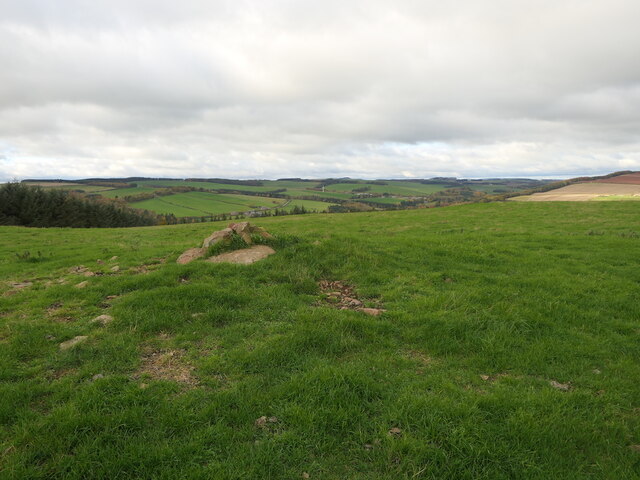
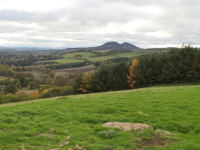
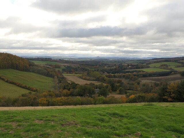
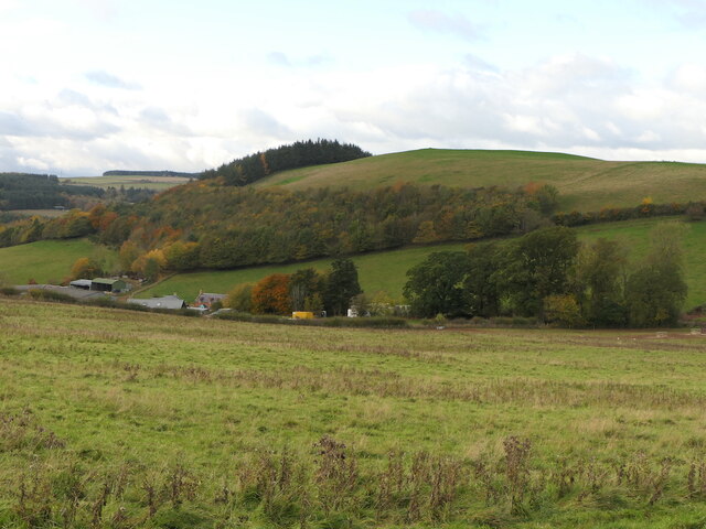
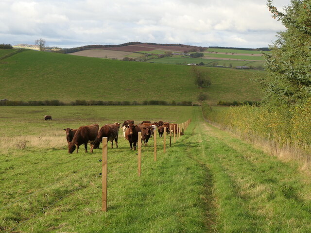
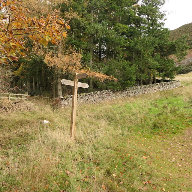
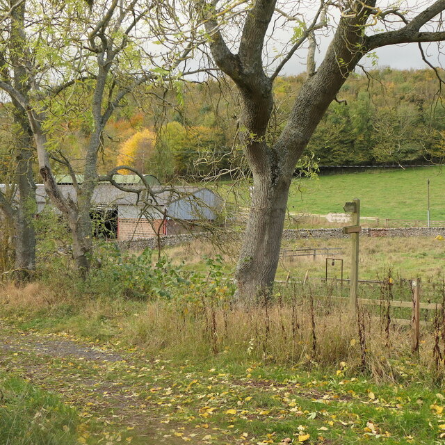
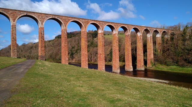
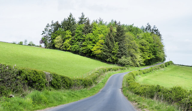
Railway Strip, Roxburghshire (Wood, Forest) is a scenic woodland area located in the southern region of Scotland. Spanning approximately 5 square kilometers, this forest is situated alongside a historic railway track, adding to its charm and character. The strip is part of a larger network of woodlands in the region and is known for its rich biodiversity and natural beauty.

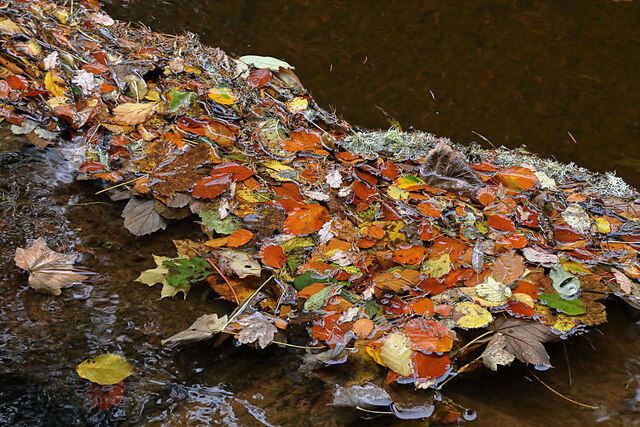
The woodland is primarily composed of native tree species such as oak, birch, and pine, creating a diverse and vibrant ecosystem. The dense canopy provides a habitat for a variety of wildlife, including birds, small mammals, and insects. Walking through the forest, visitors may also encounter various species of wildflowers, adding splashes of color to the landscape.

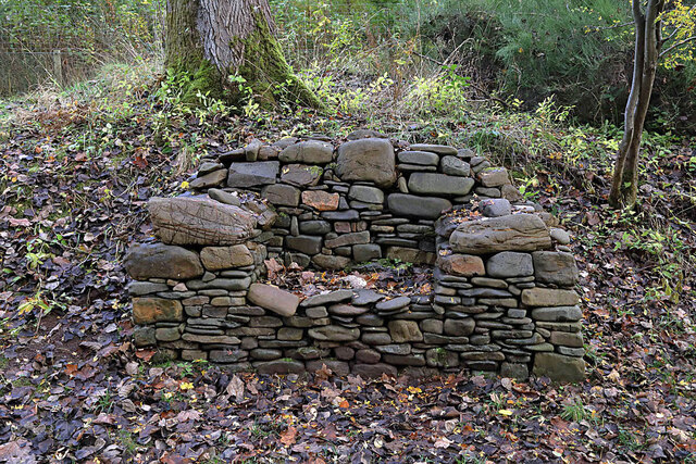
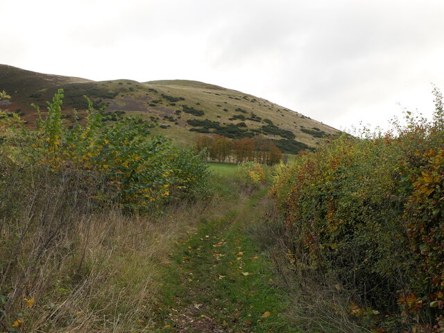
The railway track that runs through the woodland adds a unique element to the area. Although no longer in use, the tracks and surrounding infrastructure have been preserved, offering a glimpse into the region's industrial heritage. The old railway line has been transformed into a scenic walking trail, providing an opportunity for visitors to explore the forest while immersing themselves in its history.

Railway Strip, Roxburghshire is a popular destination for nature enthusiasts, hikers, and history buffs alike. The well-maintained trails and picnic areas make it an ideal spot for a family outing or a peaceful retreat in nature. Additionally, the forest is easily accessible, with ample parking and nearby amenities.

Overall, Railway Strip, Roxburghshire (Wood, Forest) offers a picturesque and immersive experience, combining natural beauty with historical significance.

If you have any feedback on the listing, please let us know in the comments section below.

Railway Strip Images

Images are sourced within 2km of 55.622094/-2.6830234 or Grid Reference NT5736. Thanks to Geograph Open Source API. All images are credited.

A stone bench seat by the Leader Water For a view of the stone seat taken in March 2013, see <a href="https://www.geograph.org.uk/photo/3374614">NT5735 : A drystane bench seat by the Leader Water</a>.
A stone bench seat by the Leader Water
For a view of the stone seat taken in March 2013, see NT5735 : A drystane bench seat by the Leader Water.
Autumn leaves on the Leader Water The leaves have been snagged up on a fallen tree trunk in the river.
Autumn leaves on the Leader Water
The leaves have been snagged up on a fallen tree trunk in the river.
A shaggy parasol mushroom (Chlorophyllum rhacodes) This emerging mushroom was photographed in a coniferous wood near Redpath.
A shaggy parasol mushroom (Chlorophyllum rhacodes)
This emerging mushroom was photographed in a coniferous wood near Redpath.
Black Hill and access path Black Hill of Earlston and a popular ascent route by Cowdenknowes Mains.
Black Hill and access path
Black Hill of Earlston and a popular ascent route by Cowdenknowes Mains.
Summit, White Hill Above Earlston.
Summit, White Hill
Above Earlston.
On White Hill View across Lauderdale towards the Eildon Hills.
On White Hill
View across Lauderdale towards the Eildon Hills.
View down Lauderdale From White Hill.
View down Lauderdale
From White Hill.
White Hill, Earlston Above Cowdenknowes Mains.
White Hill, Earlston
Above Cowdenknowes Mains.
Path to Earlston from Cowdenknowes Mains A route off Black Hill passing a herd of shorthorns.
Path to Earlston from Cowdenknowes Mains
A route off Black Hill passing a herd of shorthorns.
Signpost below Black Hill A path heads north from here towards Earlston.
Signpost below Black Hill
A path heads north from here towards Earlston.
Path signpost, Cowdenknowes Mains
A misty Borders landscape This December view towards Black Hill was taken from Eildon Mid Hill.
A misty Borders landscape
This December view towards Black Hill was taken from Eildon Mid Hill.
A Royal Bank of Scotland mobile bank at Earlston The RBS van was parked outside the Red Lion Hotel.
A Royal Bank of Scotland mobile bank at Earlston
The RBS van was parked outside the Red Lion Hotel.
Leaderfoot Viaduct and the River Tweed This is surely one of the most elegant viaducts in the UK?  The slenderness of the pillars, combined with their tapering heights make this a beautiful structure.
Leaderfoot Viaduct and the River Tweed
This is surely one of the most elegant viaducts in the UK? The slenderness of the pillars, combined with their tapering heights make this a beautiful structure.
Leaderfoot Viaduct and the River Tweed This is surely one of the most elegant viaducts in the UK? The slenderness of the pillars, combined with their tapering heights make this a beautiful structure.
Leaderfoot Viaduct and the River Tweed
This is surely one of the most elegant viaducts in the UK? The slenderness of the pillars, combined with their tapering heights make this a beautiful structure.
Trees beside Anniesfield House The road passing the trees is above the A68 close to Earlston.
Trees beside Anniesfield House
The road passing the trees is above the A68 close to Earlston.
No through road to The Park, Redpath
Haughhead Road, Earlston
Show me another place!

Railway Strip is located at Grid Ref: NT5736 (Lat: 55.622094, Lng: -2.6830234)

Unitary Authority: The Scottish Borders

Police Authority: The Lothians and Scottish Borders

What 3 Words

///emeralds.oval.presenter. Near Earlston, Scottish Borders

Related Wikis

St Andrew's College, Drygrange

St Andrew's College, Drygrange, located near Melrose, Scotland, was a Roman Catholic seminary founded in 1953 and closed in 1986. == History == === Foundation... ===

Rhymer's Tower

Rhymer's Tower, also known as Earlston Castle, is located near the village of Earlston, Scottish Borders, Scotland. The castle was the caput baroniae of...

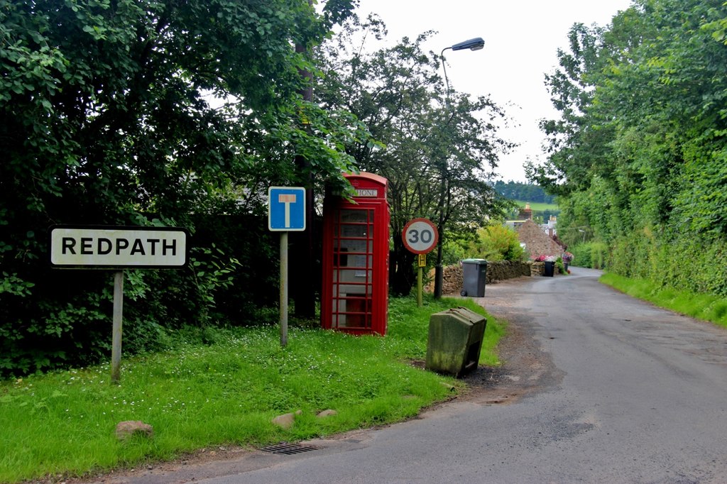
Redpath, Scottish Borders

Redpath (Scots: Rippath) is a small village located between the larger settlements of Earlston, 2 miles (3.2 km) to the north, and St Boswells, 3 miles...

Earlston railway station

Earlston railway station, in the Scottish Borders village of Earlston, was a station on the now disused Berwickshire Railway.There were two platforms...

Nearby Amenities

Located within 500m of 55.622094,-2.6830234
Sorrowlessfield Mains
Place: hamlet
Lat/Long: 55.6241171/-2.6880175
Natural: peak
Lat/Long: 55.6216608/-2.6886271
Waste Basket
Lat/Long: 55.6251114/-2.6800812
Crossing
Crossing: unmarked
Crossing Island: no
Kerb: flush
Tactile Paving: yes
Lat/Long: 55.624804/-2.6794937
Communication Mobile Phone: yes
Man Made: antenna
Lat/Long: 55.6214458/-2.6869045
Communication Mobile Phone: yes
Man Made: mast
Lat/Long: 55.6255882/-2.6864201
Material: wood
Power: pole
Lat/Long: 55.6187254/-2.6791904
Power: pole
Lat/Long: 55.6194357/-2.6795442
Power: pole
Lat/Long: 55.6201486/-2.679903
Power: pole
Lat/Long: 55.6208786/-2.680267
Power: pole
Lat/Long: 55.6215742/-2.6805978
Power: pole
Lat/Long: 55.6221749/-2.6807454
Power: pole
Lat/Long: 55.622777/-2.6808981
Power: pole
Lat/Long: 55.6234496/-2.6810483
Power: pole
Lat/Long: 55.624089/-2.6811883
Power: pole
Lat/Long: 55.6247472/-2.6813537
Power: pole
Lat/Long: 55.6253823/-2.6814962
Power: pole
Lat/Long: 55.6262244/-2.6820511
Power: pole
Lat/Long: 55.6233763/-2.6855175
Power: pole
Lat/Long: 55.6239726/-2.6856218
Power: pole
Lat/Long: 55.6247501/-2.6857491
Power: pole
Lat/Long: 55.6252918/-2.6858458
Power: pole
Lat/Long: 55.6234912/-2.6822089
Power: pole
Lat/Long: 55.6235358/-2.6833567
Power: pole
Lat/Long: 55.62352/-2.6839726
Power: pole
Lat/Long: 55.6232743/-2.6866551
Power: pole
Lat/Long: 55.6231693/-2.6879124
Power: pole
Lat/Long: 55.6222769/-2.6877546
Power: pole
Lat/Long: 55.6214334/-2.6875968
Power: pole
Lat/Long: 55.6233289/-2.6798623
Power: pole
Lat/Long: 55.6232426/-2.6789079
Material: wood
Power: pole
Lat/Long: 55.623359/-2.6781851
Power: pole
Lat/Long: 55.6236163/-2.6773503
Power: pole
Lat/Long: 55.624329/-2.6778924
Power: pole
Lat/Long: 55.6250748/-2.6784549
The data included in this document is from www.openstreetmap.org. The data is made available under ODbL.

Have you been to Railway Strip?

Leave your review of Railway Strip below (or comments, questions and feedback).