Tweed Wood

Wood, Forest in Roxburghshire

Scotland

Tweed Wood

Barley field below the Eildon Hills, Melrose A field on The Annay beside the Tweed with Eildon Hill North (L) and Mid Hill (R). The houses are on the eastern fringe of Melrose.
Barley field below the Eildon Hills, Melrose Credit: Jim Barton

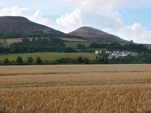
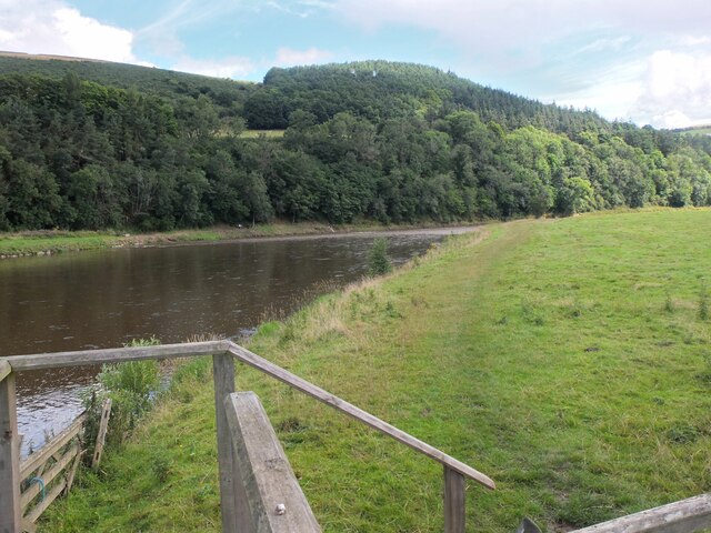
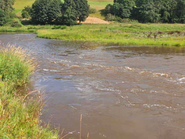
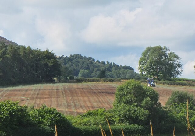
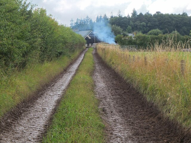
Tweed Wood, located in Roxburghshire, is a picturesque forest area known for its natural beauty and diverse flora and fauna. Situated near the banks of the scenic River Tweed, this wood provides a tranquil and serene environment for visitors to immerse themselves in nature.

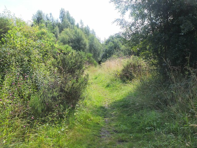
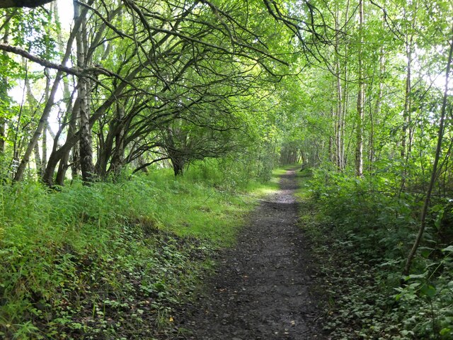
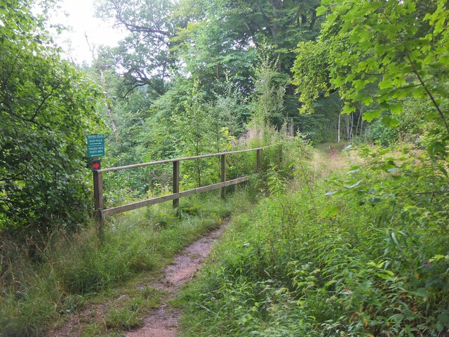
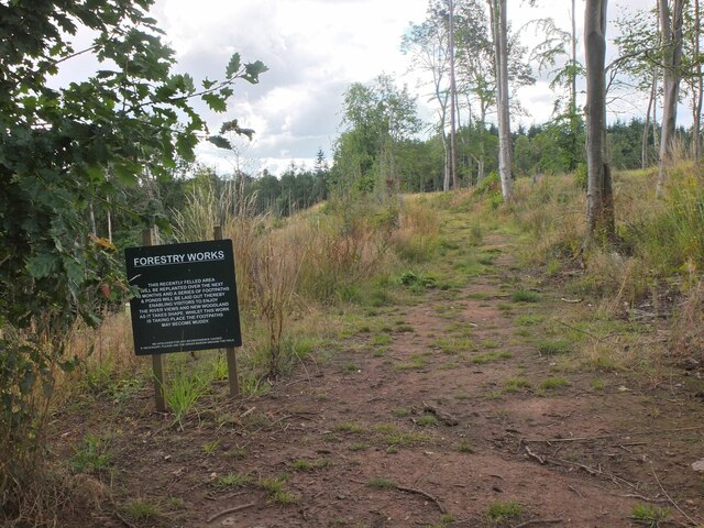
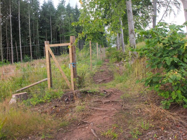
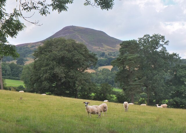
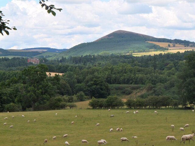
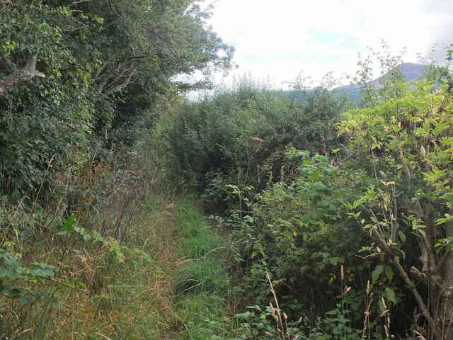
Covering a considerable area, Tweed Wood offers a range of walking trails and paths that wind through its dense foliage. The wood boasts a mix of deciduous and coniferous trees, including oak, beech, pine, and spruce, creating a visually stunning landscape throughout the seasons. In spring, the forest floor is adorned with vibrant wildflowers, while autumn brings a riot of colors as the leaves change to hues of gold and red.

The wood is home to a diverse array of wildlife, making it a haven for nature enthusiasts and birdwatchers. Visitors may spot various bird species, such as woodpeckers, owls, and robins, as well as mammals like red squirrels and deer. Tweed Wood also provides habitats for a variety of insects, including butterflies and dragonflies.

For those seeking outdoor activities, Tweed Wood offers opportunities for camping, picnicking, and fishing along the riverbanks. The tranquil atmosphere and stunning scenery make it an ideal spot for nature photography and painting.

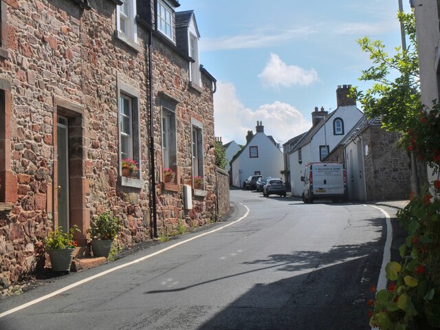
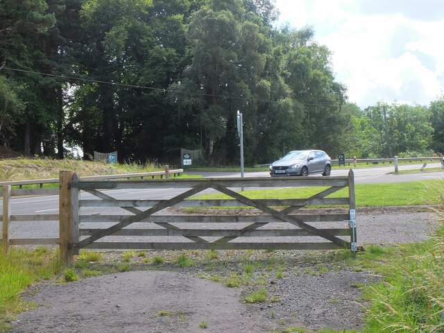
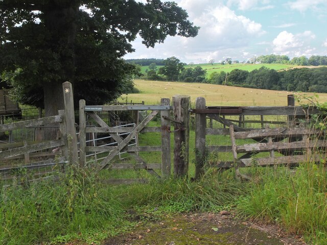
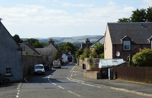
Tweed Wood is easily accessible, with well-maintained paths and ample parking facilities. Its proximity to the charming town of Roxburghshire ensures that visitors can enjoy the best of both worlds – the tranquility of the wood and the amenities of the nearby town.

In conclusion, Tweed Wood in Roxburghshire is a natural gem, offering a peaceful retreat for those seeking solace in nature. With its enchanting woodland trails, abundant wildlife, and scenic views, this wood is a must-visit destination for nature lovers and outdoor enthusiasts alike.

If you have any feedback on the listing, please let us know in the comments section below.

Tweed Wood Images

Images are sourced within 2km of 55.604914/-2.6846453 or Grid Reference NT5634. Thanks to Geograph Open Source API. All images are credited.

Barley field below the Eildon Hills, Melrose A field on The Annay beside the Tweed with Eildon Hill North (L) and Mid Hill (R). The houses are on the eastern fringe of Melrose.
Barley field below the Eildon Hills, Melrose
A field on The Annay beside the Tweed with Eildon Hill North (L) and Mid Hill (R). The houses are on the eastern fringe of Melrose.
The Tweed east of Melrose The Tweed seen from an elevated stile on the riverside path to Newstead.
The Tweed east of Melrose
The Tweed seen from an elevated stile on the riverside path to Newstead.
Yesterday's rain, River Tweed Very heavy showers yesterday have increased the flow and coloured the water with suspended mud, here in a narrowing of the river near Newstead.
Yesterday's rain, River Tweed
Very heavy showers yesterday have increased the flow and coloured the water with suspended mud, here in a narrowing of the river near Newstead.
Main Street, Newstead A village close to the Trimontium Roman site east of Melrose.
Main Street, Newstead
A village close to the Trimontium Roman site east of Melrose.
Tractor laying a pipe The tractor was reversing around the field, unreeling a hosepipe from a drum held at the front, a skilled piece of driving. Presumably the pipe is for irrigation.
Tractor laying a pipe
The tractor was reversing around the field, unreeling a hosepipe from a drum held at the front, a skilled piece of driving. Presumably the pipe is for irrigation.
Former Waverley Line near Broomhill The line from Melrose to Hawick, somewhere near the junction with the former Berwickshire railway route from the Leaderfoot Viaduct. Now it is simply a slightly overgrown footpath signposted 'Old Melrose', leading to the A68 in a few hundred metres.
Former Waverley Line near Broomhill
The line from Melrose to Hawick, somewhere near the junction with the former Berwickshire railway route from the Leaderfoot Viaduct. Now it is simply a slightly overgrown footpath signposted 'Old Melrose', leading to the A68 in a few hundred metres.
Former Waverley Line near Broomhill (2) The line a little further along; from here the next station was Newtown St Boswells. See also Walter Baxter's photograph <a href="https://www.geograph.org.uk/photo/588559">NT5733 : Dismantled railway line</a> taken in 2007.
Former Waverley Line near Broomhill (2)
The line a little further along; from here the next station was Newtown St Boswells. See also Walter Baxter's photograph NT5733 : Dismantled railway line taken in 2007.
Former Waverley Line and A68 road Here the A68 cuts across the former railway route to Hawick and Carlisle. Across the road is the entrance to Old Melrose and the tearoom at the former Ravenswood dairy.
Former Waverley Line and A68 road
Here the A68 cuts across the former railway route to Hawick and Carlisle. Across the road is the entrance to Old Melrose and the tearoom at the former Ravenswood dairy.
Monks Trail, Old Melrose The name recalls the monastery established here in the 7th century, where St Cuthbert became the Prior before travelling to Lindisfarne. The path keeps above the River Tweed on its west bank before returning to the tearoom by a field edge path.
Monks Trail, Old Melrose
The name recalls the monastery established here in the 7th century, where St Cuthbert became the Prior before travelling to Lindisfarne. The path keeps above the River Tweed on its west bank before returning to the tearoom by a field edge path.
Path in felled woodland, Old Melrose The notice informs that the area is to be replanted and new paths and ponds with views to the Tweed will be constructed.
Path in felled woodland, Old Melrose
The notice informs that the area is to be replanted and new paths and ponds with views to the Tweed will be constructed.
Path by plantation edge, Old Melrose The Monks Trail in the Ravenswood Estate.
Path by plantation edge, Old Melrose
The Monks Trail in the Ravenswood Estate.
Path to Eildon village A gate near the A68 for a path signposted to Eildon; it follows a field edge towards a mobile phone mast, then to Eildon Mains farm.
Path to Eildon village
A gate near the A68 for a path signposted to Eildon; it follows a field edge towards a mobile phone mast, then to Eildon Mains farm.
Sheep near Eildon In the background is the steep-sided Eildon Hill North.
Sheep near Eildon
In the background is the steep-sided Eildon Hill North.
Phone mast near Eildon In farmland west of the A68.
Phone mast near Eildon
In farmland west of the A68.
Sheep and Black Hill Sheep grazing in a pasture near Eildon with Black Hill (314m) beyond. Like the nearby Eildon Hills, this is of volcanic origin.
Sheep and Black Hill
Sheep grazing in a pasture near Eildon with Black Hill (314m) beyond. Like the nearby Eildon Hills, this is of volcanic origin.
Path to Eildon village - just! A heavily overgrown stretch of path near Eildon. Overhanging nettles and brambles would make this a severe test for anyone misguided enough to be wearing shorts.
Path to Eildon village - just!
A heavily overgrown stretch of path near Eildon. Overhanging nettles and brambles would make this a severe test for anyone misguided enough to be wearing shorts.
Track to Eildon Mains The track meets the old road near Eildon village.
Track to Eildon Mains
The track meets the old road near Eildon village.
Main Street, Newstead A bus is having difficulty negotiating the narrow road!
Main Street, Newstead
A bus is having difficulty negotiating the narrow road!
Show me another place!

Tweed Wood is located at Grid Ref: NT5634 (Lat: 55.604914, Lng: -2.6846453)

Unitary Authority: The Scottish Borders

Police Authority: The Lothians and Scottish Borders

What 3 Words

///intention.locate.nights. Near Melrose, Scottish Borders

Related Wikis

Newstead Helmet

The Newstead Helmet is an iron Roman cavalry helmet dating to 80–100 AD that was discovered at the site of a Roman fort in Newstead, near Melrose in Roxburghshire...

Leaderfoot Viaduct

The Leaderfoot Viaduct, also known as the Drygrange Viaduct, is a railway viaduct over the River Tweed near Melrose in the Scottish Borders. == History... ==

Trimontium (Newstead)

Trimontium was a Roman fort complex in Scotland. It is located at Newstead, near Melrose, in the Scottish Borders, in view of the three Eildon Hills which...

Drygrange Old Bridge

The Drygrange Old Bridge is a disused road bridge over the River Tweed near Melrose in the Scottish Borders. == History == It was built between 1776 and...

Nearby Amenities

Located within 500m of 55.604914,-2.6846453
Information: guidepost
Tourism: information
Lat/Long: 55.6031577/-2.6787597
Power: pole
Lat/Long: 55.6091712/-2.686617
Power: pole
Lat/Long: 55.6092402/-2.6852248
Power: pole
Lat/Long: 55.609312/-2.6838835
Power: pole
Lat/Long: 55.6066367/-2.6778339
Power: pole
Lat/Long: 55.605938/-2.6786407
Power: pole
Lat/Long: 55.605429/-2.6792082
Power: pole
Lat/Long: 55.6053011/-2.6792693
Power: pole
Lat/Long: 55.6041495/-2.6796714
Power: pole
Lat/Long: 55.6036678/-2.6798292
Power: pole
Lat/Long: 55.6031732/-2.6799794
Power: pole
Lat/Long: 55.6026585/-2.6792057
Power: pole
Lat/Long: 55.6022717/-2.6785974
Power: pole
Lat/Long: 55.6022272/-2.6783938
The data included in this document is from www.openstreetmap.org. The data is made available under ODbL.

Have you been to Tweed Wood?

Leave your review of Tweed Wood below (or comments, questions and feedback).