Newstead

Settlement in Roxburghshire

Scotland

Newstead

Footbridge across the River Tweed
Footbridge across the River Tweed Credit: Les Hull

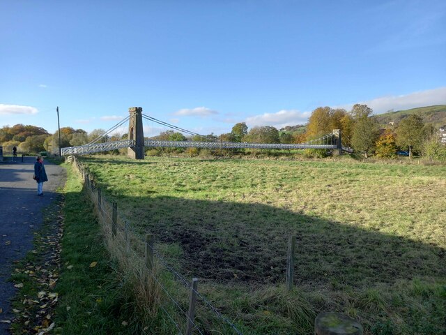
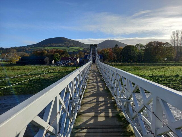
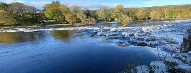
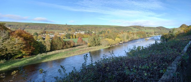
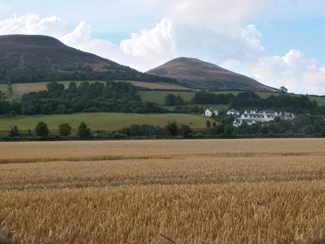
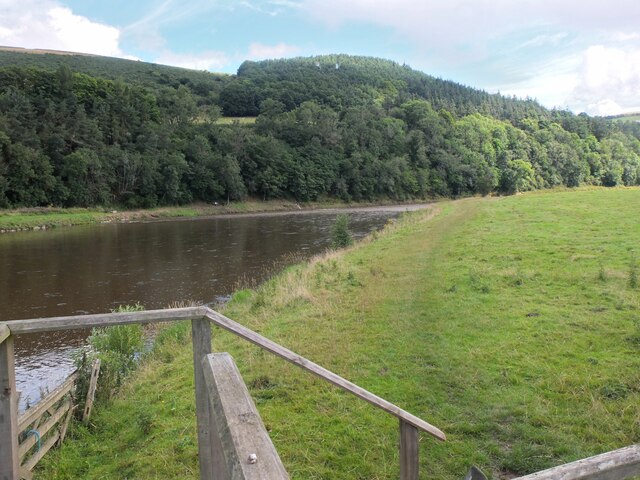
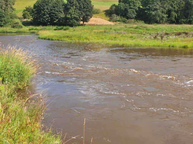
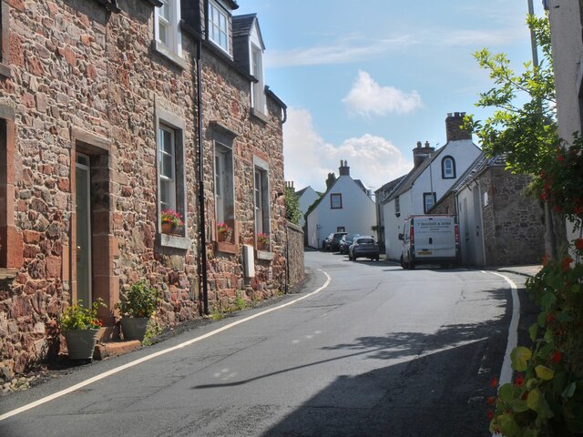
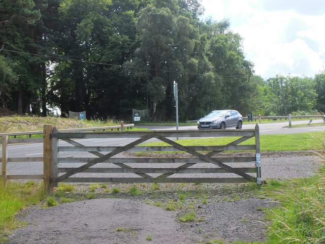
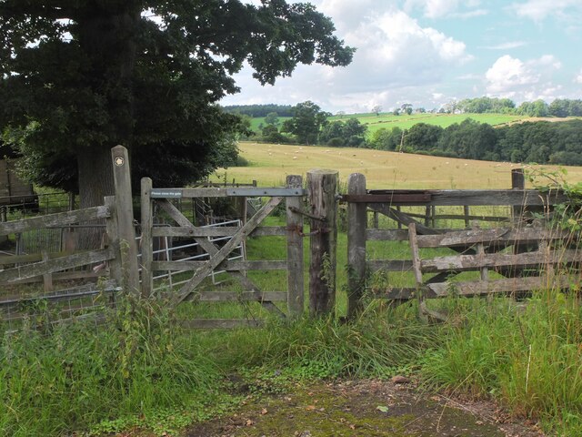
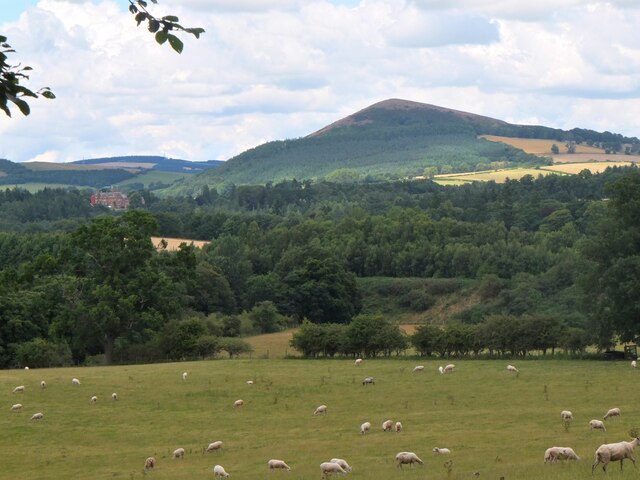
Newstead is a small village located in the county of Roxburghshire, in the Scottish Borders region of Scotland. Situated about 3 miles southeast of Melrose, it is nestled along the banks of the River Tweed. The village is known for its picturesque setting, surrounded by rolling hills and beautiful countryside, offering residents and visitors alike a peaceful and tranquil atmosphere.

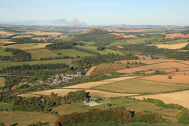
Historically, Newstead holds great significance as it is believed to be the oldest continuously inhabited village in Scotland. It was originally known as Trimontium during the Roman occupation of Britain, serving as a strategic military base. The remains of a Roman fort can still be seen at the nearby site of Trimontium Museum, which attracts history enthusiasts from far and wide.

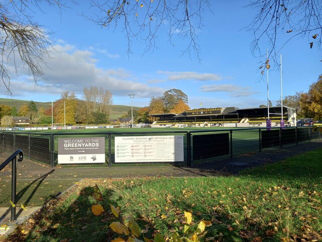
Despite its small size, Newstead boasts a strong sense of community and offers a range of amenities to its residents. The village has a primary school, ensuring local children have access to education within their own community. Additionally, there is a village hall that serves as a hub for various social events and gatherings.

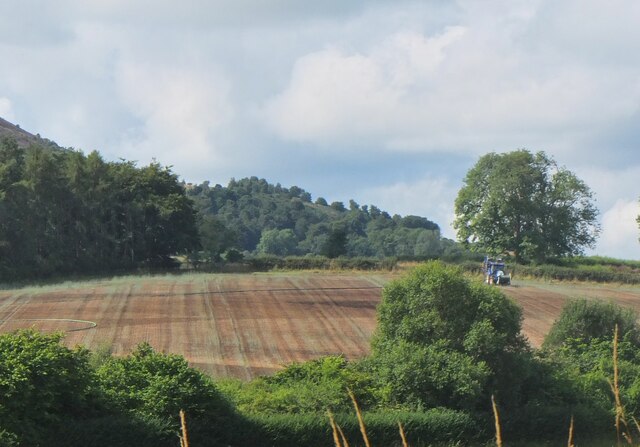
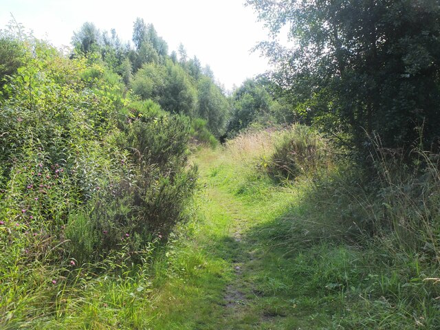
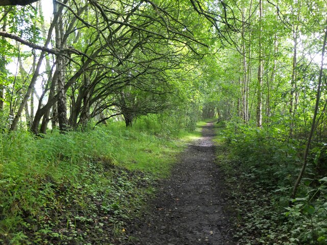
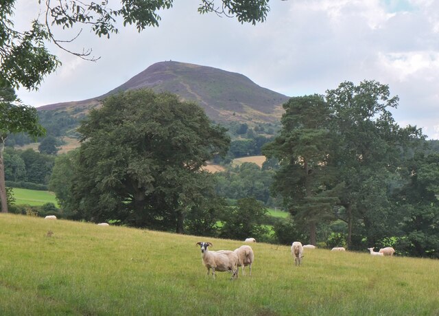
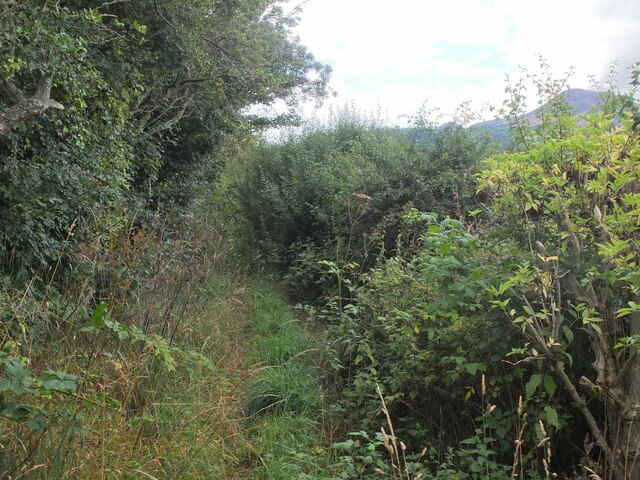
The surrounding area provides ample opportunities for outdoor activities, with numerous walking and cycling trails, as well as fishing spots along the River Tweed. The nearby Eildon Hills, a range of three distinctive peaks, offer stunning panoramic views of the surrounding countryside.

Overall, Newstead is a charming village with a rich historical background, picturesque landscapes, and a close-knit community, making it an attractive place to live or visit for those seeking tranquility and a taste of Scotland's ancient past.

If you have any feedback on the listing, please let us know in the comments section below.

Newstead Images

Images are sourced within 2km of 55.599604/-2.6989946 or Grid Reference NT5634. Thanks to Geograph Open Source API. All images are credited.

Footbridge across the River Tweed
Footbridge across the River Tweed Eildon Hill in the background
Footbridge across the River Tweed
Eildon Hill in the background
River Tweed at Melrose Site of a weir which I think might have  been damaged.
River Tweed at Melrose
Site of a weir which I think might have been damaged.
View of River Tweed Village of Gattonside and distant hills.
View of River Tweed
Village of Gattonside and distant hills.
Melrose Rugby Union Ground
Barley field below the Eildon Hills, Melrose A field on The Annay beside the Tweed with Eildon Hill North (L) and Mid Hill (R). The houses are on the eastern fringe of Melrose.
Barley field below the Eildon Hills, Melrose
A field on The Annay beside the Tweed with Eildon Hill North (L) and Mid Hill (R). The houses are on the eastern fringe of Melrose.
The Tweed east of Melrose The Tweed seen from an elevated stile on the riverside path to Newstead.
The Tweed east of Melrose
The Tweed seen from an elevated stile on the riverside path to Newstead.
Yesterday's rain, River Tweed Very heavy showers yesterday have increased the flow and coloured the water with suspended mud, here in a narrowing of the river near Newstead.
Yesterday's rain, River Tweed
Very heavy showers yesterday have increased the flow and coloured the water with suspended mud, here in a narrowing of the river near Newstead.
Main Street, Newstead A village close to the Trimontium Roman site east of Melrose.
Main Street, Newstead
A village close to the Trimontium Roman site east of Melrose.
Tractor laying a pipe The tractor was reversing around the field, unreeling a hosepipe from a drum held at the front, a skilled piece of driving. Presumably the pipe is for irrigation.
Tractor laying a pipe
The tractor was reversing around the field, unreeling a hosepipe from a drum held at the front, a skilled piece of driving. Presumably the pipe is for irrigation.
Former Waverley Line near Broomhill The line from Melrose to Hawick, somewhere near the junction with the former Berwickshire railway route from the Leaderfoot Viaduct. Now it is simply a slightly overgrown footpath signposted 'Old Melrose', leading to the A68 in a few hundred metres.
Former Waverley Line near Broomhill
The line from Melrose to Hawick, somewhere near the junction with the former Berwickshire railway route from the Leaderfoot Viaduct. Now it is simply a slightly overgrown footpath signposted 'Old Melrose', leading to the A68 in a few hundred metres.
Former Waverley Line near Broomhill (2) The line a little further along; from here the next station was Newtown St Boswells. See also Walter Baxter's photograph <a href="https://www.geograph.org.uk/photo/588559">NT5733 : Dismantled railway line</a> taken in 2007.
Former Waverley Line near Broomhill (2)
The line a little further along; from here the next station was Newtown St Boswells. See also Walter Baxter's photograph NT5733 : Dismantled railway line taken in 2007.
Former Waverley Line and A68 road Here the A68 cuts across the former railway route to Hawick and Carlisle. Across the road is the entrance to Old Melrose and the tearoom at the former Ravenswood dairy.
Former Waverley Line and A68 road
Here the A68 cuts across the former railway route to Hawick and Carlisle. Across the road is the entrance to Old Melrose and the tearoom at the former Ravenswood dairy.
Path to Eildon village A gate near the A68 for a path signposted to Eildon; it follows a field edge towards a mobile phone mast, then to Eildon Mains farm.
Path to Eildon village
A gate near the A68 for a path signposted to Eildon; it follows a field edge towards a mobile phone mast, then to Eildon Mains farm.
Sheep near Eildon In the background is the steep-sided Eildon Hill North.
Sheep near Eildon
In the background is the steep-sided Eildon Hill North.
Phone mast near Eildon In farmland west of the A68.
Phone mast near Eildon
In farmland west of the A68.
Sheep and Black Hill Sheep grazing in a pasture near Eildon with Black Hill (314m) beyond. Like the nearby Eildon Hills, this is of volcanic origin.
Sheep and Black Hill
Sheep grazing in a pasture near Eildon with Black Hill (314m) beyond. Like the nearby Eildon Hills, this is of volcanic origin.
Path to Eildon village - just! A heavily overgrown stretch of path near Eildon. Overhanging nettles and brambles would make this a severe test for anyone misguided enough to be wearing shorts.
Path to Eildon village - just!
A heavily overgrown stretch of path near Eildon. Overhanging nettles and brambles would make this a severe test for anyone misguided enough to be wearing shorts.
Show me another place!

Newstead is located at Grid Ref: NT5634 (Lat: 55.599604, Lng: -2.6989946)

Unitary Authority: The Scottish Borders

Police Authority: The Lothians and Scottish Borders

What 3 Words

///text.amazed.wrist. Near Melrose, Scottish Borders

Related Wikis

Newstead railway station (Scotland)

Newstead railway station or Bradshaw railway station, as it was referred to in early editions of the timetable, served the village of Newstead, Melrose...

Newstead, Scottish Borders

Newstead is a village in the Scottish Borders, about 1+1⁄4 miles (2 kilometres) east of Melrose. It has a population of approximately 260, according to...

Trimontium (Newstead)

Trimontium was a Roman fort complex in Scotland. It is located at Newstead, near Melrose, in the Scottish Borders, in view of the three Eildon Hills which...
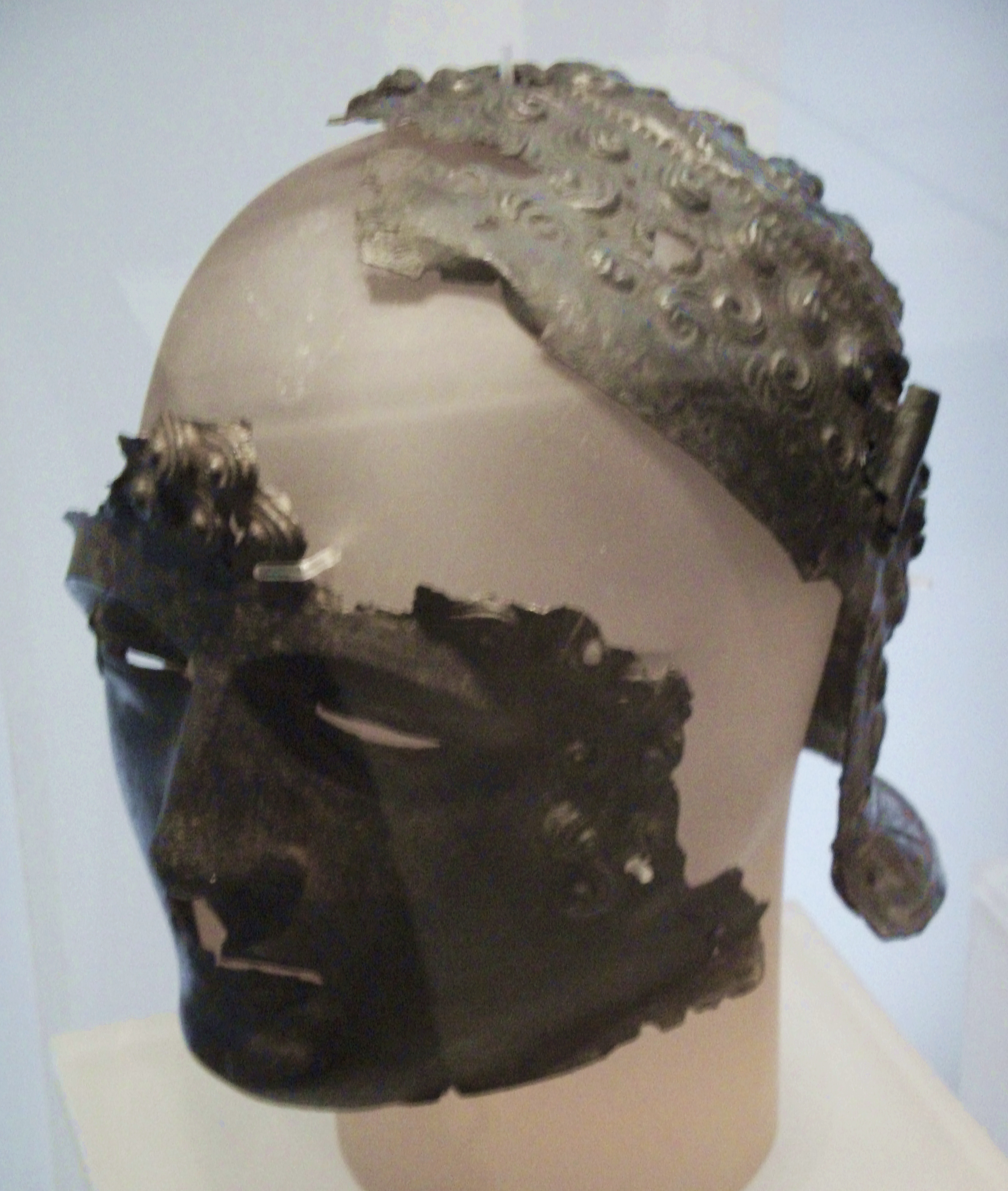
Newstead Helmet

The Newstead Helmet is an iron Roman cavalry helmet dating to 80–100 AD that was discovered at the site of a Roman fort in Newstead, near Melrose in Roxburghshire...

Nearby Amenities

Located within 500m of 55.599604,-2.6989946
Newstead
Place: village
Wikidata: Q7019853
Wikipedia: en:Newstead, Scottish Borders
Lat/Long: 55.5998126/-2.696165
Bus Stop
Claymires Lane
Bench: no
Bus: yes
Departures Board: no
Lit: no
Local Ref: nr
Naptan AtcoCode: 69001094
Naptan Bearing: W
Naptan CommonName: Claymires Lane
Naptan Indicator: nr
Naptan Landmark: Claymires Lane
Naptan NaptanCode: 72725682
Naptan Street: Main Street
Naptan Verified: yes
Public Transport: platform
Ref: 69001094
Shelter: no
Source: local knowledge;survey;NaPTAN
Lat/Long: 55.5997718/-2.6965775
Bus Stop
St John's Wynd
Bench: no
Bus: yes
Departures Board: no
Lit: yes
Local Ref: at
Naptan AtcoCode: 69001095
Naptan Bearing: E
Naptan CommonName: St John's Wynd
Naptan Indicator: at
Naptan Landmark: St John's Wynd
Naptan NaptanCode: 72725673
Naptan Street: Main Street
Naptan Verified: yes
Public Transport: platform
Ref: 69001095
Shelter: no
Source: local knowledge;survey;NaPTAN
Lat/Long: 55.5996896/-2.6938346
Bus Stop
By-pass
Bench: no
Bin: no
Bus: yes
Departures Board: no
Lit: no
Local Ref: W-bound
Naptan AtcoCode: 6900664
Naptan Bearing: W
Naptan CommonName: By-pass
Naptan Indicator: W-bound
Naptan NaptanCode: 72723762
Naptan Street: A6091
Operator: Scottish Borders Council
Public Transport: platform
Ref: 6900664
Shelter: no
Source: local knowledge;survey;NaPTAN
Tactile Paving: no
Lat/Long: 55.5980197/-2.6979318
Bus Stop
Dean Place
Bench: no
Bus: yes
Departures Board: no
Local Ref: at
Naptan AtcoCode: 690031846
Naptan Bearing: NE
Naptan CommonName: Dean Place
Naptan Indicator: at
Naptan Landmark: Dean Place
Naptan NaptanCode: 72723313
Naptan Street: Dean Road
Naptan Verified: yes
Public Transport: platform
Ref: 690031846
Shelter: no
Source: local knowledge;survey;NaPTAN
Lat/Long: 55.5988642/-2.7026507
Bus Stop
Claymires Lane
Bench: no
Bus: yes
Departures Board: timetable
Lit: no
Local Ref: opp
Naptan AtcoCode: 6900669
Naptan Bearing: E
Naptan CommonName: Claymires Lane
Naptan Indicator: opp
Naptan Landmark: Eddy Road
Naptan NaptanCode: 72723827
Naptan Street: Main Street
Naptan Verified: yes
Public Transport: platform
Ref: 6900669
Shelter: no
Source: local knowledge;survey;NaPTAN
Lat/Long: 55.5998722/-2.6964432
Bus Stop
Rushbank
Bench: no
Bus: yes
Departures Board: no
Lit: no
Local Ref: nr
Naptan AtcoCode: 6900670
Naptan Bearing: E
Naptan CommonName: Rushbank
Naptan Indicator: nr
Naptan Landmark: Rushbank
Naptan NaptanCode: 72723826
Naptan Street: Main Street
Naptan Verified: yes
Public Transport: platform
Ref: 6900670
Shelter: no
Source: local knowledge;survey;NaPTAN
Lat/Long: 55.5997442/-2.692157
Bus Stop
Rushbank
Bench: yes
Bus: yes
Departures Board: yes
Lit: no
Local Ref: opp
Naptan AtcoCode: 6900671
Naptan Bearing: W
Naptan CommonName: Rushbank
Naptan Indicator: opp
Naptan Landmark: Rushbank
Naptan NaptanCode: 72723825
Naptan Street: Main Street
Naptan Verified: yes
Public Transport: platform
Ref: 6900671
Shelter: yes
Source: local knowledge;survey;NaPTAN
Lat/Long: 55.5996722/-2.6917762
Bus Stop
St John's Wynd
Bench: no
Bus: yes
Departures Board: timetable
Lit: no
Local Ref: opp
Naptan AtcoCode: 6900672
Naptan Bearing: W
Naptan CommonName: St John's Wynd
Naptan Indicator: opp
Naptan Landmark: St John's Wynd
Naptan NaptanCode: 72723824
Naptan Street: Main Street
Naptan Verified: yes
Public Transport: platform
Ref: 6900672
Shelter: no
Source: local knowledge;survey;NaPTAN
Lat/Long: 55.5996335/-2.6943858
Bus Stop
The Orchard
Bench: no
Bus: yes
Departures Board: no
Lit: no
Local Ref: nr
Naptan AtcoCode: 6900673
Naptan Bearing: W
Naptan CommonName: The Orchard
Naptan Indicator: nr
Naptan Landmark: The Orchard
Naptan NaptanCode: 72723797
Naptan Street: Main Street
Naptan Verified: yes
Public Transport: platform
Ref: 6900673
Shelter: no
Source: local knowledge;survey;NaPTAN
Lat/Long: 55.5995382/-2.6992007
Bus Stop
By-pass
Bench: no
Bin: no
Bus: yes
Departures Board: no
Lit: yes
Local Ref: E-bound
Naptan AtcoCode: 6900675
Naptan Bearing: E
Naptan CommonName: By-pass
Naptan Indicator: E-bound
Naptan NaptanCode: 72723768
Naptan Street: A6091
Operator: Scottish Borders Council
Public Transport: platform
Ref: 6900675
Shelter: no
Source: local knowledge;survey;NaPTAN
Tactile Paving: no
Lat/Long: 55.5981768/-2.6975241
Noexit: yes
Lat/Long: 55.6000538/-2.6926501
Noexit: yes
Lat/Long: 55.5988501/-2.7005271
Bus: yes
Public Transport: stop_position
Lat/Long: 55.5988674/-2.7023674
Post Box
Brand: Royal Mail
Brand Wikidata: Q638098
Operator: Royal Mail
Operator Wikidata: Q638098
Post Box Mounting: pier
Post Box Type: lamp
Ref: TD6 77
Lat/Long: 55.5998626/-2.6964187
Bus: yes
Bus Bay: left
Public Transport: stop_position
Lat/Long: 55.5997068/-2.691965
Bus: yes
Public Transport: stop_position
Lat/Long: 55.5998067/-2.6965826
Fixme: continue
Lat/Long: 55.6023011/-2.6951124
Noexit: yes
Lat/Long: 55.5987399/-2.7001004
Generator Method: photovoltaic
Generator Output Electricity: yes
Generator Source: solar
Generator Type: solar_photovoltaic_panel
Power: generator
Lat/Long: 55.5988004/-2.6943755
Generator Method: photovoltaic
Generator Output Electricity: yes
Generator Source: solar
Generator Type: solar_photovoltaic_panel
Power: generator
Lat/Long: 55.5987557/-2.6948918
Noexit: yes
Lat/Long: 55.5988993/-2.7009369
Noexit: yes
Lat/Long: 55.5986708/-2.7001557
Generator Method: photovoltaic
Generator Output Electricity: yes
Generator Source: solar
Generator Type: solar_photovoltaic_panel
Power: generator
Lat/Long: 55.6000961/-2.6917389
Generator Method: photovoltaic
Generator Output Electricity: yes
Generator Source: solar
Generator Type: solar_photovoltaic_panel
Power: generator
Lat/Long: 55.5989815/-2.7027091
Generator Method: photovoltaic
Generator Output Electricity: yes
Generator Source: solar
Generator Type: solar_photovoltaic_panel
Power: generator
Lat/Long: 55.5985875/-2.703137
Generator Method: photovoltaic
Generator Output Electricity: yes
Generator Source: solar
Generator Type: solar_photovoltaic_panel
Power: generator
Lat/Long: 55.5990057/-2.700837
Generator Method: photovoltaic
Generator Output Electricity: yes
Generator Source: solar
Generator Type: solar_photovoltaic_panel
Power: generator
Lat/Long: 55.5996862/-2.6992893
Generator Method: photovoltaic
Generator Output Electricity: yes
Generator Source: solar
Generator Type: solar_photovoltaic_panel
Power: generator
Lat/Long: 55.5988383/-2.6939222
Give Way
Direction: forward
Lat/Long: 55.5969508/-2.7049552
Bus Stop
Dean Park
Bench: no
Bus: yes
Departures Board: no
Lit: yes
Local Ref: nr
Naptan AtcoCode: 6900666
Naptan Bearing: SW
Naptan CommonName: Dean Park
Naptan Indicator: nr
Naptan Landmark: Dean Park
Naptan NaptanCode: 72723786
Naptan Street: Dean Road
Naptan Verified: yes
Public Transport: platform
Ref: 6900666
Shelter: no
Source: local knowledge;survey;NaPTAN
Lat/Long: 55.598839/-2.7023544
Power: pole
Lat/Long: 55.5992644/-2.7055664
Power: pole
Lat/Long: 55.5993248/-2.7045127
Power: pole
Lat/Long: 55.5993939/-2.703482
Power: pole
Lat/Long: 55.5994773/-2.7021051
Power: pole
Lat/Long: 55.5995391/-2.7010514
Power: pole
Lat/Long: 55.6010057/-2.6928206
Power: pole
Lat/Long: 55.6013752/-2.6936096
Power: pole
Lat/Long: 55.601588/-2.6948567
Power: pole
Lat/Long: 55.6017836/-2.6961241
Power: pole
Lat/Long: 55.6019849/-2.6973789
Power: pole
Lat/Long: 55.6021891/-2.698659
Power: pole
Lat/Long: 55.6023932/-2.6999418
Power: pole
Lat/Long: 55.6025413/-2.7015095
Power: pole
Lat/Long: 55.6013867/-2.6976995
Power: pole
Lat/Long: 55.6007656/-2.6979719
Bus: yes
Public Transport: stop_position
Lat/Long: 55.5995722/-2.6992105
Playground: swing
Lat/Long: 55.6018629/-2.6958824
The data included in this document is from www.openstreetmap.org. The data is made available under ODbL.

Have you been to Newstead?

Leave your review of Newstead below (or comments, questions and feedback).